New York Gets Wilder The Farther North You Go
New York hiking is about much more than the Adirondacks. Upstate trails lead behind waterfalls, through narrow gorges, across bare mountain ridges, and onto summits where the forest seems to continue forever.
Some require a full day and serious preparation. Others deliver ridiculous scenery after barely an hour of walking. But they all show just how much variety is hiding beyond New York City.
Watkins Glen Gorge Trail, Watkins Glen State Park
Few hikes anywhere in New York pack this much scenery into such a short distance. Glen Creek has carved a narrow gorge through layers of rock, creating 19 waterfalls within roughly two miles of the park. The Gorge Trail threads through stone tunnels, climbs staircases built into the cliffs, and actually passes behind the spray of Cavern Cascade. Rainbow Falls is the scene most visitors recognize from photographs. The trail is seasonal because falling rock and winter conditions make the gorge unsafe, so this is primarily a late-spring through fall adventure.
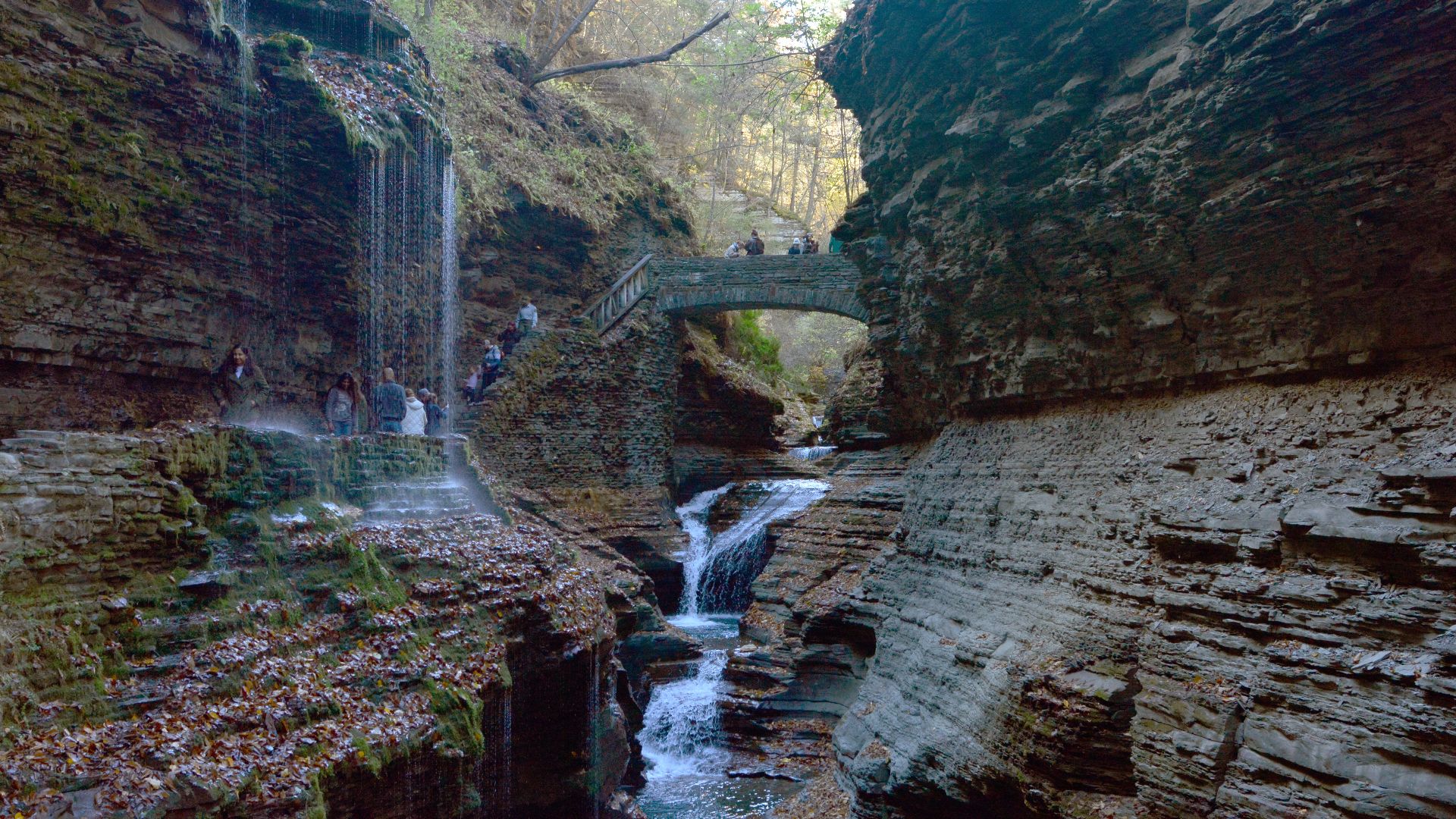 Photo by Joe Mabel, Wikimedia Commons
Devil’s Hole Trail, Niagara Falls State Park
Niagara's quieter side is much rougher than the famous overlooks suggest. The Devil's Hole area sends hikers down a long stone staircase into the Niagara Gorge, where the river squeezes through powerful rapids beneath towering rock walls. Down at water level, the scale and force of the Niagara River feel completely different from what visitors experience near the falls themselves. This is a steep outing with a demanding climb back out. Portions of the lower trail system have also experienced closures because of rockfall and unstable conditions, so checking the latest park updates before arriving is especially important.
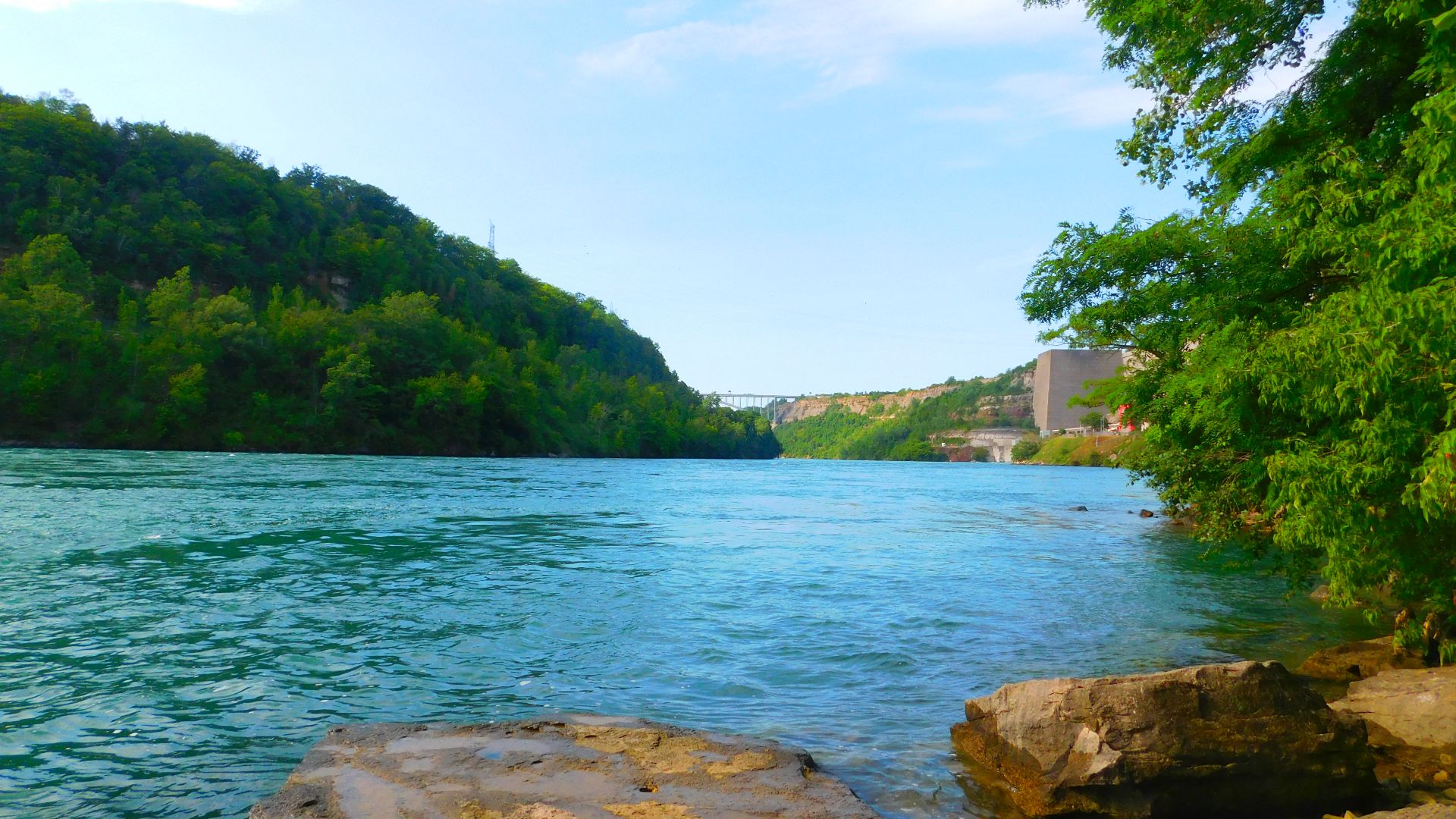 Adam Moss from Tonawanda, New York, United States, Wikimedia Commons
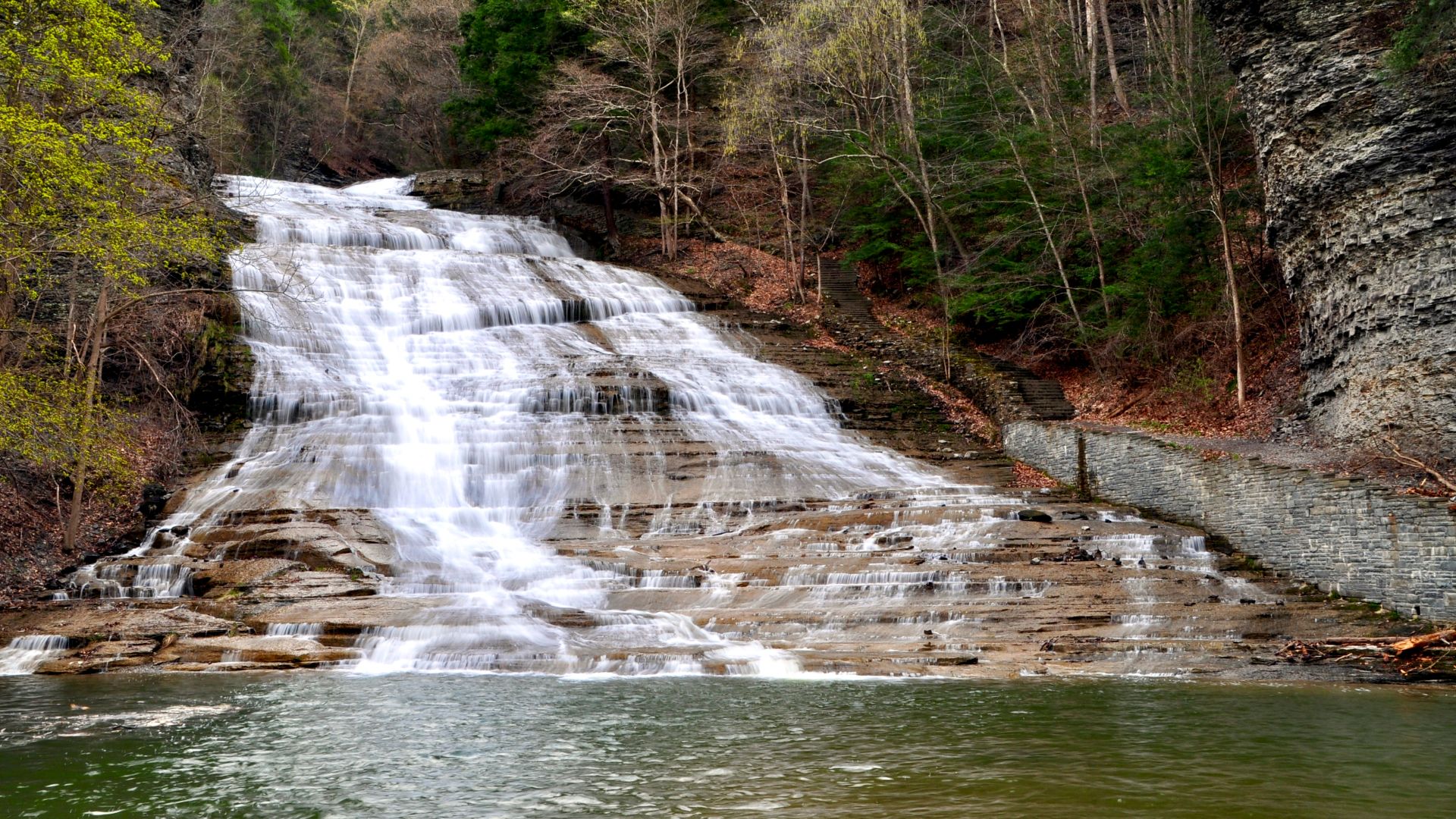
Buttermilk Falls Gorge Trail, Buttermilk Falls State Park
Buttermilk Falls is visible almost immediately after arriving, but stopping at the main cascade means missing the best part. The Gorge Trail follows Buttermilk Creek uphill past a succession of pools, smaller falls, sculpted rock, and narrow sections of gorge. Hikers can cross near the upper park and return along the Rim Trail for a compact loop that feels surprisingly adventurous considering how close it is to Ithaca. The Gorge and Rim trails are each about three-quarters of a mile, making this one of the best short waterfall hikes in the Finger Lakes.
Kaaterskill Falls, Catskill Park
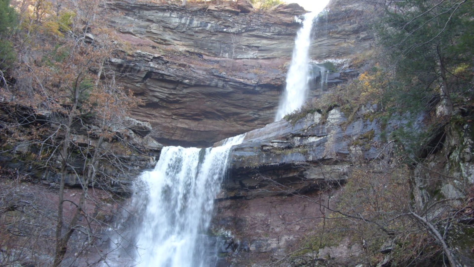
Kaaterskill Falls has been attracting travelers since long before hiking became a weekend hobby. Hudson River School painters helped turn the two-tiered cascade into one of the Catskills' defining landscapes during the nineteenth century. Together, the drops total roughly 260 feet, with the upper plunge doing most of the dramatic work. Modern improvements have made viewpoints and trails safer, but this is still steep, slippery terrain where leaving designated paths can become dangerous very quickly. For the easiest modern access, many hikers begin near Laurel House Road rather than approaching from the narrow highway below.
Taughannock Falls Gorge Trail, Taughannock Falls State Park
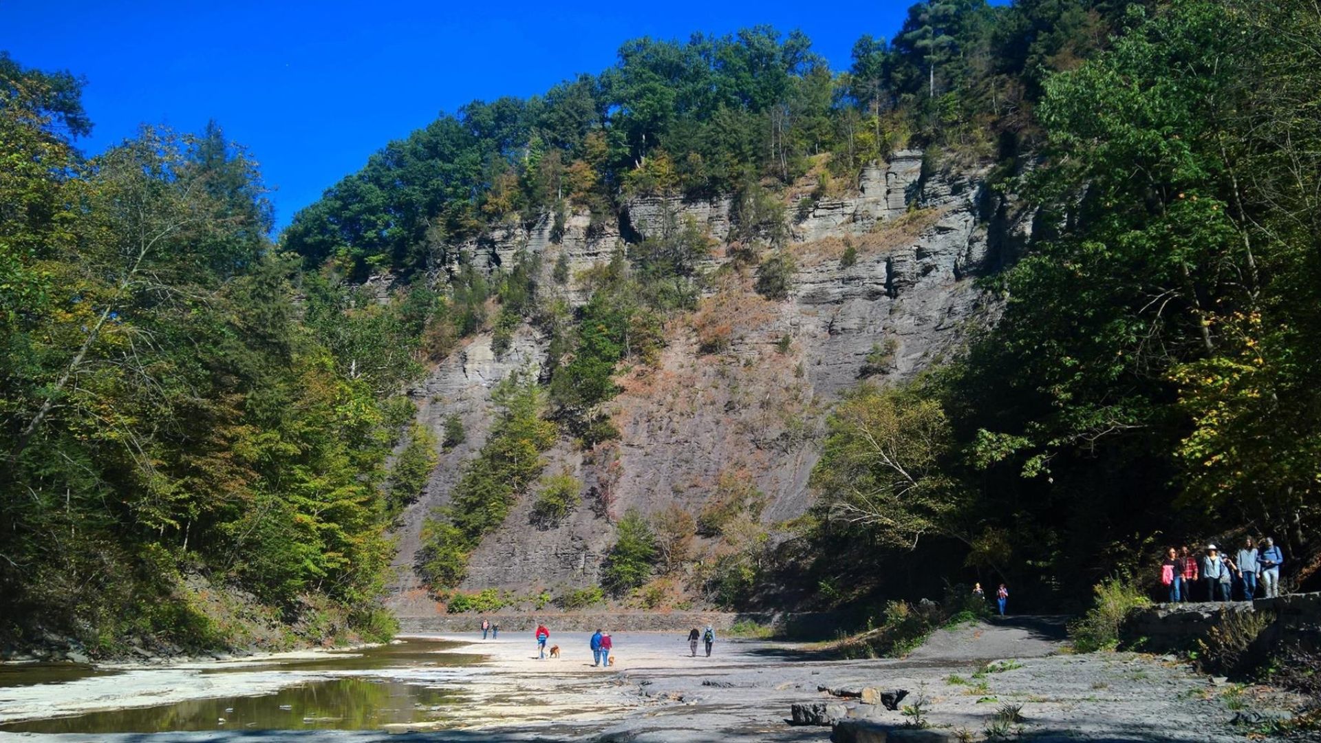
The approach to Taughannock Falls almost feels designed to hide the finale. An easy trail follows the creek through a broad gorge until a 215-foot waterfall suddenly appears inside an enormous amphitheater of cliffs. The walls surrounding it rise more than 400 feet in places, giving the waterfall a scale that's difficult to appreciate from photographs. The Gorge Trail itself is only about 1.8 miles round trip and remains relatively flat. Afterward, driving to the upper overlook provides an entirely different view and reveals just how deeply the creek has cut into the landscape.
 Andre Carrotflower, Wikimedia Commons
Letchworth Gorge Trail, Letchworth State Park
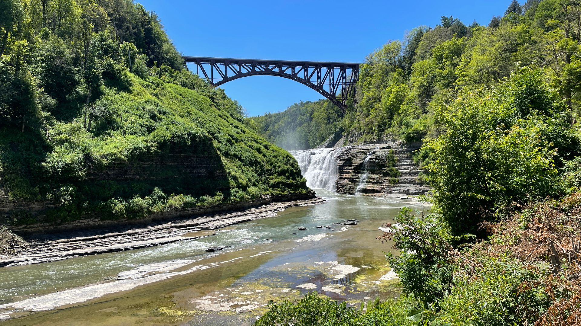
Calling Letchworth the "Grand Canyon of the East" isn't especially subtle, but the nickname makes sense once the Genesee River appears hundreds of feet below the gorge rim. Trail 1 follows the western side of the canyon and connects viewpoints overlooking Upper, Middle, and Lower Falls. Hikers don't need to complete the entire route to get the best scenery. The stretch around Upper and Middle Falls alone delivers enormous cascades, sheer cliffs, forest, and the park's iconic railroad bridge. Letchworth contains about 66 miles of trails overall, although temporary closures can affect sections, so current park alerts are worth checking.
Cobble Lookout Trail, Wilmington Wild Forest
Cobble Lookout feels almost unfair. The trail travels only about 1.3 miles each way and gains relatively little elevation, yet it ends at a broad rocky ledge with a huge view toward Whiteface Mountain, Esther Mountain, and the surrounding Adirondacks. That payoff makes it ideal for hikers who want High Peaks scenery without committing to an exhausting summit day. Fall may be the best time to go, when the valley below turns red, orange, and gold. The route follows the contour of the Stephenson Range, so much of the walk is gentler than the view at the end suggests.
Vroman’s Nose, Schoharie Valley
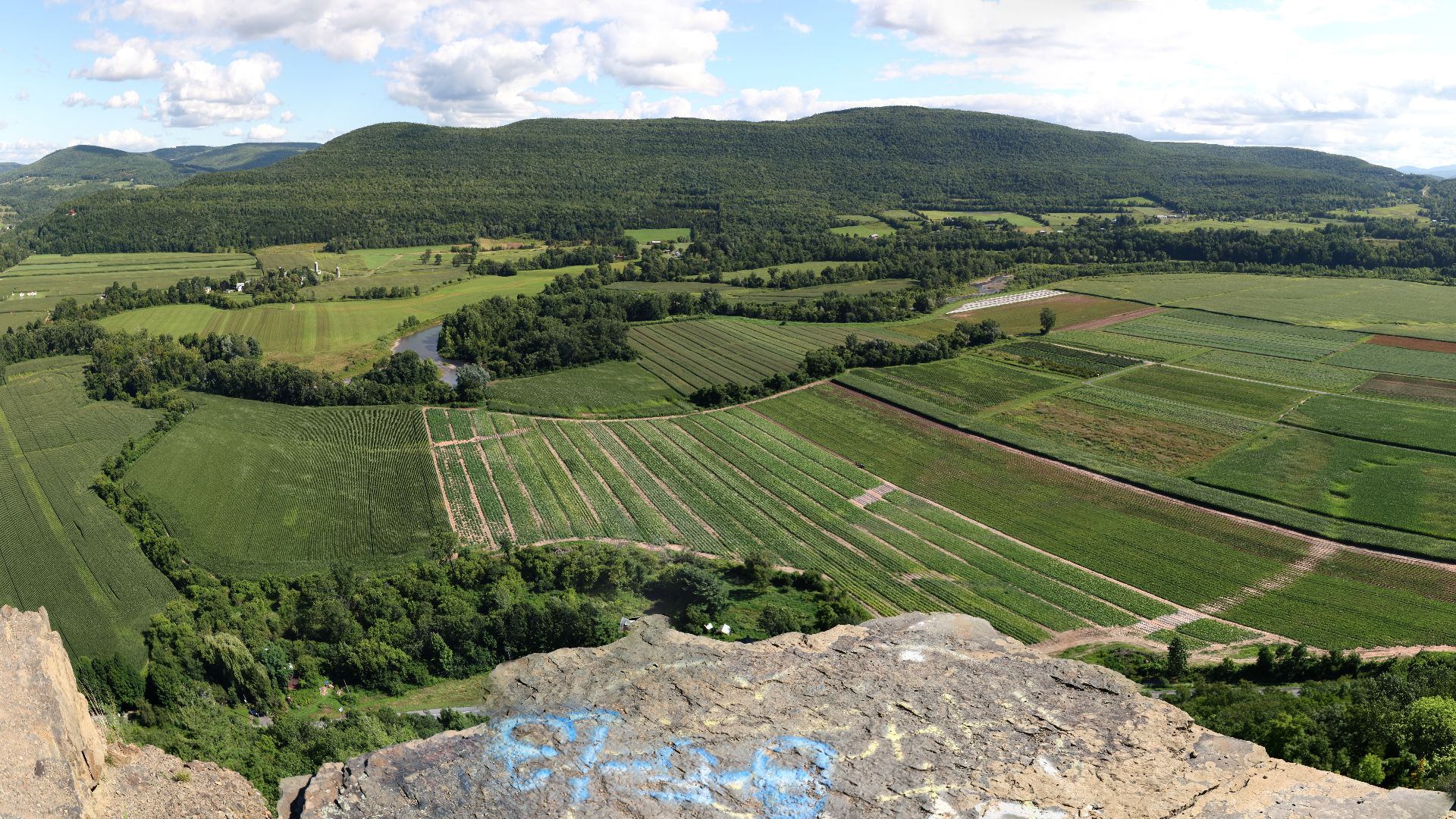
Vroman's Nose proves a mountain doesn't need to be especially tall to deliver a memorable view. The relatively short climb rises sharply above the Schoharie Valley before reaching open rock ledges overlooking farmland, roads, and the river far below. From the top, the neat patchwork of fields looks almost like a map spread across the valley floor. It's particularly impressive during fall foliage or late-afternoon light. Because the hike is shorter than many Adirondack or Catskill summit trips, it works well for travelers who want a substantial viewpoint without dedicating an entire day to reaching it.
 Ira Goldstein, Wikimedia Commons
Mount Jo, Adirondak Loj
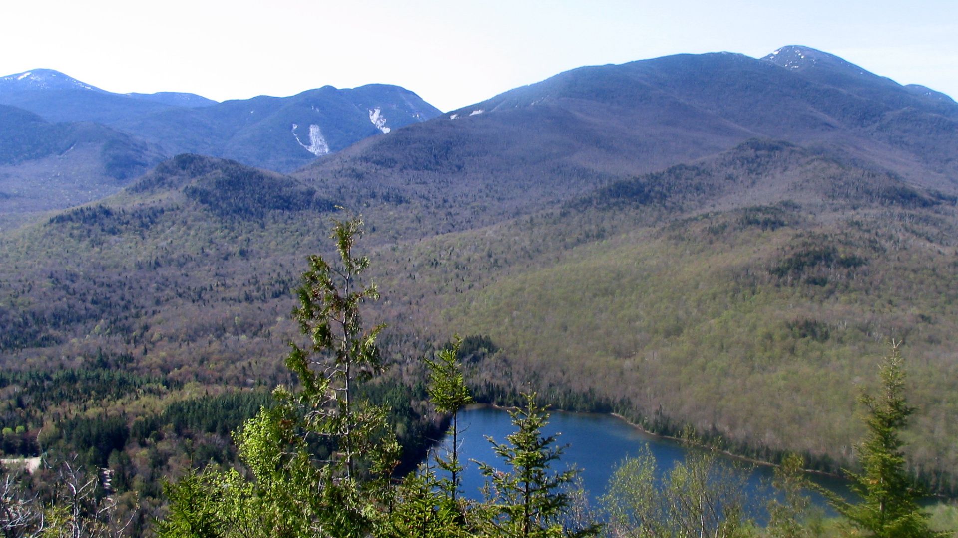
Mount Jo is one of the best introductions to Adirondack hiking because the effort-to-view ratio is almost perfect. Two routes climb from the Heart Lake area, with the Short Trail offering the steeper and more direct ascent while the Long Trail provides a more gradual approach. At the rocky summit, hikers look directly over Heart Lake toward Algonquin, Mount Colden, Mount Marcy, and other High Peaks. The entire trip is only a little over two miles, although the rocky footing means it still feels like a real mountain hike. The Long Trail was also recently rebuilt with more sustainable trail design.
Overlook Mountain Trail, Overlook Mountain Wild Forest
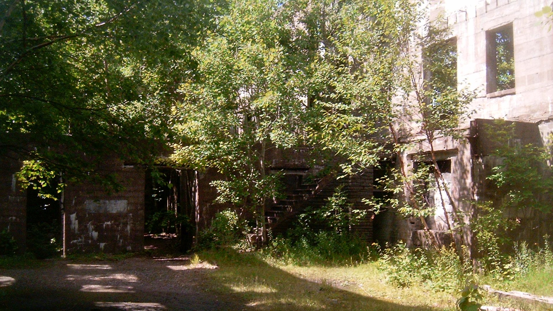
Overlook Mountain combines three things that rarely appear on the same hike: a Catskills summit, an abandoned hotel, and a fire tower. The climb from near Woodstock follows a wide, steadily ascending old road before reaching the atmospheric ruins of the Overlook Mountain House. Trees now grow around the stone walls, making the hotel look like something the forest is slowly reclaiming. Continue to the fire tower and the reward becomes enormous views across the Hudson Valley, Catskills, and surrounding mountains. The grade is persistent rather than technically difficult, making this a good endurance hike without complicated scrambling.
Balanced Rocks, Pitchoff Mountain
Balanced Rocks doesn't require climbing one of the Adirondack High Peaks to deliver one of their most dramatic viewpoints. The route climbs toward an open rocky area on Pitchoff Mountain where two enormous glacial boulders sit improbably near the edge. Beyond them, the view opens across Route 73 toward Cascade Mountain and a sweep of surrounding peaks. The hike is short compared with most summit outings in the region, but the terrain can be steep, eroded, and surprisingly rugged. On a clear fall day, the combination of exposed rock, giant boulders, and foliage below is difficult to beat.
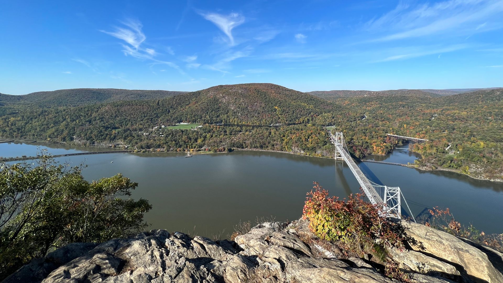
Anthony’s Nose, Hudson Highlands State Park Preserve
Anthony's Nose delivers one of the classic Hudson Valley views: the river bending below, Bear Mountain rising across the water, and the Bear Mountain Bridge stretching almost directly beneath the summit. Several approaches reach the viewpoint, including a steep route that initially follows the Appalachian Trail from Route 9D. The official park suggestion lists that option at roughly 2.4 miles round trip with around 700 feet of climbing. It's short, but the opening ascent can be surprisingly demanding. That makes the broad rocky overlook feel earned without turning the hike into an all-day expedition.
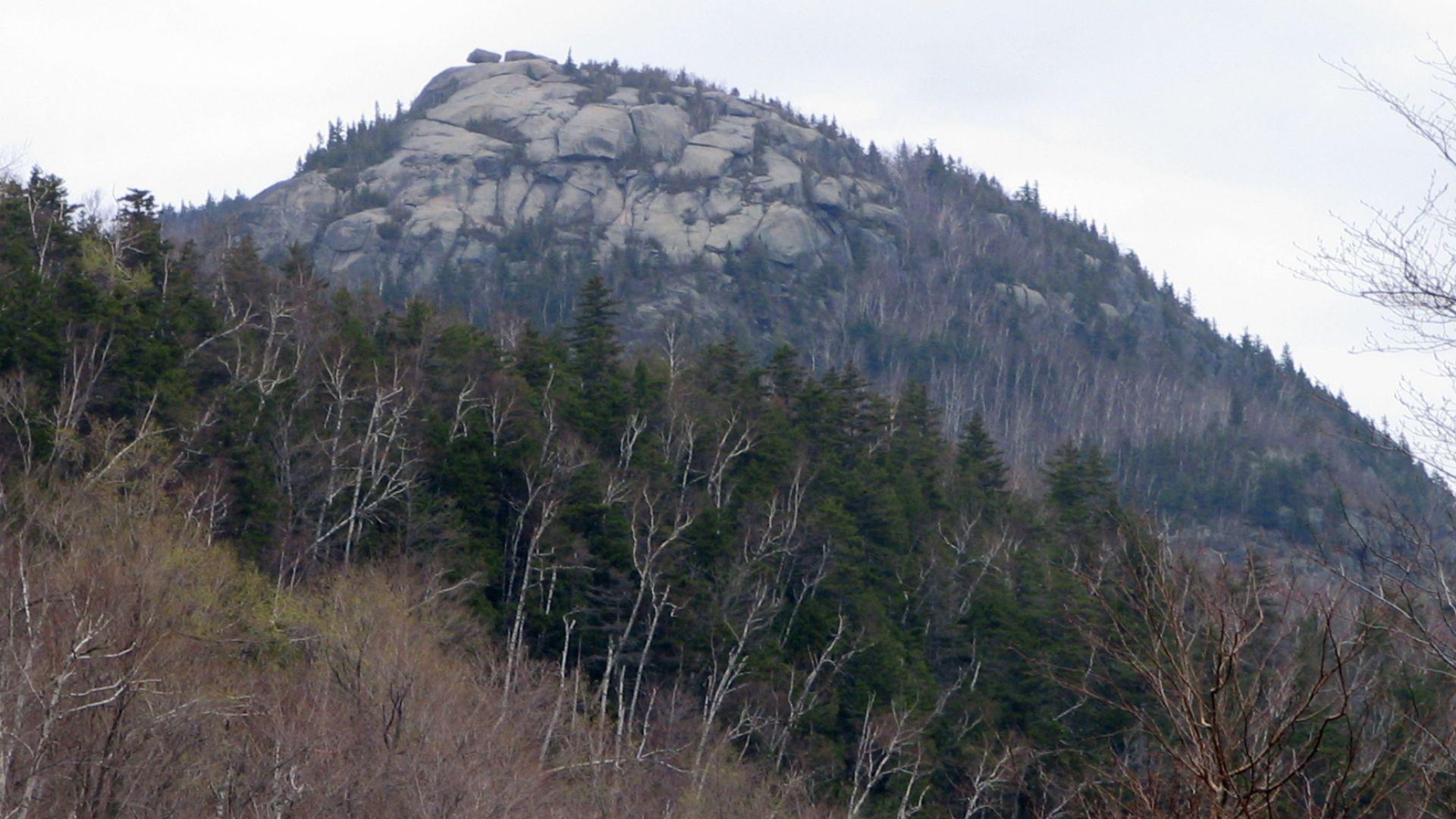
Cascade Mountain, High Peaks Wilderness
Cascade has long been one of the Adirondacks' most popular High Peaks, partly because its relatively short route makes a 4,000-footer seem approachable. Don't mistake approachable for easy. The trail climbs steeply through forest before emerging onto an exposed rocky summit where views stretch across the High Peaks in nearly every direction. Wind and weather can change quickly once hikers leave the trees. Cascade is an especially tempting first High Peak, but its popularity means trailheads can become extremely busy, particularly during fall foliage season. An early start and responsible trail behavior make a big difference.
 Laurent Gélinas, Wikimedia Commons
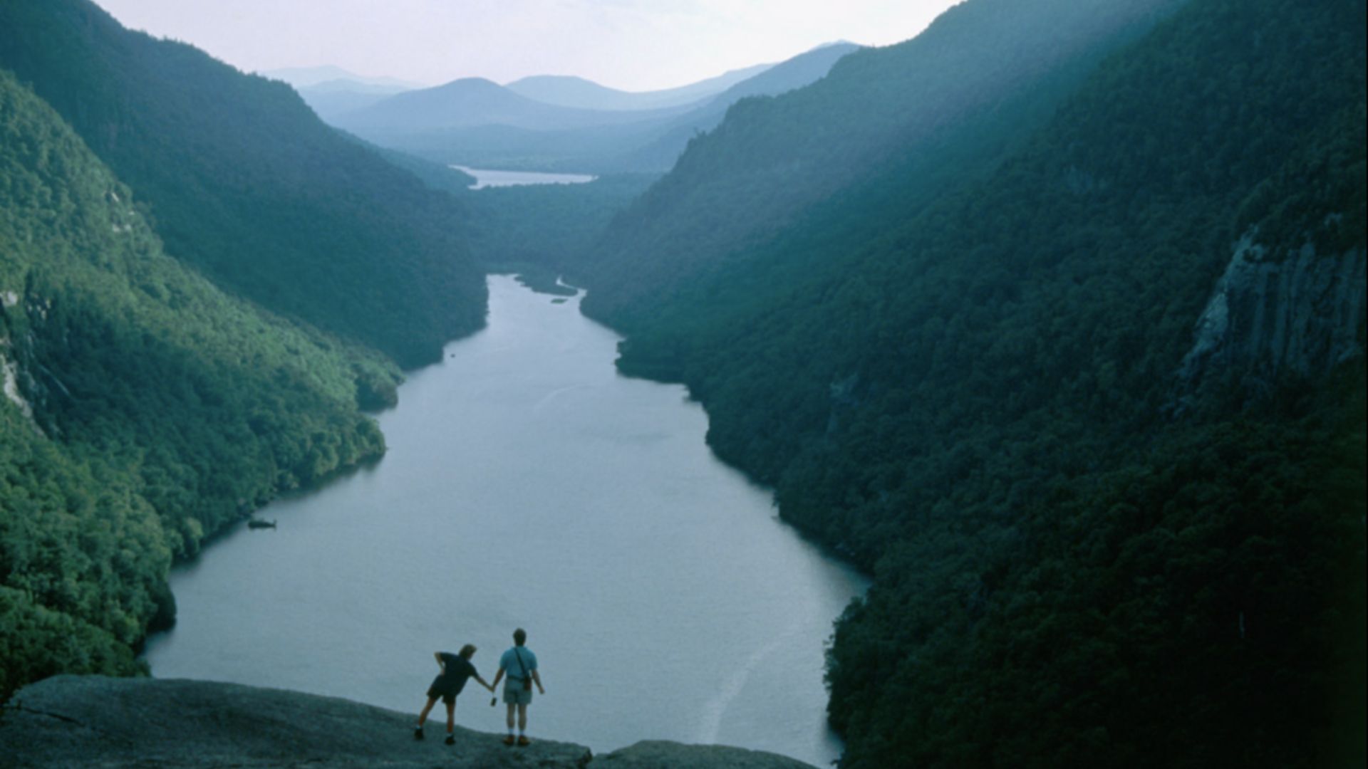
Indian Head And Fish Hawk Cliffs, Adirondack Mountain Reserve
This is the Adirondack view that seems to appear everywhere online, and it earns the attention. Indian Head overlooks Lower Ausable Lake as the water disappears between steep mountain walls, creating a scene that looks far more remote than the comparatively orderly approach suggests. Fish Hawk Cliffs provides another angle from nearby. The complete outing is long, usually around 10 or 11 miles depending on the route, but much of the approach follows Lake Road before the steeper final climb. Access through the Adirondack Mountain Reserve is regulated, so hikers should check current reservation requirements before planning a trip.
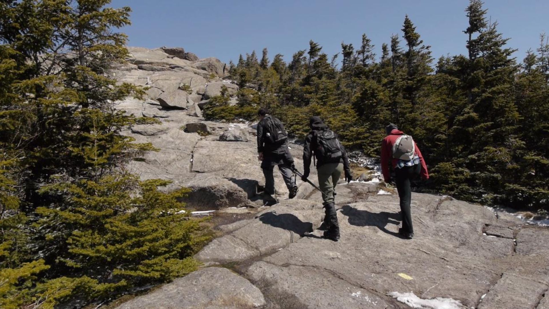
Mount Marcy, High Peaks Wilderness
Mount Marcy is the big one. At 5,344 feet, it's the highest summit in New York State, and reaching the top from the Adirondak Loj area requires roughly 15 miles of hiking and a full day for most people. The route begins gently enough before becoming increasingly rough and steep as it enters the higher mountains. Above treeline, the final climb crosses exposed rock and fragile alpine vegetation before reaching sweeping views across the Adirondacks. Marcy isn't the trail to choose for a casual afternoon. Weather, daylight, food, water, navigation, and proper equipment all matter on a mountain where conditions can deteriorate rapidly.
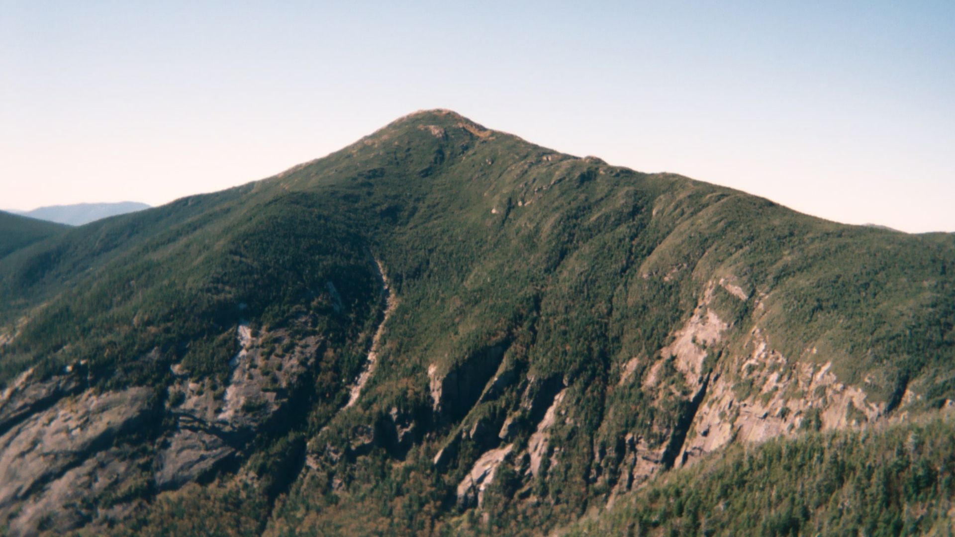 Daniel Tripp, Wikimedia Commons
Big Slide Via The Brothers, High Peaks Wilderness
Some mountain hikes save all their scenery for the summit. Big Slide via The Brothers starts paying hikers back much earlier. The route climbs over a series of rocky knobs called the Brothers, opening repeatedly onto views of the Great Range before eventually making a steeper final push toward Big Slide Mountain. That constant sequence of overlooks makes the journey itself more memorable than many High Peaks climbs spent mostly beneath tree cover. The outing is still demanding, with rough Adirondack terrain and substantial elevation gain. For experienced hikers, though, it may be one of the most satisfying ways to earn a High Peak summit.
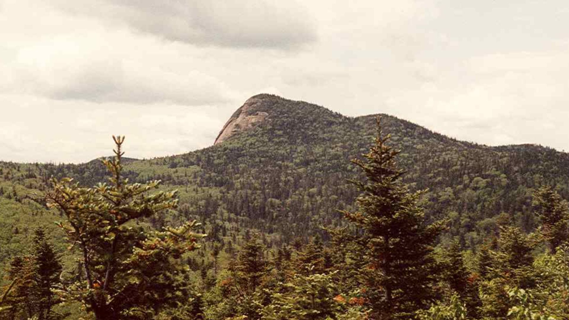
Gertrude’s Nose, Minnewaska State Park Preserve
Gertrude's Nose is one of the three trails I'd add to the list. The approximately seven-mile round trip crosses the Shawangunk Ridge to dramatic white-cliff viewpoints overlooking forests and valleys far below. Much of the fun comes from the constantly changing terrain: carriage roads give way to narrower footpaths, rocky ledges, pitch-pine forest, and enormous open vistas. The cliffs demand caution, since there are significant exposed drops and no reason to crowd the edge for a photograph. The trail is also seasonal and can close during winter conditions, while Minnewaska parking fills quickly on beautiful weekends.
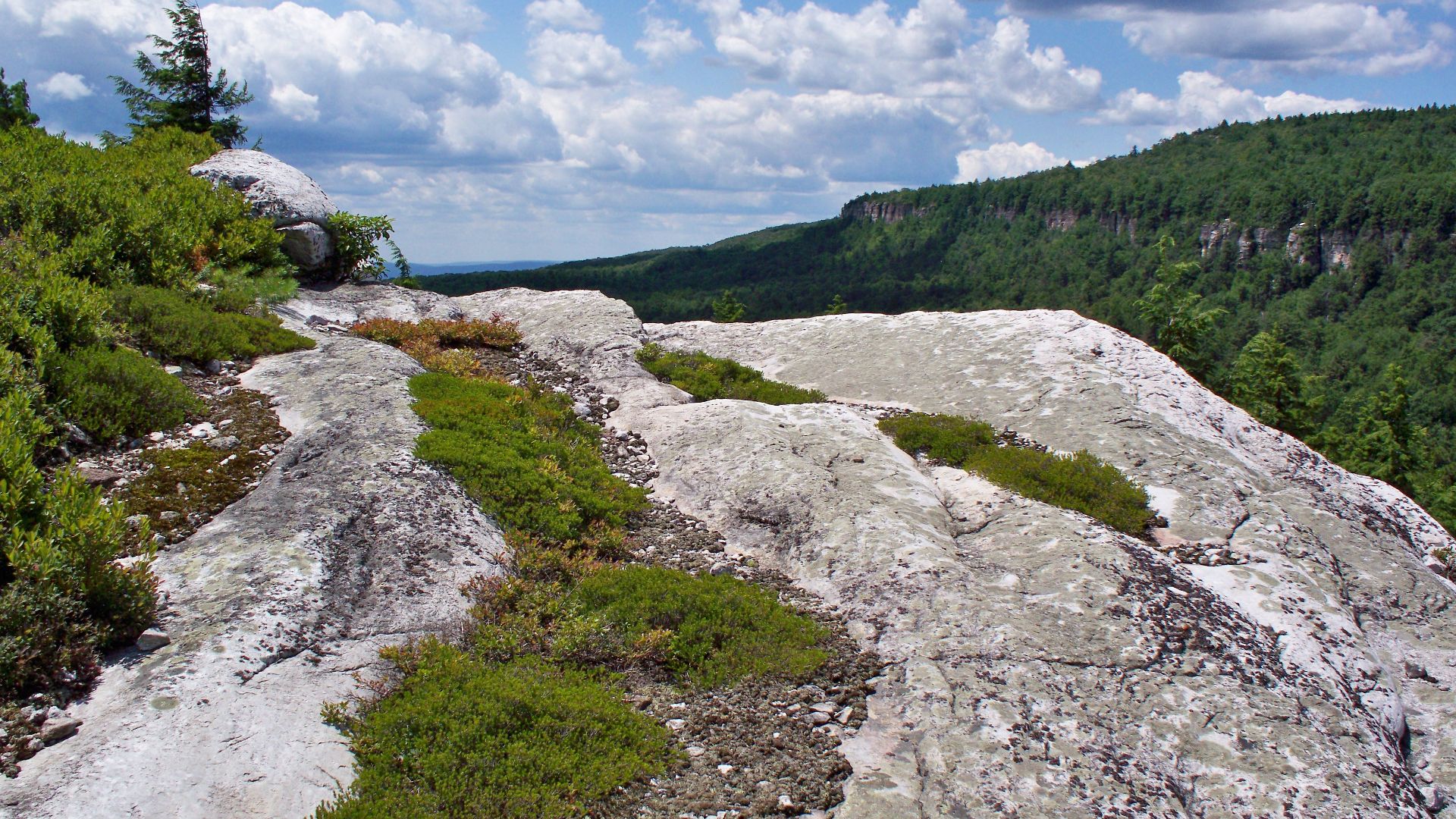 Copperhead7, Wikimedia Commons
Giant Ledge And Panther Mountain, Slide Mountain Wilderness
Giant Ledge is another addition because it offers some of the best Catskills views for a relatively manageable climb. Roughly 1.5 miles from the trailhead, hikers reach a series of open ledges overlooking some of the highest mountains in the Catskills. There are multiple viewpoints rather than a single summit reveal, so it's easy to spend more time stopping than walking once the ledges begin. Anyone with extra energy can continue to Panther Mountain at 3,720 feet. The route becomes extremely popular during peak fall foliage, when hundreds of hikers can arrive in a single day.
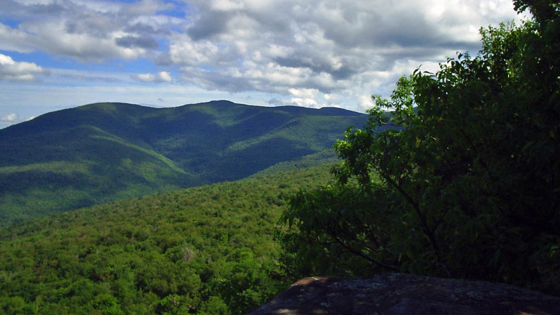 Ben Perry. Edited for Wikipedia by Daniel Case, Wikimedia Commons
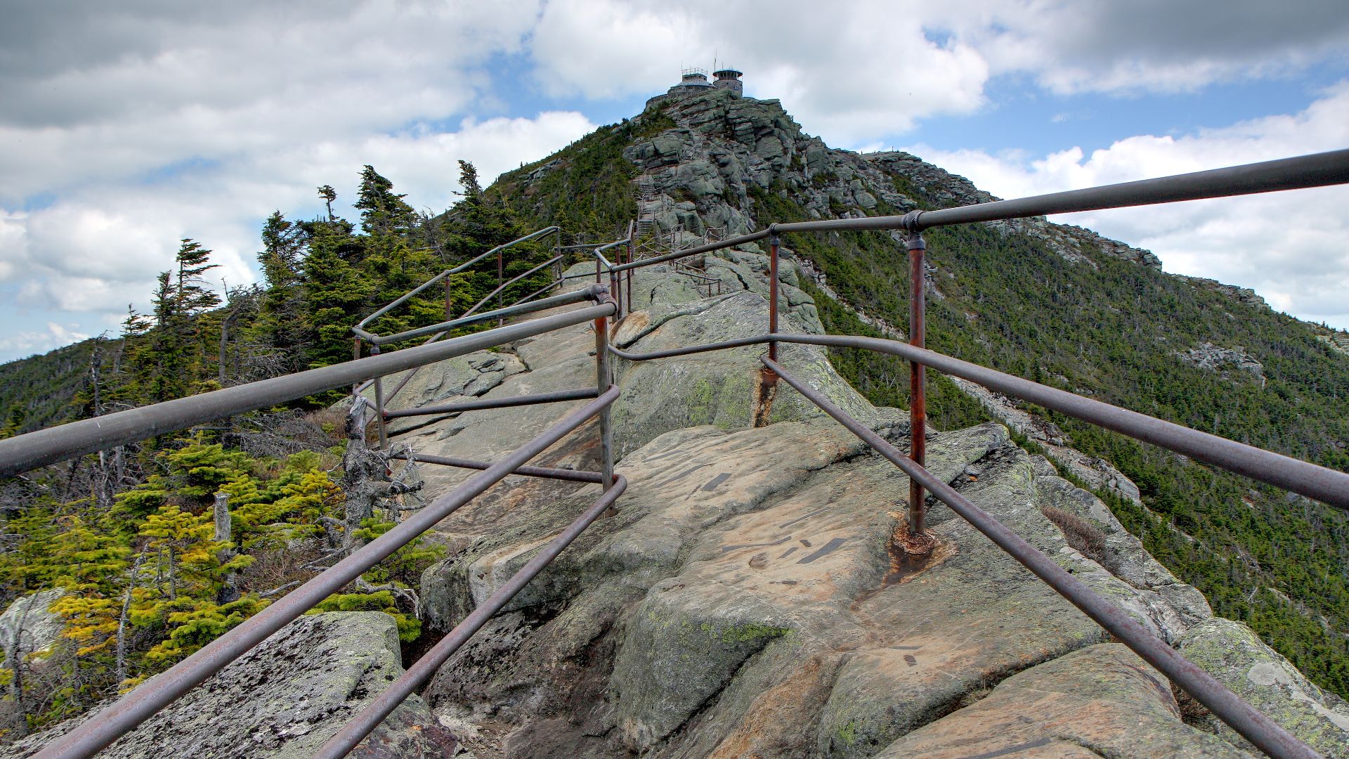
Whiteface Mountain Trail, Wilmington Wild Forest
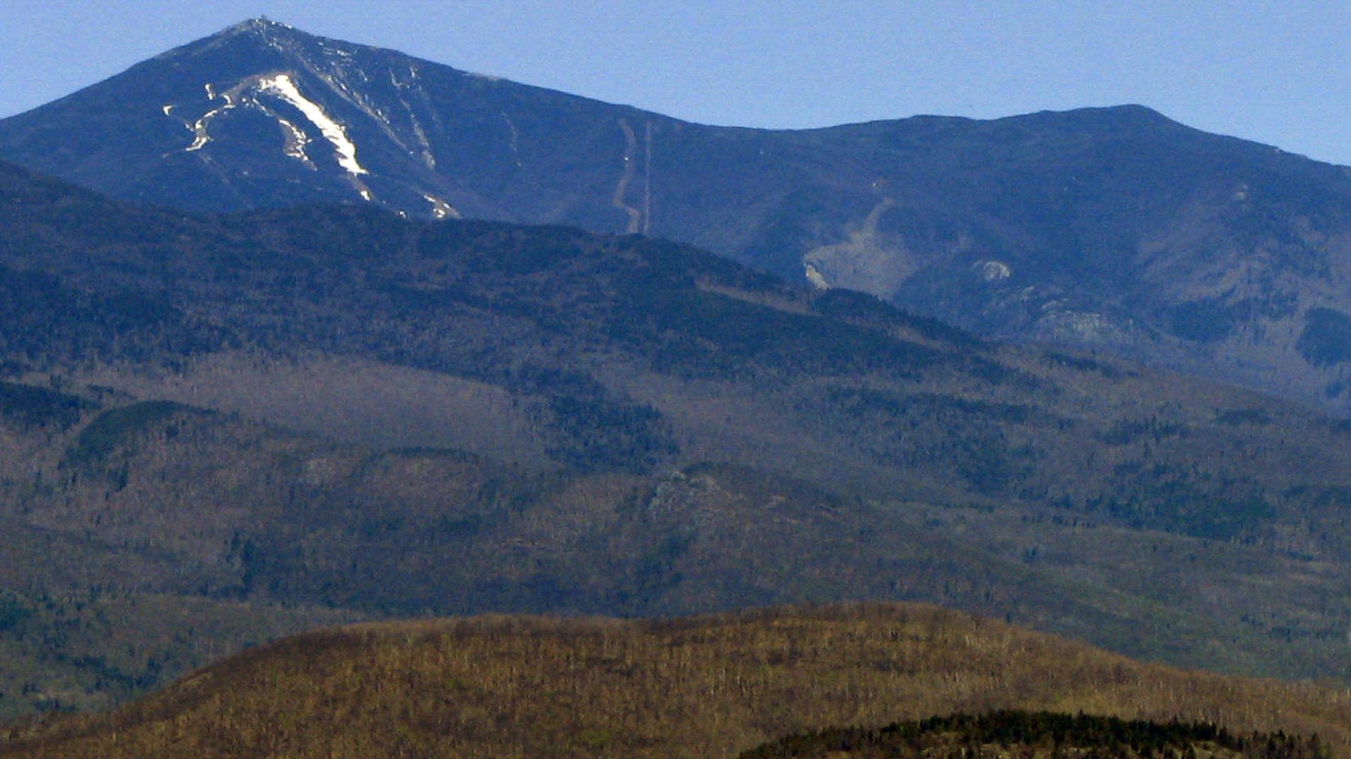
The final addition is for hikers who want Whiteface without driving the Veterans' Memorial Highway. Starting near the Wilmington Reservoir, the hiking route climbs roughly 5.2 miles to the summit and gains close to 3,700 feet. That makes it an entirely different experience from driving most of the way up and walking the final stairs. The route passes through changing forest and mountain terrain before emerging at one of the Adirondacks' most recognizable summits. On a clear day, the panorama can extend across Lake Placid, neighboring High Peaks, and far beyond New York. This is a strenuous full mountain hike, not a shortcut to the tourist overlook.
 Allen McGregor from Brampton, Canada, Wikimedia Commons
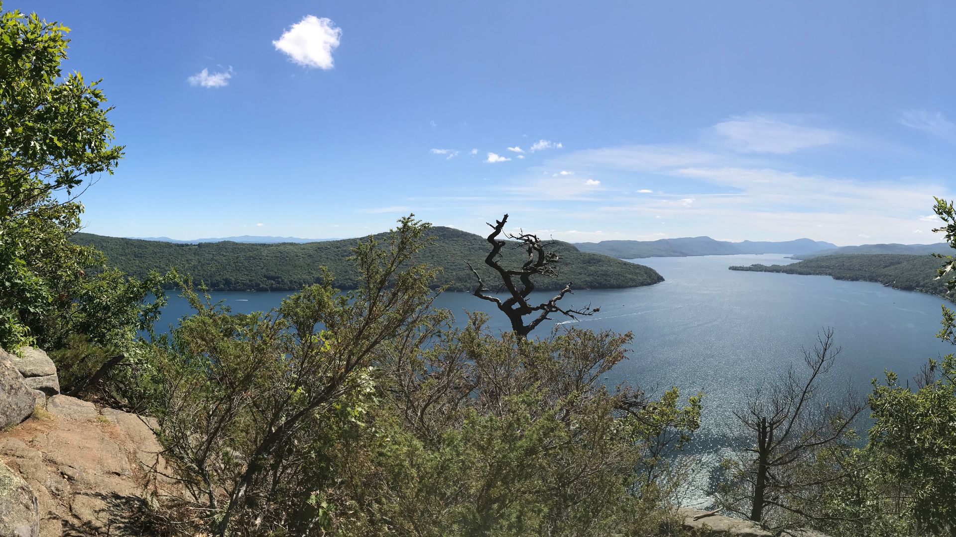
Sleeping Beauty Mountain, Lake George Wild Forest
Sleeping Beauty Mountain earns its name once the view opens up near the summit. From Dacy Clearing, the trail climbs about 2.1 miles and gains just over 1,000 feet before reaching rocky overlooks above Lake George and the surrounding Adirondack foothills. It’s considerably more approachable than the High Peaks on this list, but still feels like a proper mountain hike. The combination of broad lake views, forested ridges, and exposed rock makes it especially rewarding in fall, when the hills surrounding Lake George turn into layers of red, orange, and gold.
 OrIGInalPyRO, Wikimedia Commons
You May Also Like:
Exploring Michigan’s Hidden Gem
US National Parks That Americans Say Are Better Than The Famous Ones