
An Outdoorsy Oasis
If the great outdoors calls to you, make Pictured Rocks National Lakeshore the crown jewel of your summer plans.
This awe-inspiring landscape, sculpted over millennia, is a playground for adventurers—hikers carving through rugged trails, kayakers gliding past towering cliffs, and photographers chasing the perfect light.
Dive into the park’s most unforgettable spots—from cascading waterfalls and hidden caves to breathtaking overlooks—and discover why this natural masterpiece should be your next escape.

Location
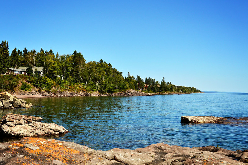
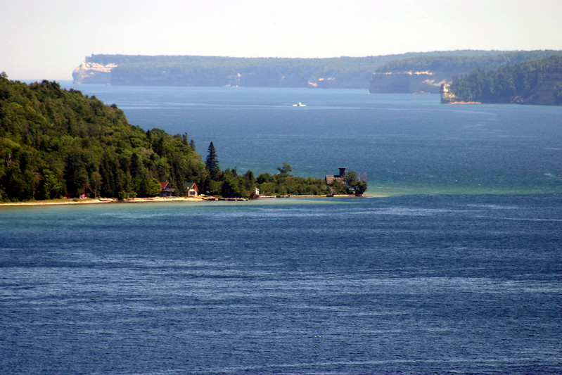
Pictured Rocks National Lakeshore is a recreation paradise in Michigan’s upper peninsula. It’s located on the southern shore of Lake Superior between Munising and Grand Marais.
Lake Superior
Lake Superior is huge and wild and can be quite rough at times. It is encouraged that only experienced adventurers take their vessels out into the waters of this massive lake.
There are inland lakes available within the park as well that are better suited for casual water exploration.
History
Pictured Rocks is the first designated national lakeshore in the United States (established in 1966). It is one of only three national lakeshores in the country.
Reputation
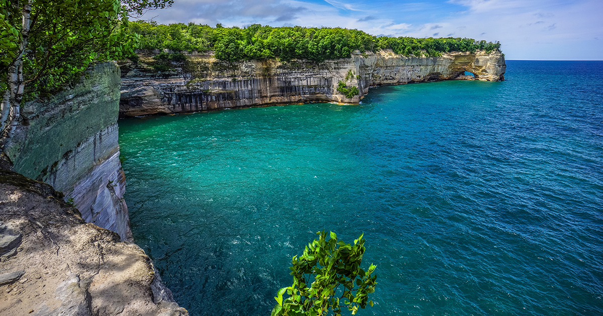
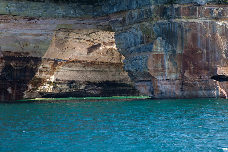
Pictured Rocks owes its name to the vibrant mineral-stained sandstone cliffs that paint the landscape in stunning hues. These colorful cliffs stretch for 15 miles along the pristine shores of Lake Superior, creating a breathtaking natural canvas.
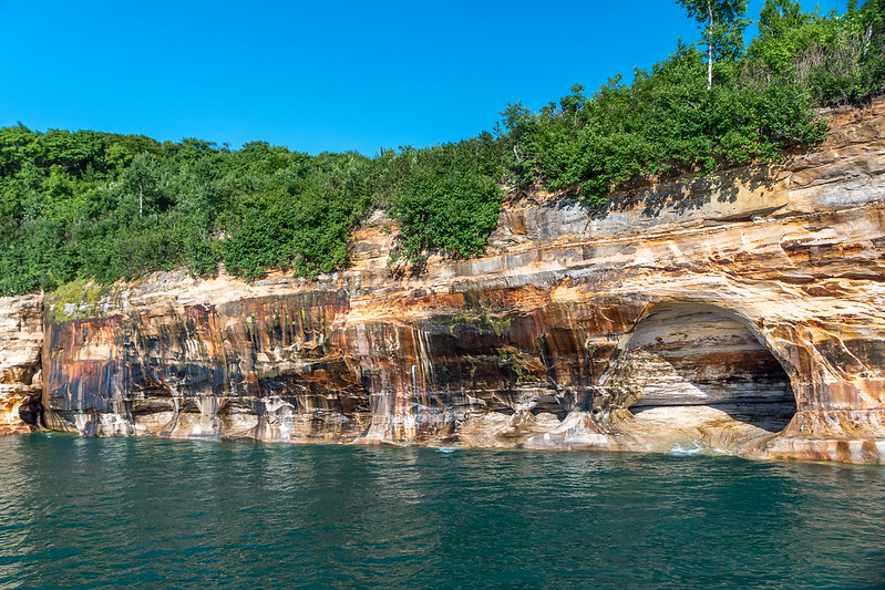
Beauty
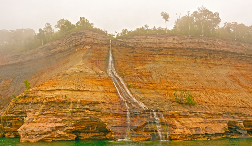
Aside from the already stunning formations of Pictured Rocks, striking colors appear when groundwater from the cliffs’ cracks drizzles down the rocks.
 Wayne Silver, CC BY 3.0, Wikimedia Commons
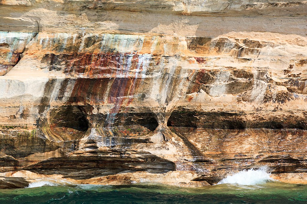
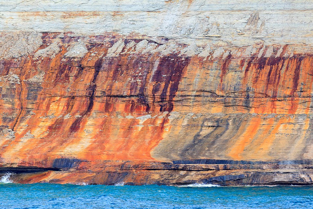
The Colors
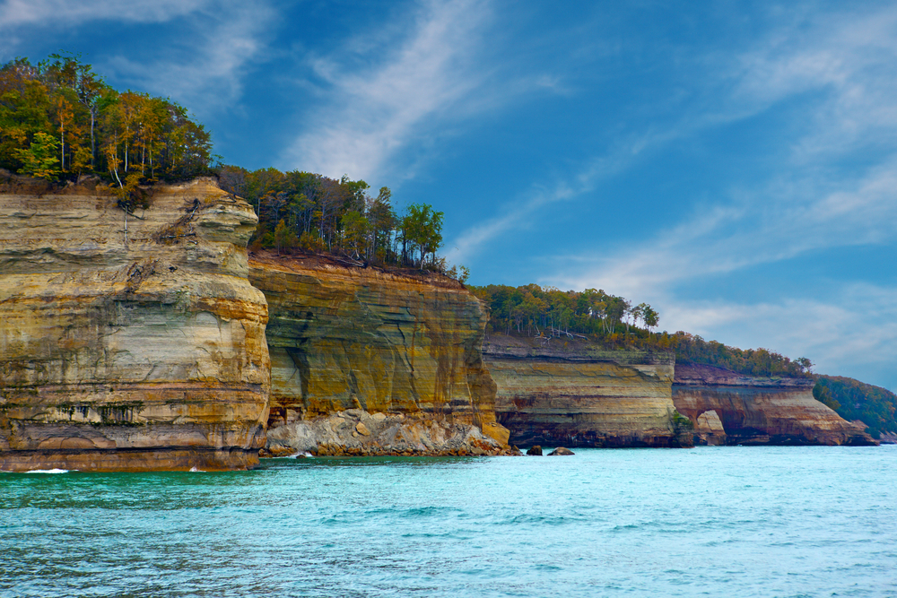
The streaks on the sandstone layers highlight the various colors as the minerals react to seeping water.
Red identifies iron, black and white mean manganese, yellow and brown show limonite and pink and green show copper.
 Wayne Silver, CC BY 3.0, Wikimedia Commons
Water Views
The best way to see these colorful cliffs is from the water. Usually, the in late afternoon and during the early evening sunlight is the picture-perfect time to go.
Geology
The rock layers here tell a story spanning hundreds of millions of years—from the ancient Late Precambrian, Cambrian, and Early Ordovician Periods, 500 to 800 million years ago, to the more recent Late Quaternary Period, reaching up to today. This deep geological timeline is etched into every colorful cliff and rocky outcrop along the shoreline.
A Treasure
The beauty of Pictured Rocks was so impressive that sandstone from the cliffs was quarried from nearby Grand Island to be used in the construction of town buildings in the late 1800s.
An Outdoor Paradise
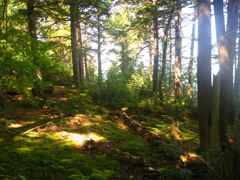
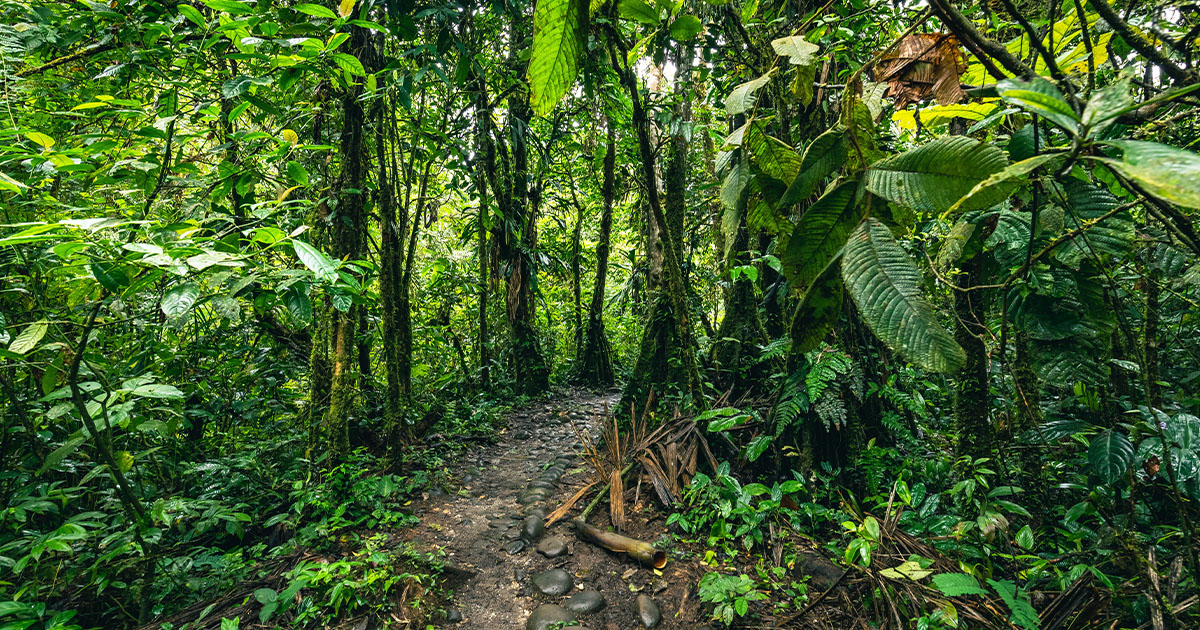
The miles of cliffs are not the only attraction at Pictured Rocks, though. There are miles of beaches, woodlands, and over 100 miles of trails taking you through the park’s unmatched beauty.
Let’s explore some of the top sites in the park.
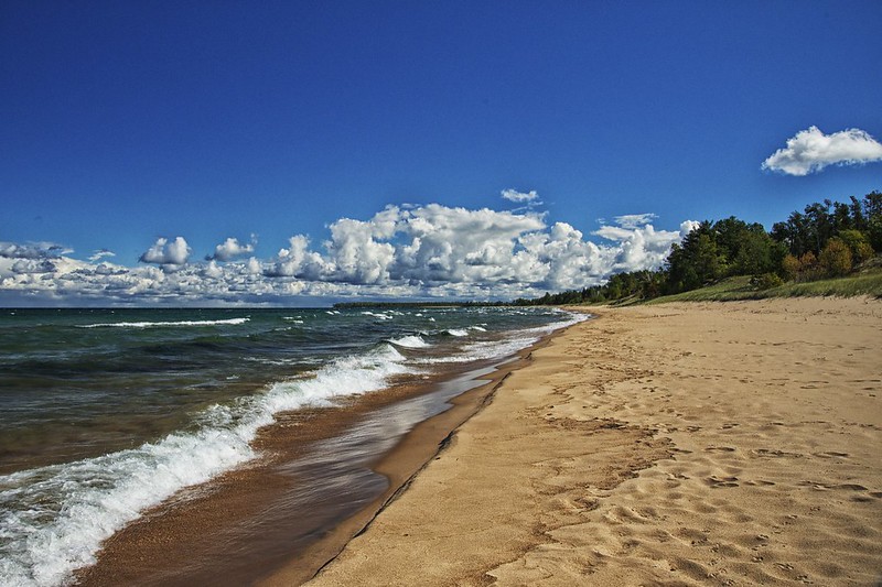
The Beaches
There are six main beaches within Pictured Rocks Park—and none of them have lifeguards. They all provide stunning views and pristine shorelines that are perfect for wading, reading, photography, and more.
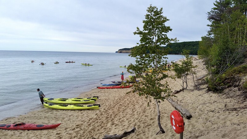
Sand Point Beach
Sand Point Beach is the park’s most popular spot, known for its warmer, shallow waters and gentle waves—ideal for families. It’s also the only beach with picnic tables right on the sand, perfect for a laid-back day by the lake.
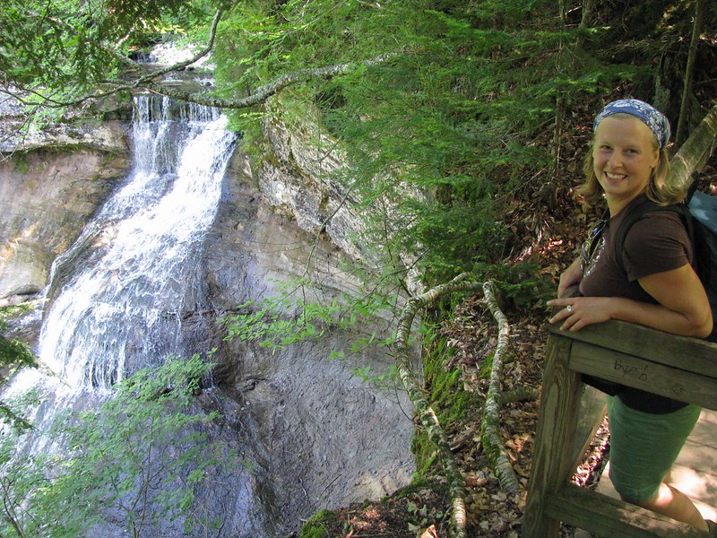
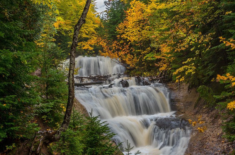
Chapel Falls Trail
Chapel Falls Trail offers a 2.5-mile round trip hike along an old roadbed through an upland maple forest. It brings you to a breathtaking 60-foot-high waterfall.
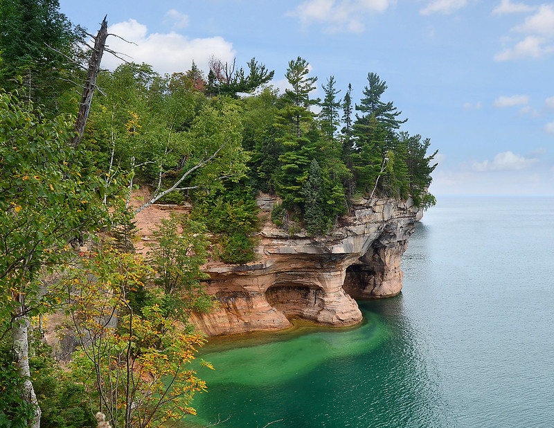
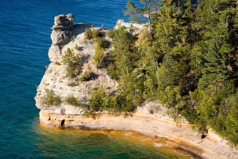
Miners Castle
Miners Castle is easily the most popular spot in the entire park. Years of erosion created this interesting rock formation, that is sadly crumbling today.
A short walk from the parking lot will take you to three different viewing platforms.
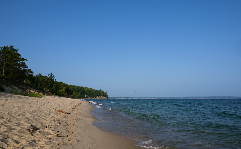
Miners Castle: The Beach
You can go past the viewing platforms and extend your hike downhill to the black-speckled sand of Miners Beach—another favorite among visitors.
You can get to this beach through some of the trails in the park as well.
 Pictured Rocks National Lakeshore, Flickr
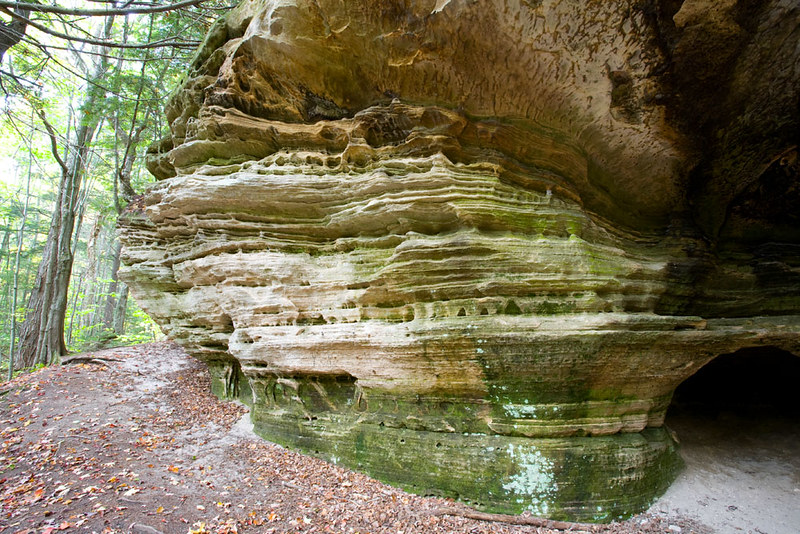
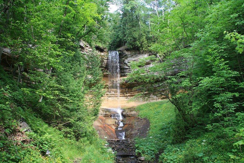
Munising Falls Trail
The Munising Falls trail offers an easy, paved 800-foot stroll leading to an observation deck where you can take in the stunning waterfall views.
The North Country Scenic Trail
The North Country Scenic trail will lead you 42 miles through the park, offering stunning views along the way.
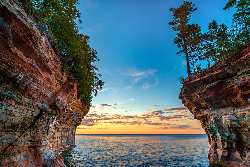
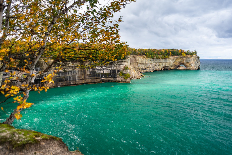
Grand Portal Point
Grand Portal Point offers one of the best views in Pictured Rocks Park. It’s not only full of intriguing caverns and unique rock formations, but it also has a suspended archway, and a massive rock face that make you suddenly realize how small you are.
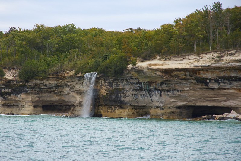
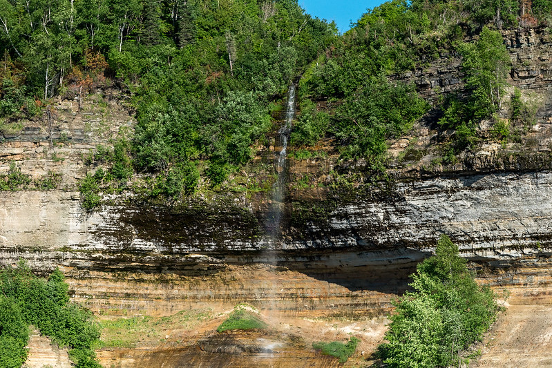
Spray Falls
Spray Falls is a remote waterfall and is considered one of the most picturesque aspects of Pictured Rocks. The water plunges 70 feet over the cliffs into Lake Superior, with an 1856 shipwreck at its base.
You can get to the falls by following the North Country Scenic Trail.
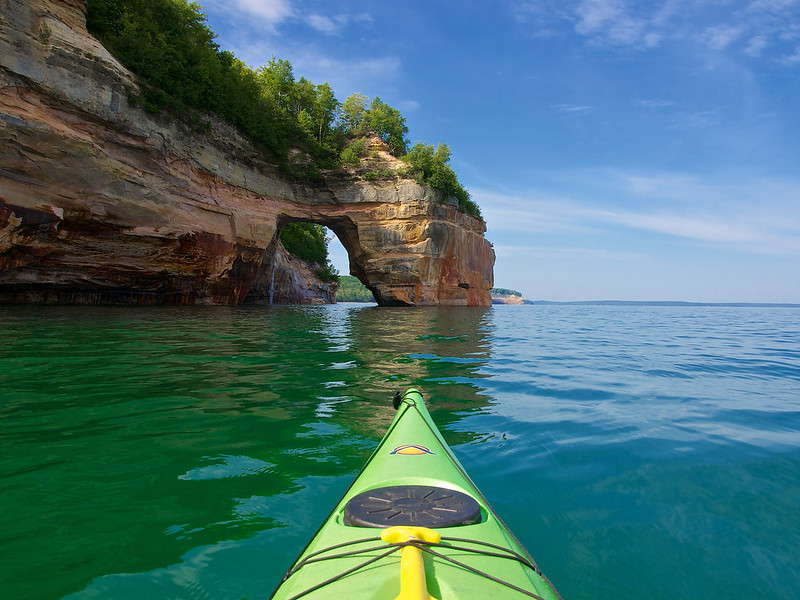
Lover’s Leap
Lover’s Leap is a kayaker’s favorite—an impressive rock arch that stretches from the shoreline out into the waters of Lake Superior.
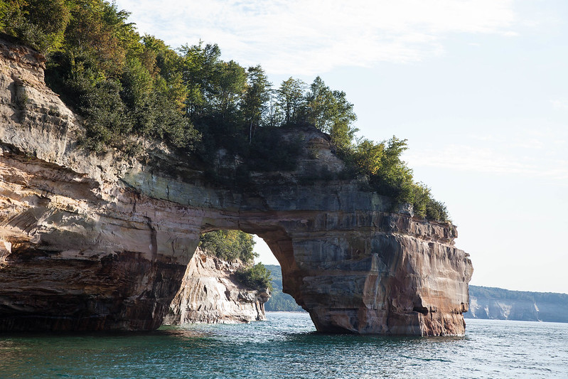
Lover’s Leap: Folklore
Legend has it, a couple displayed their love for each other by jumping off the arch together. Please, do not attempt this. The water below the arch is only a few feet deep and not at all suitable for jumping or diving.
Bridalveil Falls
Bridalveil Falls is a beautiful, seasonal waterfall that often appears on postcards for the park. It is best viewed from the water, or at a distance.
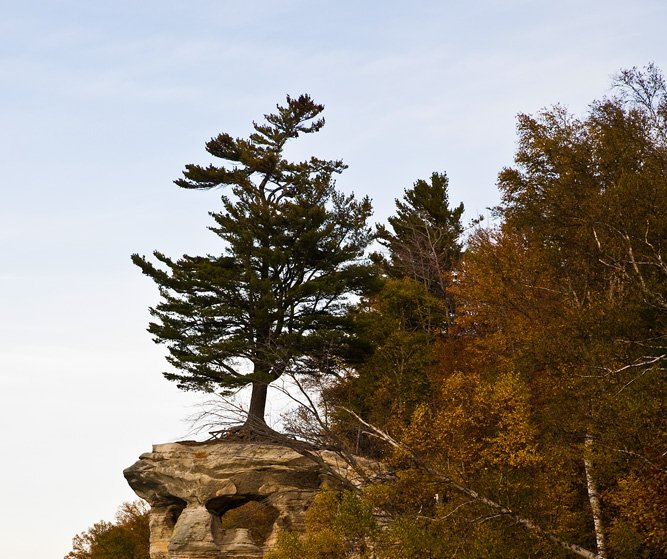
Chapel Rock
This stunning sandstone formation was carved by the high water some 3,800 years ago and was dubbed Chapel Rock by French Explorers.
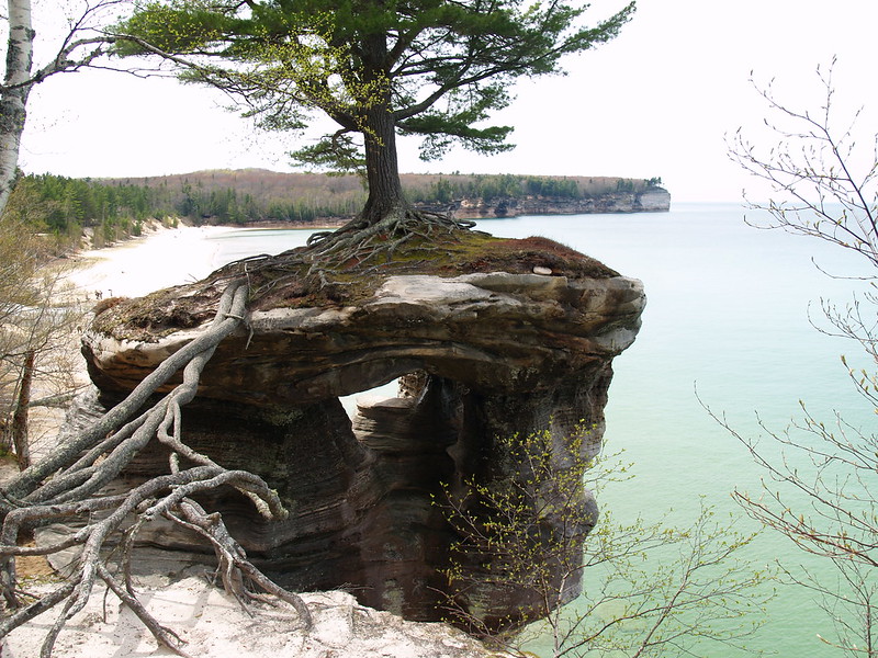
Chapel Rock: The Lone Tree
Once connected to the mainland by a natural archway that collapsed in the 1940s, Lover’s Leap now stands alone, crowned by a lone white pine estimated to be 250 years old.
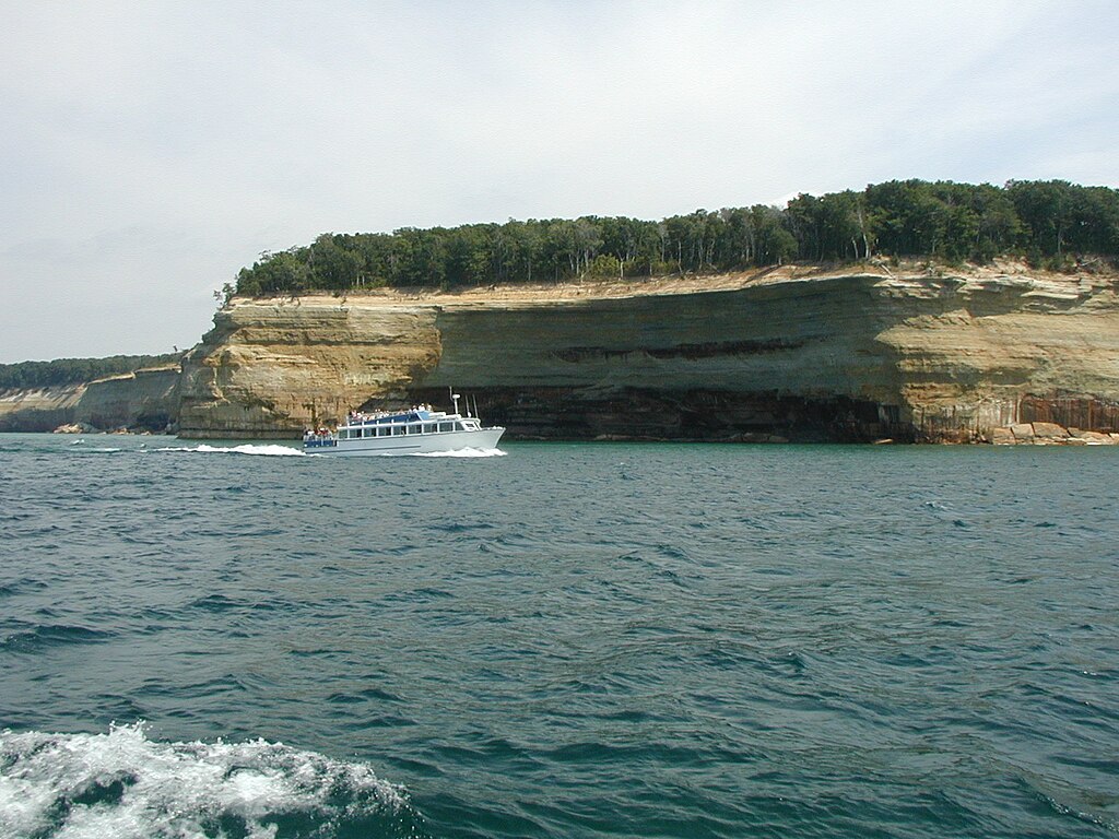
Guided Boat Tours
Pictured Rocks Cruises are available for visitors. This tour takes you around to see all the highlights of the park, including waterfalls, caves, cliffs, beaches, rock formations, a lighthouse, and more.
 Chris857, CC BY-SA 3.0, Wikimedia Commons
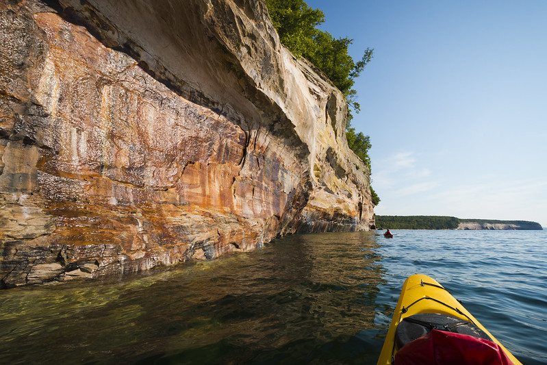
Paddle Tours
Kayak tours will take you by boat to a specific launch point where you will then steer through some of the sandstone caves, touch the mineral layers and glide over crystal clear waters below. The boat stays close in case you need a break.
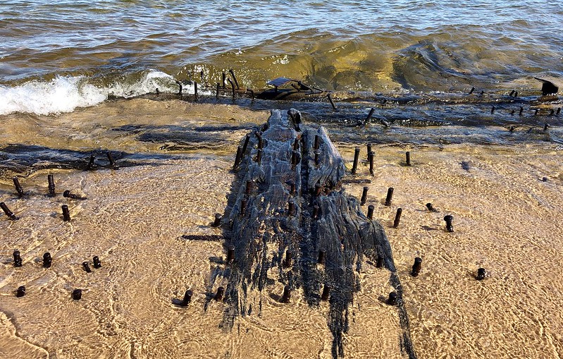
Glass Bottom Shipwreck Tours
These tours happen daily from Memorial weekend until the second week of October and reservations are encouraged. Your two-hour trip will include a visit to two different shipwreck sites as you journey near rock cliffs and through caves, and numerous other stunning sights.
 Pictured Rocks National Lakeshore, Flickr
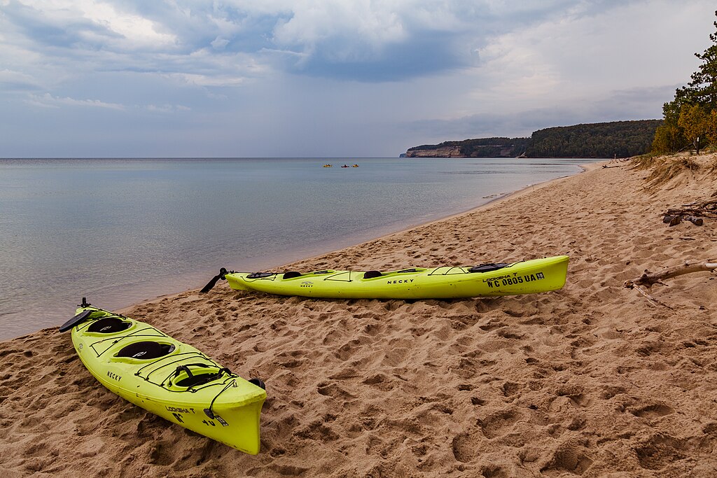
Boating & Kayaking
Boating and kayaking along rugged Lake Superior offer tourists a thrilling way to explore the lakeshore’s stunning cliffs and hidden coves up close.
 Tony Webster, CC BY-SA 2.0, Wikimedia Commons
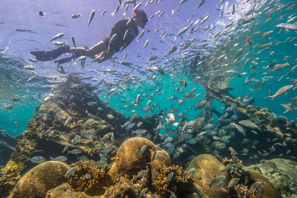
Diving & Snorkeling
Pictured Rocks is one of the best places in the Midwest United States for diving and snorkeling. Both activities are permitted throughout the park.
 National Parks Gallery, Picryl
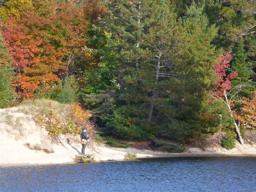
Fishing
There are multiple places within Pictured Rocks Park to fish, including Lake Superior, inland lakes, and numerous streams.
Popular fish caught here are smallmouth bass, northern pike, walleye, yellow perch, whitefish and smelt. And various trout species.
 National Parks Gallery, Picryl
Hunting
Hunting is also permitted in the park from after Labor Day to March 31st. You will find a variety of wild game in the grown-over farm fields, hardwood forests and cedar swamps along the Pictured Rocks National Lakeshore.
Winter Activities
Winter transforms Pictured Rocks into a snowy wonderland, where visitors can enjoy snowshoeing, cross-country skiing, snowmobiling, and even ice fishing.
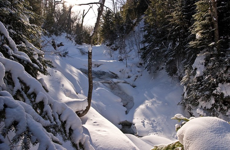
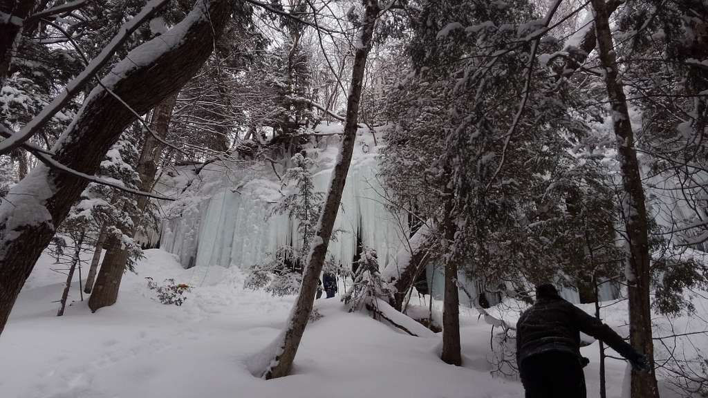
The Ice Curtains
One of the best places to check out during the winter is the ice curtains that tower up to 50 feet high between Munising Falls and Sand Point.
 National Parks Gallery, Picryl
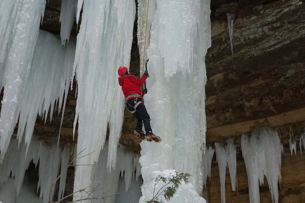
Ice Climbing
For those adventurous enough to try it, ice climbing is available along the escarpment between Munising Falls and Sand Point.
 National Parks Gallery, Picryl
Final Thoughts
Pictured Rocks National Lakeshore is undoubtably Michigan’s most beautiful hidden gem, where vibrant sandstone cliffs, waterfalls, and pristine lakeshores create a breathtaking landscape that can be enjoyed on both land and water.
If you haven’t already, add it to your summer bucket list—and don’t forget your camera!
 Rick Briggs, FlickrSources: 1, 2


.jpeg)
.jpeg)
.jpg)