America’s Strangest State Lines
America's state borders look reasonably straightforward until you examine them closely. There are mysterious wedges, enormous geographical bulges, towns split between states, and even places accessible only by traveling through another state. Behind these cartographic oddities lie surveying mistakes, colonial rivalries, political compromises, and occasionally threats of actual warfare.
 Prostock-studio, Shutterstock; Factinate Ltd
Delaware’s Twelve-Mile Circle
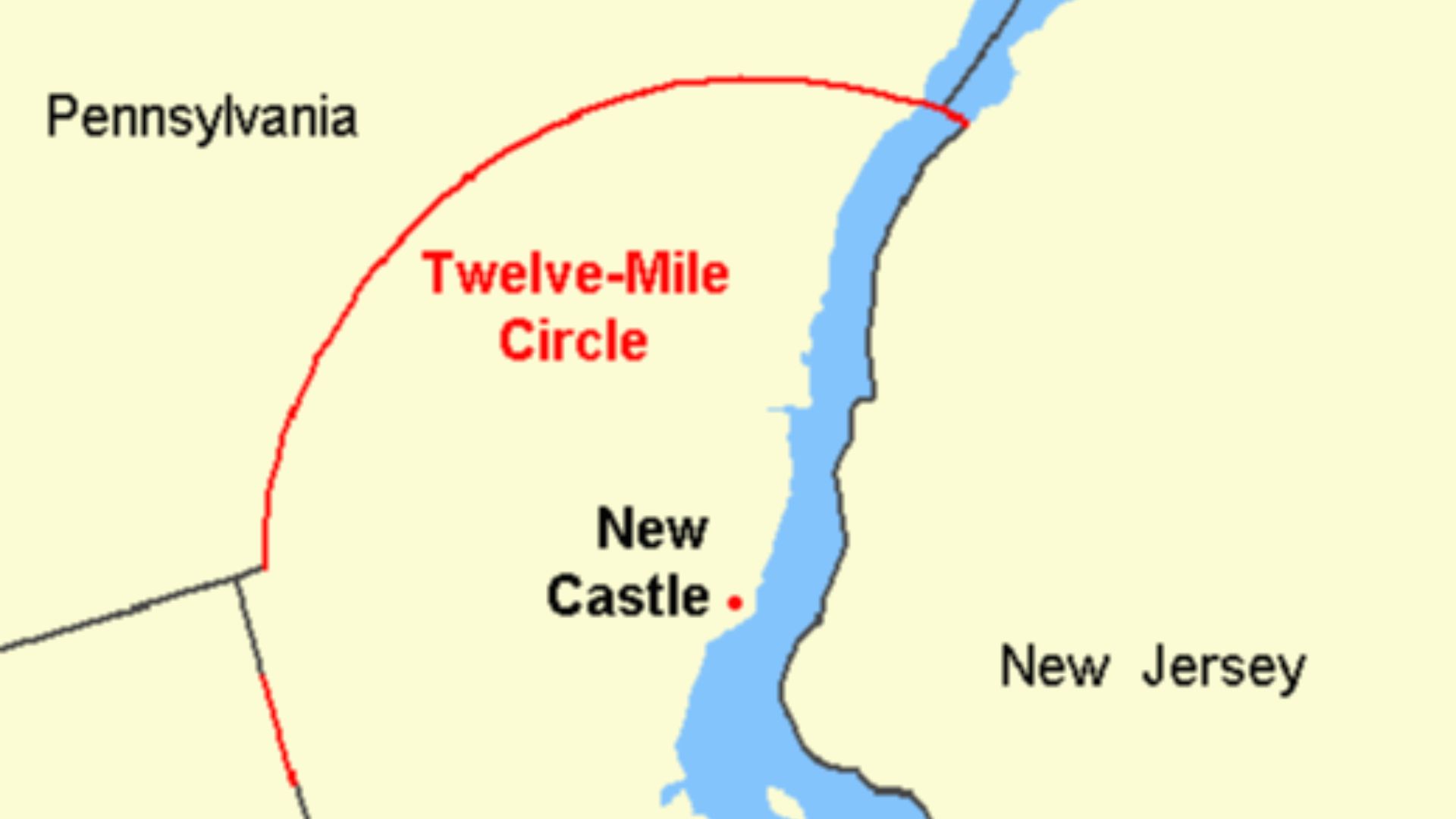
Most American state borders follow straight lines or geographical features. Delaware's northern boundary does neither. It's a sweeping circular arc with a radius of approximately 12 miles, originally established around New Castle during the colonial period. The unusual arrangement protected territory claimed by the Duke of York and created a geographical puzzle that took generations to resolve.
 BetacommandBot, Wikimedia Commons
The Mysterious Delaware Wedge
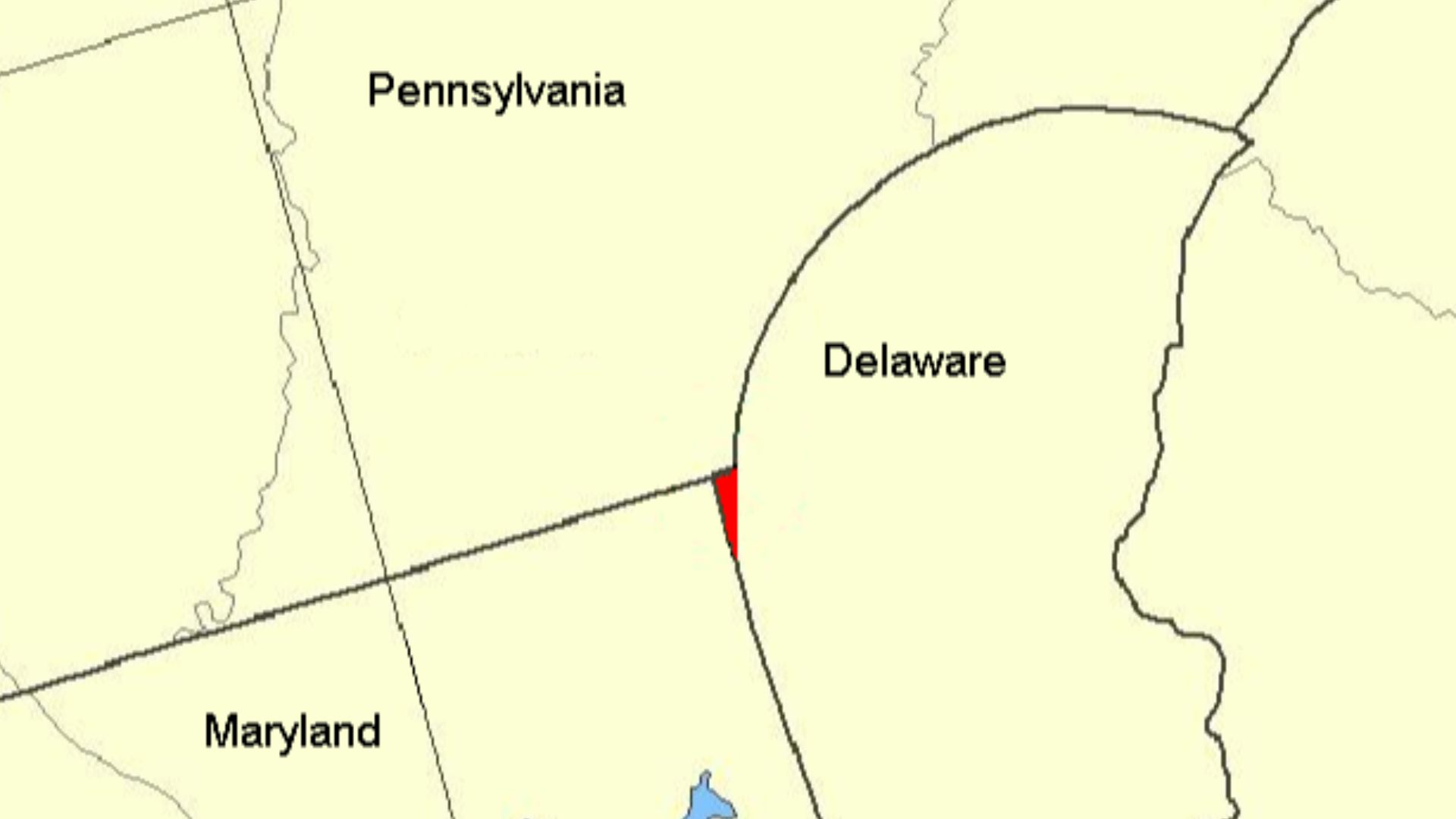
Delaware's circular boundary created another peculiar problem. Where it met the colonial survey lines, a small triangular territory was left in dispute. Pennsylvania claimed the approximately 800-acre Wedge, but Delaware governed it. The argument continued long after American independence and wasn't completely settled until 1921.
 Exterioramoeba, Wikimedia Commons
Delaware Owns The River
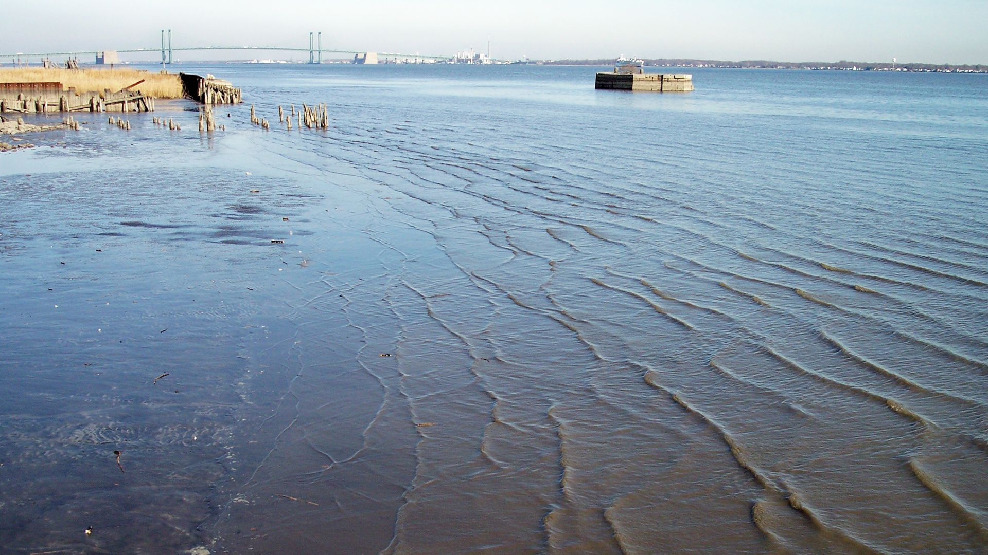
Normally, a river separating two states has a boundary running somewhere through its waters. Delaware's border with New Jersey is different. Within the Twelve-Mile Circle, Delaware's jurisdiction generally extends across the river to the New Jersey low-water mark. This unusual colonial inheritance has even generated modern disputes over waterfront development.
 Tim Kiser (w:User:Malepheasant), Wikimedia Commons
Michigan’s Almost-War With Ohio
A geographical misunderstanding nearly started a war between Michigan and Ohio. Early maps inaccurately represented Lake Michigan's southern position, producing conflicting interpretations of the boundary near Toledo. Both sides wanted the strategically valuable territory. Their increasingly hostile disagreement culminated in the Toledo War of 1835–1836.
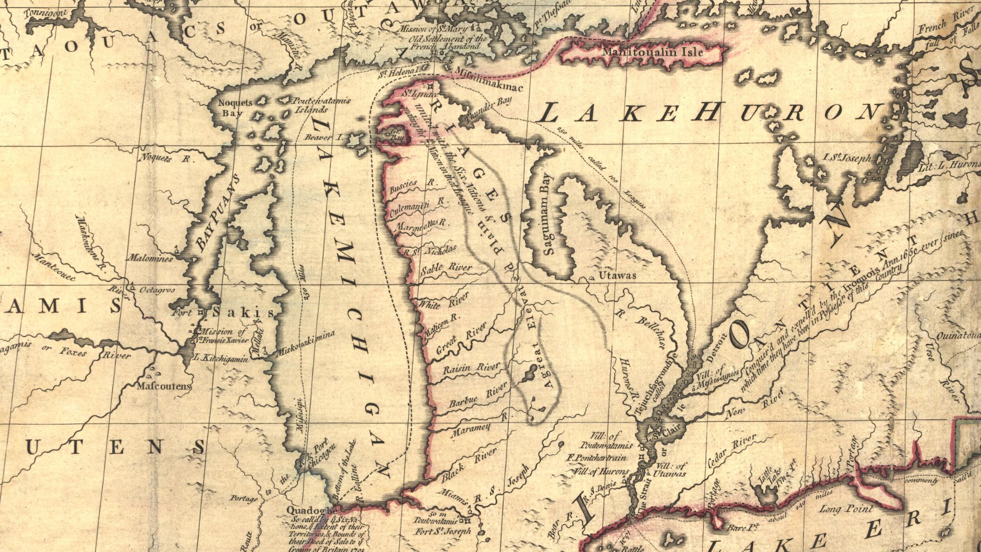 John Mitchell, Wikimedia Commons
Michigan Gets An Unexpected Prize
Michigan ultimately surrendered its claim to Toledo, but the settlement came with extraordinary compensation. Congress offered Michigan the western Upper Peninsula, territory that might otherwise have become part of Wisconsin. The arrangement helped clear the way for Michigan's statehood in 1837 and explains its unusual two-part geography.
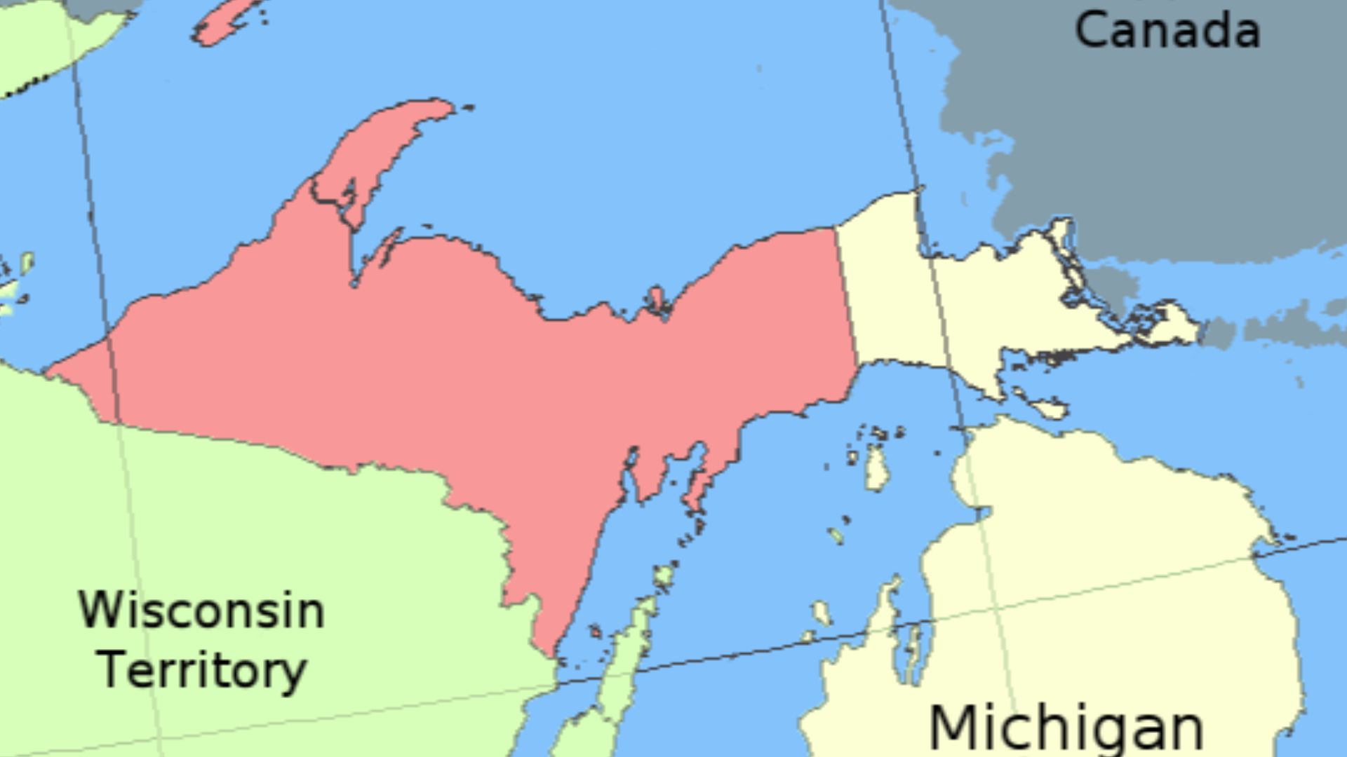 Wikipedia uploader was Hotstreets at en.wikipedia, Wikimedia Commons
Kentucky’s Completely Detached Peninsula
Kentucky contains a tiny geographical curiosity known as Kentucky Bend. Surrounded by a great loop of the Mississippi River, this detached section of Kentucky can be reached by road only through Tennessee. The anomaly resulted from the intersection of a fixed latitude boundary with the Mississippi's enormous natural meanders.
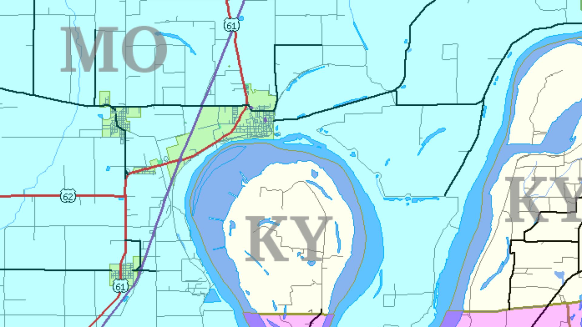 Jim Efaw (self), Wikimedia Commons
The Missouri Bootheel
Missouri's southeastern corner looks as though somebody accidentally drew an extra rectangle onto the state. The Bootheel was no accident, however. During Missouri's formation, influential settlers successfully pressed for the region to be included. The result was a conspicuous extension southward into territory that geographically resembles neighboring Arkansas.
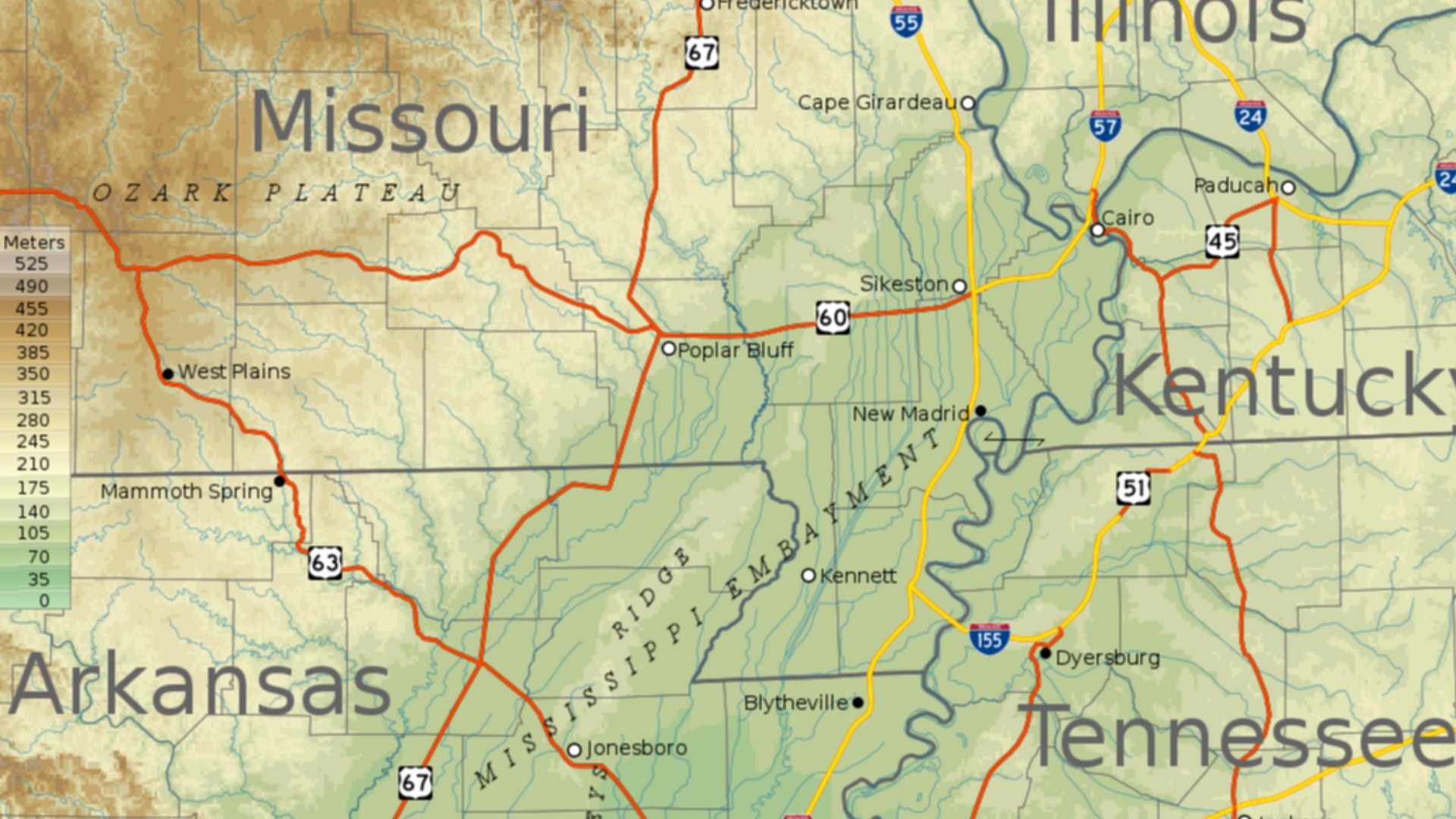
Iowa’s Great Honey War
In 1839, Iowa Territory and Missouri nearly fought over an ambiguous boundary. Confusing treaty language, inconsistent surveys, and competing territorial claims created a disputed strip. The confrontation became known as the Honey War after a Missouri tax collector reportedly seized honey-producing trees. Armed forces assembled, but the disagreement ended without a battle.
![The maps shows the lands disputed in the Honey War between Missouri and Iowa. It is based on the text of the court decision settling the dispute. [1]](https://www.factinate.com/storage/app/media/splashtravels/2026/10/5/1791180594edcf010a5c670ff5f77a264b66dc22eff1a9f27b.png) No machine-readable author provided. Kmusser assumed (based on copyright claims)., Wikimedia Commons
No machine-readable author provided. Kmusser assumed (based on copyright claims)., Wikimedia Commons
Connecticut’s Curious Little Notch
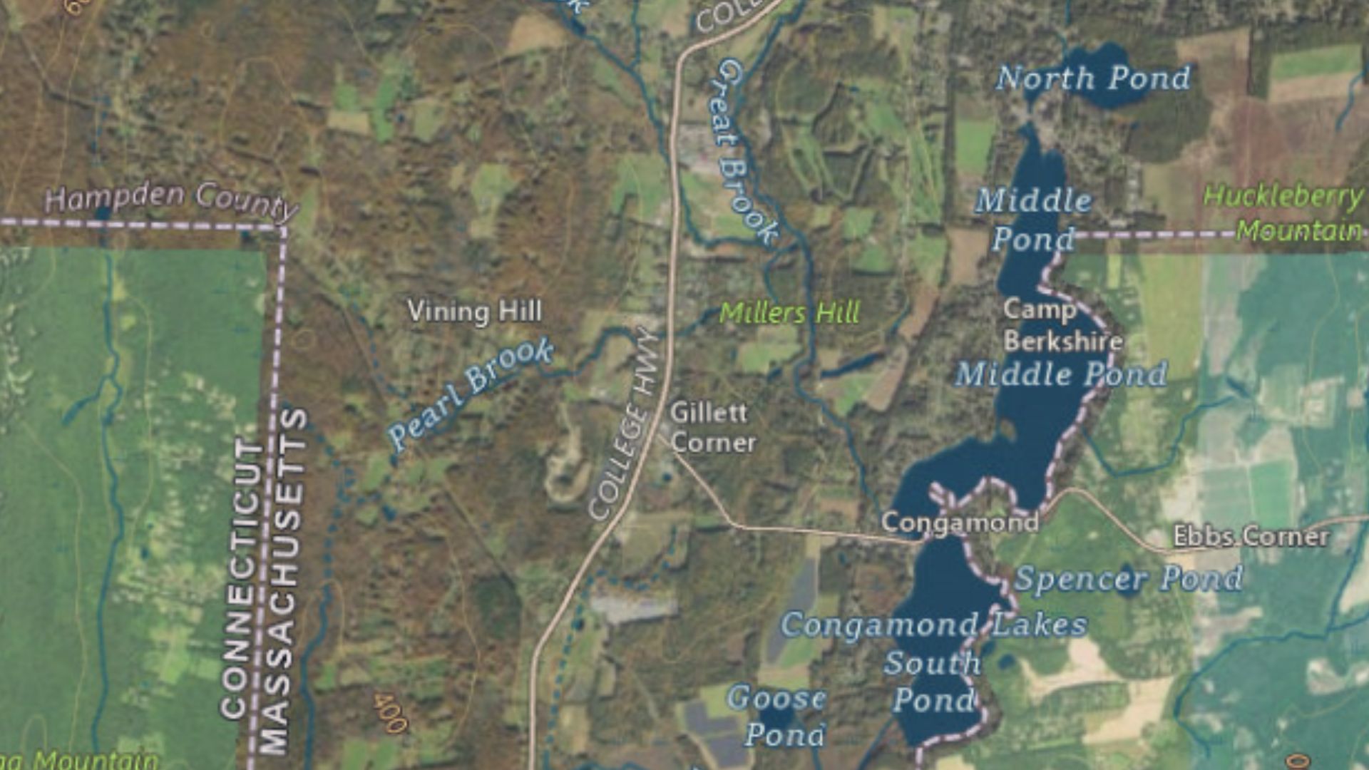
Look closely at Connecticut's northern border and you'll discover a strange rectangular indentation near Southwick, Massachusetts. Known as the Southwick Jog, it originated in conflicting colonial surveys and competing territorial claims. A compromise eventually gave Massachusetts the protruding territory, leaving Connecticut with one of America's most conspicuous boundary irregularities.
 I took the screenshot myself., Wikimedia Commons
Connecticut’s Forgotten Western Claim
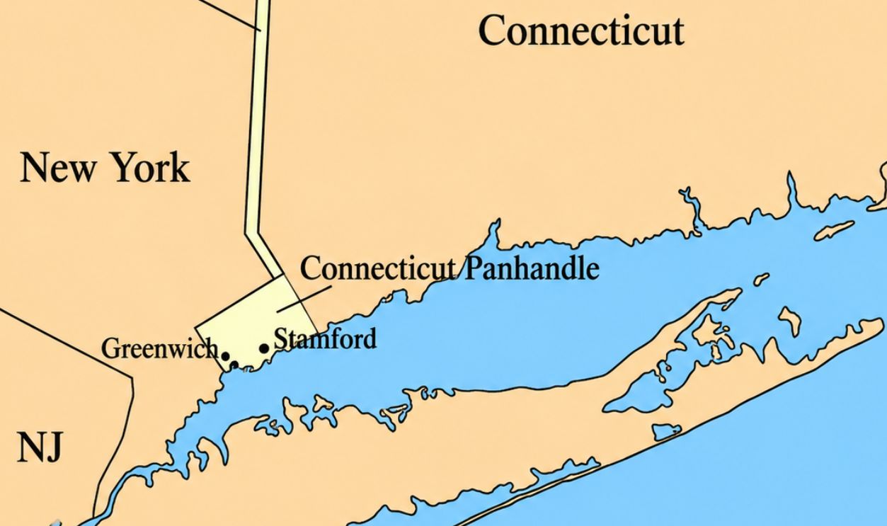
Connecticut's southwestern panhandle is another reminder of colonial boundary confusion. Connecticut and New York originally disputed extensive territory along their shared border. An agreement in 1683 allowed Connecticut to retain communities including Greenwich and Stamford, while New York received compensating territory farther north. The result was Connecticut's distinctive southwestern extension.
New York’s Strange Northern Corner
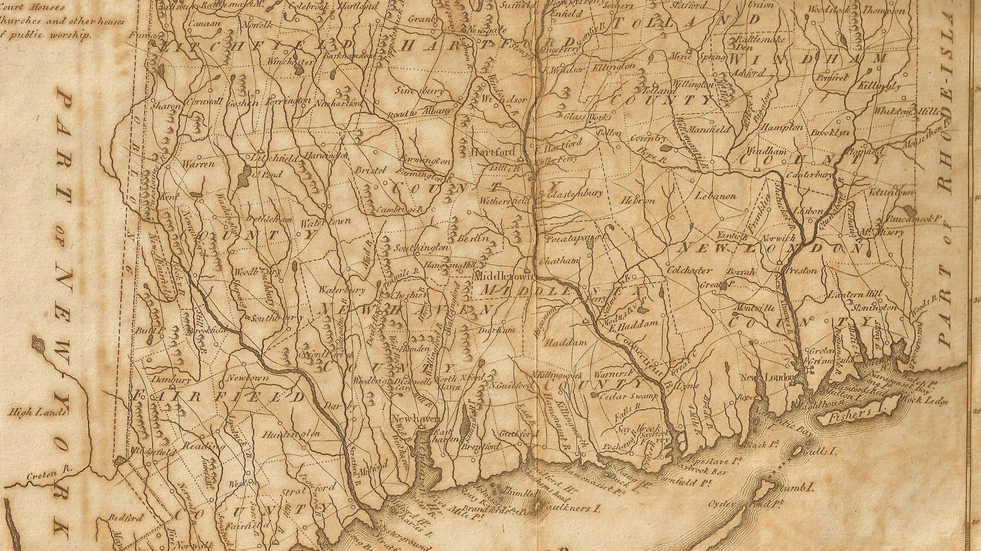
The border between New York, Massachusetts, and Connecticut contains another peculiar legacy of colonial negotiations. The boundaries were established through separate agreements rather than one coordinated survey. Connecticut's northwest corner, Massachusetts' southwestern edge, and New York's eastern boundary consequently form a complicated arrangement of lines reflecting centuries-old territorial bargaining.
 DigbyDalton, Wikimedia Commons
Vermont’s Riverbank Border
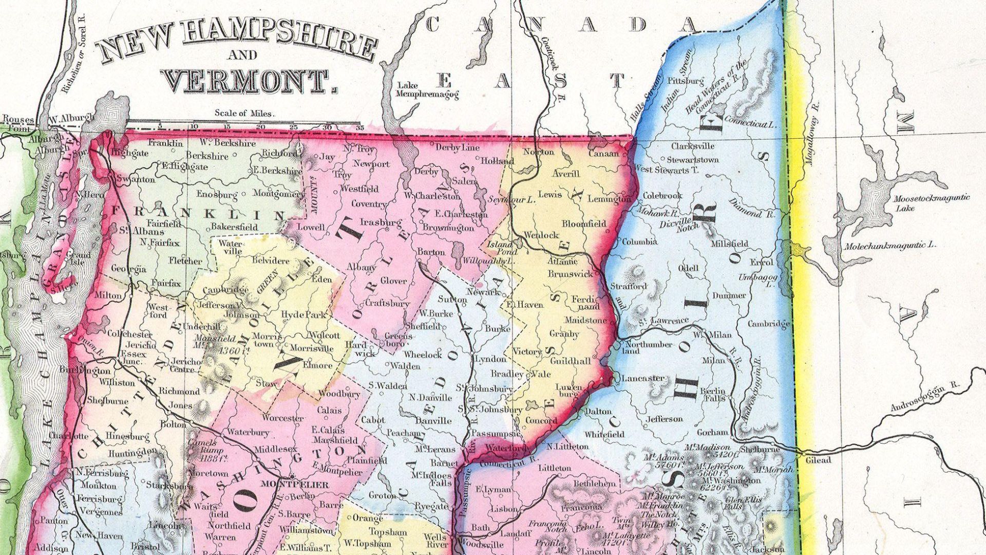
The Connecticut River appears to provide a natural boundary between Vermont and New Hampshire. But the legal border generally follows the low-water mark on Vermont's side, leaving most of the river within New Hampshire. The unusual arrangement originated in competing colonial grants and was eventually confirmed by the United States Supreme Court.
 Samuel Augustus Mitchell, Wikimedia Commons
New Hampshire’s Coastal Sliver
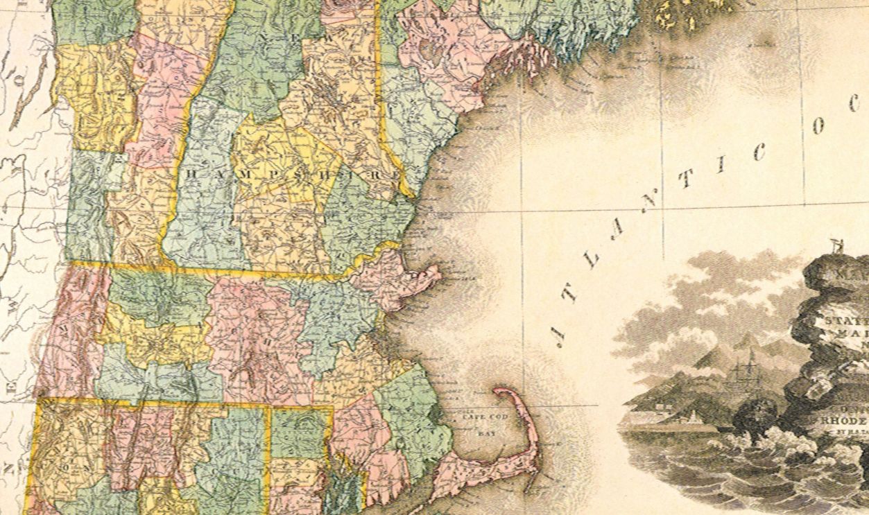
New Hampshire has one of America's shortest ocean coastlines, squeezed between Massachusetts and Maine. Its tiny Atlantic frontage reflects colonial territorial divisions that eventually separated the three states. Maine remained part of Massachusetts until 1820, leaving New Hampshire with a narrow but economically important stretch of Atlantic shoreline.
Maine’s Complicated Northern Border
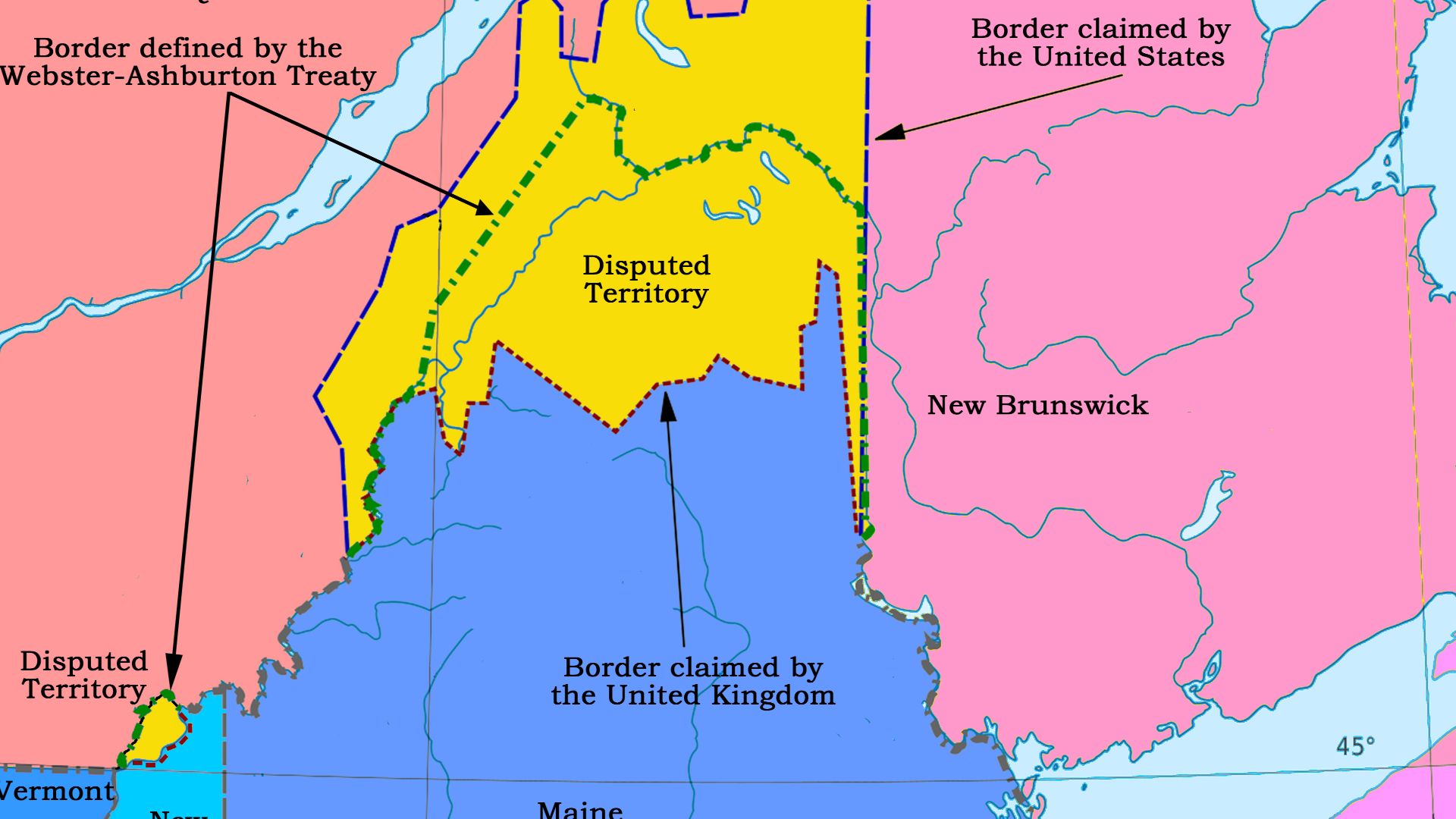
Maine's northern border was once so poorly defined that Americans and British colonists nearly went to war over it. The Aroostook War of 1838–1839 involved rival authorities, militia mobilizations, and competing interpretations of earlier treaties. The Webster-Ashburton Treaty of 1842 finally established much of the modern boundary between Maine and Canada.
Maryland’s Narrowest Point
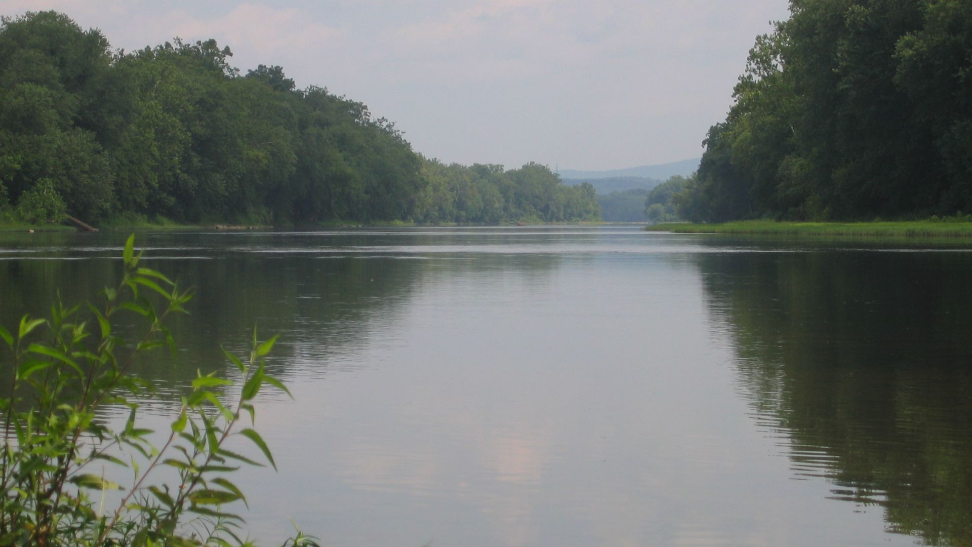
Near Hancock, Maryland becomes astonishingly narrow. Only a few miles separate Pennsylvania to the north from West Virginia across the Potomac River to the south. The peculiar geographical pinch resulted from the intersection of colonial survey lines with the winding Potomac, creating a state that almost appears to have been squeezed in half.
West Virginia’s Eastern Panhandle
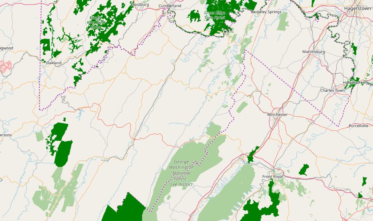
West Virginia's Eastern Panhandle stretches northeastward between Maryland and Virginia, creating one of the country's strangest state outlines. Its shape reflects older Virginia boundaries and the counties that ultimately joined West Virginia during the Civil War. Geography, transportation connections, and sharply divided local loyalties complicated the creation of the new state.
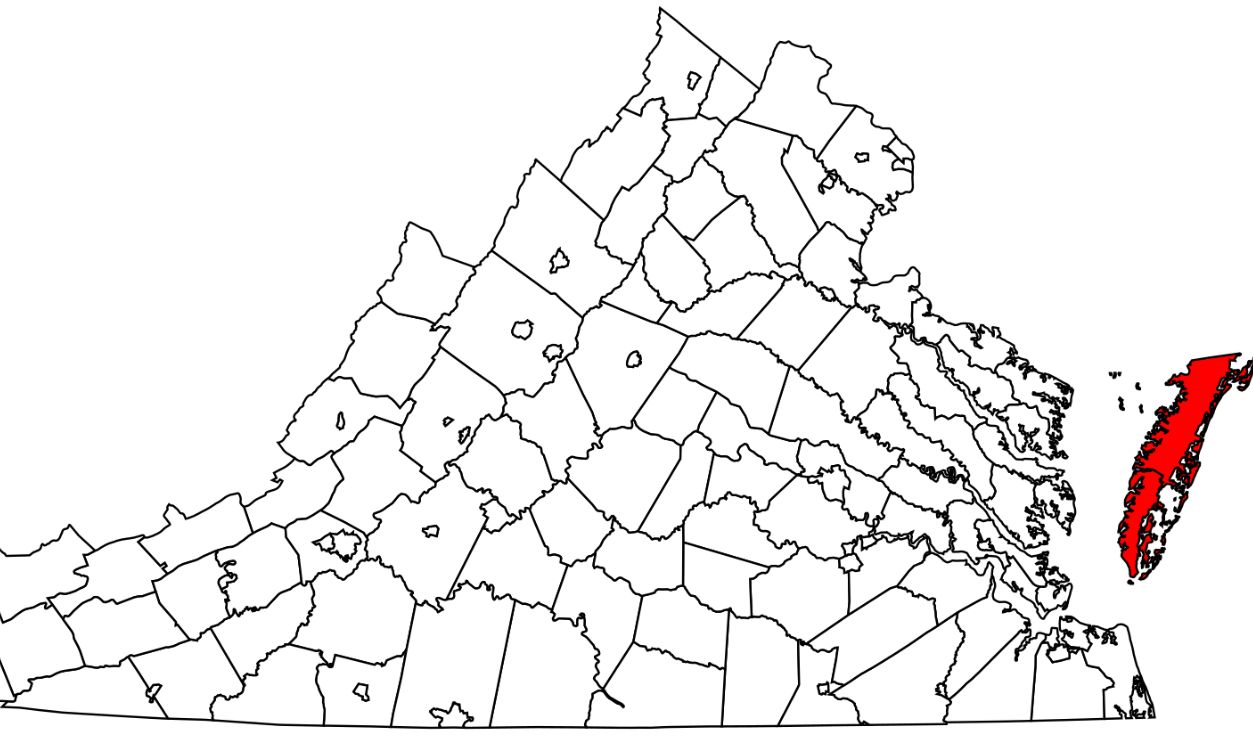
Virginia’s Detached Eastern Shore
Virginia possesses a long, narrow territory separated from the rest of the state by Chesapeake Bay. Its Eastern Shore occupies the southern end of the Delmarva Peninsula, which Virginia shares with Maryland and Delaware. Colonial settlement patterns and territorial grants produced this unusual arrangement, leaving Virginia with a region geographically closer to neighboring states.
North Carolina’s Surveying Surprise
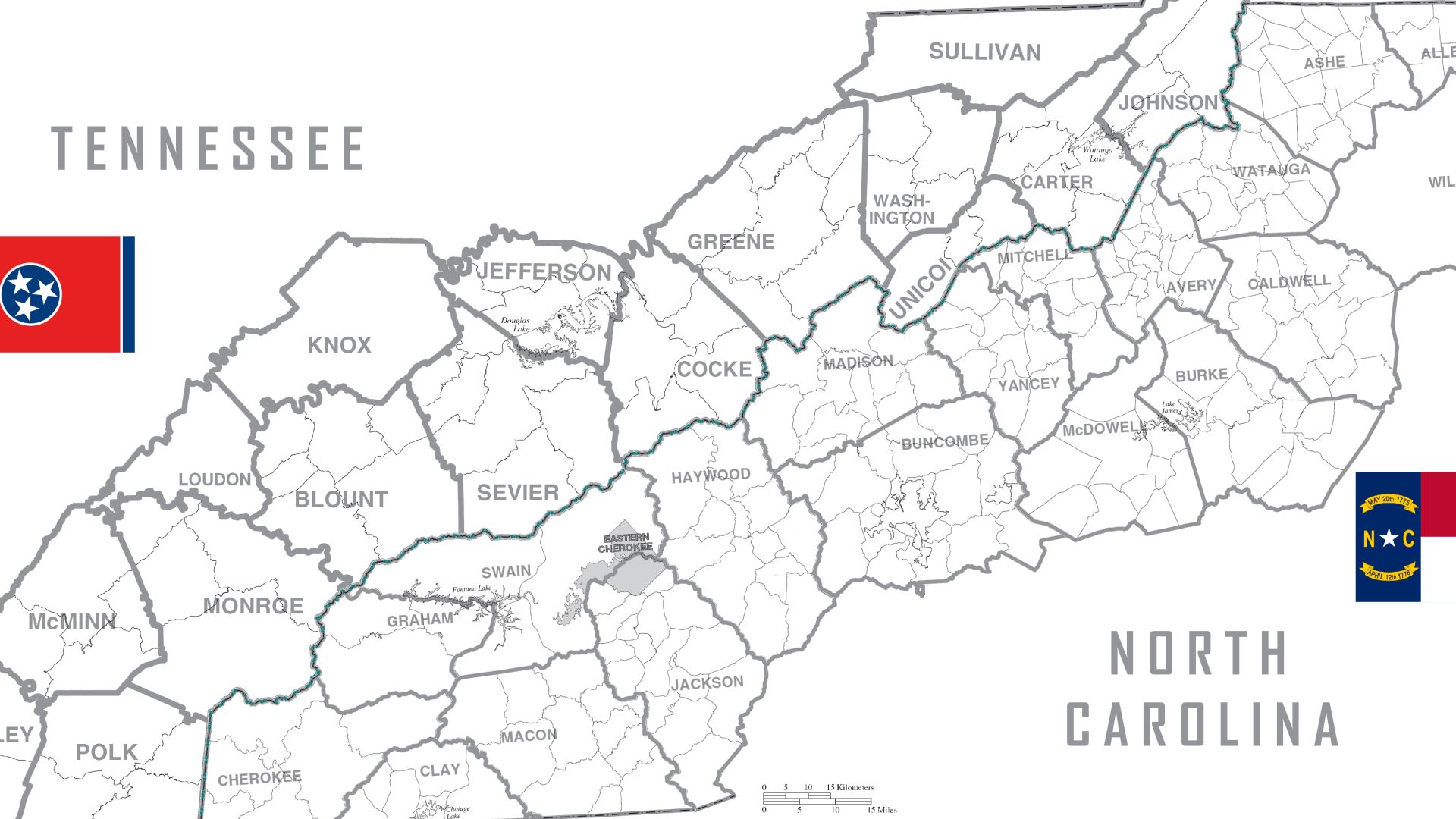
The mountainous border between North Carolina and Tennessee proved extraordinarily difficult to establish. Early surveyors struggled with rough terrain, incomplete geographical knowledge, and disputed colonial claims. When Tennessee became a state in 1796, it inherited a western boundary that had already generated disagreements. Subsequent surveys and legal disputes continued refining the line.
 ArcticBartek, Wikimedia Commons
Georgia’s Missing Tennessee Access
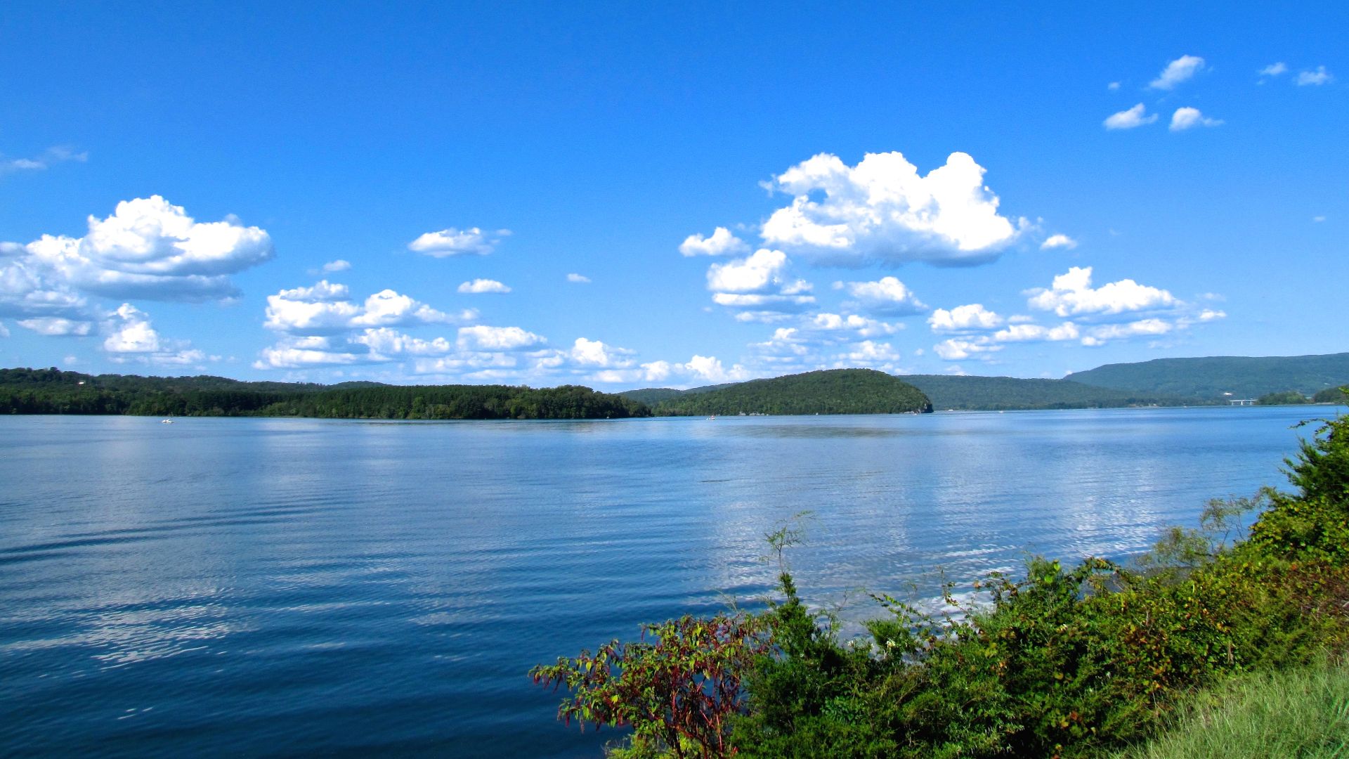
Georgia's northern boundary contains a surveying controversy with surprisingly modern consequences. An 1818 survey placed the state's northern line south of the intended 35th parallel. Georgia has repeatedly argued that the discrepancy deprived it of access to the Tennessee River, a potentially valuable water source. Tennessee has resisted Georgia's territorial claims.
 Brian Stansberry, Wikimedia Commons
Alabama’s Peculiar Coastal Strip
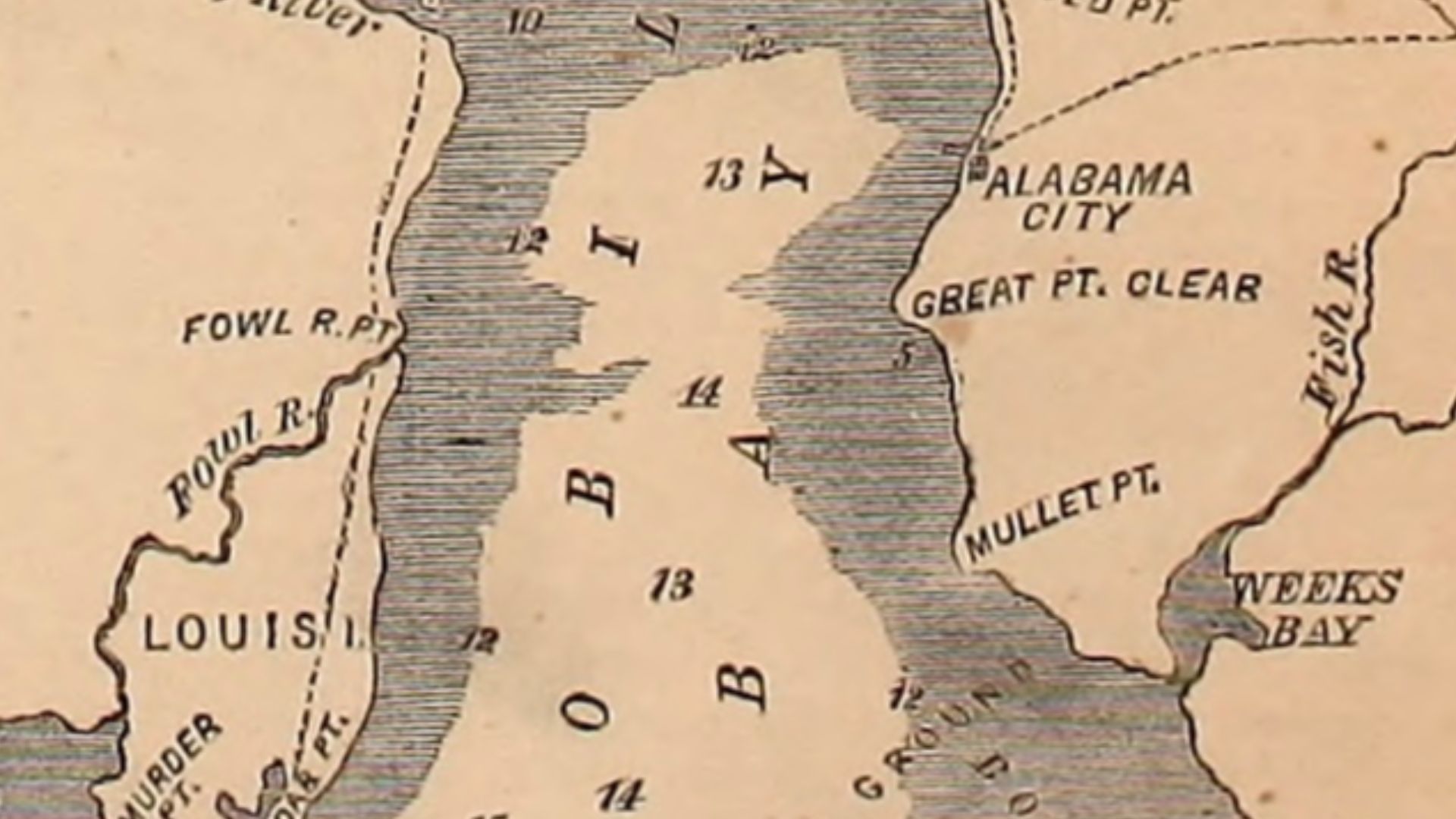
Alabama reaches the Gulf of Mexico through a relatively narrow coastal opening, while Florida's Panhandle stretches westward across much of the northern Gulf Coast. The arrangement reflects the complicated history of Spanish West Florida, British colonial administration, and subsequent American territorial divisions. Alabama's access to Mobile Bay became particularly important.
 Harper's Weekly, Wikimedia Commons
Oklahoma’s Enormous Panhandle
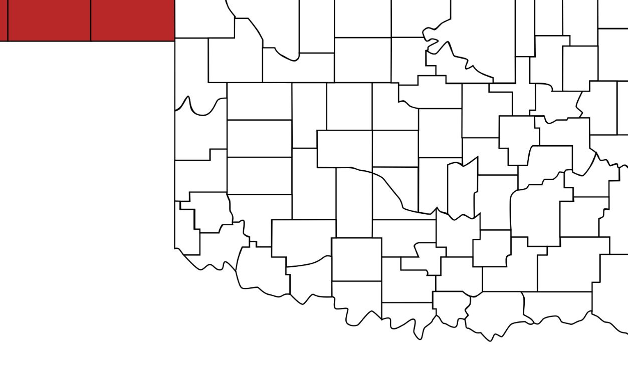
Oklahoma's Panhandle exists largely because of slavery-era political geography. When Texas entered the United States, it eventually surrendered territory north of latitude 36°30′ as part of the Compromise of 1850. The strip subsequently became known as No Man's Land before being incorporated into Oklahoma Territory in 1890.
 User:Derfel73; Scott Nazelrod, Wikimedia Commons
Texas And Its Western Elbow
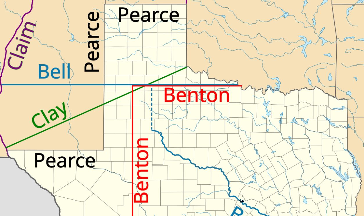
Texas once claimed an enormous territory extending far beyond its present borders. The Compromise of 1850 established new boundaries and compensated Texas for relinquishing its claims. The resulting western border incorporated geographical and political compromises, helping explain the state's peculiar outline around El Paso and its long boundary with New Mexico.
 USA_Texas_location_map.svg: Alexrk, Wikimedia Commons
California’s Slanted Eastern Border
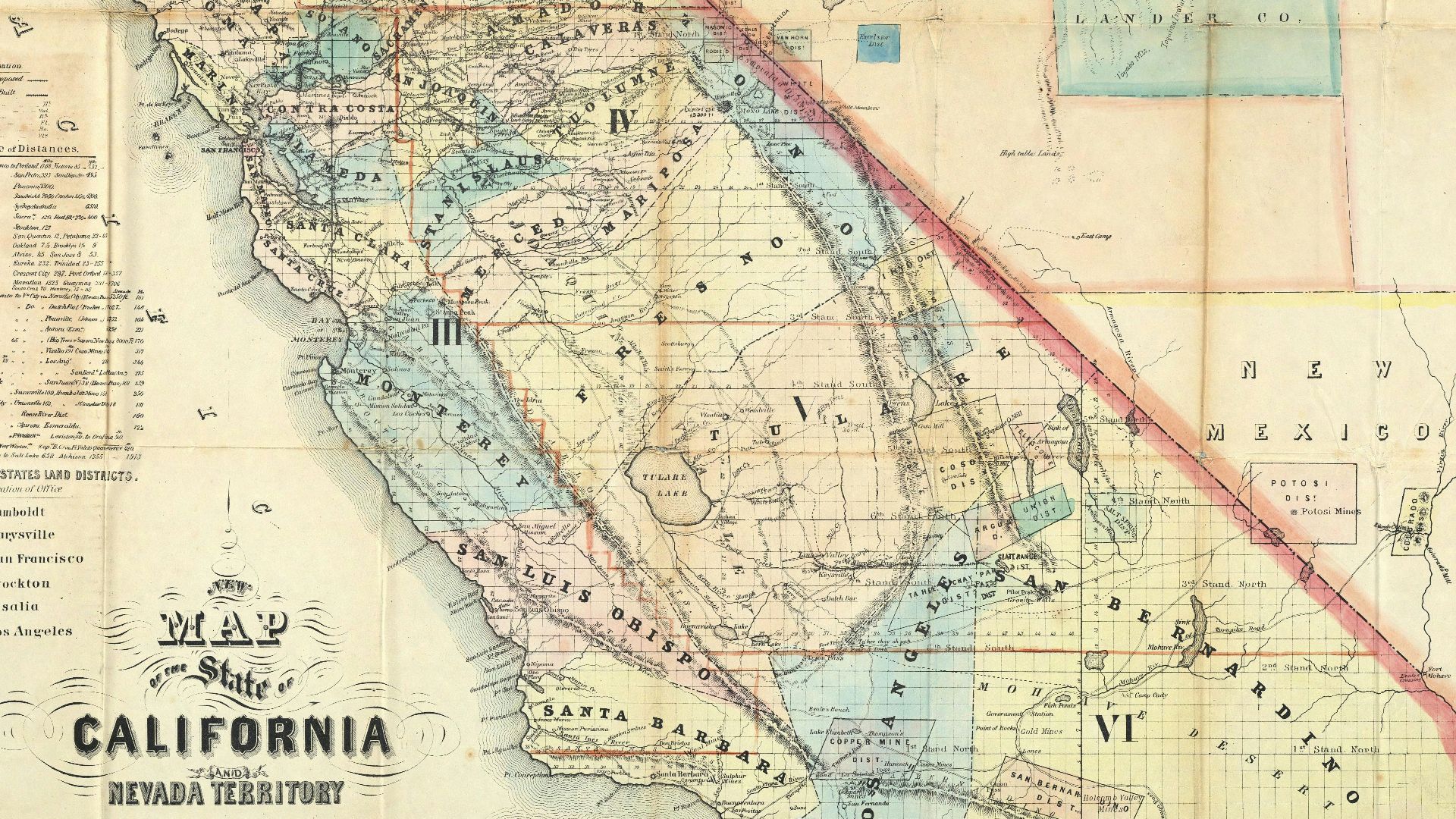
California's eastern boundary takes an unexpected diagonal turn rather than following a simple north-south line. Delegates drafting California's 1849 constitution deliberately chose boundaries incorporating valuable territory while avoiding an even larger state. The diagonal line connecting the Sierra Nevada region with the Colorado River became one of America's most recognizable artificial borders.
 Doolittle, A.J. Holt, A.J. Ransom, Leander Nagel, L. (Louis), Wikimedia Commons
The Four Corners Puzzle
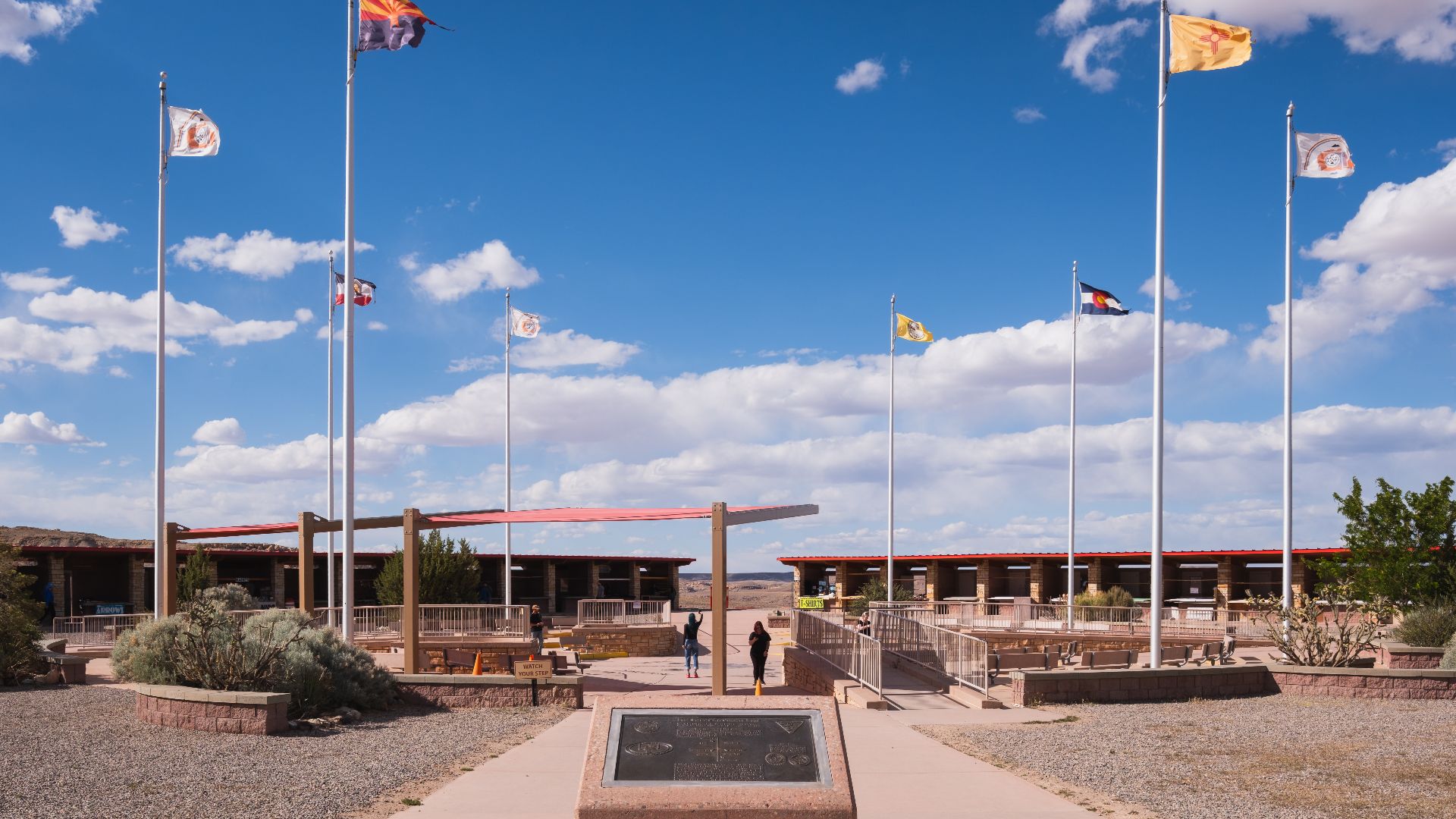
Arizona, Utah, Colorado, and New Mexico meet at a single point, creating America's famous Four Corners. The intersection resulted from territorial boundaries established through congressional legislation and nineteenth-century surveys. Although modern measurements have inspired claims that the monument is misplaced, the legally recognized boundary point remains where the original surveys established it.
 Christian David, Wikimedia Commons
You May Also Like:
The World's Strangest Borders That Make Almost No Geographic Sense
Americans Should Know These States Used To Have Completely Different Names—But Most Don’t
The States Most Likely To Become Their Own Country—According To Other Americans