Maps Get Very Weird
International borders look wonderfully simple in an atlas until you zoom in. Then countries suddenly develop detached towns, narrow corridors, enclaves inside enclaves, and territories reachable only through somebody else's country. These 26 places prove that history has produced geography no sane cartographer would design from scratch.
Baarle, Belgium And Netherlands
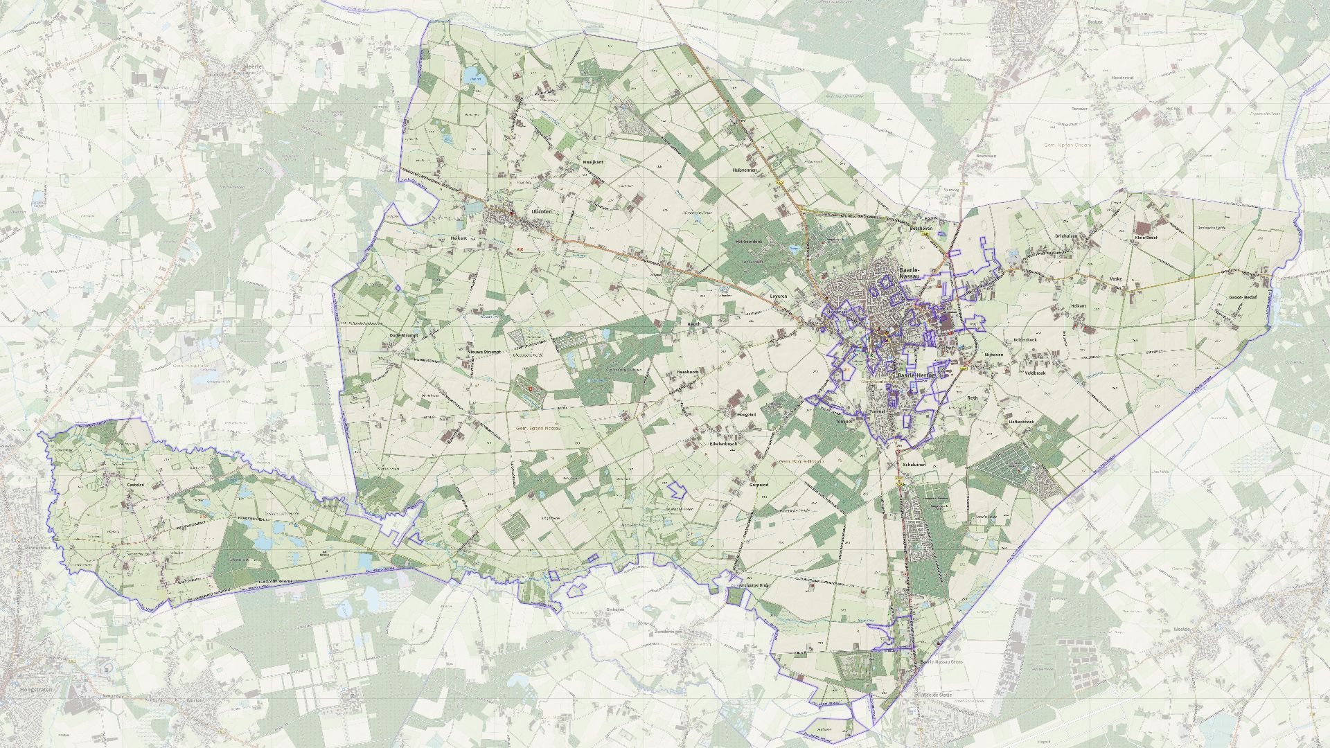
Baarle may be the undisputed champion of ridiculous borders. Belgian Baarle-Hertog consists of 22 enclaves scattered through Dutch Baarle-Nassau, with Dutch counter-enclaves tucked inside some Belgian ones. The boundary crosses streets, gardens, buildings, and even rooms, creating a genuine international jigsaw puzzle.
 Janwillemvanaalst, Wikimedia Commons
Madha, Oman
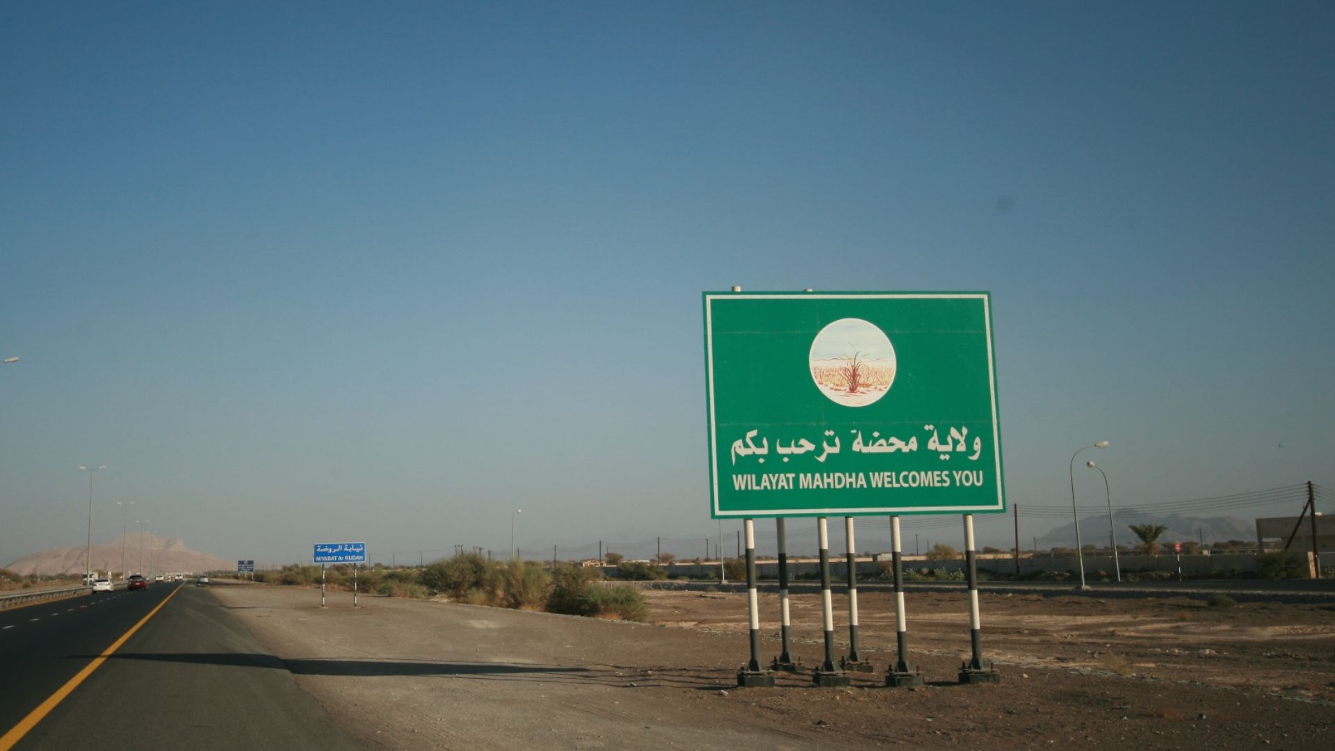
Oman's territory is already unusually fragmented, but Madha takes things further. This Omani wilayat belongs to Musandam Governorate yet sits completely surrounded by the United Arab Emirates. In other words, you can leave the UAE, enter a tiny pocket of Oman, and then encounter an even stranger surprise inside it.
 Alexandermcnabb, Wikimedia Commons
Nahwa, United Arab Emirates
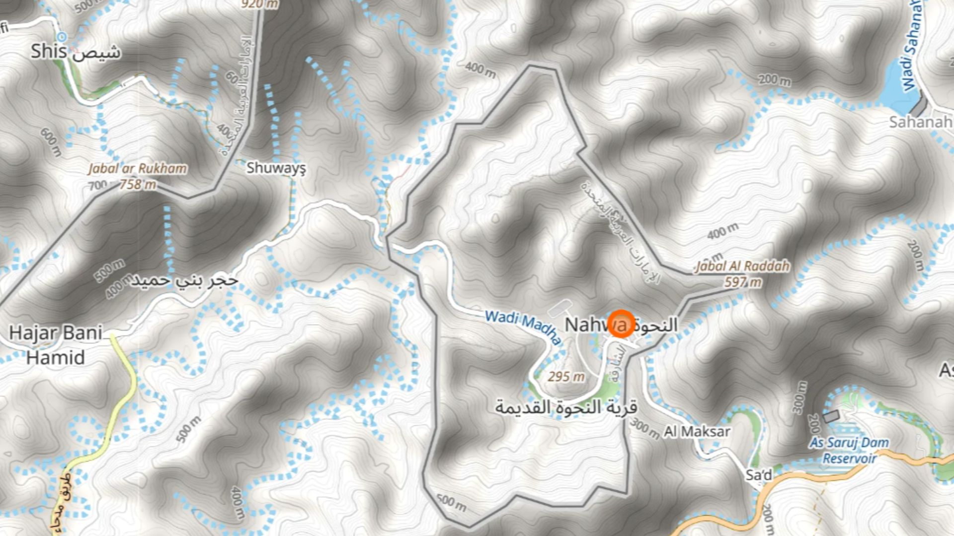
Inside Oman's Madha enclave is Nahwa, which belongs to the UAE. That makes Nahwa a counter-enclave: Emirati territory surrounded by Omani territory that is itself surrounded by the UAE. It is one of those places where explaining your location requires something resembling a geography flowchart.
 IbrahimKumar, Wikimedia Commons
Llívia, Spain
The Spanish town of Llívia sits completely inside France, roughly five kilometers from Spain proper. The oddity dates to the 17th-century settlement that transferred surrounding communities to France while Llívia remained Spanish. Later treaties even had to address practical access between the enclave and Spain.
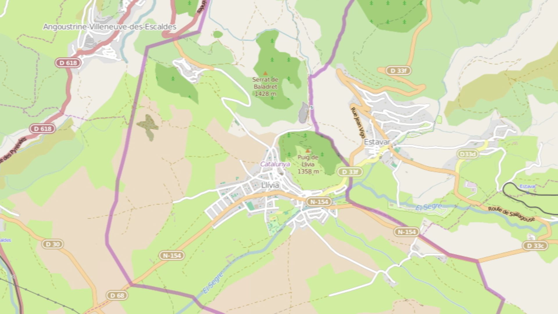 OSM contributors, Wikimedia Commons
Campione D'Italia, Italy
Campione d'Italia is unmistakably Italian, except for the inconvenient fact that Switzerland surrounds it. The municipality covers roughly 2.6 square kilometers beside Lake Lugano, and its nearest connection with the rest of Italy is tantalizingly close across mountainous terrain. Switzerland nevertheless sits between Campione and its homeland.
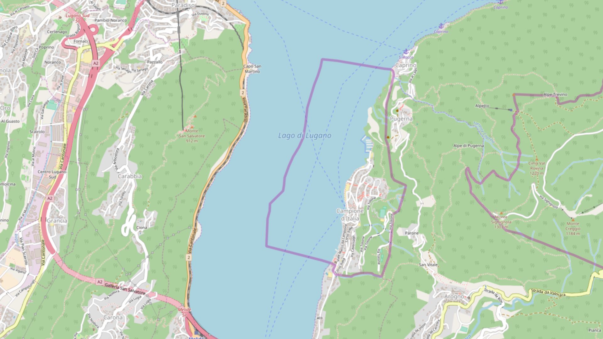 OpenStreetMap contributors, Wikimedia Commons
The Vennbahn, Belgium
After World War I, the Treaty of Versailles awarded Belgium the Vennbahn railway line along the German frontier. Because the railway itself became Belgian territory, pieces of Germany lying beyond it were cut off. Five German exclaves remain today, created essentially because somebody made a railway into an international border.
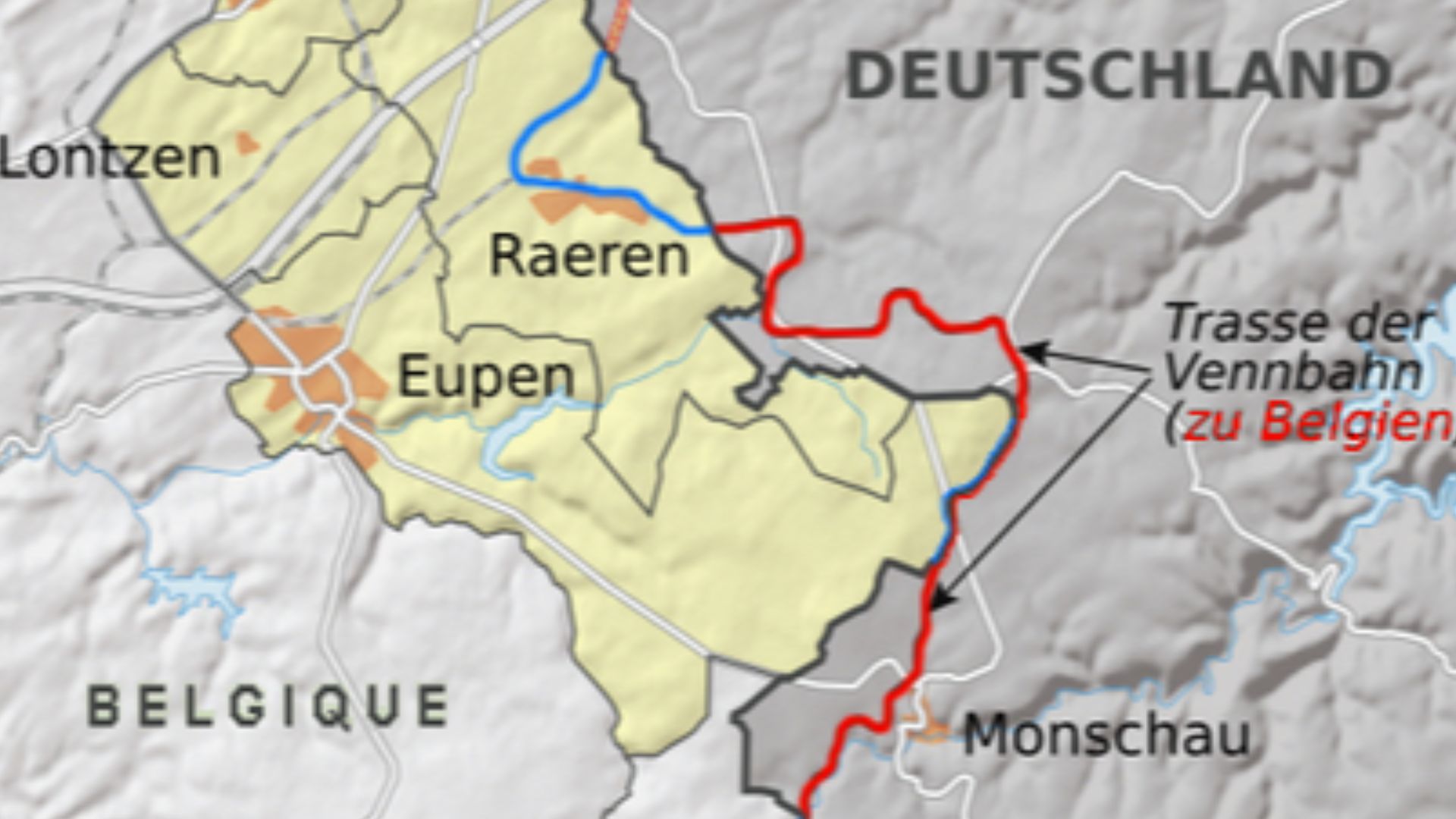 modified by Julieta39, Wikimedia Commons
Jungholz, Austria
Jungholz belongs to Austria, but reaching it normally means going through Germany. Its only territorial connection with the rest of Austria is at the summit of Sorgschrofen mountain, essentially reducing the connection to a single point. Unsurprisingly, the practical road into town comes from the German side.
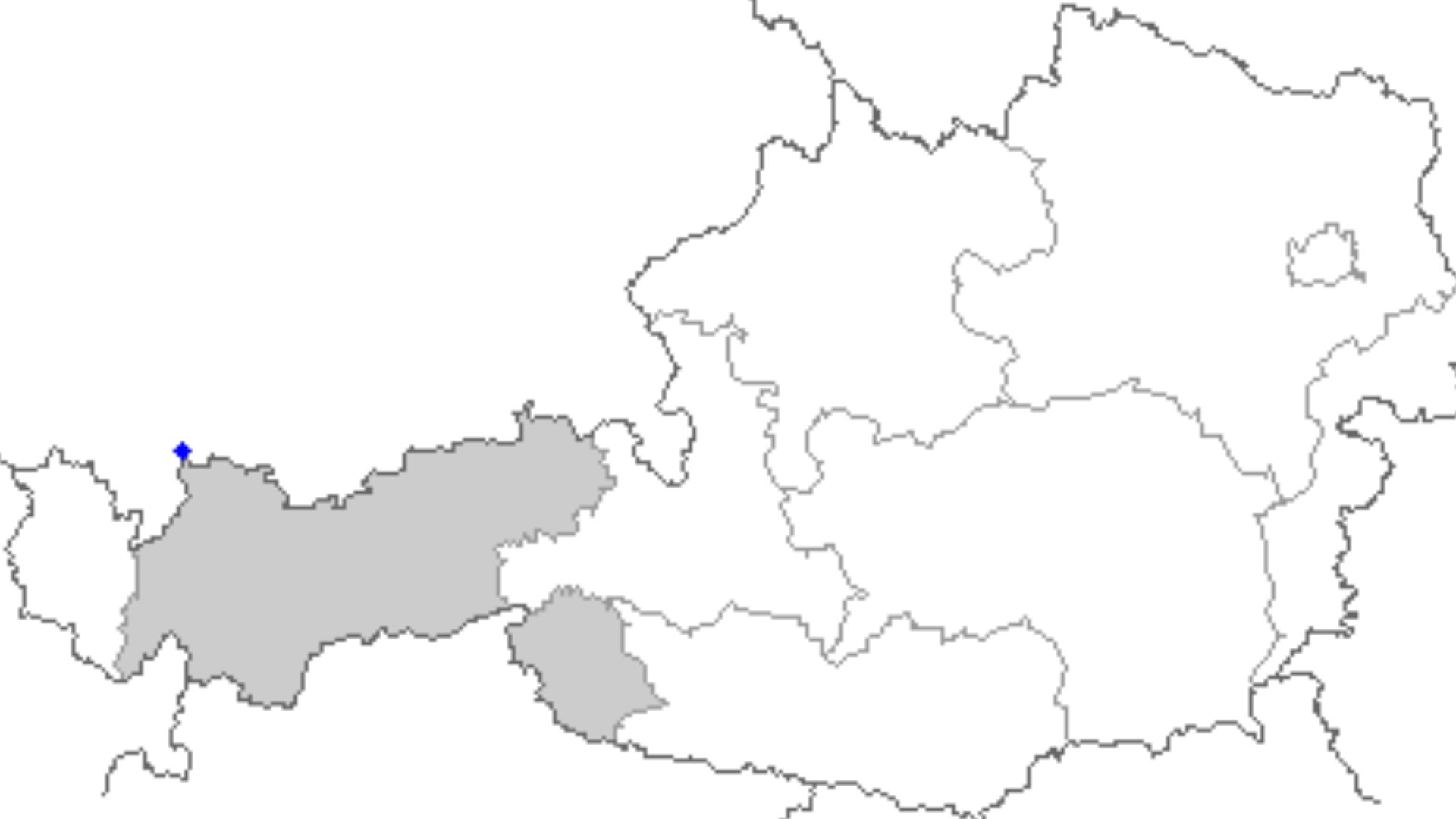 Data collected and hosted from: Niko Hofinger, Wikimedia Commons
Kleinwalsertal, Austria
Austria has another geographic headache nearby. Kleinwalsertal is unquestionably Austrian, yet mountains make it accessible by road only through Germany. Austria's own tourism authorities cheerfully acknowledge the absurdity: to drive into this Austrian valley, your route has to approach it from another country.
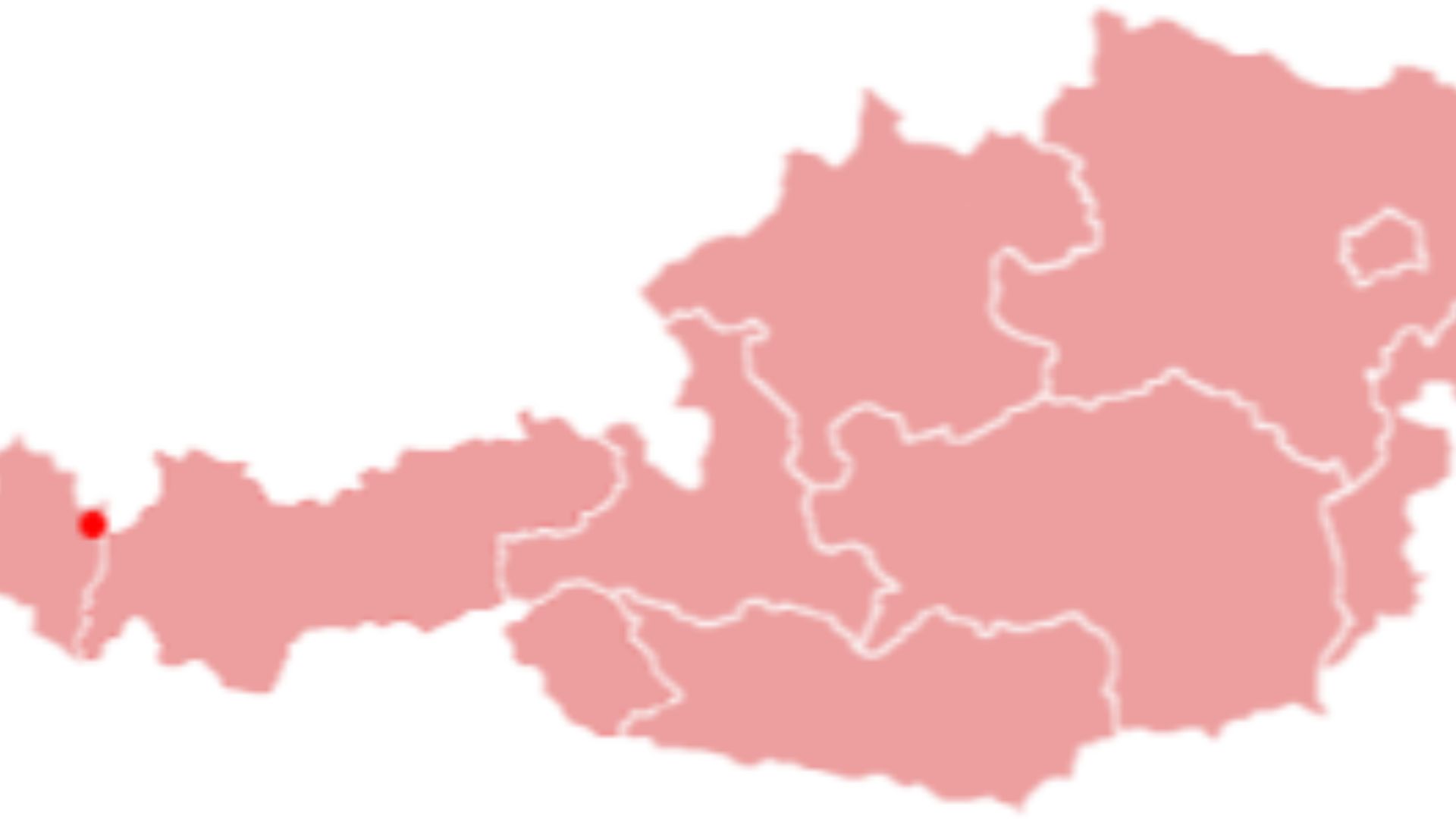 The original uploader was C.lingg at German Wikipedia., Wikimedia Commons
Point Roberts, United States
Draw the Canada-U.S. boundary straight along the 49th parallel and eventually you accidentally slice through a peninsula. That's basically how Point Roberts, Washington happened. The American community hangs beneath British Columbia and has no land connection to the rest of Washington, forcing road travelers to pass through Canada.
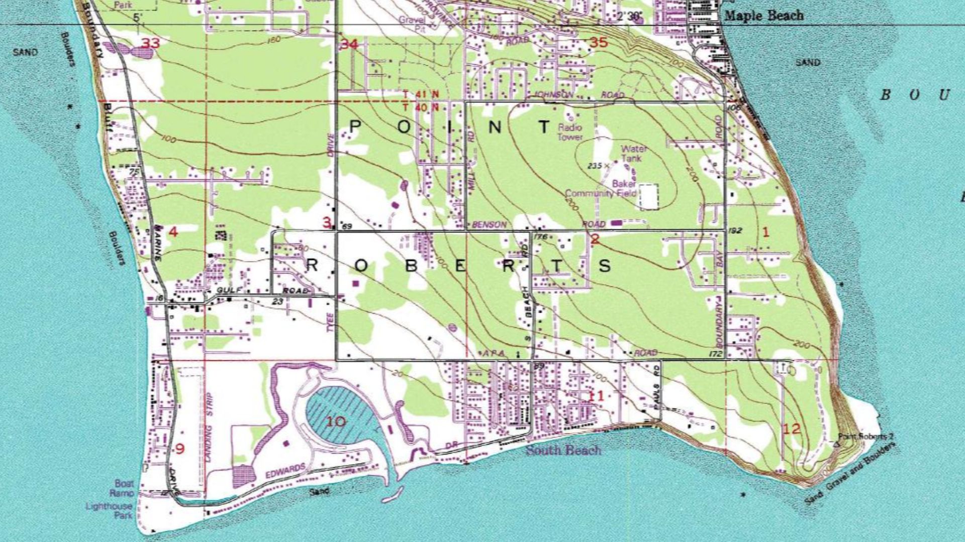 United States Geological Survey, Wikimedia Commons
Northwest Angle, United States
Minnesota's Northwest Angle exists partly because 18th-century negotiators had faulty geographic information. The eventual boundary left a piece of Minnesota north of the 49th parallel, separated from the rest of the state. By land, Americans traveling there must pass through Canada before re-entering their own country.
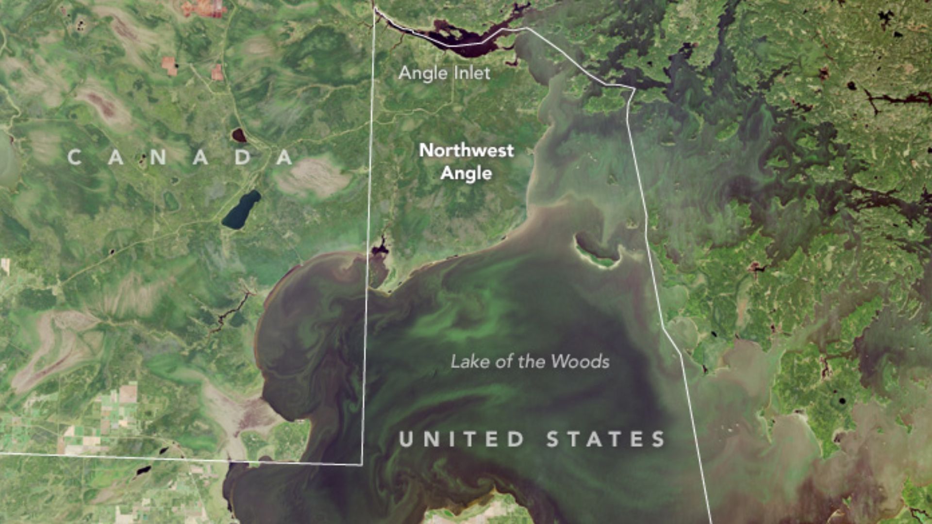 Operational Land Imager (OLI) on Landsat 8, Wikimedia Commons
Haskell Library, Two Countries
The Canada-U.S. border gets stranger at Derby Line, Vermont, and Stanstead, Quebec. The Haskell Free Library and Opera House was deliberately built across the international boundary. A line through the building marks the border, meaning visitors can effectively wander between two countries while remaining inside one library.
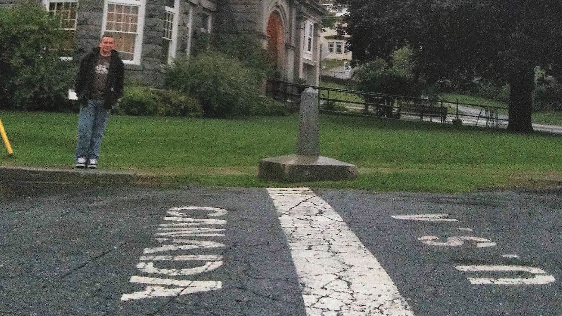 Reubenzadeh, Wikimedia Commons
Hans Island, Two Countries
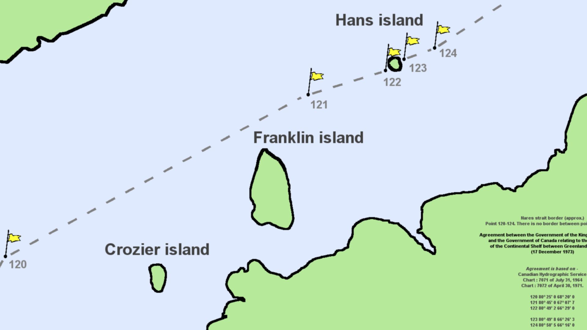
For decades, Canada and Denmark disputed tiny, uninhabited Hans Island, known in Greenlandic as Tartupaluk. In 2022 they finally settled matters by drawing an international land boundary across the island itself. The line follows a natural ravine, giving Canada and Greenland a remarkably remote shared land border.
 User Twthmoses on en.wikipedia, Wikimedia Commons
Kaliningrad, Russia
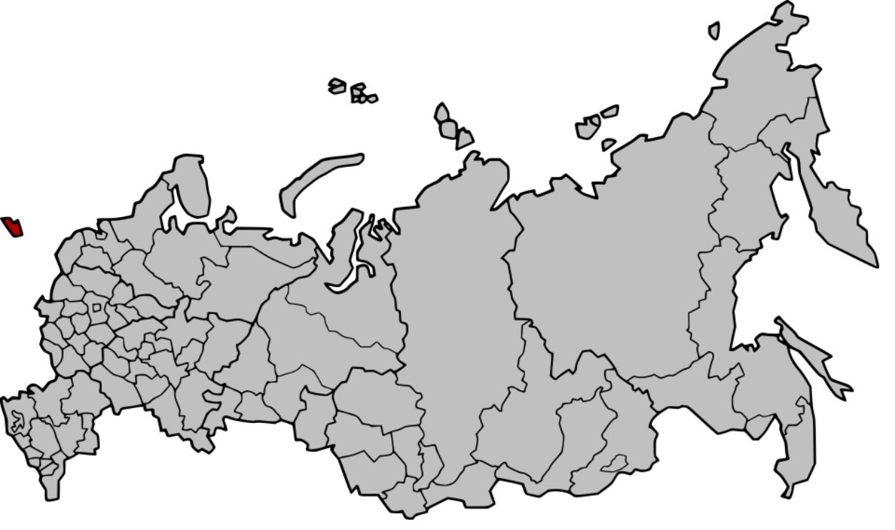
Russia contains an enormous geographic outlier on the Baltic Sea. Kaliningrad Oblast is separated from the Russian mainland, sitting between Poland and Lithuania. Its isolation has required special arrangements concerning transit, turning this small chunk of Russia into one of Europe's most geopolitically unusual detached territories.
Nakhchivan, Azerbaijan
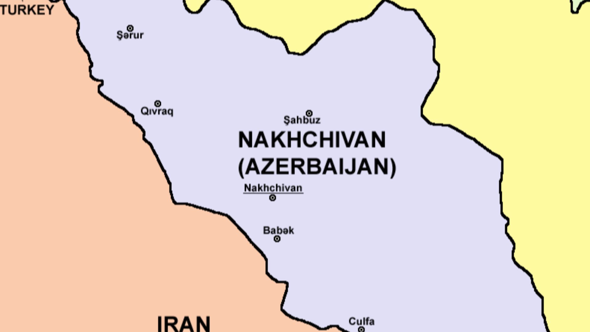
Azerbaijan comes in two major pieces. The Nakhchivan Autonomous Republic belongs to Azerbaijan but is separated from the country's main territory by Armenia. That geographic separation has enormous practical significance in a region where borders, transportation links, territorial disputes, and relations between Armenia and Azerbaijan have long been complicated.
Musandam, Oman
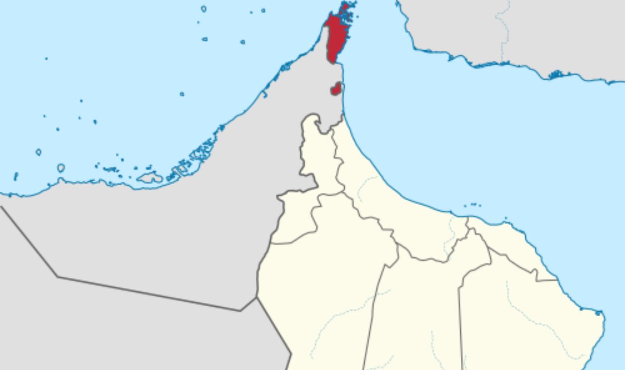
Look at the tip of the Arabian Peninsula and you will find Oman separated from itself. Musandam Governorate occupies the strategically crucial Strait of Hormuz, but a strip of United Arab Emirates territory divides it from the rest of Oman. It is effectively an Omani peninsula reached overland through another country.
Oecusse, Timor-Leste
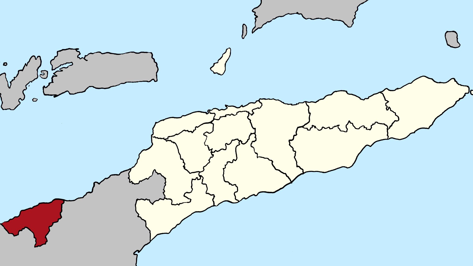
Most of Timor-Leste occupies the eastern side of Timor, but Oecusse sits far away on the island's northwestern coast. Indonesia surrounds it on the landward side. The arrangement survives from the colonial division of Timor between Portugal and the Netherlands, leaving independent Timor-Leste with its own detached enclave.
 J. Patrick Fischer, Wikimedia Commons
Temburong, Brunei
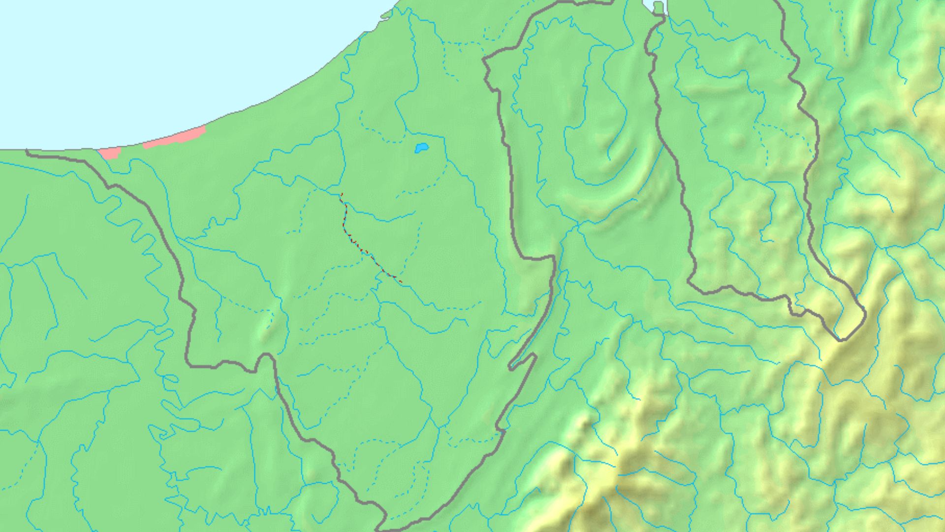
Brunei is split into two pieces by Malaysia's Limbang district. Temburong forms the eastern portion, historically forcing road travelers between the two Bruneian sections to pass through Malaysia. Brunei's later infrastructure development made domestic travel easier, but the national boundary still looks as though Malaysia took a bite from the country.
 Mats Halldin (talk), Wikimedia Commons
Cabinda, Angola
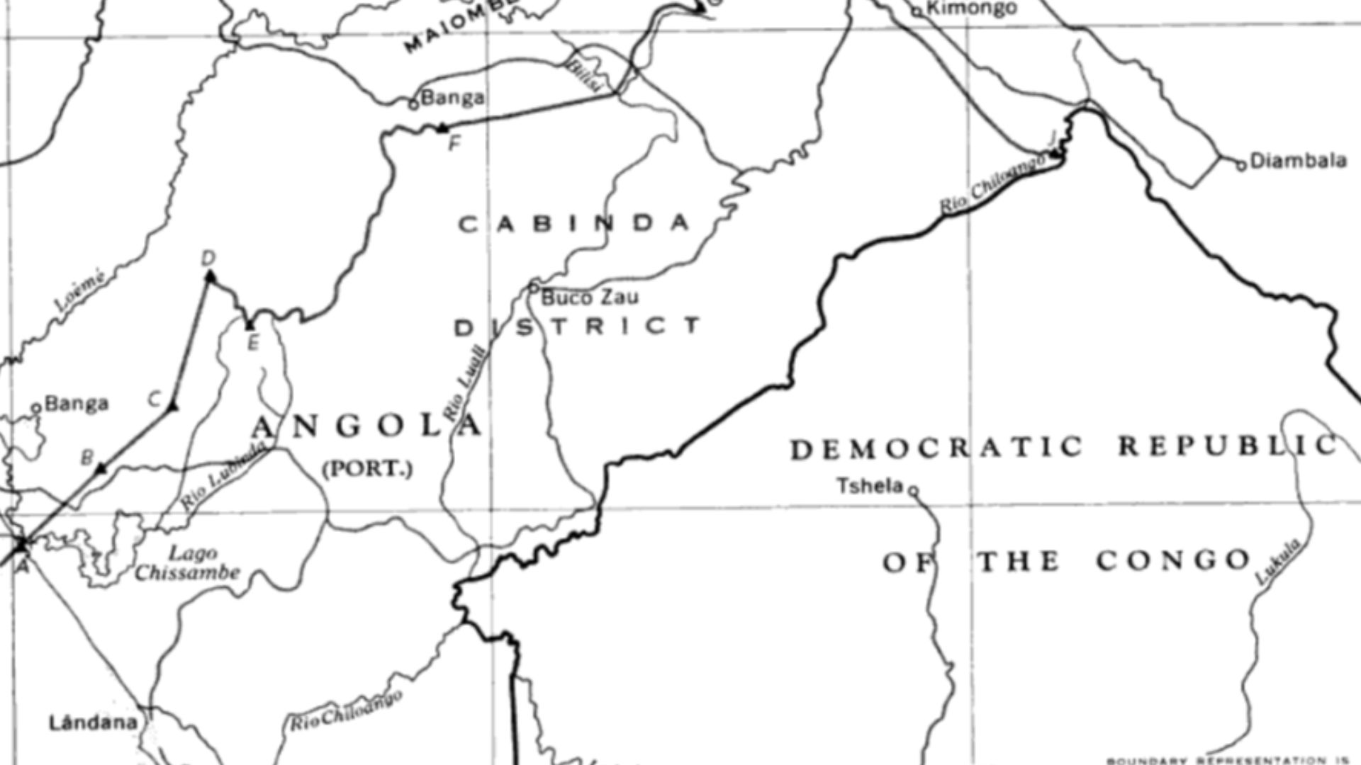
Angola's oil-rich Cabinda province sits on Africa's Atlantic coast, but it does not touch the rest of Angola. A strip belonging to the Democratic Republic of the Congo separates the exclave from its parent country, producing one of Africa's most conspicuous examples of colonial borders surviving into the modern era.
The Gambia
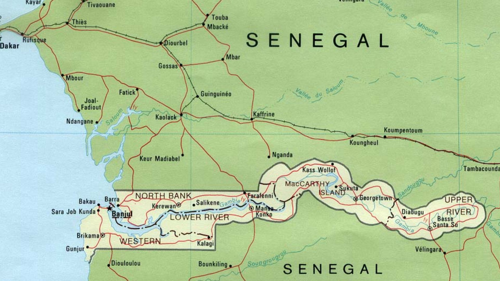
Few countries look stranger on a map than The Gambia. The nation stretches inland from the Atlantic as a remarkably narrow ribbon surrounding the Gambia River, while Senegal wraps around nearly everything else. Its peculiar shape reflects colonial competition that confined British-controlled territory largely to the river corridor.
 Bohr~commonswiki, Wikimedia Commons
Namibia's Zambezi Region
Namibia suddenly grows a long, skinny arm pointing eastward. The former Caprivi Strip was designed during colonial negotiations to give German South West Africa access to the Zambezi River. The 1890 agreement guaranteed Germany a corridor at least 20 English miles wide, creating today's extraordinary panhandle.
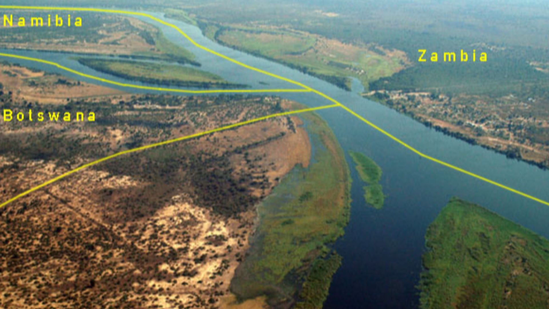 Aerian photography by Brian McMorrow, borders added by Julieta39, Wikimedia Commons
Afghanistan's Wakhan Corridor
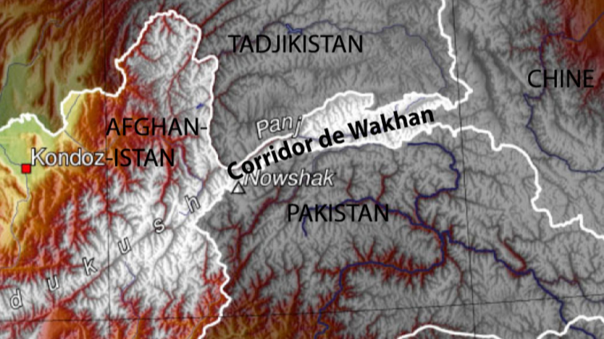
Afghanistan's northeastern corner stretches toward China like an impossibly long finger. The Wakhan Corridor is roughly 350 kilometers long but only around 20 to 60 kilometers wide in places. Its bizarre form emerged from imperial maneuvering that helped separate British and Russian spheres of influence in Central Asia.
The Congo Pedicle
The Democratic Republic of the Congo thrusts deeply into Zambia in a shape known as the Congo Pedicle. Colonial negotiations produced this huge territorial intrusion, complicating travel within Zambia itself. What appears on a map like somebody pushed Congo downward into its neighbor is another legacy of European boundary-making.
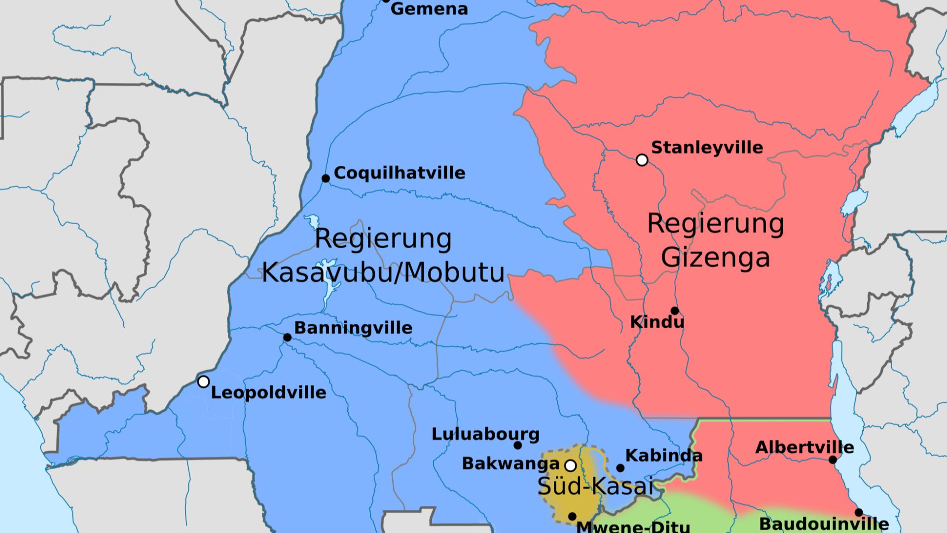 Don-kun, Uwe Dedering, Wikimedia Commons
The Neum Corridor
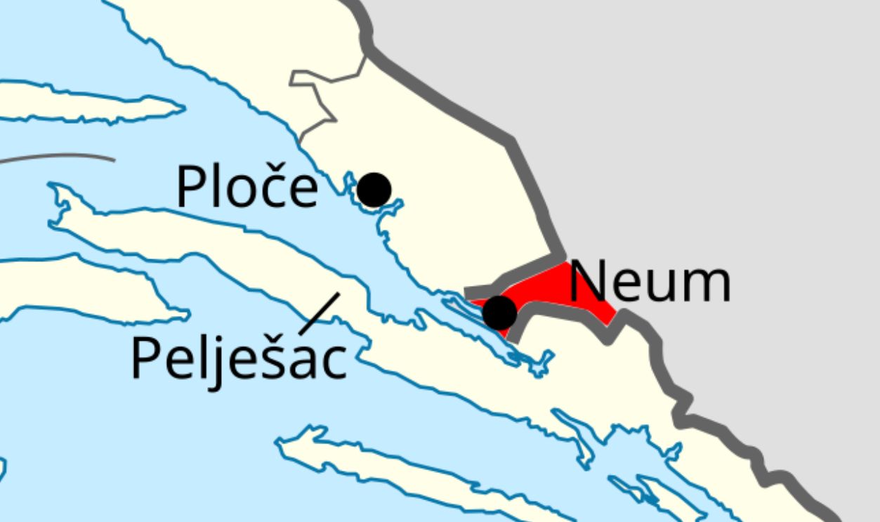
Croatia's famously long coastline contains an interruption. Bosnia and Herzegovina reaches the Adriatic at Neum, creating a corridor that separates the Dubrovnik region from the rest of Croatia by land. Before Croatia built its Pelješac Bridge connection, ordinary coastal road journeys involved briefly entering another country.
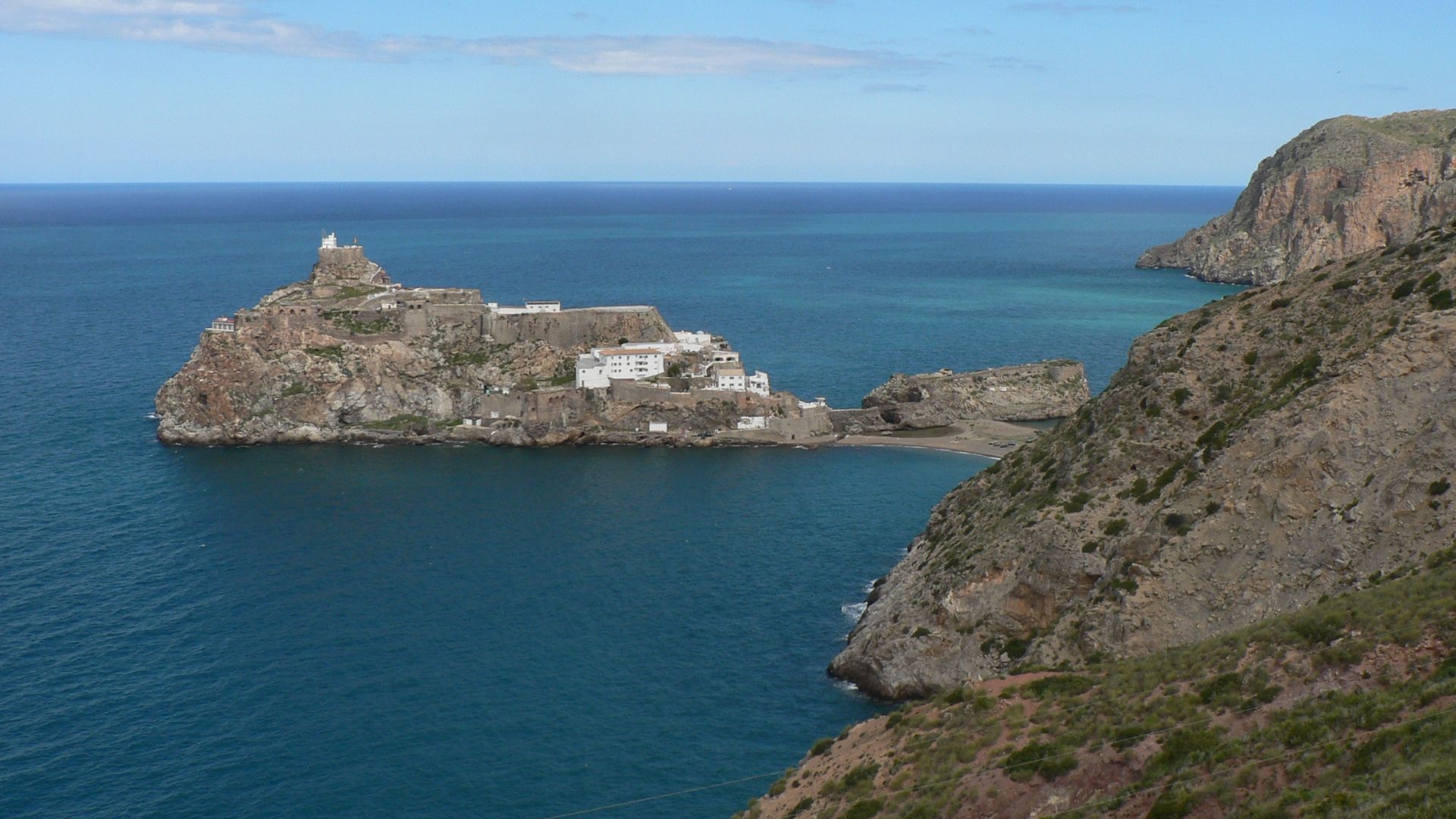
Peñón De Vélez
Spain's strangest border may be barely visible on a normal map. Peñón de Vélez de la Gomera is a tiny Spanish possession on the North African coast adjoining Morocco. Spanish government information recognizes it as a land-border location, alongside the much larger and better-known enclaves of Ceuta and Melilla.
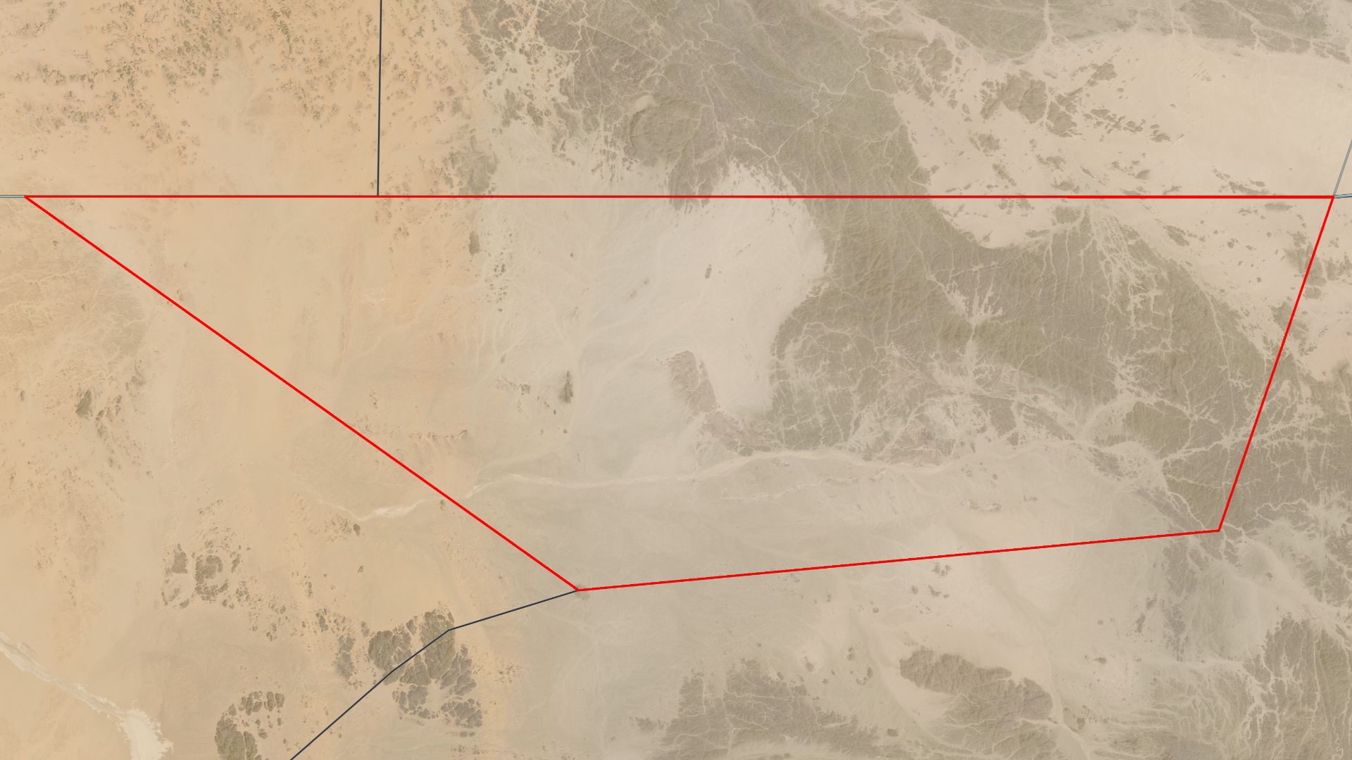
Bir Tawil, Nobody
The Egypt-Sudan frontier produces a truly extraordinary result. Because Egypt and Sudan rely on different historical boundary lines while both claiming the more valuable Hala'ib Triangle, neither asserts sovereignty over nearby Bir Tawil. The barren desert consequently remains one of Earth's rare territories claimed by no recognized state.
 Landsat 8 / OLI, Wikimedia Commons
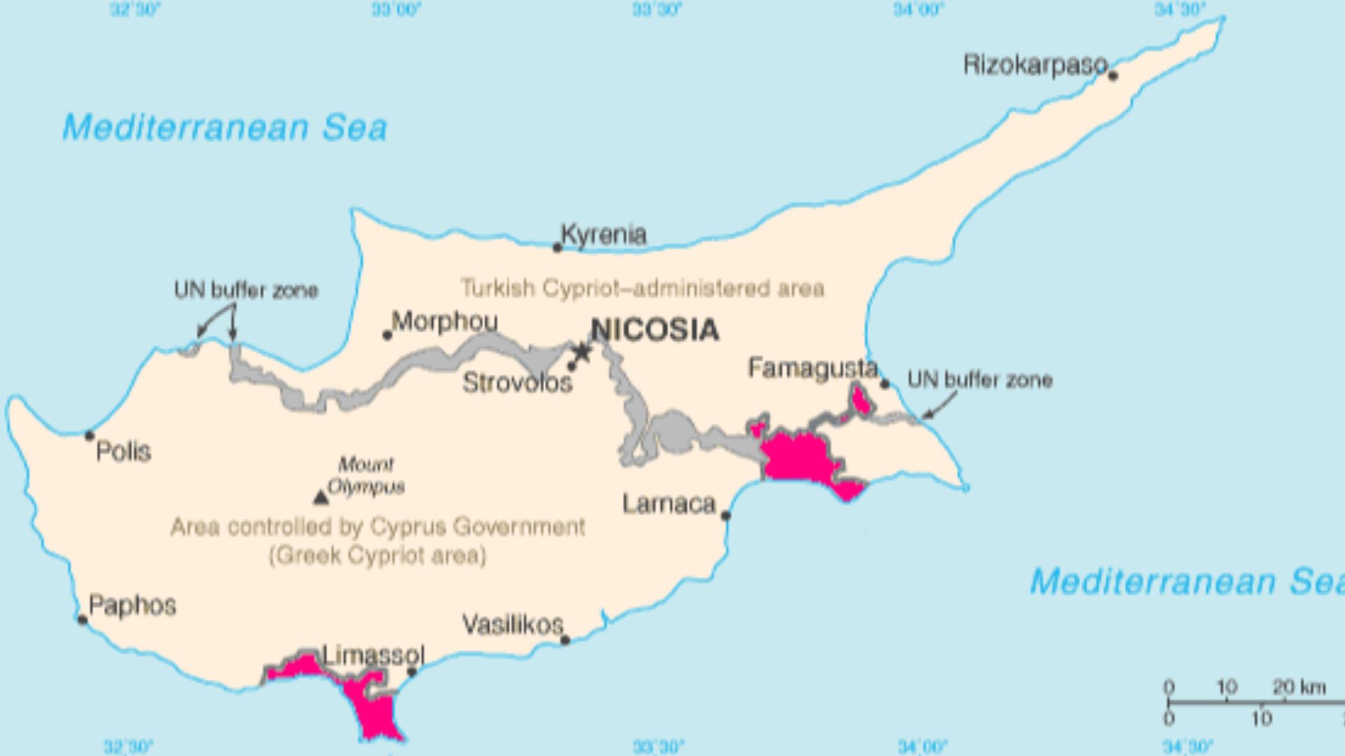
Britain's Cyprus Puzzle
When Cyprus became independent in 1960, Britain retained sovereignty over Akrotiri and Dhekelia as military base areas. Their boundaries created an extraordinary patchwork, especially around Dhekelia, where the treaty specifically required arrangements for access involving Cypriot communities surrounded by British sovereign territory. Britain effectively kept pieces of Cyprus inside Cyprus.
 CIA, Hoshie, Wikimedia Commons
You May Also Like:
18 Fascinating Geographical Oddities Of The United States
13 High-Risk International Borders
Sources: 1, 2, 3, 4, 5, 6, 7, 8, 9, 10, 11, 12, 13, 14, 15, 16, 17, 18, 19, 20, 21, 22, 23, 24