
Beyond The Map
Geography class never told you the whole story. Hidden in plain sight, America's terrain tells tales that sound made-up but aren't. Just imagine rivers changing direction, deserts freezing, and islands bridging continents.

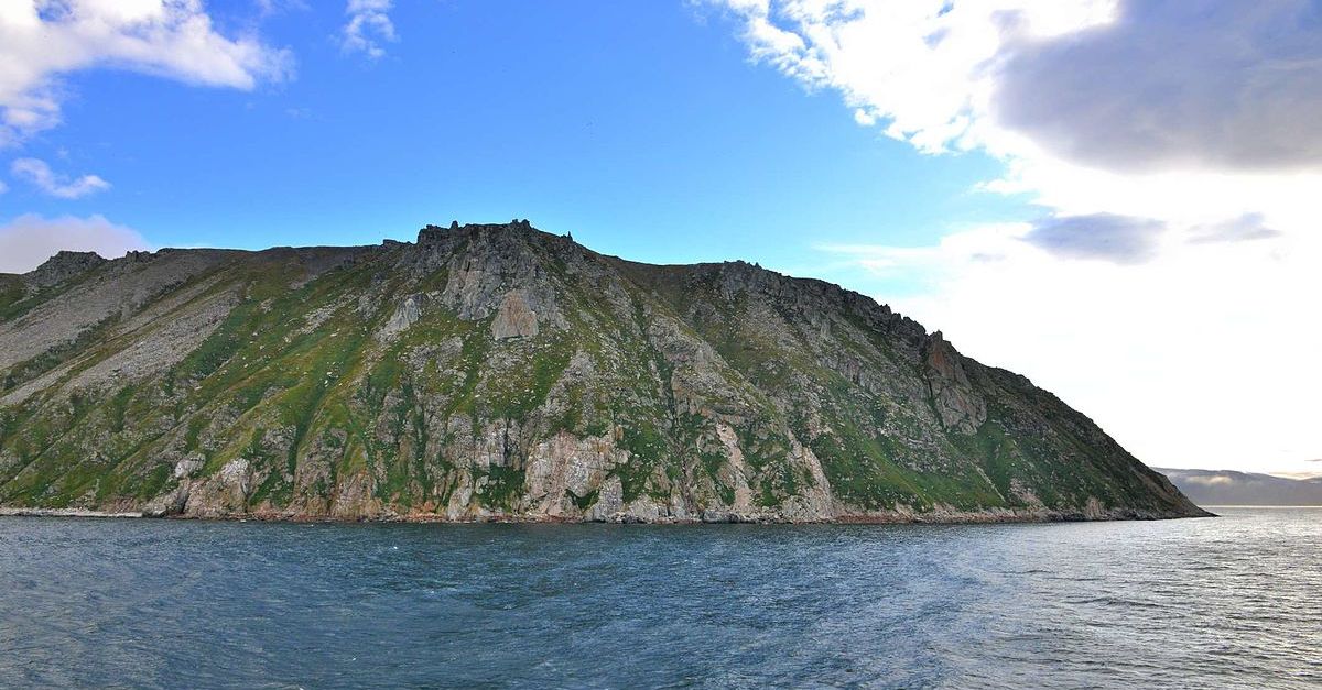
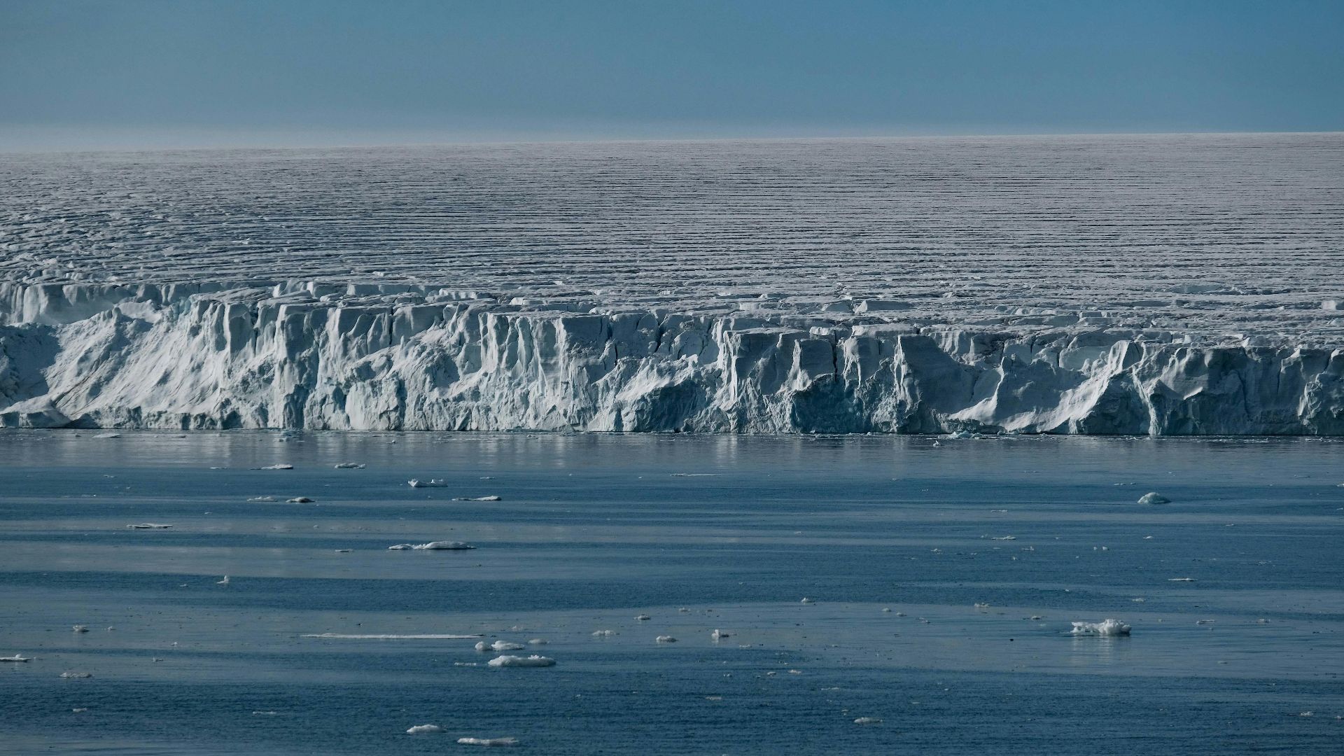
Alaska: Both Easternmost & Westernmost State
Did you know the state that reaches farthest west also stretches farthest east? Alaska's Aleutian Islands create this geographical oddity. The island chain extends so far across the Pacific that it crosses the 180th Meridian, the dividing line between Eastern and Western Hemispheres.
 U.S Fish and Wildlife Service, Wikimedia Commons
Alaska: Both Easternmost & Westernmost State (Cont.)
While we typically think of Alaska as our northernmost frontier, its true distinction lies in its horizontal reach. This means that some of Alaska’s islands, such as Semisopochnoi Island, lie in the Eastern Hemisphere, making them the easternmost points of the United States by longitude.
 C.A. Neal, Alaska Volcano Observatory / U.S. Geological Survey, Wikimedia Commons
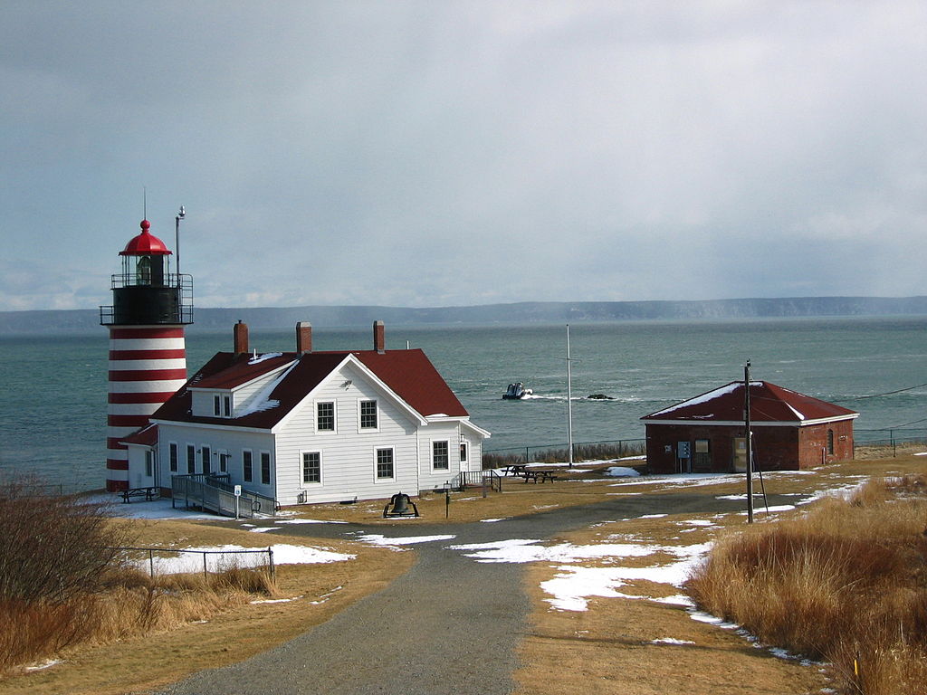
Maine: Closer To Africa Than Florida
Counterintuitive geography brings about surprising connections across our planet. Maine's easternmost point at Quoddy Head sits approximately 3,154 miles from El Beddouza, Morocco. Meanwhile, Miami, Florida, which seems closer to Africa, is actually about 4,425 miles from the continent.
 Michael Trindade Deramo, Wikimedia Commons
Maine: Closer To Africa Than Florida (Cont.)
Earth's curvature explains this geographical surprise. The northern reaches of the Atlantic narrow significantly, compared to southern waters, forming this unexpected proximity. Next time you're standing on Maine's rocky coast, consider that you're closer to African shores than someone sunbathing on a Florida beach.
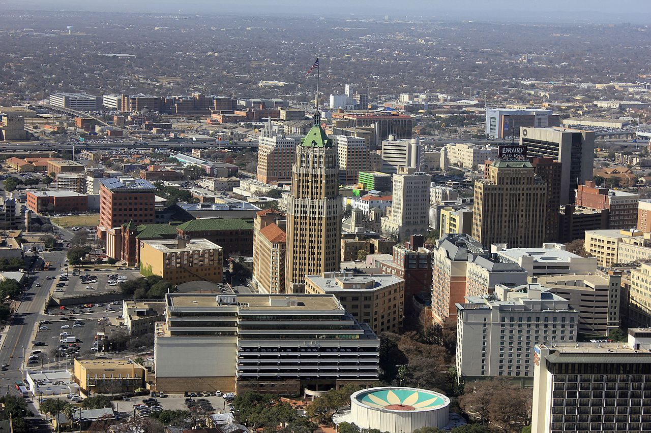
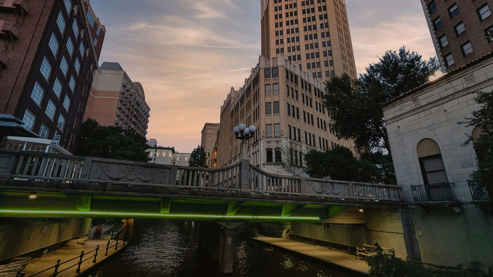
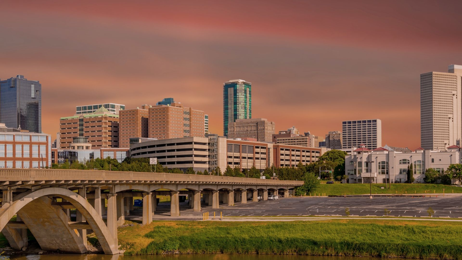
80% Of Americans Live East Of San Antonio
The population of the United States follows historical patterns invisible on most maps. Draw an imaginary north-south line just west of San Antonio, Texas, and you'll find that approximately 80% of all Americans live to the east of it. This is a noteworthy demographic imbalance.
80% Of Americans Live East Of San Antonio (Cont.)
Why does this divide exist? Historical settlement patterns tell part of the story. European colonization began on the eastern seaboard, with western expansion coming later. The rugged lands of the West—deserts, mountains, and arid plains—also presented natural barriers to dense settlement.
80% Of Americans Live East Of San Antonio (Cont.)
This concentration of humanity in the eastern half of the country affects everything from electoral politics to economic development and infrastructure investment. Major cities along or just east of this line include San Antonio, Austin, Fort Worth, Oklahoma City, Wichita, Omaha, and Fargo.
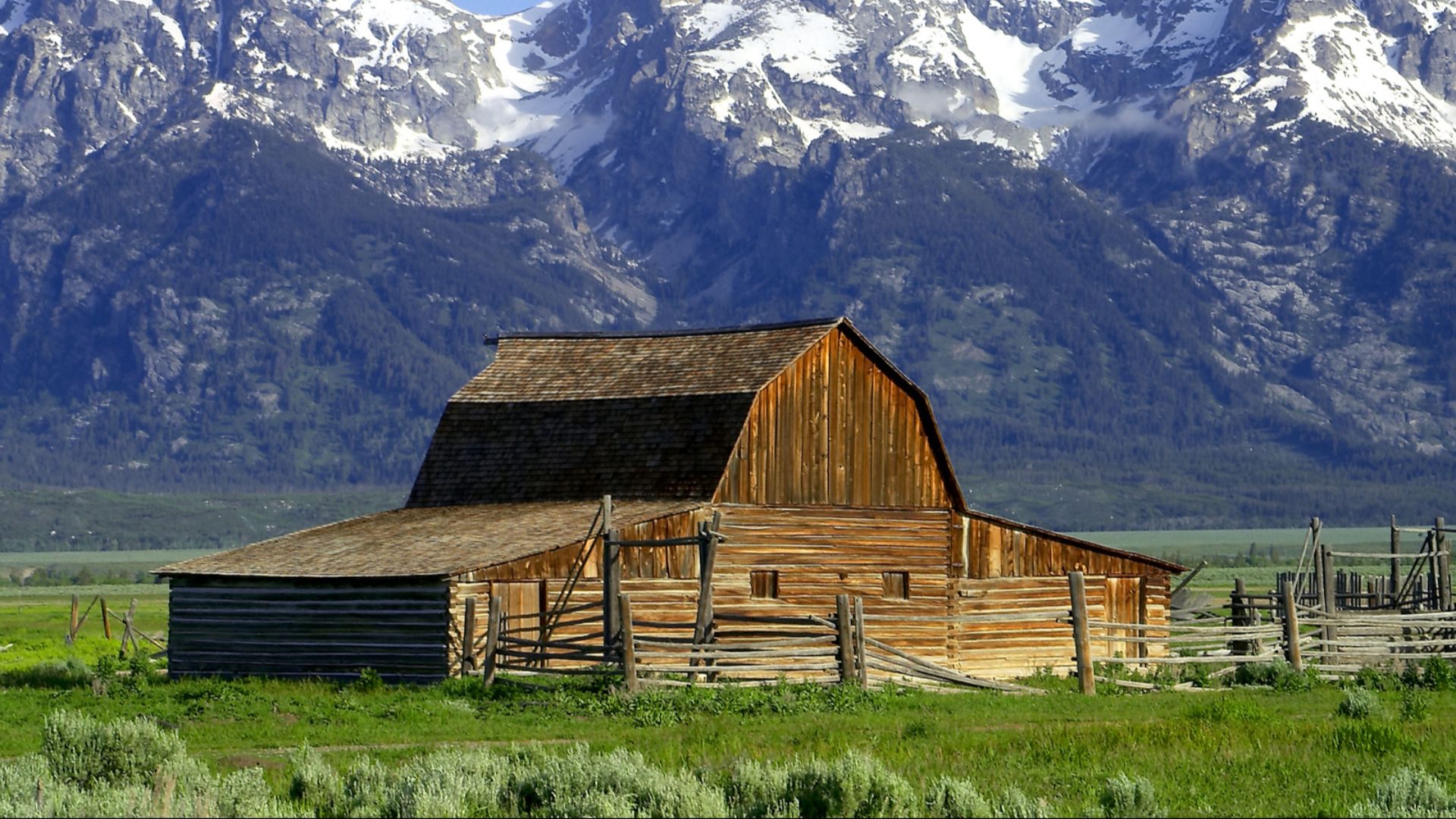
Wyoming: More Cattle Than People
The vast, windswept plains of Wyoming hold an intriguing secret. This state counts more hoofed residents than human ones. With just over 580,000 people, Wyoming is said to be among America's least populous states. But step onto its prairies and you'll encounter a million cattle grazing.
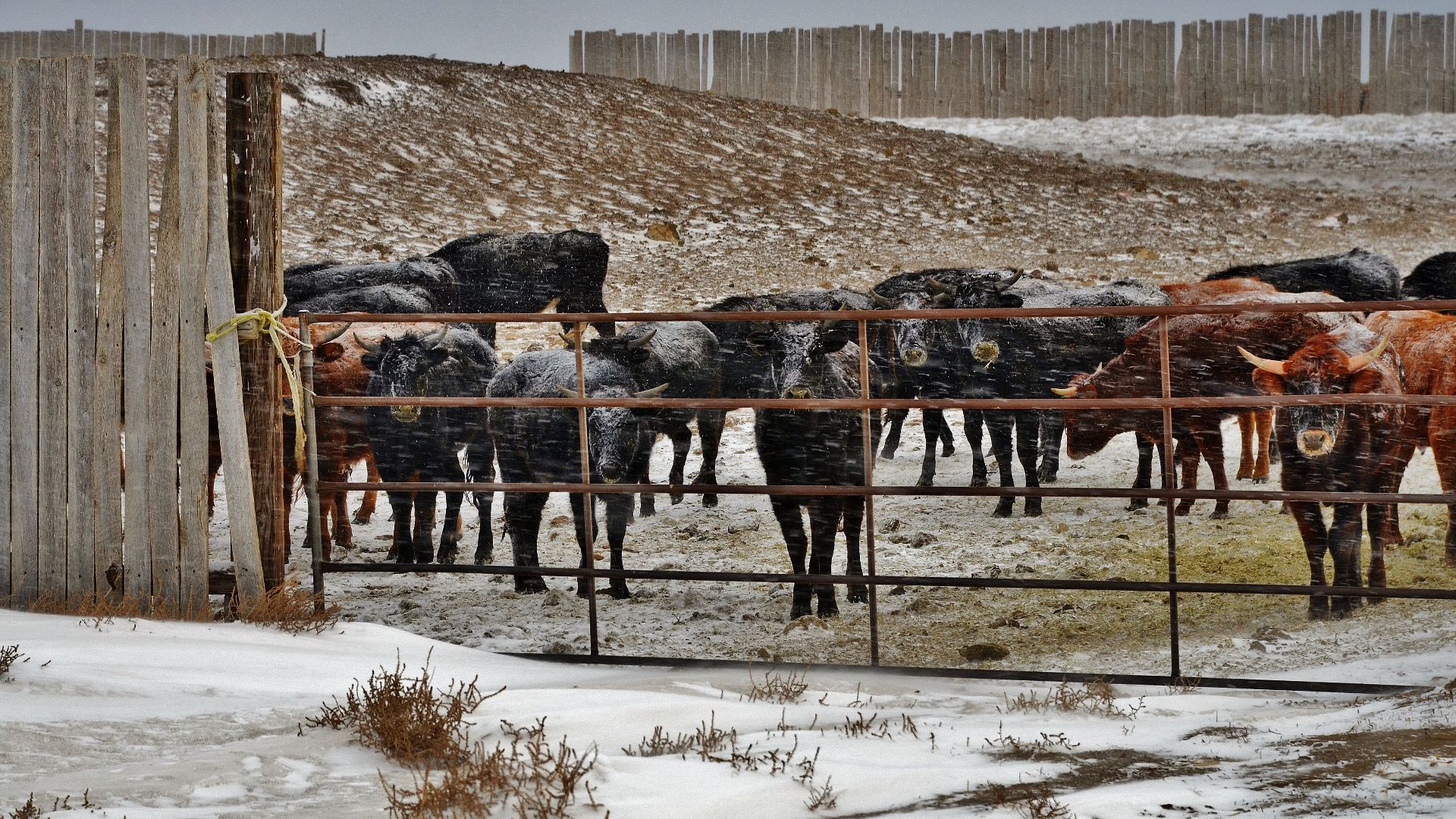
Wyoming: More Cattle Than People (Cont.)
Agriculture drives this bovine dominance. Wyoming's economy is largely driven by cattle ranching, which makes beef one of the state's primary exports. Apparently, Wyoming ranks fourth among US states for the highest cattle-to-person ratio, with only South Dakota, Nebraska, and Montana having a higher ratio.
 Jon Sullivan, PD Photo., Wikimedia Commons
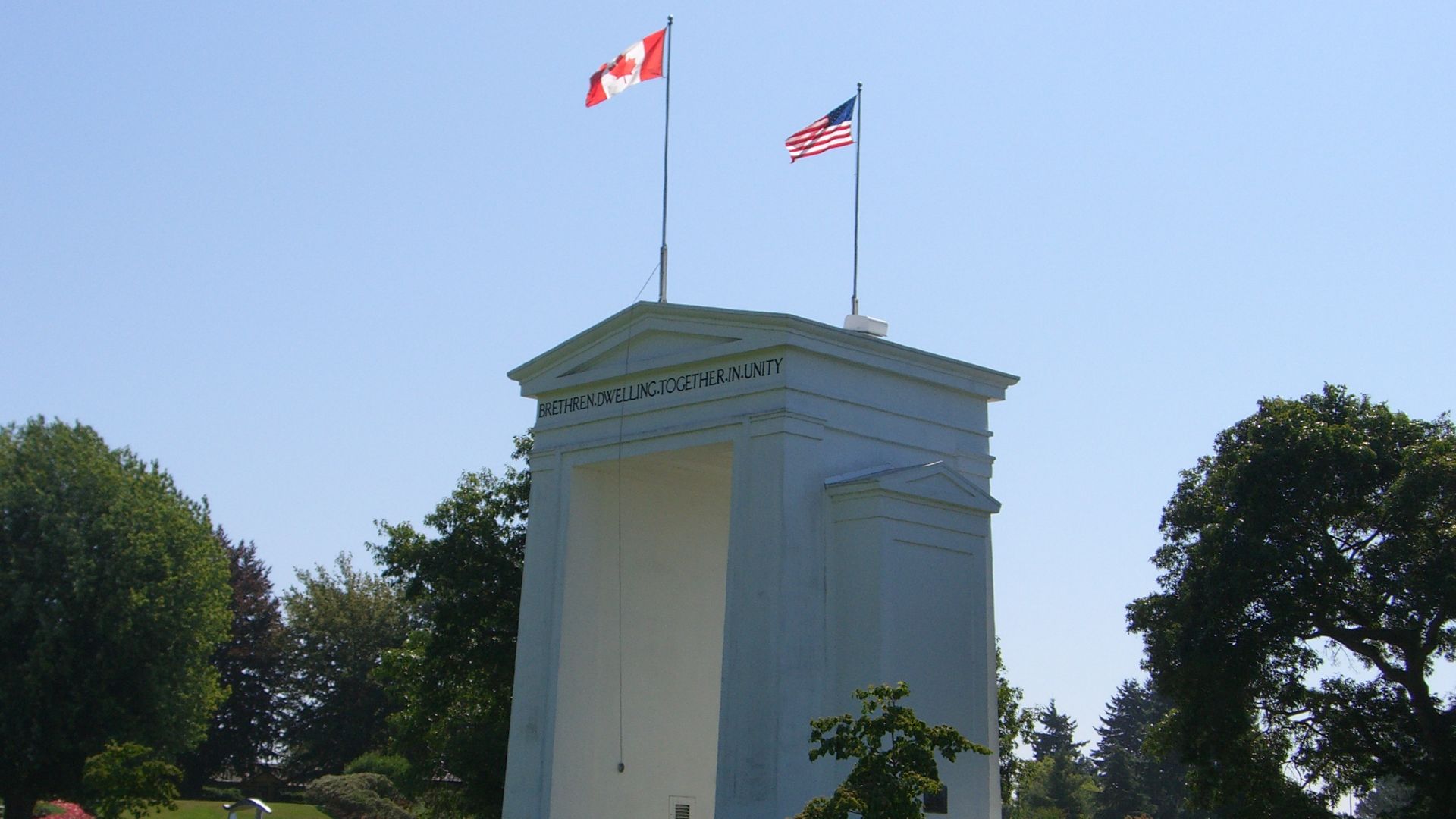
US-Canada: World's Longest Border
That boundary between our friendly neighbors is surprisingly long. The US-Canada border stretches about 5,525 miles from the Atlantic to the Pacific, rendering it the longest international border in the world. Alaska adds a big chunk to this with its 1,500-mile stretch.
 No machine-readable author provided. Theorb assumed (based on copyright claims)., Wikimedia Commons
US-Canada: World's Longest Border (Cont.)
Despite its immense length, it remains one of the world's least militarized international boundaries, with much of it unguarded. The border spans diverse areas, ranging from dense forests to mountain ranges, Great Lakes waterways, and remote Arctic regions.
 U.S. Army Corps of Engineers soldier or employee, Wikimedia Commons
US-Canada: World's Longest Border (Cont.)
It touches eight Canadian provinces and territories and thirteen US states. These include Alaska, Washington, Montana, Minnesota, Michigan, New York, and Maine. The border was first established by the Treaty of Paris in 1783 and shaped into its current form by the 1908 Treaty.
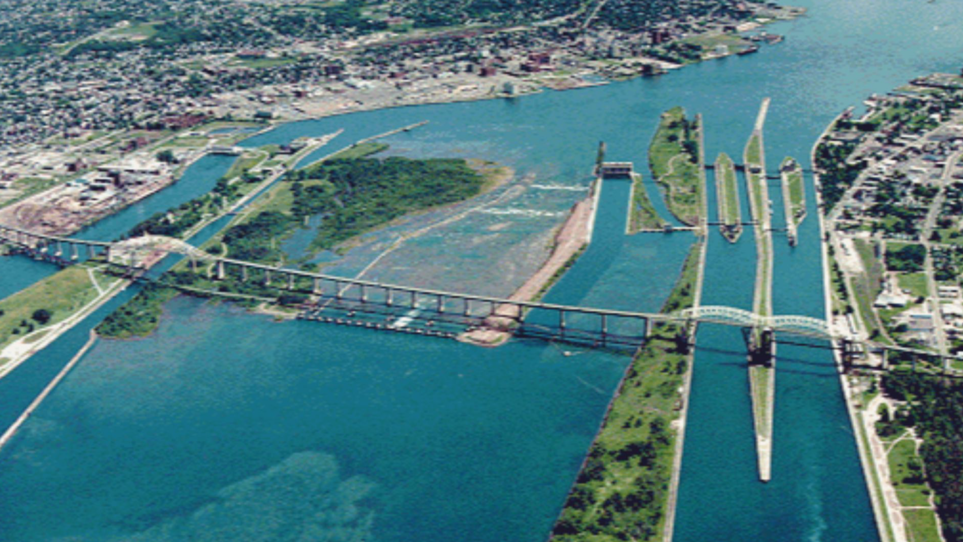
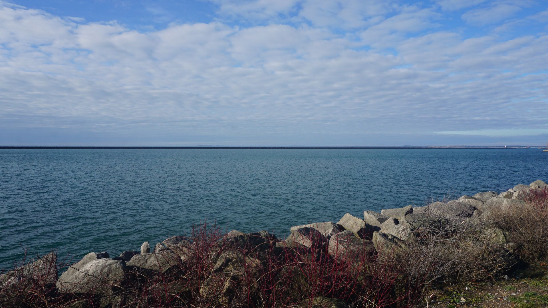
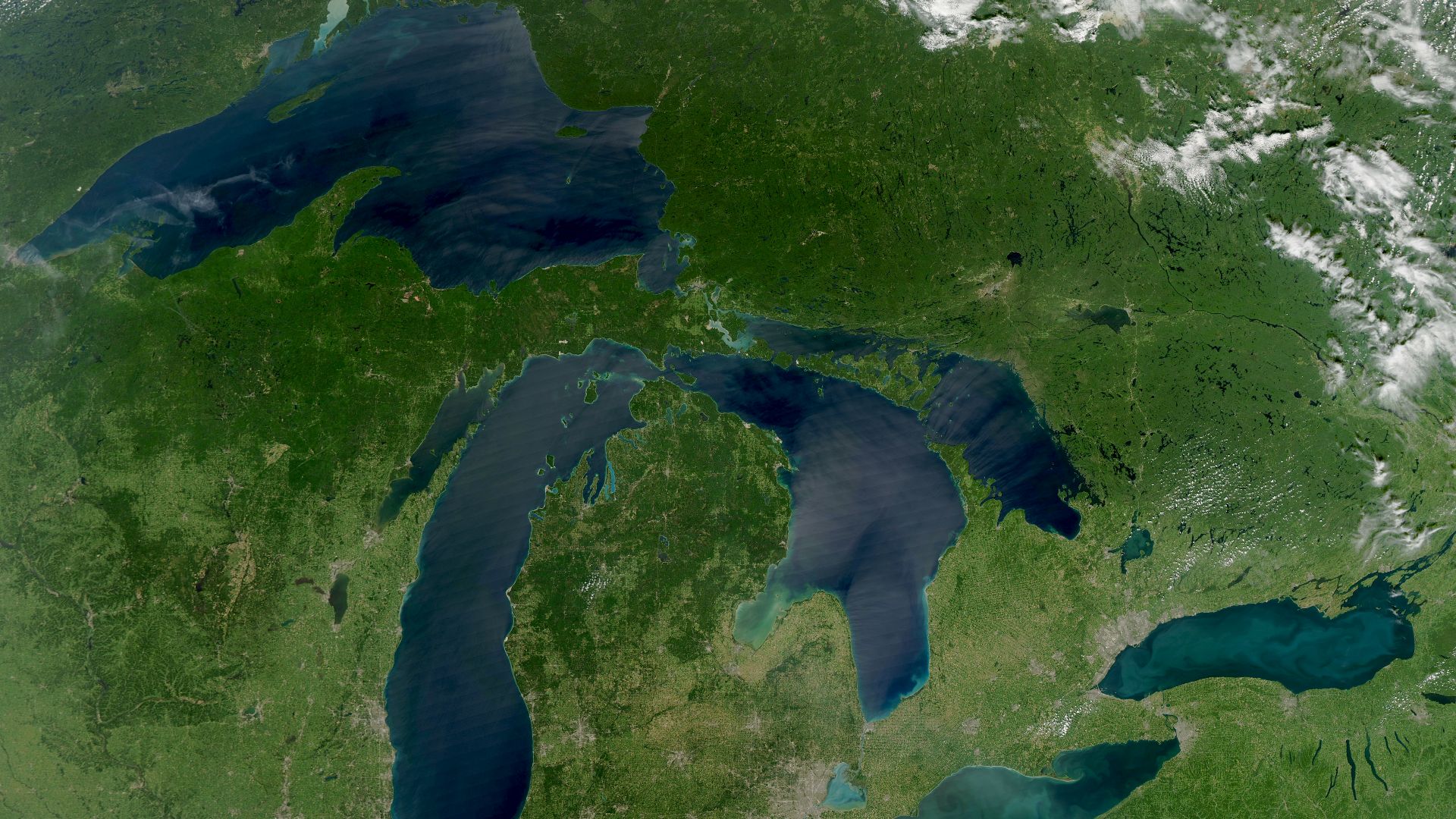
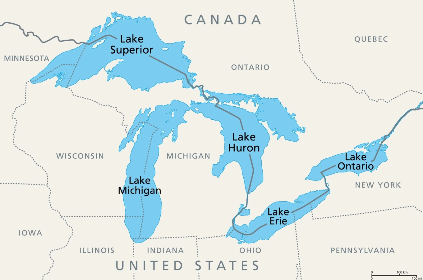
Great Lakes: 21% Of Earth's Surface Freshwater
The gleaming blue expanse of the Great Lakes represents an aquatic treasure unlike any other on our continent. Superior, Michigan, Huron, Erie, and Ontario together hold over six quadrillion gallons of freshwater. This is a staggering 21% of all surface freshwater on Earth.
 Michael Barera, Wikimedia Commons
Great Lakes: 21% Of Earth's Surface Freshwater (Cont.)
There is literally enough water to cover the entire contiguous United States to a depth of about 9.5 feet (2.9 meters). The Great Lakes system formed roughly 14,000 years ago when retreating glaciers carved enormous basins that filled with meltwater.
Great Lakes: 21% Of Earth's Surface Freshwater (Cont.)
Today, these inland seas continue to shape regional climate and provide drinking water to over 40 million people across two countries. It’s important to note that only about 1% of Earth's total water is liquid freshwater on the surface; the rest is either saline or frozen.
Colorado's Non-Rectangular Borders
Perfectly straight lines defining Colorado hide a surprising secret about America's “rectangle state”. Modern GPS technology has revealed what 19th-century surveyors couldn't achieve. Apparently, Colorado's borders contain numerous small deviations from their intended rectangular shape. These imperfections tell a story of human limitation.
Colorado's Non-Rectangular Borders (Cont.)
When surveyors marked Colorado's boundaries in the 1800s, they lacked today's precision instruments. Working with rudimentary tools across challenging terrain inevitably led to errors. The western border, in particular, deviates from a true north-south line due to the difficulties of maintaining accurate measurements.
Colorado's Non-Rectangular Borders (Cont.)
Similarly, on the southern border near Edith, Colorado’s line shifts southeast for about 3,400 feet before resuming a due east course. It follows a small valley’s topography rather than a straight line. The eastern border also has small misalignments due to early surveying troubles.
 Rhododendrites, Wikimedia Commons
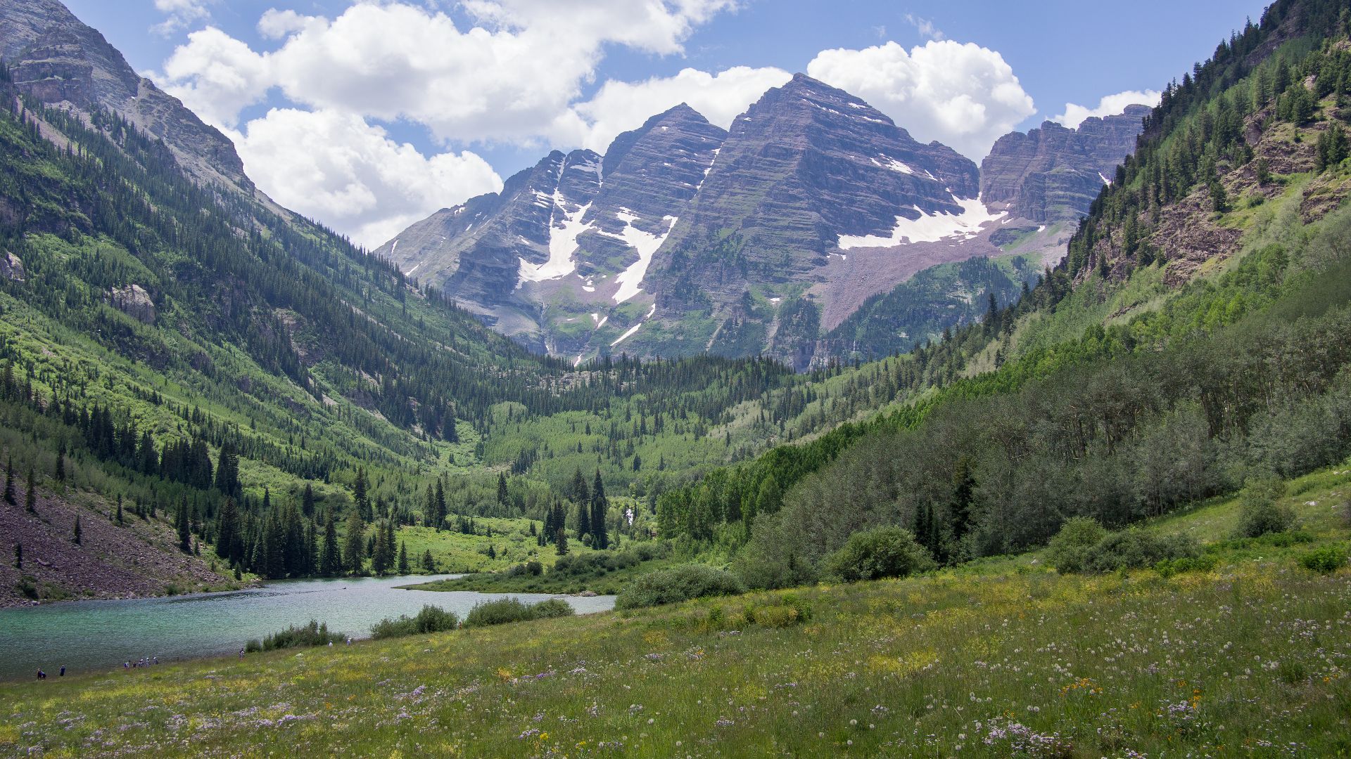
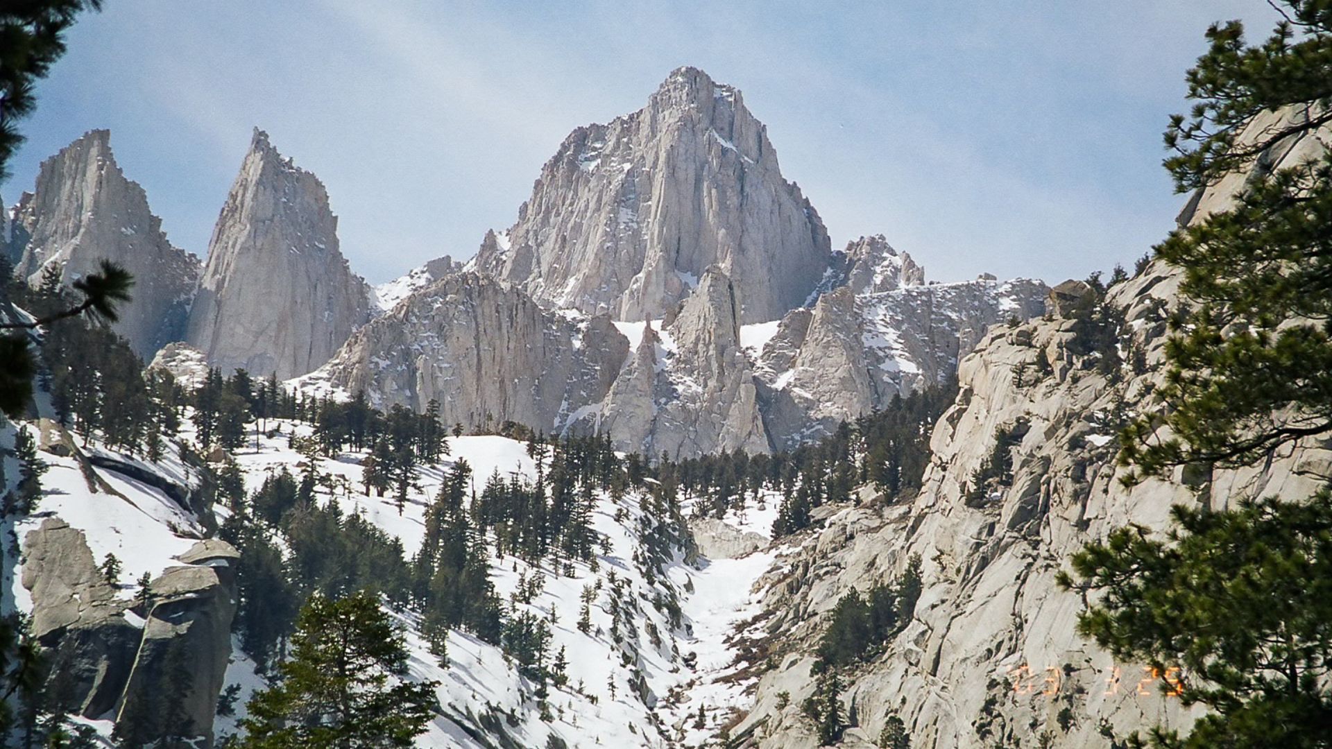
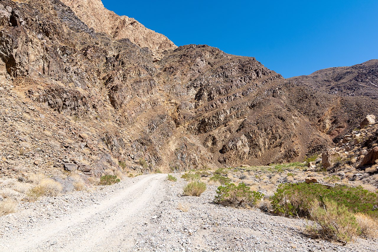
Mount Whitney And Death Valley: 85 Miles Apart
California holds a geographical extreme that's hard to comprehend. After all, America's highest and lowest points exist practically as neighbors. Mount Whitney rises proudly to 14,505 feet above sea level, while just 85 miles away, Death Valley's Badwater Basin sinks to 282 feet below sea level.
 Geographer (talk · contribs), Wikimedia Commons
Mount Whitney And Death Valley: 85 Miles Apart (Cont.)
Such an elevation change occurs within a distance that can be driven in less than two hours. Tectonic activity, besides the boundary between the Pacific and North American plates, pushed the Sierra Nevada range upward. Simultaneously, it created the down-dropped basin here.
 RuggyBearLA, CC BY 2.0, Wikimedia Commons
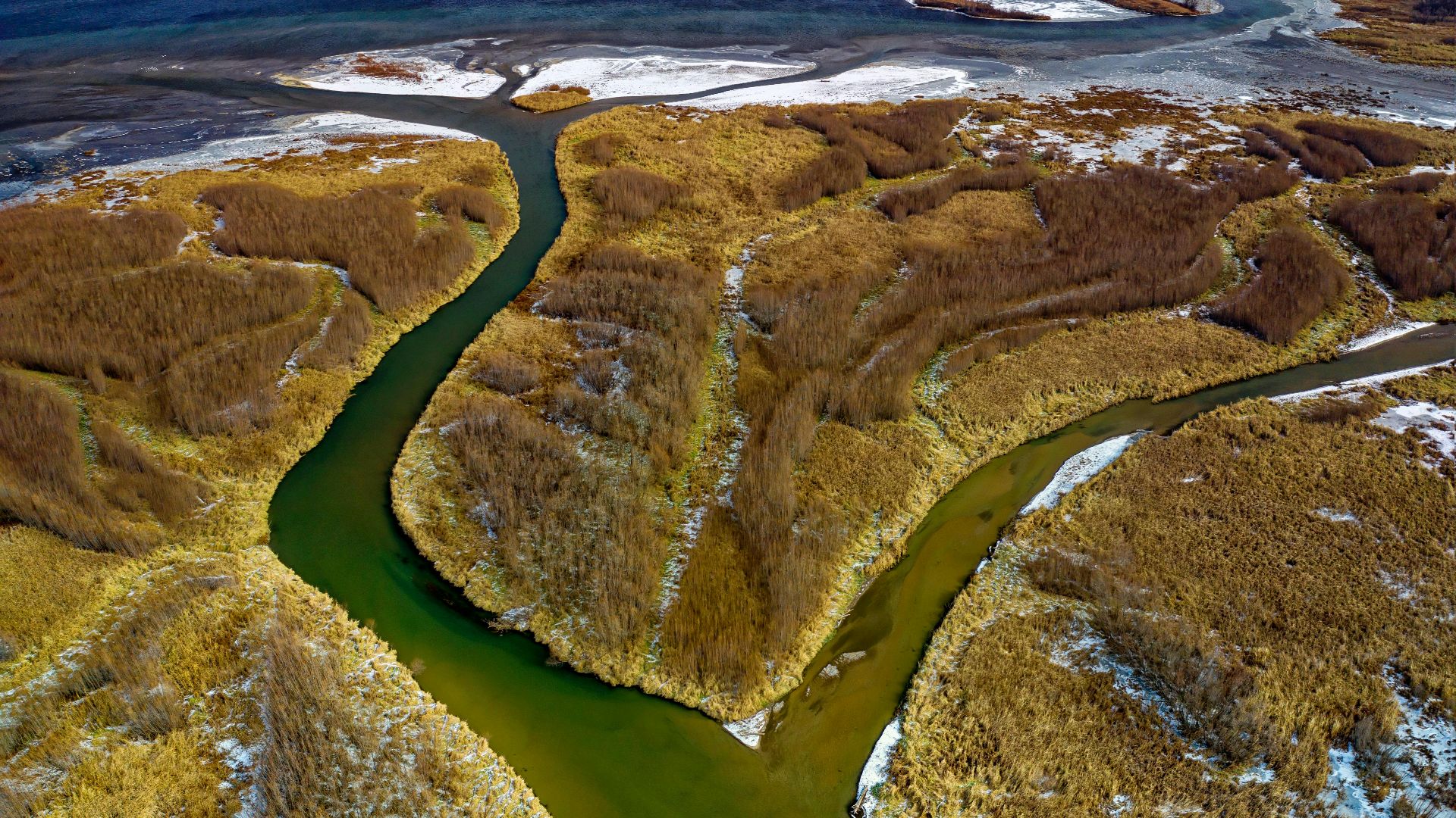
The Mississippi River Once Flowed Backward
One of the US’s most powerful geographical features temporarily reversed course during a catastrophic natural event. Fascinating. The New Madrid earthquakes of 1811–1812 caused sections of the mighty Mississippi River to flow backward as the ground beneath it heaved and subsided.
The Mississippi River Once Flowed Backward (Cont.)
Eyewitnesses described water rushing upstream as the riverbed underwent a dramatic alteration. These earthquakes remain among the most powerful in American history, estimated between magnitudes of 7.5–8.0. The seismic energy temporarily changed the river's course, formed new lakes, and destroyed entire forests.
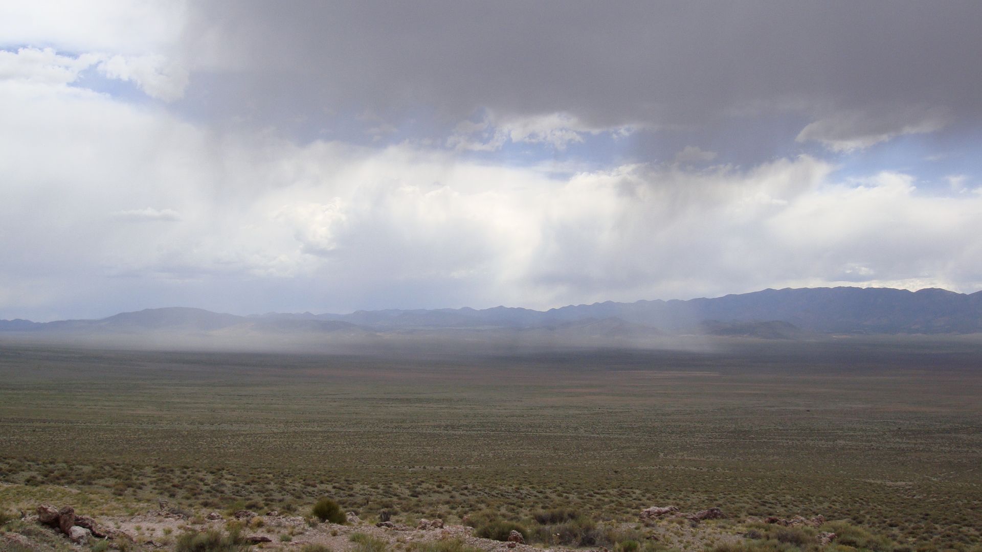
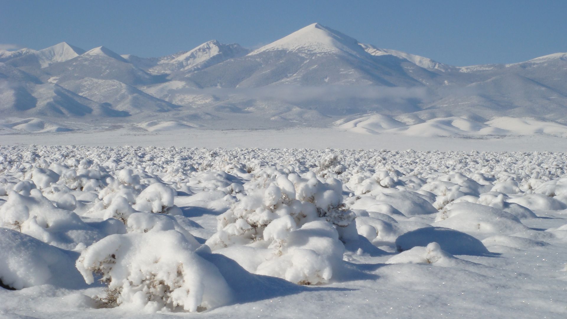
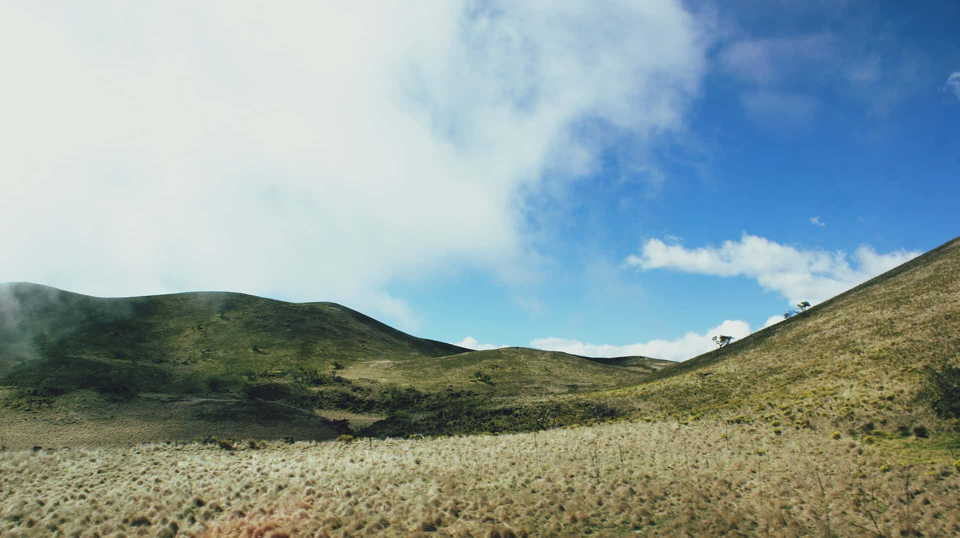
Great Basin: America's Cold Desert
When Americans think of "desert," they generally imagine the hot sands of the Southwest. However, the Great Basin desert across Nevada and Utah defies these expectations. Unlike the scorching Mojave or Sonoran deserts, this "cold desert" regularly experiences freezing winters with snowfall.
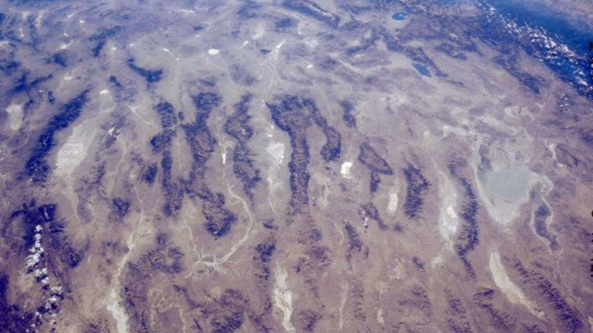
Great Basin: America's Cold Desert (Cont.)
Of course, it still maintains the arid conditions of desert environments. Sadly, climate change is expanding this unique ecological zone in concerning ways. Rising temperatures are shifting precipitation patterns and increasing evaporation rates, causing the Great Basin to grow beyond its historical boundaries.
 Qfl247 (talk · contribs), Wikimedia Commons
Great Basin: America's Cold Desert (Cont.)
Annual precipitation ranges from about 6 to 12 inches, much of it falling as snow during winter months. The desert’s dryness is largely due to the rain shadow effect generated by the Sierra Nevada mountains, which block moist Pacific air from reaching the basin.
 Qfl247 (talk · contribs), Wikimedia Commons
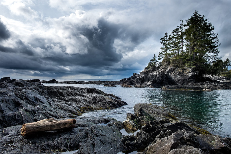
The Graveyard Of The Pacific
The unreliable waters where the Columbia River meets the Pacific Ocean have earned an ominous nickname: “The Graveyard of the Pacific”. More than 2,000 shipwrecks litter these waters, making it one of the deadliest maritime regions in America.
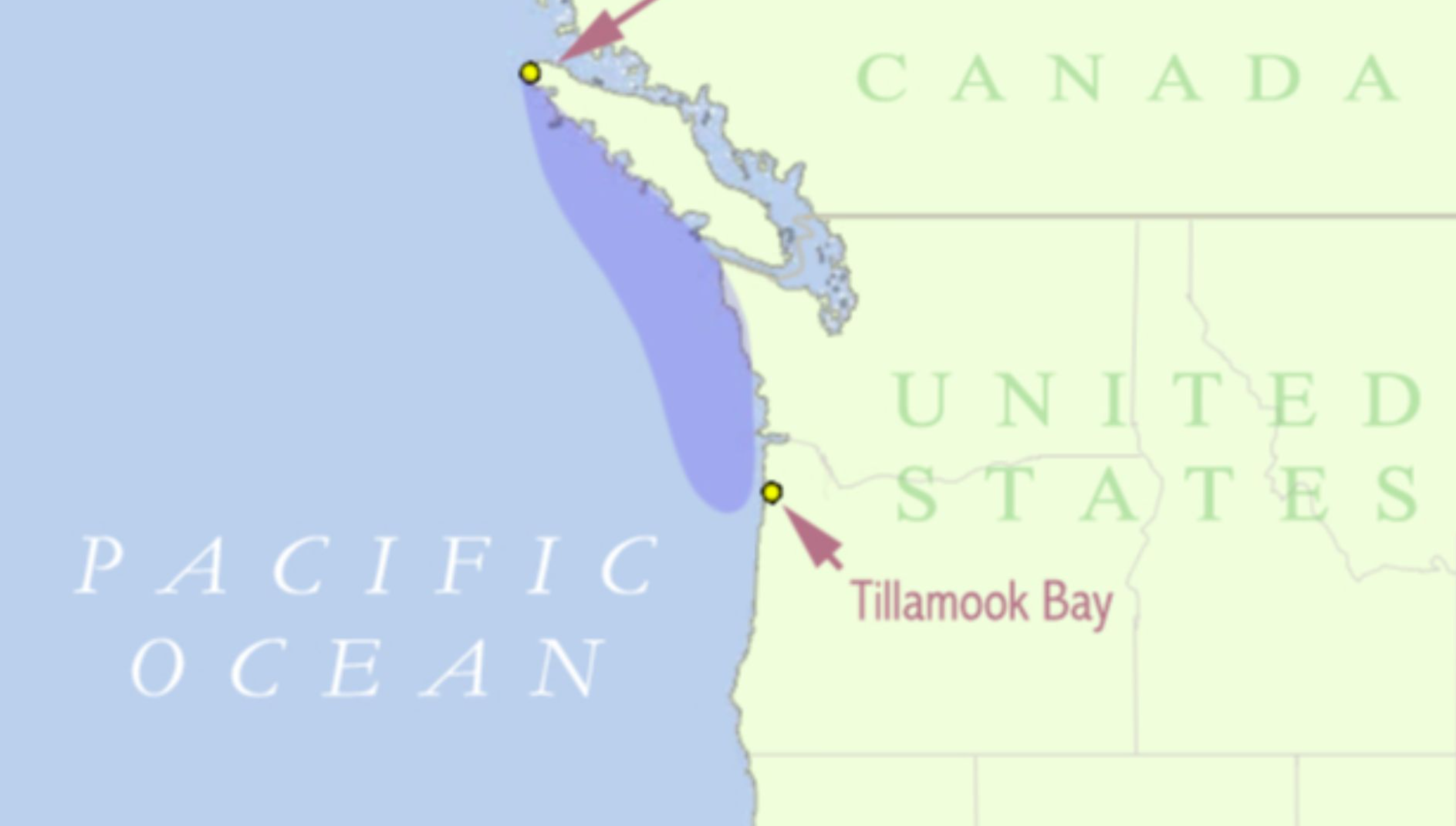
The Graveyard Of The Pacific (Cont.)
Powerful currents, shifting sandbars, and unpredictable weather put together a storm of navigational hazards. Ships entering the Columbia River must cross a shallow bar where river currents collide with ocean waves. These conditions become dangerous during winter storms when waves can exceed 40 feet.
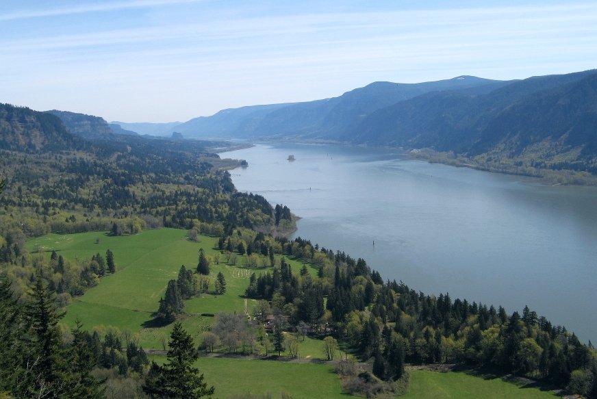
The Graveyard Of The Pacific (Cont.)
The Graveyard of the Pacific includes not only the Columbia Bar, but also the rocky, rugged shoreline of the Olympic Peninsula and the west coast of Vancouver Island. Thankfully, jetties built in the late 19th and early 20th centuries have helped reduce shipwrecks.
Mammoth Cave: World's Longest System
In Kentucky, the Mammoth Cave National Park is the world's longest known cave system, currently mapped at about 426 miles of interconnected passageways. This extensive length results from the 1972 discovery that connected Mammoth Cave with the Flint Ridge Cave System.
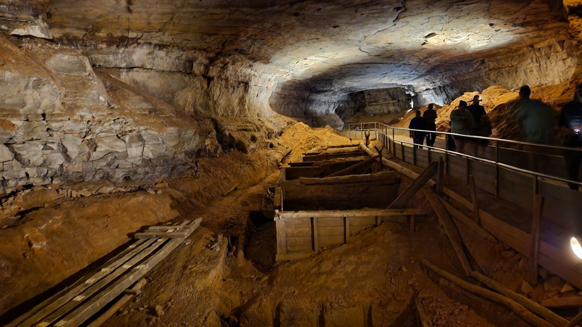
Mammoth Cave: World's Longest System (Cont.)
This brought about the creation of the Mammoth–Flint Ridge Cave System and established it as the longest cave system globally. Exploration continues to expand the known length, with estimates suggesting there may be hundreds of additional miles yet to be discovered.
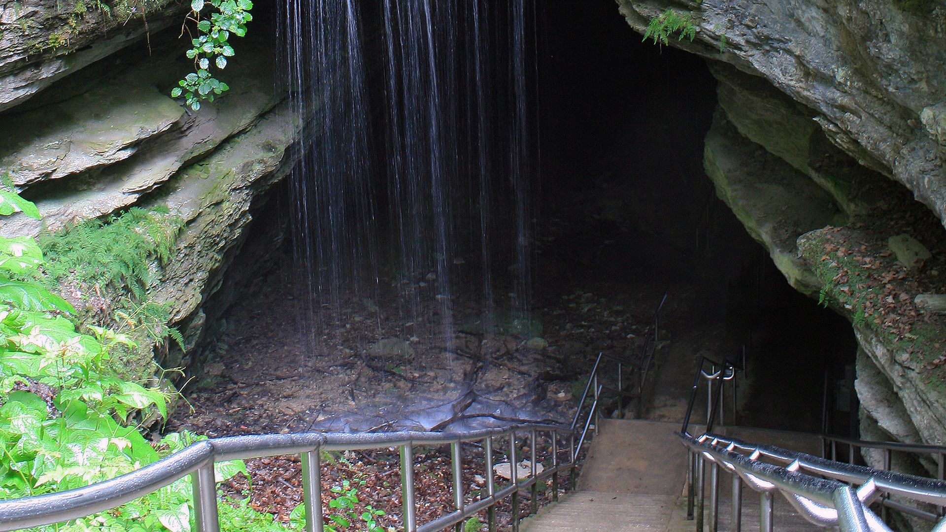
Mammoth Cave: World's Longest System (Cont.)
The cave's formation began over 10 million years ago as groundwater gradually dissolved the region's limestone bedrock. Sinking streams, sinkholes, and springs are common in the area, rapidly channeling surface water underground. You could call it an interplay of geology, water, and time.
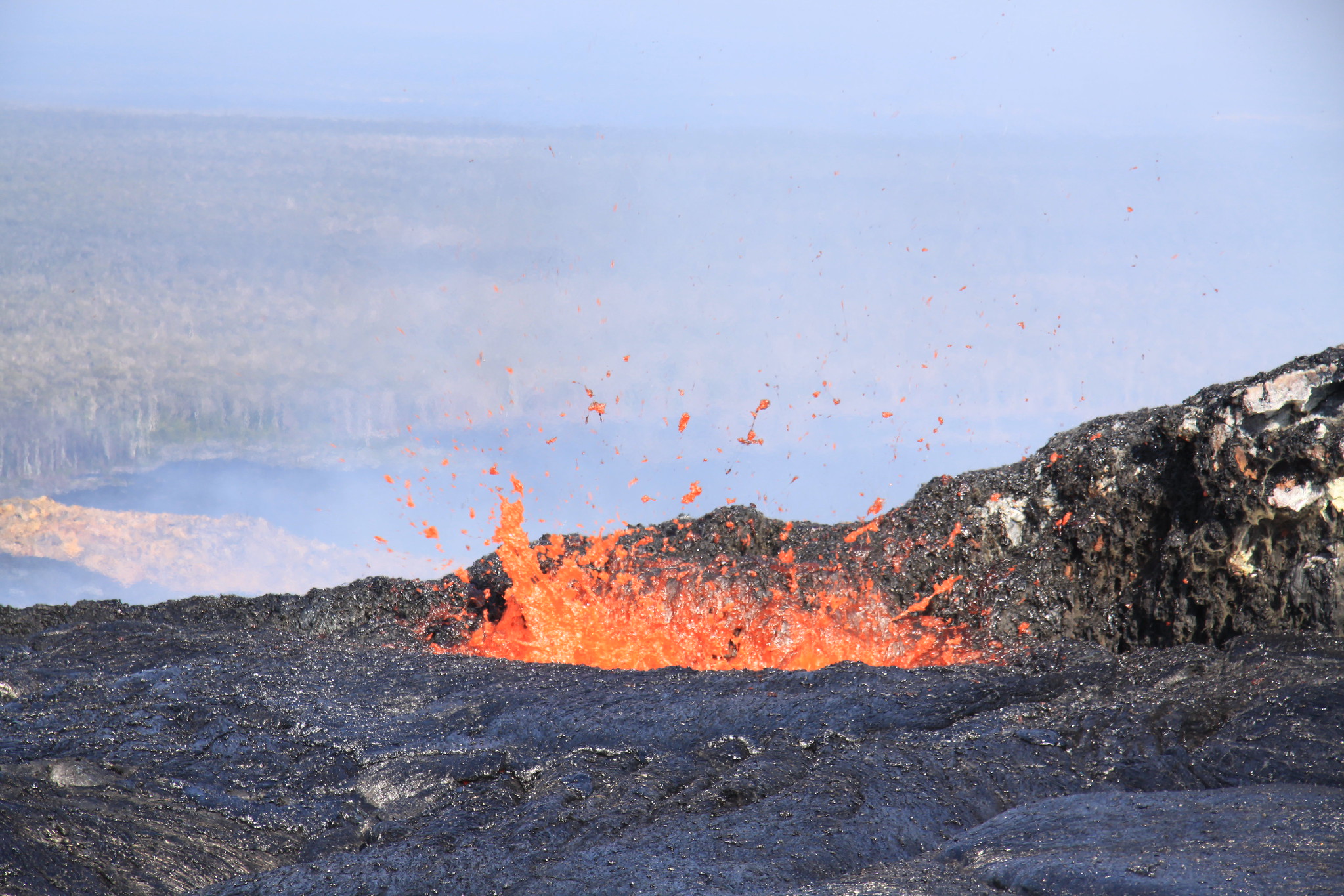
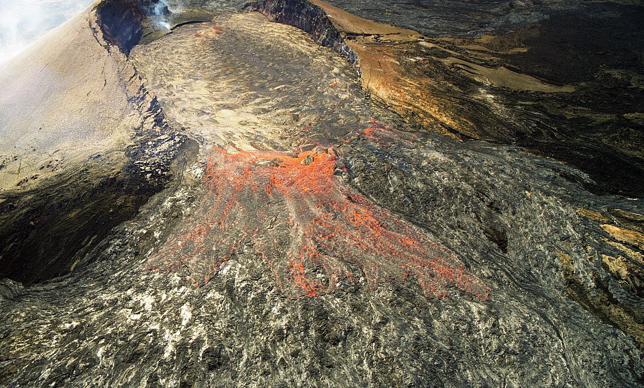
Hawaii's Growing Landmass
In our constantly changing world, Hawaii stands out as one of the few places visibly expanding before our eyes. The Big Island continues to grow as Kilauea volcano pumps molten rock from Earth's mantle to the surface. When this 2,000°F lava reaches the ocean, it instantly cools.
 U.S. Geological Survey, Flickr
Hawaii's Growing Landmass (Cont.)
What we get next is a brand new land that becomes part of America's territory. Since 1983, Kilauea's continuous eruption has added hundreds of acres to Hawaii's coastline. This growth doesn't come without risk, as the same volcanic forces building new land have destroyed entire communities.
 Brian Snelson, CC BY 2.0, Wikimedia Commons
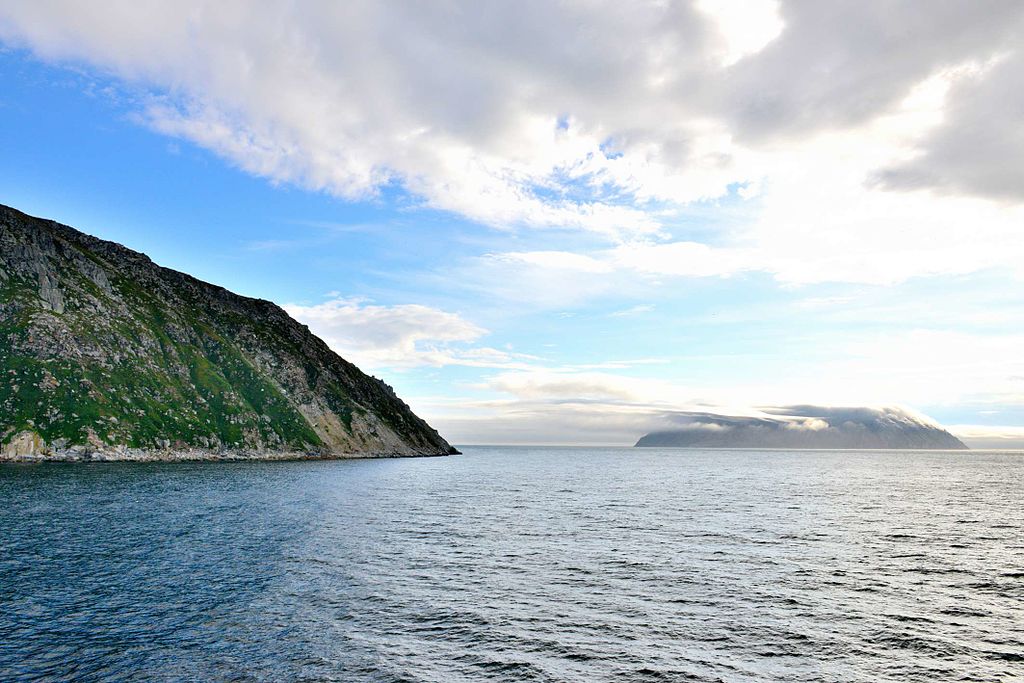
US To Russia Path
The geopolitical divide between America and Russia shrinks to about 2.4 miles at one remarkable location. During winter months, the Bering Strait between Alaska's Little Diomede Island and Russia's Big Diomede Island freezes. However, recent decades have seen considerable variability.
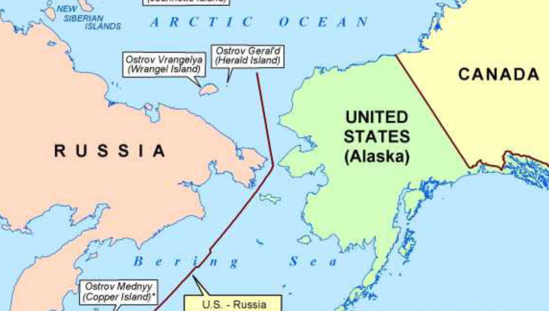
US To Russia Path (Cont.)
Big Diomede (Russia) and Little Diomede (USA) are not only separated by international borders but also by different calendar days. They're literally known as "Tomorrow Island" and "Yesterday Isle" respectively. While technically possible, this crossing remains extremely dangerous due to unpredictable ice conditions.
 Ansgar Walk, CC BY-SA 3.0, Wikimedia Commons
African Fragment Under Alabama
Beneath Alabama's surface rests a geological puzzle piece from another continent entirely. Geologists have discovered that portions of the state are actually sitting atop a fragment of African continental crust that remained behind when the supercontinent Pangaea broke apart millions of years ago.
African Fragment Under Alabama (Cont.)
An ancient connection to Africa like this exists just off the southeastern American coastline. Well, the discovery came through advanced seismic imaging that allowed scientists to peer deep into the Earth's structure. When continents collided to form Pangaea, they developed mountain ranges and thrust belts.
 Fama Clamosa, Wikimedia Commons
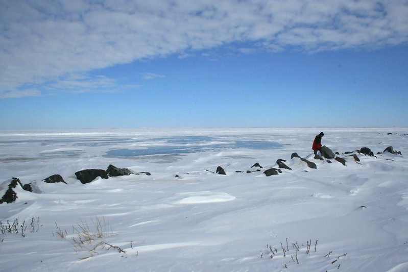
US Borders Three Oceans
While most Americans can easily name the Atlantic and Pacific as the oceans bordering our nation, many forget about the third ocean that touches United States territory. The Arctic Ocean washes against Alaska's northern shores, giving the country the distinction of being a three-ocean nation.
US Borders Three Oceans (Cont.)
Remember that this geographical reality has significant implications for national security, commerce, and environmental policy. As Arctic ice continues to recede due to climate change, such an overlooked coastline grows increasingly important. New shipping lanes are opening along Alaska's Arctic coast, potentially changing global trade routes.
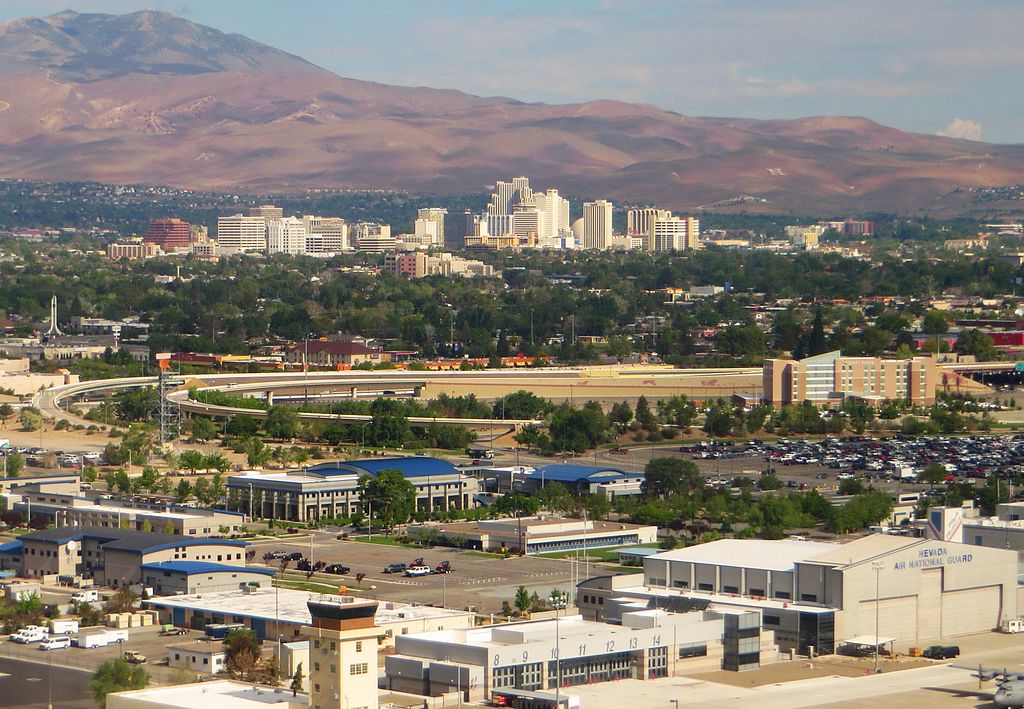
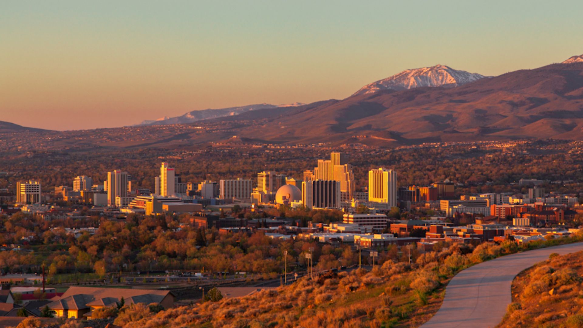
Reno: West Of Los Angeles
Our mental map of the United States often places California as our westernmost frontier, with Nevada placed behind it in the continental interior. Yet, geographical reality contradicts this intuition. Why? Reno, Nevada, lies approximately 86 miles farther west than Los Angeles, California.
 Ken Lund, CC BY-SA 2.0, Wikimedia Commons
Reno: West Of Los Angeles (Cont.)
This geographical quirk results from California's coastline angling sharply southeast near its southern portion. While most of Nevada indeed lies east of California, the western edge of Nevada goes farther west than southern California's coastline. State boundaries often follow arbitrary political decisions rather than natural geographical features.
 Trevor Bexon, Wikimedia Commons
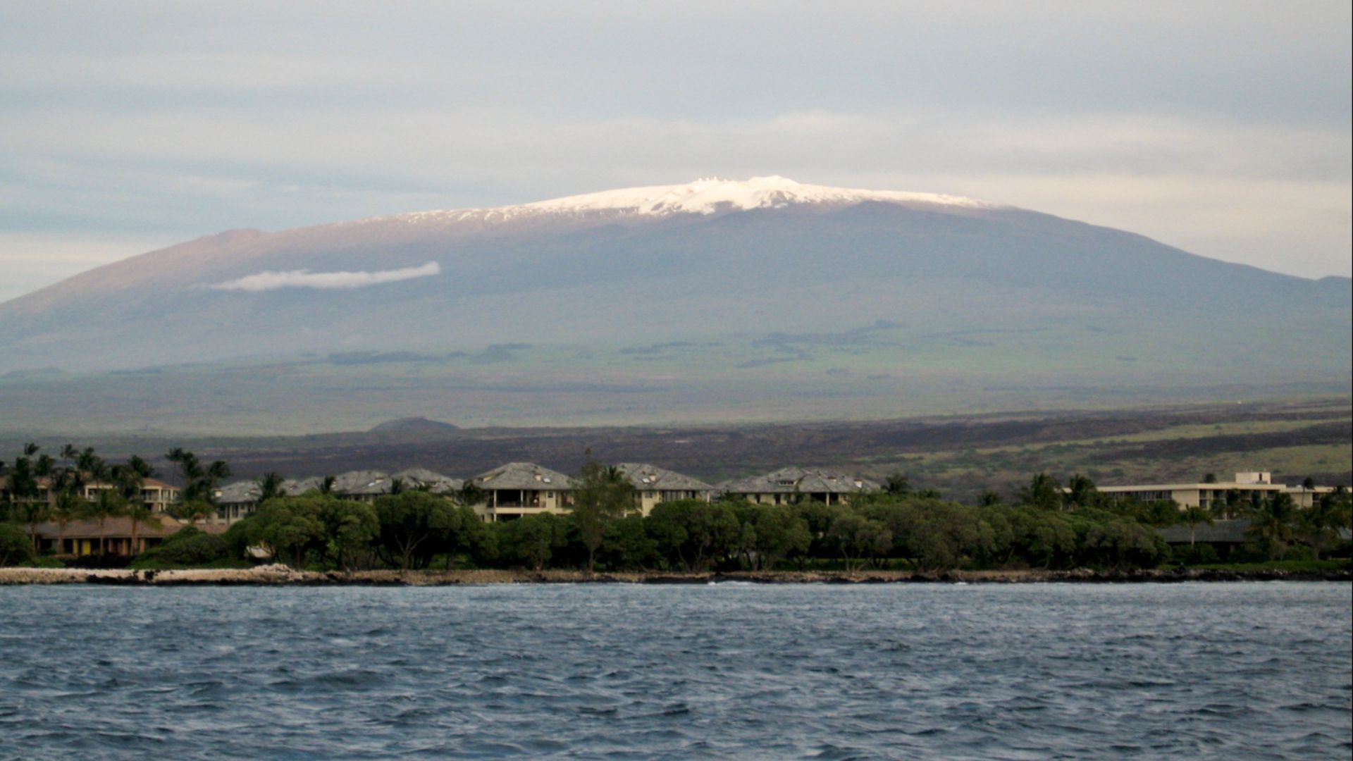
Mauna Kea: Taller Than Everest
Hawaii's Mauna Kea volcano shows that the way we usually measure height can be pretty misleading. Even though Mount Everest is known as the tallest mountain in the world at 29,032 feet above sea level, the real story about Mauna Kea is often overlooked.
 Vadim Kurland, Wikimedia Commons
Mauna Kea: Taller Than Everest (Cont.)
When you measure it from its base underwater to the top, Mauna Kea stands about 33,500 feet tall, which means it's over 4,000 feet taller than Everest. Most of Mauna Kea's mass lies beneath the Pacific Ocean, with only 13,796 feet visible above the waves.
Mauna Kea: Taller Than Everest (Cont.)
The volcano formed through countless eruptions over a million years as the Pacific tectonic plate moved over a hotspot in Earth's mantle. This same volcanic process formed the entire Hawaiian island chain. Its summit hosts some truly advanced astronomical observatories.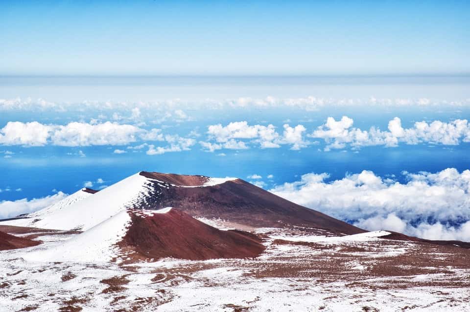 Pixabay


.jpg)