
Mapping Ancient Highways: How Rome’s Roads Were Reimagined
When you think of Rome, you might picture emperors, gladiators, or marble columns, but one of the empire’s greatest achievements was its road system. For centuries, scholars thought they had a handle on how the Romans connected their vast realm. Now, a sweeping digital initiative known as Itiner-e has redrawn the map, revealing a transportation system far larger, and far more intricate, than anyone realized.
 Davidbena, Wikimedia Commons, Modified
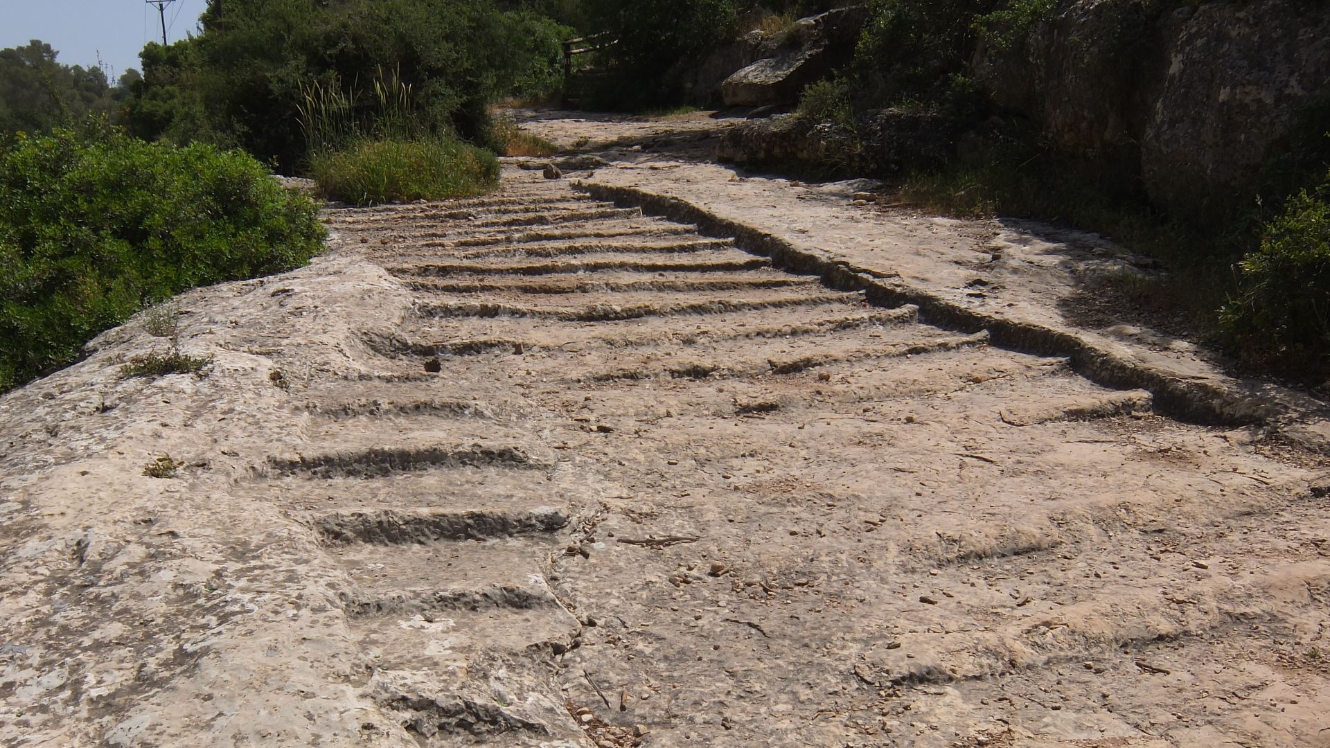
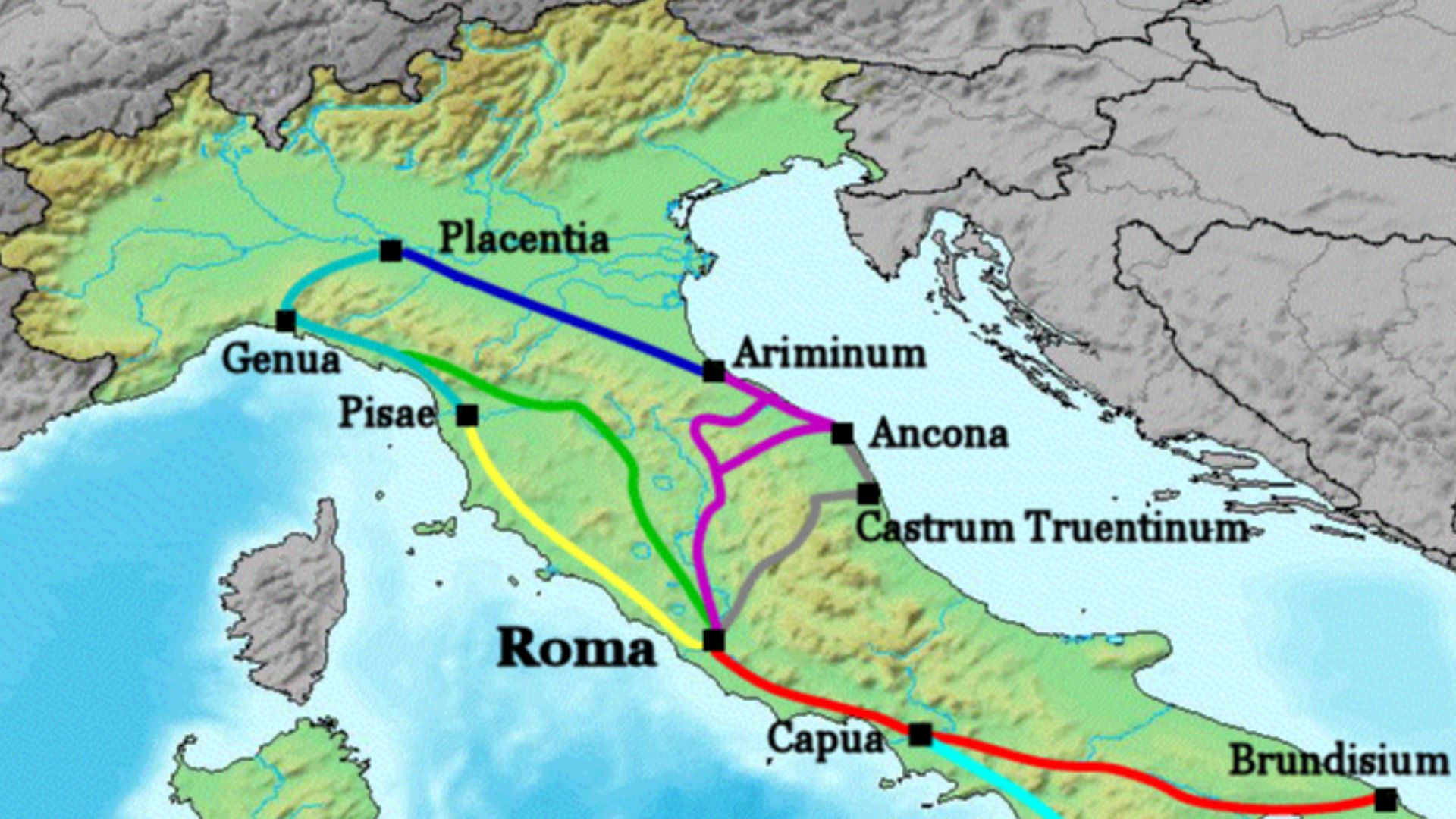
The Legend Of Roman Roads
Romans built roads like nobody else before them. Their engineering prowess made possible military dominance, economic integration, and cultural exchange across what was once the most powerful empire in the world. More than just dirt tracks, these were carefully constructed routes with layers of stone, gravel, and drainage that lasted for centuries and in many places still influence modern highways.
 Paul Hermans, Wikimedia Commons
The Big Reveal: Itiner-e
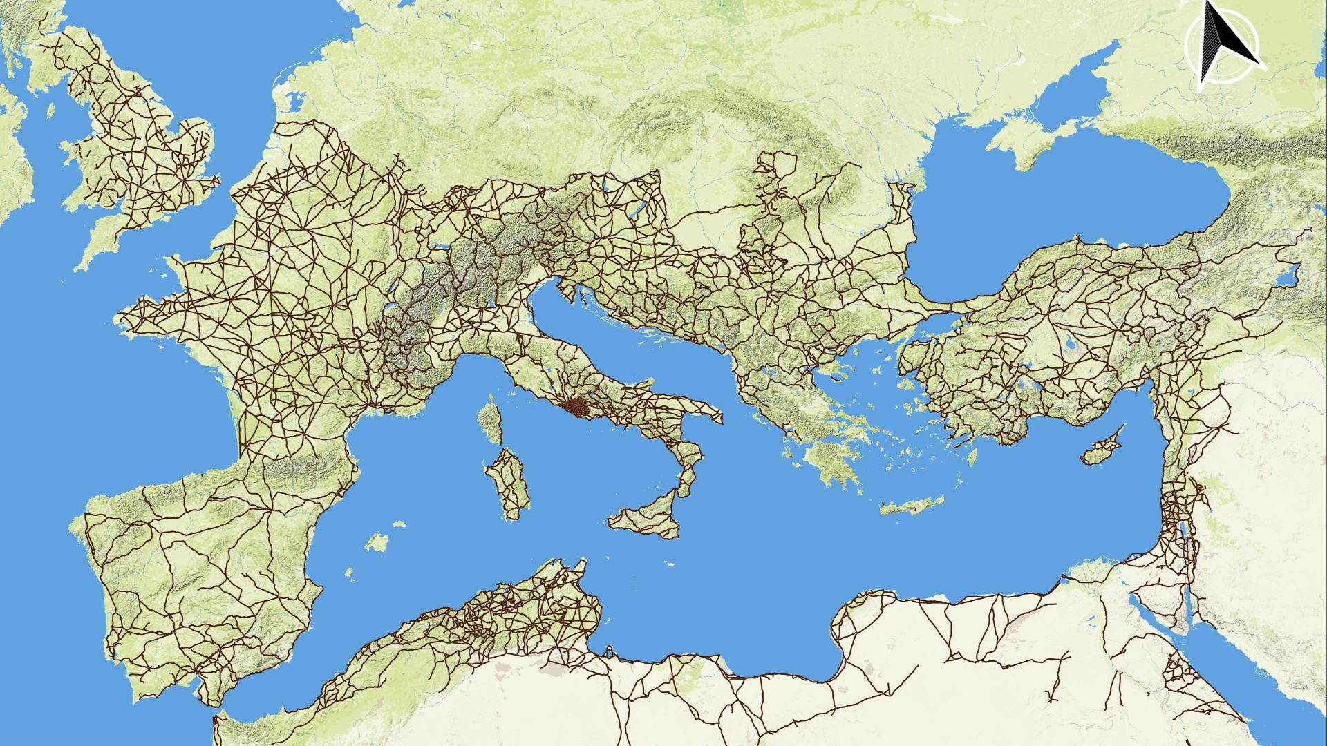
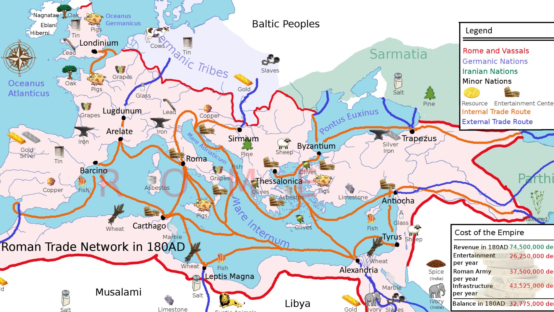
The Itiner-e project is a collaboration of archaeologists and historians who have created the most detailed digital map of the Roman road network ever produced. Rather than relying on old atlases or piecemeal data, the team compiled thousands of archaeological records, historical maps, literary sources, and modern satellite imagery to produce a network of almost 300,000 km (about 186,000 miles) of ancient roads as they existed around 150 CE.
 Mellangoose, Wikimedia Commons
Not All Roads Lead To Rome
It might seem ironic, but the new map shows that not all roads actually led to Rome. While the city was an empire’s hub, much of the network focused on connecting regional centers, provinces, and economic zones. Places like the Po Valley in northern Italy and corridors through the Alps emerge as major hubs in their own right. Rome itself often served as a terminus rather than the busiest crossroads.
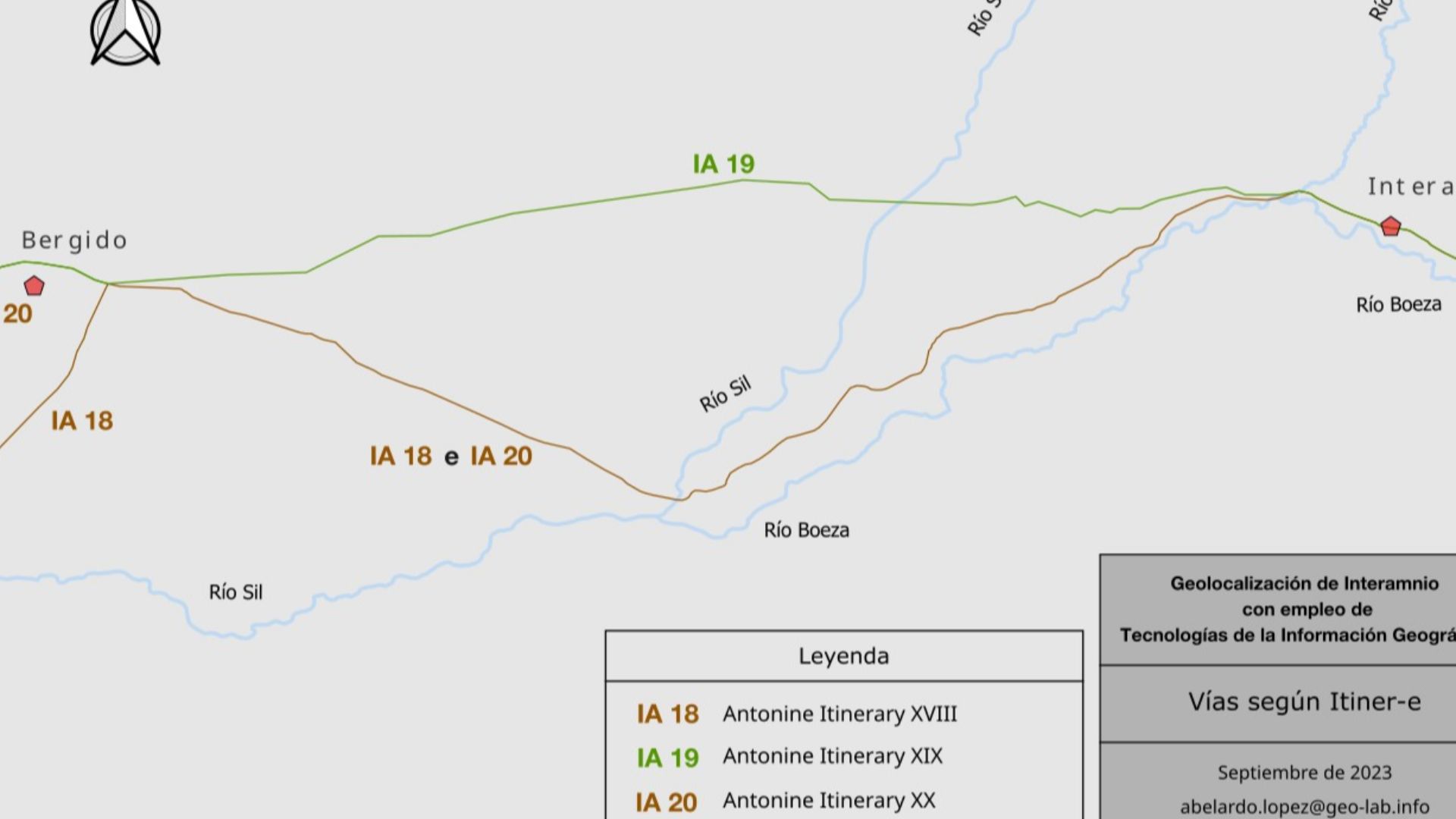
How Itiner-e Was Built
Creating Itiner-e was a mammoth task. Researchers started by gathering all known roads from older resources like the Barrington Atlas and the DARMC (Digital Atlas of Roman and Medieval Civilizations). They then integrated data from archaeological excavations, historical milestones, aerial photos, and satellite imagery. Modern GIS software allowed them to link these disparate sources into a coherent, dynamic digital atlas.
The Scale Is Mind-Blowing
The earlier estimate for the Roman road system was around 188,555 km. The new Itiner-e reconstruction pushes that to nearly 300,000 km, almost double what was previously recorded. This network spans across modern Europe, North Africa, and parts of the Middle East and Asia.
 Livioandronico2013, Wikimedia Commons
Itiner-e As A Living Resource
Itiner-e is a map that’s designed to grow. Only about three percent of the network’s precise path is known with full certainty. About 90 percent is less precise but still mapped from credible evidence, and around seven percent is hypothetical based on patterns and likely connections. This means future discoveries can be added, making Itiner-e more detailed over time.

What The New Map Reveals
One of the most surprising things about the new data is that secondary roads far outnumber main highways. These smaller routes connected villages, markets, and rural hinterlands to bigger towns and cities. It reveals a balance between centralized imperial planning and local mobility networks that historians hadn’t fully appreciated before.
 Rosario Lepore, Wikimedia Commons
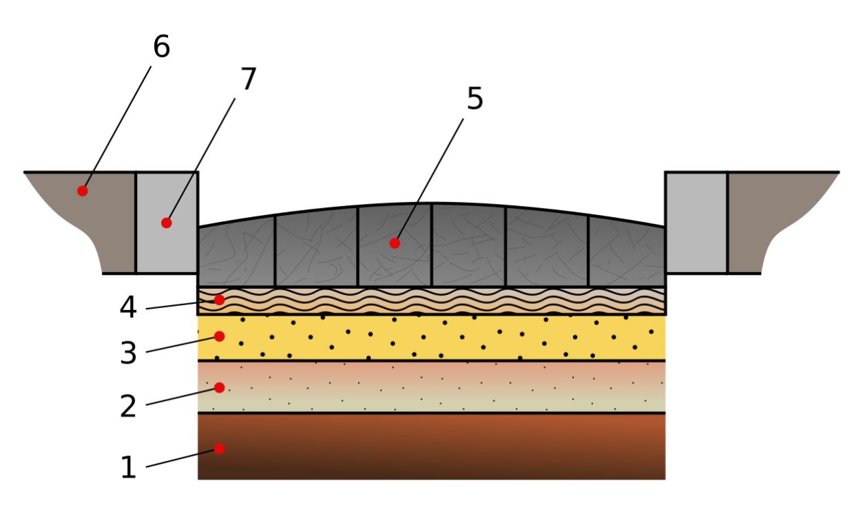
More Than Just Lines On A Map
Roman roads were built for efficiency and durability. They typically featured a layered foundation for drainage, paved surfaces, and standardized milestones that helped travellers know their location and distance to the next town. This level of planning allowed couriers, merchants, and soldiers to move rapidly across vast distances.
 Via_Munita.png: Smith, William, William Wayte, and G. E. Marindin, Wikimedia Commons
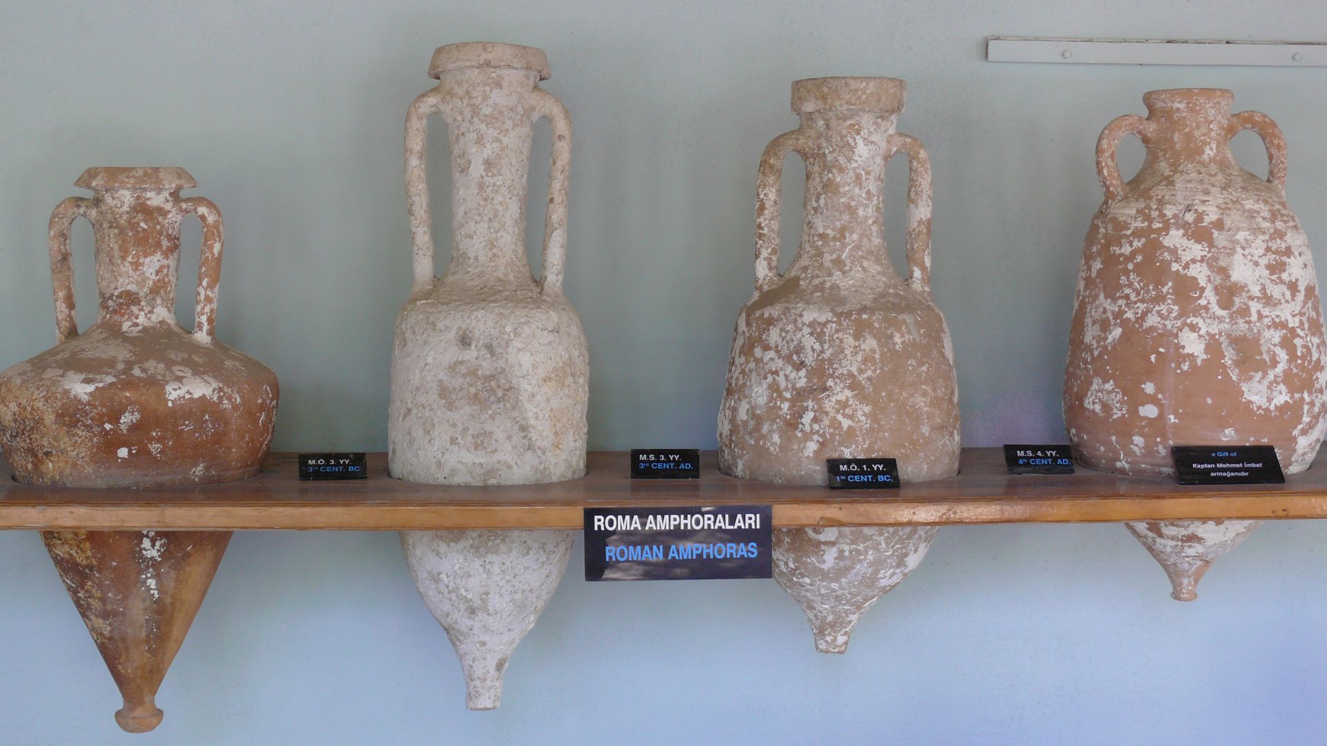
How Roads Shaped Trade And Empire
With roads crisscrossing provinces from Britain to Egypt and Syria, economies were deeply interconnected. Goods such as wine, olive oil, metals, grain, and textiles flowed along these routes. The remapped network helps researchers model how trade moved through the empire and how ideas, cultural practices, and even disease may have spread.
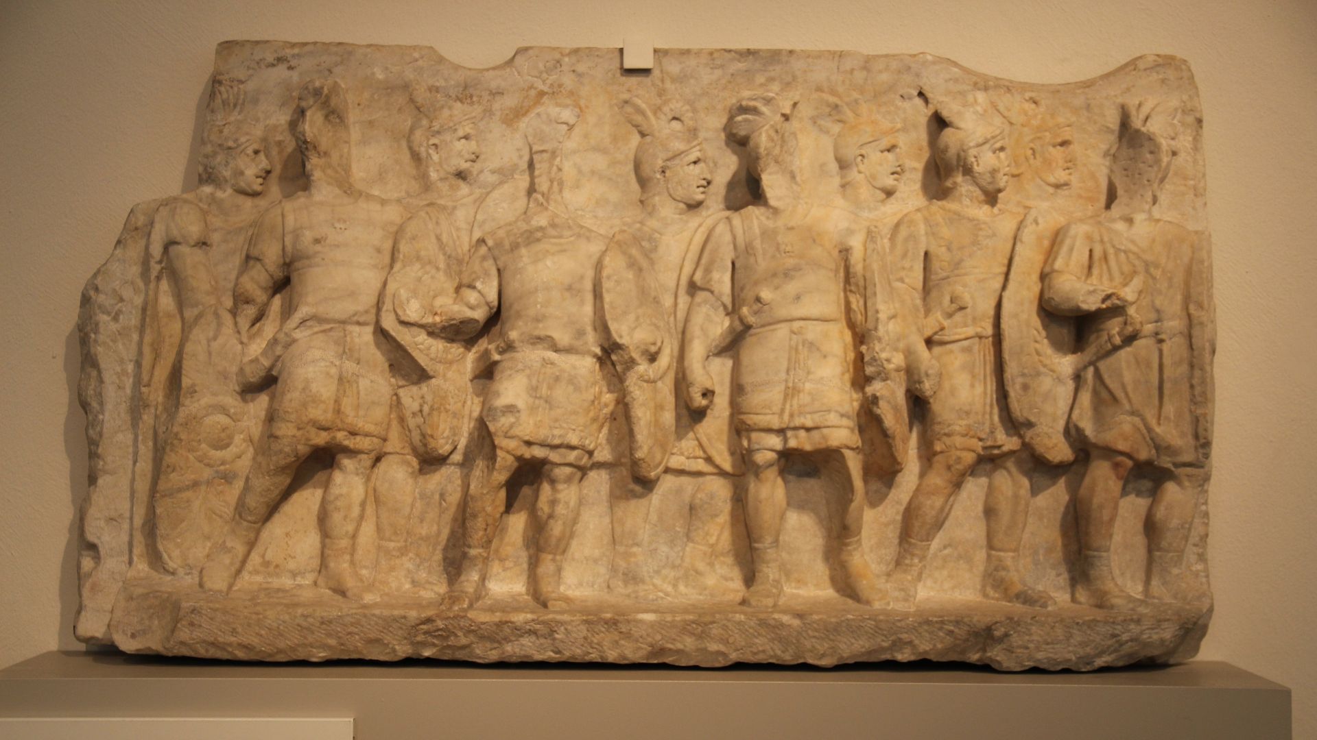
Roads And The Roman Army
The Roman legions relied on these roads to project power, respond to rebellions, and maintain garrisons across distant frontiers. Efficient movement was a strategic advantage, the very lifeblood of a system that kept the empire from fracturing too quickly under its vast size.
 Gary Todd from Xinzheng, China, Wikimedia Commons
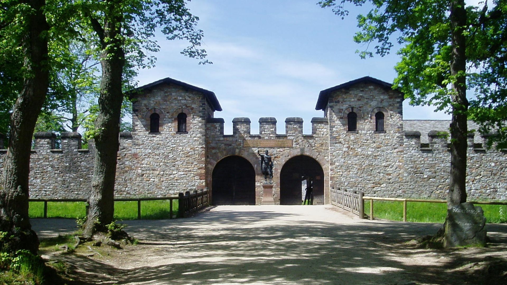
Towns And Waystations Along The Way
Roman roads were dotted with mansiones (rest houses), mutationes (stations for fresh horses), inns, and settlements that grew around intersections. These sites remind us that travel was not just for military or elite—everyday people used these roads for pilgrimage, trade, and migration.
 en:User:Ekem, Wikimedia Commons
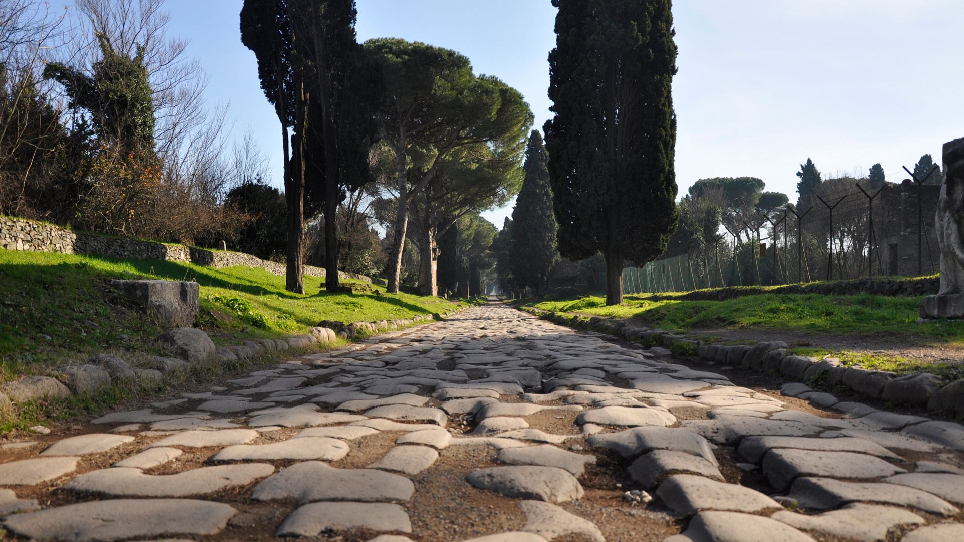
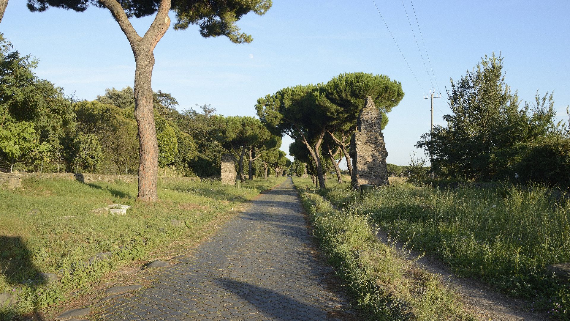
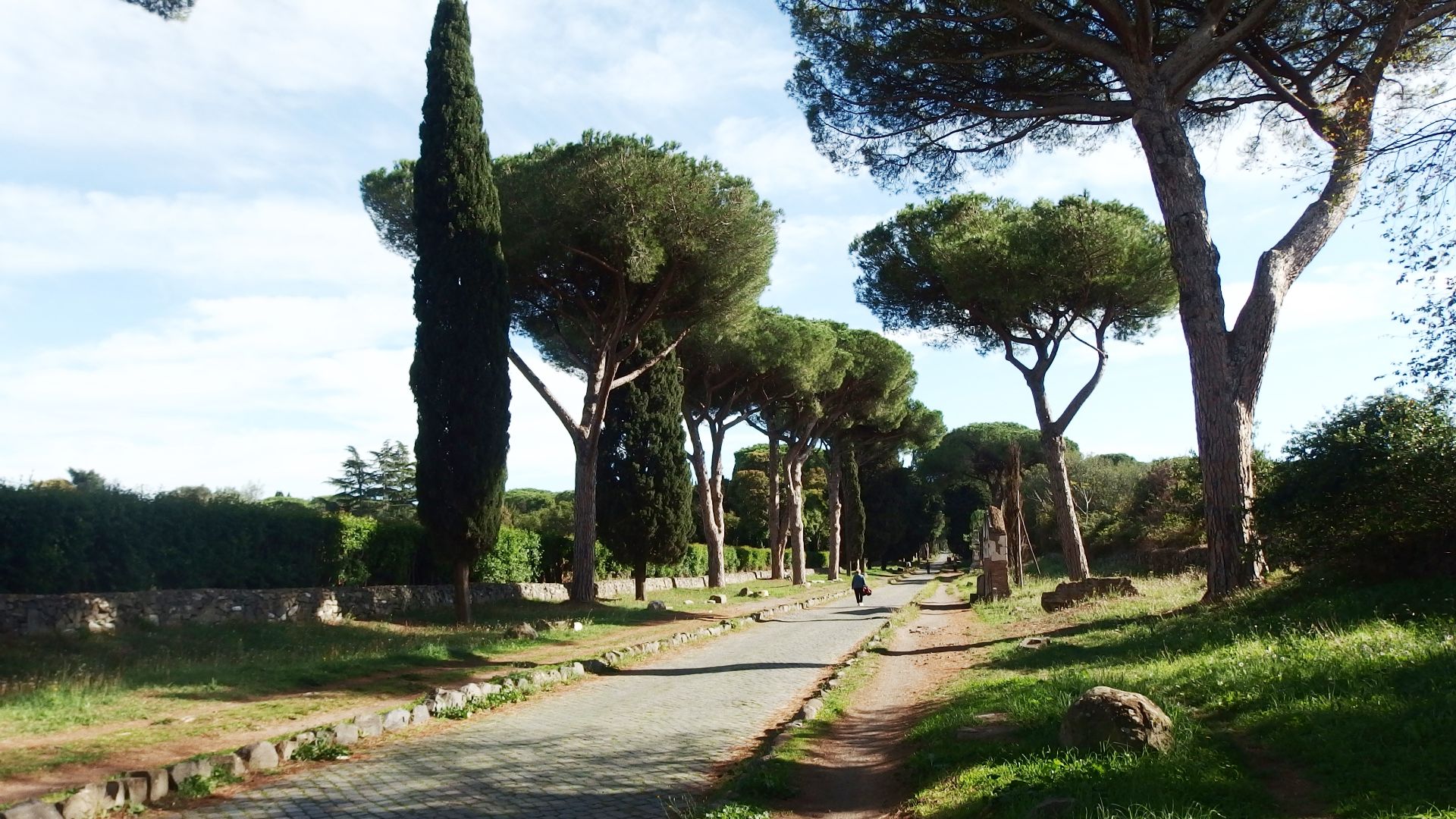
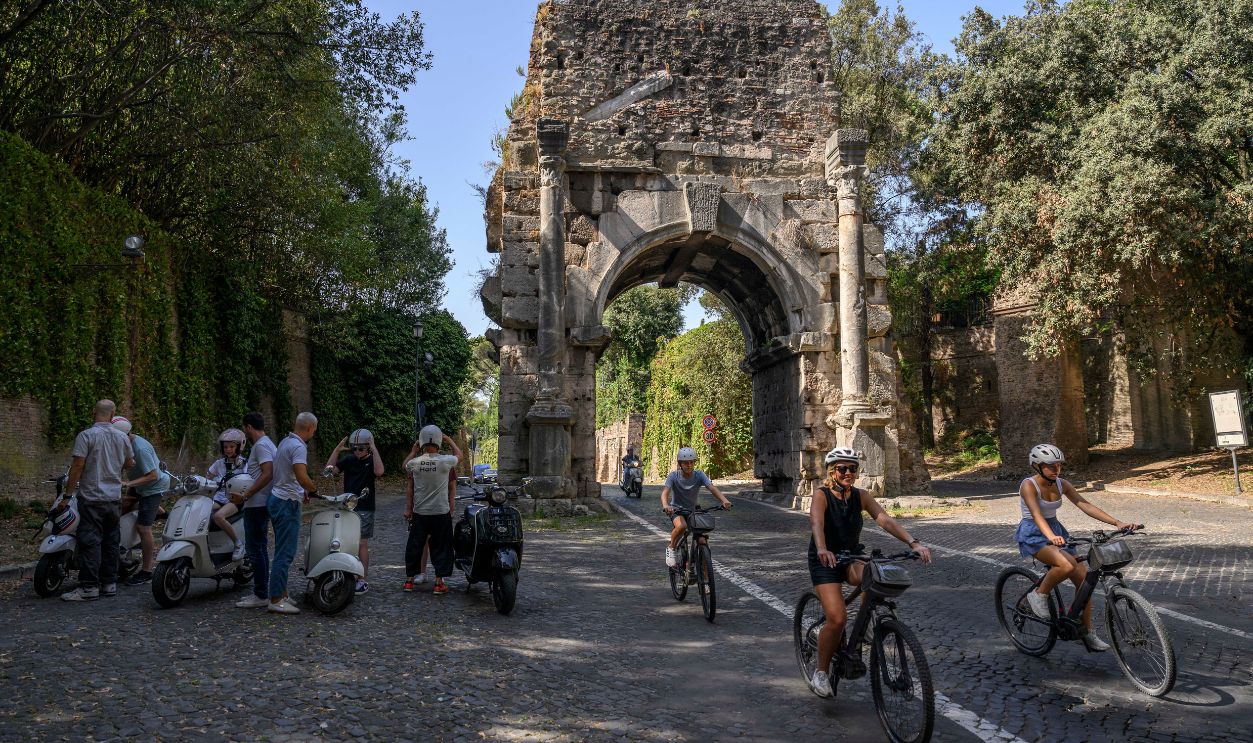
Famous Roads Tourists Can Still Walk Today
Several Roman roads survive in part and make incredible visits for history lovers. The Appian Way near Rome is perhaps the most celebrated. It once connected Rome to Brindisi in southeast Italy, its ancient sections can still be walked today.
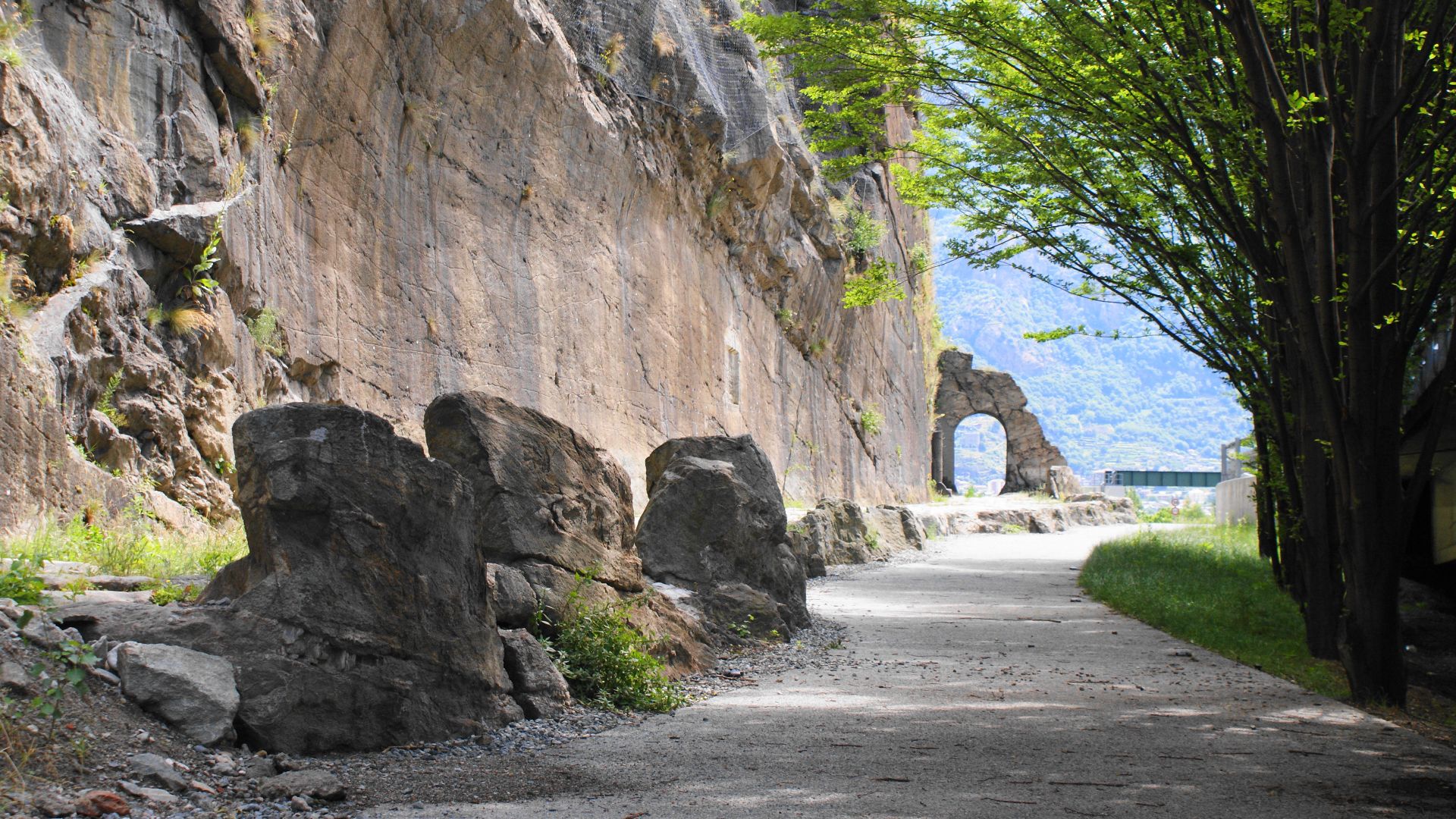
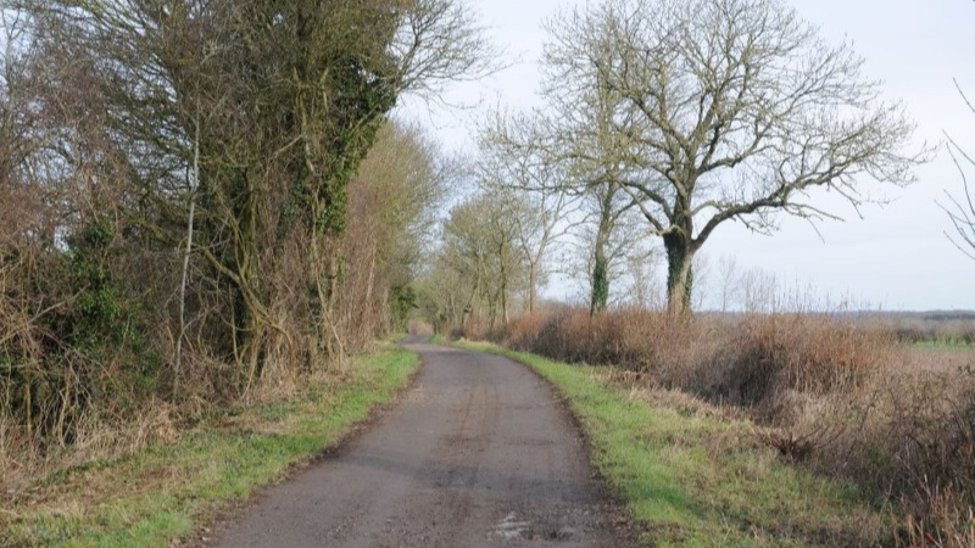
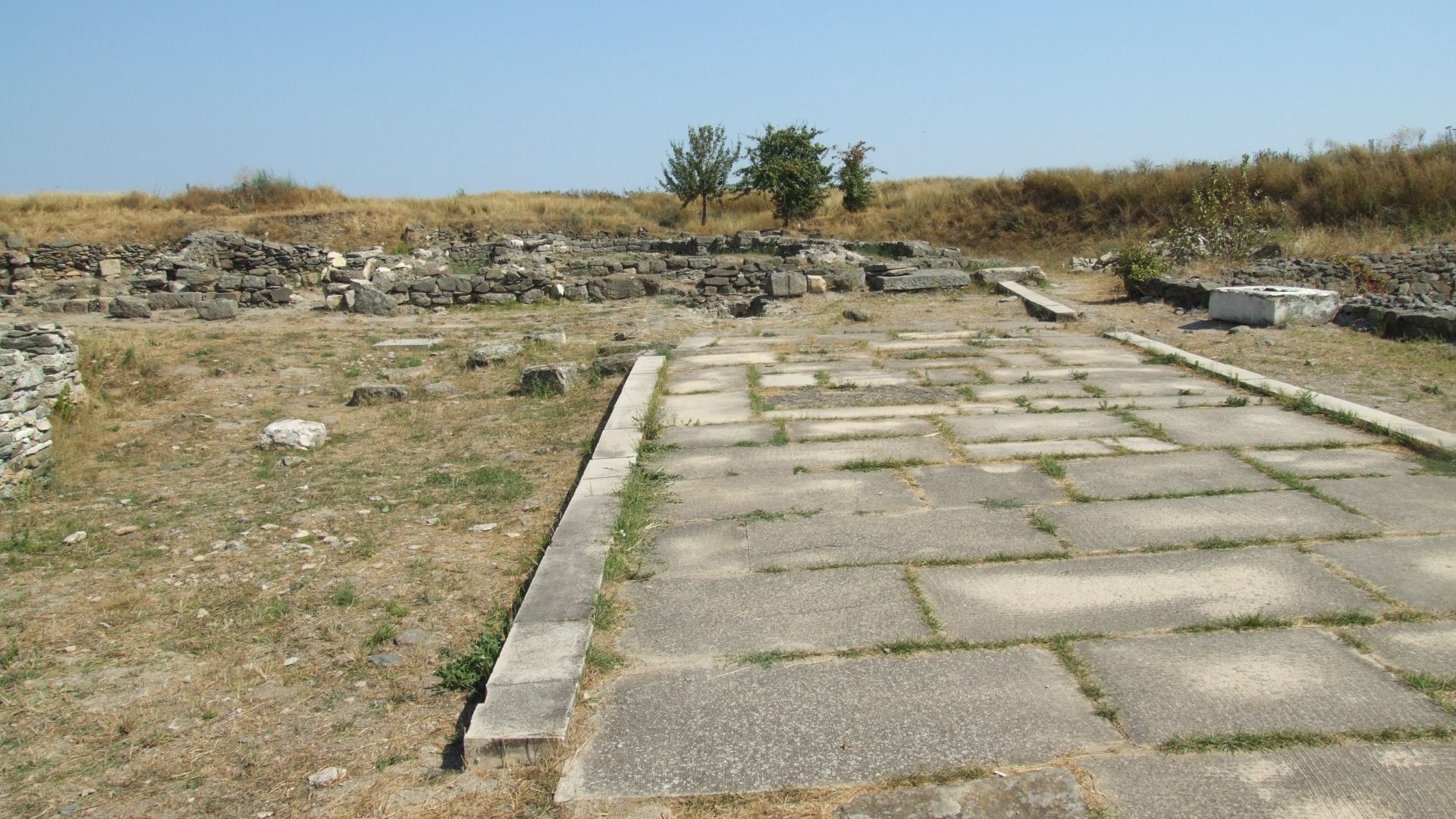
Other Ancient Routes Across Europe
In Roman Britain, the Fosse Way stretches about 230 miles from Exeter to Lincoln, while in Hispania, the Via Augusta linked southern Spain along the Mediterranean coast. Further west, the Roman Road of Agrippa connected Gaulish settlements and remains visible in parts of France. Walking these today is like stepping back into the ancient world of chariots, pack animals, and merchant caravans.
 Philip Halling , Wikimedia Commons
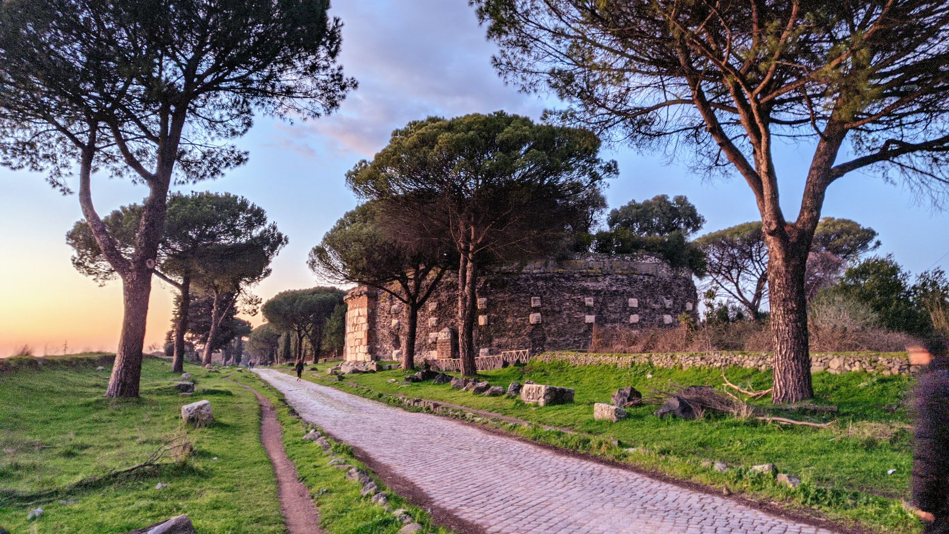
Modern Roads That Follow Ancient Paths
It’s not just footpaths and ruins; many modern highways trace the routes laid down by Roman engineers. In Italy, portions of contemporary roads, especially north of Rome, hug the same lines as their ancient predecessors, a living echo of history.
Gaps In The Map And What Comes Next
Despite the immense scope of Itiner-e, large gaps remain. Some roads are known only through texts, others are conjectured based on settlements and milestones, and still others are awaiting archaeological confirmation. Future research aims to fill these gaps, incorporate maritime and river routes, and even model chronological changes in the network.
 James McMurtrie (1840 – 2 February 1914), Wikimedia Commons
Rewriting Ancient Connectivity
By combining historical sources and cutting-edge mapping techniques, scientists are giving us not just a big map but a dynamic understanding of how movement shaped ancient society. Itiner-e allows researchers to study connectivity, migration, and even epidemiology across time and space.
Why This Matters Today
Mapping Rome’s roads isn’t just an academic exercise. It helps us understand how infrastructure supports empire, trade, and cultural exchange, which are lessons as relevant today as they were two millennia ago. These roads were the skeleton of a civilization, and now we finally see its full shape.
 Antonio Masiello, Getty images
Final Thoughts
The old proverb “all roads lead to Rome” still resonates, but the new Roman road map shows that roads led everywhere else too. From Britain to Egypt and from Spain to Syria, these engineered routes formed the nervous system of an empire. Thanks to projects like Itiner-e, we can now navigate that system with fresh clarity, exploring not just the roads themselves but the stories of the people who walked, rode, and marched along them.
 CristianChirita, Wikimedia Commons
You May Also Like:
A work crew was building a road in France when they uncovered an ancient Roman villa.


