Some Views Come With White Knuckles
Across North America, certain famous drives combine astonishing scenery with steep grades, unpredictable weather, or extreme remoteness, yet travelers keep lining up to experience them.
Going-To-The-Sun Road Hugs The Mountainside
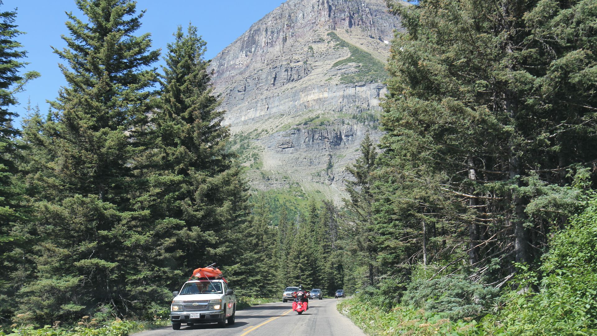
Glacier National Park's Going-to-the-Sun Road climbs through terrain the National Park Service describes as narrow, steep, winding, and exposed in places. Vehicle combinations longer than 21 feet or wider than eight feet are prohibited across the alpine section, and the speed limit drops to 25 mph at higher elevations. Blind curves, wildlife, pedestrians, rock overhangs, and limited sight distance demand attention even on clear summer days.
Yet Glacier's Famous Road Is The Attraction
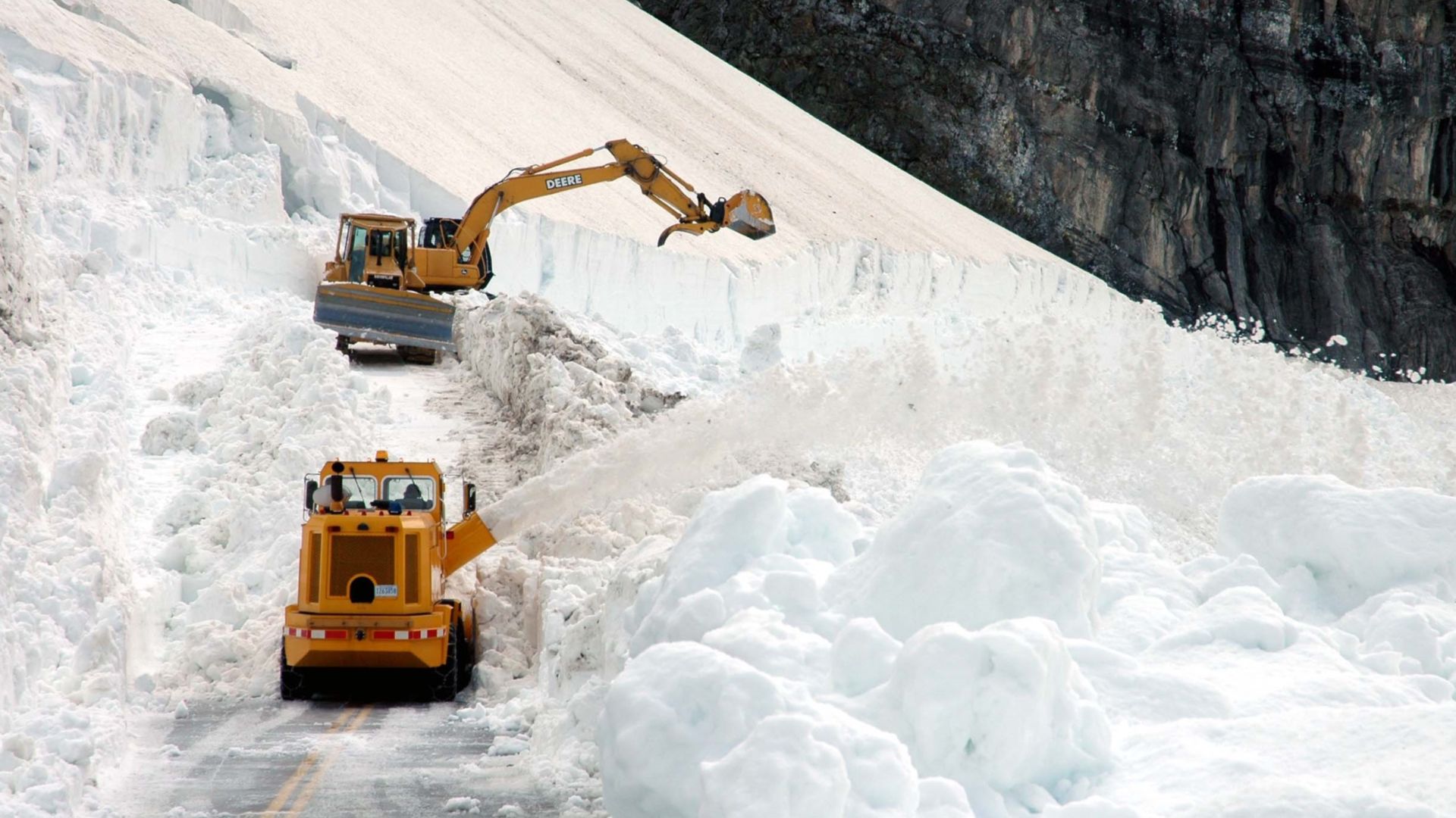
The 50-mile route crosses Logan Pass at 6,646 feet and takes roughly two hours without stops. Pullouts reveal glacial valleys, waterfalls, alpine terrain, and some of Glacier's signature scenery, which explains why parking around Logan Pass can fill extremely early. Seasonal snow limits the complete drive largely to summer, making the brief opening window feel even more special.
 Photographer, Erich Peitzsch, USGS, Wikimedia Commons
Canada's Icefields Parkway Gets Extremely Remote
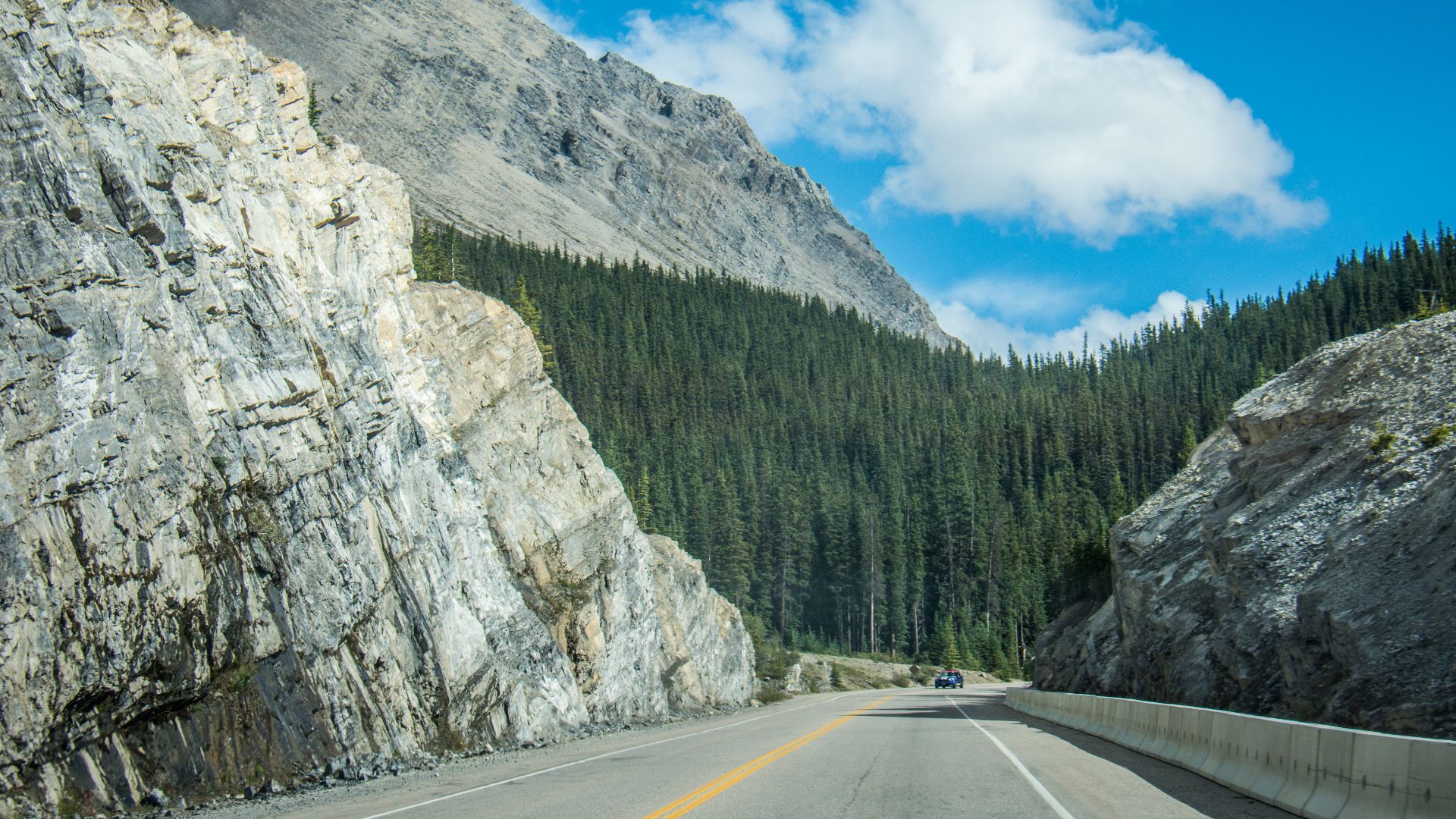
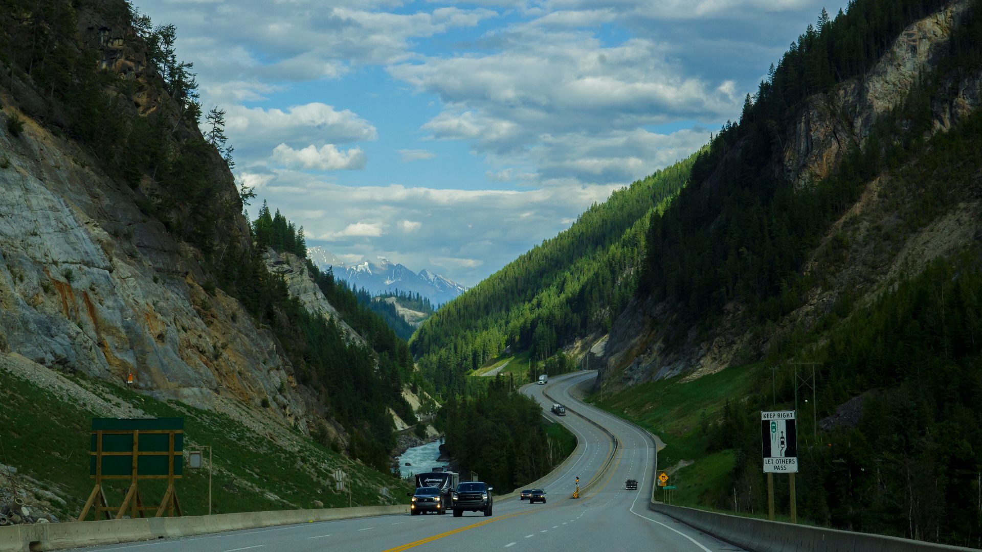
The Icefields Parkway runs 232 kilometres between Lake Louise and Jasper through the Canadian Rockies. Parks Canada warns that the route has limited services, no cell coverage, rapidly changing weather, and long stretches where travelers must be self-reliant. Winter is more serious still, with mandatory snow tires or chains, compact snow, avalanche-related closures, and no services anywhere between the two communities.
 m01229 from USA, Wikimedia Commons
Drivers Accept The Risk For Glacier Country
Few highways offer such sustained mountain scenery. The road passes ancient glaciers, icefields, alpine lakes, wildlife habitat, and towering peaks for hours at a time. Parks Canada calls it one of the world's most spectacular drives, which makes carrying food, filling the tank, and losing cell service feel like part of the expedition.
 Thomas Fuhrmann, Wikimedia Commons
Alaska's Dalton Highway Is Not An Ordinary Road Trip
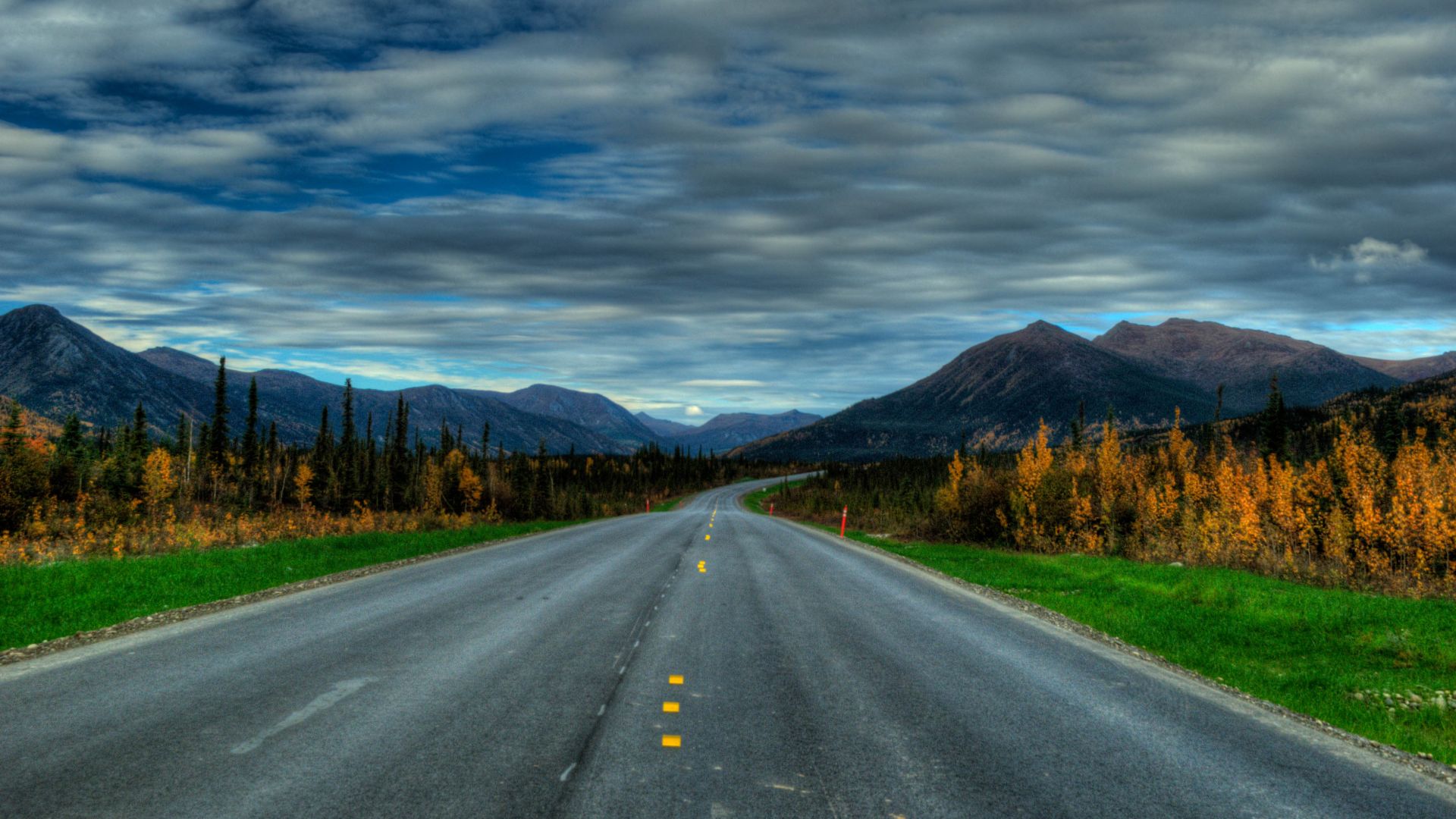
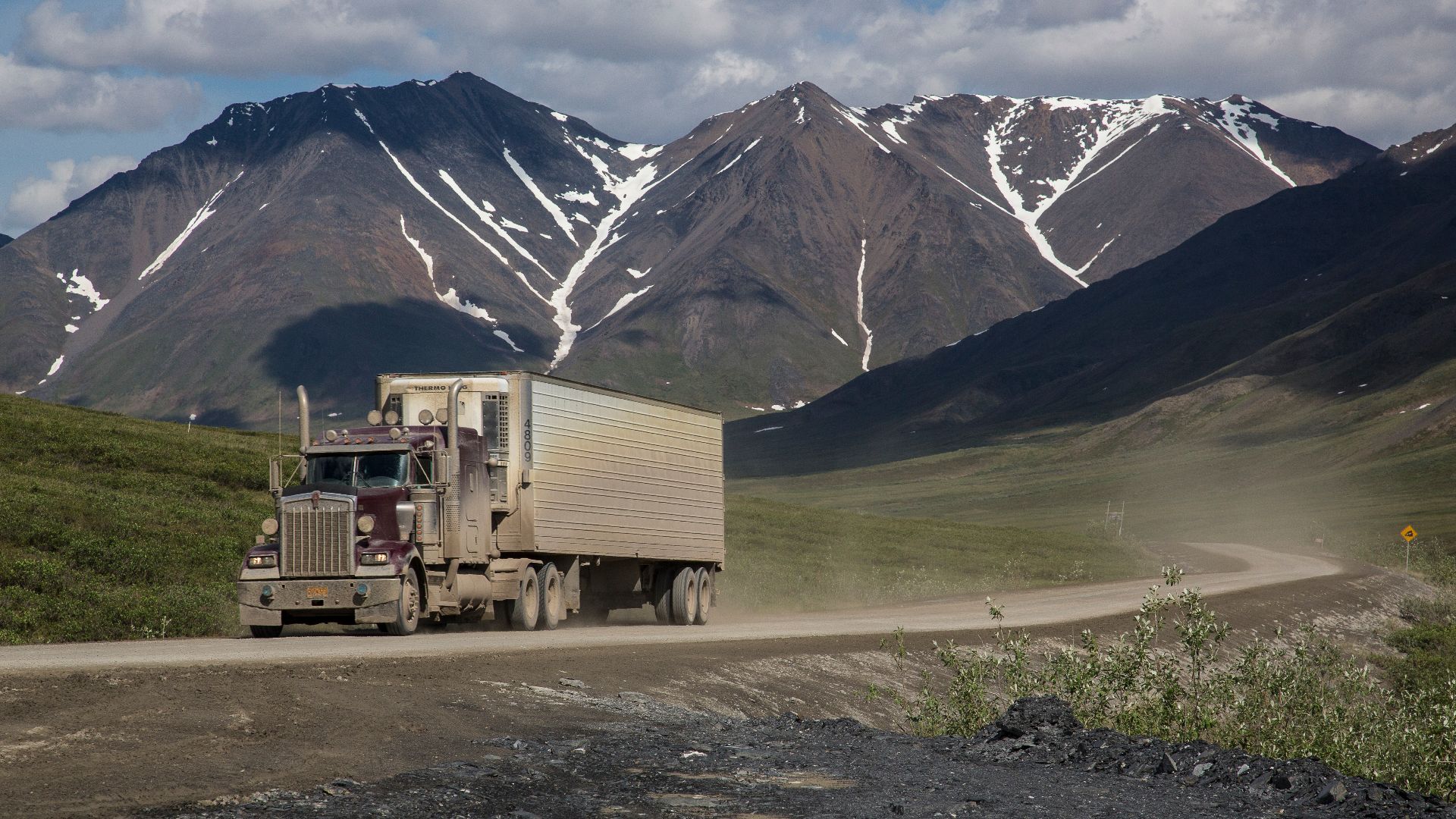
The Dalton Highway was built as an industrial transportation corridor to Alaska's North Slope, and commercial trucks remain its dominant traffic. Alaska transportation officials warn of long stretches of gravel and dirt, rough surfaces, extremely limited services, and severe weather, particularly around Atigun Pass. Travelers are advised to bring extra fuel, water, food, emergency equipment, warm clothing, and spare tires.
 Elias Angulo, Wikimedia Commons
The Dalton Offers A Road Trip Few Places Can Match
Those difficulties are exactly what attract adventurous drivers. The highway heads north through boreal forest, crosses the Arctic Circle, climbs the Brooks Range, and eventually reaches the Arctic coastal plain near Deadhorse. For travelers seeking genuine remoteness rather than another polished scenic byway, the Dalton remains difficult to resist.
 Bureau of Land Management Alaska, Wikimedia Commons
The Dempster Highway Can Shred A Tire
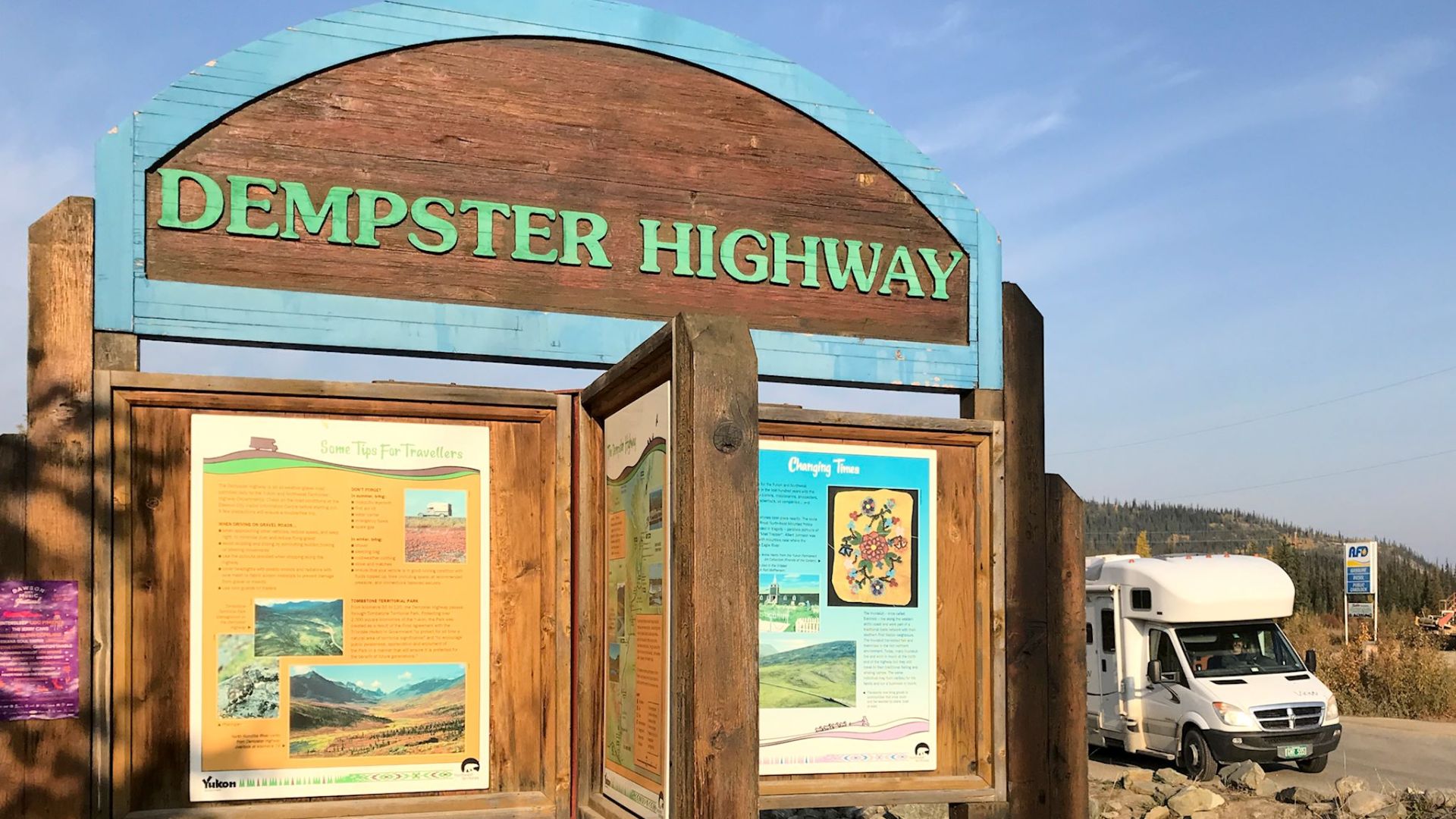
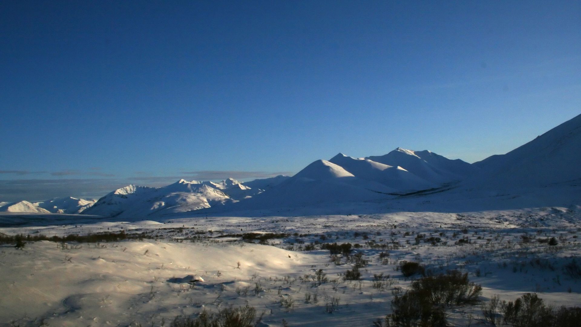
Canada's Dempster Highway delivers a similar northern challenge. Travel Yukon warns that sharp shale can damage tires and advises carrying one or even two spares, extra fuel, food, water, and proper repair equipment. Gas on the Yukon portion can be separated by hundreds of kilometres, while loose gravel, dirt, wildlife, and sparse services make casual improvisation a bad strategy.
 dvs from Vermont, USA, Wikimedia Commons
But The Dempster Reaches The Arctic By Road
The route crosses vast tundra, mountain landscapes, the Arctic Circle, and some of Canada's least populated country. Travelers can pass through Tombstone Territorial Park before continuing toward the Northwest Territories and eventually the Arctic Ocean road connection through Inuvik and Tuktoyaktuk. The very emptiness that makes the Dempster demanding also makes it unforgettable.
 Ian Mackenzie, Wikimedia Commons
Highway 1 At Big Sur Has A Fragile Relationship With The Cliffs
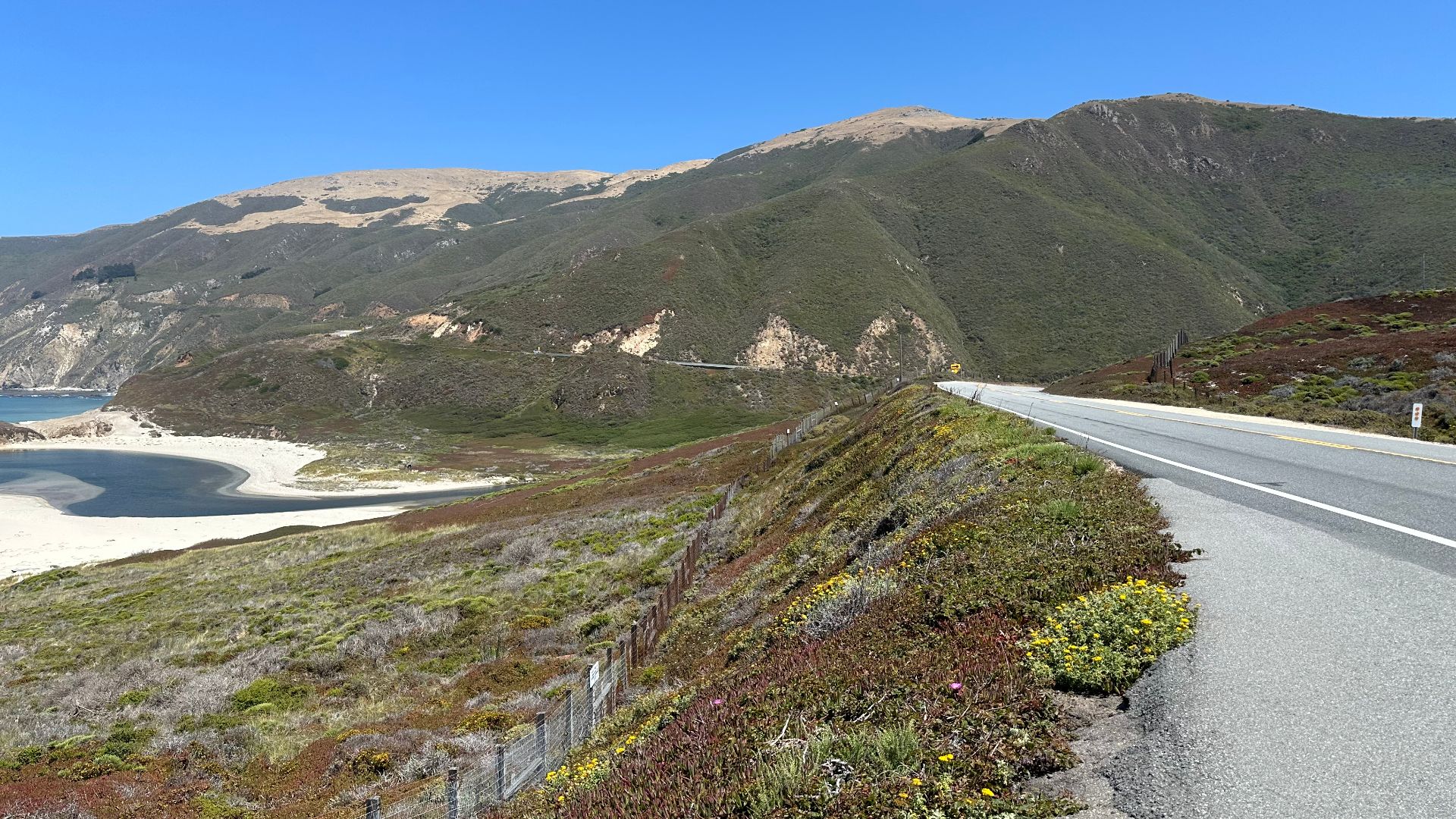
California's Highway 1 winds directly between steep coastal slopes and the Pacific through Big Sur. Landslides have repeatedly closed portions of the roadway, including the major Regent's Slide closure that required extensive stabilization work before reopening in January 2026. Wildfires also forced fresh closures along sections of the route later that year.
Big Sur Keeps Pulling Drivers Back
Visit California describes Big Sur's roughly 90-mile coastline as one of the state's most spectacular settings. Highway 1 provides views of ocean bluffs, redwoods, beaches, and landmarks such as Bixby Bridge along a road engineered into terrain that barely seems to have room for it. The combination of vulnerability and beauty is part of why road-condition checks are essential before a Big Sur trip.
Utah's Moki Dugway Drops Straight Down A Mesa
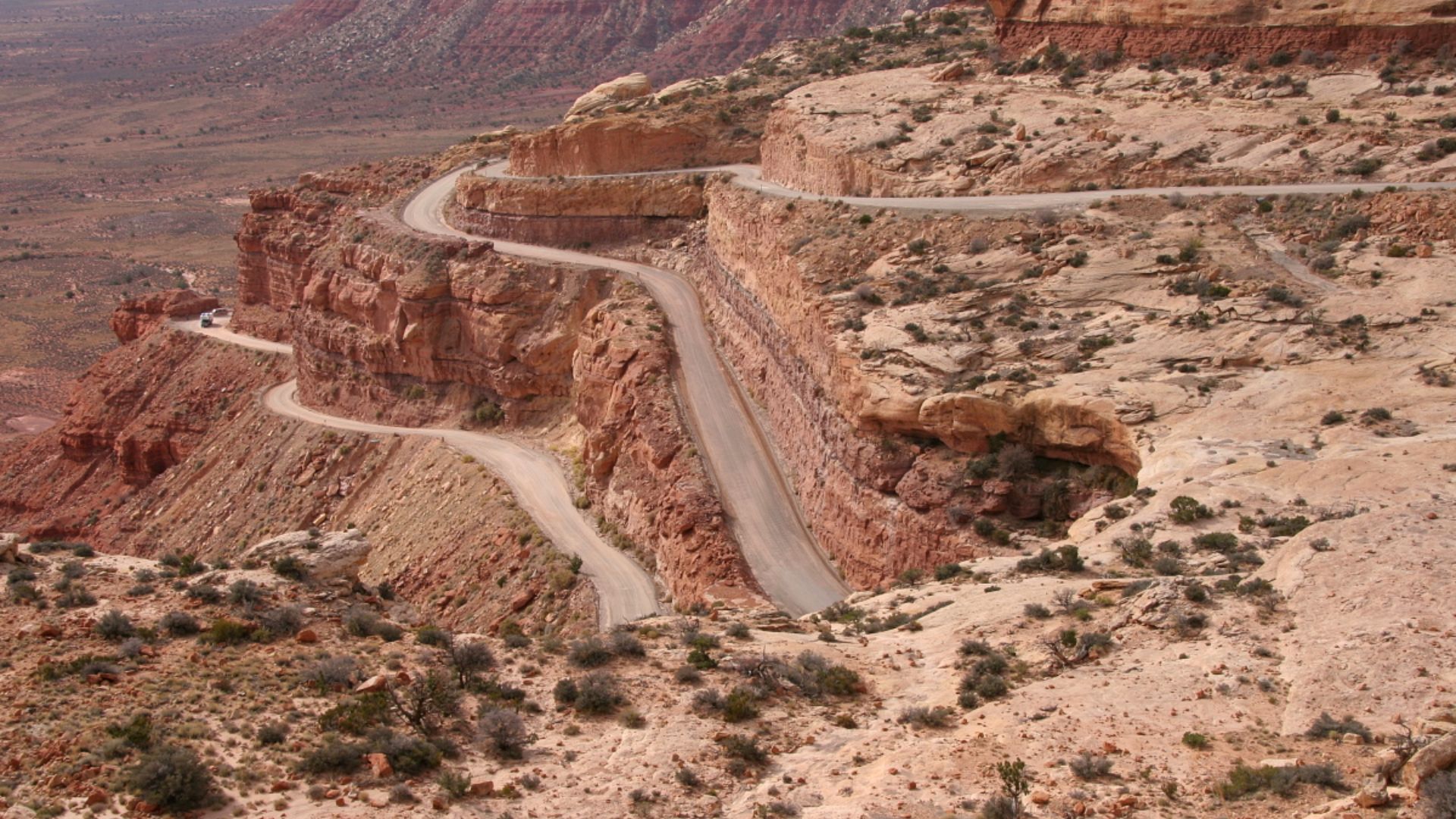
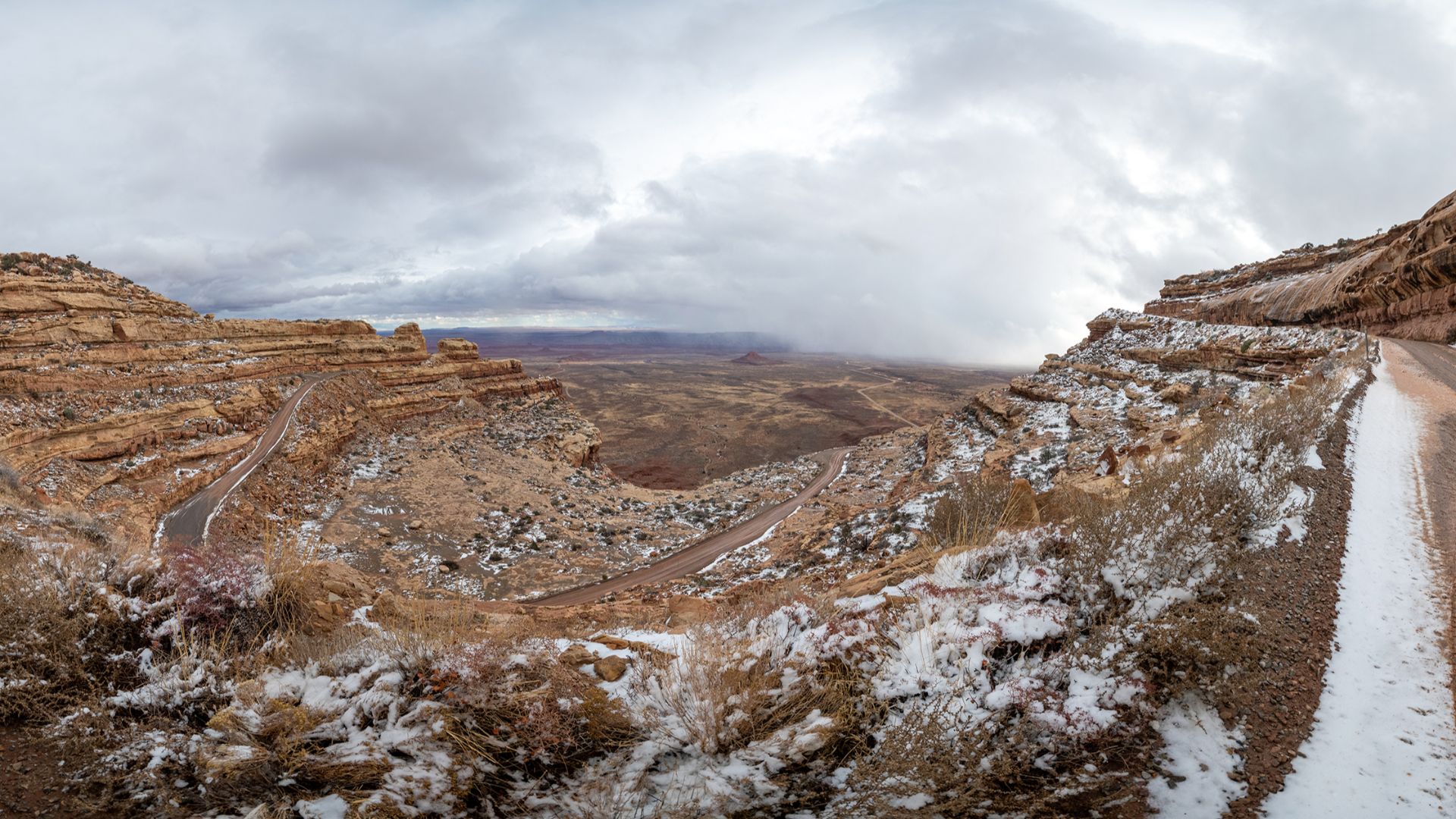
The Moki Dugway packs roughly 1,200 feet of elevation change into three miles of graded gravel. The Bureau of Land Management puts the grade at 11 percent and specifically advises caution for motorhomes and vehicles towing trailers. Its tight switchbacks crawl down a cliff face where drivers have little incentive to hurry.
The View From The Dugway Explains Everything
The upper overlooks open onto an enormous desert landscape stretching toward Monument Valley, Shiprock, Sleeping Ute Mountain, and the Carrizo Mountains. The road itself was constructed in the 1950s to carry uranium and vanadium ore from Cedar Mesa. Today, tourists take essentially the same improbable route simply because driving it feels like part scenic overlook and part engineering stunt.
 RuggyBearLA, Wikimedia Commons
Shafer Trail Makes The Moki Dugway Look Polished
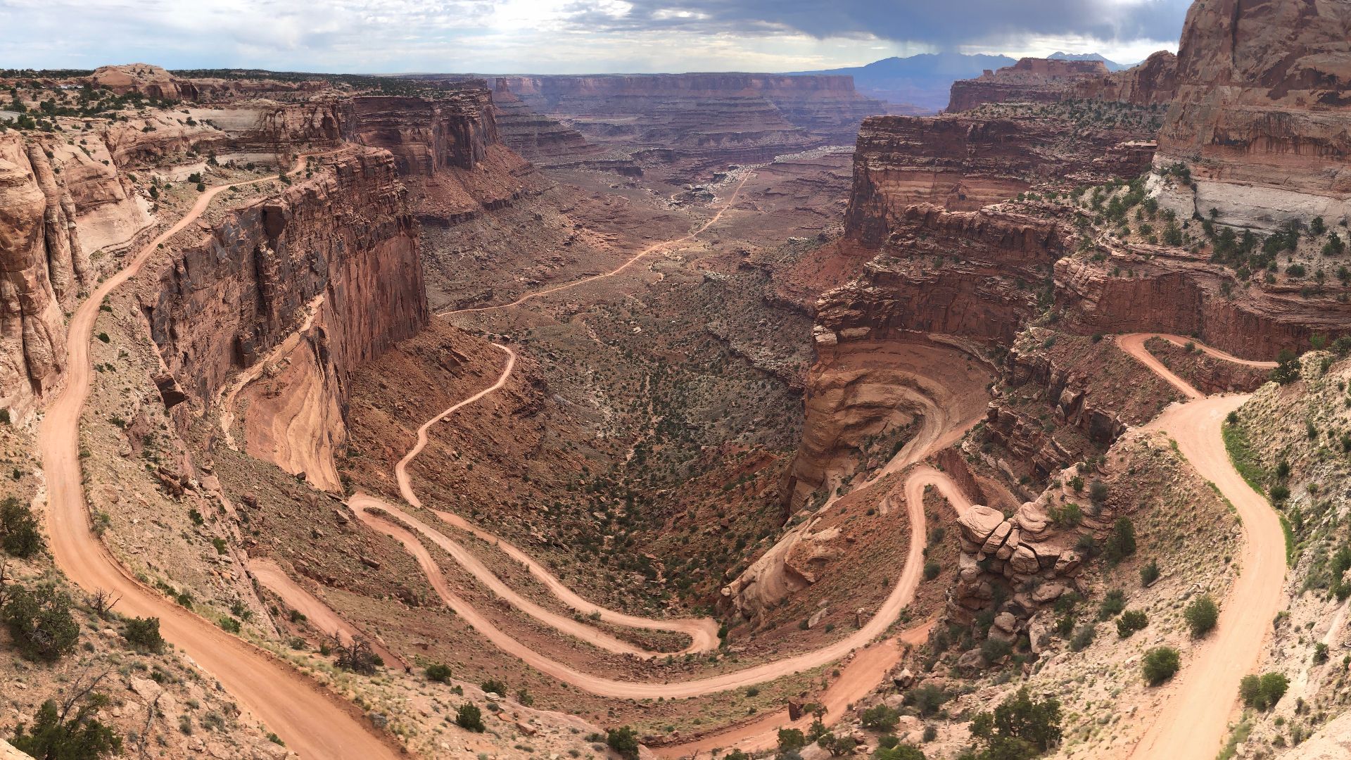
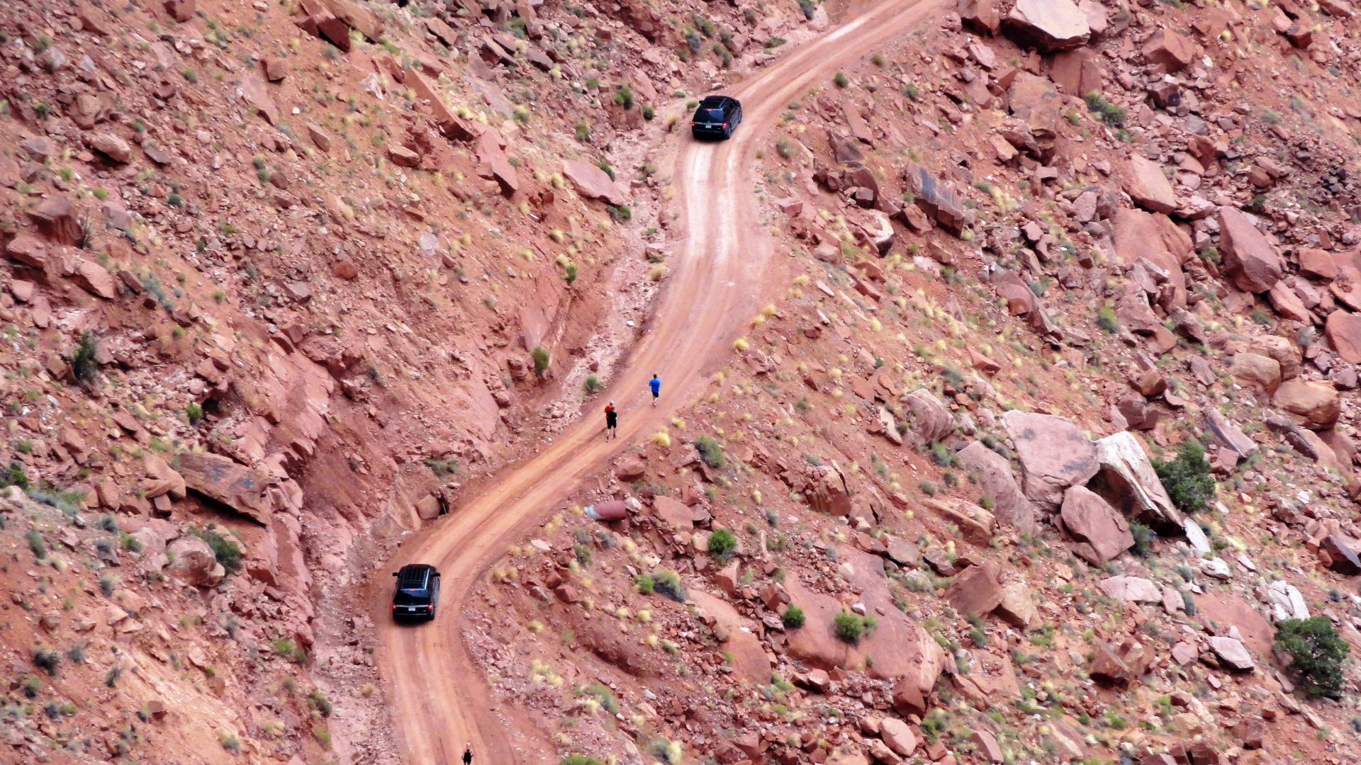
Inside Canyonlands National Park, Shafer Trail descends 1,500 feet through a sandstone cliff on an unpaved backcountry road. The National Park Service strongly recommends a high-clearance four-wheel-drive vehicle with low-range gearing and warns that rain or snow can change conditions rapidly. The speed limit is only 15 mph, and uphill traffic receives the right of way on the narrow route.
 CanyonlandsNPS, Wikimedia Commons
Canyonlands Turns The Drive Into The Destination
Shafer began as a route used by Native people, later served sheep herders, and eventually carried trucks hauling uranium. Today, recreational drivers follow the switchbacks for the immense canyon views and the experience of descending from Island in the Sky toward the basin below. Hundreds make the drive each year even though a backcountry breakdown can result in a towing bill exceeding $1,000.
 Fabio Achilli from Milano, Italy, Wikimedia Commons
Trail Ridge Road Climbs Into Thin Air
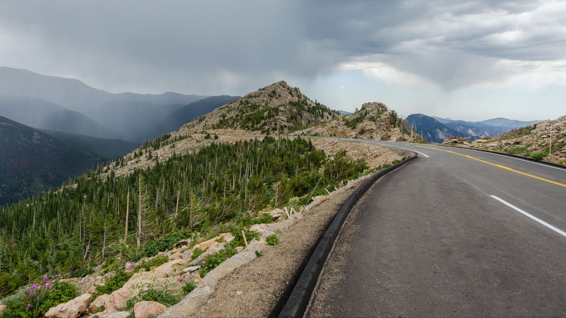
Rocky Mountain National Park's Trail Ridge Road reaches 12,183 feet, making it the highest continuous paved road in the United States. High elevation, steep mountain driving, fast-changing weather, and heavy summer traffic require more attention than the smooth pavement initially suggests. The park also advises motorists to use lower gears on descents so their brakes do not overheat.
The Roof Of Rocky Mountain National Park Is Worth It
The 48-mile road crosses alpine tundra between Estes Park and Grand Lake. Drivers get sweeping views of the Continental Divide, valleys, lakes, wildlife habitat, and wildflowers without undertaking a high-altitude hike. Temporary closures can happen at any time, but when the road is open, it offers one of North America's easiest ways to reach a truly alpine landscape.
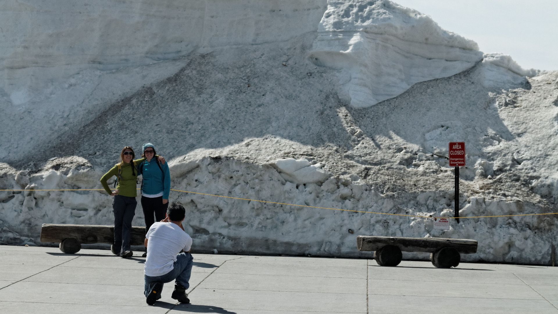 KimonBerlin, Wikimedia Commons
Independence Pass Sometimes Narrows To One Car
Colorado's Independence Pass crosses the Continental Divide at 12,095 feet. CDOT describes sections as narrow and curvy with steep drop-offs, tight turns, steep inclines, and places where only one vehicle can pass at a time. Vehicles longer than 35 feet are prohibited, while freeze-thaw cycles can also send loose rock onto the roadway.
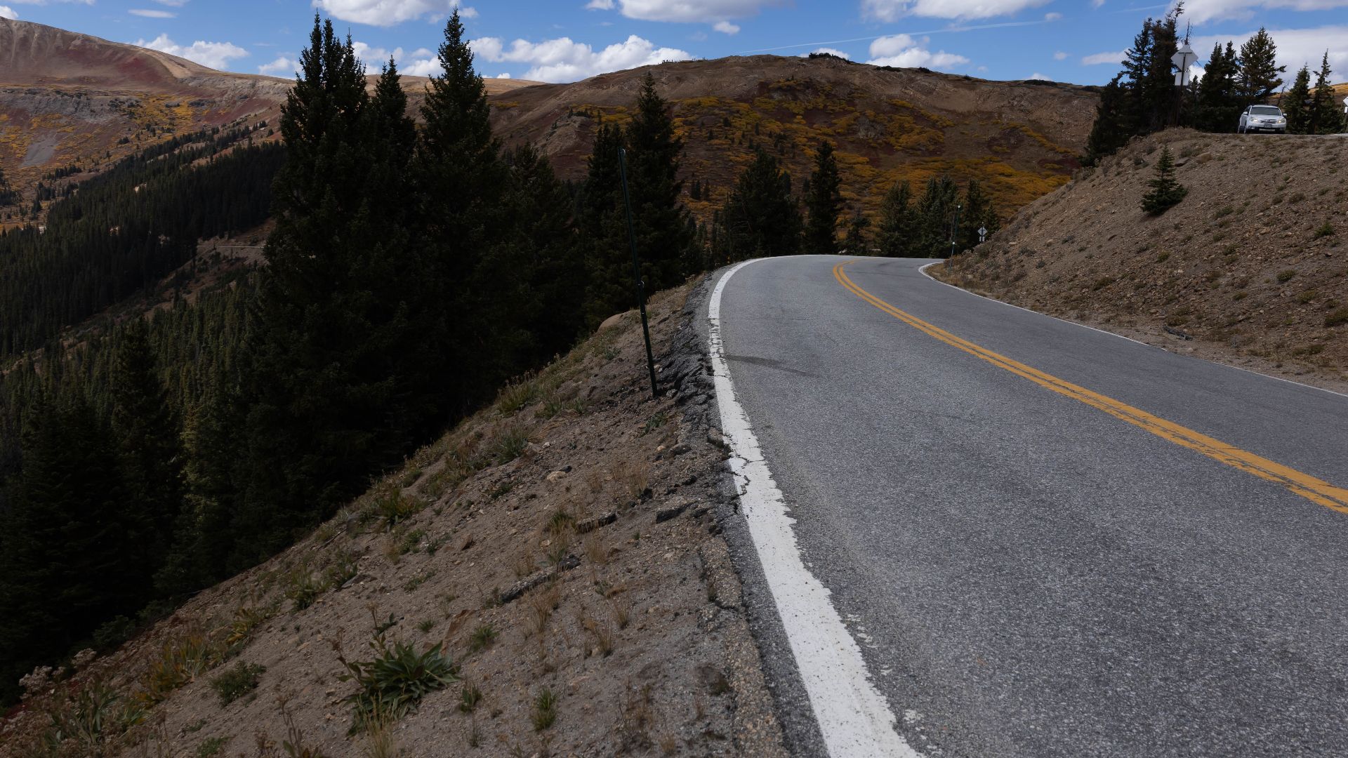 mark byzewski, Wikimedia Commons
People Line Up For Its Seasonal Opening
The pass closes through winter because deep snow makes travel impossible, then usually returns around Memorial Day after avalanche mitigation, snow clearing, and repairs. Drivers use it to cross between the Aspen and Twin Lakes areas through a spectacular section of the Sawatch Range. In some years, cars have literally lined up waiting for the seasonal gates to open.
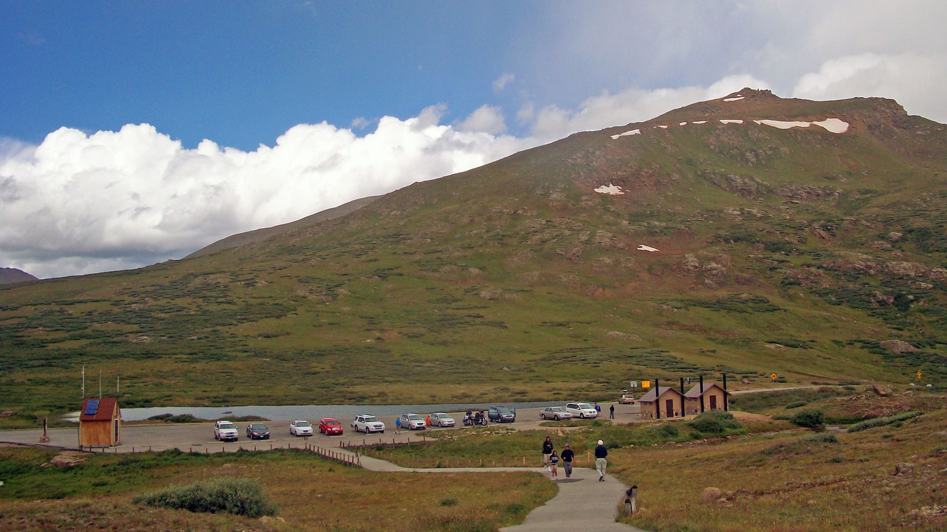 Daniel Case, Wikimedia Commons
Mount Washington Auto Road Comes With A Heights Warning
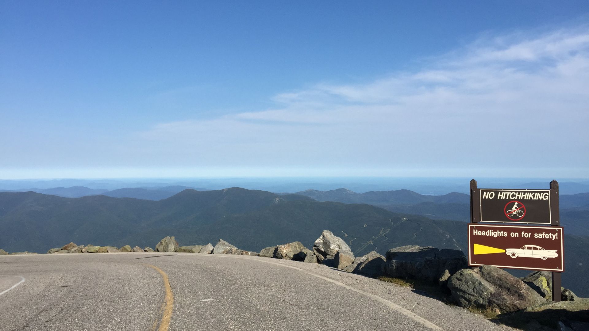
New Hampshire's Mount Washington Auto Road does not pretend to be an ordinary mountain highway. Its official guidance describes a steep, narrow road without guardrails, with an average grade of 12 percent over the 7.6-mile climb. Drivers are even warned that people afraid of heights may not enjoy the experience.
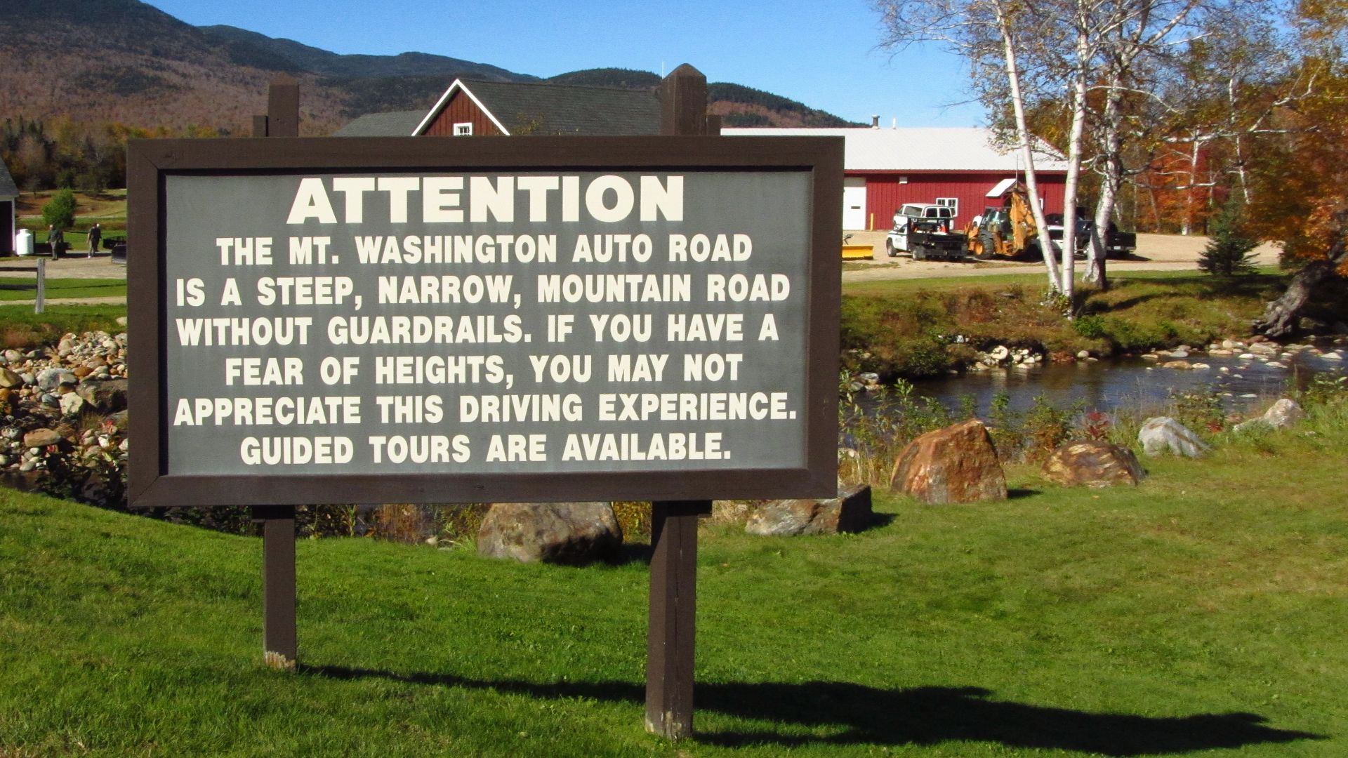 Robert Linsdell from St. Andrews, Canada, Wikimedia Commons
The Summit Turns Anxiety Into Bragging Rights
The road gains more than 4,600 feet before reaching the summit of the Northeast's highest mountain. More than 150 turns and switchbacks pack the short journey with drama, while the descent requires careful use of low gears to protect the brakes. Travelers unwilling to drive themselves can take a guided tour, but plenty prefer the satisfaction of saying they drove it.
Needles Highway Has Tunnels Barely Wider Than A Car
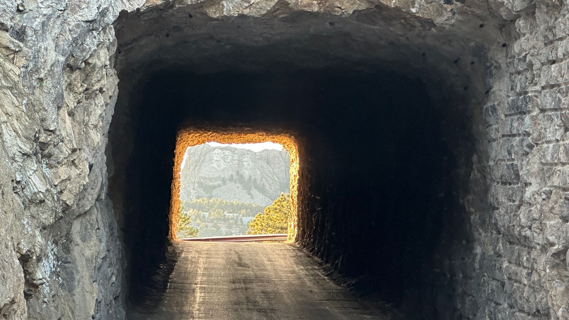
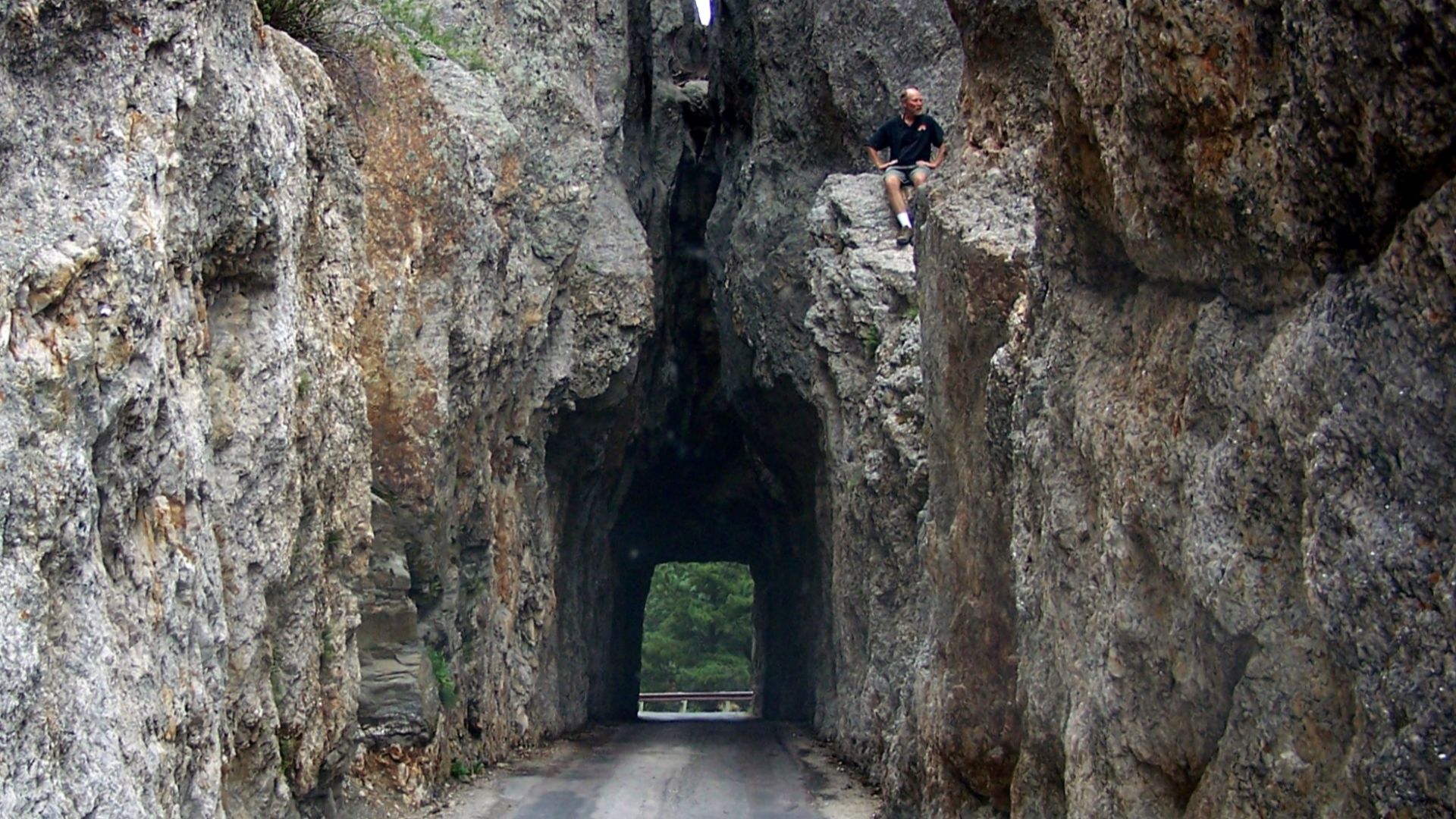
South Dakota's Needles Highway runs only 14 miles, yet Custer State Park recommends allowing at least an hour. The Needles Eye Tunnel is just eight feet wide and nine feet nine inches high, creating obvious problems for larger vehicles. Curves, granite formations, slow traffic, and narrow passages make speed beside the point.
 BakedintheHole, Wikimedia Commons
Those Tiny Tunnels Frame The Black Hills
The road was deliberately routed through rugged granite country under the direction of former South Dakota governor Peter Norbeck. Drivers pass Sylvan Lake, forests, steep rock spires, and the famous Needle's Eye formation along the way. It feels less like a transportation corridor than a road designed specifically to make tourists say, “We're really driving through there?”
 Little Mountain 5, Wikimedia Commons
The Tail Of The Dragon Packs 318 Curves Into 11 Miles
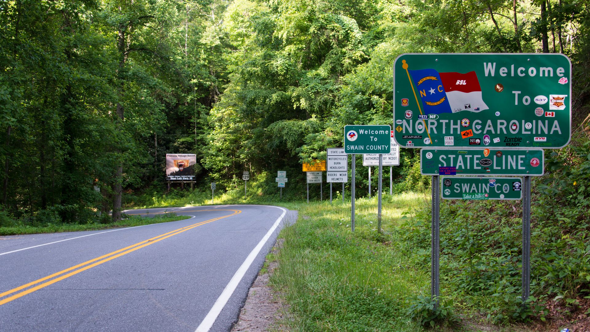
U.S. Highway 129 near Deals Gap earned its name from a relentless series of bends through the mountains of North Carolina and Tennessee. Visit North Carolina counts 318 curves within an 11-mile stretch. The route's remote setting and absence of ordinary intersections make the turns themselves the primary challenge.
Drivers Go There Specifically For The Curves
Most tourists avoid roads that twist constantly, but the Tail of the Dragon reverses that logic. Motorcycle and sports-car enthusiasts seek it out because the endless bends turn ordinary driving into a technical recreation experience. Western North Carolina's tourism industry openly promotes the road as a destination for people who enjoy precisely the conditions that would make many vacationers turn around.
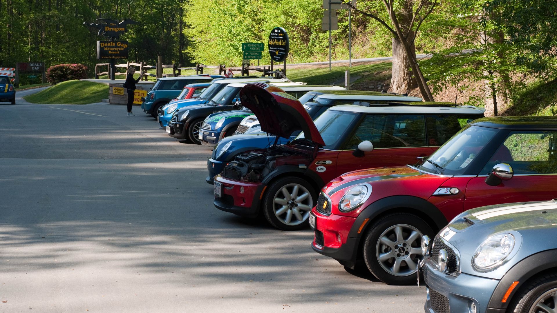 Kevin Stephenson from Florence, AL, USA, Wikimedia Commons
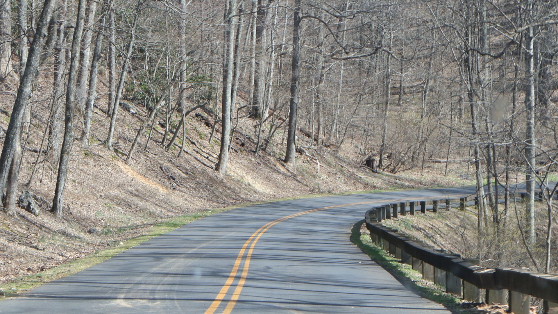
The Blue Ridge Parkway Is Deceptively Gentle
The Blue Ridge Parkway often looks peaceful enough to lull drivers into relaxing too much. The National Park Service warns about steep grades, narrow shoulders, limited sight distance, tightening curves, wildlife, bicycles, and scenery that can distract motorists from the road. Rangers investigate roughly 200 crashes per year, with about half involving serious injury.
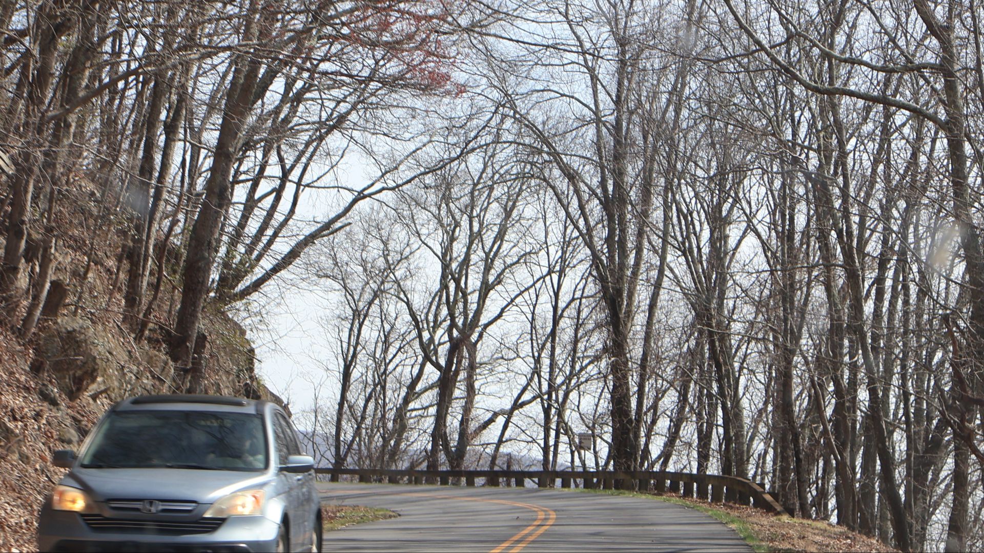
More Than 250 Overlooks Keep Everyone Coming
The parkway's flowing curves were designed to fit the Appalachian landscape rather than bulldoze through it. Mountains, forests, wildflowers, wildlife, and more than 250 overlooks help explain its nickname, “America's Favorite Drive.” The irony is that the scenery creating the attraction is also one of the distractions the National Park Service warns drivers about.
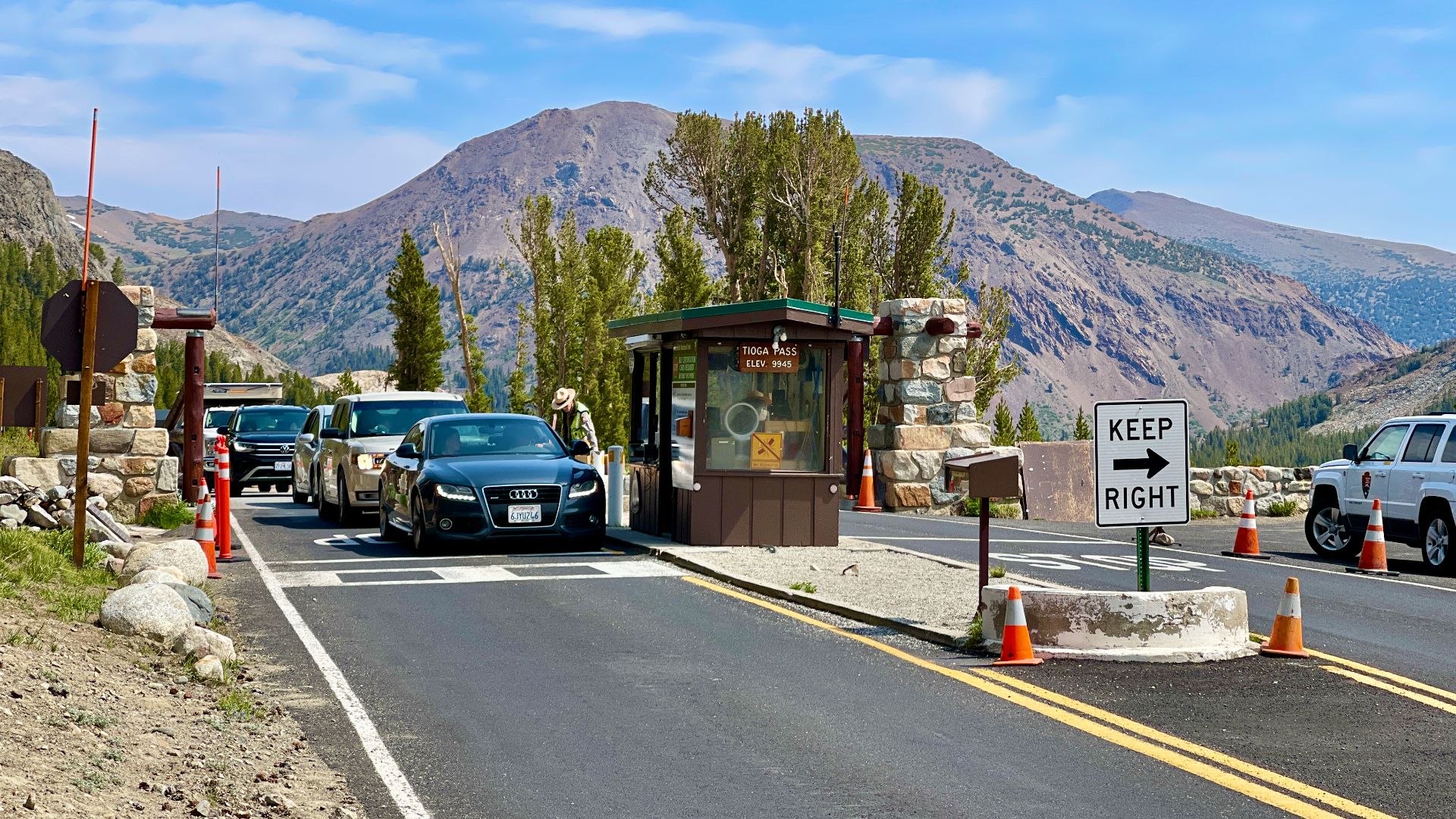
Tioga Pass Can Punish Cars As Well As Drivers
Highway 120 across Yosemite's Tioga Pass is a steep and winding mountain road. The National Park Service notes that one eight-mile section climbs roughly 2,500 feet and includes grades as steep as eight percent, with overheated engines and brakes among the concerns for vehicles towing trailers. Help can take hours to reach a disabled vehicle in some circumstances.
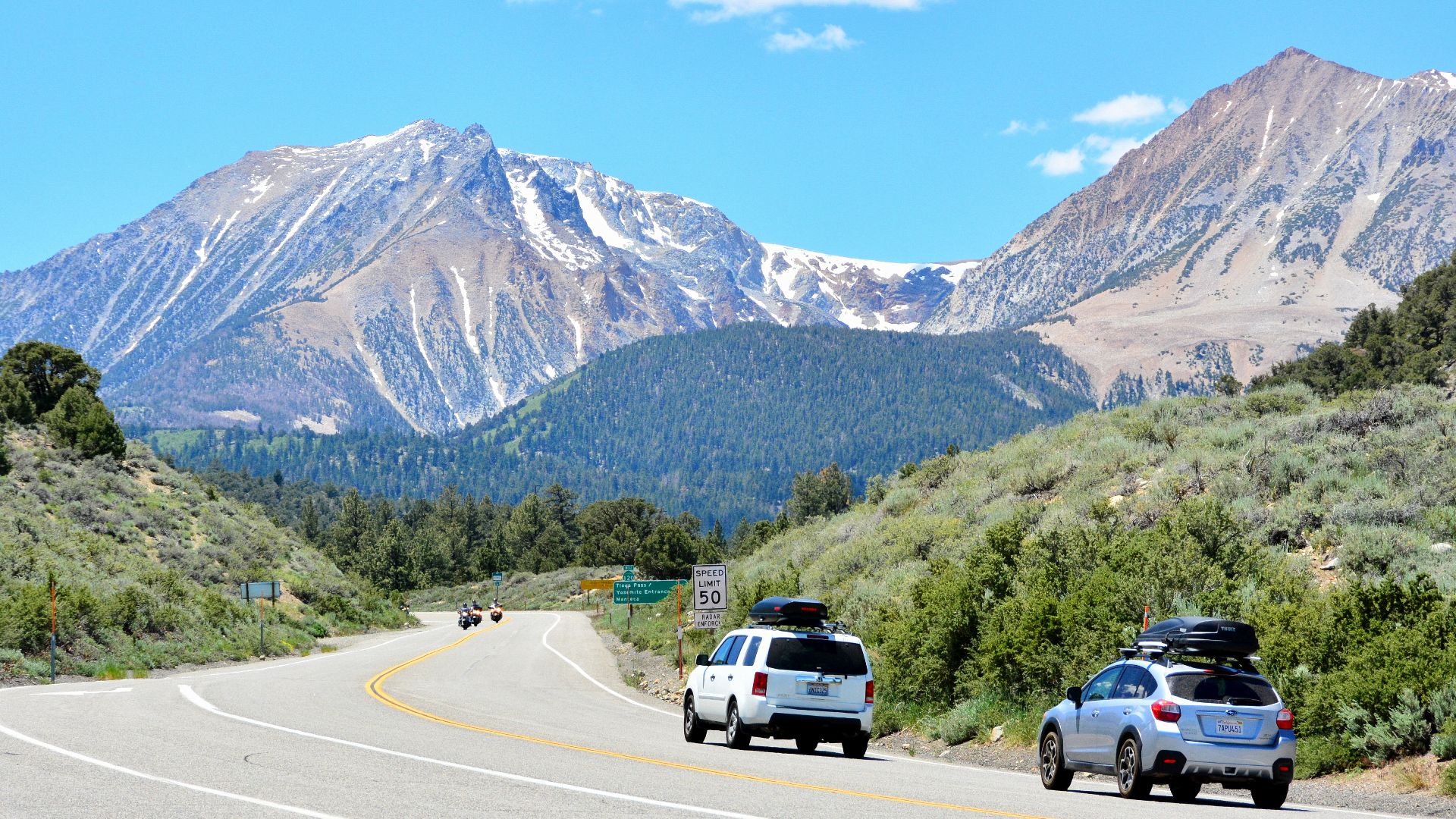
Tioga Is The High-Country Doorway To Yosemite
When winter snow finally clears, Tioga Road gives motorists access to Yosemite's high country and a direct route across the Sierra Nevada. The road generally closes for winter and can remain inaccessible until late May or June. Its seasonal nature turns the reopening into a gateway to Tuolumne Meadows and landscapes unavailable by car for much of the year.
 Oliver Ratzesberger, Wikimedia Commons
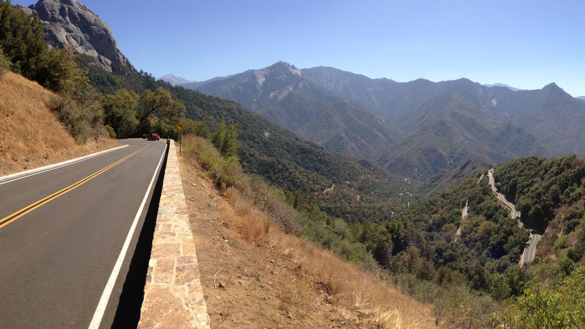
Sequoia's Generals Highway Is A Brake Test
The Generals Highway from Sequoia National Park's foothills toward Giant Forest is tight, twisting, steep, and full of hairpin turns. The National Park Service warns that frequent braking can overheat brakes badly enough to cause failure or even fire, and longer vehicles are discouraged on portions of the route. Winter adds snow, ice, rapidly changing chain requirements, and possible closures.
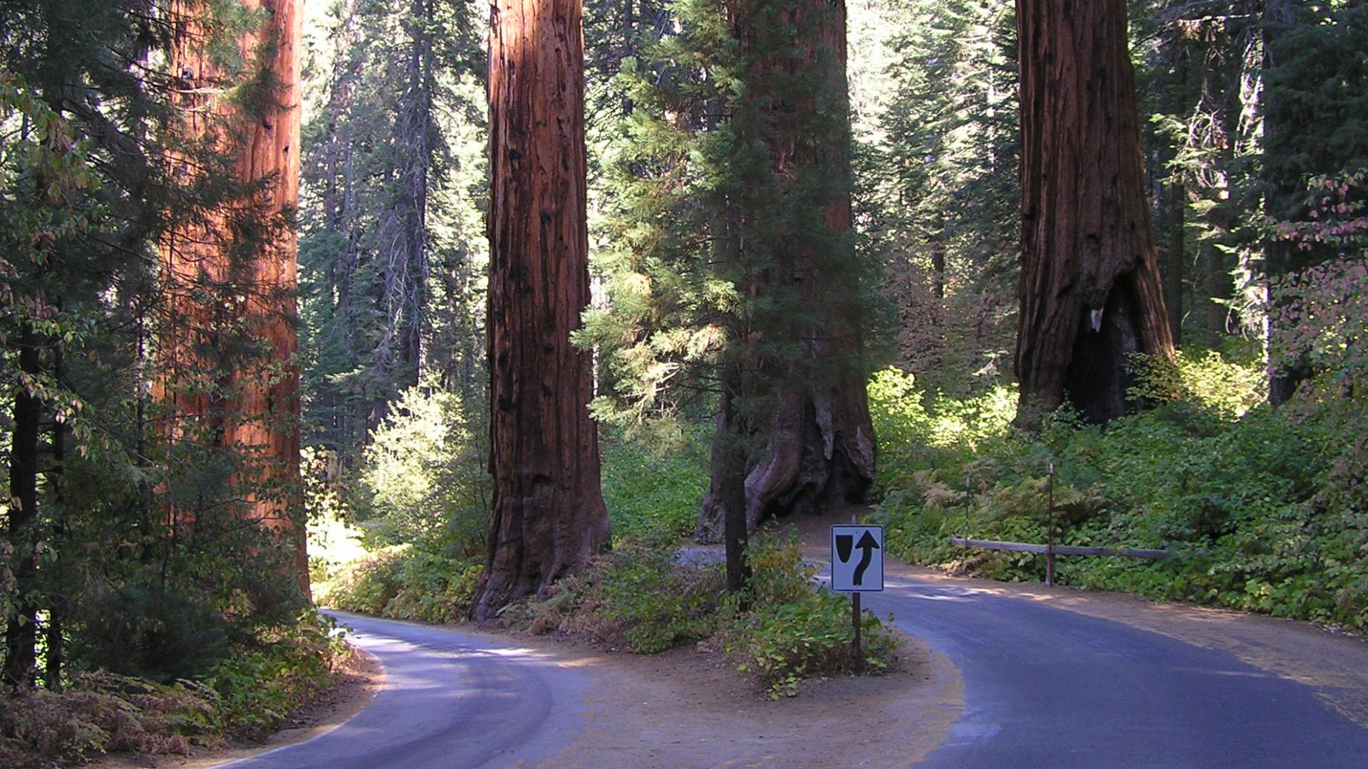
Giant Trees Wait At The End Of The Climb
The reward for those curves is access to the Giant Forest and some of the world's most extraordinary sequoias. The road climbs roughly 5,000 feet over a relatively short distance, shifting from foothill environments into cool mountain forest. For many travelers, seeing giant sequoias standing above the road is enough reason to tolerate every hairpin turn on the way up.
You May Also Like:
10 Hidden Gems for a Safe and Affordable Family Vacation
America’s Best Historic Downtowns According To Europeans
Four Key Tips For Traveling On A Budget
Sources: 1, 2, 3, 4, 5, 6, 7, 8, 9, 10, 11, 12, 13, 14, 15, 16, 17, 18, 19, 20, 21, 22, 23, 24, 25, 26, 27, 28, 29, 30, 31, 32, 33, 34