When Disaster Tears The Lid Off Deep Time
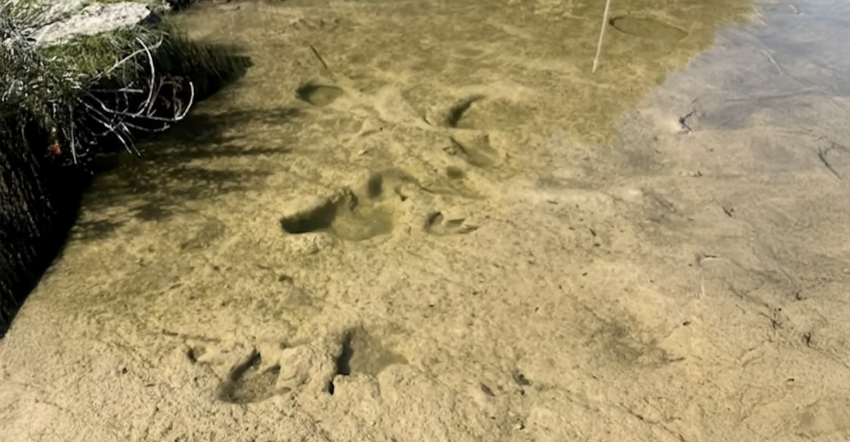
In July 2025, devastating floods ripped away the topsoil cover across central Texas. Amid the wreckage left in the flood's aftermath volunteers uncovered something astonishing: 15 ancient dinosaur footprints, exposed as if by nature’s own excavation. The find bridges today’s catastrophic flash flood to Earth’s distant past.
A Volunteer’s Surprise Discovery
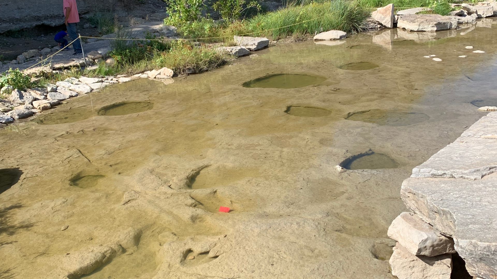
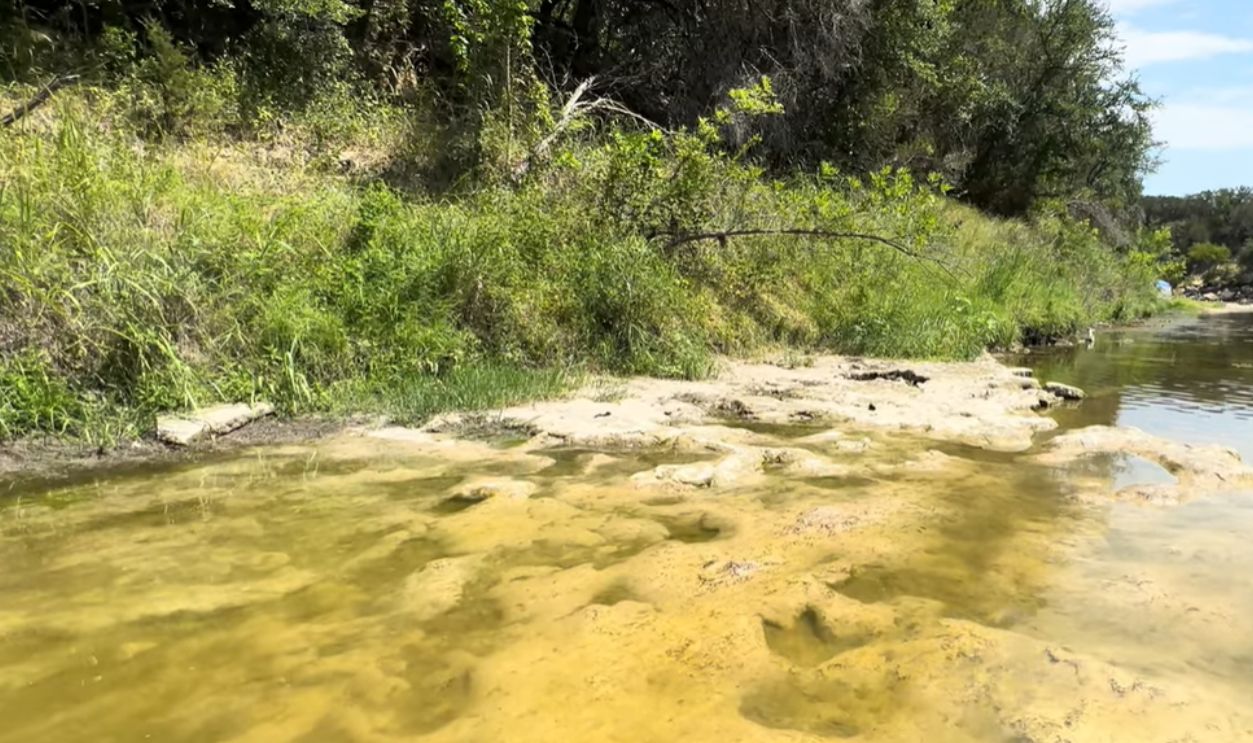
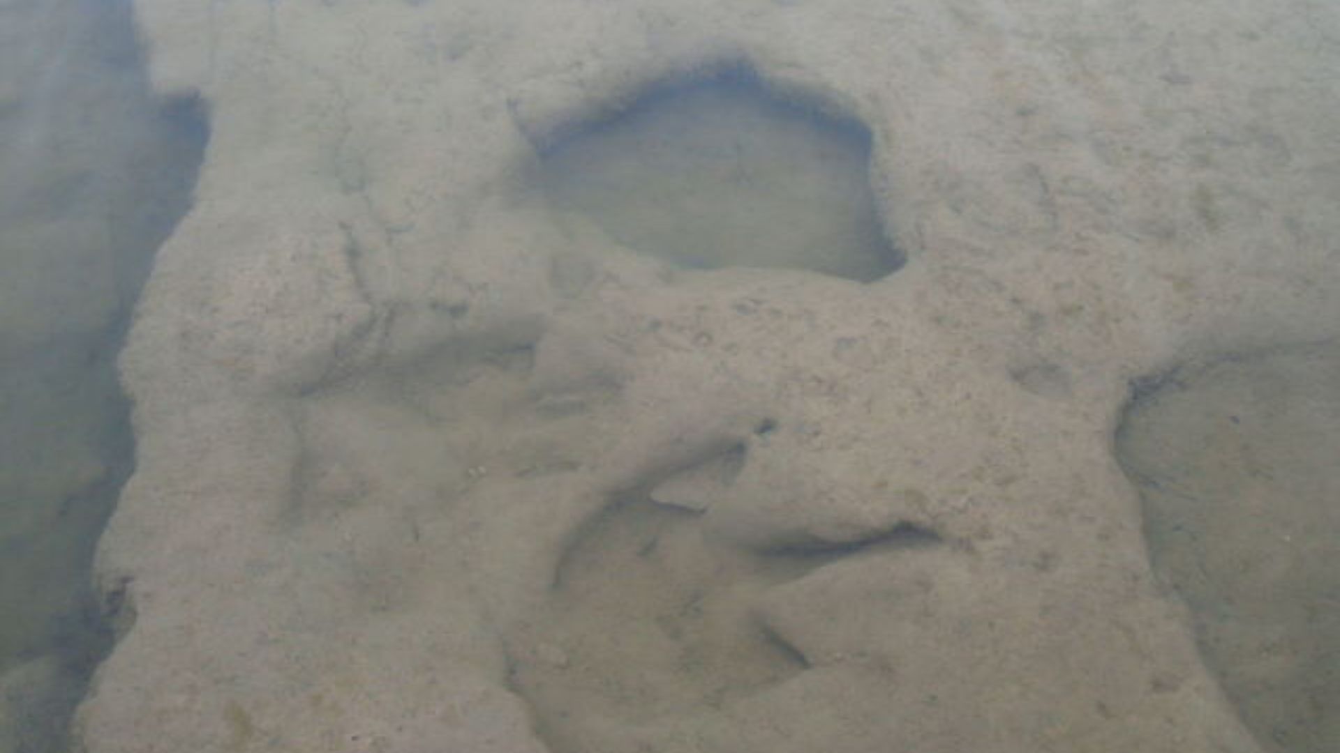
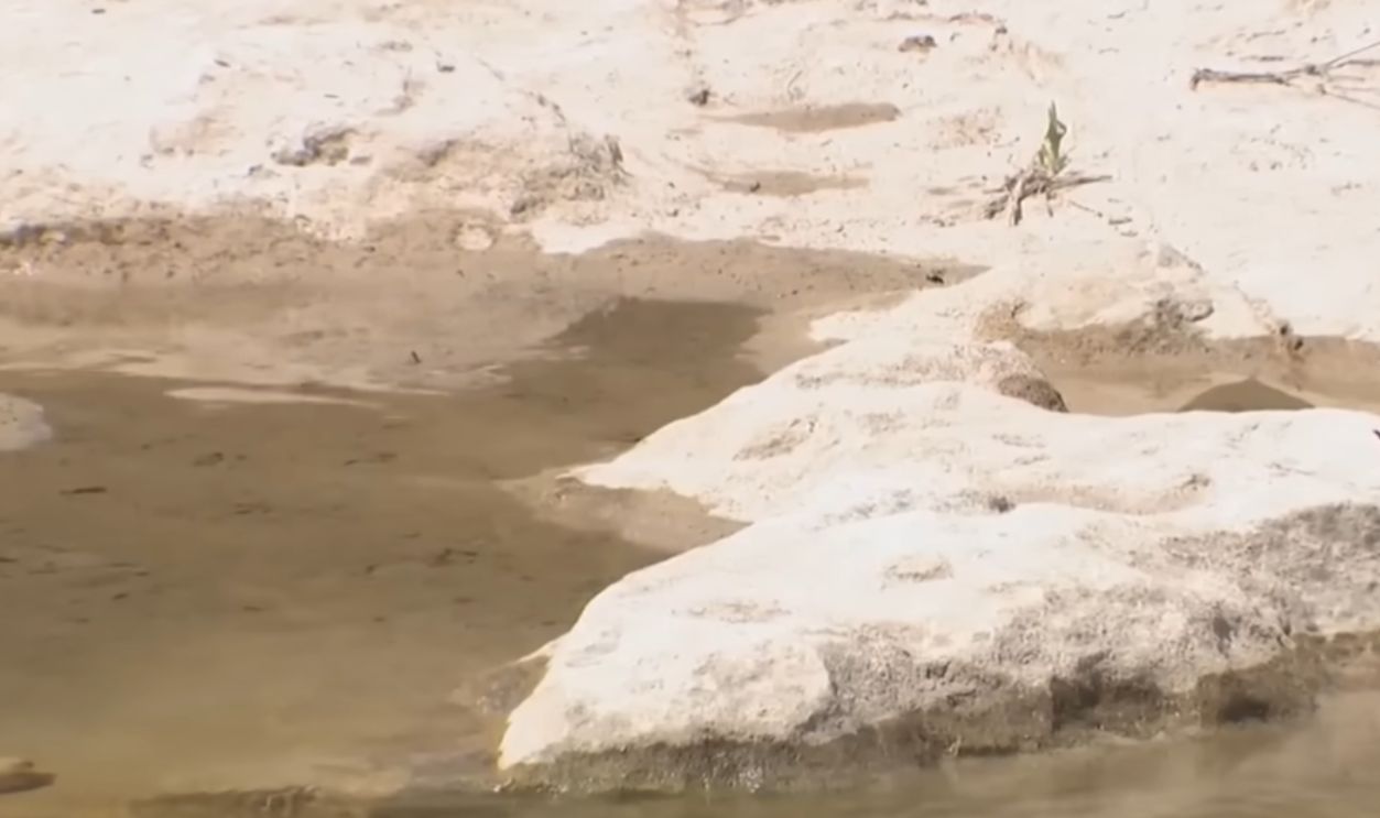
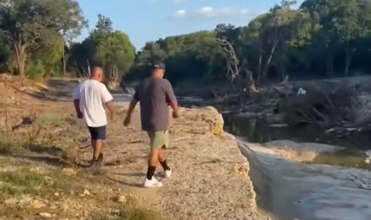
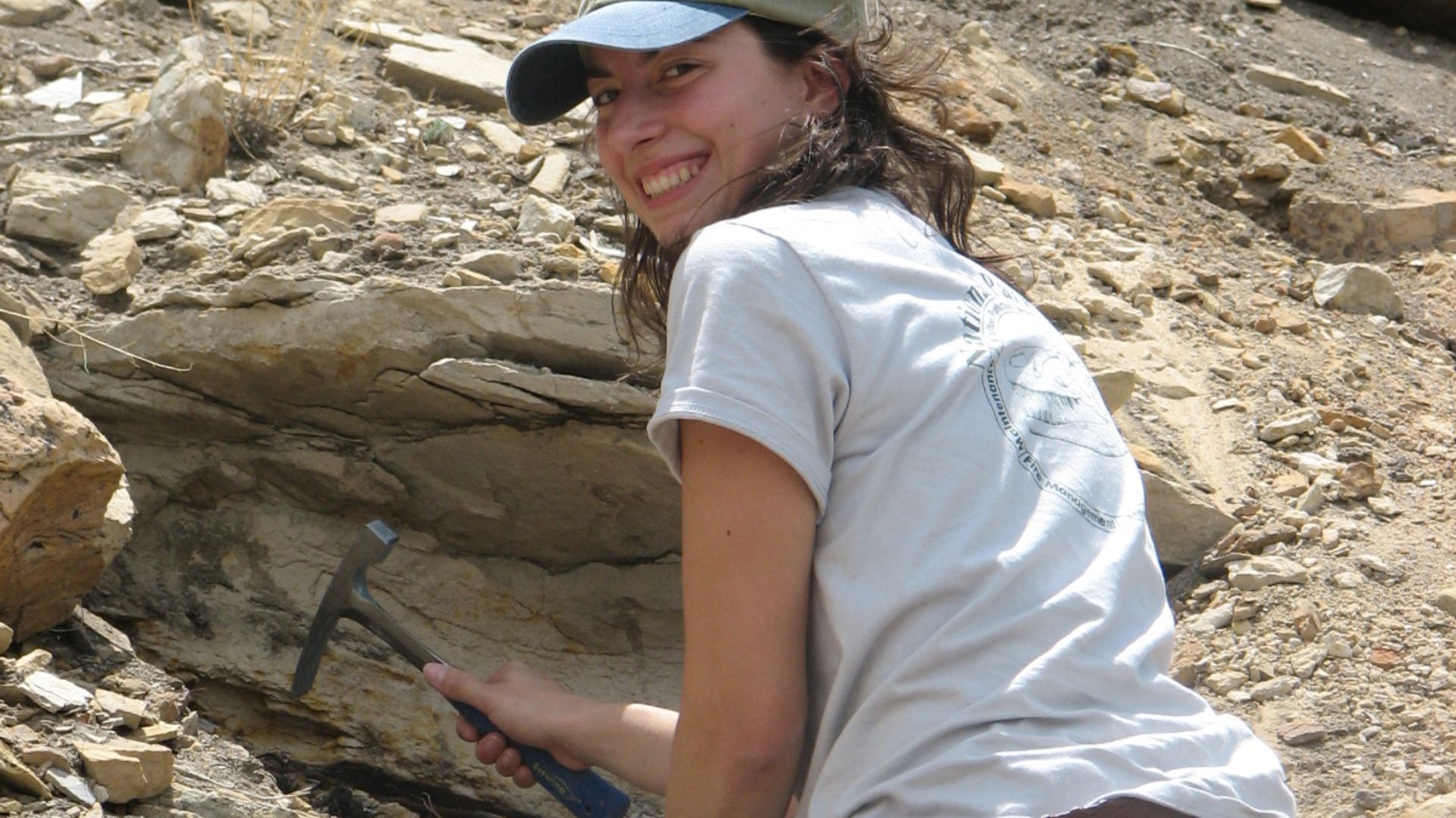
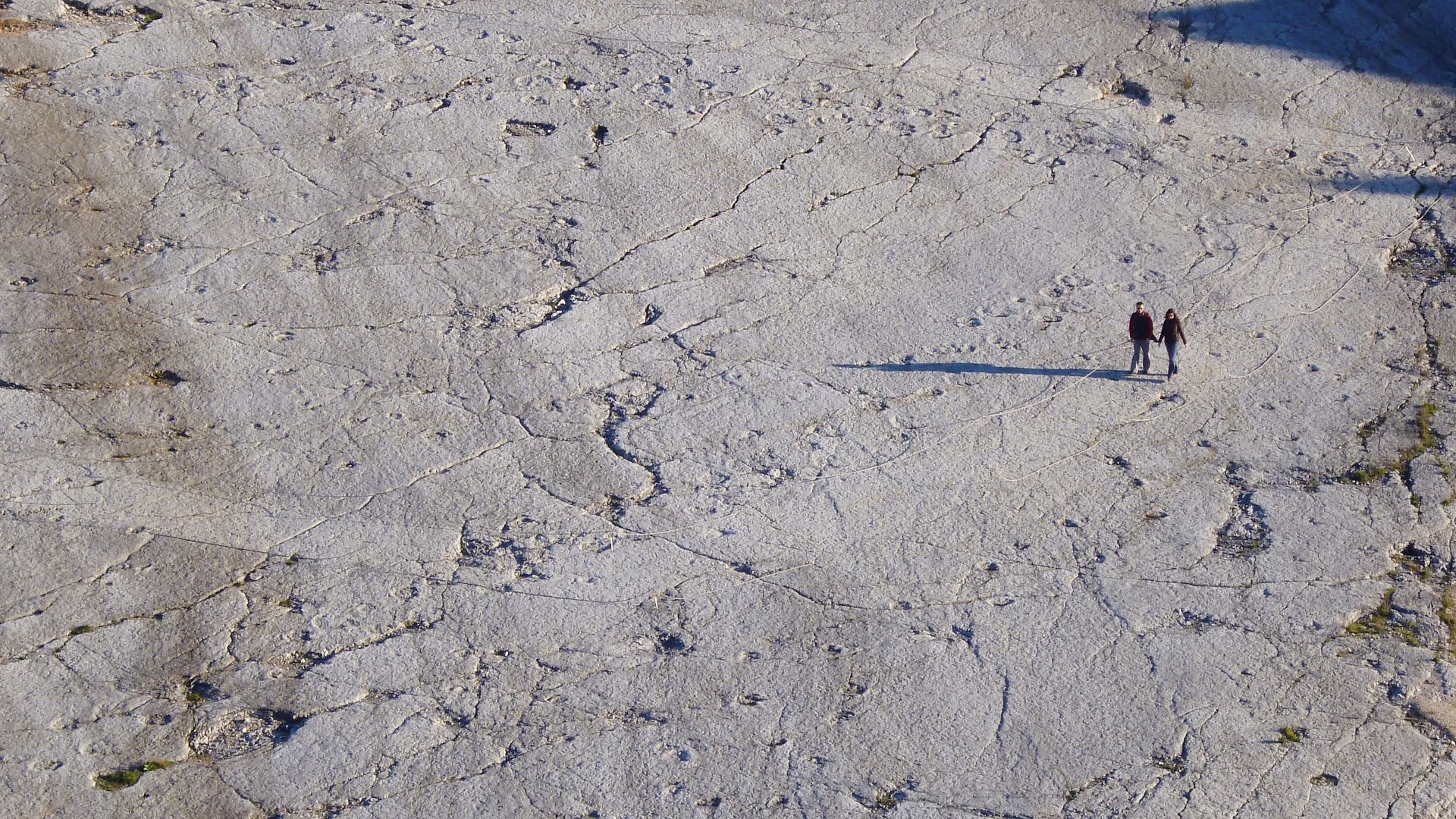
While clearing debris along Sandy Creek in northwest Travis County, an observant volunteer spotted faint impressions in the limestone. The floodwaters had carried off loose overburden and exposed the bedrock where the tracks had lay hidden for millions of years.
 Sandy Creek Bridge reopens after July flooding, KVUE
Dating The Tracks: 110–115 Million Years Old
Paleontologists established that the footprints lie in the Glen Rose Formation, a Cretaceous rock layer between about 110 and 115 million years old. The geological context confirms these footprints date from the early Cretaceous era.
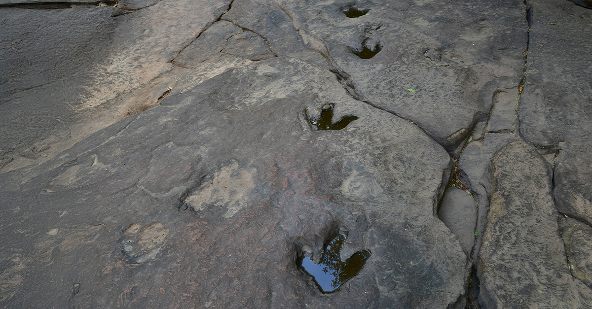
Size, Shape, And Claws: Clues To A Predator
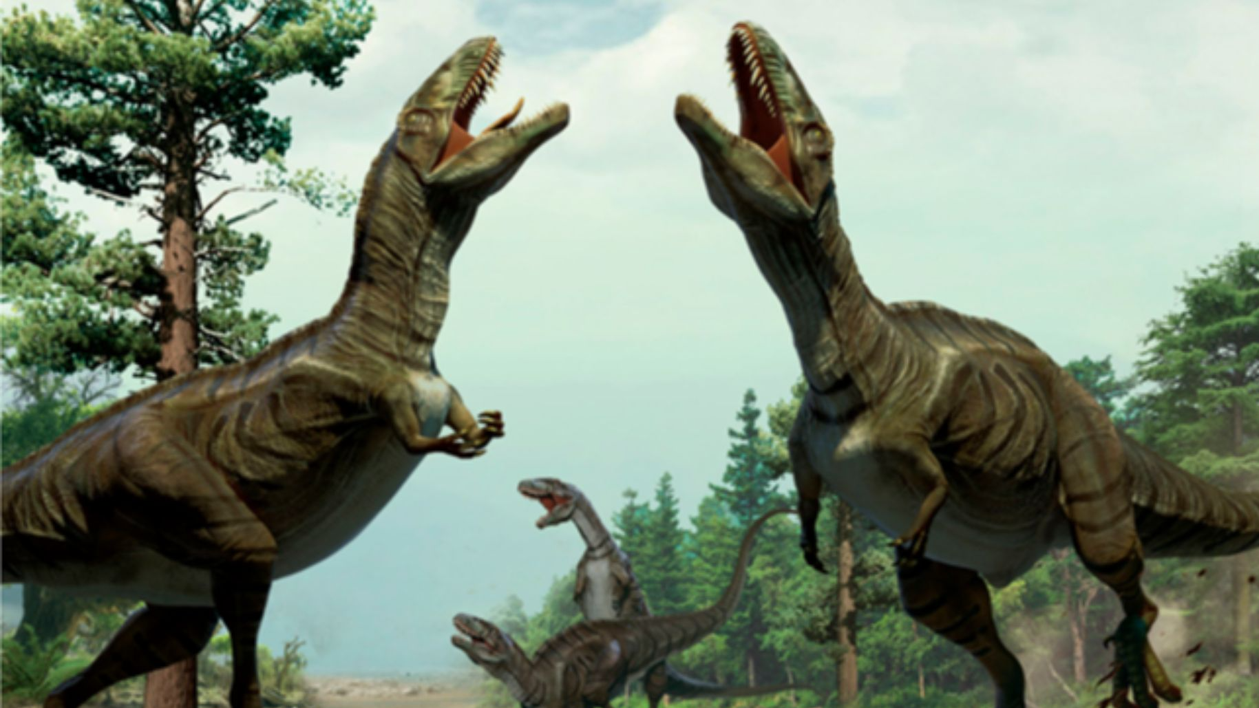
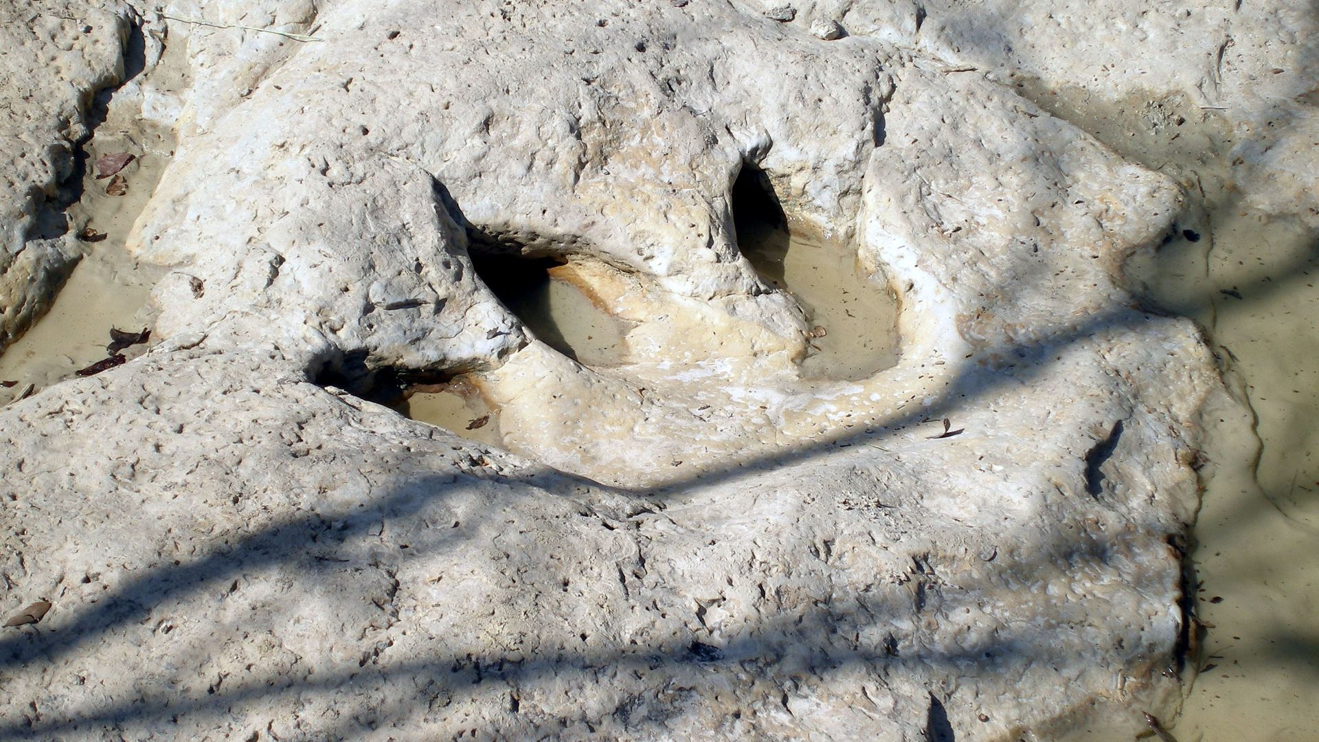
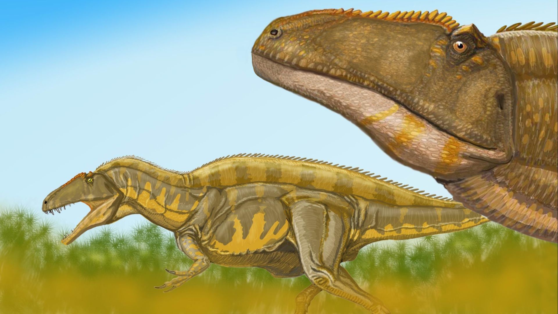
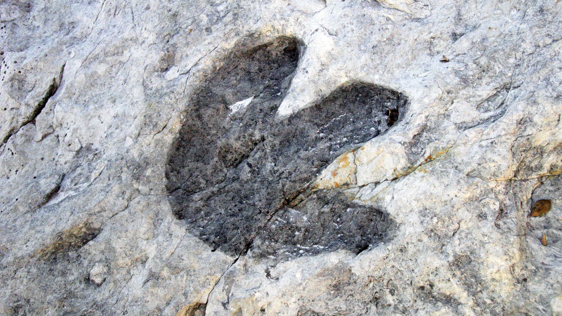
Each footprint is approximately 18 to 20 inches long and has three claws. This form suggests a large bipedal (two-legged) predator, likely similar to Acrocanthosaurus, a known early Cretaceous theropod in North America.
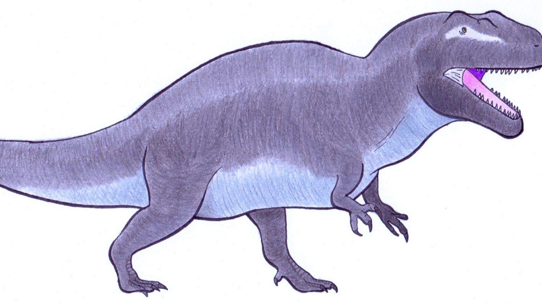
Acrocanthosaurus: The “High-Spined Lizard”
Acrocanthosaurus, which literally means “high-spined lizard,” is known from other parts of Texas and the US, and is identified partly by the tall neural spines along its back. While no bones were found at the site, the footprint size and style match this apex predator.
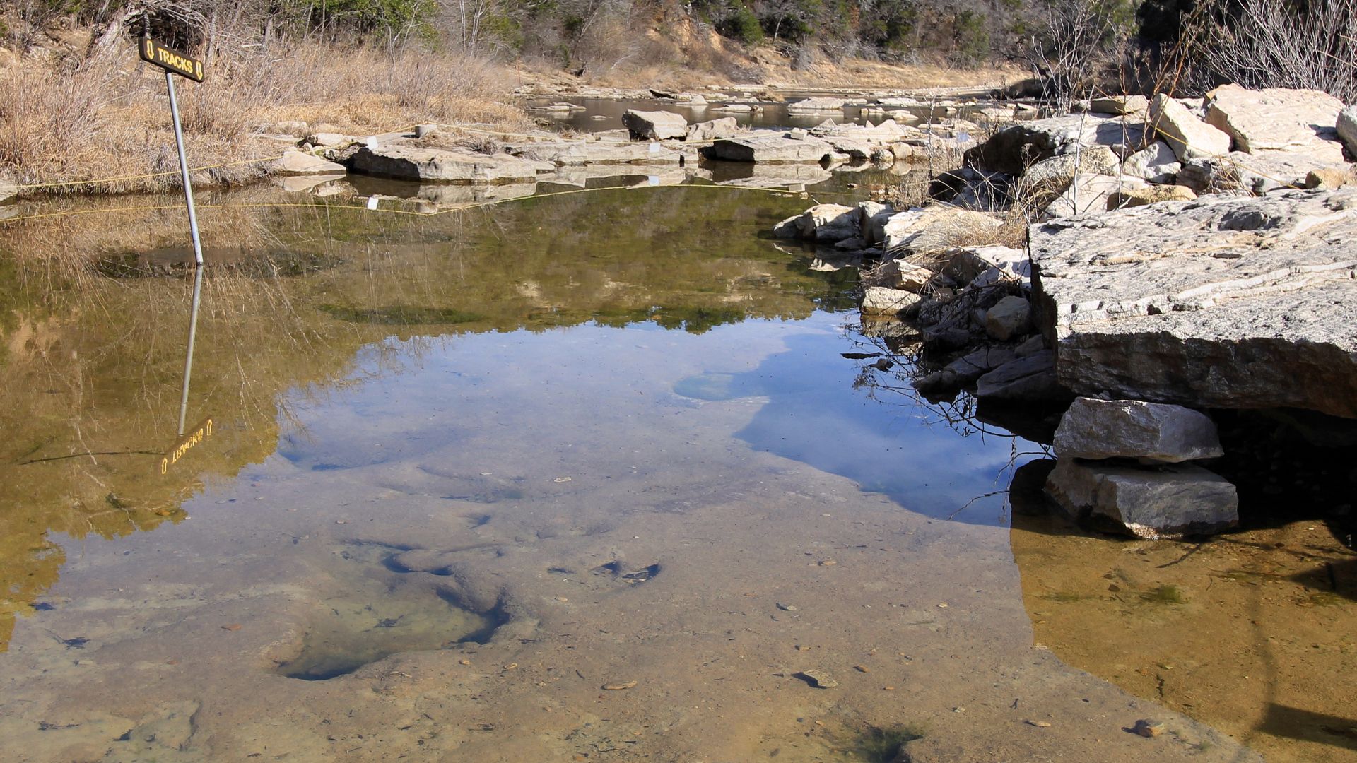
Multiple Tracks, Or Multiple Dinosaurs?
The footprints form a criss-cross pattern, suggesting that either one dinosaur retraced its steps or multiple dinosaurs moved across this area. Paleontologists hope further scanning of the prints will resolve whether they represent a group or a lone predator.
 Diane Turner from Arlington, United States, Wikimedia Commons
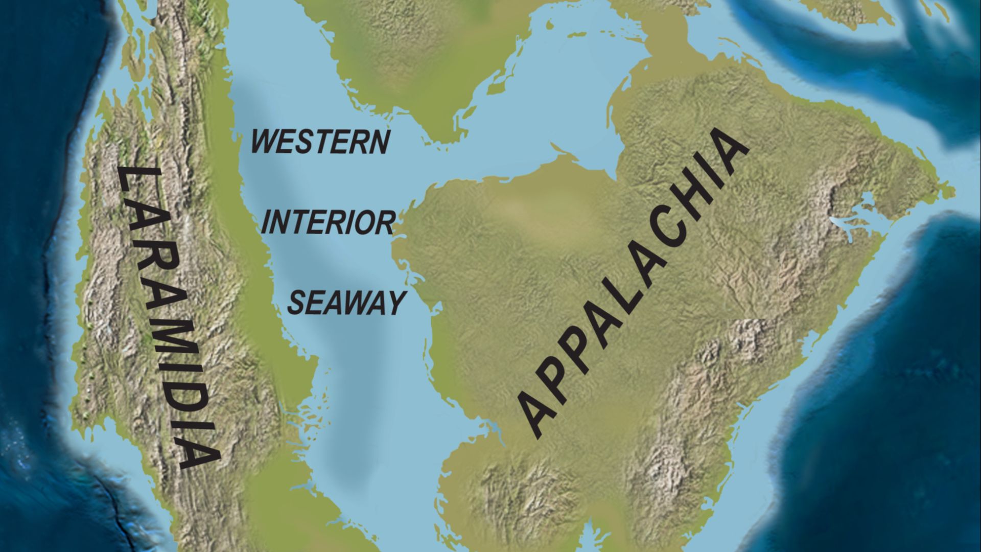
From Ancient Shore To Modern Stream
At the time these dinosaurs were walking around in the vicinity, the area that is now Travis County lay along the edge of the ancient Western Interior Seaway. What is now dry land was once marshy shoreline or shallow sea margin, ideal terrain for dinosaurs to leave footprints.
Texas: A Rich Track Record
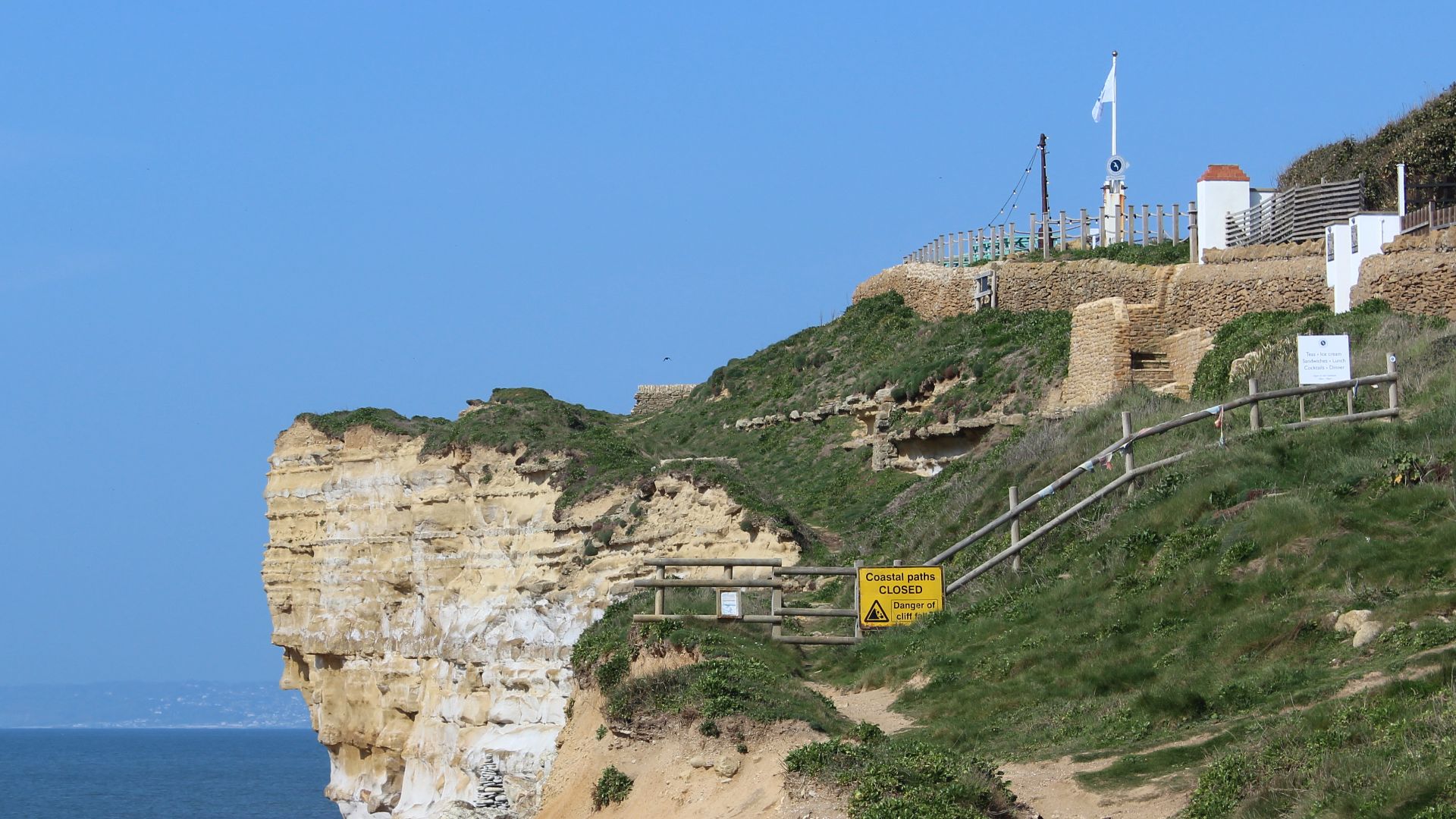
Dinosaur footprints are found in other parts of Texas as well. Sites like the Paluxy River beds in Dinosaur Valley State Park preserve thousands of trackways in the same Glen Rose Formation, showing that this new discovery builds on a legacy of deep time in the region.
 Robert Nunnally from Allen, TX, USA, Wikimedia Commons
Floods As Natural Exposers
Though floods like the ones that hit Texas in 2025 are tragic, the high-intensity currents act like a giant geological brush by removing overlying sediment, trees, and soil to re‑expose buried rock. In this case, nature revealed these ancient hidden traces that otherwise would’ve remained unseen for years.
 Dinosaur footprints from 115 million years ago found after Texas flood, ABC News
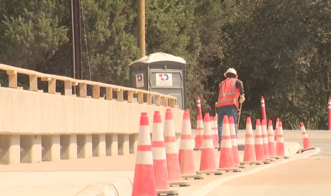
Collaboration With Cleanup Crews
Once officials began to comprehend the true significance of the find, scientists worked with flood recovery crews to protect the tracks. Heavy machinery, erosion, and people trampling the area all pose risks to the footprints, so careful mapping and site stabilization were urgent priorities.
 Central Texas flooding leads to discovery of possible dinosaur tracks, WPLG Local 10
3D Imaging And Documentation Plans
Researchers are already planning to return to the site and properly document the tracks using high‑resolution mapping, drone imagery, and 3D scanning. These techniques will allow detailed study without damaging the fossils, preserving them digitally for science and education.
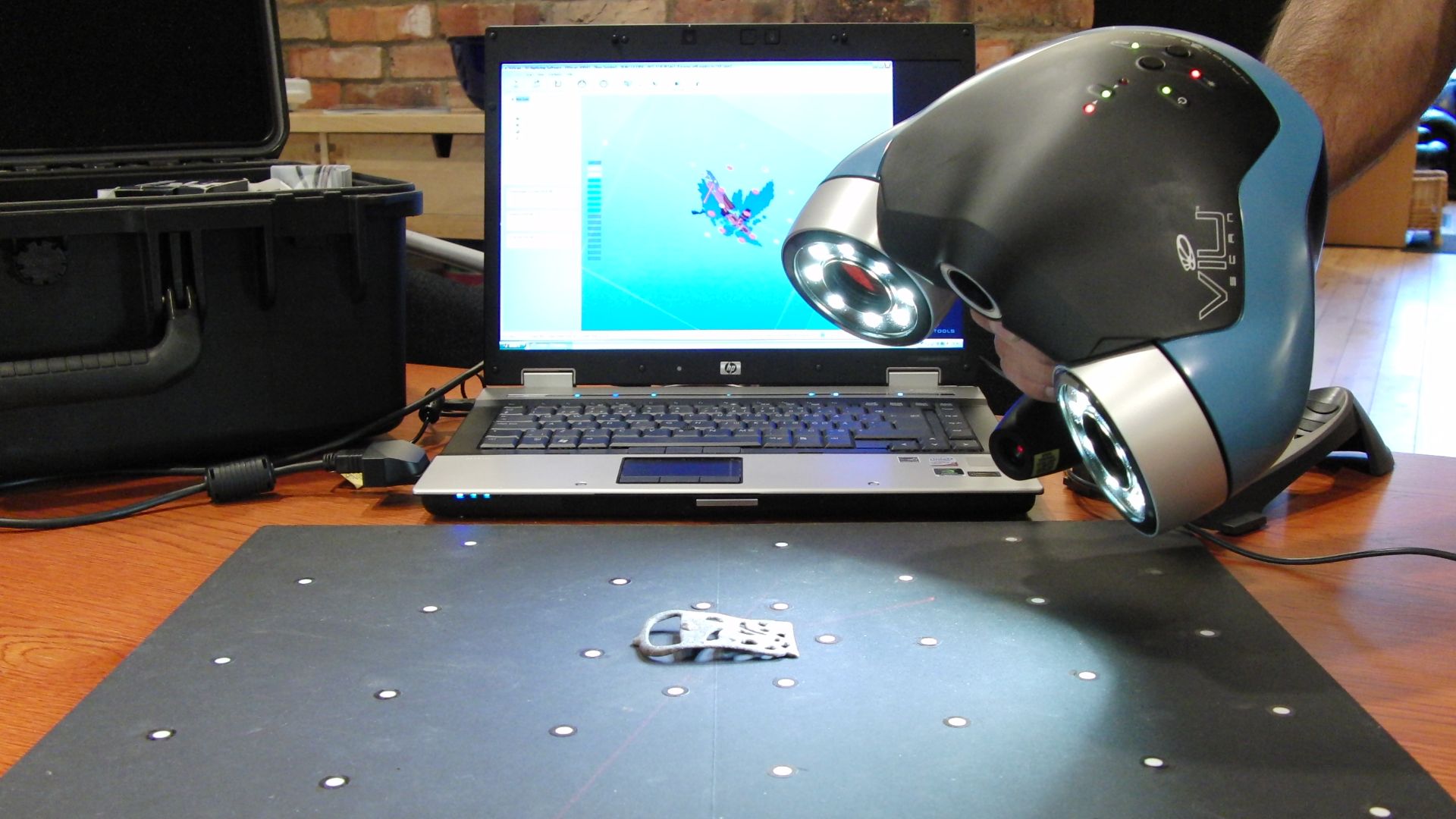 Creative Tools from Halmdstad, Sweden, Wikimedia Commons
Preservation Challenges On Private Land
Because the footprints are on private property, access into the site is limited. Owners and scientists have to strike a balance between conservation, liability, and scientific access. The landowner has requested anonymity to protect the site and prevent an onslaught of unauthorized visitors.

Building On Our Knowledge Of Predator Behavior
If the prints are confirmed to be Acrocanthosaurus or a related predator, the prints offer some insight into movement, gait, weight distribution, and habitat preferences of these large reptilian meat-eaters in Cretaceous Texas. This helps paleontologists develop their reconstructions.
 Mariomassone, Wikimedia Commons
Implications For Paleontology
This discovery shows once again that disaster events frequently yield fresh paleontological evidence. It emphasizes the value of community involvement, remote sensing, and opportunistic science in not only revealing buried records of Earth’s prehistory, but comprehending what it all means.
 NPS Natural Resources, Wikimedia Commons
Linking Past And Present Landscapes
By comparing the ancient environment to modern topography, scientists can model how waterways, soils, and climate have all changed through time. The alignment of track direction, slope, and ancient habitat disruptions all tell a story of landscape evolution.

Public Curiosity And Wonder
The imagery of dinosaur footprints appearing in a flood‑ravaged creek bed near Austin immediately captured the public imagination. It connects everyday Texans with the distant past, making science accessible and inspiring a sense of wonder in the local community.
 Larry D. Moore, Wikimedia Commons
Future Survey Targets
There are geological clues that more tracks may be concealed upstream or in nearby channels. Archaeologists are determined to extend surveys along the Glen Rose Formation corridors, especially near streams and previous flood plains where erosion has exposed new layers.
Risk And Reward Of Re-Exposed Fossils
While floods do expose fossils, they also cause major erosion, acid corrosion, and damage from human activities. Rapid documentation and site stabilization are necessary to prevent the prints from degrading further by exposure and weathering.
Scientific Legacy In Texas
This find has sparked a renewed interest in Texas paleontology. It adds a fresh chapter to a long local fossil history, linking modern climate-driven calamities to the uncovering of ancient traces lost to time.
 Dmitry Bogdanov, Wikimedia Commons
Footprints Through Time
These 115-million-year-old tracks are an amazing discovery allowing a glimpse into the deep past of Planet Earth that lies beneath our feet. When natural disasters change the landscape, there’s always a chance to turn up something new.
 James St. John, Wikimedia Commons
You May Also Like:
50 years ago, a legendary fossil named Lucy completely changed our understanding of human evolution.