

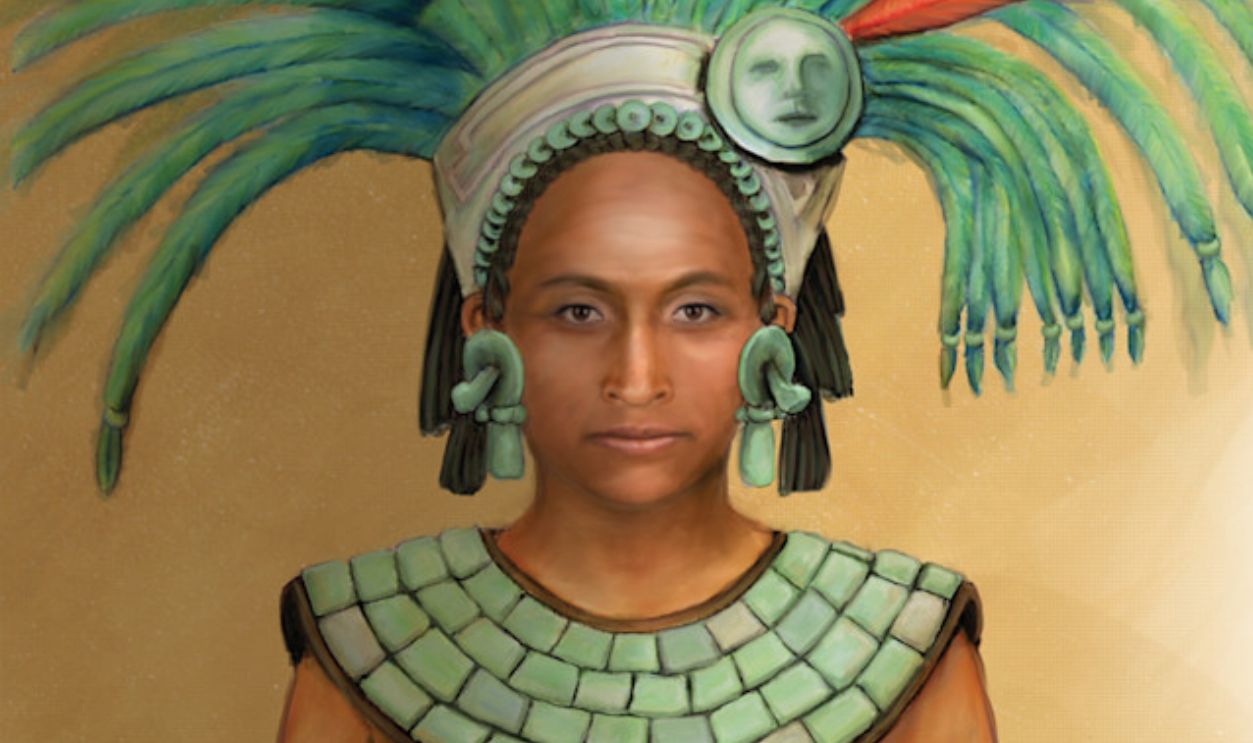
A Hidden City
Deep in Mexico's tropical lowlands, a forgotten Maya city has surfaced after centuries. What was once an indistinct mass beneath the trees now reveals towering structures and long-lost evidence of urban life.
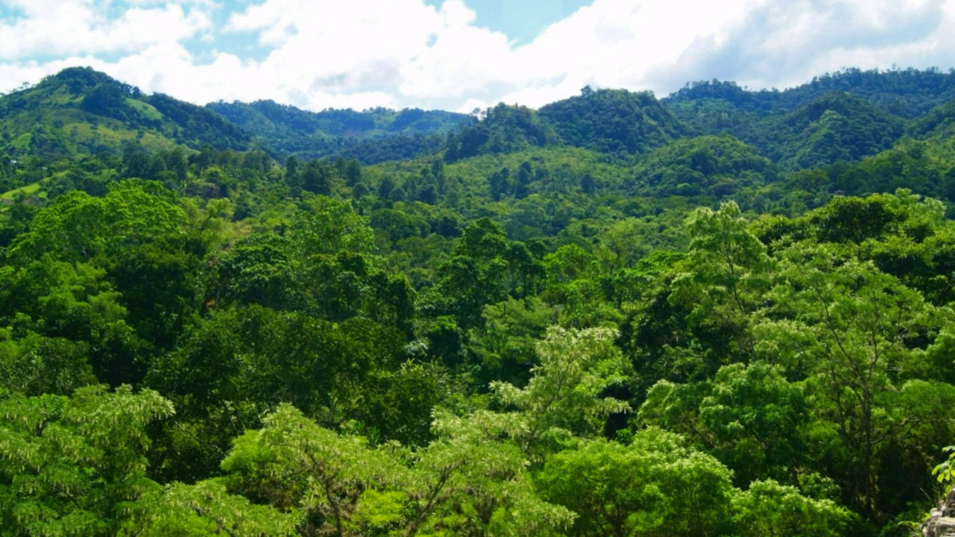
A Jungle Concealment Lasted Over A Thousand Years
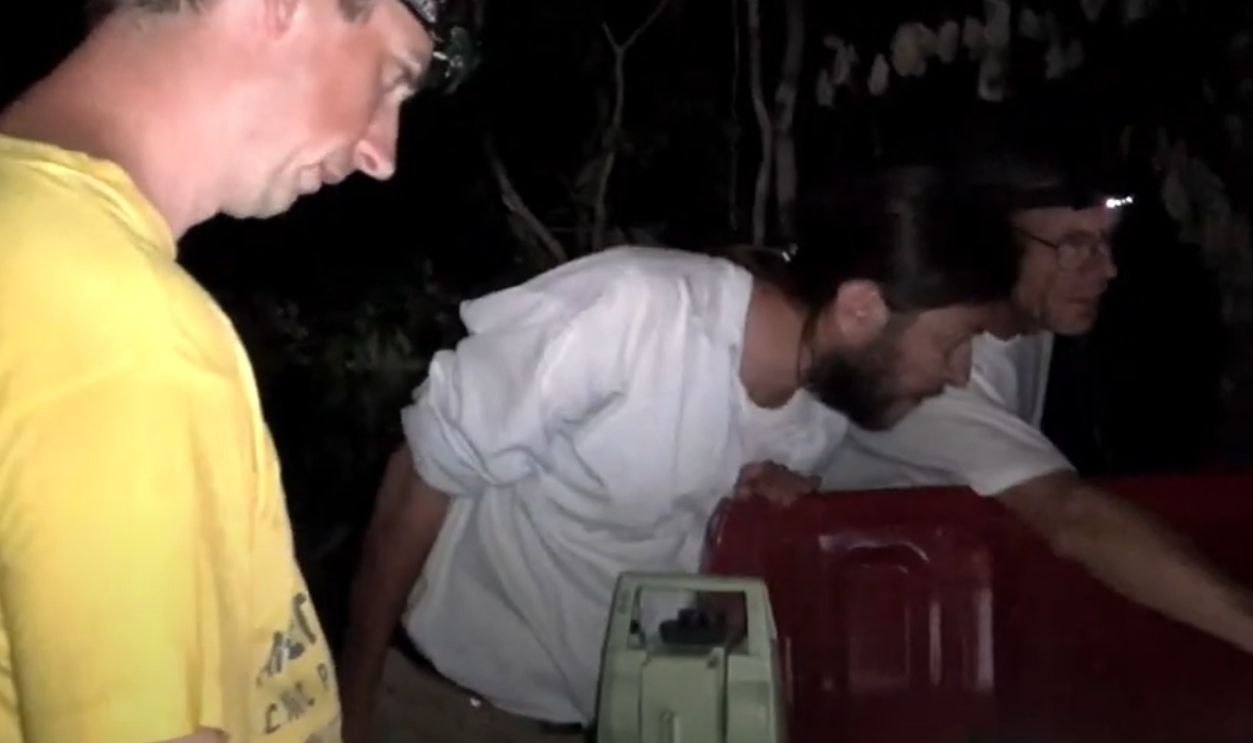
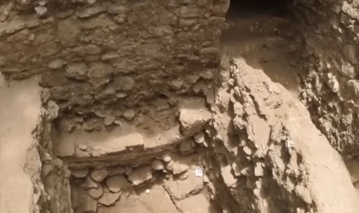
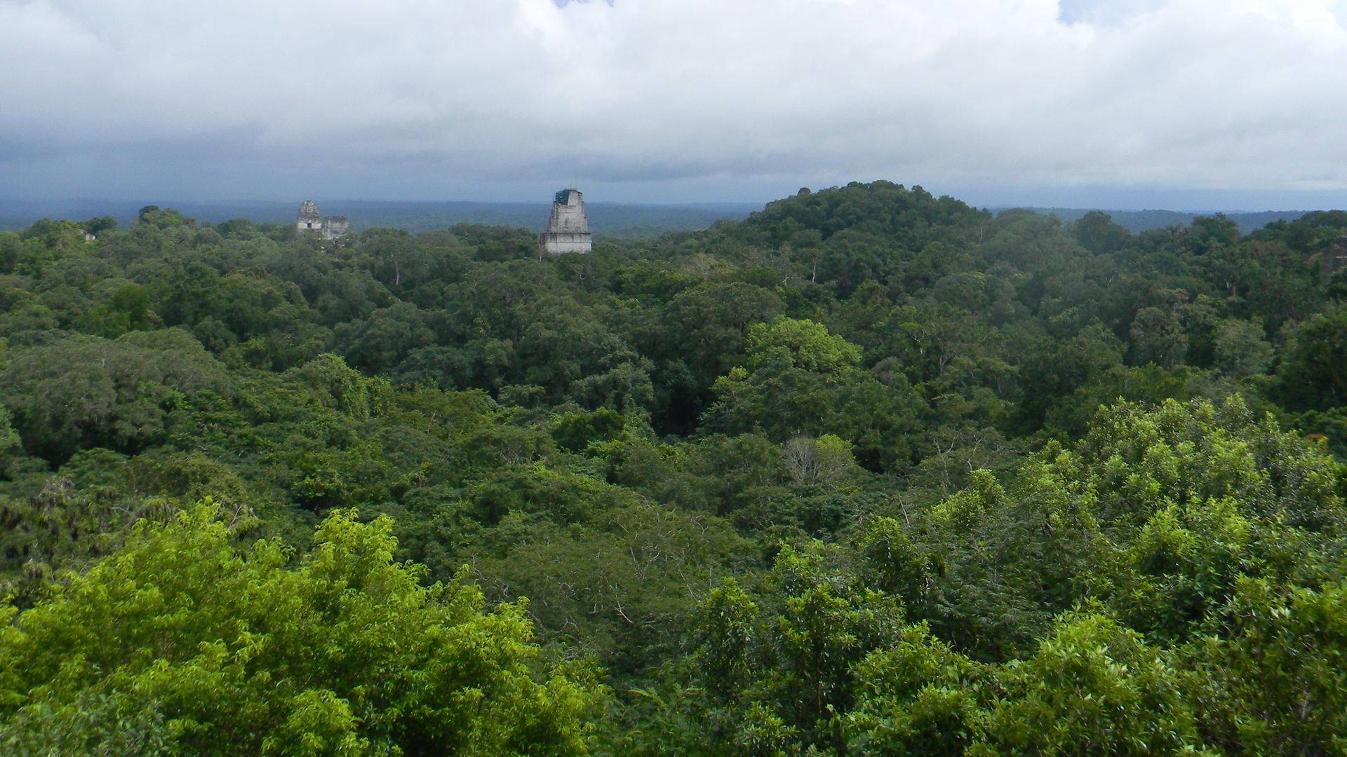
No roads pointed to it, nor did maps hint at its presence. For centuries, the tropical forests of Campeche concealed Ocomtun beneath a dense, unyielding canopy. Shielded by foliage and forgotten by time, the city remained untouched by modern eyes until 2023.
 Sem Brignoli, Wikimedia Commons
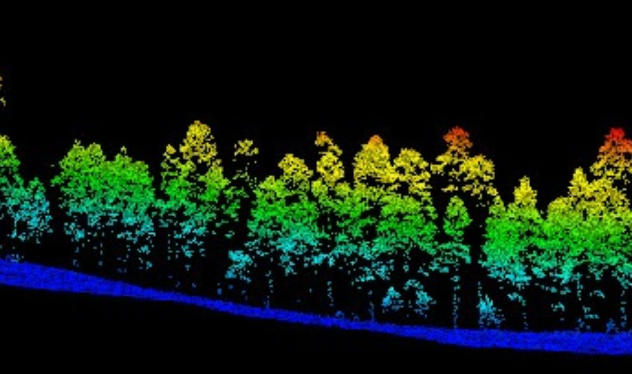
Alianza Regional LiDAR Data
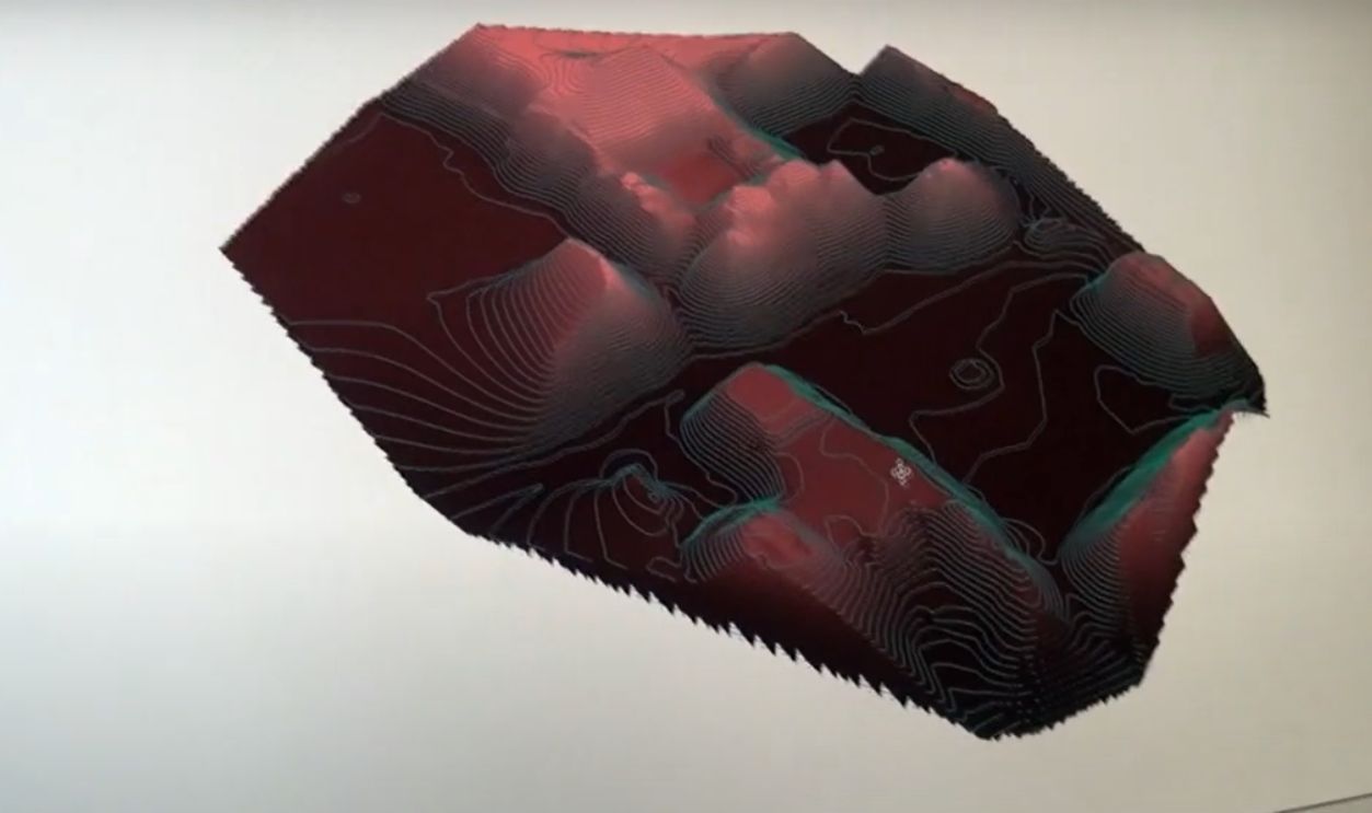
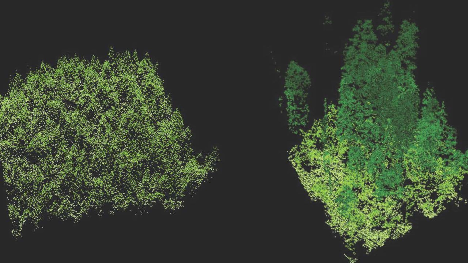
Even satellite imagery showed only an unbroken green mass. It wasn't until Alianza Regional LiDAR data digitally stripped away the vegetation that archaeologists spotted the layout of plazas and mounds. The forest had hidden Ocomtun so well that even modern tools initially failed to detect it.
 Ancient Mayan city discovered in Mexico jungle by accident | BBC News by BBC News
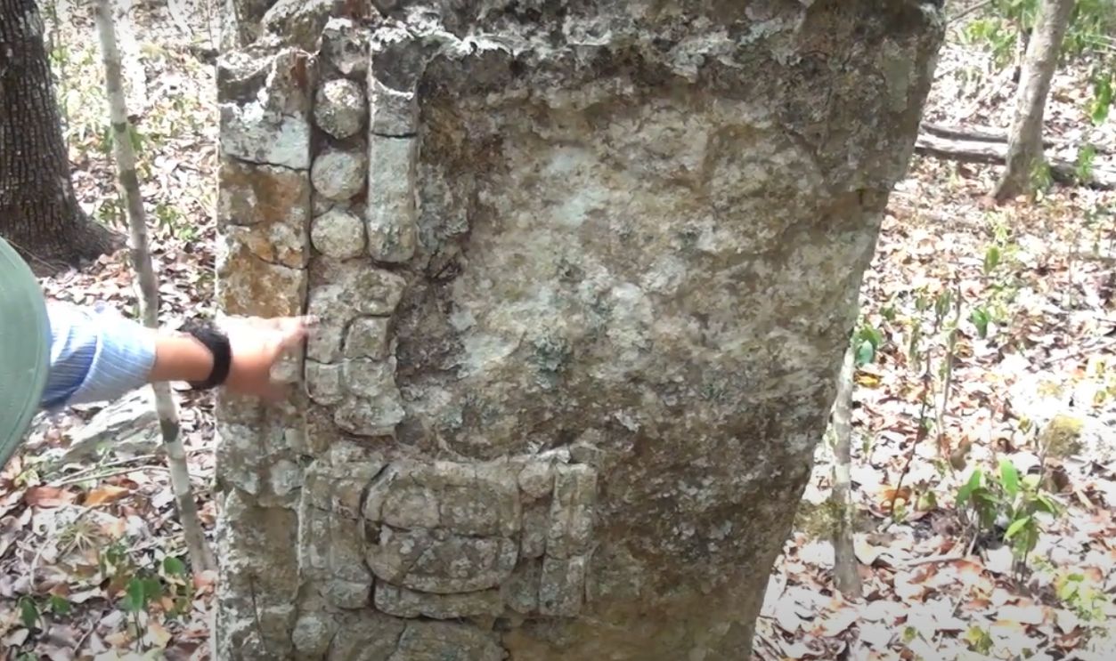
Ocomtun Rose Where Stone Columns Still Stand
The city's name was not invented but observed. Among the most striking features uncovered were cylindrical stone columns rising from collapsed buildings. These "ocomtun", in the Yucatec Maya language, gave the site its identity and hinted at once-thriving ceremonial or administrative functions long buried in the soil.
 Ancient Mayan city discovered in Mexico jungle by accident | BBC News by BBC News
How LiDAR Cracked The Canopy Code
Flying above the jungle, researchers sent pulses of laser light toward the ground. What returned wasn't guesswork but topography. LiDAR peeled back the forest with precision by exposing plazas and platforms invisible from the ground, all without lifting a single stone.
 Mc clapurhands, Wikimedia Commons
What Was Revealed?
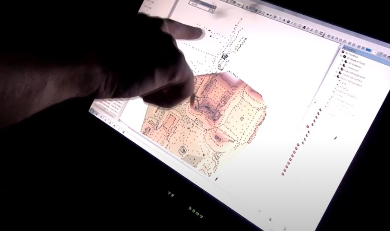
The scans captured altitude shifts as subtle as 10 centimeters, which allows archaeologists to distinguish between natural hills and man-made structures. This method revealed more than 50 architectural features that included pyramid bases and platforms, many previously invisible in satellite imagery or ground surveys.
 Southwestern Region, Wikimedia Commons
The Discovery Team Was Led By Ivan Sprajc
Years of remote sensing data shaped a focused strategy. When Ivan Sprajc and his team set out, they weren't exploring blindly, as what they found redefined the map of Maya civilization
. The Slovenian archaeologist, who worked with Mexico's National Institute of Anthropology and History, had planned the expedition precisely.
 Prof. dr. Ivan Sprajc by Ministry of Higher Education, Science and Innovation
The Layout And Density Of The Land
The breakthrough was made possible through the Alianza Regional LiDAR initiative, which surveyed over 5,000 square kilometers across Mesoamerica. This shared dataset helped Sprajc's team identify unexamined regions like Ocomtun with pinpoint accuracy that linked its layout and density to emerging patterns across Guatemala and Mexico.
 Prof. dr. Ivan Sprajc by Ministry of Higher Education, Science and Innovation
Ocomtun Rewrites The Maya Map
Ocomtun is a significant Maya site in the central Yucatan forest zone, a region long overlooked by researchers. Its size and complexity bridge a gap between famous sites like Calakmul and Edzna to enhance our understanding of how regional urban networks once operated.
 Prof. dr. Ivan Sprajc by Ministry of Higher Education, Science and Innovation
The City’s Role
Located between the Rio Champoton basin and the Puuc region, Ocomtun's location hints at its possible role as a trade or ceremonial hub. Its architectural features resemble both northern and southern Maya styles, reinforcing the theory that this site was a cultural and logistical crossroads during the Late Classic period.
 Daniel Schwen, Wikimedia Commons
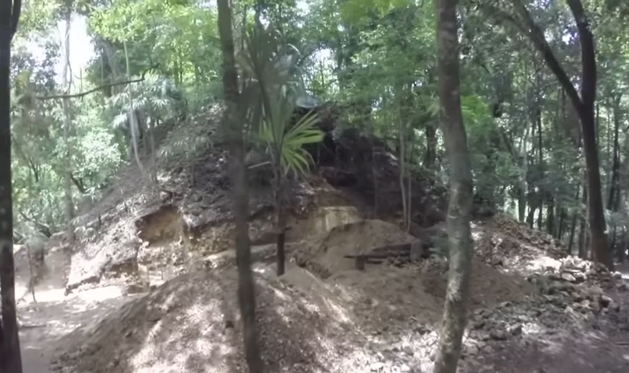
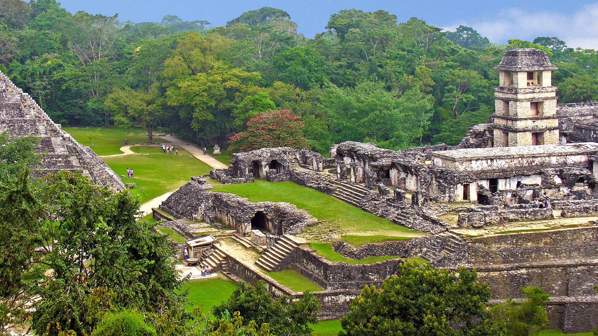
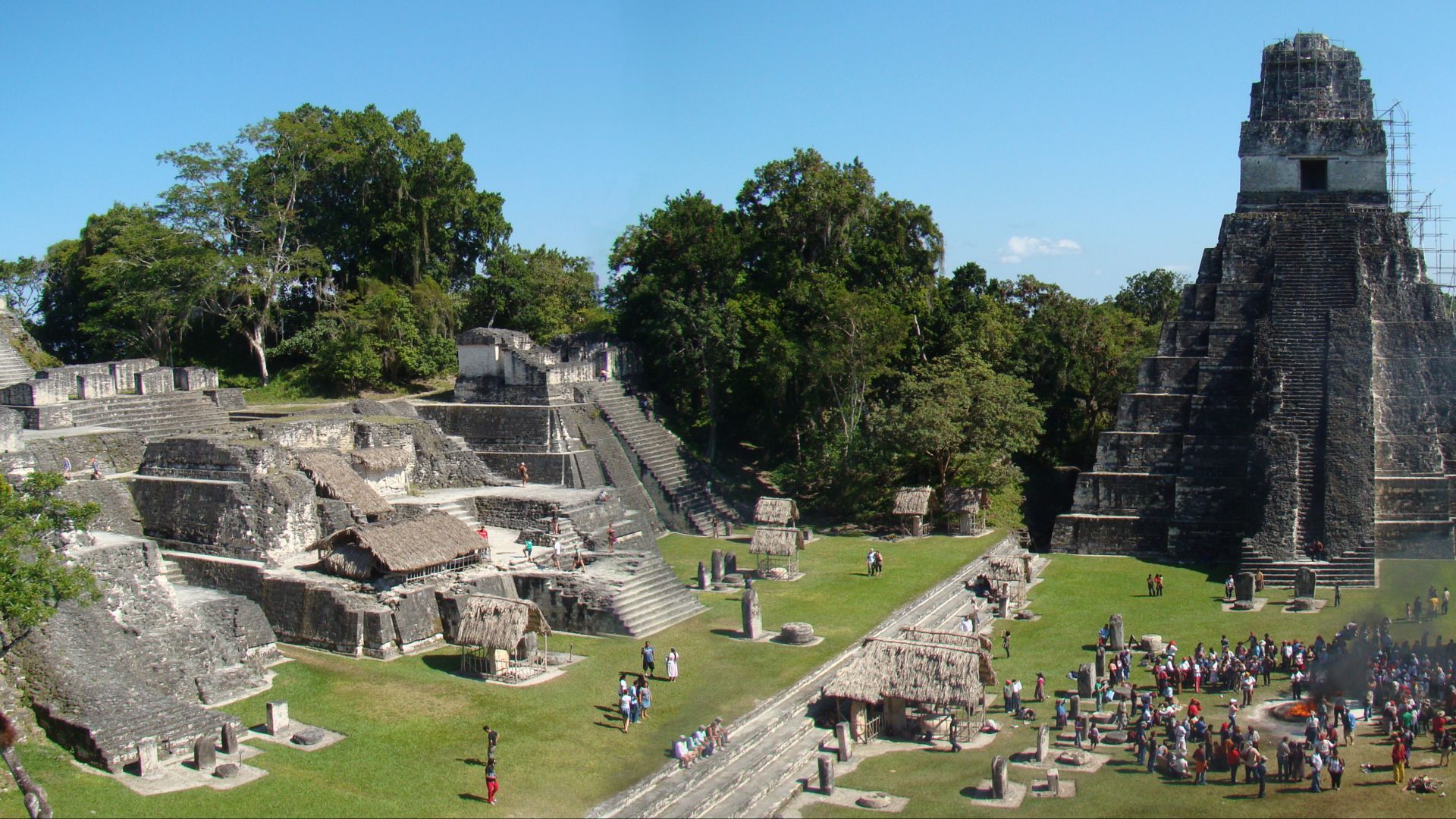
Buried Platforms, Not Just Temple Ruins
Not all ancient Maya structures rose skyward. Ocomtun revealed broad rectangular platforms (some over 80 meters long) that may have supported elite residences or administrative buildings. Their function extended beyond the ceremony, as their scale suggests coordinated construction and planning far beyond isolated pyramid buildings.
 Ancient Mayan city discovered in Mexico jungle by accident | BBC News by BBC News
Buried Platforms, Not Just Temple Ruins (Cont.)
In many Maya cities, such platforms were strategically placed near civic plazas and key access roads—a pattern likely followed in Ocomtun. Similar platforms elsewhere often featured superstructures, such as postholes and flooring remnants, which suggests they served both administrative and residential roles at the site.
 Ancient Mayan city discovered in Mexico jungle by accident | BBC News by BBC News
The Ball Court That Signaled Sacred Conflict
At Ocomtun, the ball court was a ceremonial arena, not a place for leisure. Positioned between major plazas and aligned with Maya ritual spaces, it hosted events where sport intertwined with politics and belief and where some contests ended in bloodshed.
The Ball Court That Signaled Sacred Conflict (Cont.)
The placement of Ocomtun’s ball court resembles those in Copan and Uxmal, where central courts often staged ritualized power displays, though Ocomtun’s exact role awaits further study. In certain high-stakes games tied to ritual or political events, losers might have faced sacrifice, though this was not typical.
 David R. Hixson, Wikimedia Commons
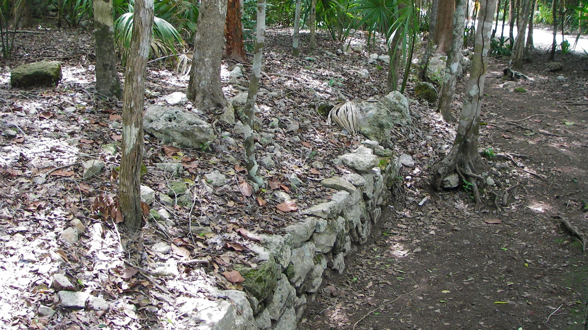
Ancient Roads And A Controlled Urban Layout
Aerial scans revealed elevated roads—known as sacbeob—that stitched the city's parts together. These stone causeways connected plazas and monumental platforms across uneven terrain. Their consistent width and direct routing point to deliberate zoning, with urban sectors organized around ceremonial and civic functions.
 HJPD, CC BY-SA 3.0, Wikimedia Commons
Smart City
Many of these causeways measured over five meters wide and extended hundreds of meters. Built with compacted gravel or layered limestone cobbles, they reflected careful engineering. Their durability and reach suggest long-term urban planning, even though they pass through flood-prone zones and uneven ground.
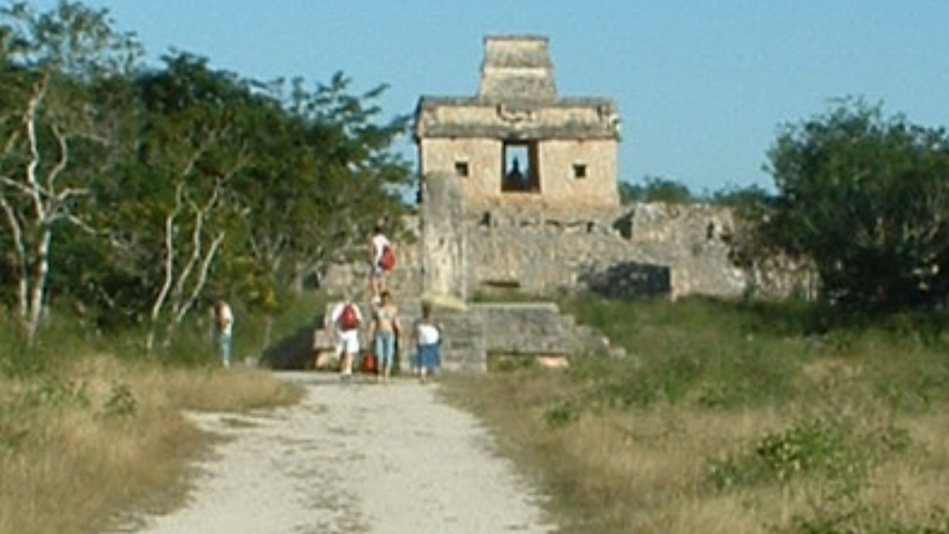 Photo by David Wohl, Wikimedia Commons
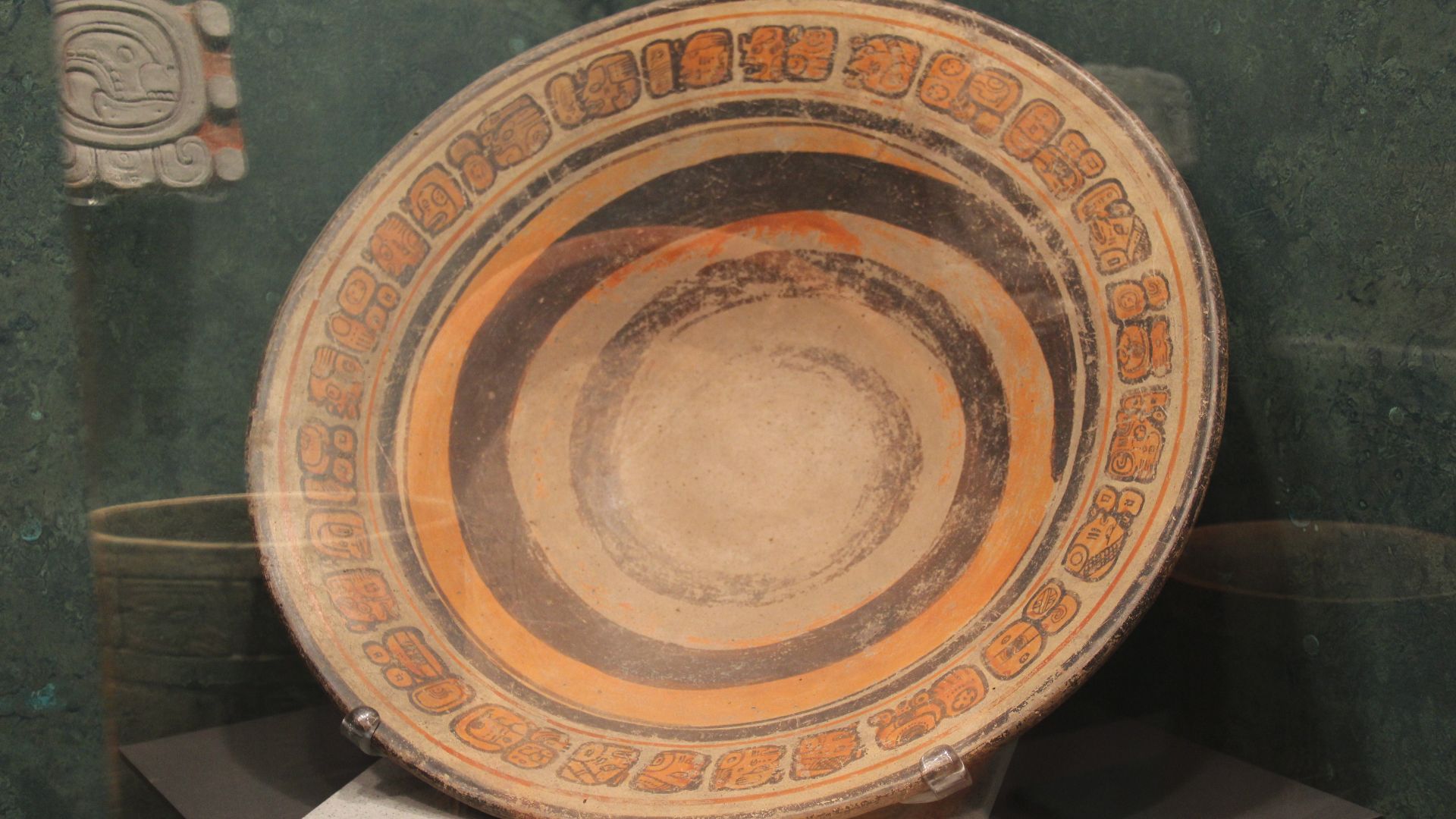
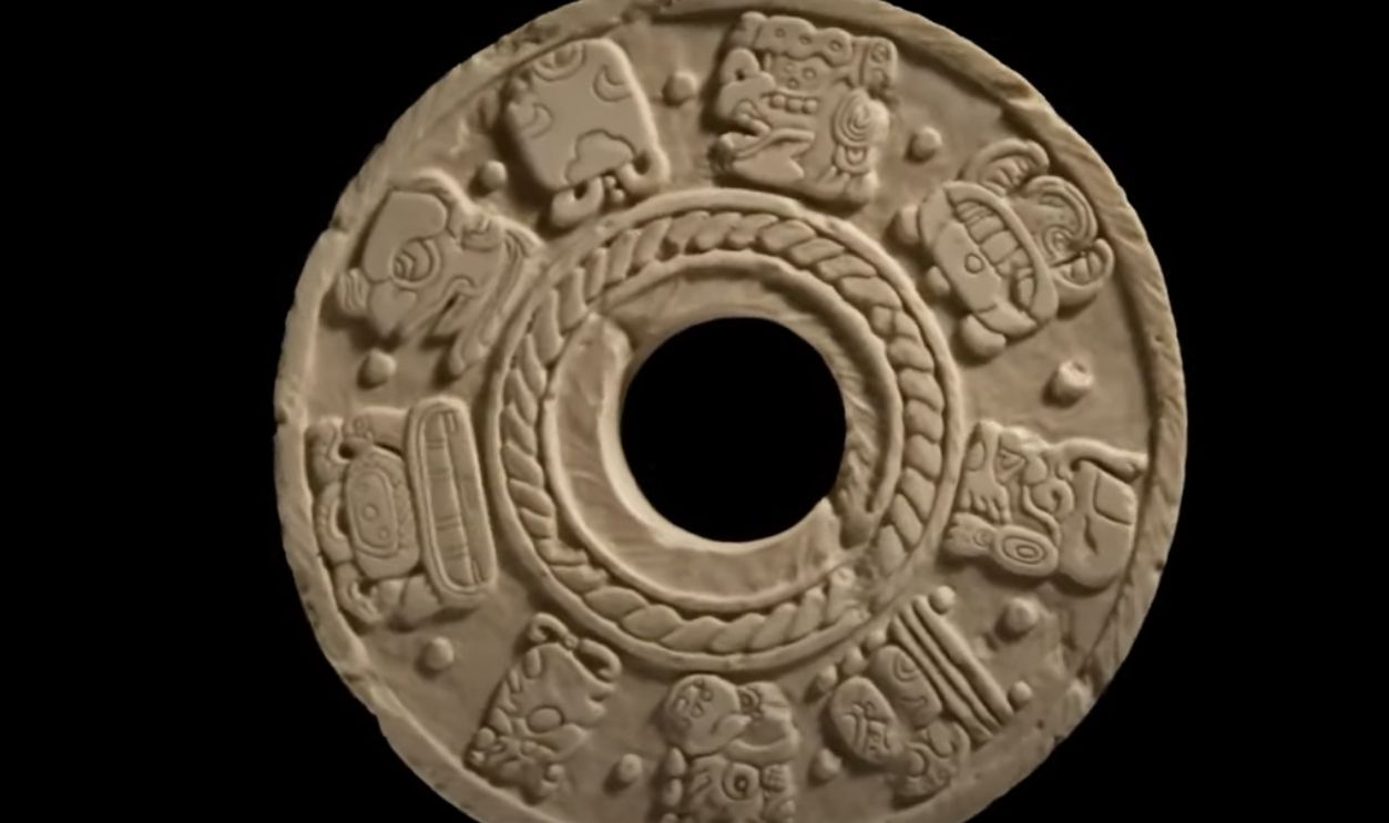
Ceramics That Date The Occupation
Pottery fragments found across the site anchor Ocomtun in the Late Classic period, roughly 600 to 900 AD. Rim styles and paste composition match ceramic groups from nearby regions. These artifacts help chronologically situate the city's peak alongside other dominant centers.
 Gary Todd from Xinzheng, China, Wikimedia Commons
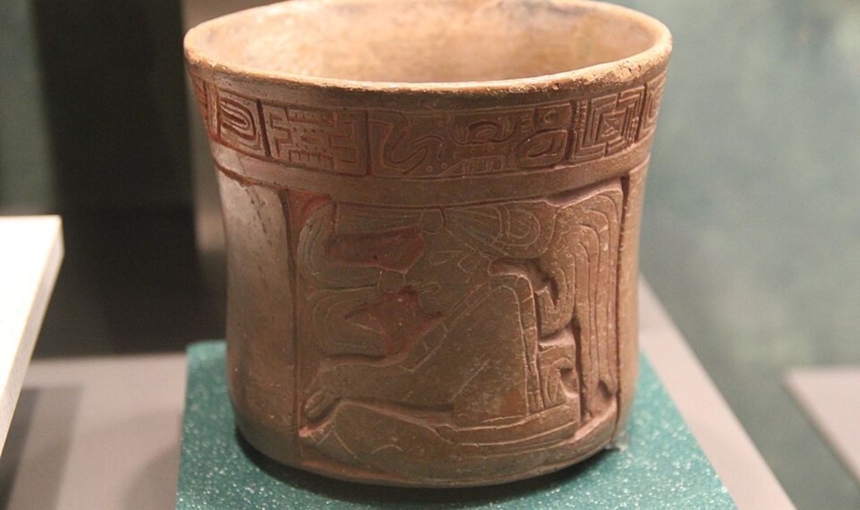
The Meaning Behind Decorative Pieces
Some ceramic forms found at Ocomtun closely resemble those from the Rio Bec and Chenes regions, which suggests cultural or trade links. Decorative motifs—such as fluted bodies and red slip finishes—mirror trends of elite consumption. These stylistic clues provide insight into the city's external influences and sociopolitical affiliations.
 Gary Todd, CC0, Wikimedia Commons
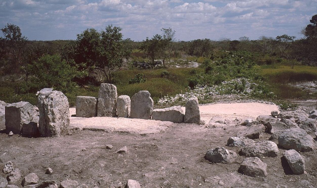
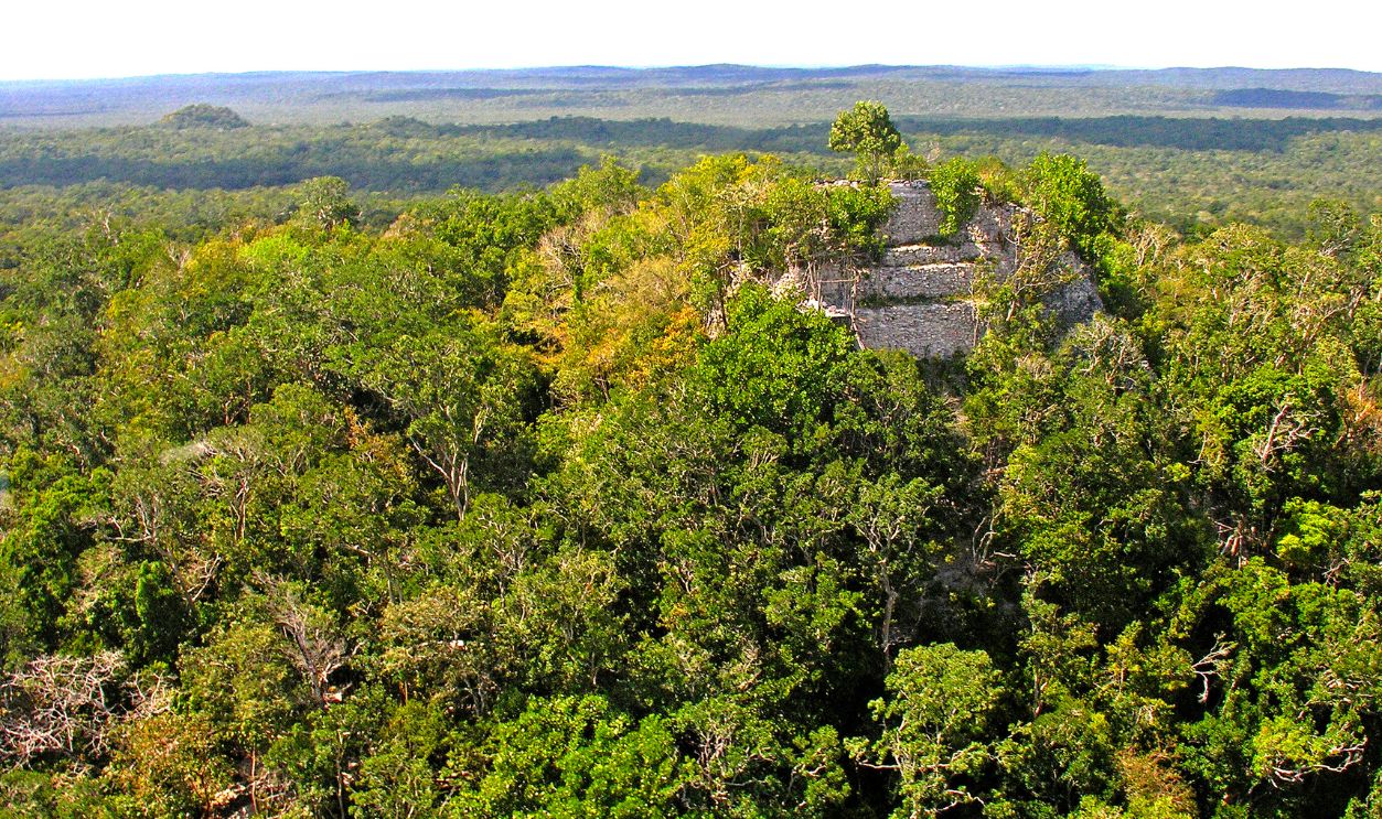
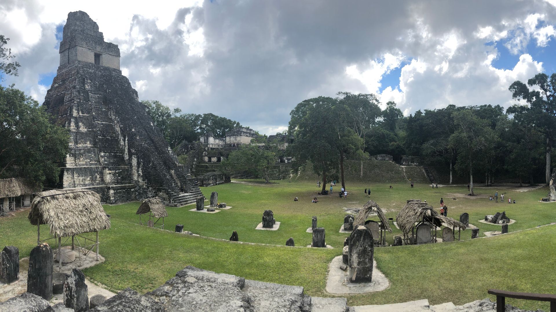
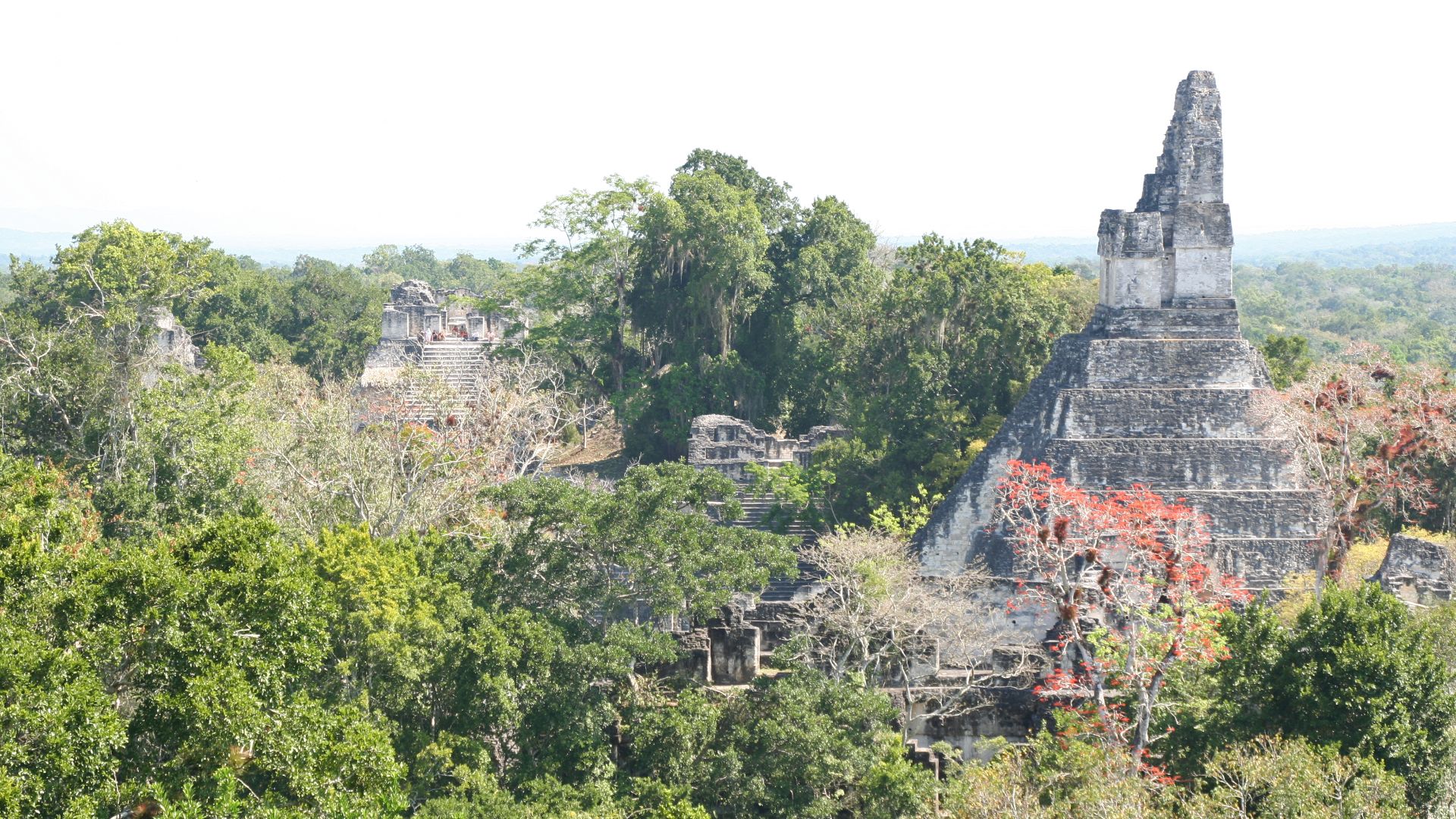
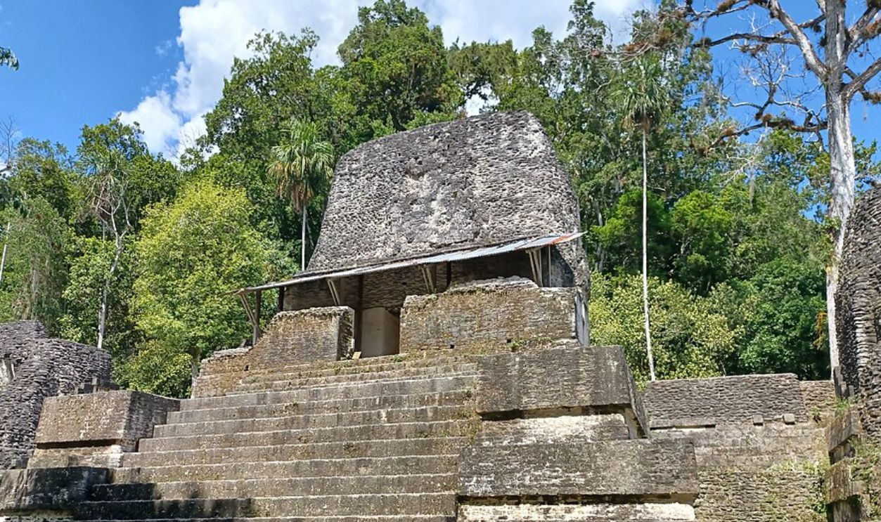
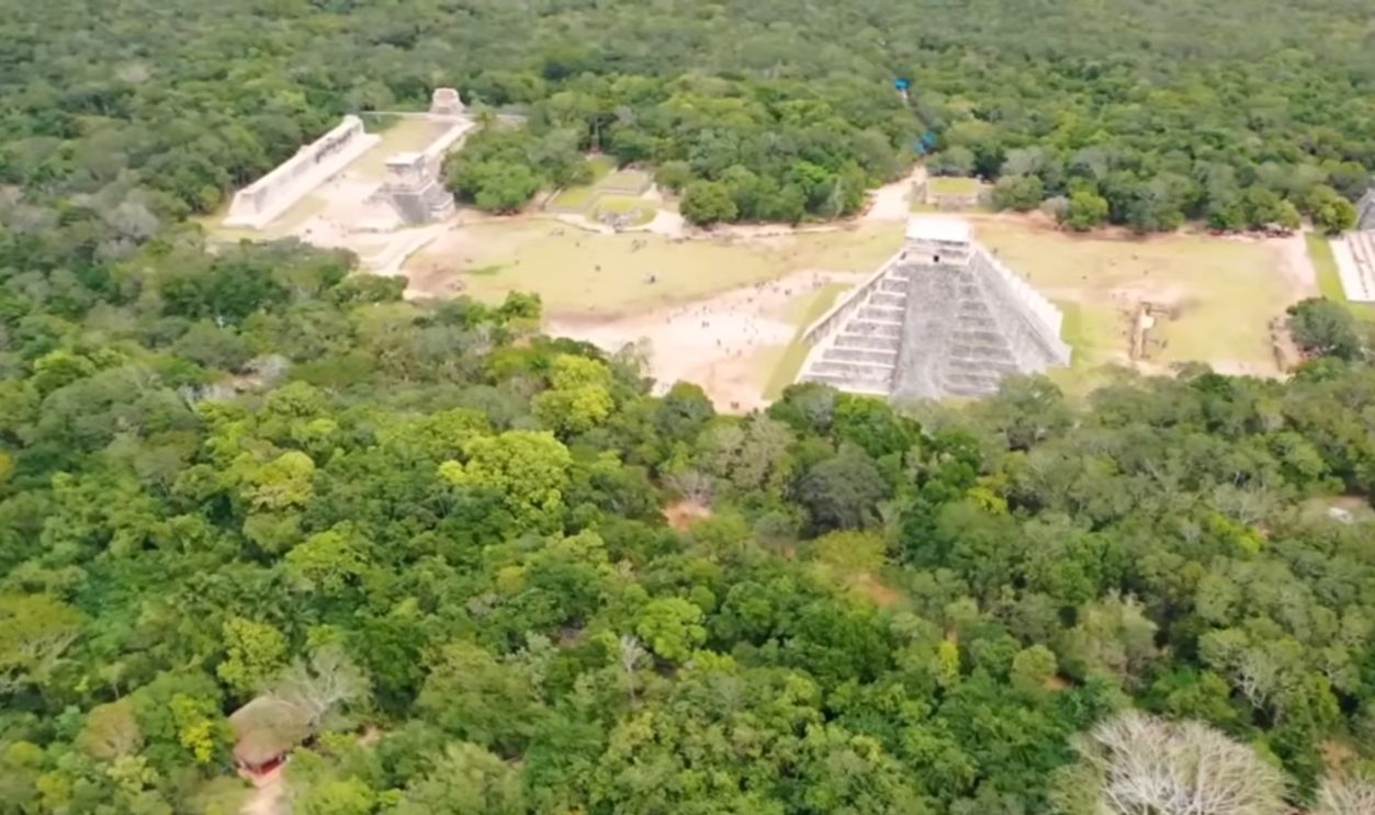
Site Features Built For Visibility, Not Secrecy
Towering over the jungle floor, some pyramids exceeded 15 meters in height. Their position atop platforms made them even more visible, and this symbolized dominance across the surrounding terrain. These structures may have served religious and territorial purposes by projecting regional power.
The Geometry Behind The Plazas
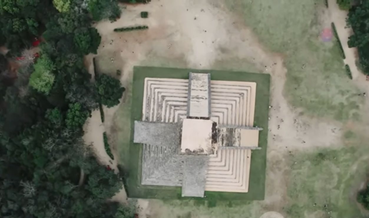
When researchers charted the layout of Ocomtun's plazas, patterns emerged. Their orientation followed cardinal directions or solar alignments, including possible solstice lines. This geometric precision served more than a decorative role; it reflected a cosmological order encoded in architecture, a signature feature of Maya ceremonial planning.
 Dennis G. Jarvis, Wikimedia Commons
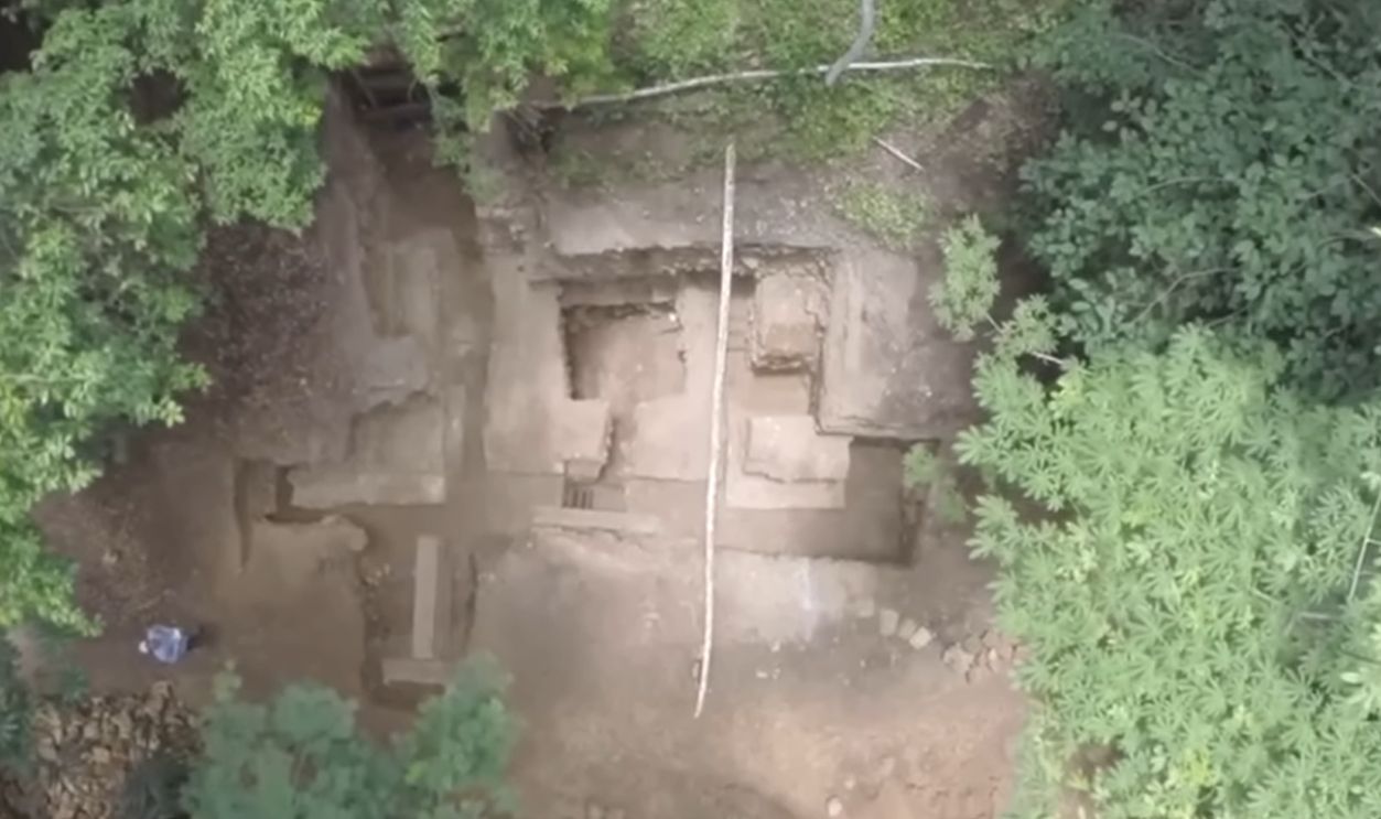
LiDAR Detected Over 50 Architectural Structures
A high-resolution LiDAR survey mapped more than 50 individual structures across 123 acres. These included stepped pyramids, elongated platforms, circular altars, connecting causeways, etc. Many features were concealed by vegetation, which makes them impossible to identify in satellite imagery or even during prior ground-level surveys.
 Prof. dr. Ivan Sprajc by Ministry of Higher Education, Science and Innovation
Similarities Were Noted
LiDAR imagery revealed spatial clustering within the site to suggest distinct civic and possibly residential zones. Some structures appeared in deliberate groupings that mirrored known layouts from sites like Becan and Edzna. These patterns explain how Ocomtun's civic life may have been spatially organized.
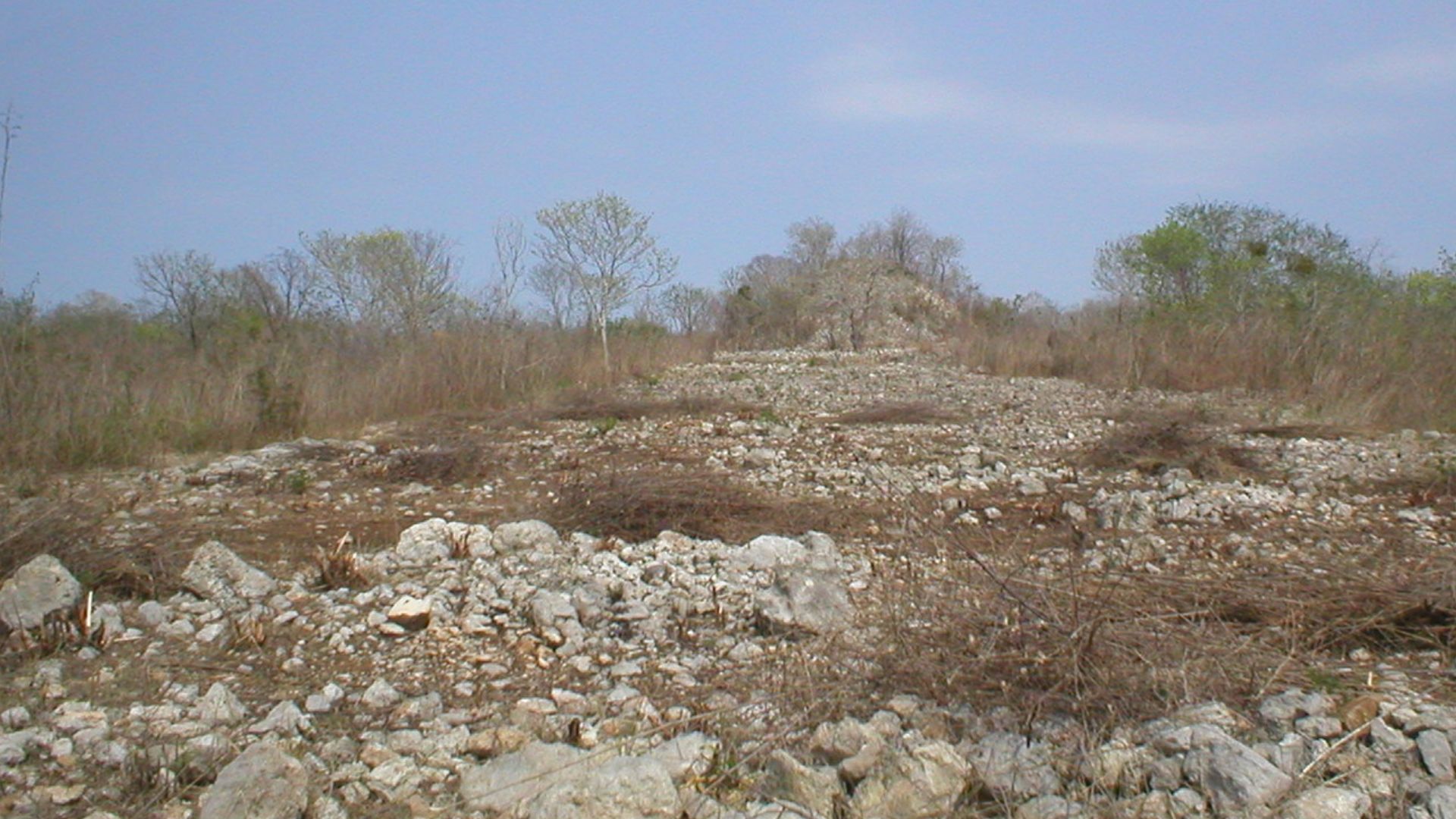
A Settlement Without Fortification Walls
Unlike many Maya cities that show evidence of perimeter defenses, Ocomtun lacks identifiable fortification walls. This absence could imply relative peace or centralized power. Natural barriers like wetlands may also have served as protective buffers in place of constructed boundaries.
Elevated Causeways Cut Through Swampland
Some roads rose through the wetlands like stone ribbons. These sacbeob were built atop packed gravel and limestone and raised to remain functional during the rainy season. Their engineering reflects a deep knowledge of seasonal flooding and a long-term commitment to urban connectivity.
 Keith Walbolt, Wikimedia Commons
The Absence Of Inscribed Stelae
No readable stone stelae bearing ruler names or dates have been found at Ocomtun. This absence is notable because elite monuments were common in major Maya centers. The city's prominence may have declined before stela carving became widespread in the region.
 User:Authenticmaya~commonswiki, Wikimedia Commons
The Geometry Behind The Plazas
When researchers charted the layout of Ocomtun's plazas, patterns emerged. Their orientation followed cardinal directions or solar alignments, including possible solstice lines. This geometric precision served more than a decorative role; it reflected a cosmological order encoded in architecture, a signature feature of Maya ceremonial planning.
 Bjørn Christian Tørrissen, Wikimedia Commons
From City-State Networks To Empire Misconceptions
A single empire didn't rule the Maya world. Ocomtun belonged to a shifting mosaic of city-states, each with its leaders and calendar systems. These independent centers formed and dissolved alliances over centuries by creating a decentralized network, often mischaracterized as unified in early accounts.
 Simon Burchell, Wikimedia Commons
From City-State Networks To Empire Misconceptions (Cont.)
Diplomatic relations included everything from trade pacts to open conflict. Inscriptions at Dos Pilas and Calakmul reveal shifting alliances and marriages arranged to consolidate influence. Ocomtun, located between larger political powers in the western Yucatan, likely maneuvered through a similar negotiation and regional strategy arena.
Rewriting The 'Collapse' Narrative
The idea of a sudden Maya collapse oversimplifies a complex and uneven decline. While southern centers like Tikal lost power by the 10th century, others flourished in the north, including Chichen Itza. The shift wasn't a disappearance but a gradual reorganization—urban cores declined while rural populations and new centers emerged.
 Daniel Schwen, Wikimedia Commons
Environmental And Social Factors
Scholars suggest that decentralization and local resilience shaped Maya continuity. Some regions reorganized politically around smaller capitals and dispersed communities. This shift reflects an adaptive strategy, not a collapse, in response to drought and broader environmental and social pressures.
 Simon Burchell, Wikimedia Commons
Climate Change Played A Measured Role
A clearer picture of ancient droughts has emerged from lakebed sediment studies. In regions like Peten, Guatemala, paleoclimatic records show marked drops in rainfall between 820 and 870 AD. Extended droughts likely stressed agriculture, which contributed to sociopolitical instability in cities like Ocomtun during its later occupation phase.
 Prof. dr. Ivan Sprajc by Ministry of Higher Education, Science and Innovation
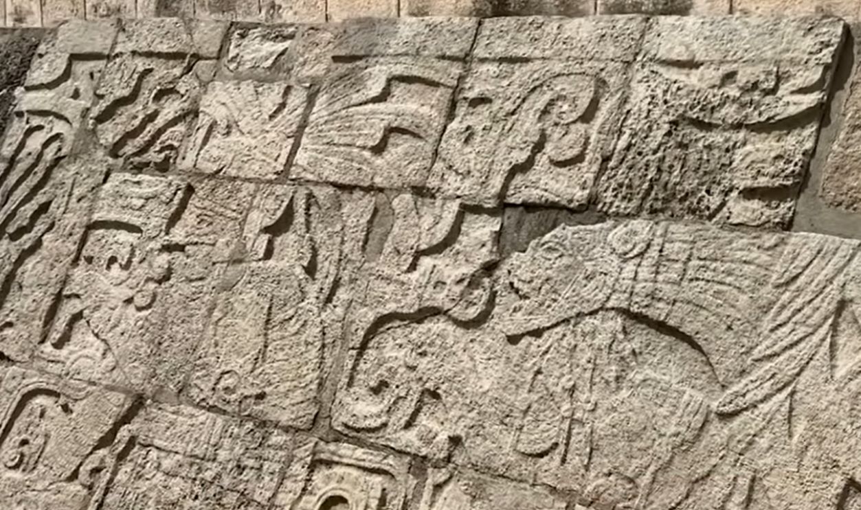
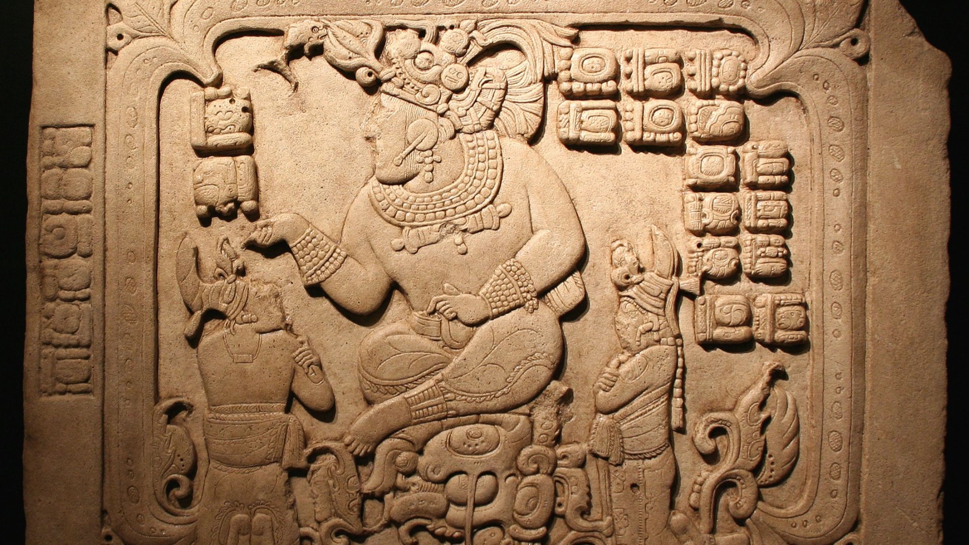
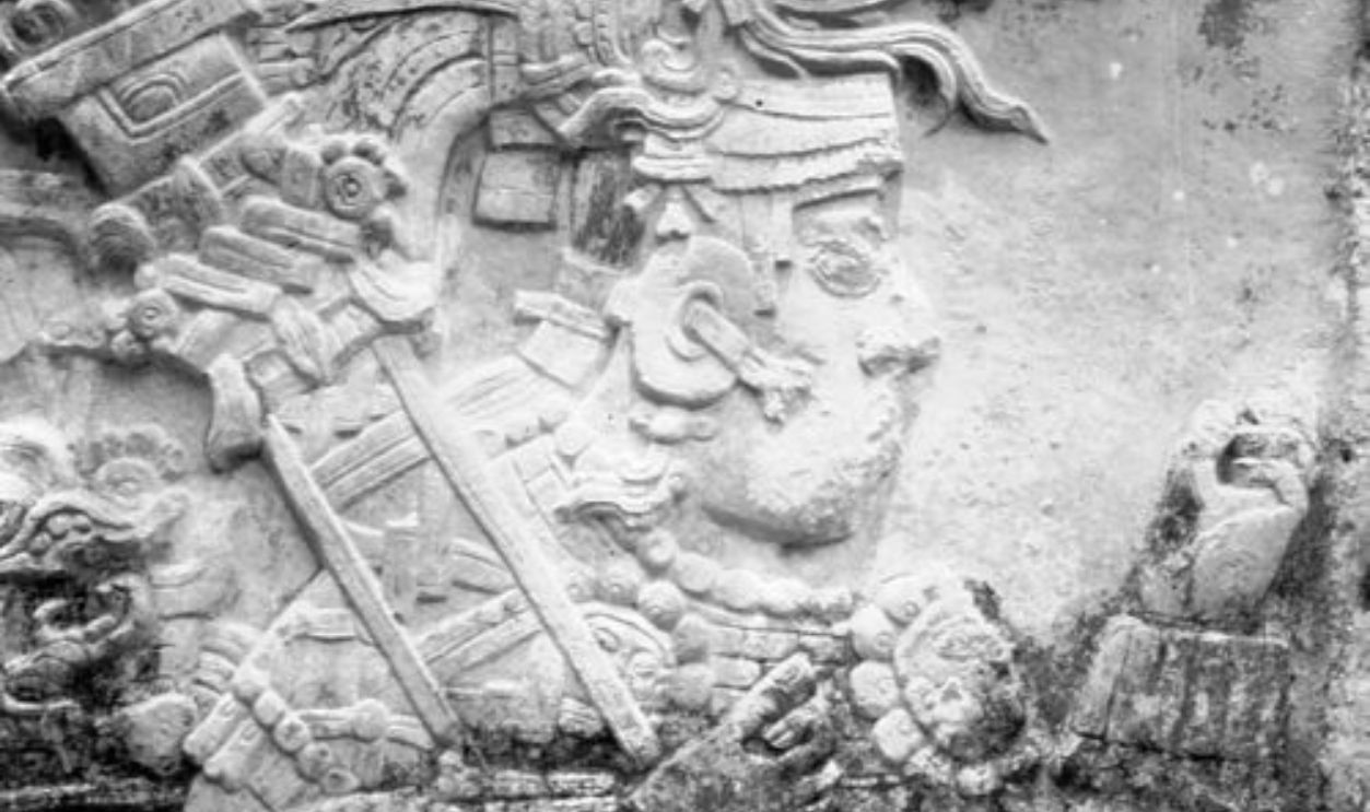
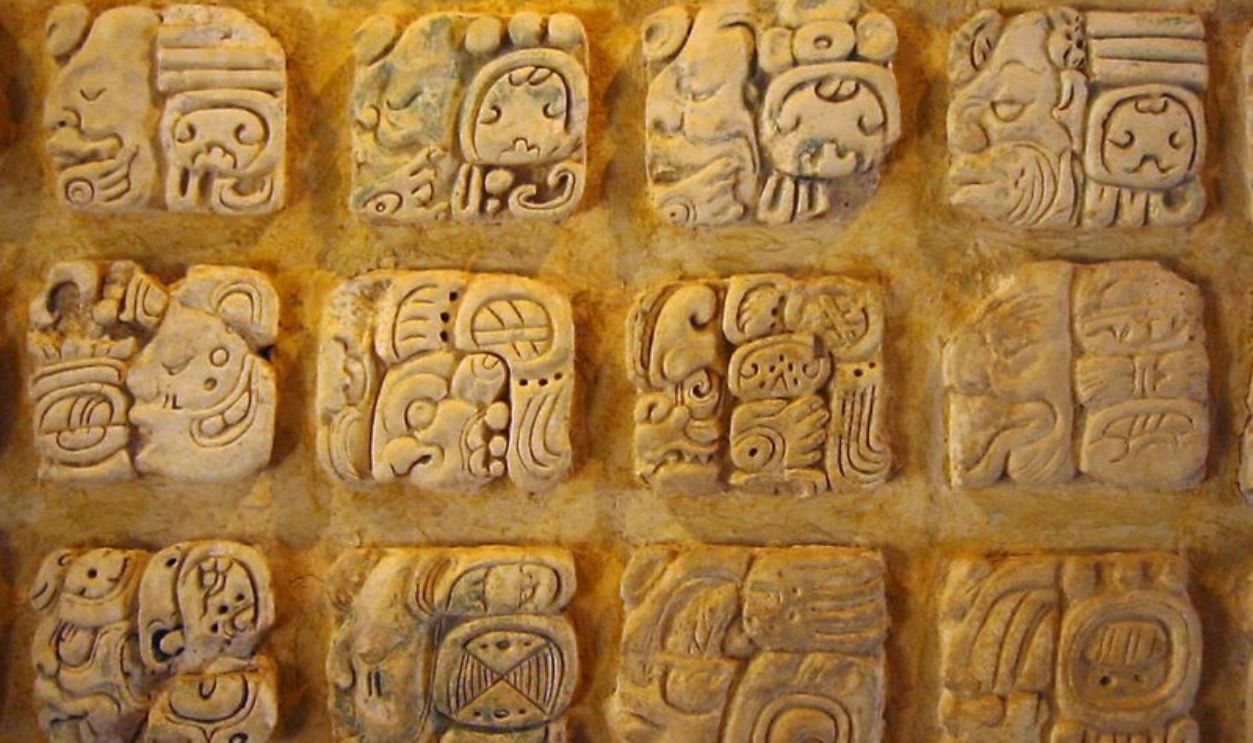
Maya Glyphs Tell A Partial Story
Much of what we know comes from inscriptions carved in stone or painted on ceramics. However, gaps remain, with only 80% of the glyphic system decoded. Many texts record elite events, such as births and dynasties, while the daily lives of most Maya are still largely silent.
 User:Kwamikagami, Wikimedia Commons
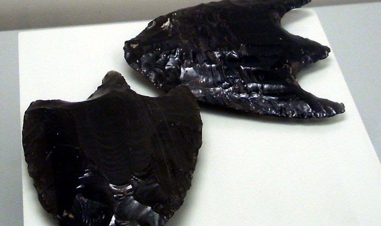
Trade Routes Reconstructed Through Artifacts
Archaeologists traced exchange networks through material signatures. At Ocomtun, obsidian from Guatemala's highlands and jade, likely sourced from the Motagua Valley, have been identified. These finds place the city within long-distance trade circuits spanning the Yucatan Peninsula, which proves it was more connected than its isolation suggests.
 Simon Burchell, Wikimedia Commons
Trade Routes Reconstructed Through Artifacts (Cont.)
Marine shell fragments and non-local ceramics found at Ocomtun indicate exchange with coastal communities and inland production zones. When analyzed through compositional studies, these items link the site to regional economies active across ecological zones, even in remote jungle interiors.
Gods, Rituals, And The Sacred Terrain
Maya temples followed the land. Builders placed pyramids near caves and cenotes, which they believed were portals to Xibalba (the Mayan underworld). These choices reflected spiritual geography by turning natural features into ritual sites for offerings and communication with divine forces.
 Simon Burchell, Wikimedia Commons
The Calendar That Outlived Its People
Few ancient systems matched its accuracy. The Maya Long Count calendar tracked solar and lunar cycles over thousands of years. Its base date—August 11, 3114 BC—marked mythological creation. This mathematical model calculated planetary alignments and eclipses with a precision that rivaled modern algorithms.
 Ancient Aliens: The Mayan Calendar Mystery (Season 14) | Exclusive | History by HISTORY
Why Earlier Explorers Missed It?
Thick forest and scarce documentation left central Campeche largely unexamined. Unlike better-known regions like Peten or Chiapas, early 20th-century expeditions bypassed the area. Dense jungle and logistical difficulty kept sites like Ocomtun hidden from even experienced field researchers.
 Bernard DUPONT, Wikimedia Commons
Remote Sensing Avoids Physical Damage
LiDAR gave archeologists a way to see without disturbing them. Without digging, researchers identified pyramids and platforms through vegetation using laser data. This noninvasive approach preserves fragile sites and avoids destructive methods that often degrade or erase ancient architecture.
Remote Sensing Avoids Physical Damage (Cont.)
The technique also supports ethical research standards by minimizing harm to culturally significant environments. In regions inhabited by modern Maya communities, non-intrusive methods reduce the risk of damaging ancestral sites. As a result, LiDAR is now a preferred tool for balancing discovery with cultural respect.
Artificial Intelligence In Maya Archaeology
Pattern recognition has reached the jungle. Researchers now use AI to scan LiDAR datasets for signs of human activity. These algorithms, trained on thousands of known features, flag promising formations like stone mounds, alignments, and plazas. Some of these might be overlooked in hours of manual review.
 Sarah Frey, Oregon State University, Wikimedia Commons
Ocomtun Compared To Other LiDAR Sites
Among recently scanned sites, Ocomtun stands out in scale and complexity. Its architectural density rivals that of centers like El Palmar and Chactun. With over 50 mapped structures and organized urban zones, it has emerged as one of central Yucatan's most significant Maya settlements.
 Francesc Fort, Wikimedia Commons
Digital Archives And Open Access
LiDAR data is now available through platforms led by INEGI and the Observatorio de la Selva Maya. These open-access archives allow global researchers to compare settlement patterns by revealing deeper regional insights across Maya cities once hidden beneath dense vegetation.

Still, 90% Of The Jungle Unmapped
Only a fraction of the story has been uncovered till now. Experts estimate that a substantial portion, possibly around 90%, of Mexico’s lowland jungle remains unmapped by LiDAR. Vast areas of promising terrain may still hide entire cities that await discovery through advanced scanning technology.
Maya Descendants Were Never Gone
More than six million people speak Maya languages across Mexico, Guatemala, Belize, and Honduras. These communities preserve oral traditions and spiritual practices rooted in pre-Columbian heritage. The discovery of Ocomtun affirms their enduring connection to a history that was never truly lost.
 Henrique Matos, Wikimedia Commons
Local Knowledge Deserves More Credit
Local observations—such as accounts of unusual landforms—have historically contributed to archaeological findings, though no confirmed reports are directly linked to Ocomtun. Increasingly, such insights are recognized as valuable starting clues that help enhance formal scientific exploration.


.jpg)