

The Map Was Completely Different
Reconstructing the Ice Age world is forcing archaeologists to reconsider routes, coastlines, and environments that disappeared thousands of years ago, and the people who moved through them may have followed paths that modern maps make almost impossible to see.
Modern Coastlines Can Mislead Us
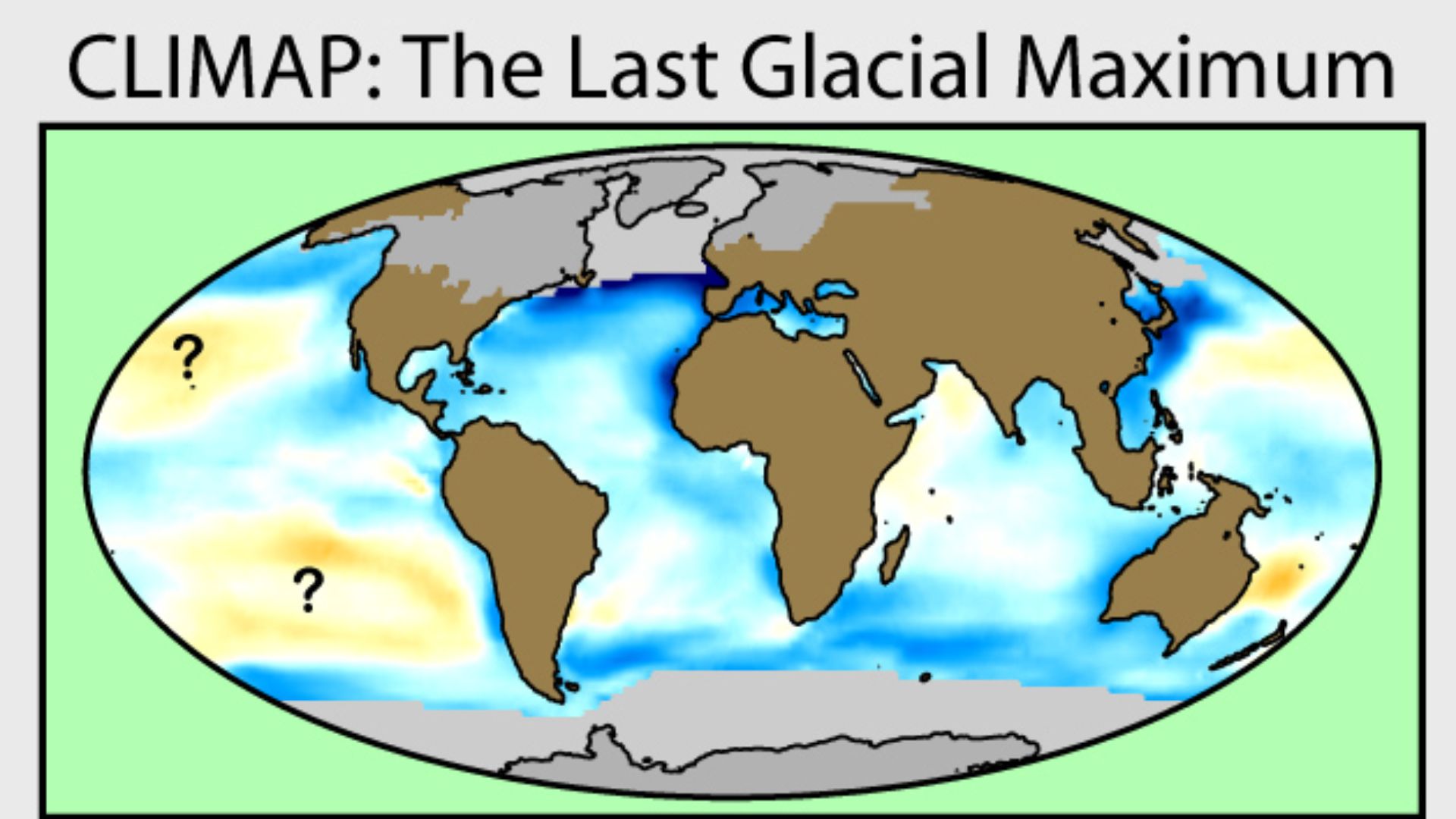
Most maps used to imagine prehistoric migration begin with coastlines that did not yet exist. During the Last Glacial Maximum, so much water was locked in continental ice that global sea level stood roughly 120 to 135 metres lower than today. Huge areas now beneath shallow seas were dry land where people could live, hunt, gather, and travel.
 BetacommandBot, Wikimedia Commons
The Missing Land Was Often Prime Territory
Submerged terrain was not simply empty space connecting more important places. Continental shelves contained rivers, wetlands, grasslands, estuaries, and coastlines that could have offered food and transportation. Archaeologists increasingly treat these vanished regions as inhabited landscapes rather than mere “land bridges.”
 Pamela Doretti, Wikimedia Commons
Beringia Was Practically A Country
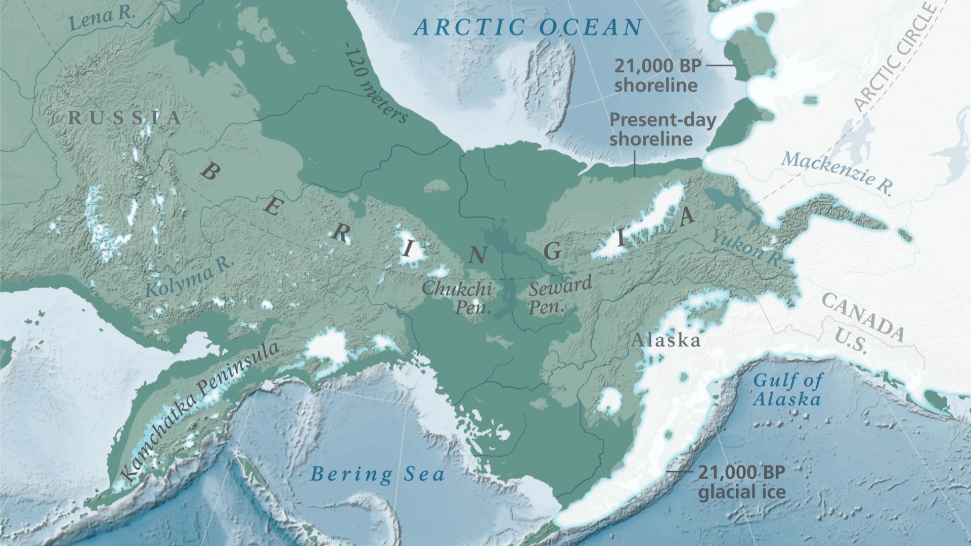
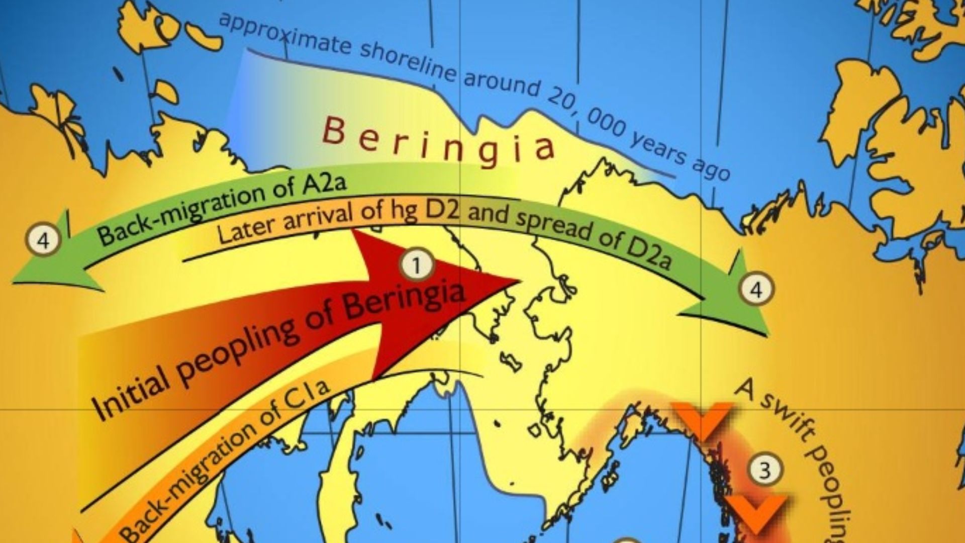
The famous Bering Land Bridge was far larger than the narrow crossing its name suggests. Lower sea levels exposed an enormous region joining northeastern Asia and Alaska, creating the Ice Age landscape known as Beringia. Parts of it supported shrub tundra and large mammals even during severe glacial conditions.
 Unknown authorUnknown author, Wikimedia Commons
People May Have Lived There For Generations
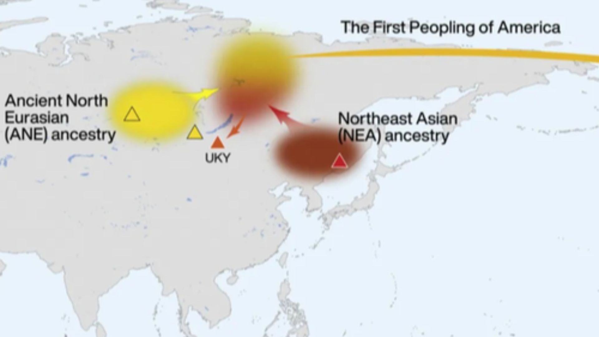
Genetic research has helped transform Beringia from a simple migration route into a possible long-term homeland. Ancient-genome studies indicate that populations ancestral to Indigenous peoples of the Americas became separated from other Asian populations during the Late Pleistocene. Some models therefore envision people remaining within greater Beringia for a substantial period before later dispersals.
 Erika Tamm et al, Wikimedia Commons
Bluefish Caves Made Beringia Much More Interesting
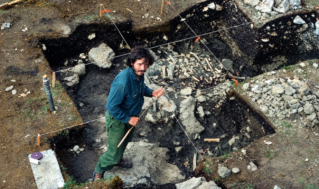
Reanalysis of animal bones from the Bluefish Caves in Yukon produced evidence interpreted as human butchery dating to roughly 24,000 years ago. The results support the possibility that humans were living in eastern Beringia during the Last Glacial Maximum. That is much earlier than the classic picture of hunters simply racing through the region after the ice retreated.
 Ruth M. Gotthardt, Wikimedia Commons
White Sands Pushed The Argument Farther South
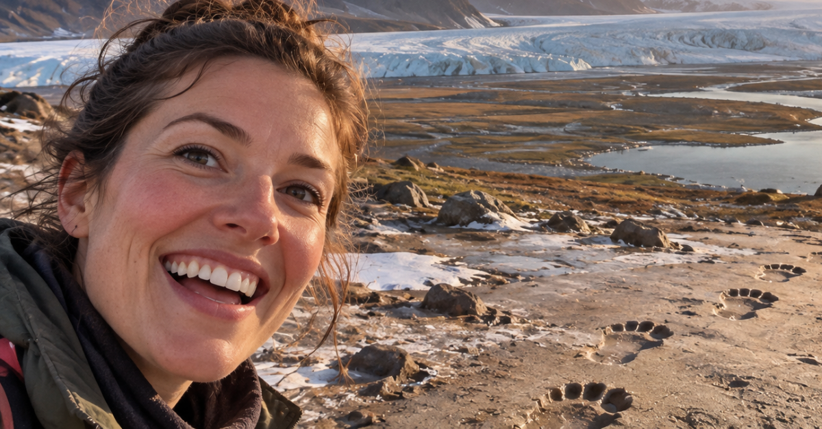
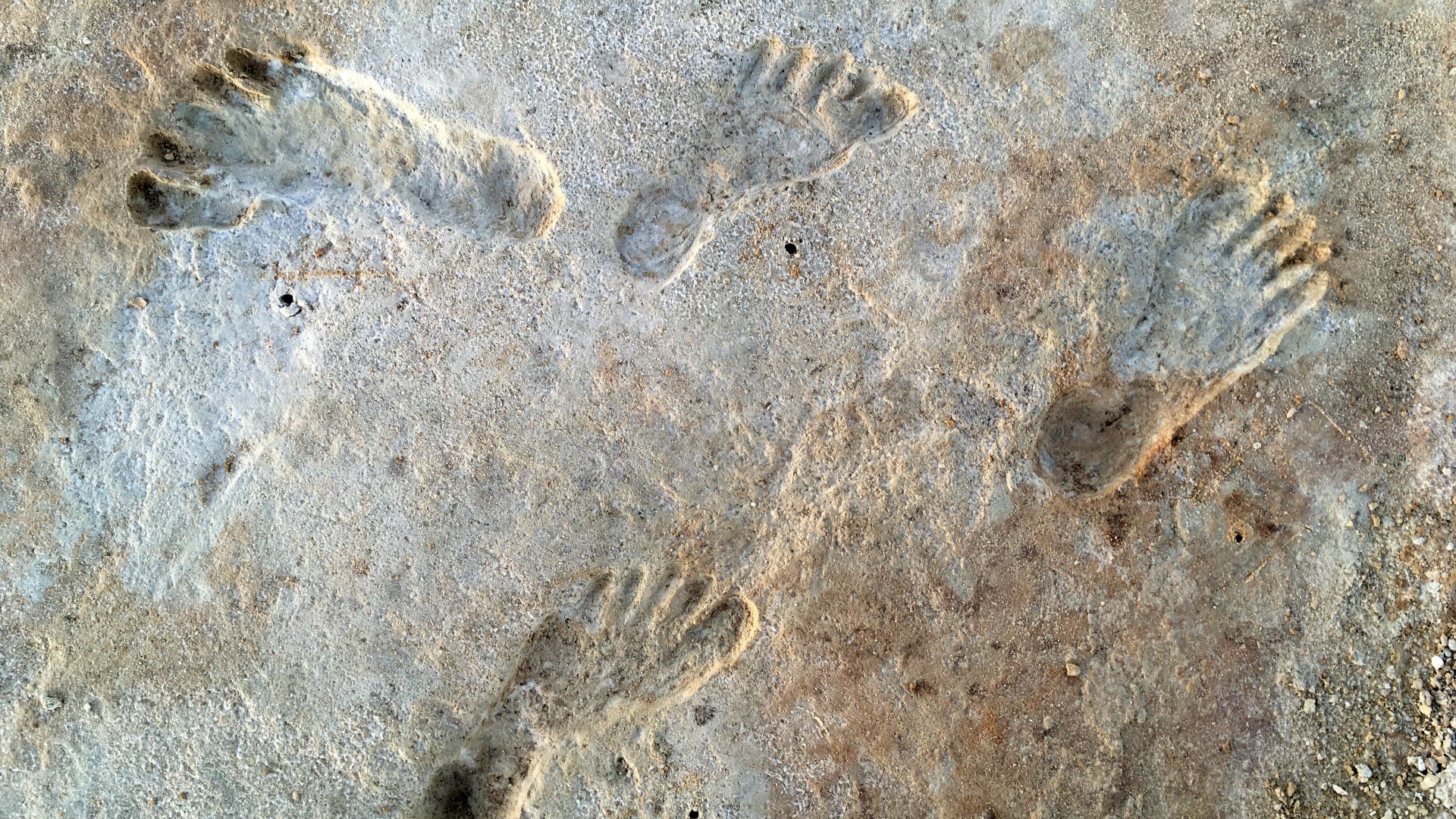
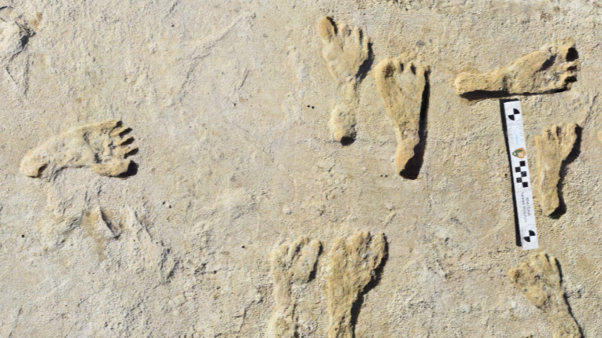
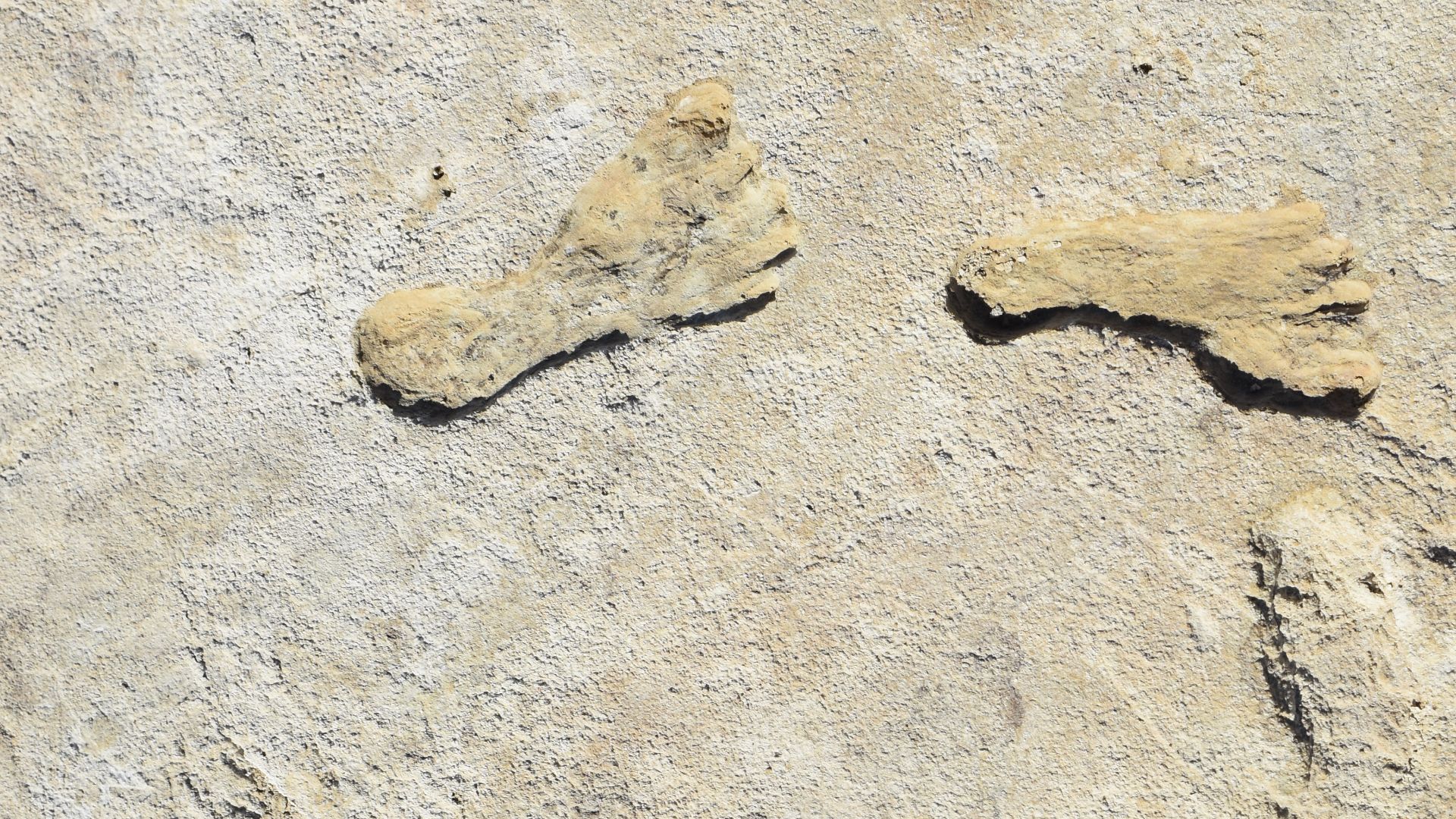
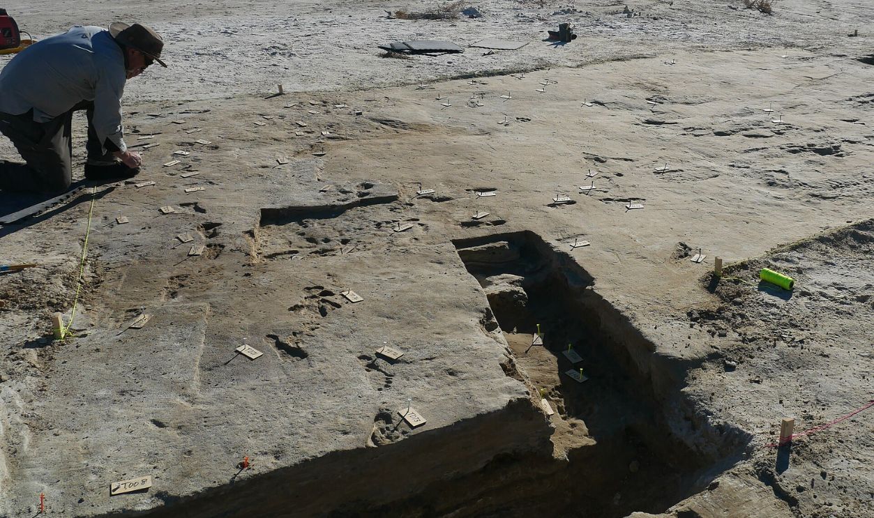
Footprints at White Sands National Park in New Mexico have been dated to about 21,000 to 23,000 years ago. Independent dating using pollen and sediment later supported the original age estimates. If correct, people were already far south of the great North American ice sheets while the Last Glacial Maximum was still underway.
 US Geological Service, Wikimedia Commons
A Lost Lake Preserved Their Footsteps
White Sands looked very different when those people walked there. The modern gypsum desert contained the much larger Lake Otero, and humans crossed wet and dry ground along its shifting margins alongside Ice Age animals. Falling lake levels created surfaces where footprints formed and were subsequently preserved by sediment.
That Creates A Route Problem
For decades, one influential model placed the first major movement into the Americas through an ice-free corridor between the Laurentide and Cordilleran ice sheets. Environmental reconstructions suggest that this corridor did not become biologically productive enough to support migrating people until after humans were already living south of the ice. That timing makes it difficult to use the corridor as the only explanation for the earliest dispersal.
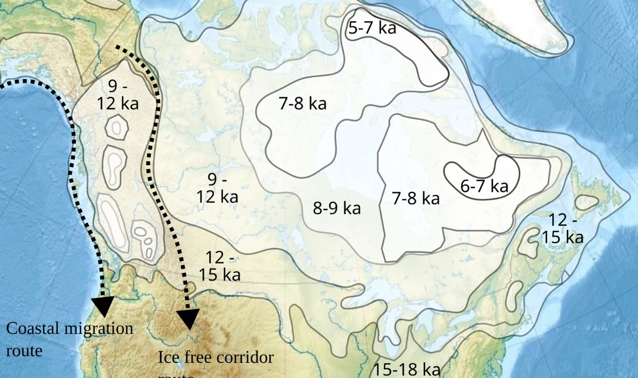 Hemiauchenia, Wikimedia Commons
The Pacific Coast Suddenly Looks Much More Important
An alternative is that early travelers moved along the Pacific edge of North America. Parts of the Alaskan and northwestern Canadian coast became ice-free early enough to make such travel possible, and coastal ecosystems could have supplied marine foods. Boats or shoreline travel may therefore have played a larger role than older land-focused models assumed.
Unfortunately, Much Of That Route Is Underwater
The strongest evidence for an early coastal migration may now lie beneath the Pacific. Post-Ice Age sea-level rise drowned former beaches, estuaries, campsites, and islands from Alaska southward. Searching only today's coastline is therefore like looking for an ancient highway while ignoring the ground where the highway actually ran.
 Answer.to.the.rock, Wikimedia Commons
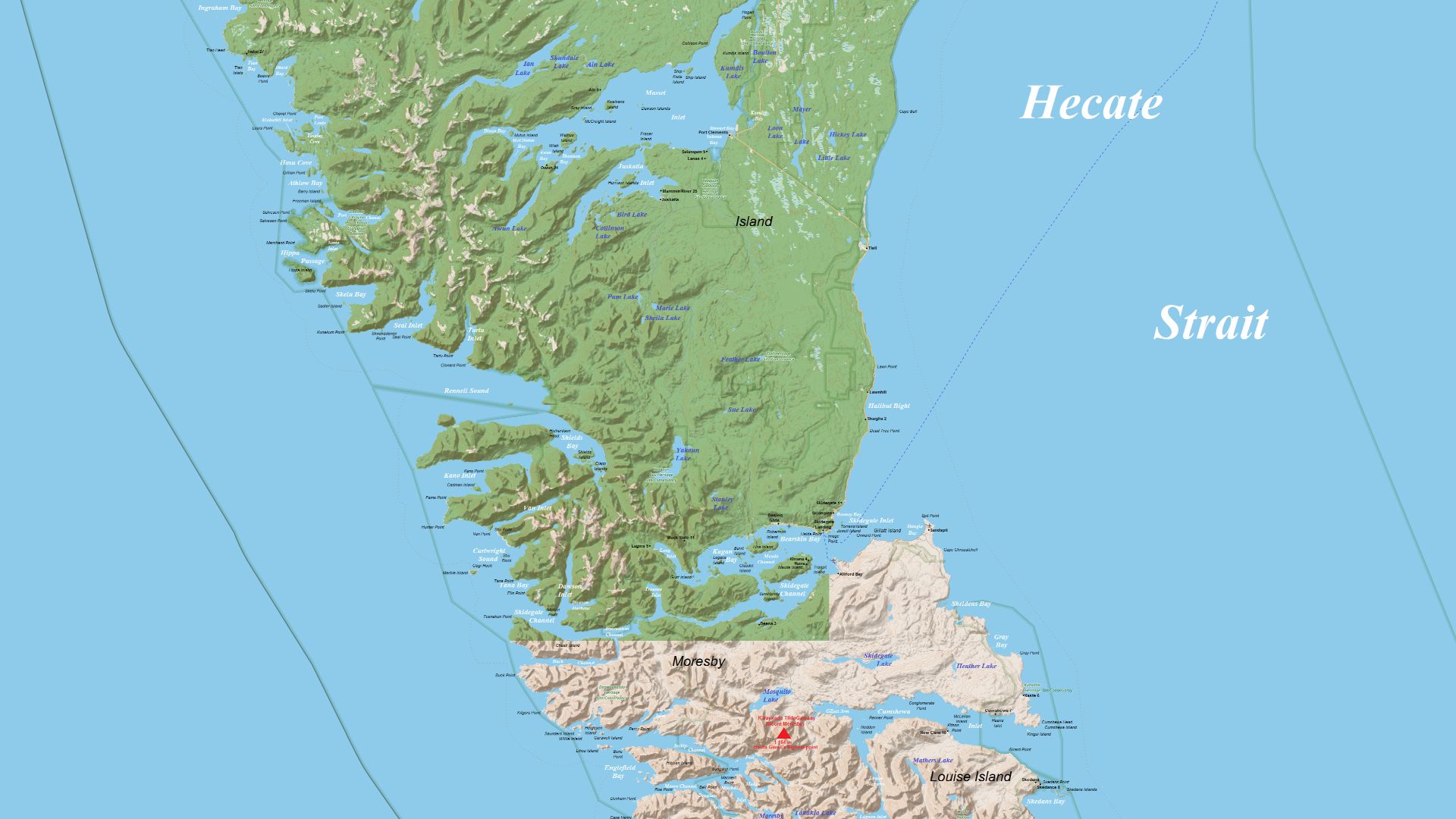
Haida Gwaii Shows What Archaeologists Are Up Against
Parks Canada says much of the early history of Haida Gwaii is now underwater because of dramatic sea-level changes between roughly 15,000 and 11,000 years ago. Researchers use reconstructed ancient shorelines, sonar, diving, cores, and underwater vehicles to identify places where people may once have lived. The project demonstrates how archaeology increasingly has to follow prehistoric coastlines into the sea.
Pacific Footprints Show People Were Coastal
Human footprints discovered on Calvert Island, British Columbia, date to roughly 13,000 years ago. They provide direct evidence of people using Canada's Pacific coast around the end of the Pleistocene. The prints do not prove how the first migrants reached the Americas, but they demonstrate that coastal populations were present very early.
Monte Verde Made A Simple Timeline Hard To Defend
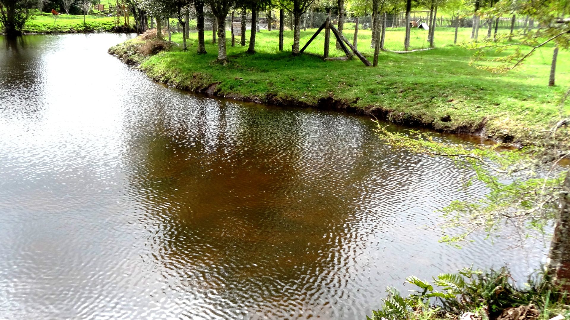
Farther south, Monte Verde in Chile became crucial because securely dated occupation there predates the traditional Clovis horizon in North America. The site's location thousands of kilometres south of Beringia implies that people had already dispersed astonishingly far by the time Clovis technology appeared. Any migration model has to leave enough time for that journey.
 Rodolfo Ditzel Lacoa, Wikimedia Commons
“Clovis First” Could Not Survive All The New Evidence
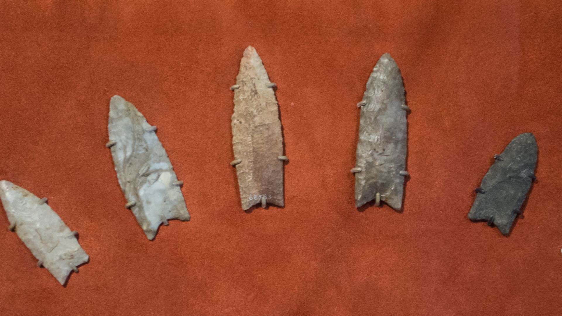
For much of the 20th century, archaeologists often treated the makers of Clovis projectile points, beginning roughly 13,000 years ago, as the first widespread inhabitants of the Americas. Sites predating Clovis gradually weakened that model. Major reviews now describe Clovis-first as effectively refuted, although the timing and routes of earlier settlement remain debated.
 Tim Evanson, Wikimedia Commons
Genetics Makes The Story Even Less Linear
Ancient genomes show that the peopling of the Americas involved population splits, expansions, and groups not represented by a single simple migration arrow. Researchers have identified complex relationships among ancient populations in Siberia, Alaska, and the Americas. The evidence favors a process unfolding over time rather than one uniform population moving south once.
 Yu et al. 2020, Wikimedia Commons
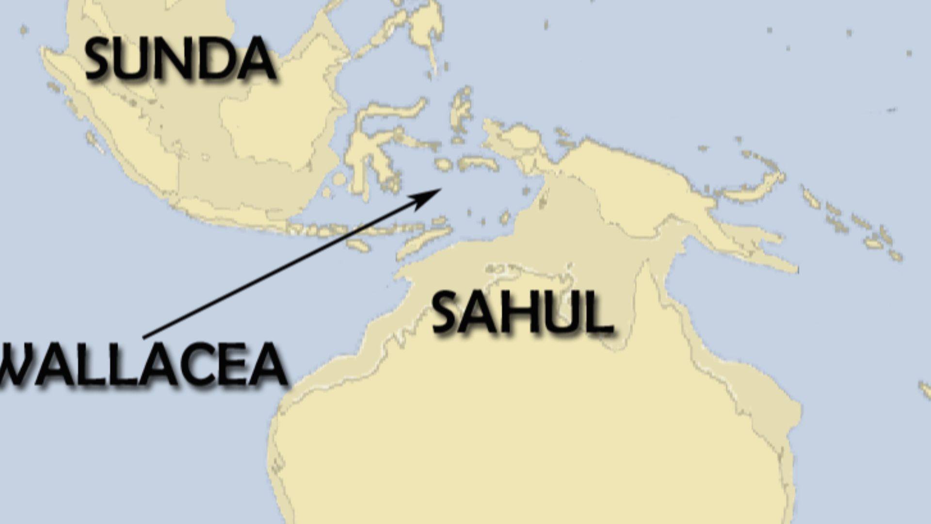
Sahul Was Another Continent We No Longer See
Australia and New Guinea were not separate landmasses through much of the Ice Age. Lower sea levels joined them, along with surrounding shelves, into the much larger continent archaeologists call Sahul. Travelers reaching this world still had to cross open water from Southeast Asia, but the land they encountered afterward looked radically different from today's map.
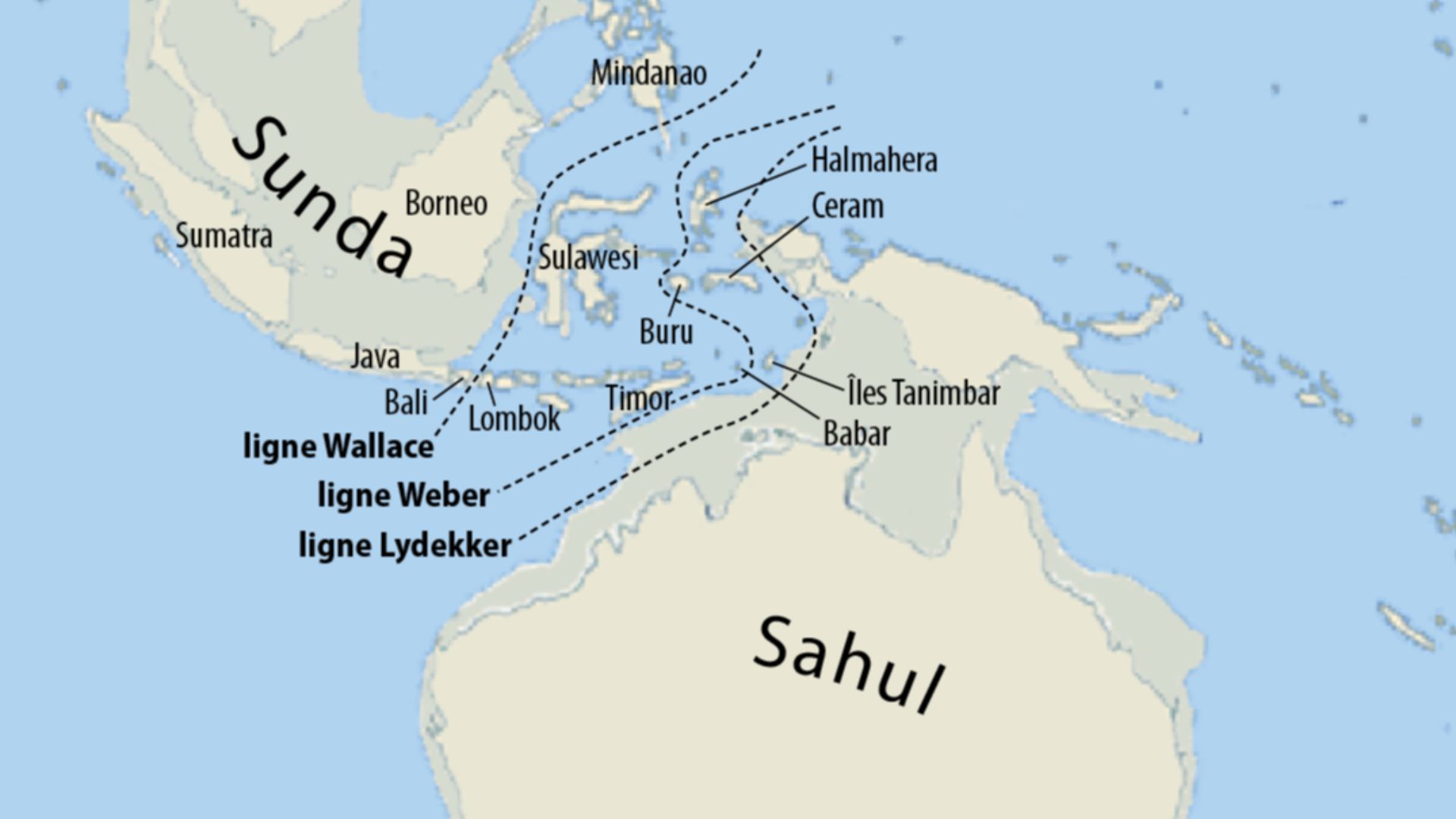 Maximilian Dörrbecker (Chumwa), Wikimedia Commons
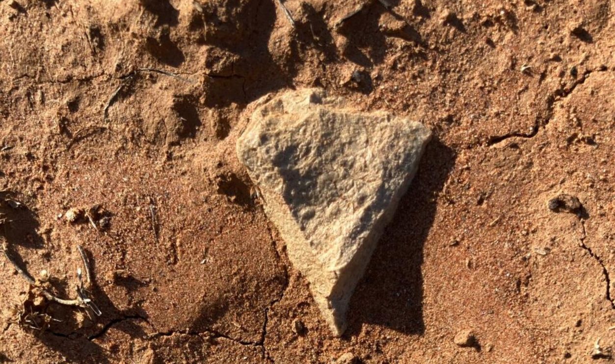
Humans Were In Northern Australia Very Early
Excavations at Madjedbebe in northern Australia produced evidence for human occupation around 65,000 years ago. Archaeologists found stone tools, grinding stones, pigments, and other materials in well-dated layers. That age places people in Sahul extraordinarily early in the broader global dispersal of Homo sapiens.
The First Journey Across Sahul Was Not Random
Researchers have reconstructed the vanished terrain of Sahul and modelled how people could have moved through it. Their work identifies broad corridors shaped by freshwater, visibility, terrain, and human walking efficiency. These “superhighways” suggest that landscape structure may have directed dispersal even when newcomers had never seen the country before.
 Christophe cagé, Wikimedia Commons
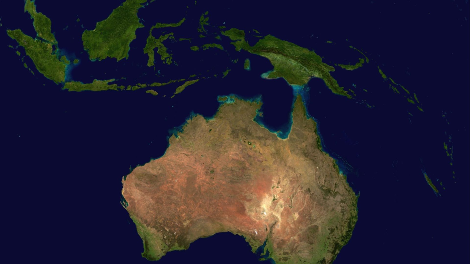
Some Of Sahul's Best Evidence May Be Drowned
Sea-level rise later separated New Guinea from Australia and submerged extensive lowlands around Sahul's margins. If the earliest arrivals initially occupied coastal environments, many of those sites are now inaccessible to conventional excavation. Inland sites such as Madjedbebe may therefore represent only one surviving portion of a much larger settlement landscape.
Sundaland Was A Lost Southeast Asian World
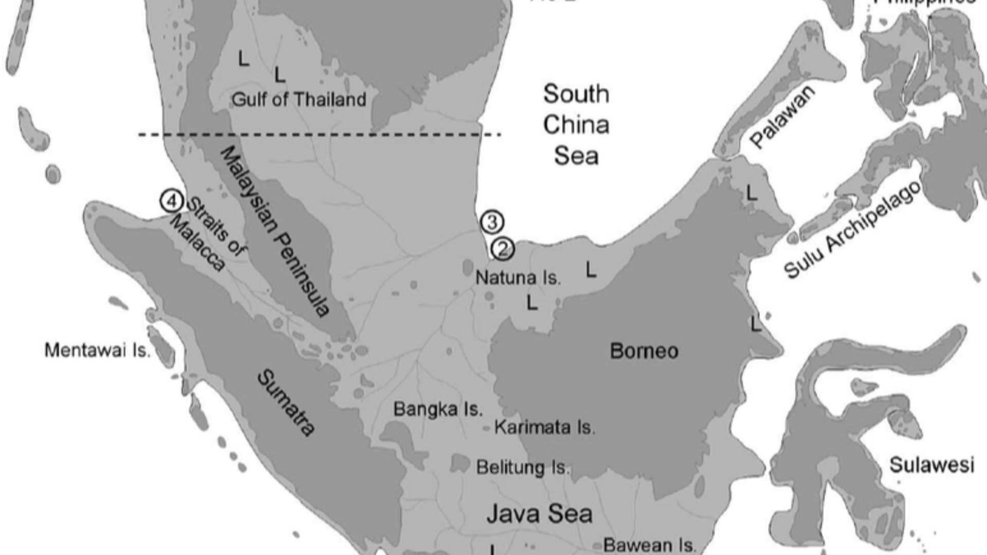
Western Indonesia also looked dramatically different. During low sea-level periods, the Malay Peninsula, Sumatra, Java, Borneo, and broad areas between them formed the enormous exposed region known as Sundaland. Modern seas cover much of the terrain through which animals and humans once moved.
Rising Water Reshaped Human Geography There
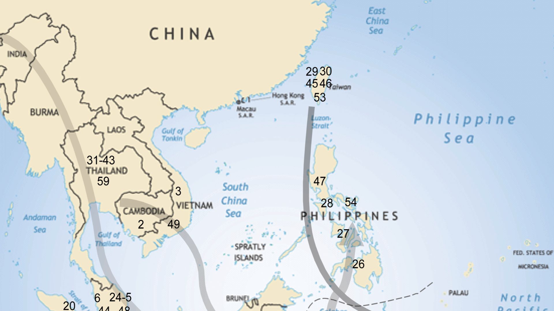
A 2023 study combining paleogeographic reconstruction with modern genomic data concluded that postglacial flooding removed more than half of Sundaland's exposed land area. The researchers linked rapid sea-level rise with population fragmentation and subsequent migration. In this case, drowning the landscape did not simply erase evidence because it may also have helped move people elsewhere.
The Seabed Is Producing Fossils Too
Recent work in the Madura Strait off Java has identified fossils dredged from what was once a river valley on submerged Sundaland. More than 6,000 vertebrate fossils were recovered, including two skull fragments attributed to Homo erectus. The discovery shows how landscapes now buried beneath marine sediments can preserve evidence unavailable on today's islands.
 Internet Archive Book Images, Wikimedia Commons
Arabia Was Not Always A Desert Barrier
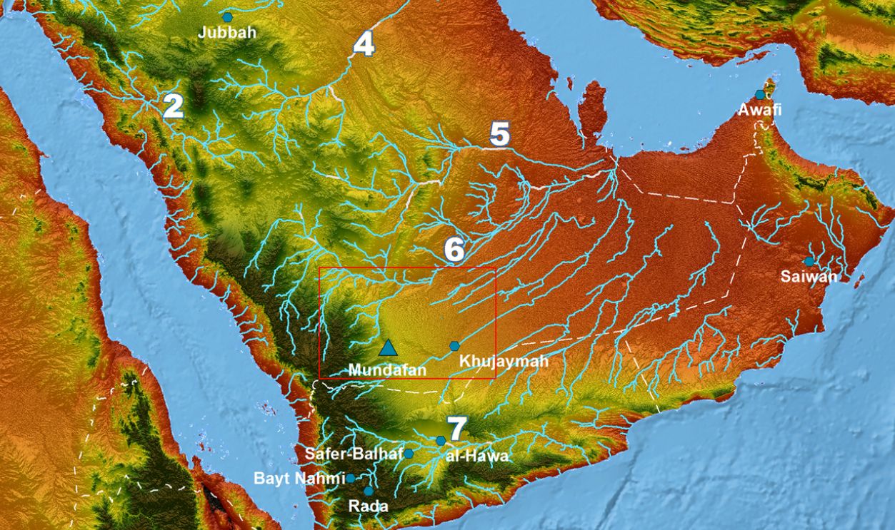
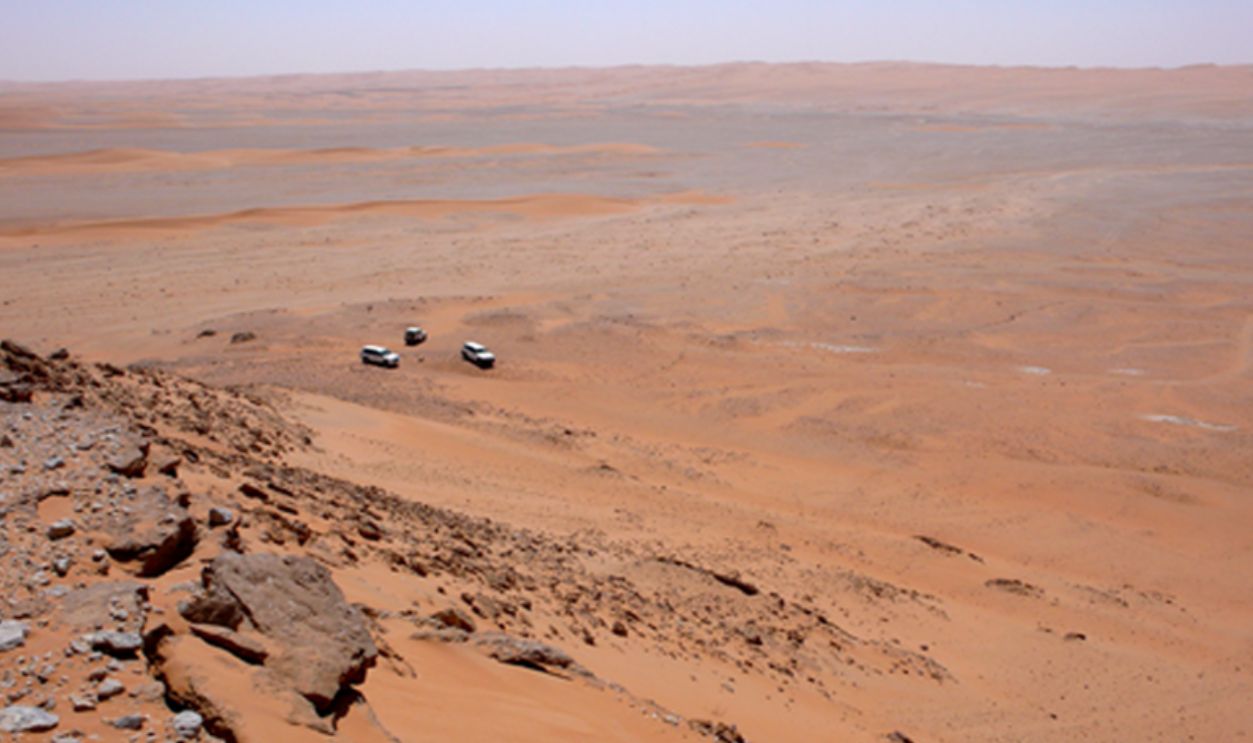
The Arabian Peninsula is often imagined as a harsh obstacle separating Africa from Eurasia. Pleistocene Arabia repeatedly became wetter, producing lakes, grasslands, and expanded animal habitats. Archaeological work in today's Nefud Desert has revealed human occupations tied closely to those greener phases.
 Rémy Crassard, Wikimedia Commons
People Entered Arabia Again And Again
Research at ancient lake basins has identified at least five periods of hominin expansion into northern Arabia over roughly 400,000 years. Different stone-tool traditions appear in different wet phases, suggesting repeated arrivals rather than continuous occupation by one population. Climate periodically opened a landscape corridor and then shut it down again.
 Rémy Crassard, Wikimedia Commons
“Green Arabia” Changes Out-Of-Africa Stories
These findings complicate the idea of one decisive migration out of Africa. Southwest Asia seems to have alternated between connection and isolation as rainfall patterns changed. Populations of different hominins may repeatedly have expanded, contracted, and encountered one another across regions that are arid today.
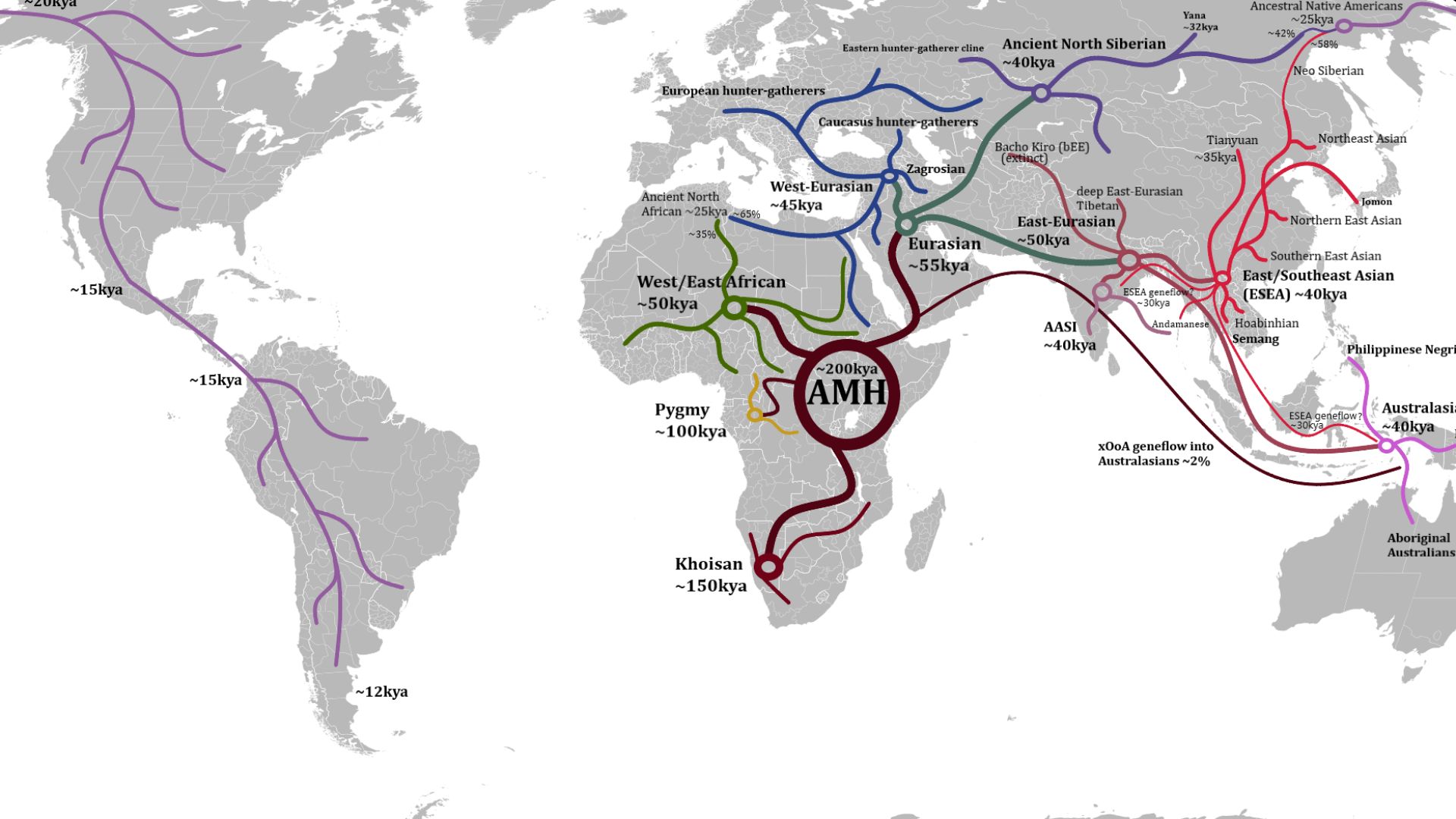
The Red Sea Coast Has Its Own Missing Record
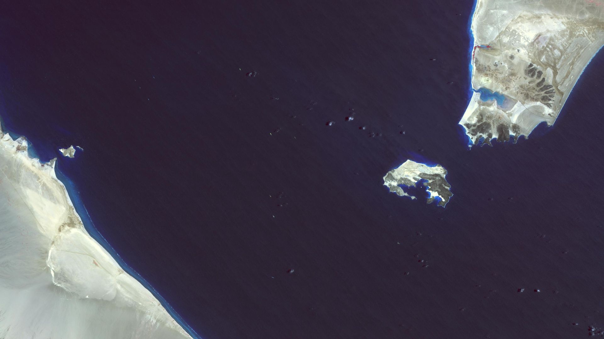
Another proposed dispersal route runs along the Red Sea and across or near the Bab al-Mandab strait. Archaeological work in Eritrea has found Middle Stone Age tools along ancient coastal environments, adding evidence that humans occupied this broader zone. Yet many Pleistocene shorelines relevant to the southern route are now underwater, making the hypothesis unusually difficult to test.
 NASA/METI/AIST/Japan Space Systems, and U.S./Japan ASTER Science Team, Wikimedia Commons
Europe Lost An Entire Landscape Too
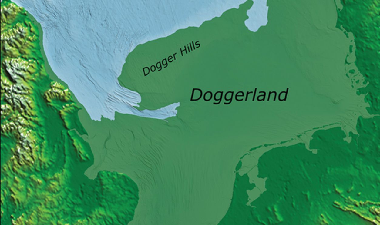
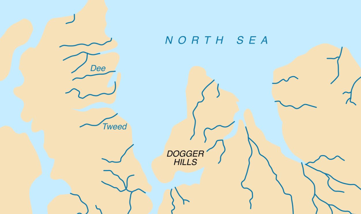
The North Sea once covered far less area than it does today. Britain was connected to continental Europe through the inhabited plains, wetlands, rivers, and coastlines collectively called Doggerland. Archaeologists have recovered Mesolithic tools and animal remains from the seabed, confirming that people occupied parts of this vanished world.
 James Walker, Wikimedia Commons
Doggerland Was More Than Britain's Bridge
Researchers increasingly object to describing Doggerland merely as the land bridge people crossed to reach Britain. It was a substantial landscape where hunter-gatherers could have lived, moved seasonally, gathered resources, and maintained connections across northwestern Europe. Once that region disappeared, archaeologists effectively lost a major piece of the continent's settlement record.
Rising Seas Changed Connections As Well As Coastlines
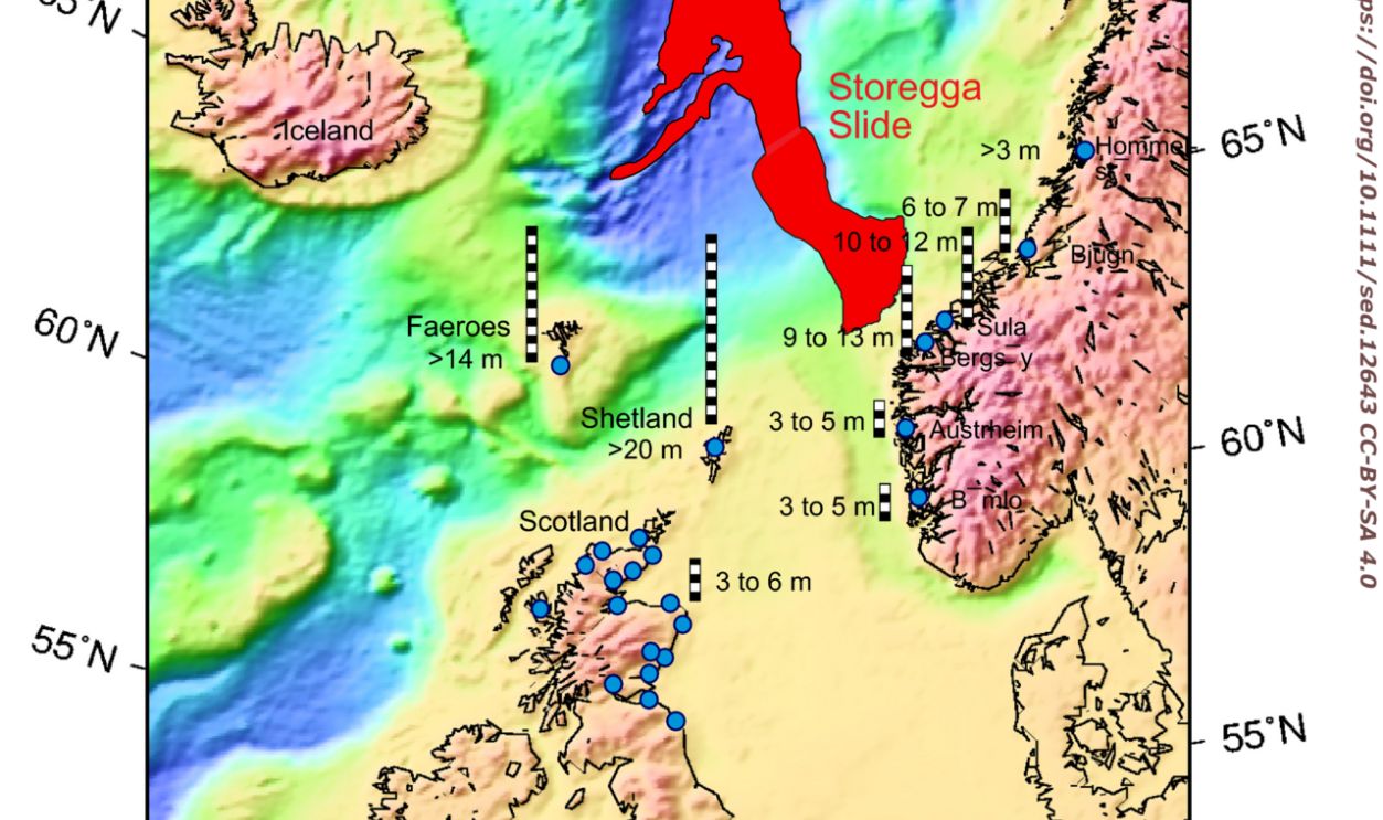
Doggerland gradually fragmented as postglacial seas rose, eventually separating Britain from continental Europe. The Storegga tsunami struck the region around 8,150 years ago, although newer research argues against the simplistic idea that a single wave alone destroyed all of Doggerland. Gradual inundation had already transformed where communities could live and how they remained connected.
 Alastair G. Dawson et Sue Dawson, Wikimedia Commons
Archaeology Has A Giant Sampling Problem
The easiest archaeological sites to excavate today are on dry land, which creates an unavoidable bias. If ancient people favored coasts, rivers, estuaries, and low plains, some of their most attractive landscapes were precisely the ones most likely to disappear when Ice Age seas rose. What survives above water may therefore be a distorted sample of where people actually lived.
Underwater Archaeology Is Beginning To Correct It
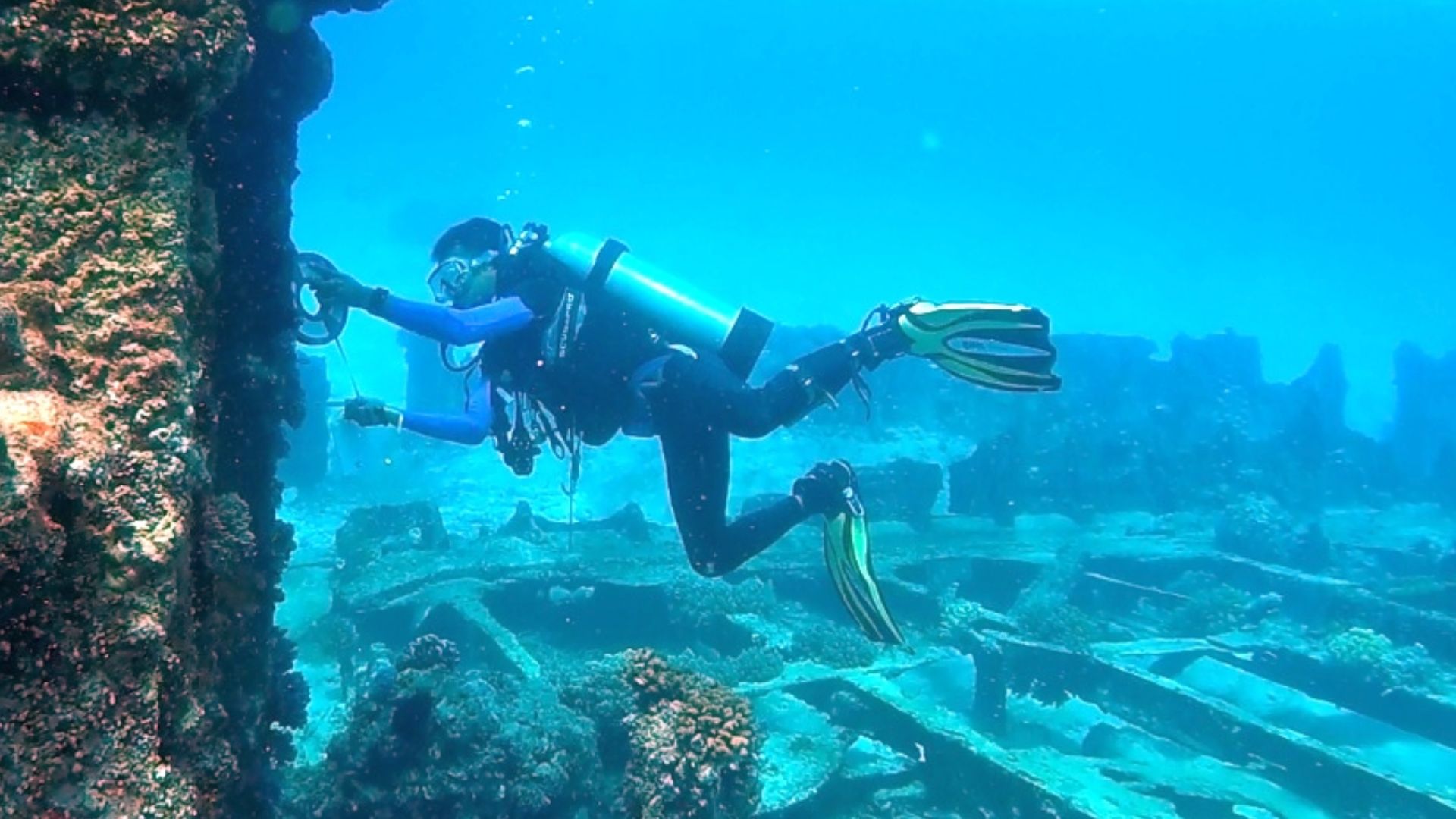
Researchers now combine sonar, sediment cores, ancient sea-level models, geophysics, diving, remotely operated vehicles, and data from offshore industries to reconstruct lost terrain. This work can identify drowned rivers, lakes, shorelines, and locations with high archaeological potential. Instead of treating the modern seafloor as an empty boundary, archaeologists increasingly approach it as buried landscape.
 Dwi sumaiyyah makmur, Wikimedia Commons
Human Migration Was Probably A Series Of Windows
The new picture is less like arrows drawn permanently across a map and more like doors opening and closing. Lower seas created land, wetter climates turned deserts green, retreating ice exposed coastlines, and rising water later severed routes that had existed for thousands of years. People responded to those opportunities repeatedly rather than simply following one predetermined path.
 Esteban Ortiz-Ospina, Wikimedia Commons
The Biggest Discovery May Still Be Underwater
Evidence from White Sands, Beringia, Sahul, Arabia, Sundaland, and Doggerland already shows how dramatically changing landscapes alter migration stories. Yet many of the places most likely to preserve the missing chapters are precisely the landscapes now submerged beneath continental shelves. The next major revision to human prehistory may begin not with an excavation trench, but with a map of a coast that no longer exists.
You May Also Like:
The Ice Age Migration Routes Out Of Africa That May Be Hidden Underwater Today
Ancient Artifacts That Were Discovered Thousands Of Miles From Their Place Of Origin
Ancient Routes That Modern Travelers Can Still Follow—Which One Would You Explore First?
Sources: 1, 2, 3, 4, 5, 6, 7, 8, 9, 10, 11, 12, 13, 14, 15, 16, 17, 18, 19, 20, 21, 22, 23, 24, 25, 26, 27, 28, 29, 30, 31, 32, 33







.JPG)