A Beach That Doesn’t Keep Secrets for Long
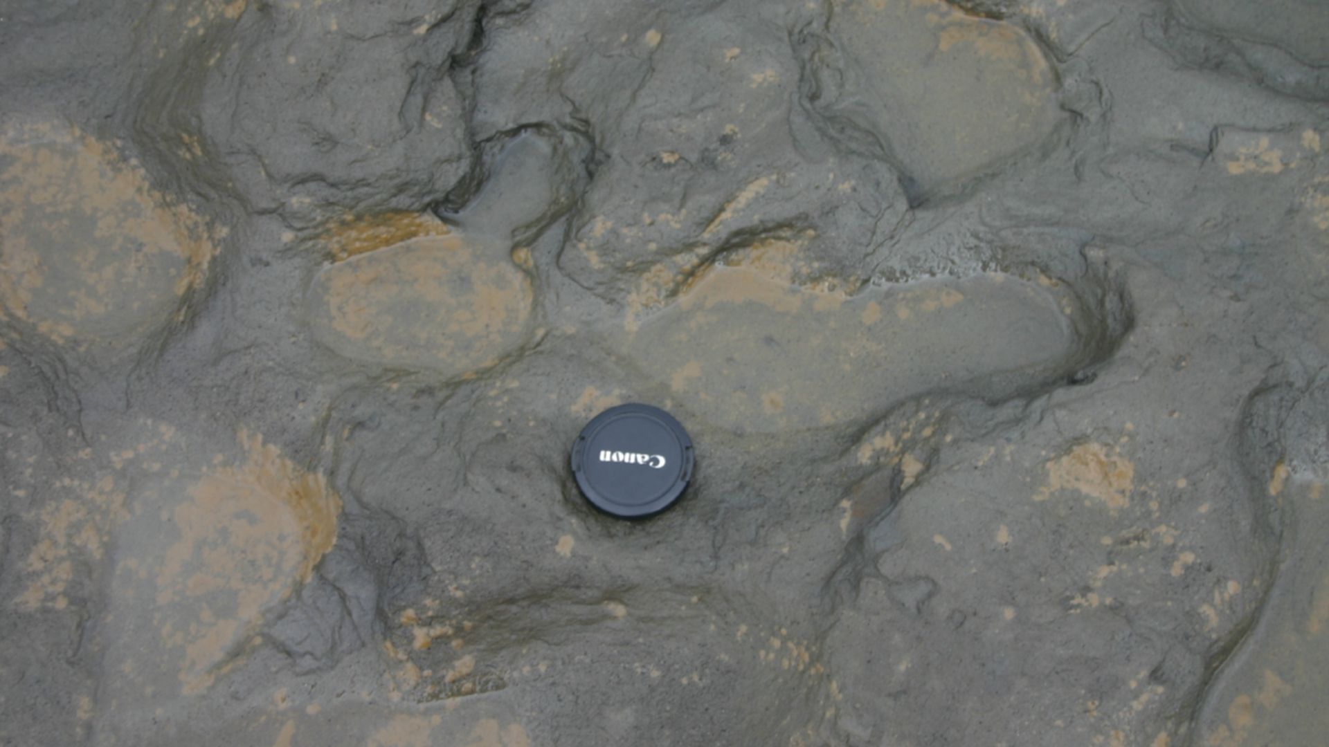
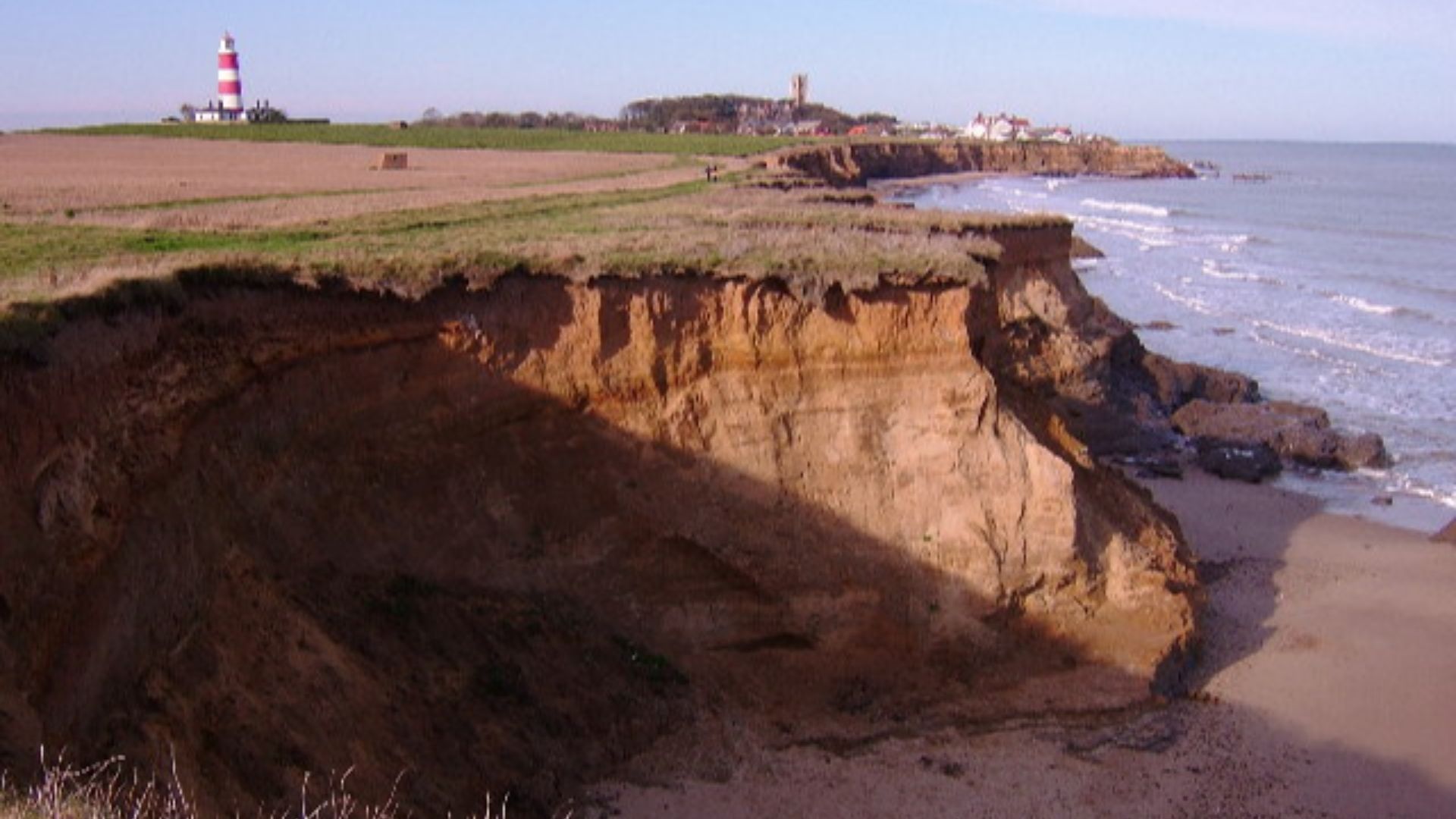
Along the coast of Happisburgh, a quiet village in Norfolk, England, the North Sea is slowly chewing away at the land. It’s been happening for years—but in May 2013, something incredible happened. After a storm and a rare low tide, the sand pulled back… and revealed ancient human footprints that had been hidden for nearly a million years.
And the story they tell is truly remarkable.
The Discovery That Caught Everyone Off Guard
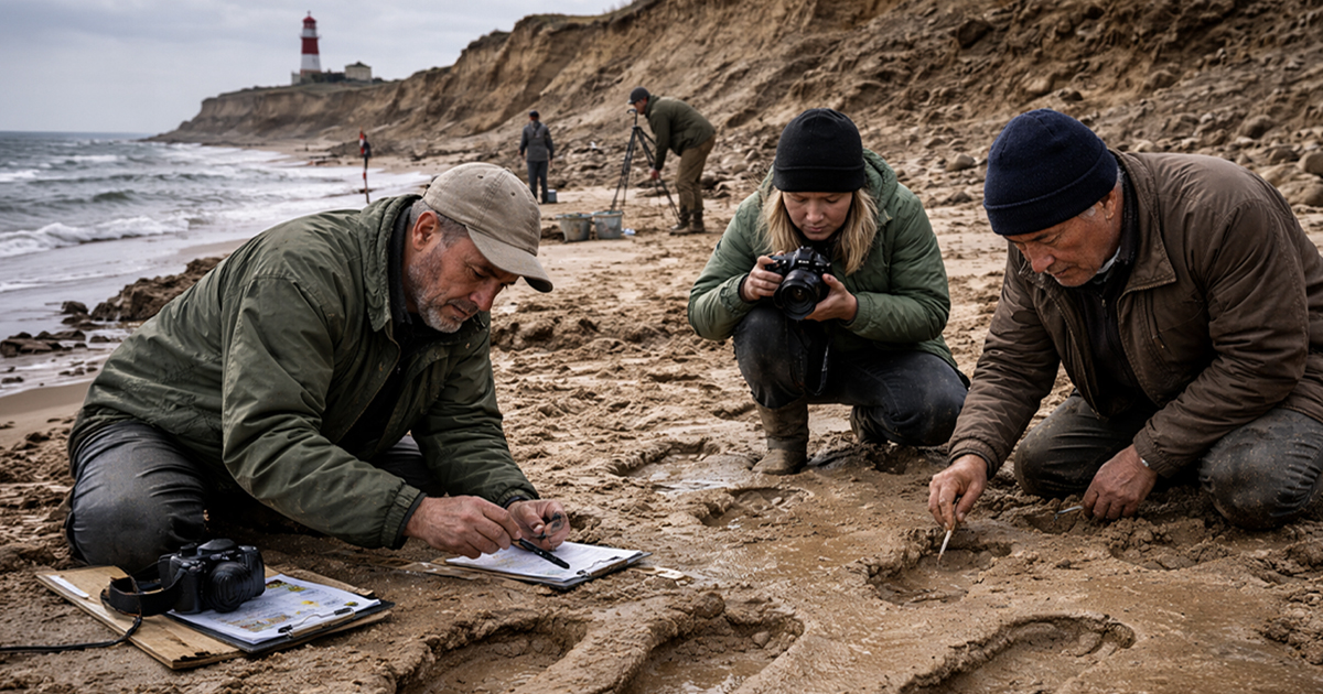
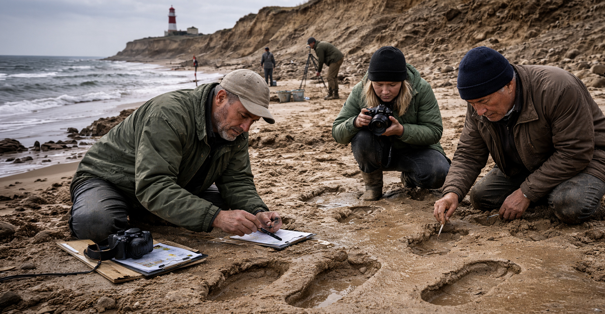
The footprints were first spotted by researchers from the Pathways to Ancient Britain project, including Dr Nick Ashton from the British Museum. At first, they thought it might just be odd markings in the mud—but it didn’t take long to realize they were looking at actual human footprints. Ashton later called the discovery “completely unexpected.”

Almost a Million Years Old
Once scientists took a closer look, they realized just how big this find was. The footprints were dated to around 800,000 to 900,000 years ago, making them the oldest human footprints ever found outside of Africa. The findings were later published in PLOS ONE in 2014, confirming just how rare and important this discovery really was.
 Martin Bates, Wikimedia Commons
Who Were These People?
The footprints are believed to have been made by Homo antecessor, one of the earliest human species to live in Europe. They weren’t quite like us, but they weren’t completely different either. These early humans lived by hunting, gathering, and adapting to a world filled with massive animals like mammoths and ancient deer.
 Emoke Denes, Wikimedia Commons
Not Just One Set of Tracks
This wasn’t just a single person passing through. Researchers identified at least five individuals, based on the different sizes of the footprints. Some were clearly adults, while others were much smaller—likely children. That means this wasn’t just a random moment… it was probably a group moving together.
A Family Walk, Frozen in Time
When you really think about it, this is the wild part. These footprints likely captured a single moment—maybe just a few minutes—almost a million years ago. Dr Isabelle De Groote explained that this kind of find gives us a rare glimpse into “a moment of activity” from the distant past.
What They Were Doing There
The group was probably walking along an ancient estuary, where a river met the sea. This area would’ve been rich in food—shellfish, plants, maybe even small animals. Basically, it was a good place to survive. The footprints suggest they were moving together along the muddy shoreline.

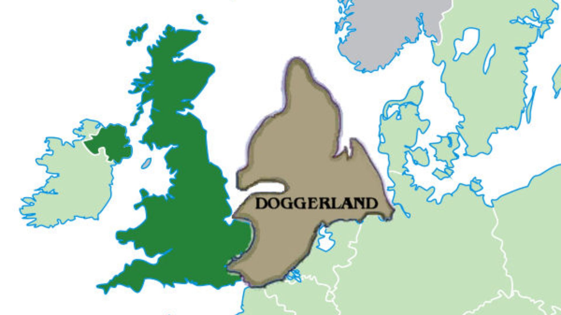
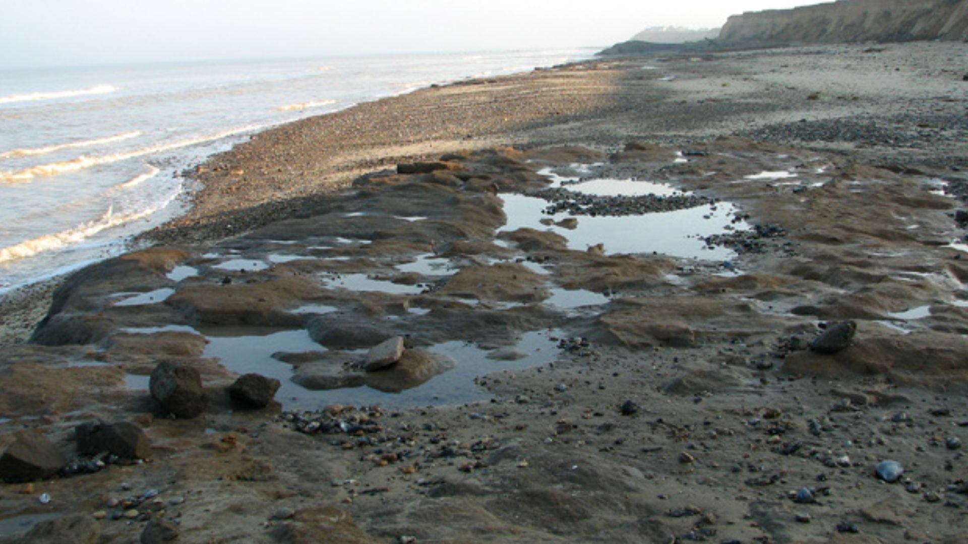
Britain Wasn’t Even an Island Yet
Here’s something that makes it even crazier—Britain wasn’t an island back then. It was connected to mainland Europe by a landmass called Doggerland. So these early humans didn’t cross water to get here… they just walked.
A Climate That Shouldn’t Have Worked
For a long time, scientists thought early humans couldn’t survive this far north because of the cold. But these footprints prove otherwise. During warmer periods, early humans adapted and made it work—even in places like ancient England.
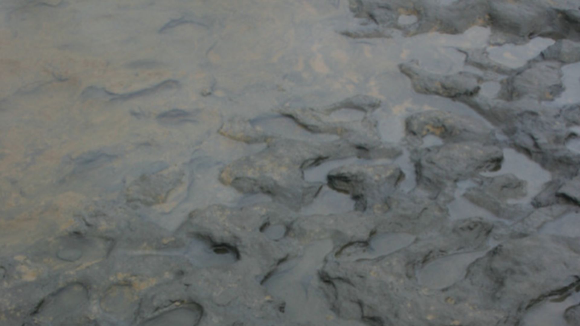
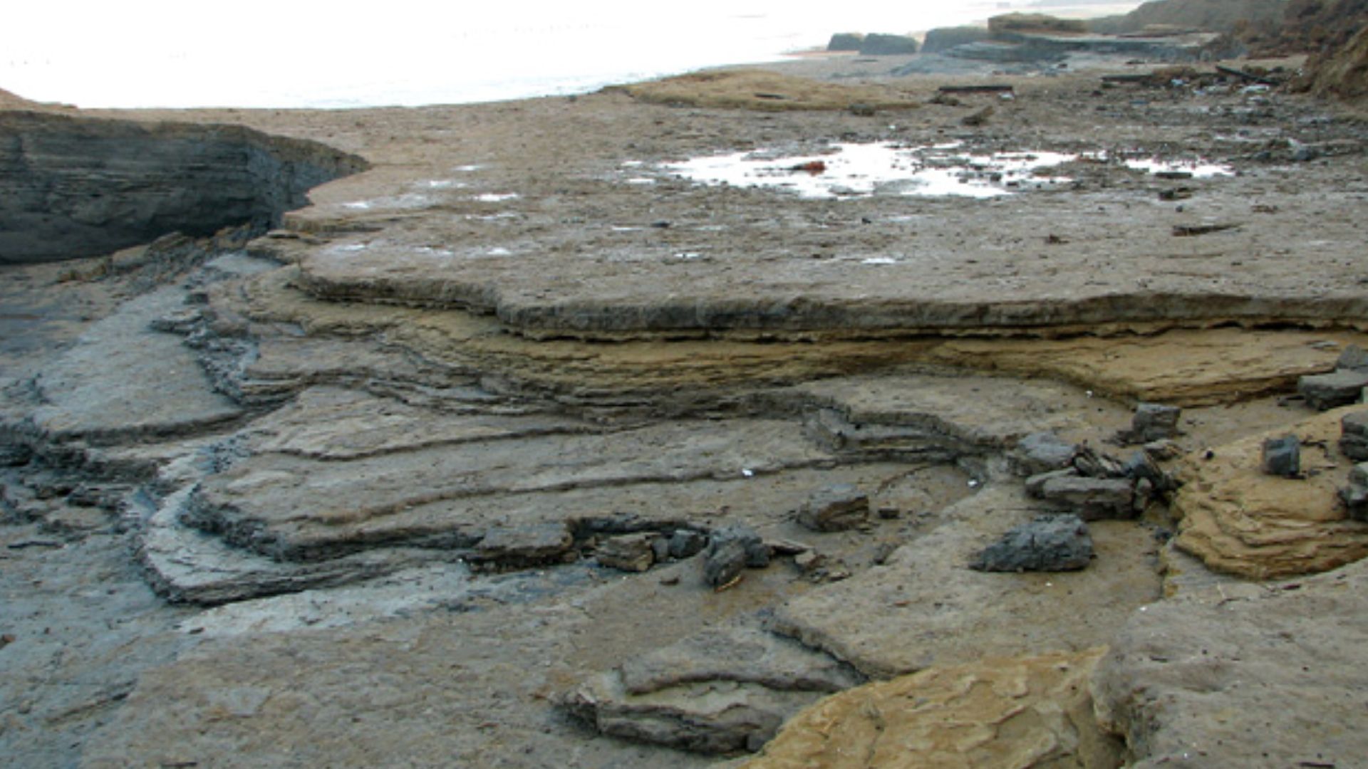
But how did these footprints last so long?
Everything Had to Go Perfectly
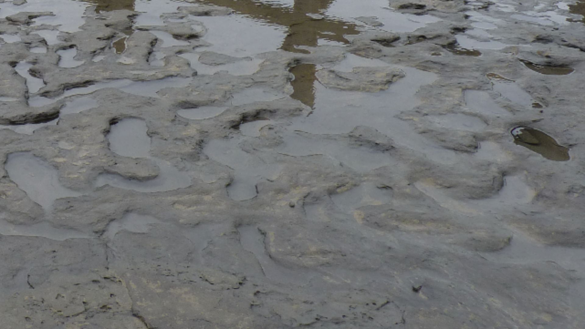
For footprints to last nearly a million years, a very specific chain of events had to happen. The mud had to be soft enough to hold the shape, then quickly covered by sediment, and then protected for hundreds of thousands of years. It’s the kind of thing that almost never happens.
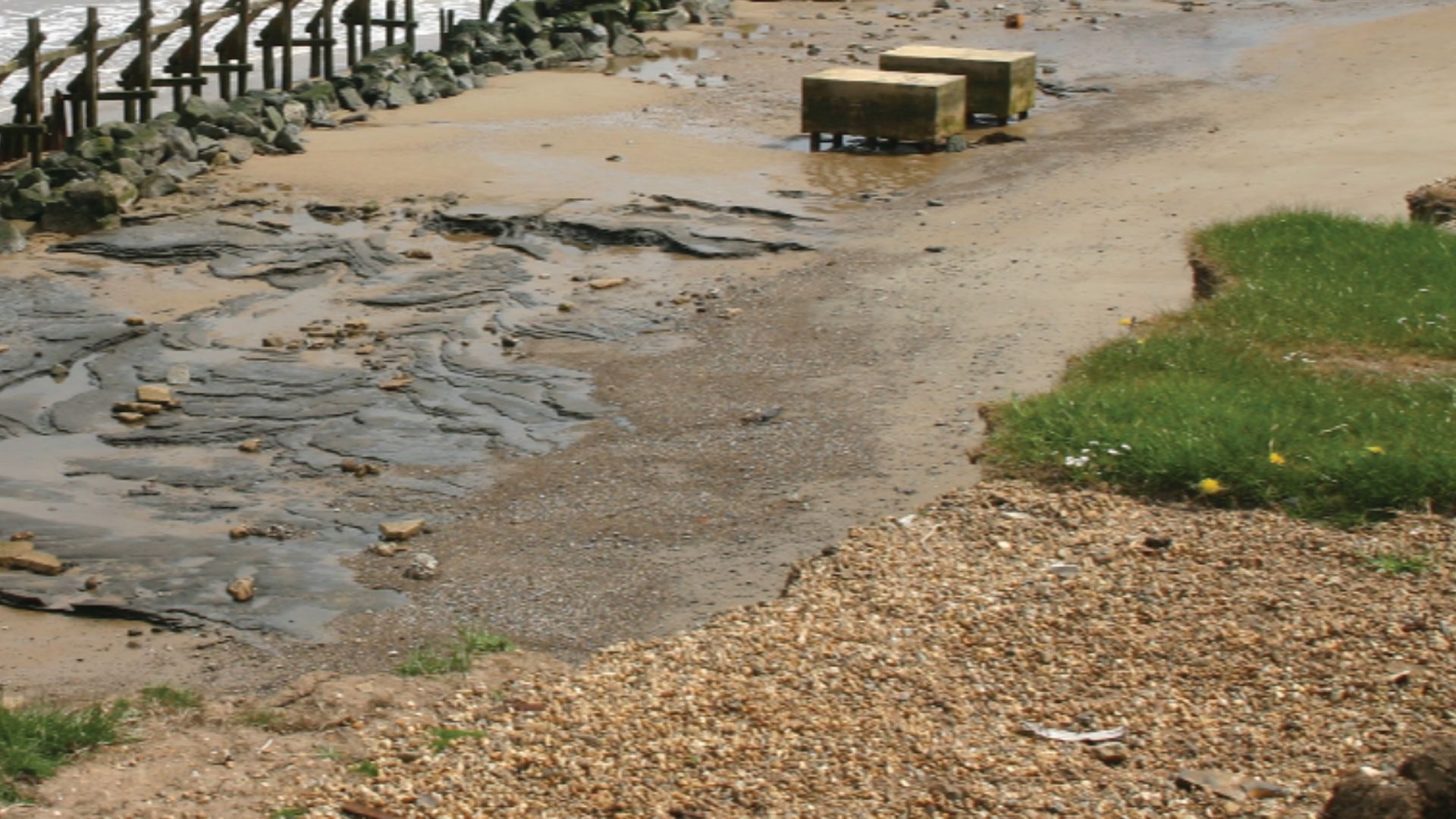
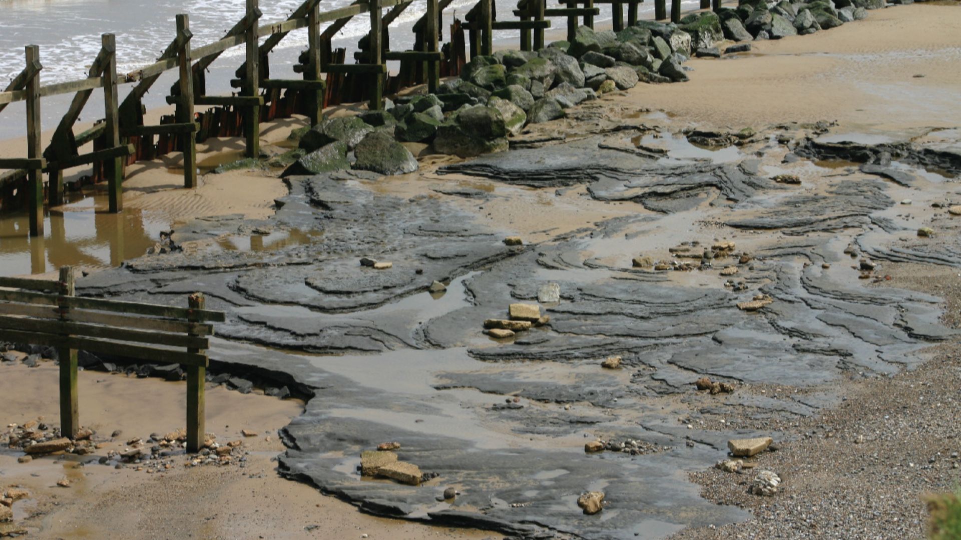
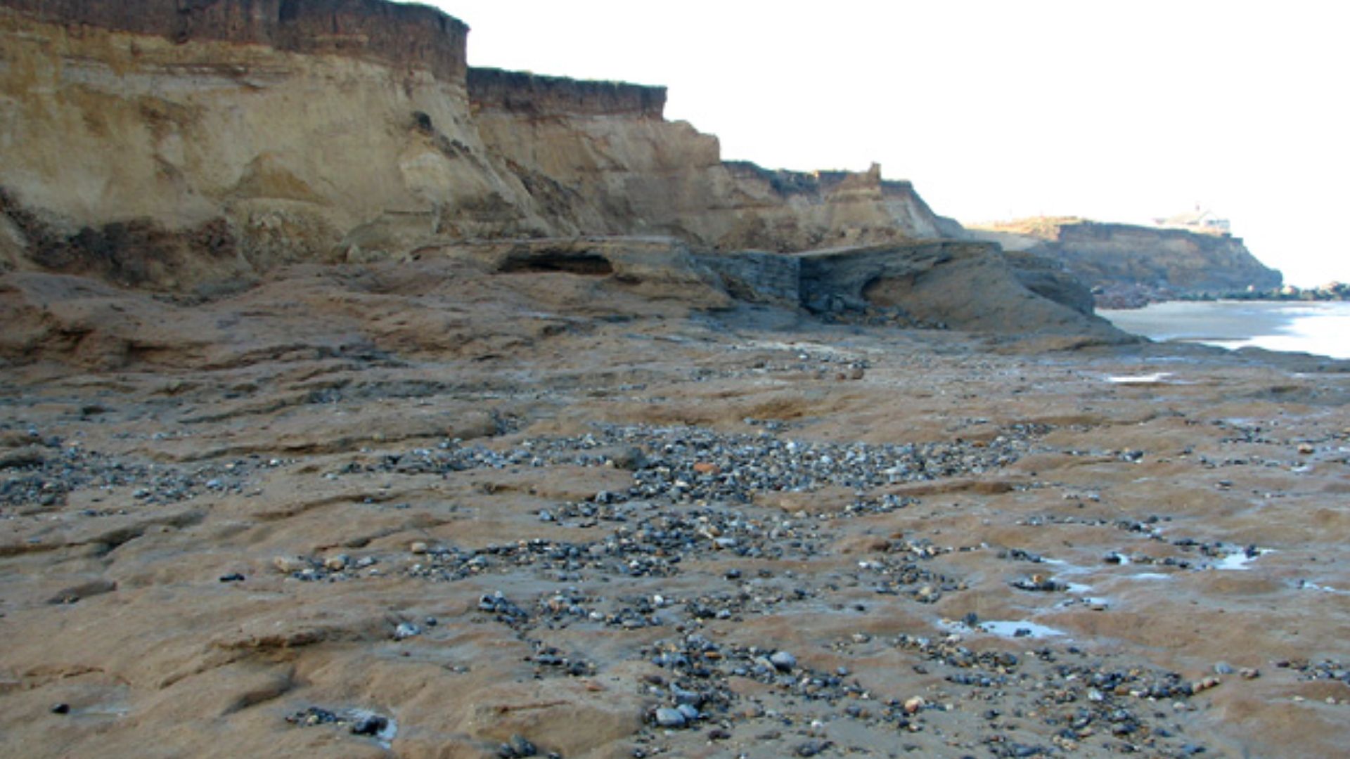
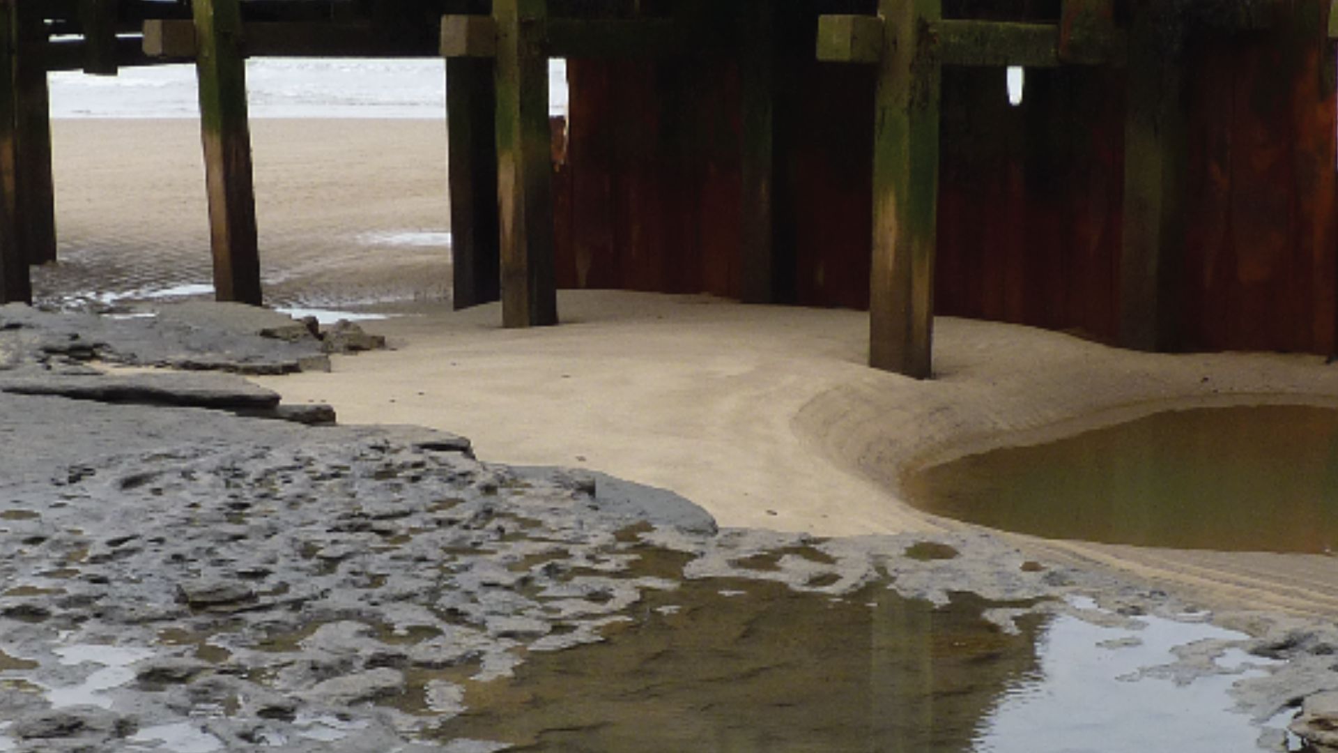
And Then the Sea Gave Them Back
For all that time, the footprints stayed hidden underground—until coastal erosion finally exposed them. The same force that’s been destroying the coastline is what revealed them in the first place.
But this isn't necessarily a good thing.
 Evelyn Simak , Wikimedia Commons
The Clock Started Immediately
Here’s the problem: the moment the footprints were exposed, they started disappearing. Waves, wind, and tides began breaking them down almost right away. What had lasted nearly a million years suddenly had only days left.
Researchers had to act fast.
 Martin Bates, Wikimedia Commons
An Archaeological Emergency
Dr Nick Ashton described it as an “archaeological emergency,” and that’s not an exaggeration. The team knew they had a very short window to study something incredibly rare before it was gone forever.
And it wasn't easy.
 Jim Whiteside, Wikimedia Commons
Racing Against the Tide
Archaeologists rushed to the site and worked between tides, sometimes with just a few hours to document everything. The conditions weren’t great—wet, muddy, and constantly changing—but they had no choice but to move fast.

Saving Them Digitally
Since there was no way to physically preserve the footprints, the team used 3D scanning and photogrammetry to record them. This allowed them to create detailed digital models that could be studied long after the real prints were gone.
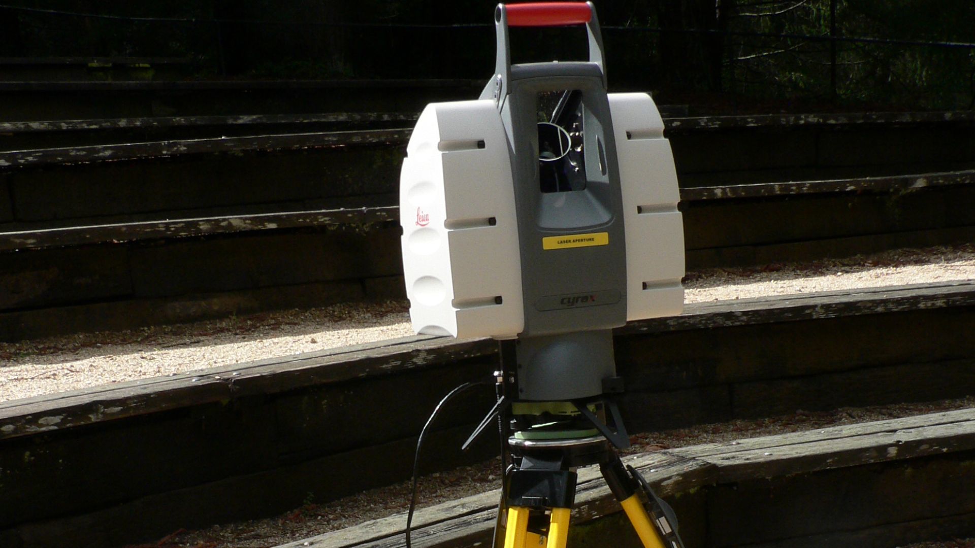 David Monniaux, Wikimedia Commons
Gone Within Weeks
And just like that, they disappeared. Within about two weeks, most of the footprints had been completely erased by the sea. After nearly a million years of survival, they were gone in days.
But that's not the end of the story.
 Evelyn Simak , Wikimedia Commons
But It Didn’t End There
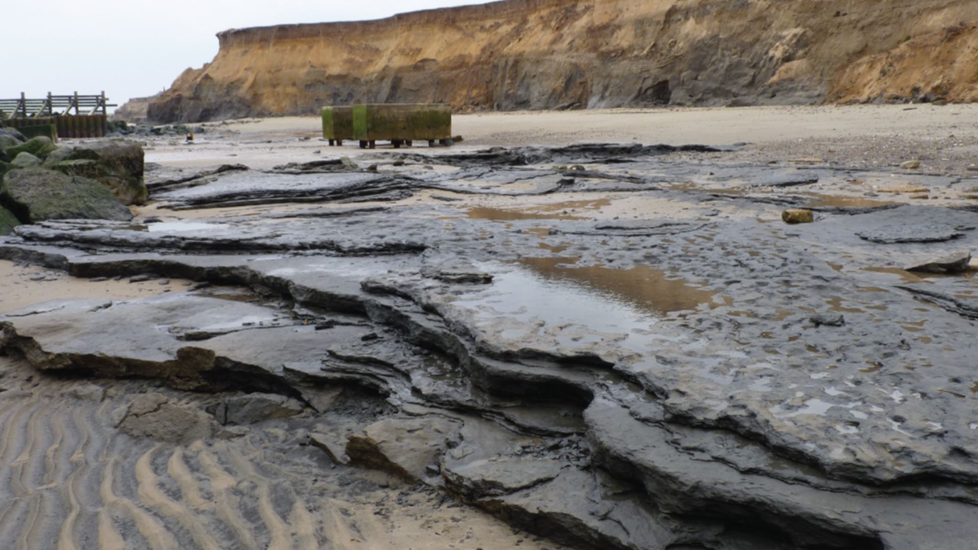
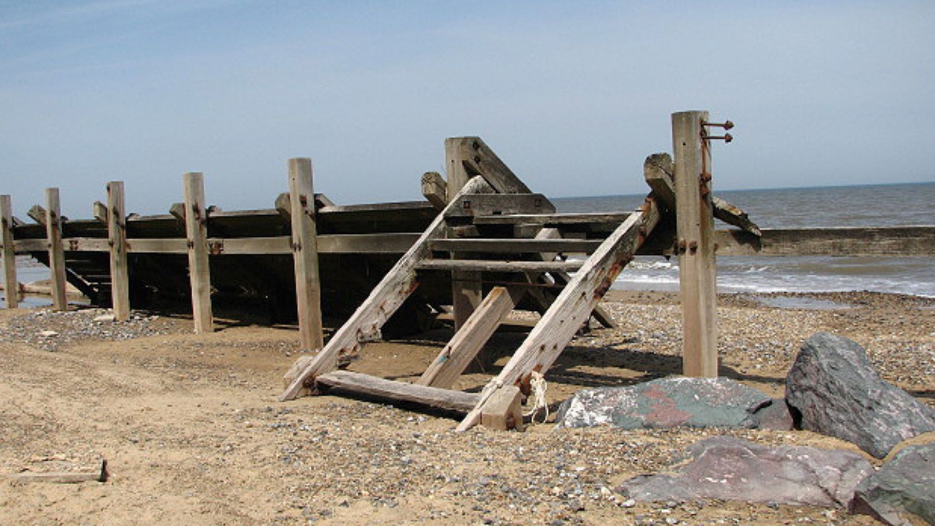
The Happisburgh coast is still eroding today, and new discoveries continue to pop up from time to time. Archaeologists have also found stone tools and animal remains in the area, showing that early humans used this region more than once.
 Solipsist~commonswiki, Wikimedia Commons
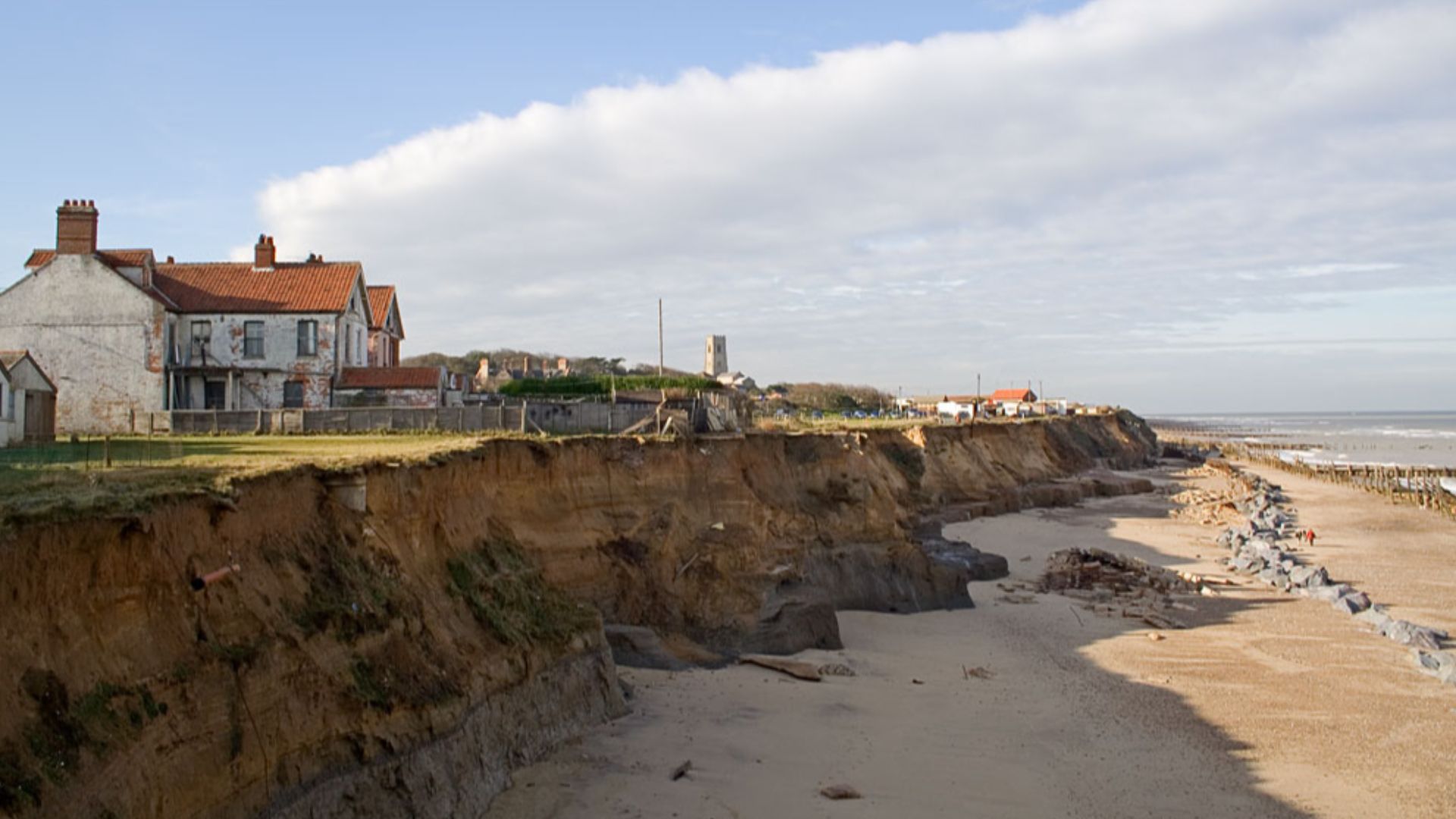
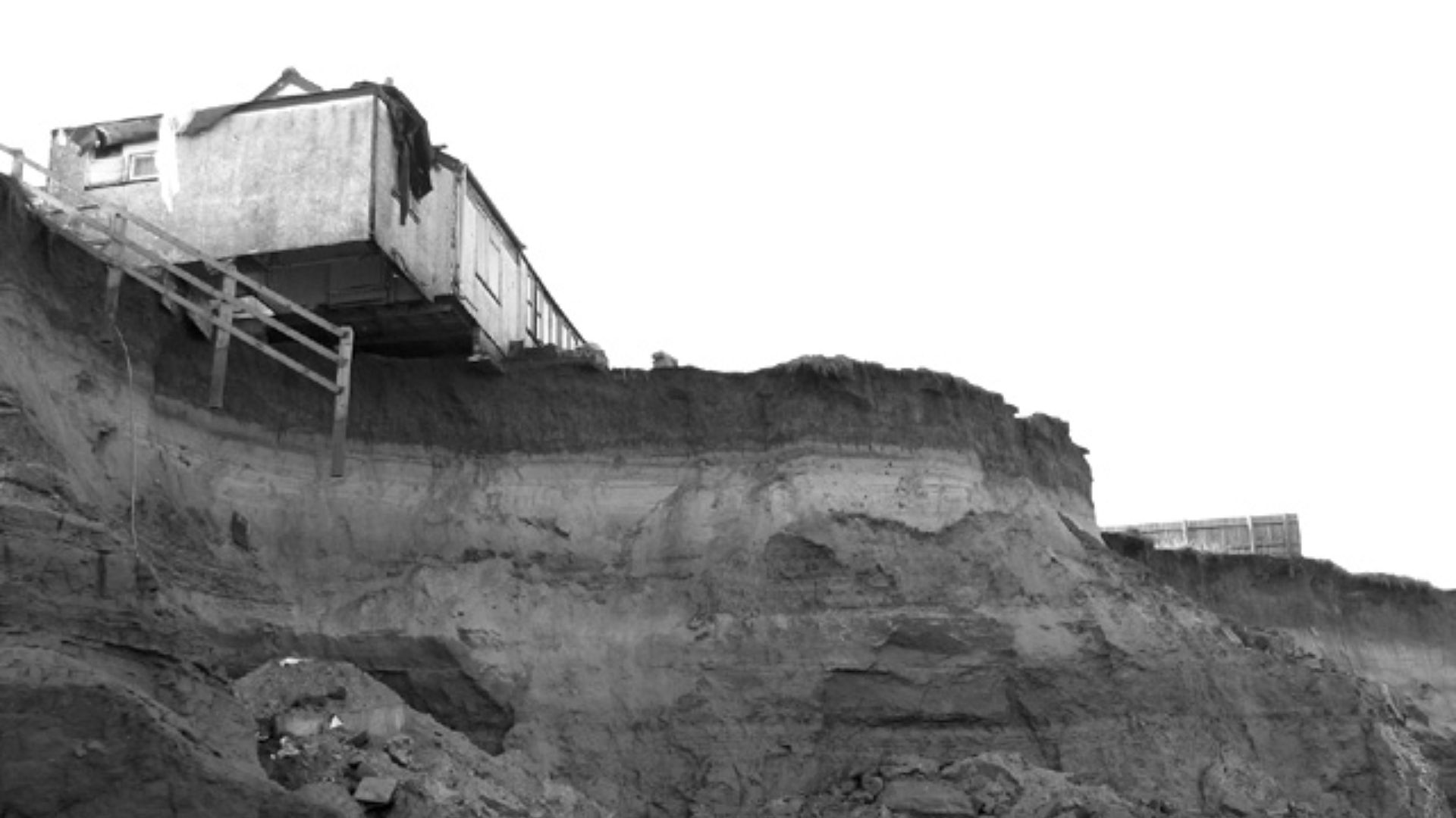
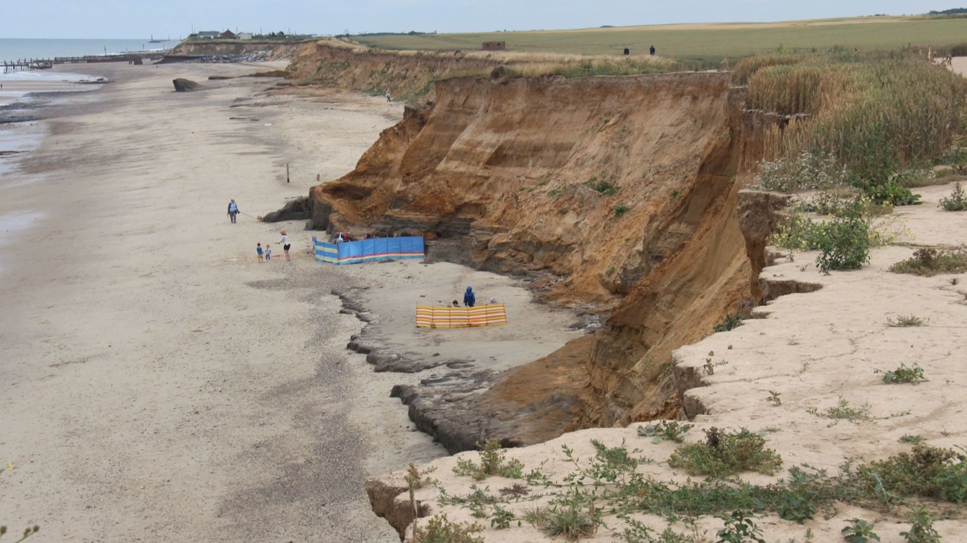
A Dangerous Trade-Off
The same erosion revealing these discoveries is also destroying the land. Homes in Happisburgh have already been lost, and experts say more could follow. It’s a strange situation—history is being uncovered at the same time it’s being wiped out.
 Evelyn Simak , Wikimedia Commons
Why Footprints Matter So Much
Footprints are different from bones or tools. They show movement. They show behavior. As Dr De Groote pointed out, they give us direct evidence of how people actually moved through their environment.
A Rare Glimpse Into Daily Life
When you look at these footprints, you’re not just seeing marks in the mud. You’re seeing a group of early humans walking together—possibly a family—going about their day, completely unaware they were leaving behind something so important.
 Evelyn Simak , Wikimedia Commons
And Then… Nothing Again
After the scans were done, the sea came back and erased everything. No physical trace was left behind—just digital records and the story they told.
The Final Twist: History Revealed by Destruction
The story of Happisburgh is a strange one. The same waves destroying England’s coastline are also uncovering its oldest human history. And every time the sea pulls back, there’s a chance something incredible will appear… even if it only lasts a few days.
 Evelyn Simak, Wikimedia Commons
You May Also Like: