
Soil Spills Secrets
Nobody expected a hobbyist scrolling satellite images to crack open a mystery Rome left behind. But that's exactly what happened. A quiet corner of Germany just got a whole lot more interesting.
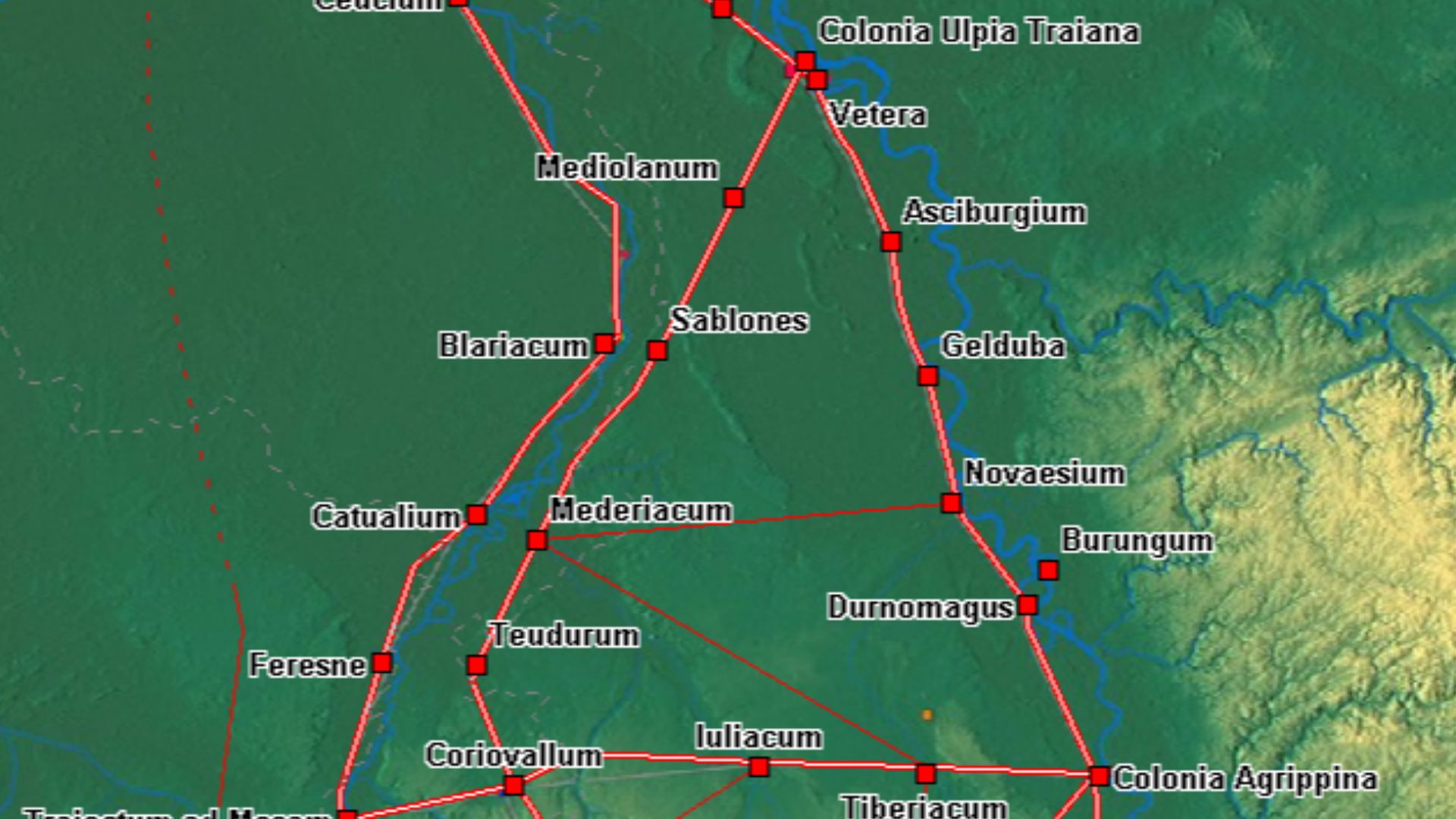
Roman Frontiers
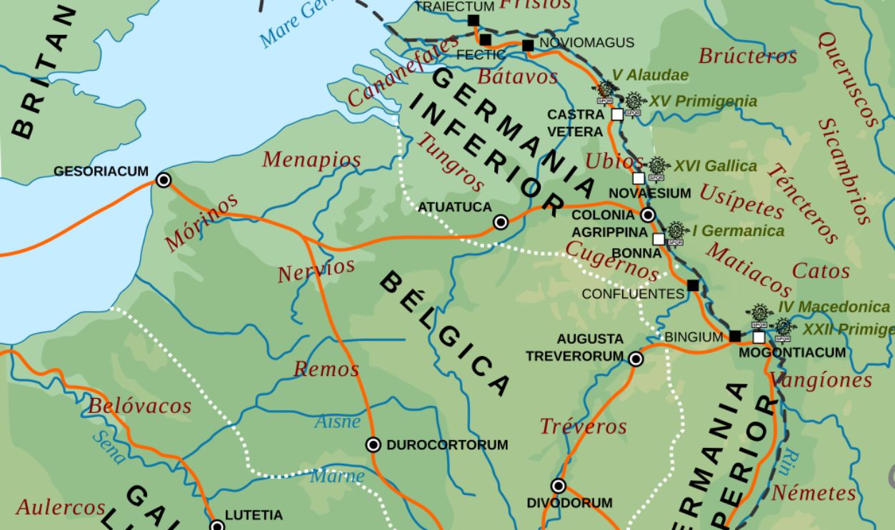
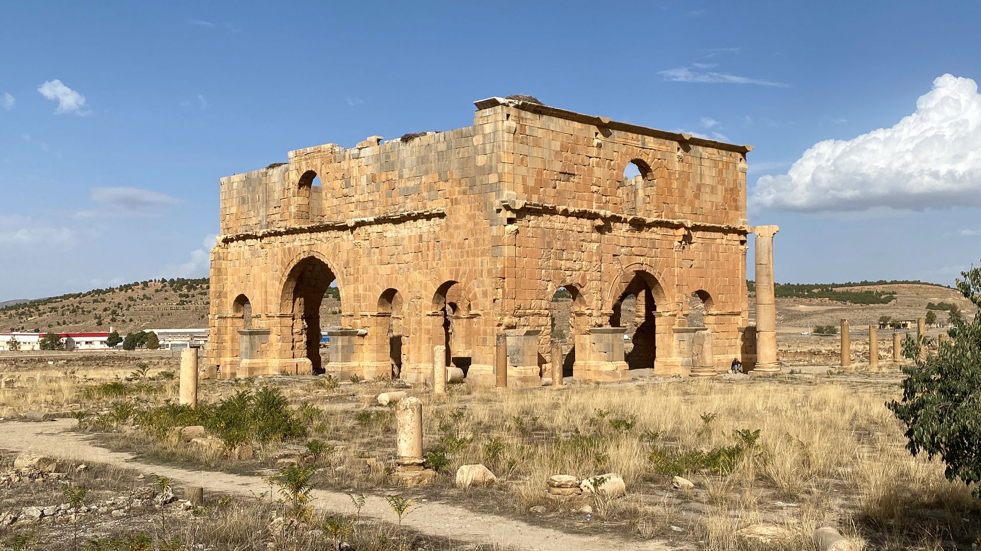
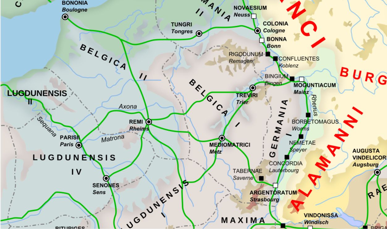
The Rhine River was Rome's hard stop for centuries. After the Battle of the Teutoburg Forest in 9 AD, where Germanic tribes annihilated three entire Roman legions, Emperor Augustus pulled all forces west. That defeat killed Rome's ambition to conquer Germania, making it one of the few regions the empire never truly controlled.
 derivative work: RedTony, Wikimedia Commons
Camp Origins
Roman military camps, called castra, weren't just sleeping quarters. They were the empire's strategic backbone. Every evening after a day's march, soldiers were expected to construct a fully fortified camp from scratch. Each featured a rectangular layout, rounded corners, surrounding ditches, ramparts, and secured gate passages.
Military Expansion
Rome never truly gave up on Germania. Starting in 13 BCE, generals like Drusus and Tiberius led campaigns to push the frontier eastward. Though Teutoburg ended that dream, by the third century AD, new Germanic tribal confederations began threatening imperial borders again.
Site Location
Nobody expected to find Roman military infrastructure in Saxony-Anhalt, a modern German state tucked between the northern Harz Mountains and the Elbe River. Yet that's exactly where four camps surfaced—near the towns of Aken, Trabitz, and Deersheim.
 Olivier Cleynen, Wikimedia Commons
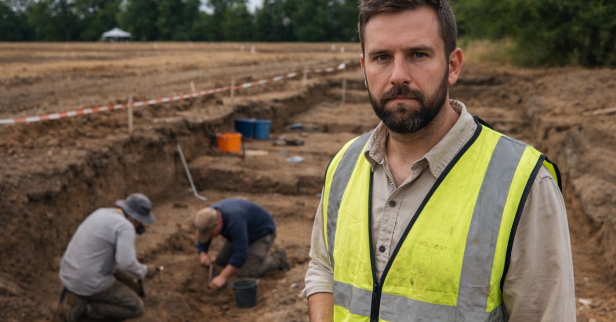
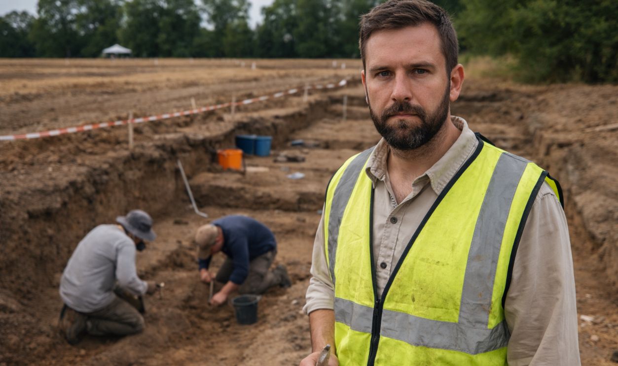
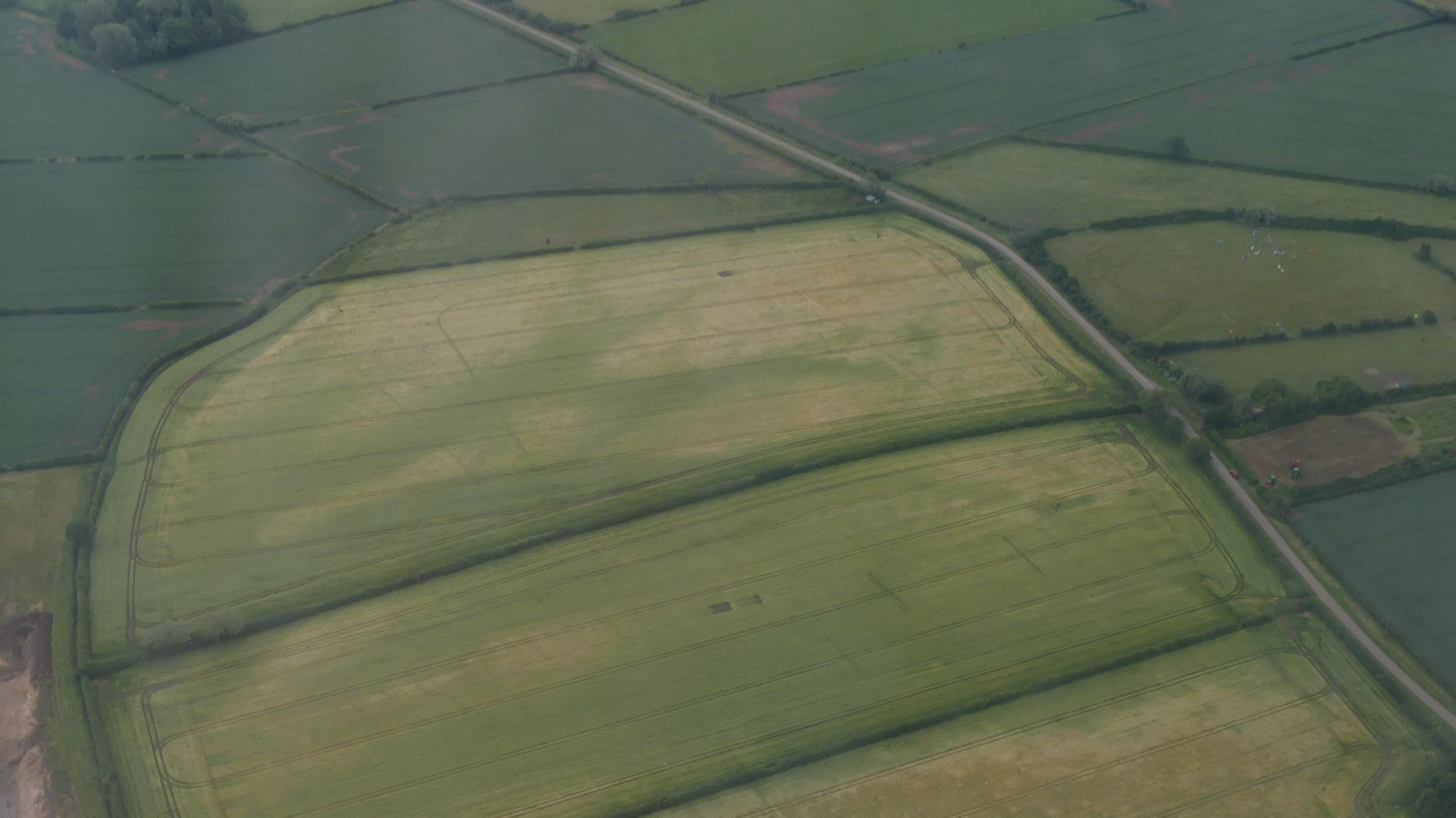
Excavation Begins
It started with a hobbyist and a laptop. In 2020, amateur archaeologist Michael Barkowski spotted unusual rectangular outlines and apparent ditches in online satellite imagery near Aken. Suspecting Roman marching camps, he flagged his findings to professionals. The State Office for Heritage Management and Archaeology of Saxony-Anhalt moved in to verify.
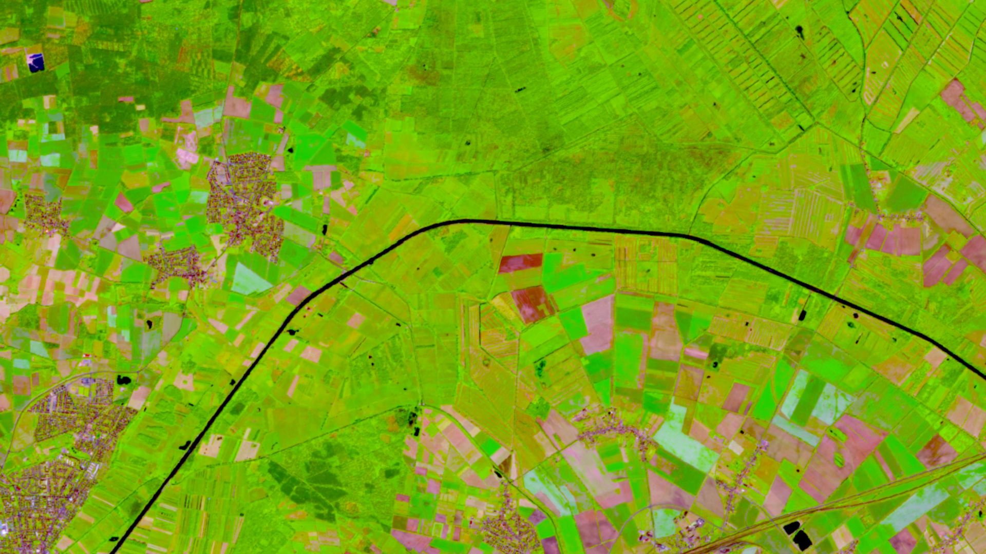 European Union, Copernicus Sentinel-2 imagery, Wikimedia Commons
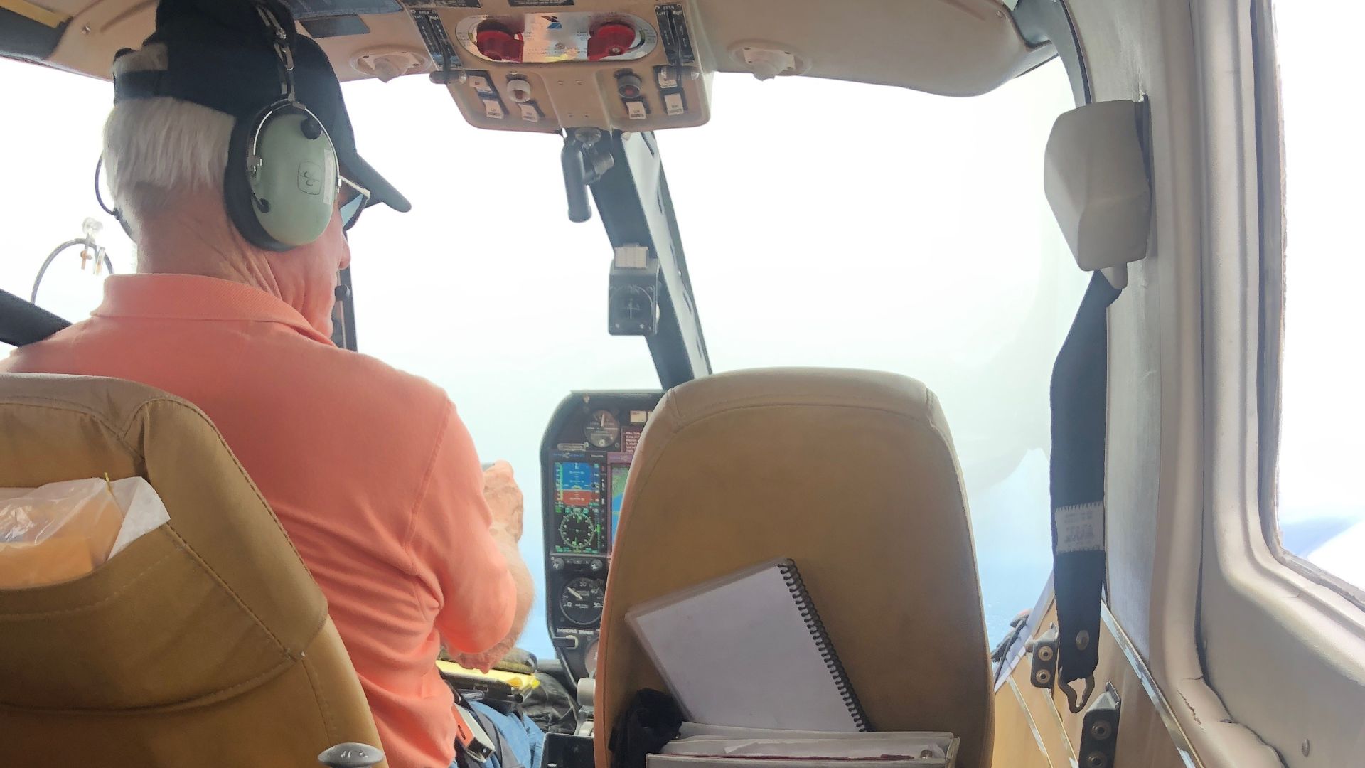
Aerial Surveys
Once professionals took over, the skies became their most powerful tool. Aerial archaeologist Ralf Schwarz directed survey flights that confirmed the southwestern corner of the Aken camp and its characteristic titulum, which was a protective ditch segment guarding the gate.
 Amelia DuVall (USGS Western Ecological Research Center), Wikimedia Commons
Ground Scans
Aerial photography tells you something is there—ground technology confirms it. Teams combined geophysical surveys, satellite imagery, and systematic metal-detector walks across the fields, with trained volunteers covering the land methodically. The resulting data, gathered between 2024 and 2025, was conclusive.
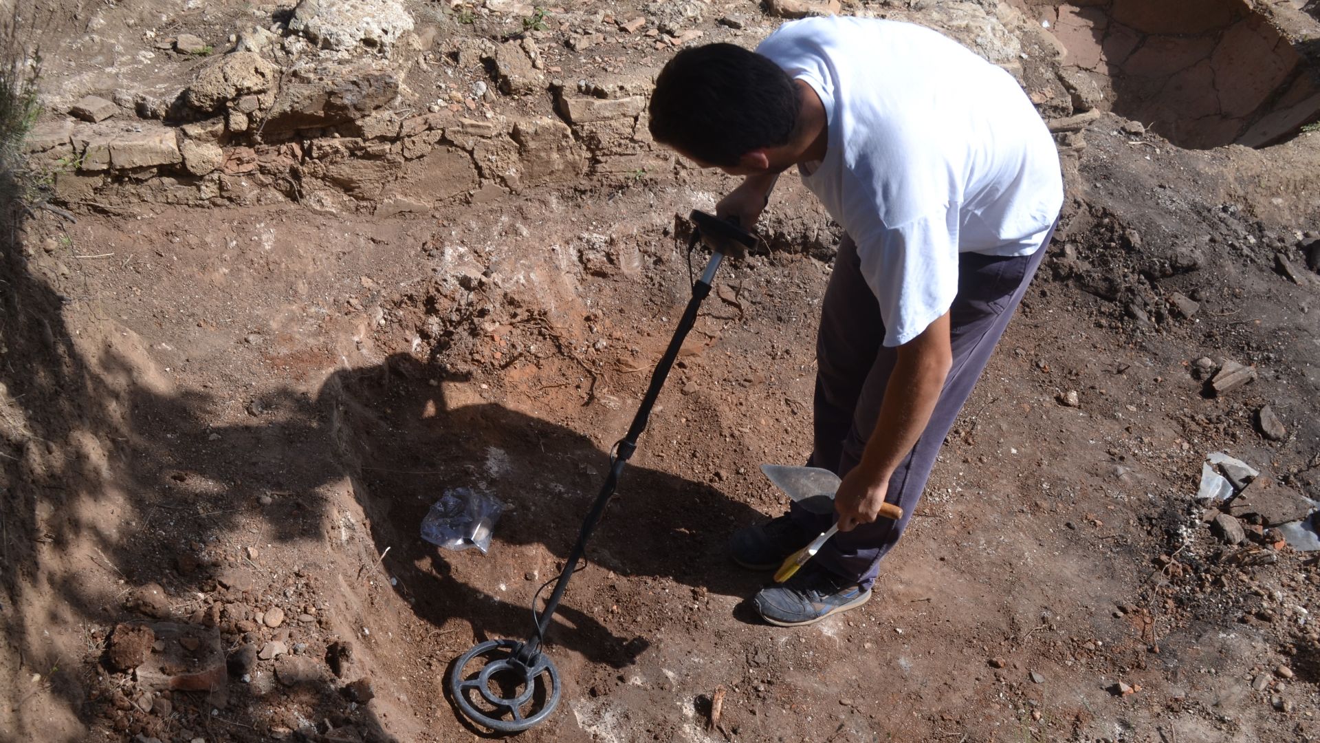
First Findings
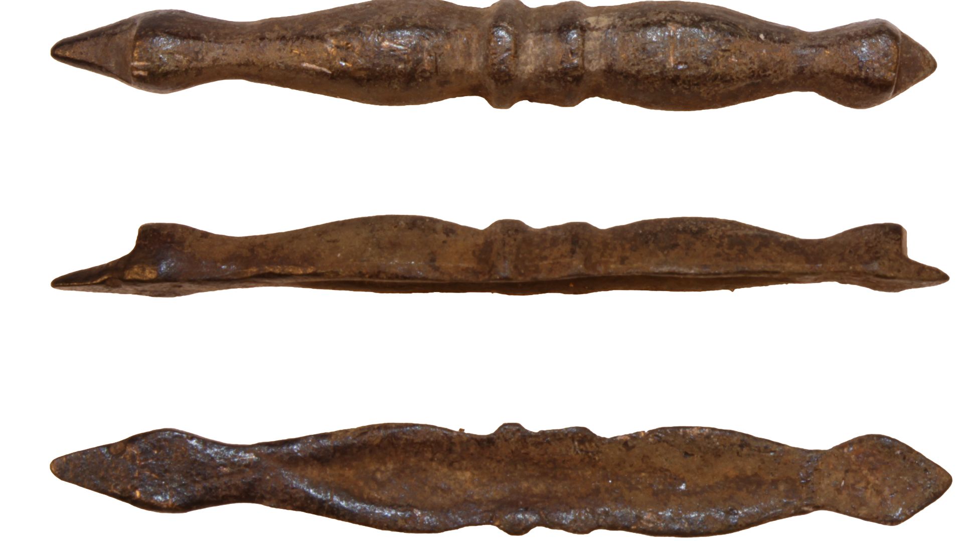
When metal detectors finally swept across all four sites, the haul was staggering. Over 1,500 metal artifacts surfaced, including iron hobnails from legionary sandals, bolts, and fibula fragments. Those hobnails are particularly telling. They're essentially a soldier's footprint fossilized in soil.
 Cambridgeshire County Council, Philippa Walton, 2007-04-04 11:49:12, Wikimedia Commons
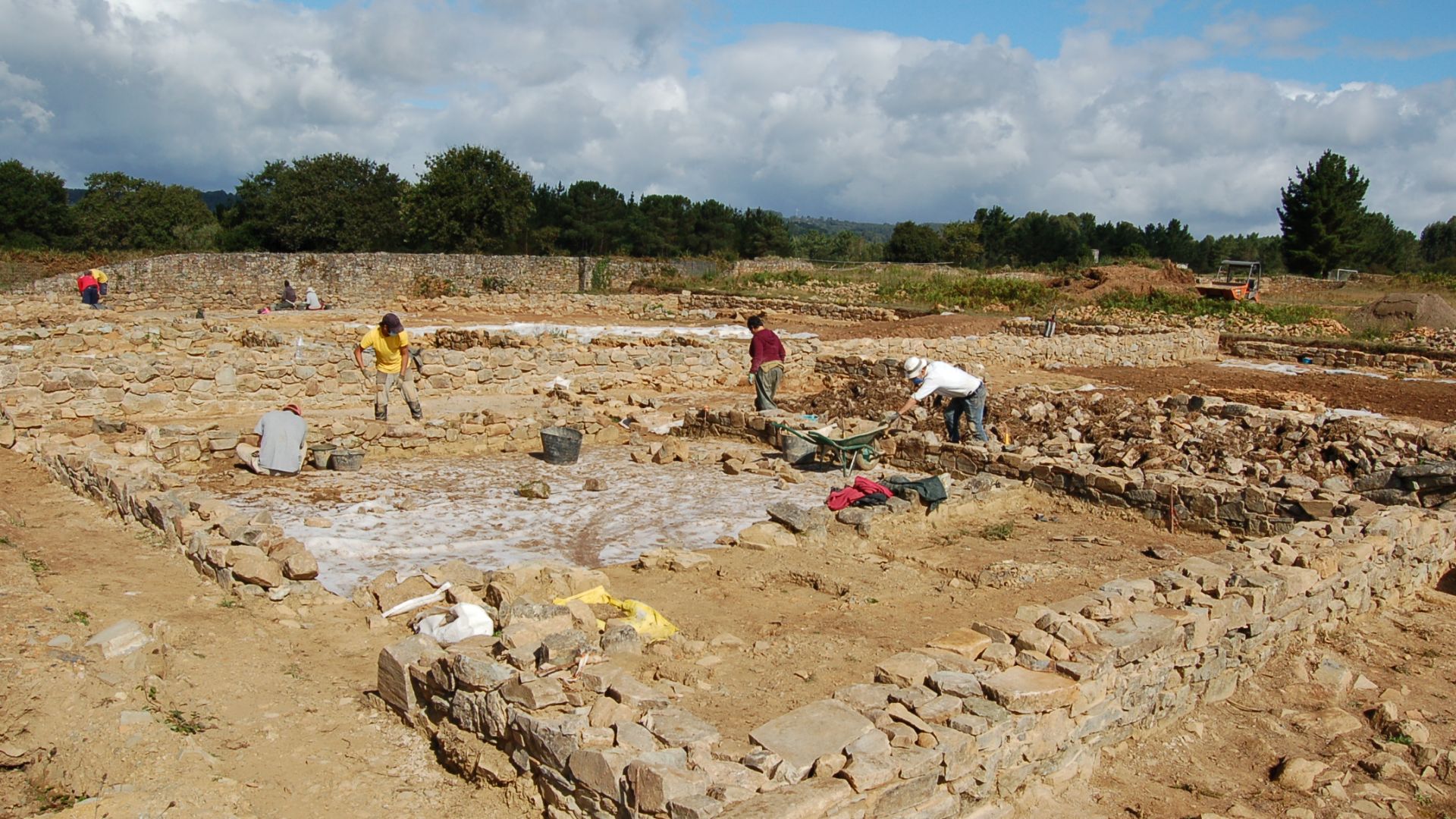
Camp Layout
Excavations at Aken and Trabitz exposed the camps' signature V-shaped defensive ditches, about 1.7 to 1.8 meters wide and over a meter deep. That sharp V-geometry was intentional: anyone falling in would be injured immediately.
 David Smith , Wikimedia Commons
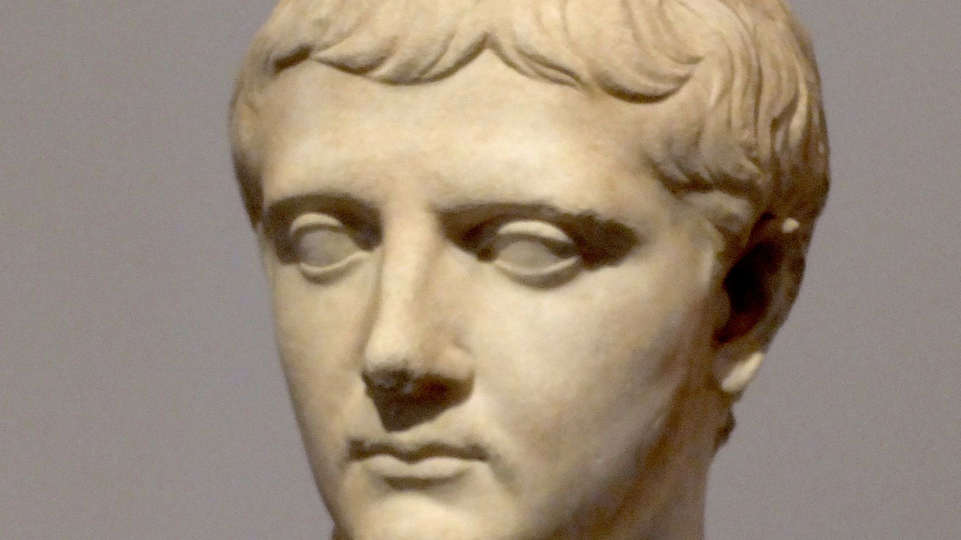
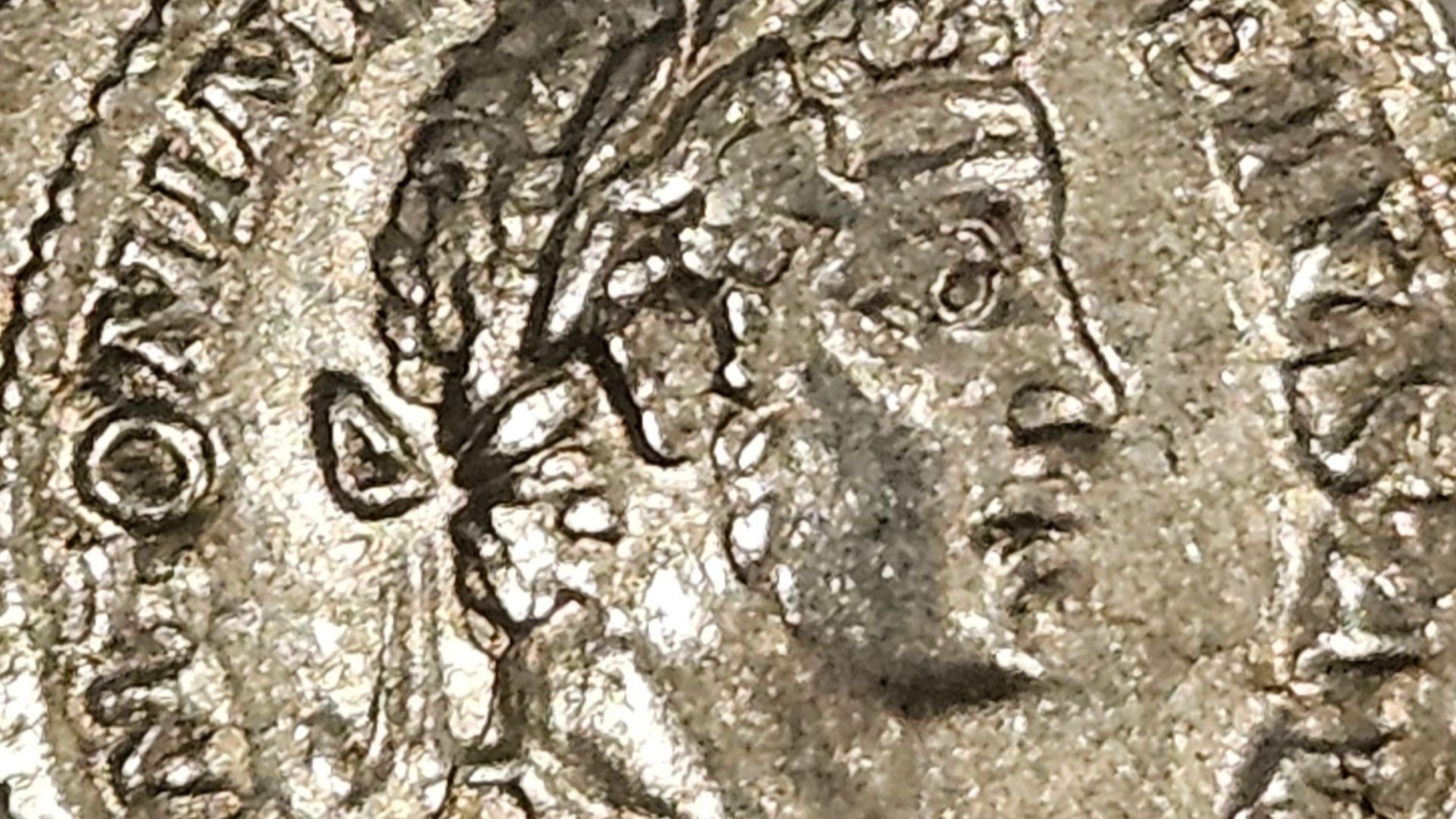
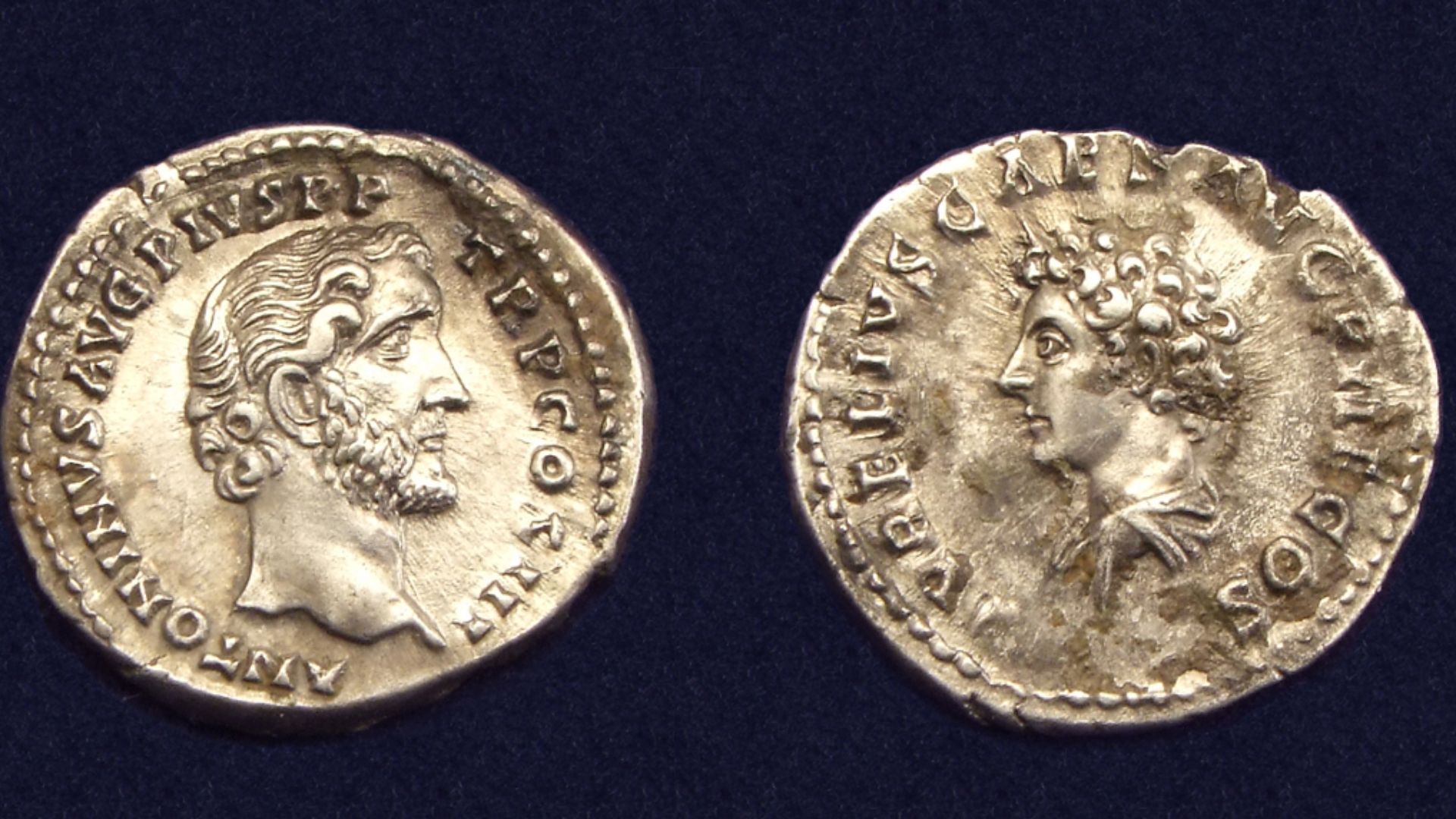
Coin Hoards
Among all 1,500-plus artifacts, one item rewrote the timeline. A silver denarius of Emperor Caracalla, who reigned from 211 to 217 AD, was recovered at Trabitz. As a terminus post quem, it proves the camp couldn't predate the coin's minting. Coins from Marcus Aurelius and Antoninus Pius were also found.
Barrack Blocks
Roman marching camps weren't chaotic. They followed a rigid internal grid. Barrack blocks were positioned with mathematical precision, arranged symmetrically on either side of the camp's main road, the Via Praetoria. Every unit knew exactly where to set up.
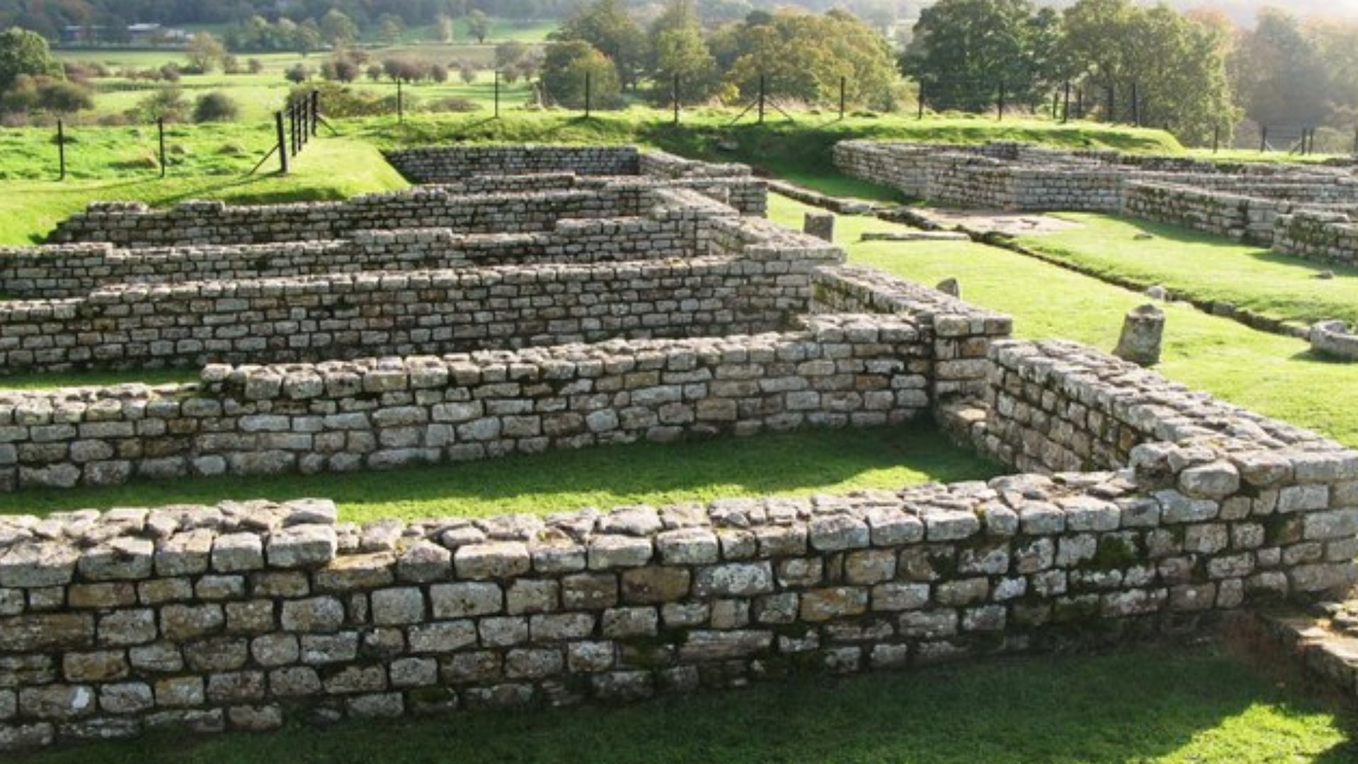
Commander's Quarters
At the heart of every Roman marching camp stood the praetorium—the commanding officer's tent or quarters. It sat at the intersection of the camp's two main roads, making it the literal and symbolic center of operations. The commander's central position reinforced the Roman military hierarchy.
 Bernard Gagnon, Wikimedia Commons
Soldier Life
Life inside these camps was relentlessly structured. Roman legionaries woke before dawn, completed physical drills, maintained weapons, and stood rotating guard shifts through the night. They ate standardized rations, mostly grain, olive oil, and salted meat.
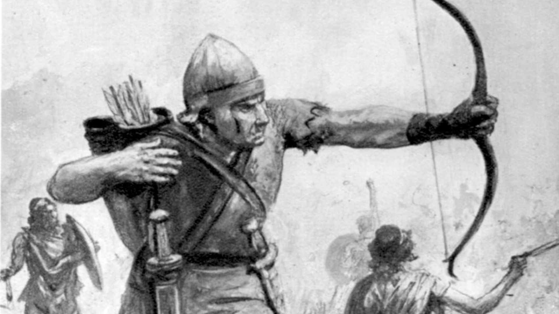
Weapons Cache
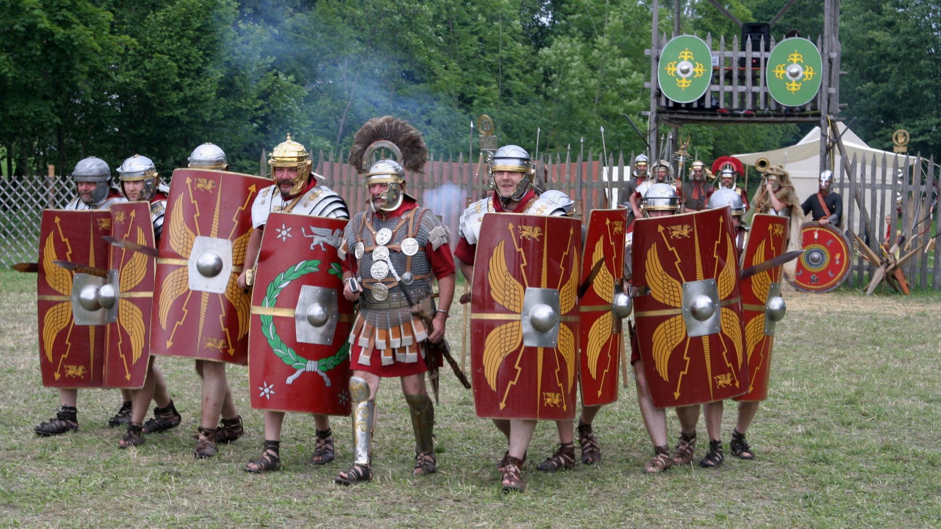
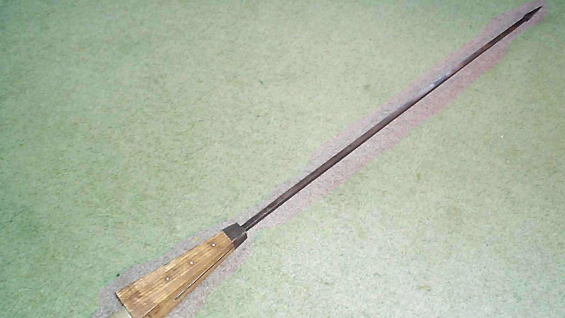
Roman soldiers stationed in Germania campaigns carried a highly specific arsenal. The pilum, a heavy iron-tipped javelin designed to bend on impact and disable enemy shields, was standard issue. Short gladius swords handled close combat.
 The original uploader was Wandalstouring at English Wikipedia., Wikimedia Commons
Ritual Objects
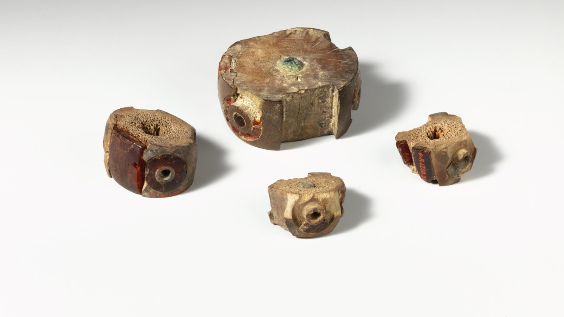
Roman soldiers were deeply superstitious. Camps typically contained shrines to protective deities—Mars, the god of war, and the legion's own standards were treated as sacred objects. Fibula fragments recovered at Saxony-Anhalt carry significance beyond fashion; certain brooch designs were associated with specific military units.
Supply Routes
Moving four Roman camps' worth of soldiers deep into Germania required extraordinary logistical planning. Roman armies were self-sufficient columns carrying grain, medical supplies, engineering tools, and smithing equipment. The location of the Saxony-Anhalt camps, positioned between the Harz Mountains and the Elbe River, suggests the legions deliberately followed river corridors.
Legion Identity
The Saxony-Anhalt camps haven't yet yielded direct legion stamps, but the artifact profile strongly narrows the candidates. Third-century Roman campaigns in Germania are historically linked to legions stationed along the Rhine frontier. Coins minted under Caracalla, Antoninus Pius, and Marcus Aurelius recovered at the sites suggest troop rotations spanning decades.
 NumisAntica, Wikimedia Commons
Foreign Troops
Not all soldiers in Roman Germania were Italian. By the third century, Rome's legions were heavily composed of provincial recruits. These included men from Gaul, Pannonia, Syria, and North Africa. Auxiliary units, drawn from conquered peoples, often served on the frontlines of Germanic campaigns.
 Amedee Forestier, Wikimedia Commons
Camp Expansion
The near-identical dimensions found across the Aken 1 and Aken 2 camps suggest they weren't built simultaneously. Roman armies would return to strategically advantageous locations and rebuild. This pattern of reuse indicates the Elbe corridor was part of a deliberate, repeated Roman strategy to project military power.
 Simon Tomson , Wikimedia Commons
Burial Evidence
Roman soldiers who died on campaign rarely made it home. Field burials near marching camps were common, though identifying them archaeologically is difficult. Germanic campaign sites across Germany have previously yielded cremation graves with military grave goods nearby.
 All rights reserved, Philippa Walton, 2018-01-25 14:47:35, Wikimedia Commons
Written Records
Ancient texts vaguely described Roman penetration toward the Elbe, but historians treated them cautiously. One late Roman account describes Emperor Maximinus Thrax launching a campaign hundreds of miles into Germania. Another link Emperor Caracalla to a 213 AD Germanic offensive.
 Unknown authorUnknown author, Wikimedia Commons
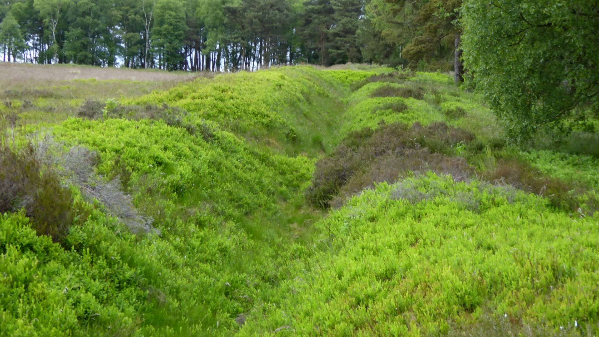
Preservation State
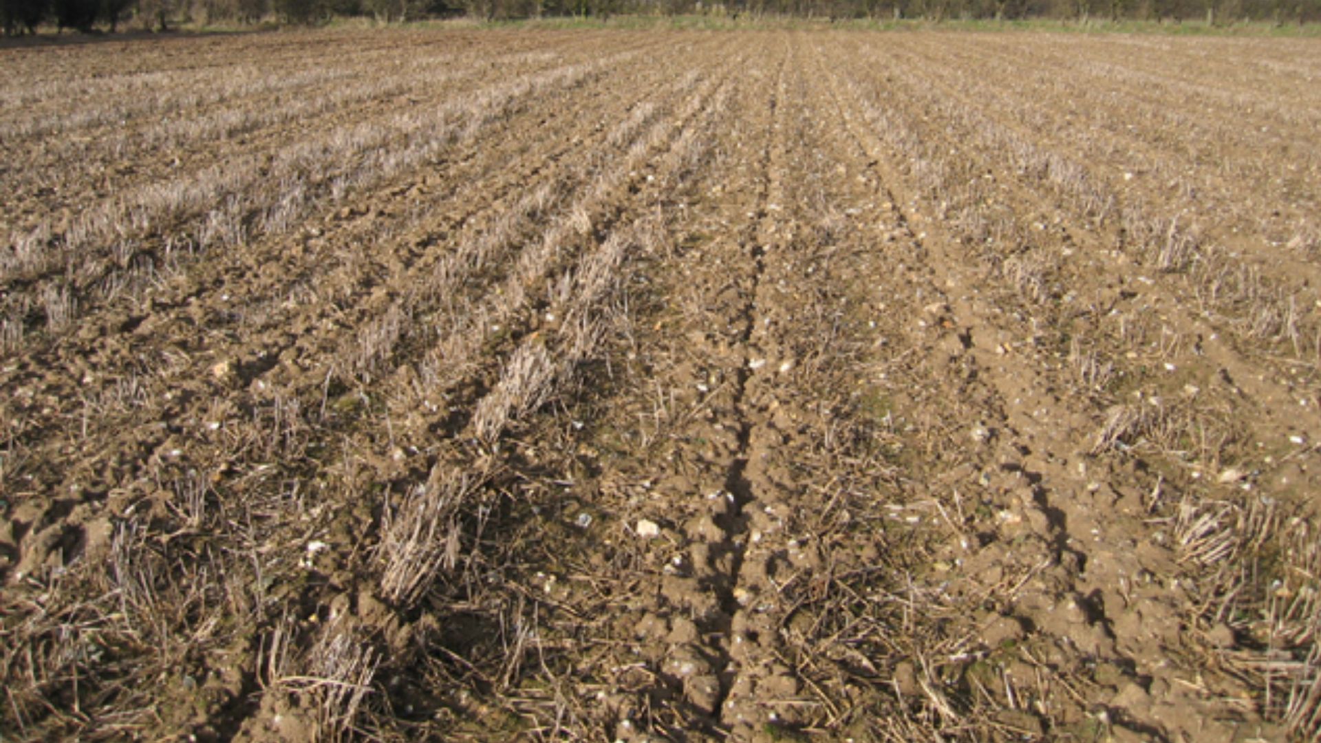
1800 years underground left the camp structures in fragmentary but readable condition. The V-shaped ditches survived because they were cut into subsoil, preserving their profile even after the surface was repeatedly ploughed by medieval and modern farmers.
 Rodney Burton, Wikimedia Commons
Dating Methods
Pinning down the camps' age required two independent methods working in agreement. Radiocarbon analysis of organic material from the ditch fills pointed to the early third century AD. The Caracalla denarius from Trabitz then provided a hard terminus post quem of 211 AD.
 Yulia Kolosova, Wikimedia Commons
Historical Impact
This discovery fundamentally reshapes the map of Roman military reach. Historians previously placed third-century Roman-Germanic conflicts close to the Limes, the empire's fortified border system. The Saxony-Anhalt camps sit significantly northeast of that assumption, forcing a complete reassessment of Roman strategic mobility.
 The original uploader was ArdadN at English Wikipedia, Wikimedia Commons


