
Carved Through Mountains
Archaeologists in Jerusalem uncovered a colossal trench that's been hidden for millennia. The structure proves biblical texts weren't exaggerating about how ancient kings fortified their capital. This barrier literally divided the city into two separate worlds.
 MENAHEM KAHANA, Getty Images, Modified
Discovery Announcement
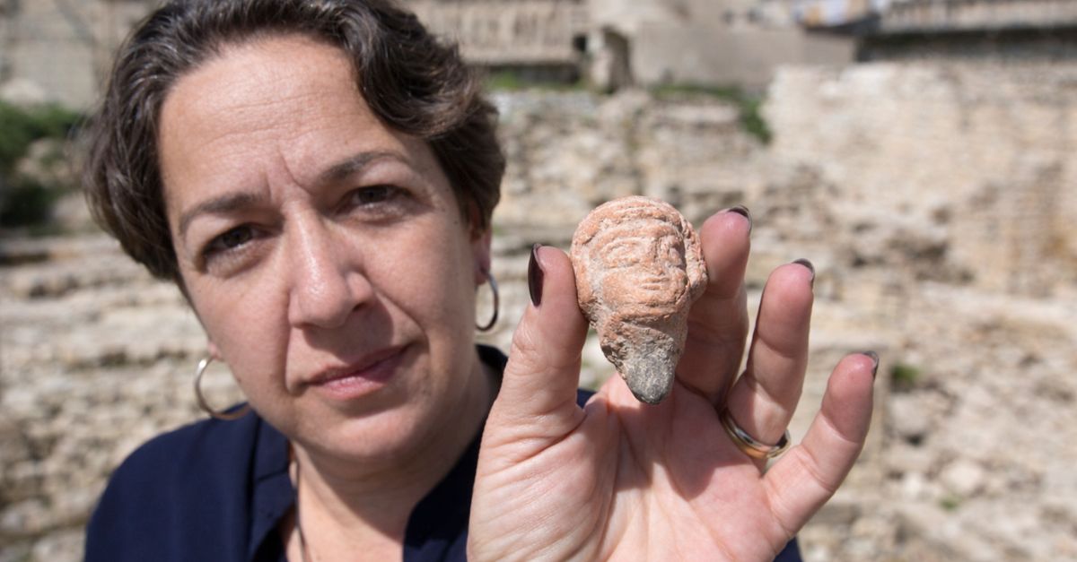
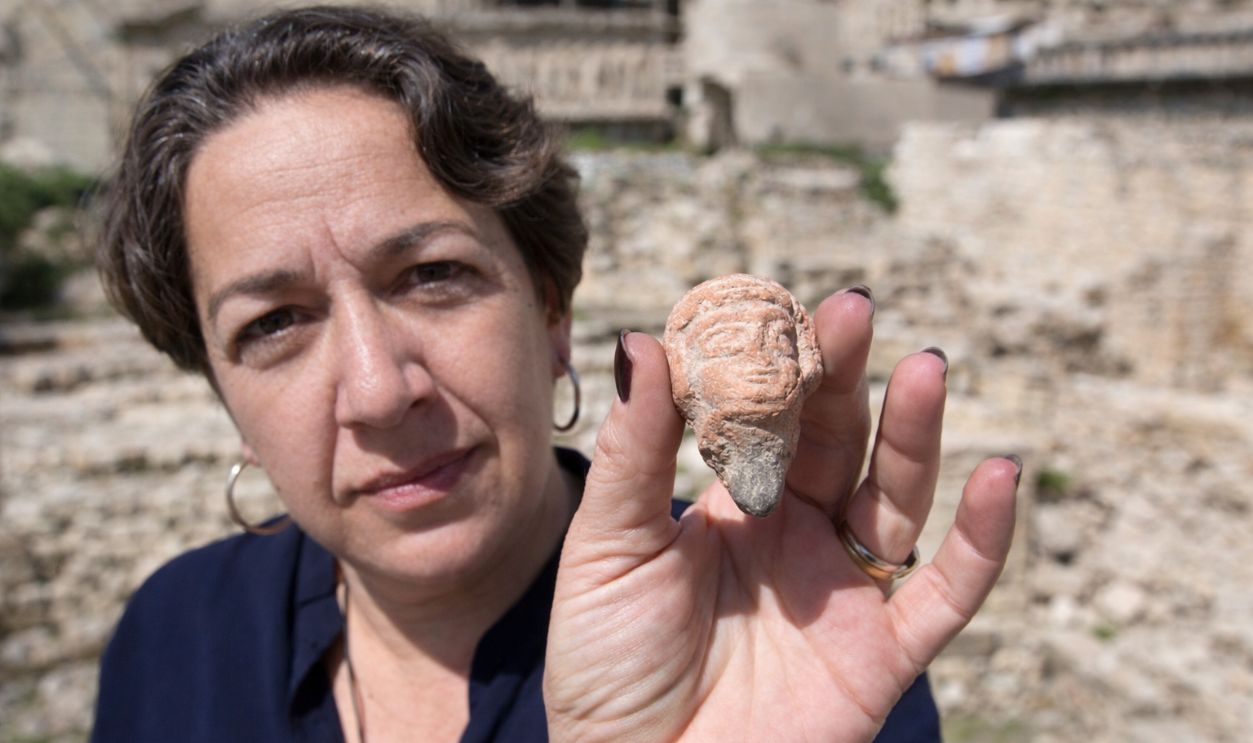
The Israel Antiquities Authority and Tel Aviv University jointly announced they'd uncovered a massive defensive moat in the City of David that directly corresponds to structures mentioned in the Bible. We're talking about a monumental fortification that's been hiding beneath a parking lot in Silwan, East Jerusalem.
Excavation Site
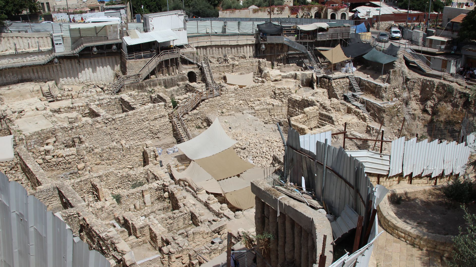
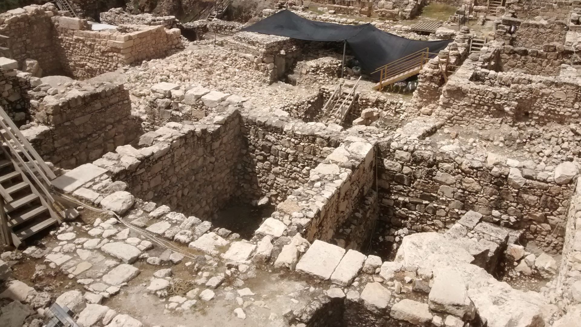
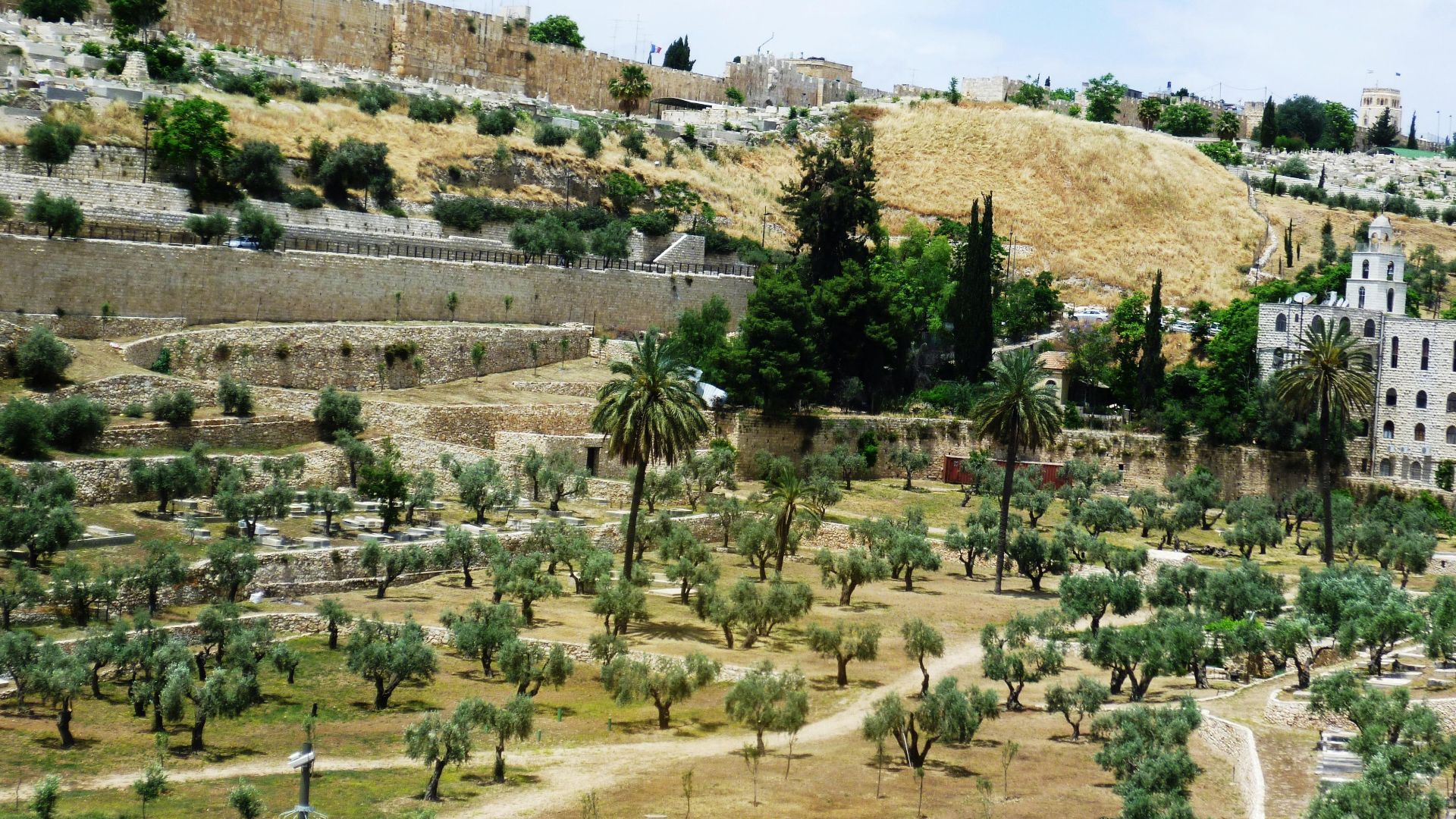
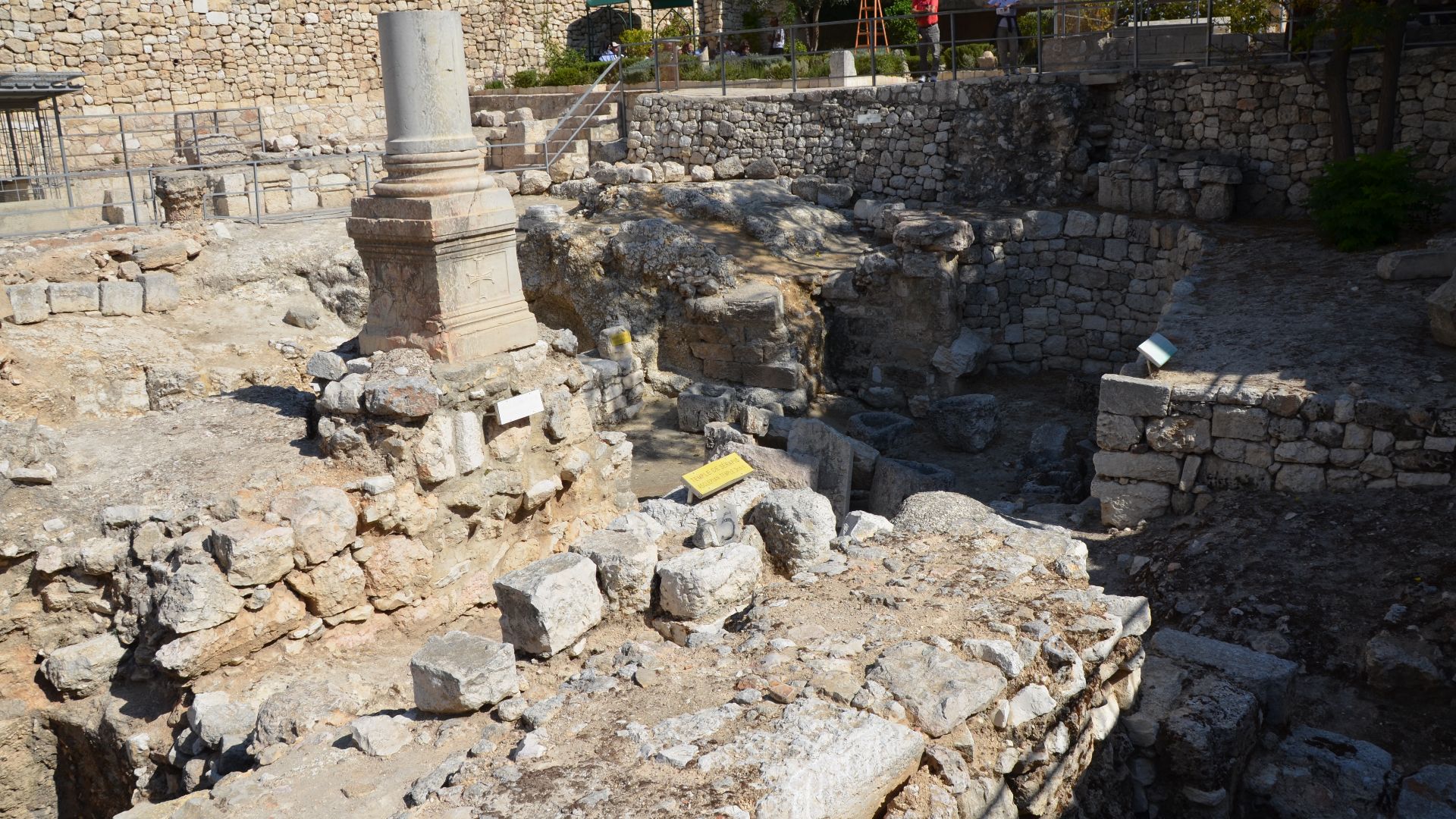
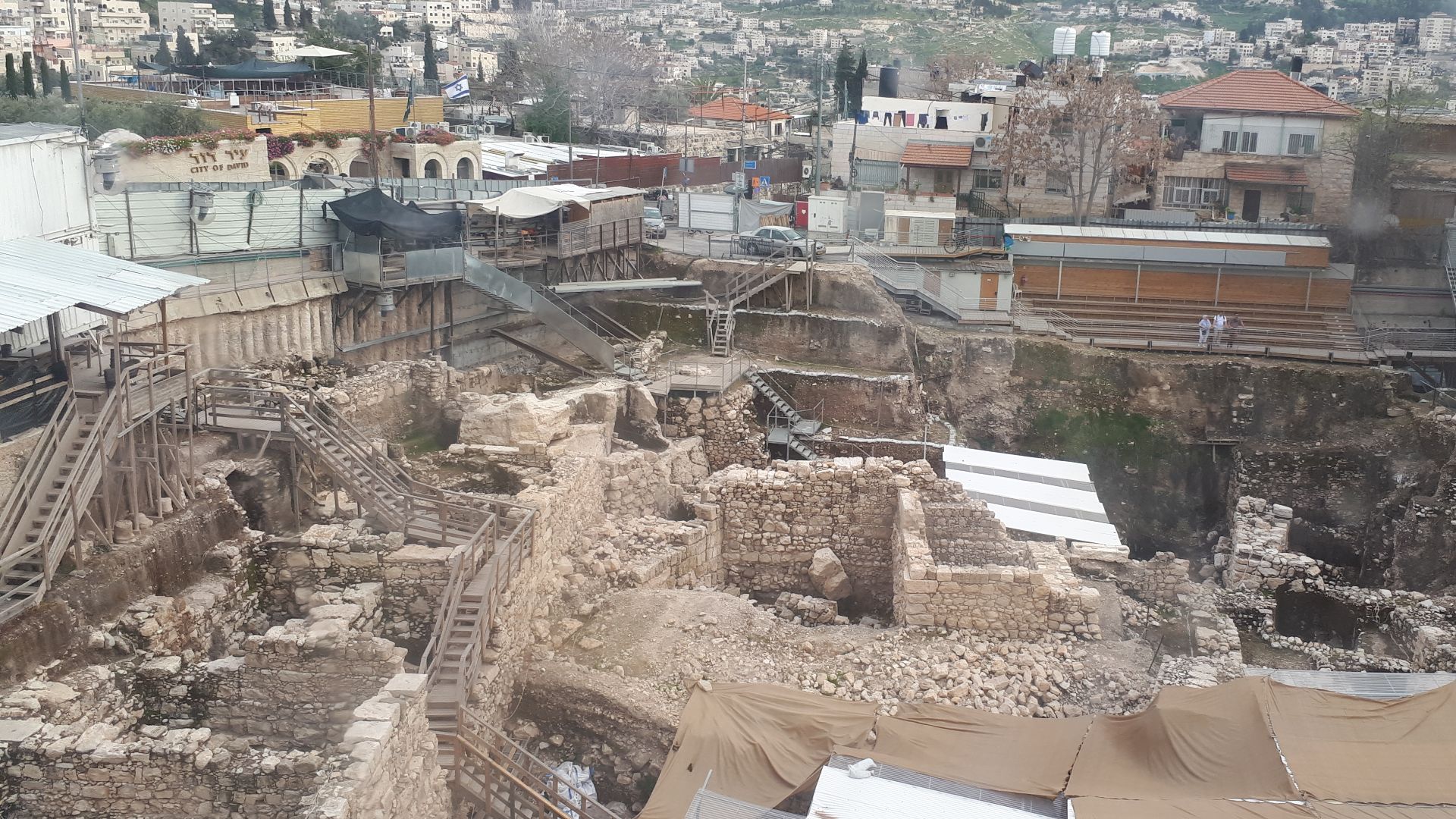
This 3,500-square-meter area, the Givati Parking Lot, has become one of the most significant digs in modern biblical archaeology. Located within the Jerusalem Walls National Park, just steps from the Old City walls, this former visitor parking area for the Western Wall has been systematically excavated since 2007.
 Gary Todd from Xinzheng, China, Wikimedia Commons
Structure Dimensions
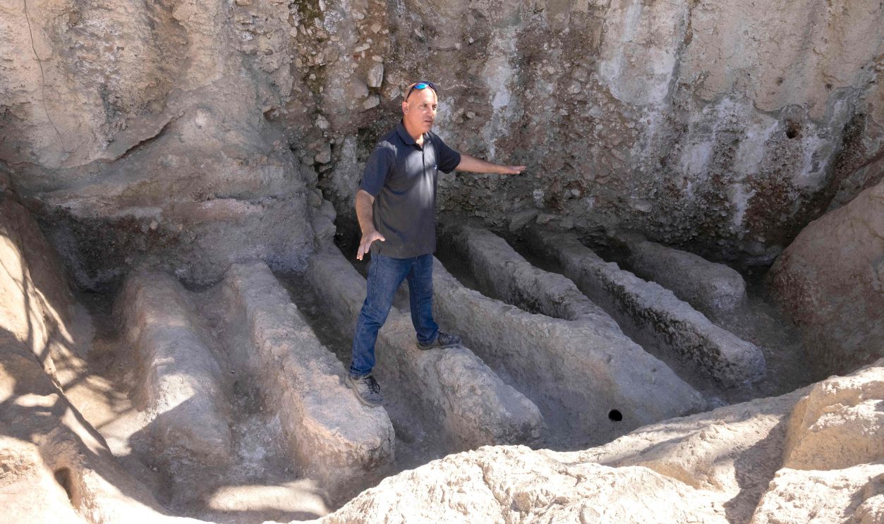
Here's where things get massive. The moat stretches at least 230 feet long and plunges nearly 30 feet deep into solid bedrock. The width? A staggering 100 feet across, with sheer vertical cliffs flanking both sides that would've made crossing without detection virtually impossible.
Dating Methods
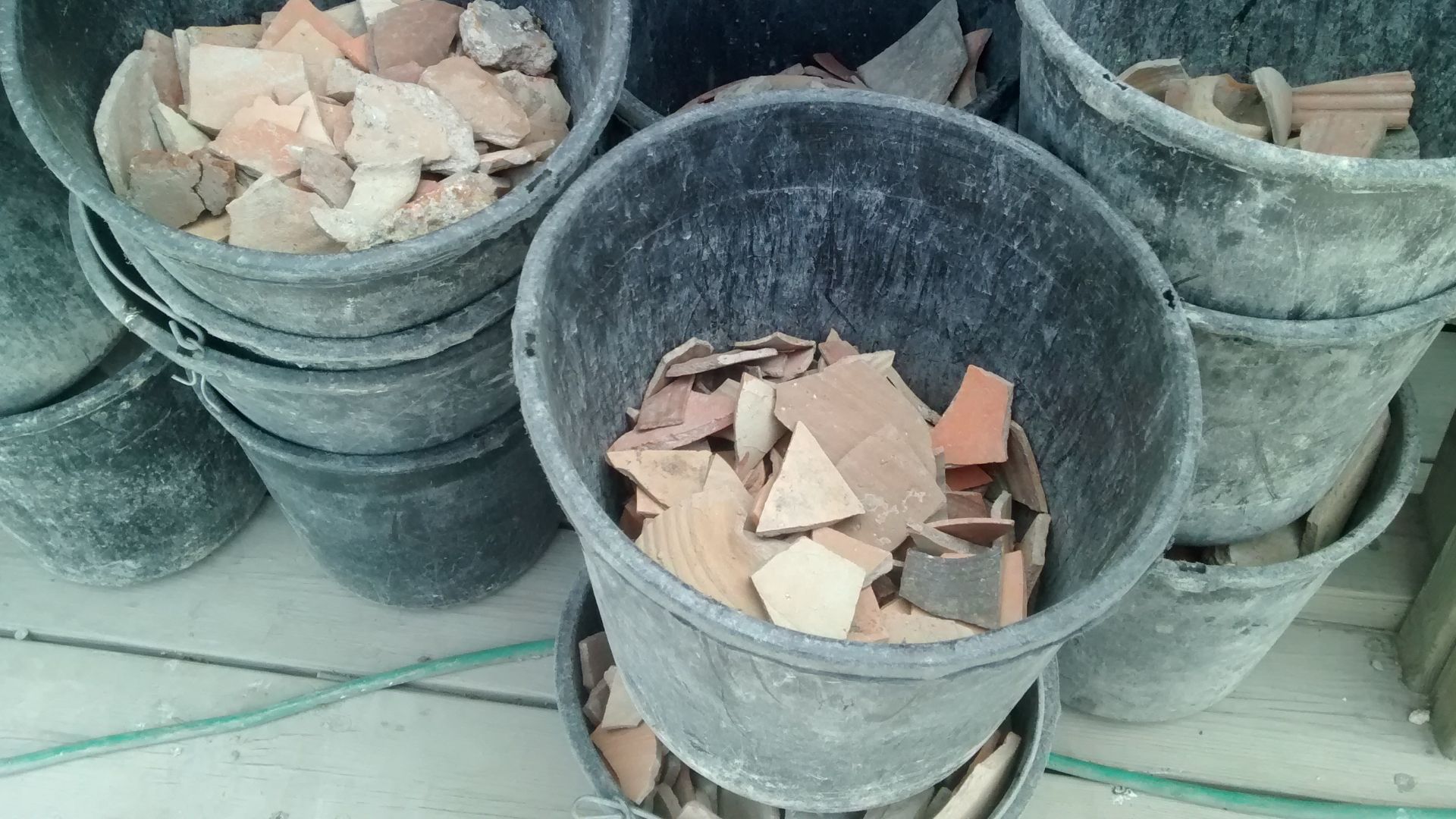
Stratigraphic analysis of the surrounding archaeological layers provided the critical timeline for this discovery. Researchers examined pottery fragments, construction techniques, and the geological layers pressed against the moat's walls to establish its usage period. The evidence confidently places active use during the Iron Age, approximately 900 BCE.
Biblical References
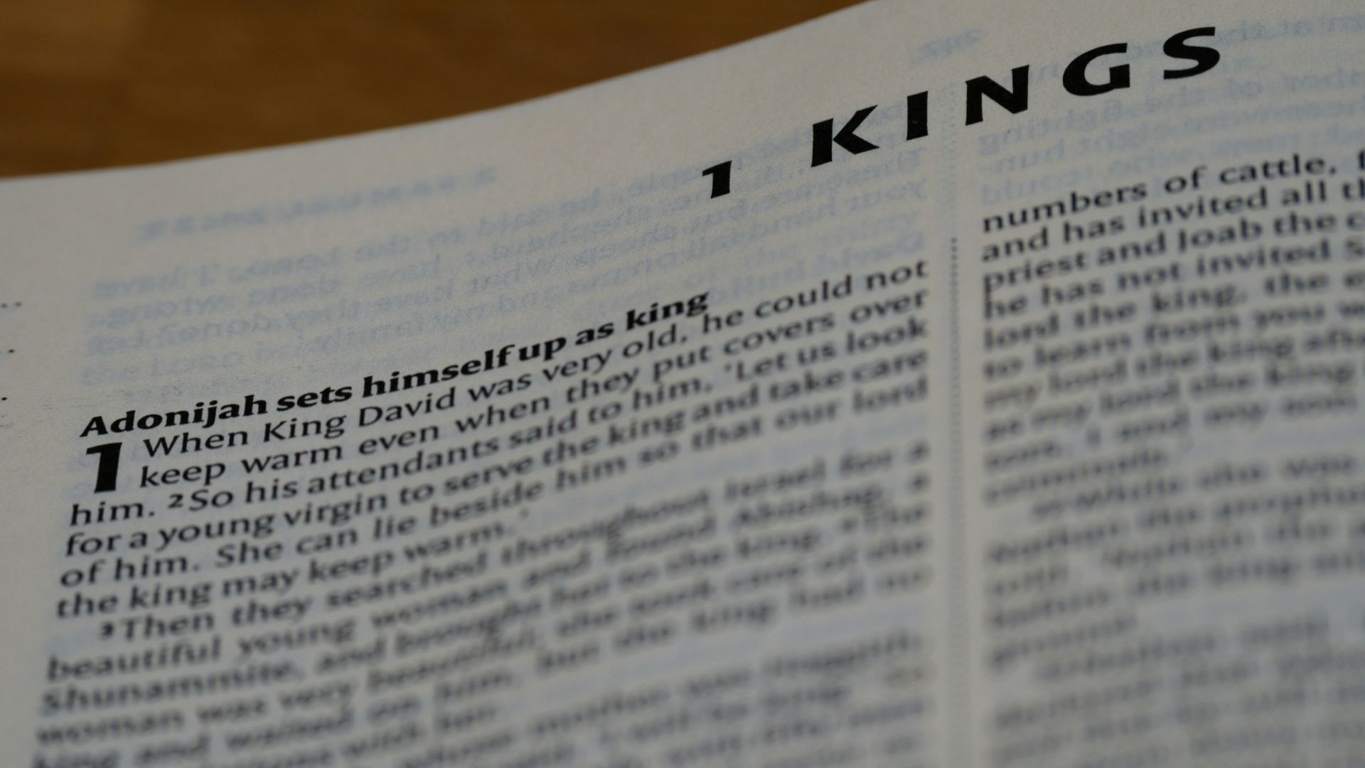
The First Book of Kings drops a tantalizing clue in verse 11:27: "Solomon built up the 'Millo' and closed up the breach in the wall of the City of David his father”. For centuries, scholars debated what "Millo" actually meant—some thought it referenced fill material, others believed it described terracing.
Ophel Explanation
Ophel comes from Hebrew, meaning “swelling” or “fortified hill”. It refers to a raised area south of Jerusalem’s Temple Mount that served as a strategic, defended zone in ancient times. Biblically, the Ophel appears as an important administrative and residential area linked to early Jerusalem’s growth.
Millo Meaning
The word "Millo" has puzzled biblical translators for generations, with various versions offering "landfill," "supporting terraces," or simply leaving it untranslated. Recent archaeological consensus suggests it relates to the Assyrian term "mulu," meaning earthworks or embankments. The Millo likely served as both a fortification and an architectural solution.
 Mary and Angus Hogg , Wikimedia Commons
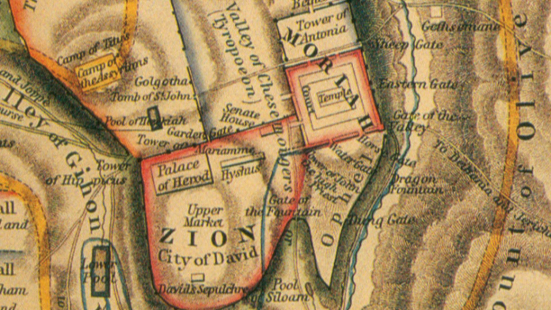
City Division
Ancient Jerusalem wasn’t one unified city. It was carefully divided into distinct zones, with a deep, imposing moat acting as a physical barrier between them. This separation controlled movement, improved defense, and clearly marked administrative and residential areas, showing the city was deliberately planned rather than growing randomly.
 Lyman Coleman, Wikimedia Commons
Defensive Purpose
Military strategists designed this moat to exploit Jerusalem's one geographic weakness: its vulnerable northern approach. Unlike the steep valleys protecting the city's eastern, western, and southern flanks, the north offered relatively easier access for invading armies. The massive trench turned this weakness into an impenetrable barrier.
 George Adam Smith, Wikimedia Commons
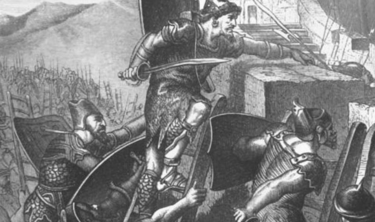
King David
In the past, David conquered Jerusalem from the Jebusites around 1000 BCE. This Canaanite hilltop stronghold became Israel's political and spiritual capital. The Bible describes him building up areas "from the Millo inward," suggesting he inherited and maintained existing Jebusite fortifications rather than starting from scratch.
 Gerard van Honthorst, Wikimedia Commons
King Solomon
Solomon's construction program reads like ancient history's most ambitious infrastructure project. According to 1 Kings 9:15, he raised massive labor levies specifically to build “the house of the Lord, and his own house, and Millo, and the wall of Jerusalem, and Hazor, and Megiddo, and Gezer”.
 Pedro Berruguete, Wikimedia Commons
King Josiah
The moat saw active military use during Josiah's reign from 640 to 609 BCE, a period when this reformer king dramatically centralized religious worship in Jerusalem. Dr Yiftah Shalev expressed confidence that the fortification functioned throughout the First Temple period, particularly during Josiah's time.

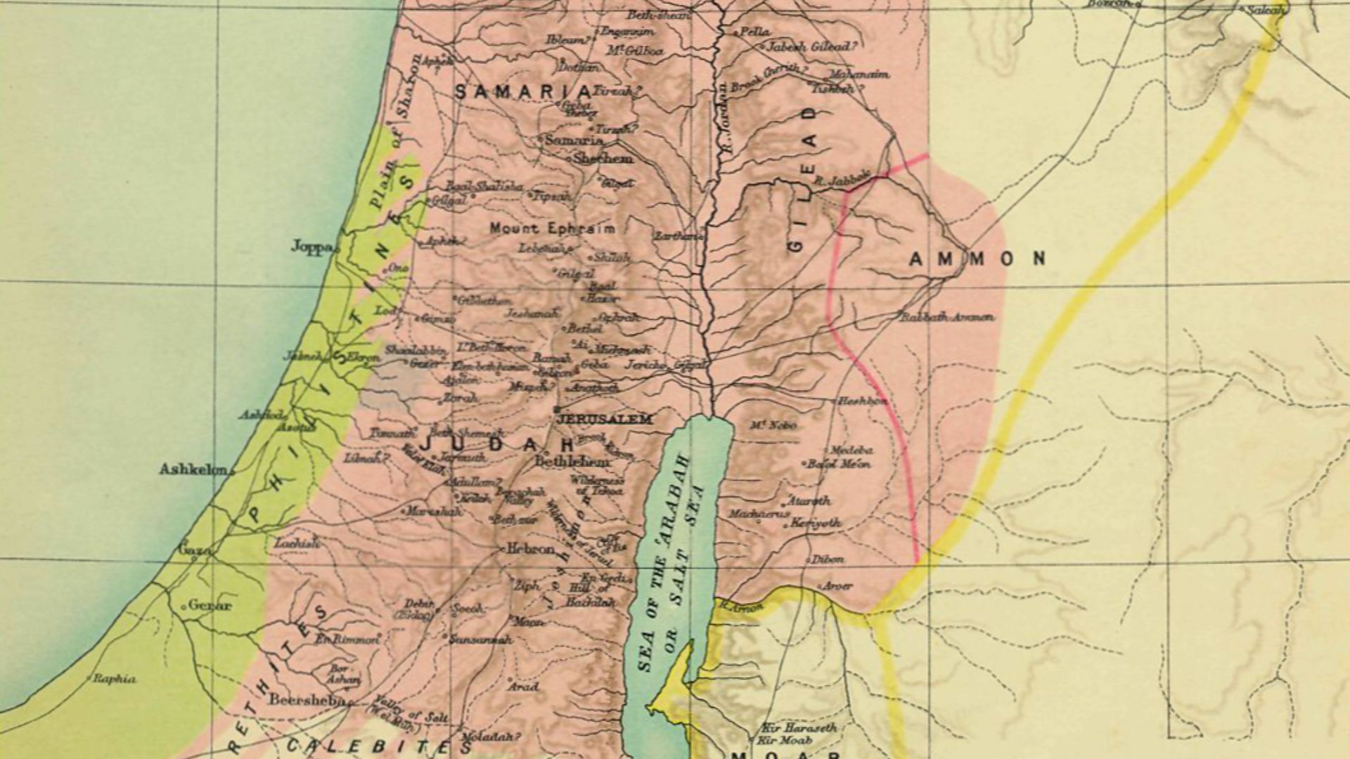
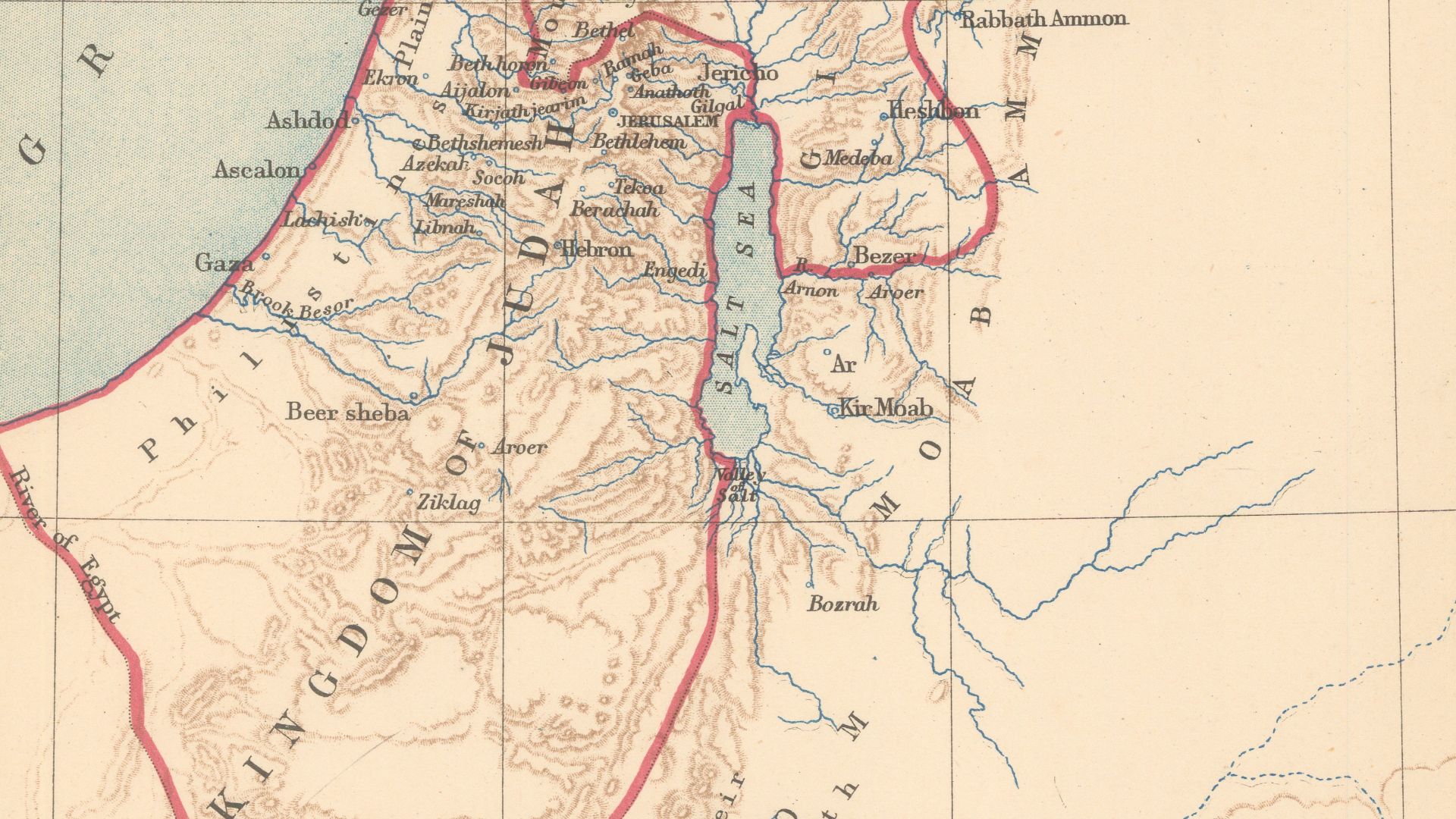
Kingdom Judah
After Solomon's demise around 930 BCE, the united monarchy fractured into two kingdoms: Israel in the north and Judah in the south. Judah remained under Davidic dynasty rule for four centuries, with Jerusalem as its unwavering capital despite constant threats from surrounding empires.
 Edward Weller, Wikimedia Commons
Political Context
It is said that the moat witnessed Jerusalem's most turbulent centuries, standing guard during Assyrian king Sennacherib's siege in 701 BCE when Hezekiah ruled Judah as a reluctant vassal state. It remained functional when Babylonian forces under Nebuchadnezzar encircled the city in 597 BCE, ultimately breaching Jerusalem's defenses.
 Unknown author, Wikimedia Commons
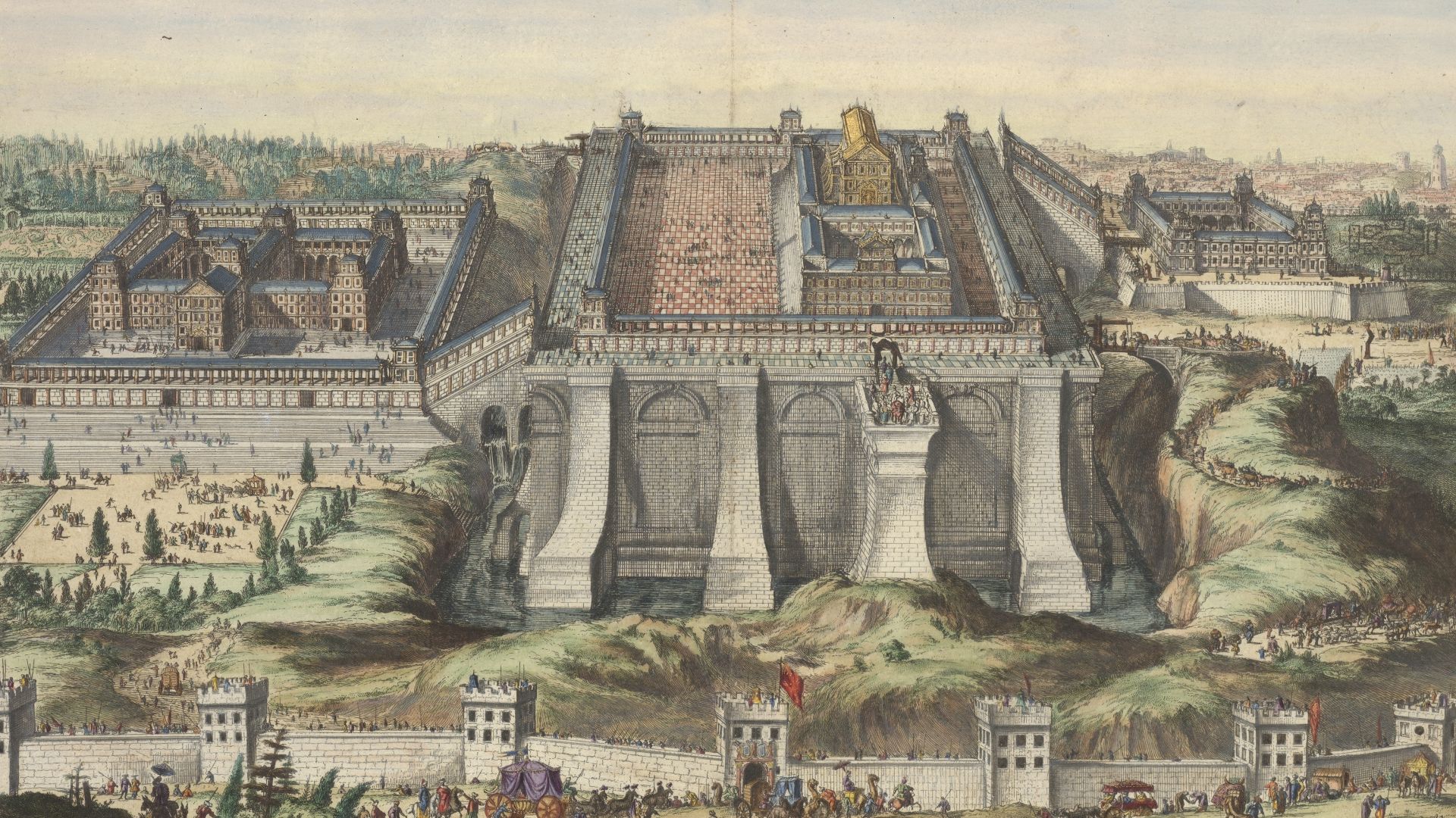
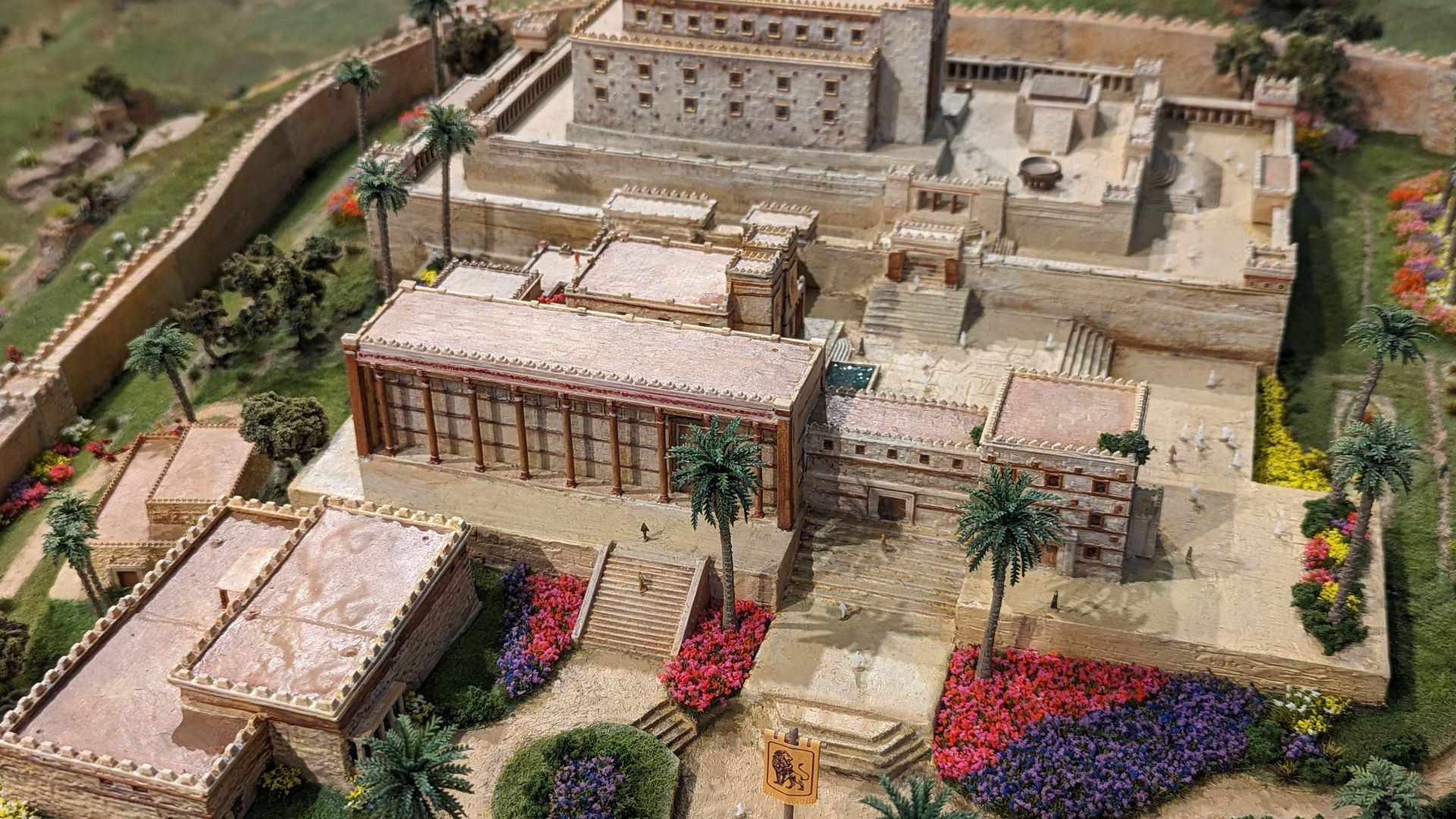
First Temple
Solomon constructed the First Temple on Mount Moriah around 957 BCE. The temple complex occupied the upper city, which the moat specifically protected from invasion. Biblical descriptions detail its Phoenician-influenced architecture featuring cedar from Lebanon, gold overlays, and intricate bronze work.
 Hendrick en Jacob Keur, Marcus Doornick, Wikimedia Commons
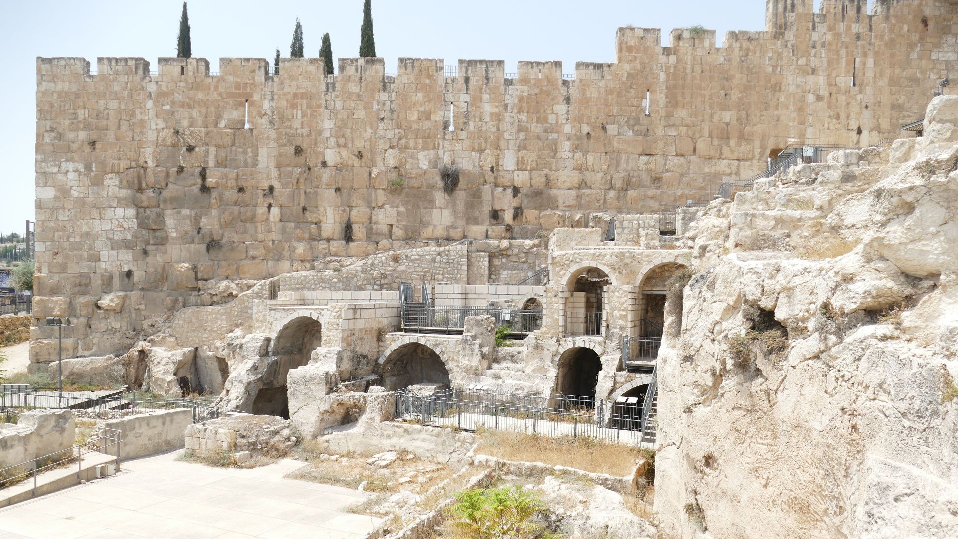
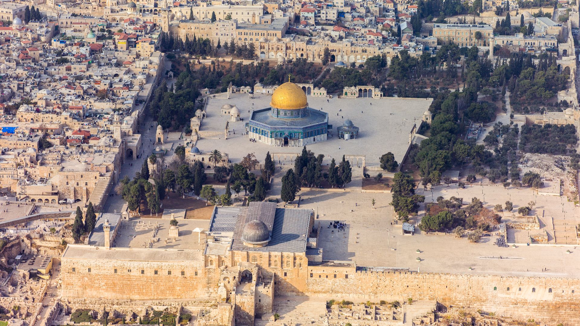
Temple Mount
This massive platform sits directly north of where the moat was carved, representing the ultimate destination the fortification was designed to protect. Today's Temple Mount measures approximately 37 acres, though its exact configuration during the First Temple period remains debated since later Herodian expansions dramatically altered the topography.
Royal Palace
Solomon's palace complex actually dwarfed the temple in size, taking thirteen years to complete compared to the temple's seven years, according to biblical accounts. Archaeological evidence suggests these structures followed the "bit hilani" design, a stereotyped palace architecture common throughout the ancient Near East featuring characteristic entrance halls and columned courtyards.
Residential Areas
South of the moat, ordinary Jerusalemites lived in densely packed neighborhoods clinging to steep slopes that plunged toward the Kidron Valley. Excavations have revealed typical Israelite houses from this period, following a uniform "four-room" plan: three parallel rooms with a fourth perpendicular room at the back.
 Radoslaw Botev, Wikimedia Commons
Engineering Challenges
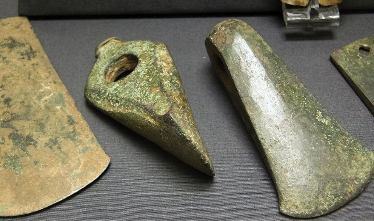
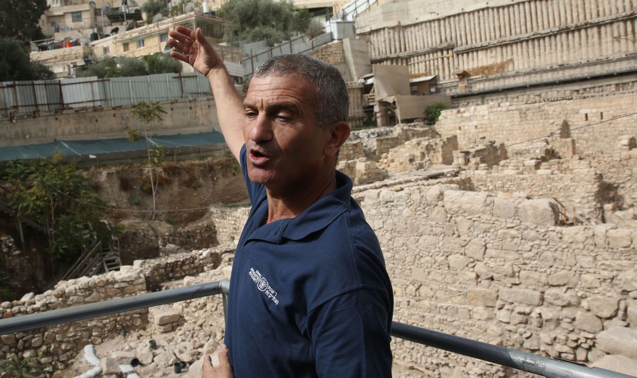
Carving this moat required removing thousands of tons of bedrock using only Bronze Age copper tools, wooden wedges, and fire-setting techniques. Eli Escusido, IAA Director, marveled that ancient engineers "literally moved mountains and hills" approximately 3,800 years ago without modern machinery.
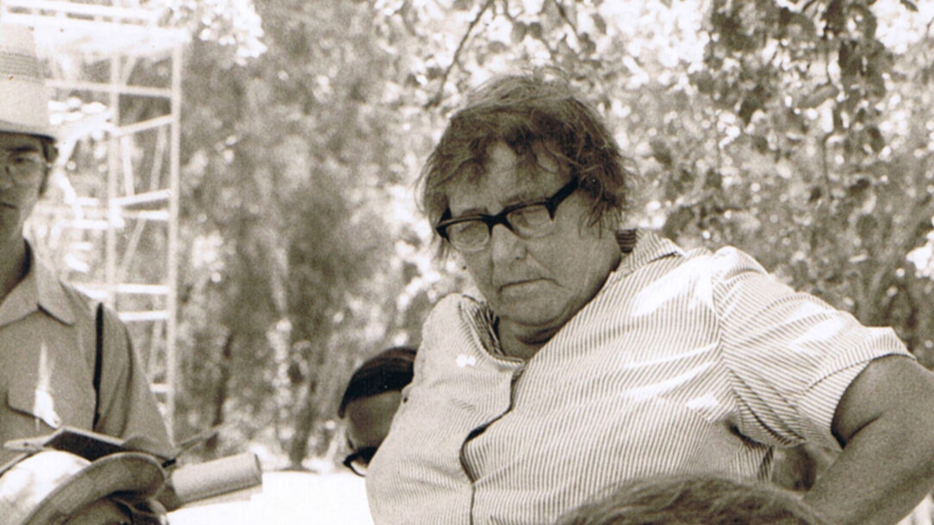
Kathleen Kenyon
British archaeologist Dame Kathleen Kenyon first encountered a section of this moat during her landmark Jerusalem excavations between 1961 and 1967, digging in what's now recognized as slightly east of the Givati Parking Lot. Her pioneering stratigraphic methods revolutionized biblical archaeology.
 Vassilios Tzaferis, Wikimedia Commons
1960s Discovery
Kenyon's 1960s dig marked the first scientific excavation to encounter this fortification, though she didn't recognize its true significance at the time. Working in Area M, her team meticulously documented layers of architectural terracing on the steep eastern slopes, uncovering what she interpreted as supporting structures for buildings above.
 Carole Raddato from FRANKFURT, Germany, Wikimedia Commons
Modern Excavation
Excavations resumed at the Givati Parking Lot in March 2007 under the direction of Dr Doron Ben-Ami from Hebrew University and Yana Tchekhanovets from the Israel Antiquities Authority, initially focusing on remains from multiple historical periods layered atop one another. The site covers roughly half a hectare.
Archaeological Significance
This discovery fundamentally challenges long-held assumptions about Jerusalem's size, sophistication, and urban planning during the First Temple period. For 150 years, archaeologists searched for physical proof that Jerusalem was genuinely divided into distinct zones as biblical texts described, and this moat provides that concrete evidence.
Visitor Access
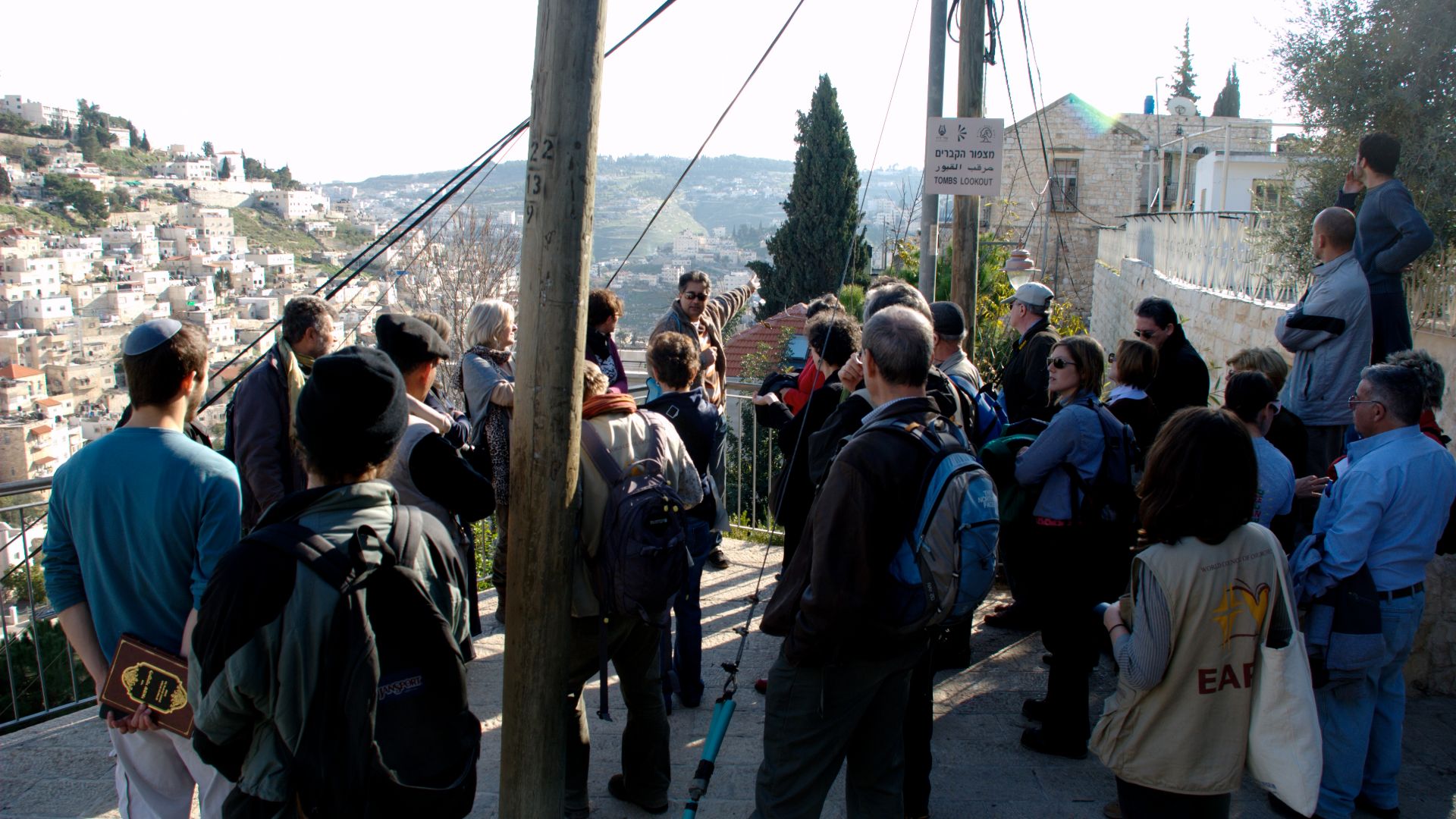
The excavation site now welcomes public visitors at the City of David National Park, where people can sometimes descend into the ancient trench and stand surrounded by towering hewn walls carved millennia ago. Walking the moat's floor creates an immediate visceral understanding of the structure's imposing scale.
 Ian McKellar from San Francisco, CA, USA, Wikimedia Commons


