

Casa Grande Chronicles
Most people speed right past it on Interstate 10. There's an ancient four-story building standing in the Arizona desert that's older than the Aztec Empire. The Hohokam people built it, then vanished altogether.

Ancient Origins
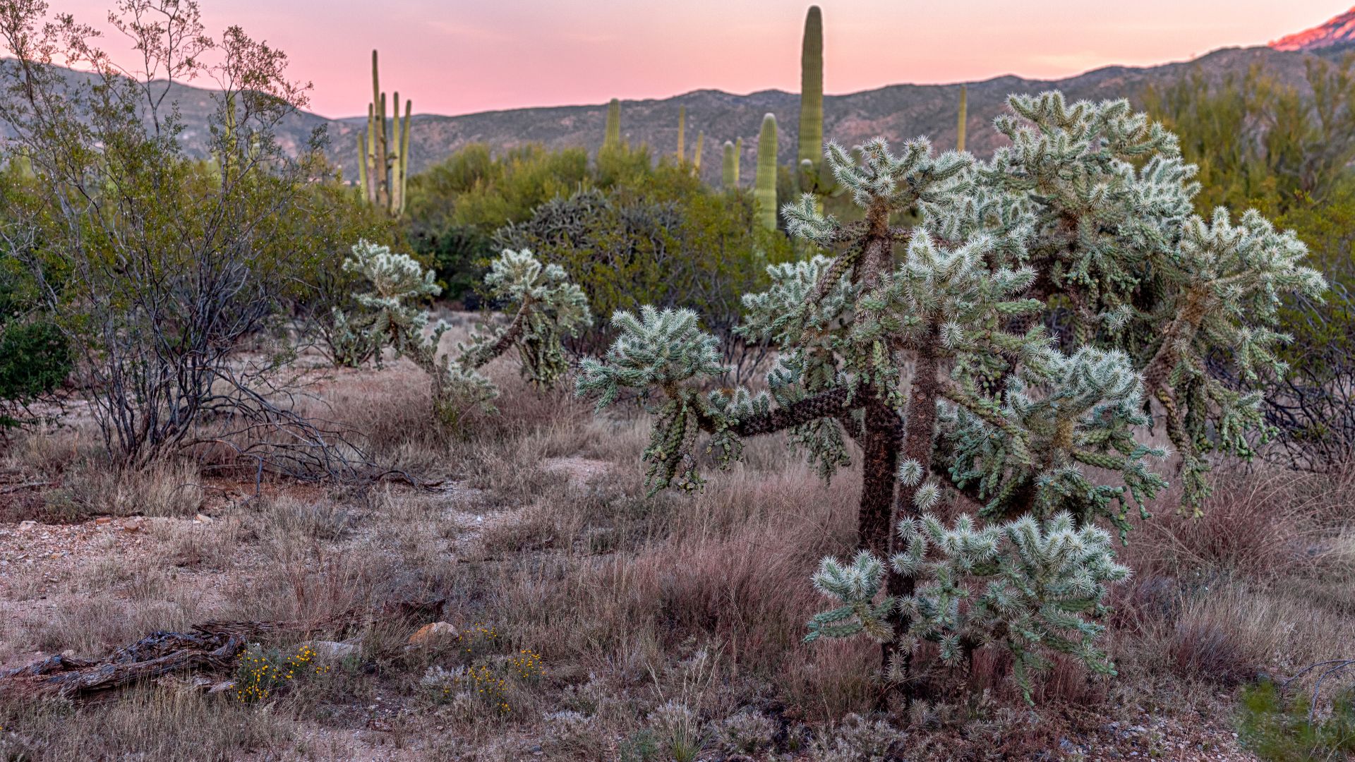
The story begins around 5,500 BCE, when early hunters and gatherers first roamed the Sonoran Desert, long before Casa Grande was ever built. These resourceful people survived by collecting mesquite beans, cactus fruits, and hunting desert game in one of North America's harshest environments.
 NOIRLab/NSF/AURA/P. Horalek, Wikimedia Commons
Hohokam Culture
Picture tens of thousands of people thriving in the scorching Arizona desert for over 1,400 years—that's the Hohokam achievement. Between 300 CE and 1450 CE, they developed vast canal networks in the ancient Southwest, with some estimates suggesting tens of thousands lived at their peak.
Agricultural Revolution
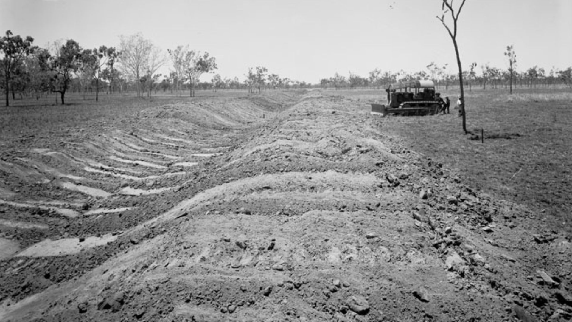
Around 300 BCE, something revolutionary happened. The desert dwellers mastered irrigation farming where others saw only wasteland. They cultivated corn, beans, squash, cotton, and tobacco using water management techniques that would rival ancient civilizations worldwide. Saguaro fruits, prickly pear, and mesquite pods supplemented their diet.
 Agriculture And Stock Department, Information Branch, Photography Section, Wikimedia Commons
Canal Engineering
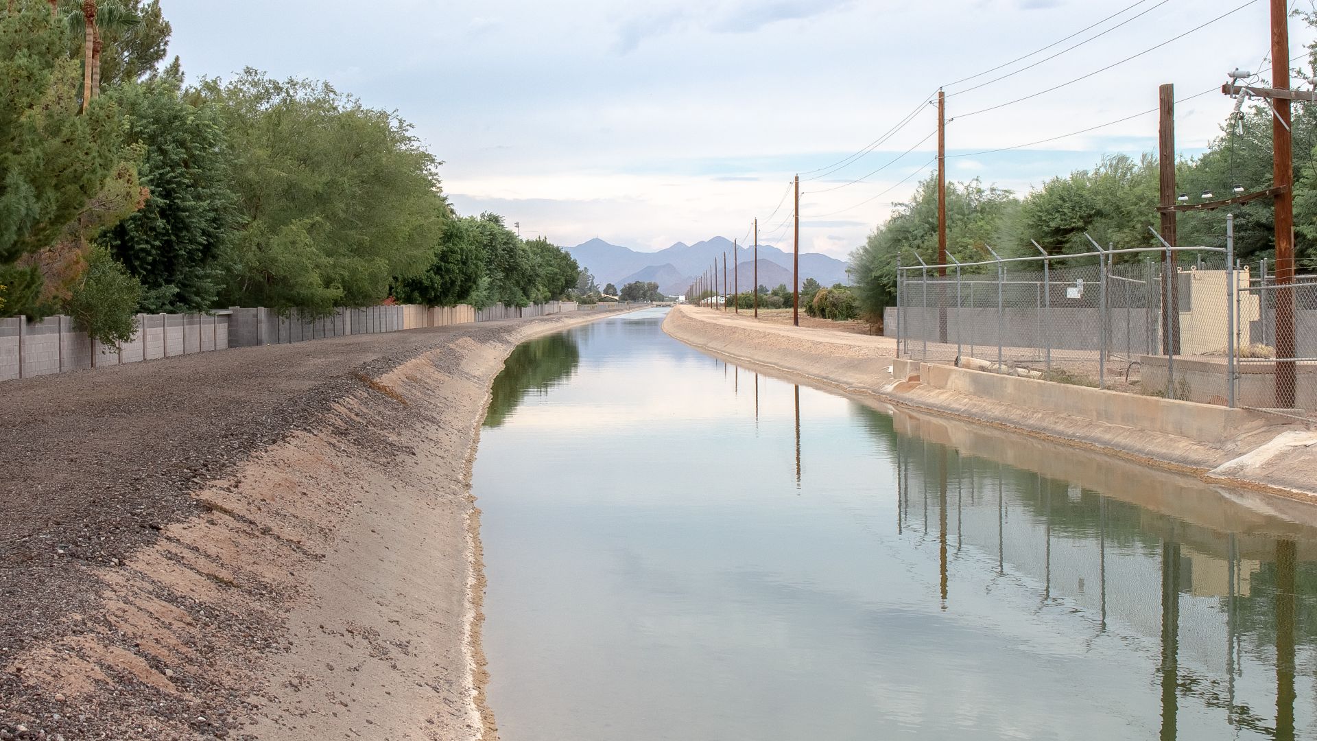
By 1300 CE, the Hohokam had constructed the most complex irrigation system in prehistoric North America, hundreds of miles of canals dug entirely by hand using stone tools and digging sticks. Some channels measured 13 feet wide and 12 feet deep, engineered with precision.
 Tony the Marine (talk), Wikimedia Commons
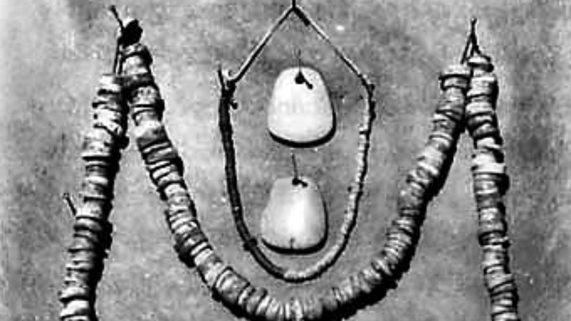
Trade Networks
Casa Grande sat at an important crossroads where goods from modern-day Mexico, California, and the Great Plains converged. Archaeologists have uncovered copper bells, iron pyrite mirrors, and colorful parrots from Mexico. In exchange, Hohokam artisans traded their finely crafted shell jewelry.
 National Parks Service, US depatament of the Interior, Wikimedia Commons
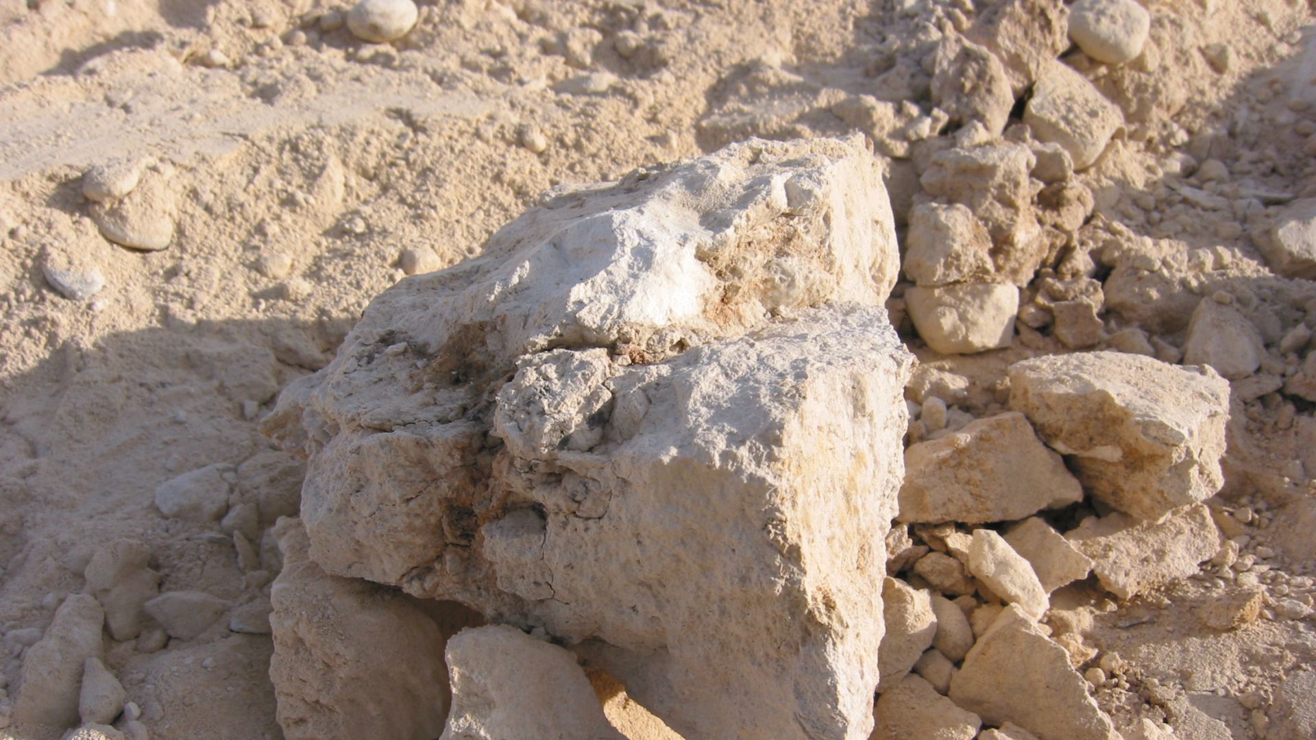
Construction Begins
Around 1320 CE, workers began building what would become the Great House, hauling more than 3,000 tons of caliche—a natural concrete-like material of sand, clay, and calcium carbonate found beneath desert topsoil. Construction took approximately 30 years, with completion around 1350 CE.
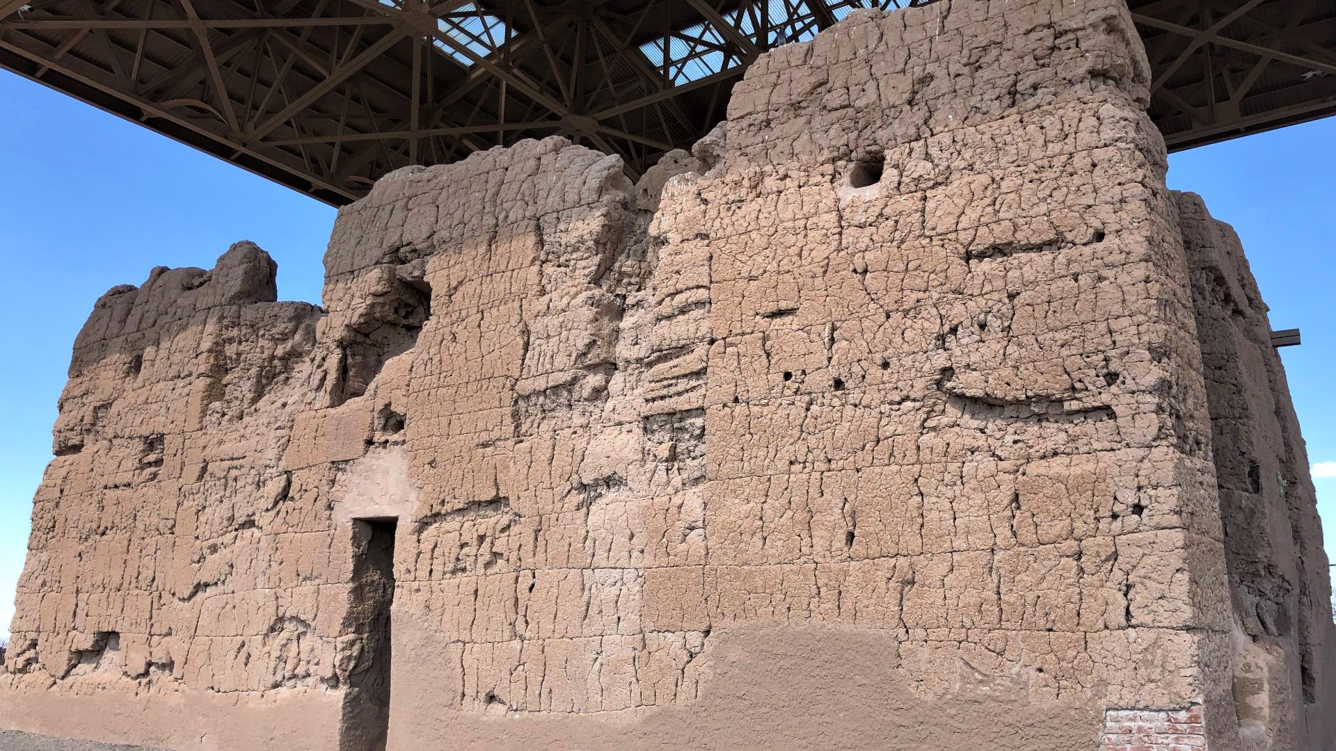
Great House
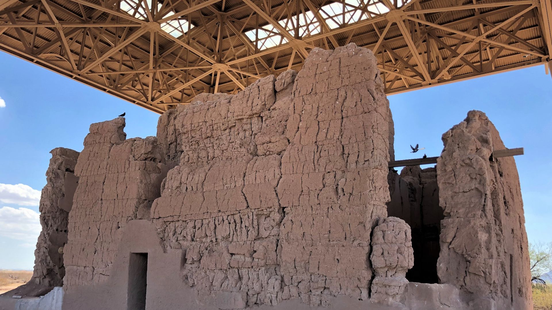
Standing four stories tall and stretching 60 feet long, Casa Grande remains the largest known prehistoric structure built by the Hohokam people. The outer rooms rise three stories while the inner chamber reaches four. Those walls are four feet thick at the base.
 Beyond My Ken, Wikimedia Commons
Astronomical Observatory
The Great House walls align perfectly with the four cardinal directions—north, south, east, and west—revealing a profound understanding of astronomy. A circular opening in the upper west wall frames the setting sun during the summer solstice on June 21st. Twin holes in opposite walls capture equinox sunrises in March and September.
 National Forest Service, Wikimedia Commons
Mysterious Abandonment
By 1450 CE, Casa Grande and surrounding Hohokam villages lay abandoned, their inhabitants vanished after more than a millennium of continuous occupation. Theories abound: environmental stress and social upheaval disrupted canal systems, followed by prolonged droughts and regional instability in the late 1300s.
 Frank Russell, Wikimedia Commons
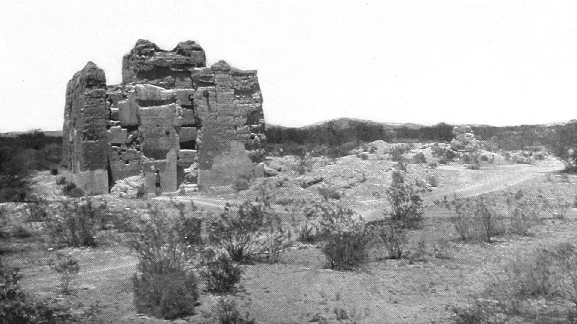
Lost Centuries
For over two centuries, Casa Grande stood silent and crumbling in the desert, occasionally visited by Native peoples but largely forgotten by the outside world. The structure weathered monsoons, sandstorms, and extreme temperature swings without any protection or maintenance.
 United States Forest Service, Wikimedia Commons
Kino's Discovery
Father Eusebio Francisco Kino, an Italian Jesuit missionary, mathematician, and cartographer, became the first European to document Casa Grande in November 1694. Traveling ancient trading routes through Pimeria Alta, he encountered the massive adobe structure and named it "Casa Grande"—Spanish for “Great House”.

European Documentation
Following Kino's visit, other expeditions documented the ruins throughout the 1700s and 1800s. Lieutenant Colonel Juan Bautista de Anza's party stopped there in 1775, and Brigadier General Stephen Watts Kearny's military detachment visited in 1846. Each visitor marveled at the structure's size and mysterious purpose.
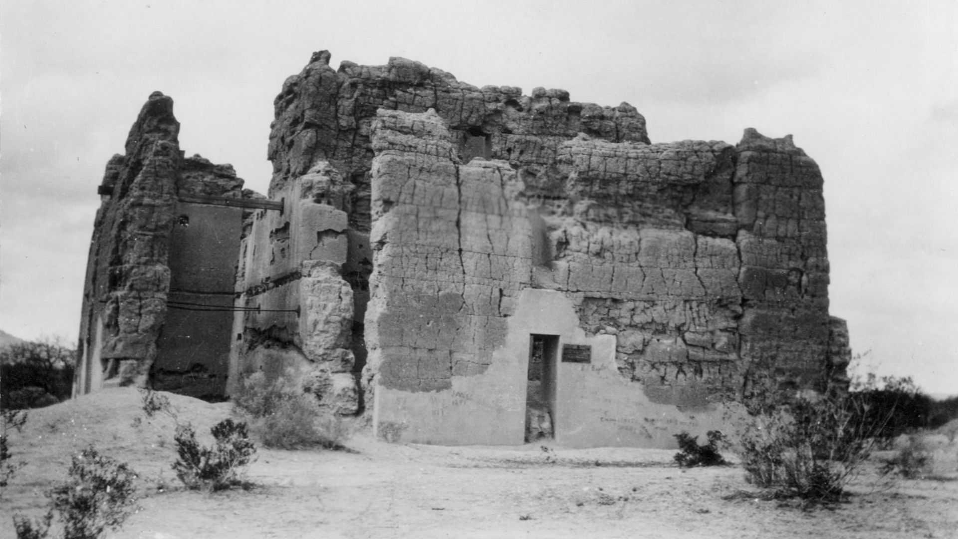
Railroad Vandalism
Everything changed in the late 1870s when a railroad line arrived nineteen miles west of Casa Grande, bringing unprecedented tourist traffic via connecting stagecoach routes. Souvenir hunters carved their names into the ancient walls, chipped off pieces of the structure as keepsakes, and vandals left extensive graffiti still visible today.
 Unknown authorUnknown author, Wikimedia Commons
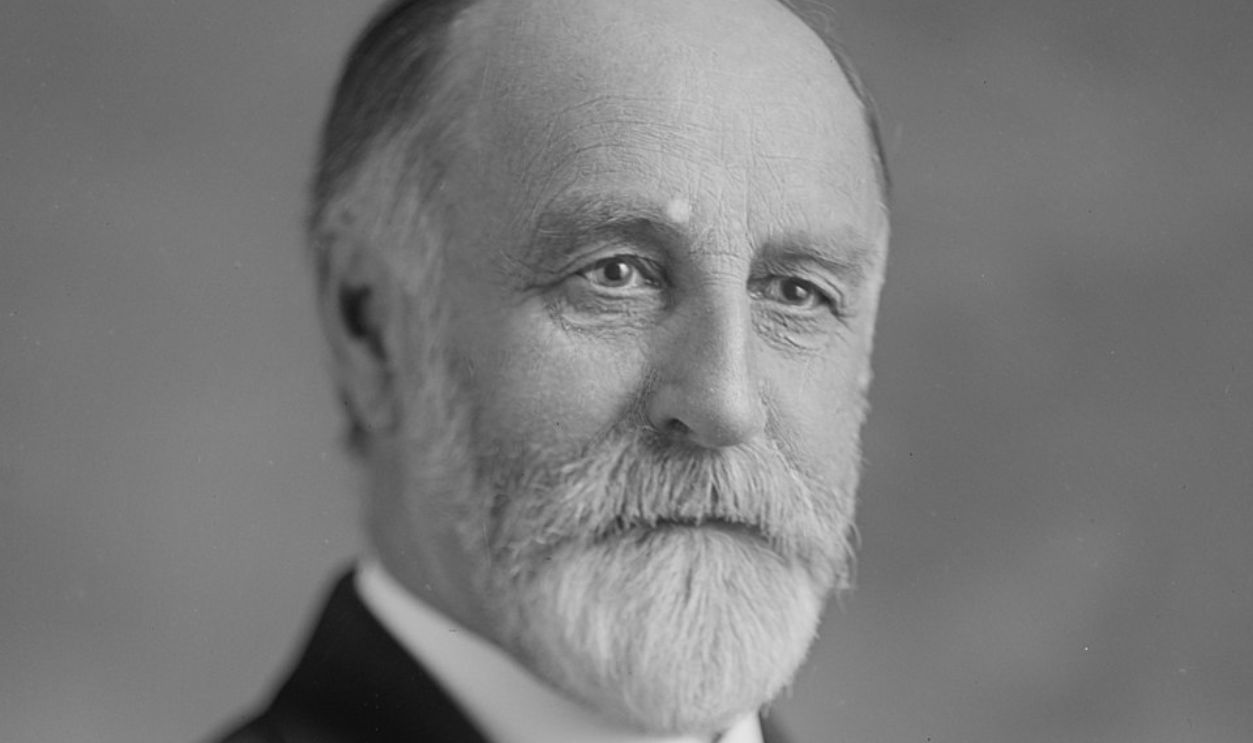
First Reserve
Mary Hemenway, a wealthy Boston philanthropist, funded the Hemenway Southwestern Archaeological Expedition from 1886 to 1894, which documented the extensive vandalism at Casa Grande. Her team's shocking reports prompted her to launch a national campaign for federal protection. On June 22, 1892, President Benjamin Harrison issued Executive Order 28-A.
National Monument
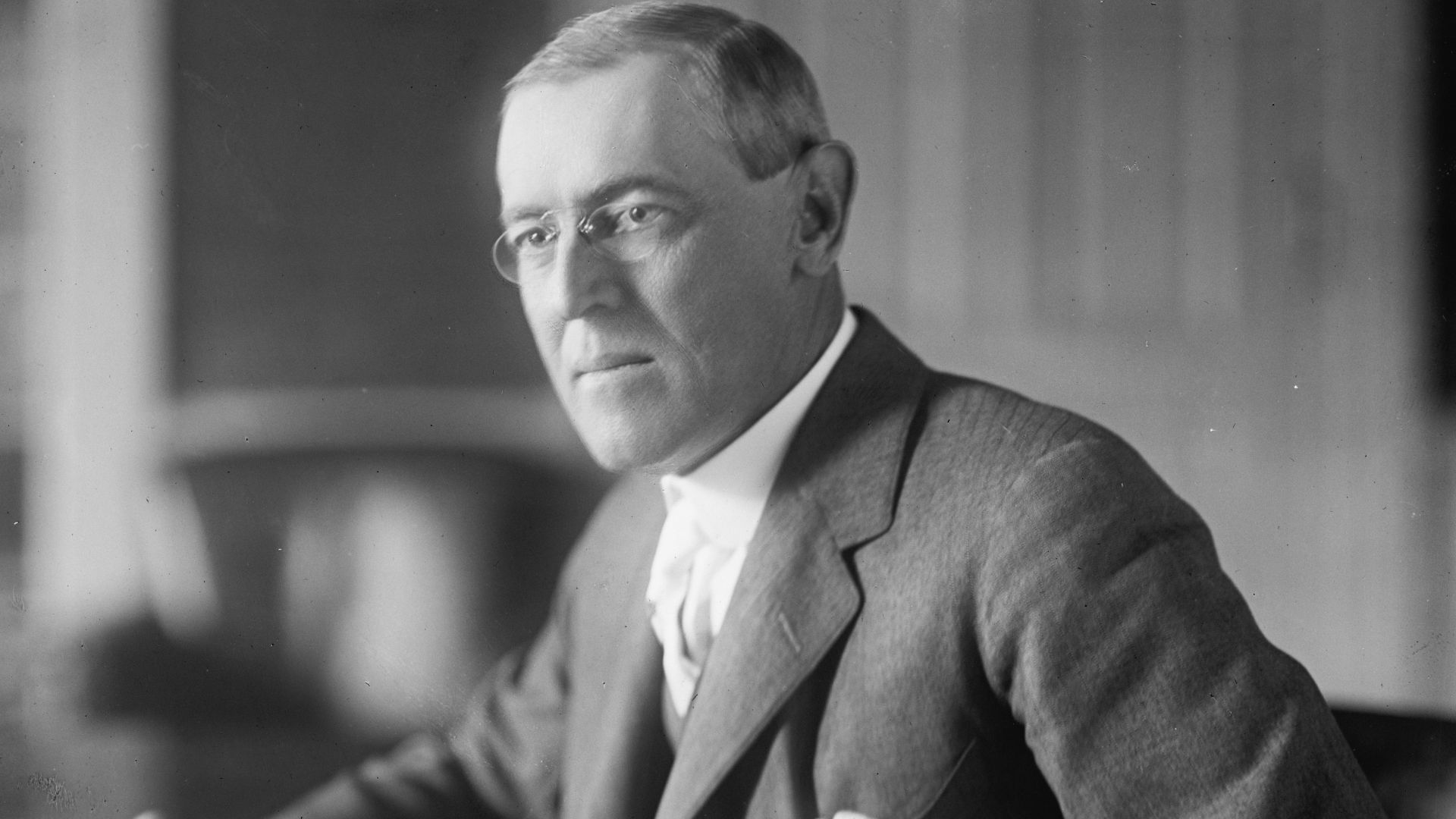
The site underwent transitions over the following decades. In 1891, Cosmos Mindeleff from the Bureau of American Ethnology supervised repairs until funding ran out. A protective roof was erected in 1903. Finally, on August 3, 1918, President Woodrow Wilson officially redesignated Casa Grande as a National Monument.
 Harris & Ewing, photographer, Wikimedia Commons
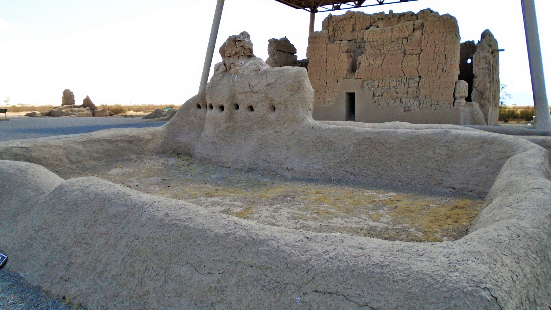
Protective Shelter
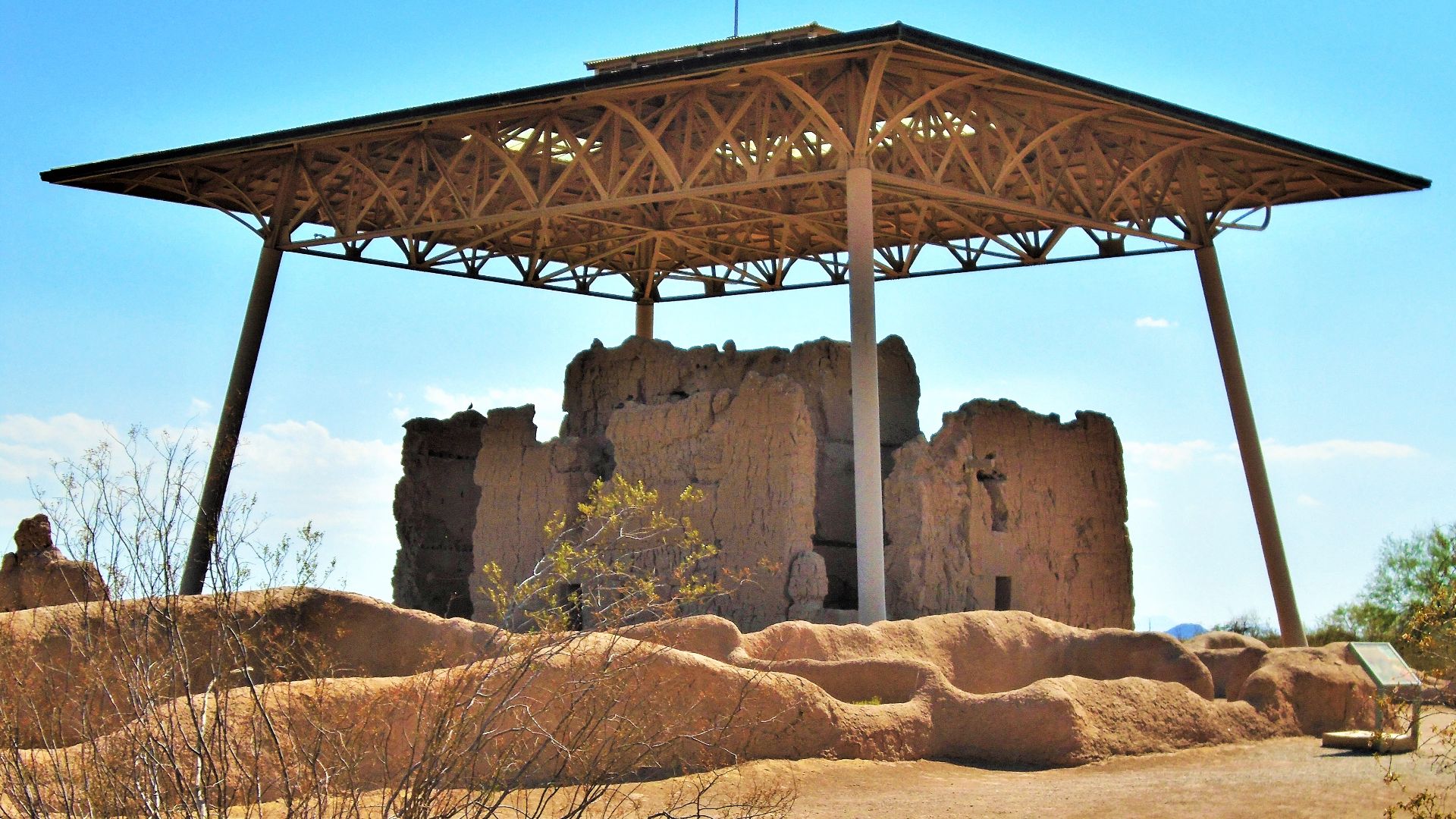
By 1930, the original 1903 corrugated-iron roof had blown off during high desert winds, leaving the ancient structure exposed once again to Arizona's punishing elements. Congress appropriated funds in 1932 for a new protective shelter, recognizing that without intervention, the adobe walls would gradually dissolve back into the desert soil.
 Beyond My Ken, Wikimedia Commons
Olmsted Design
Frederick Law Olmsted Jr created the innovative shelter design in 1932. His striking solution featured a steel-framed hip roof supported by angled posts, standing 46 feet high and painted sage green to harmonize with surrounding mountains and desert vegetation. It was completed on December 12, 1932.
 Beyond My Ken, Wikimedia Commons
CCC Contributions
Between 1937 and 1940, the Civilian Conservation Corps built five adobe support buildings at Casa Grande using traditional methods and locally sourced adobe materials. These structures, designed in Pueblo Revival style by in-house National Park Service architects, served as housing and administrative offices for monument staff.
 National Park Service, Wikimedia Commons
Tribal Descendants
Today, at least eight Native American tribes maintain cultural and spiritual connections to Casa Grande: the Akimel O'odham (Pima), Tohono O'odham, Gila River Indian Community, Salt River Pima-Maricopa Indian Community, Ak-Chin Indian Community, Hopi Tribe, Zuni Pueblo, and others. These communities call the site “Siwan Wa'a ki”.
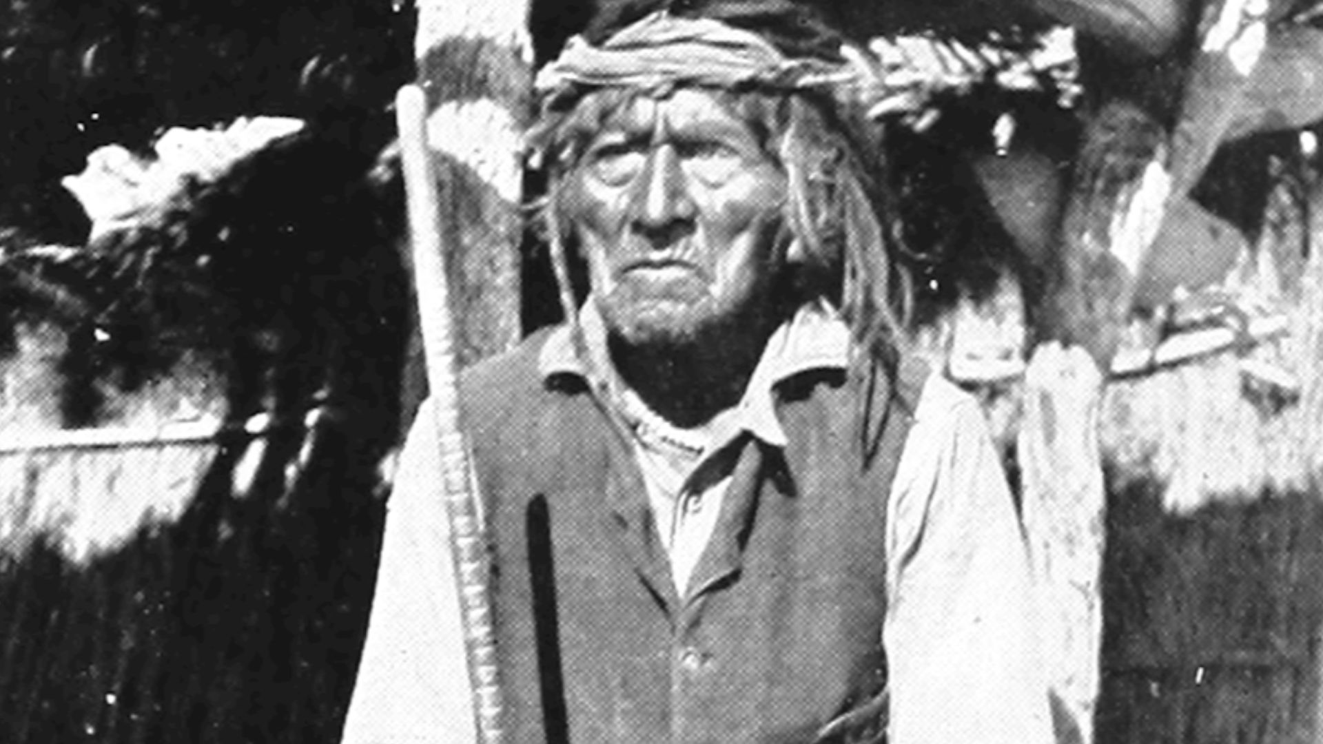 Frank Russell, Wikimedia Commons
Archaeological Research
Archaeological excavations between 1906 and 1908 by Jesse Walter Fewkes uncovered the Great House's foundation and compound walls, revealing the true scale of the ancient village. DNA analysis of plant remains reveals what crops the Hohokam cultivated. Also, chemical analysis of pottery traces ancient trade routes across miles.
 Harris & Ewing, photographer, Wikimedia Commons
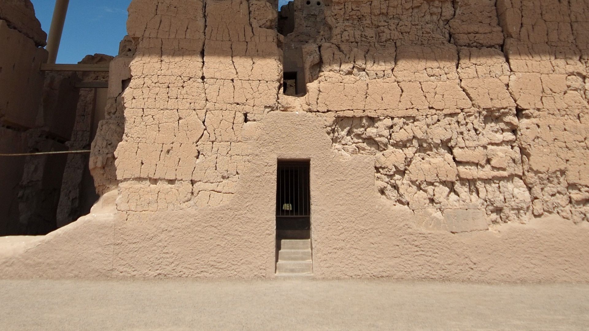
Construction Materials
The builders employed a sophisticated "puddling" technique, mixing caliche—sand, clay, and calcium carbonate—with water to create layers of wet adobe that dried between applications. Each course was built incrementally, creating the noticeable horizontal cracks visible today that mark where one layer ended and another began.
 Oosoom at English Wikipedia, Wikimedia Commons
Solstice Alignments
On June 21st each year, the summer solstice sunset shines directly through a circular opening in the Great House's upper west wall, illuminating the interior chamber. This precise alignment served as a calendrical marker helping Hohokam farmers determine optimal planting and harvesting times in the unpredictable desert climate.
 Beyond My Ken, Wikimedia Commons
Moon Cycles
Perhaps the most astronomical feature is a square opening that aligns with the moon's maximum northern or southern setting position—an event occurring once every 18.6 years in a complex lunar cycle. This alignment was proposed by researchers in 1978 based on architectural observations.
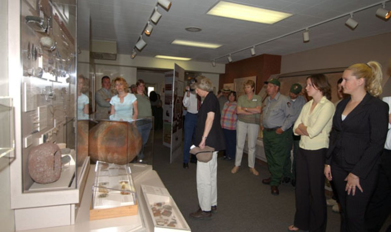
Visitor Center
Casa Grande Ruins National Monument welcomes 60,000–80,000 visitors annually to its modern facility featuring interactive exhibits, artifact displays, and an informative film presentation. The bookstore offers educational materials. Besides, park rangers lead guided tours from November through March, sharing insights about Hohokam culture.
 National Archives at College Park - Still Pictures, Wikimedia Commons


.jpg)