
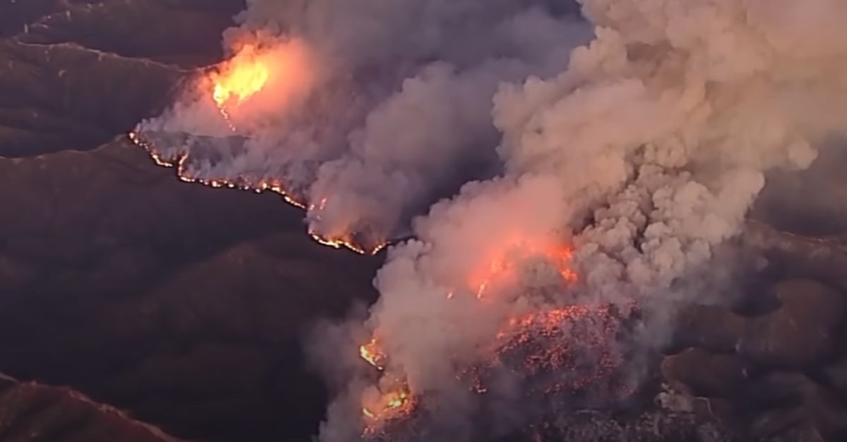
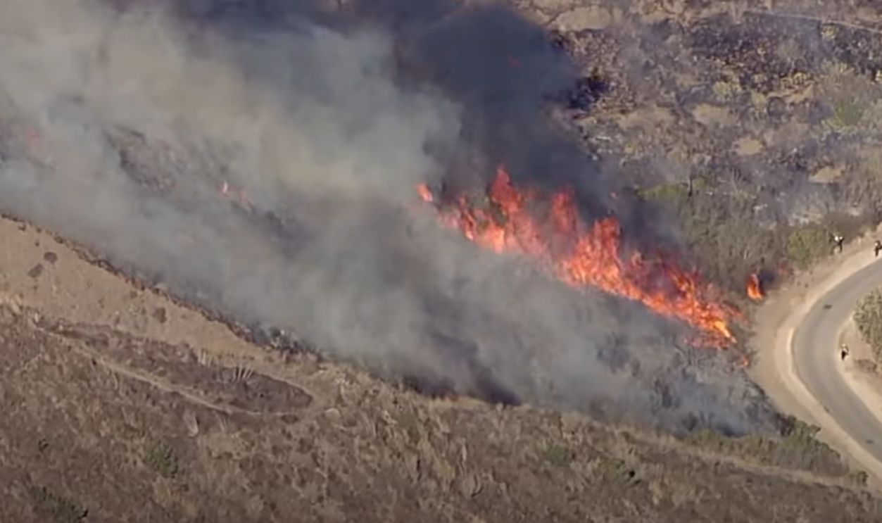
Fire Erupts In Santa Monica Mountains on January 7
On January 7, the Palisades Fire ignited in the Santa Monica Mountains, rapidly growing due to dry conditions and strong winds. Within hours, the fire was out of control.
Where It All Began
The Palisade Fire started near the Skull Rock Trailhead along the Temescal Ridge Trail in Topanga State Park in Los Angeles on January 7, 2025. Investigators believe it may have been ignited by lingering hotspots from a previous fire, the Lachman Fire, which occurred on January 1 , 2025.
 Tony Webster, CC BY 2.0, Wikimedia Commons
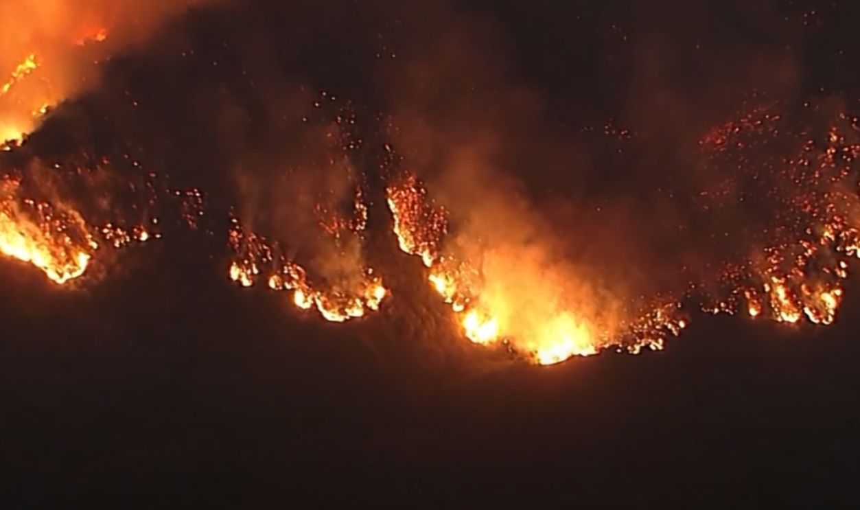
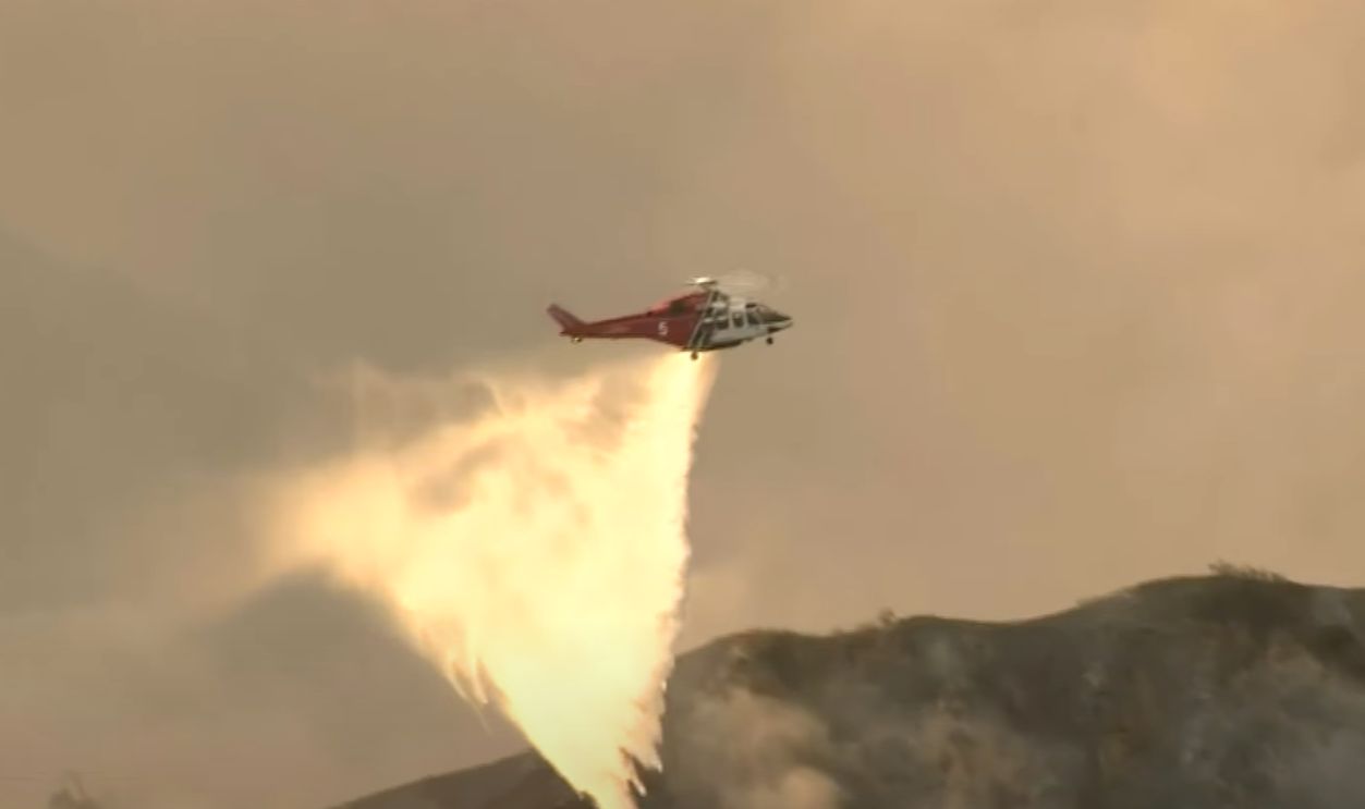
It Was The Perfect Storm
Experts call this a "perfect storm" scenario: Dry fuel, wind, and steep terrain combine, allowing wildfires to spread unpredictably. The Santa Monica Mountains' rugged terrain posed a challenge for early firefighting efforts, even though helicopters and aerial support were critical during the first 48 hours.
 Helicopters battle Palisade fire as flames burn on Santa Monica mountains by The Independent
Strong Santa Ana Winds Help Spread Flames Rapidly
Santa Ana winds, reaching speeds of 90 mph, became one of the fire's worst enemies. These winds are notorious for pushing wildfires in unpredictable directions, and they create chaos for emergency crews. The gusts carried embers miles away from the fire's origin. They spread flames beyond what was initially anticipated.

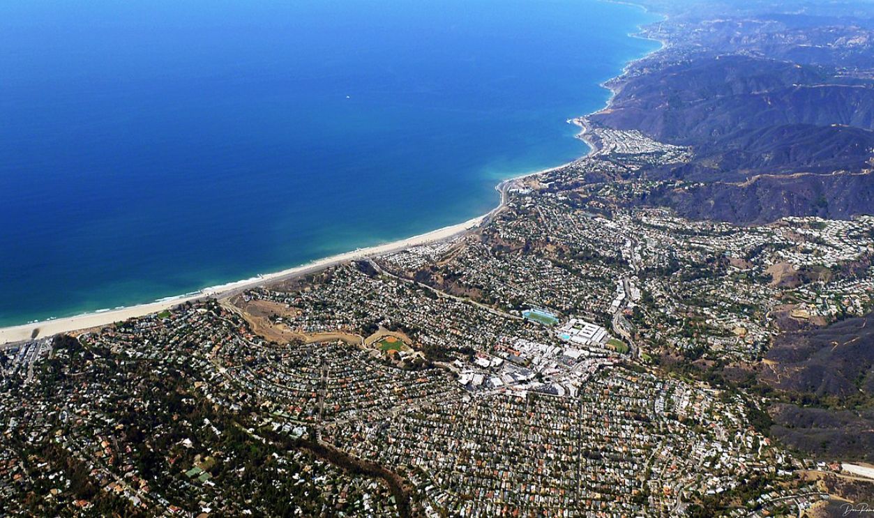
Pacific Palisades First Hit By The Blaze
Pacific Palisades was one of the first neighbourhoods directly impacted as the fire advanced. The wind-driven blaze quickly crept into residential areas, posing a massive threat to homes and lives. Firefighters and local authorities scrambled to coordinate evacuations, hoping to limit damage in this densely populated region.
 Perfect water drop takes down chunk of Palisades Fire by FOX 11 Los Angeles
Why The Pacific Palisades?
The terrain in Pacific Palisades, combined with suburban development, made it a prime target for destruction. Dense foliage, coupled with dry conditions, turned the area into a fire trap. Aerial teams were deployed immediately to offer essential visual assessments to guide ground teams in directing evacuations and firefighting efforts.
 D Ramey Logan, CC BY-SA 4.0, Wikimedia Commons
Initial Impact On Residential Areas In Pacific Palisades
The first few days saw heavy damage to residential properties in Pacific Palisades. On the first day of the Palisade Fire, approximately 50 homes were destroyed in the Pacific Palisades neighbourhood. By the end of the second day, January 8, 2025, the number of destroyed homes had increased to around 100.
 Timeline: How the deadly California wildfires unfolded by ABC News
Evacuations Begin As Fire Grows To Over 1,000 Acres
By January 8, the Palisades Fire had already grown to more than 1,000 acres, prompting mandatory evacuations. Thousands had evacuated all areas north of Montana Avenue from the beach to 11th Street. More covered the north sides of Montana Avenue, Wilshire Boulevard, and the west sides of 10th Street.
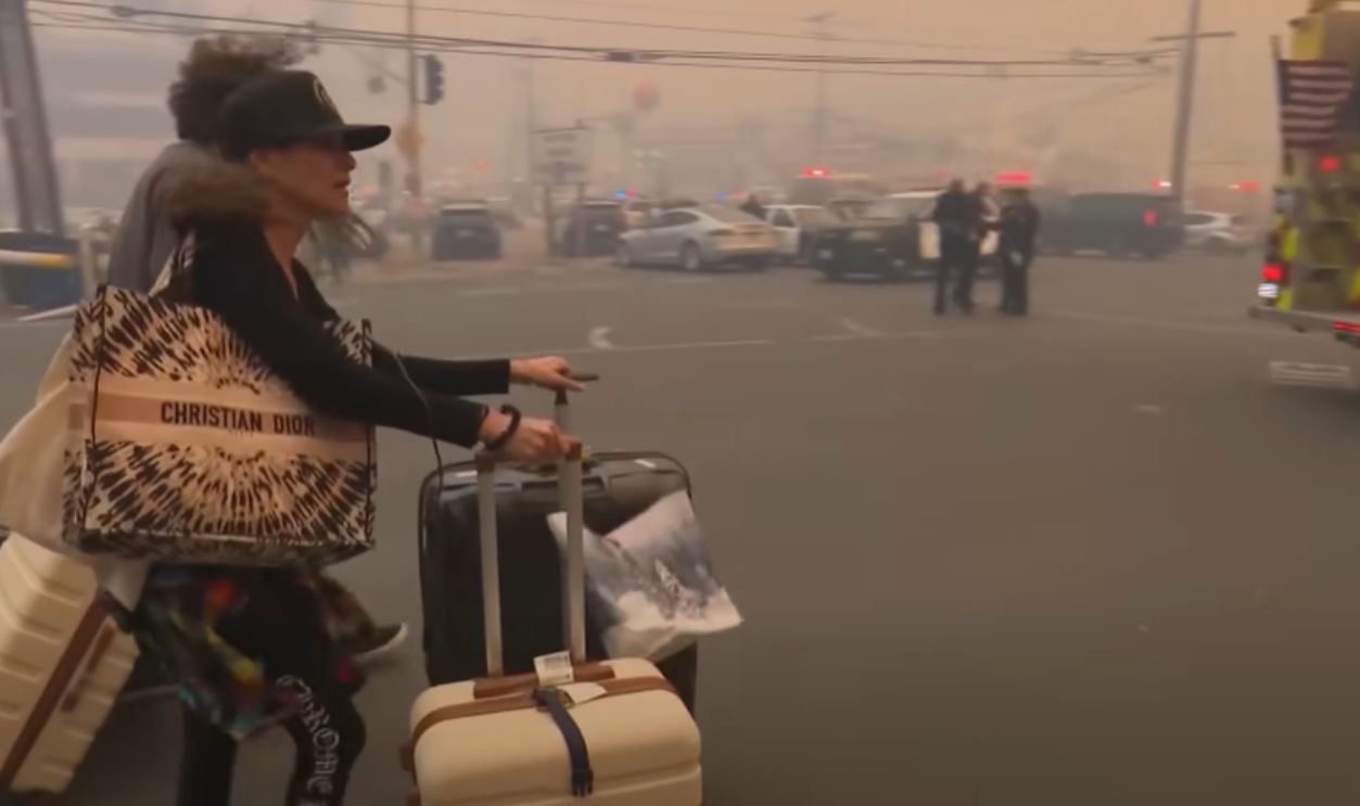 People fleeing L.A. wildfire abandon their cars to escape on foot by CBC News: The National
As Expected, It Was Messy
Evacuations can be chaotic, especially when people are asked to leave with little notice. During these stages, thousands were forced to flee and leave behind their homes and possessions. Emergency shelters were set up, but the focus remained on halting the fire's advance before it reached even more populated areas.
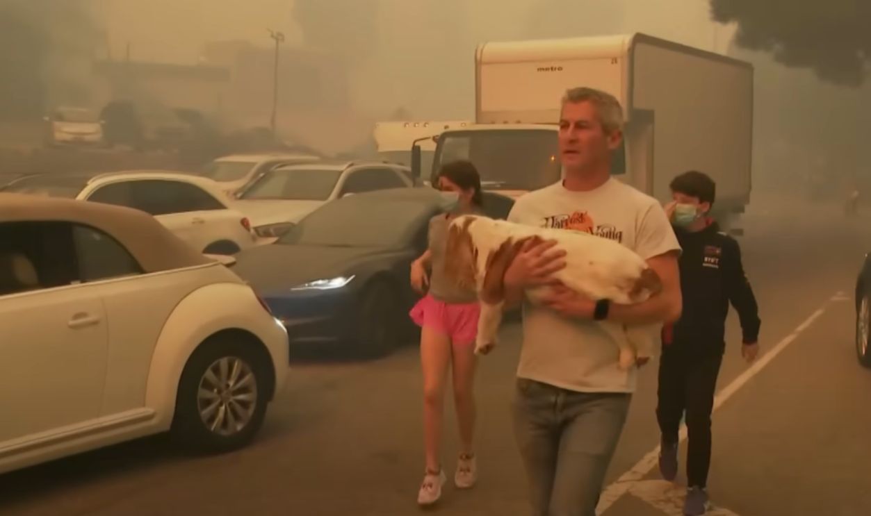 People fleeing L.A. wildfire abandon their cars to escape on foot by CBC News: The National
Palisades Fire Spreads Toward Malibu
Firefighters faced an intense battle as the fire pushed toward Malibu the same day they started. The coastal city, famous for its celebrity residences, now found itself in the crosshairs of the blaze. Celebrities’ homes, many perched on hillside lots, became prime targets for the fire's destructive path.
 Palisades Fire forces Santa Monica evacuations by FOX 11 Los Angeles
Malibu Evacuations Prompted As Wind Gusts Reach 90 MPH
Wind gusts of 90 mph sent the fire careening toward Malibu. With these powerful gusts, the situation escalated quickly. Local authorities were forced to issue evacuation orders for residents in Malibu, urging them to leave immediately as flames crept closer.
 More fire danger in Malibu | KTVU by KTVU FOX 2 San Francisco
Several Hollywood Stars Lost Their Homes In Malibu
Mel Gibson lost his $14.5 million mansion while he was away filming a podcast. Paris Hilton was present and just stood in shock as her $8.4 million beach home burned down on live TV. Milo Ventimiglia, with his pregnant wife, had to evacuate their home, which was destroyed.
 Mel Gibson's Malibu Mansion That Just Burned Down! by Luxury Homes
There Were More
Adam Brody and Leighton Meester, as well as Billy Crystal, watched what they watched their homes burn down in flames. Malibu's layout made the burning of these properties particularly vulnerable. Aerial footage captured the terrifying sight of flames encroaching on Malibu's prized coastline.
 Images show luxury homes in Malibu destroyed by wildfires | AFP by AFP News Agency
Fire Destroys Homes In Pacific Palisades And Topanga
By January 9, the fire had ravaged homes in both Pacific Palisades and Topanga. Entire blocks of houses were consumed by flames as firefighters worked tirelessly to save what they could. By then, about 20,000 acres were torched, and over 5,300 structured flattened.
Lives Were Lost
Still, on the 9th, the LAFD fire chief Kristin Crowley announced at a press conference two lives had been claimed in the fires. This was at 5:20 pm. By 6:45 pm, a CAL FIRE status report stated the acres burned had reached 19,978 acres.

The Scene Became Unrecognizable
The impact on homes was devastating, but so was the toll on the local wildlife. The dense vegetation in Topanga Canyon, coupled with the fire’s spread, left behind an environment that was nearly unrecognizable. The challenge to restore this habitat would be immense. Restoration will require years of recovery work.
 Palisades Fire Near Topanga Canyon Forces Evacuations by CBS News Sacramento
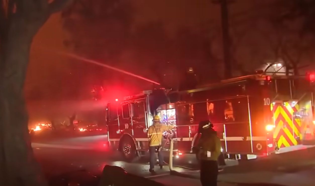
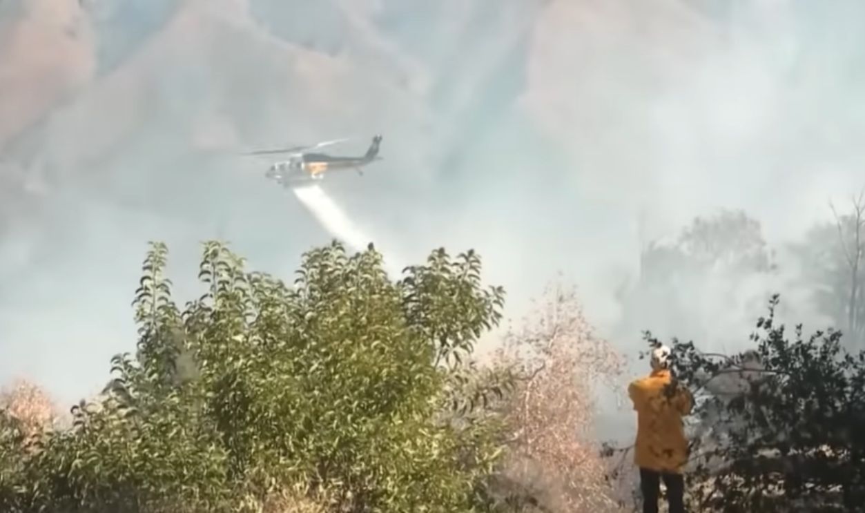
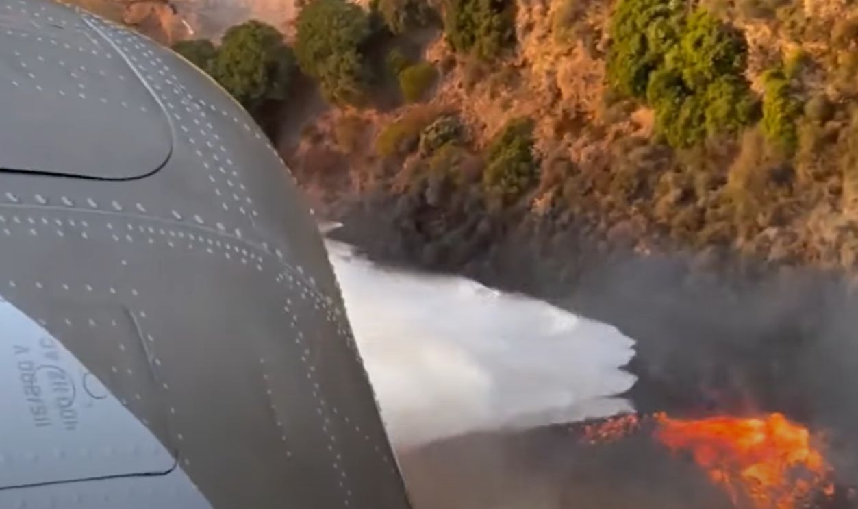
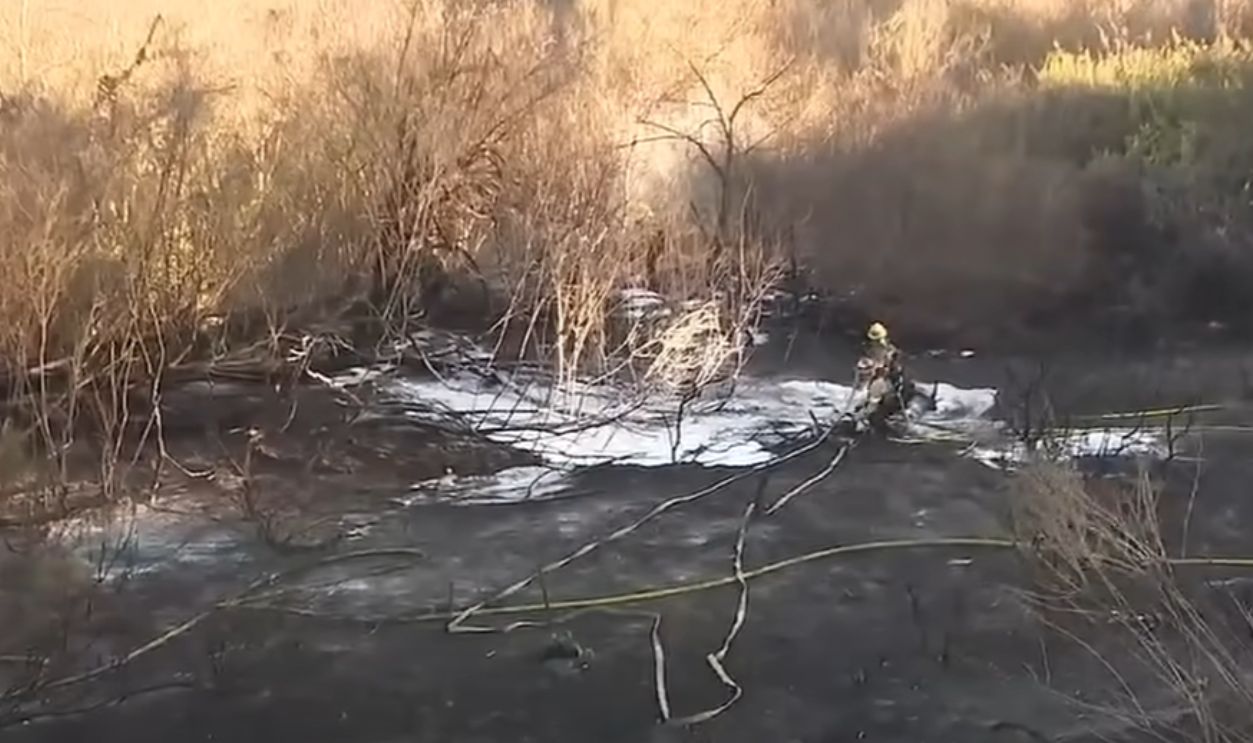
Crews Work Relentlessly To Contain Fire
When the morning of January 10 came, the fire had spread significantly, but containment efforts were beginning to be successful. Firefighters worked relentlessly; they shifted tactics to keep the blaze from spiralling out of control. They relied heavily on aerial support—water drops and fire-resistant liquids.
 Palisades Fire Near Topanga Canyon Forces Evacuations by CBS News Sacramento
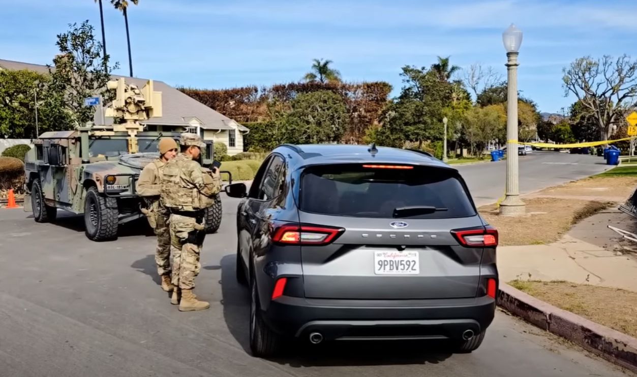
More Evacuations
Evacuation orders were issued on all sides, north of Encino Reservoir and south of Sunset Boulevard. To the east and west were Interstate 405 and Mandeville Canyon, respectively. These orders affected everyone in Encino, San Fernando Valley, and Tarzana.
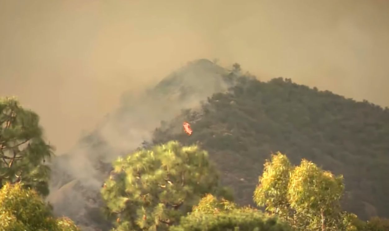
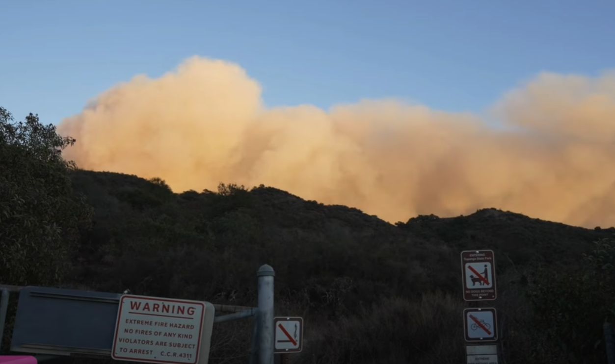
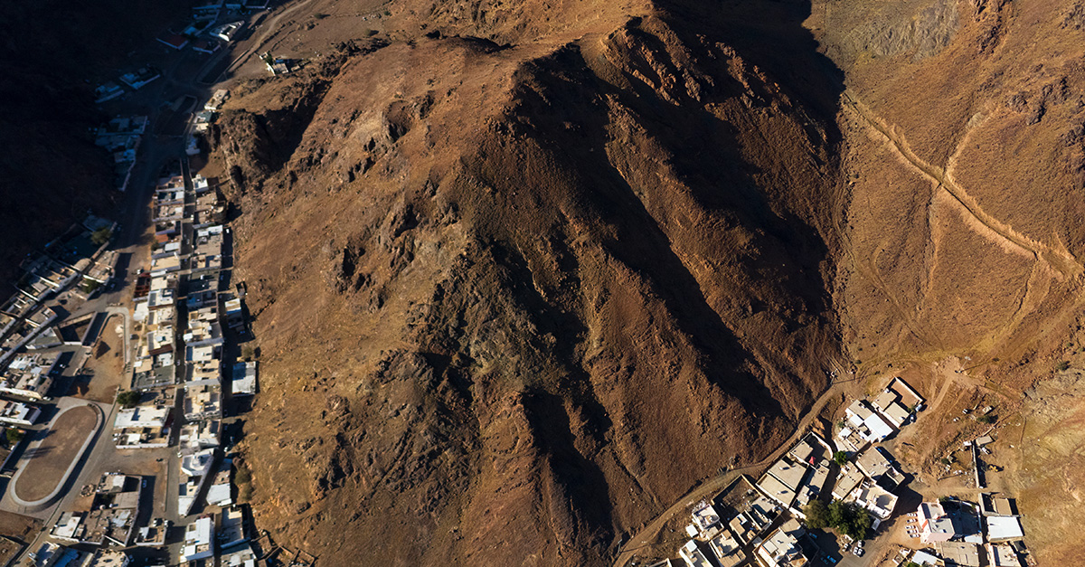
Topanga Canyon Affected By Dangerous Fire Expansion
On the morning of January 10, the fire reached Topanga Canyon, known for its lush vegetation and steep hillsides. The current status of acres scorched at 7:39 am was 20,438, the fire containment percentage was about 8%, and about 3,073 people were actively fighting the fire.
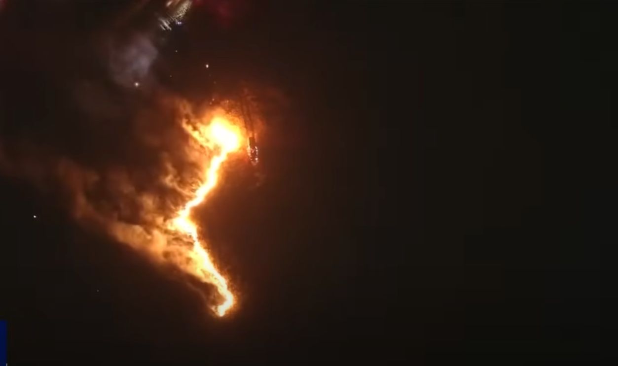
Firefighters Work Overnight To Prevent Further Damage
Aerial snapshots show the relentless battle between firefighters and the blaze, working through the night to halt the fire’s progression. The images show stark contrasts between the darkened sky and the glowing edges of the flames as teams protect vulnerable structures and communities.
 Aerial footage shows Los Angeles firefighting from above by The Times and The Sunday Times
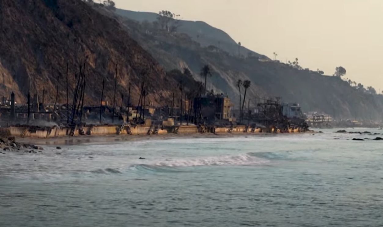
Flames Move Toward Pacific Coast Highway
Images captured from above showcase how the fire crept toward Pacific Coast Highway, one of California’s most iconic roads. The fiery lines cutting through coastal hillsides painted a dramatic scene. All homes that once peacefully sat beside the Pacific Coast Highway and the Big Rock Neighbourhood were in ashes.
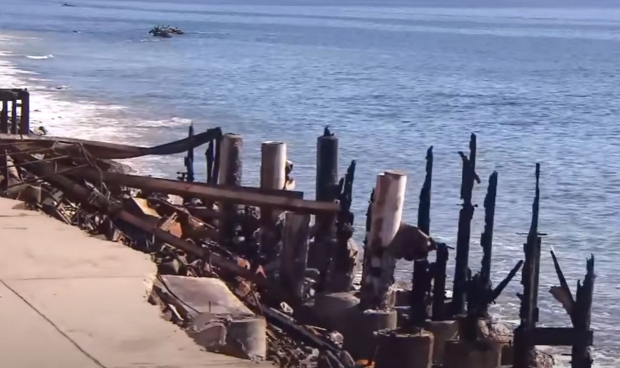 Owner Returns to Ruins of Malibu Restaurant After Fires by Inside Edition
The Death Toll Had Risen
On the 11th, the Los Angeles County Department of Medical Examiner gave an update on the death toll, and the numbers were saddening. The total now stood at 24. Eight lost their lives in the Palisades, with one succumbing to injuries. By the 14th, the numbers stood at 25.
 Cbl62, CC BY-SA 3.0, Wikimedia Commons
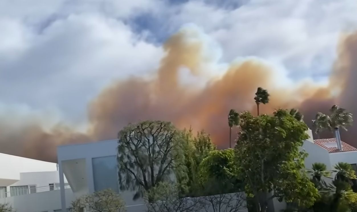
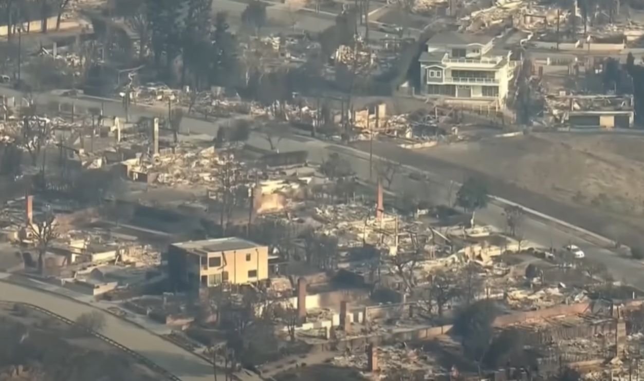
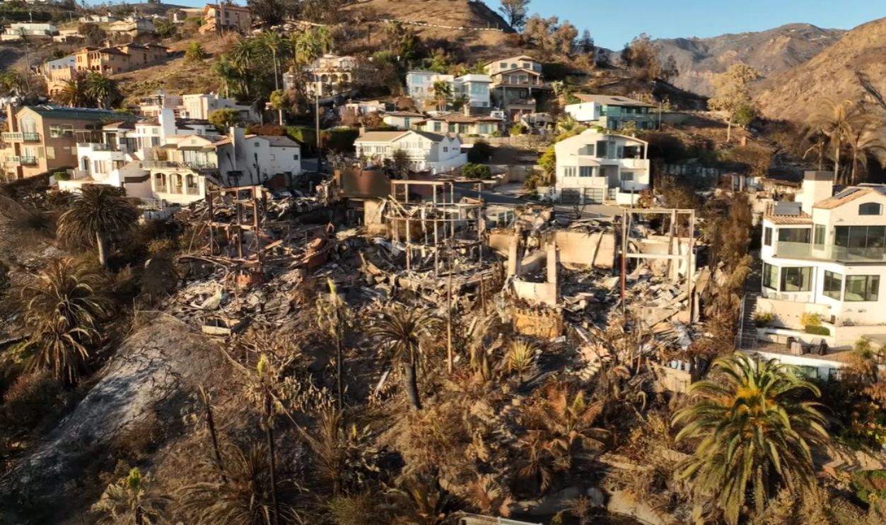
The Most Destructive Fire In Los Angeles History
The Palisades Fire destroyed over 5,000 structures, surpassing the Sayre Fire of 2008 and the Bel Air Fire of 1961. The loss extended beyond property, as heavy smoke blanketed the city such that residents in severely affected areas were advised to wear masks and stay indoors.
 Palisades Fire reaches over 50% containment as more winds expected by KTLA 5
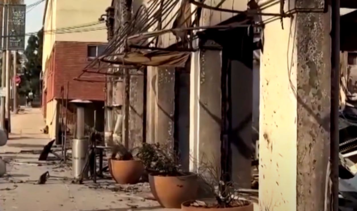
North Of Sunset Boulevard Gone
The fire reduced most structures north of Sunset Boulevard to ashes. Everything was unrecognizable. Landmarks like the Palisades Village Mall stood as rare survivors amidst a sea of destruction. Houses, schools, and churches that defined the neighbourhood were leveled, including Corpus Christi Catholic Church and St. Matthew’s Episcopal Parish School.
 The Pacific Palisades before and after the fires | REUTERS by REUTERS
Historical Losses And Musical Archives Destroyed
The fire wiped out an archive containing over 100,000 Arnold Schoenberg scores, rented widely by musicians and orchestras. Though no original manuscripts were lost, the primary collection was entirely destroyed. The music world mourned the irreplaceable loss of this iconic archive.
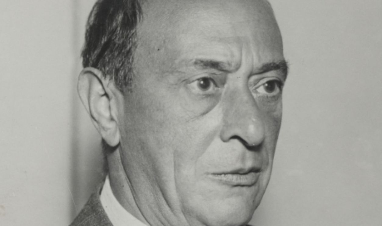 Max Fenichel, Wikimedia Commons
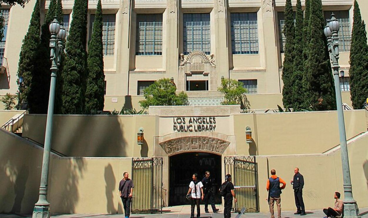
Public Resources Decimated By The Flames
The Palisades annex of the Los Angeles Public Library was among the significant losses, leaving the community without its cherished local hub. Schools like Palisades Elementary and Marquez Elementary were also completely destroyed. Palisades Charter High School suffered severe damage, but thankfully, heroic firefighters saved its main buildings.
 MikeJiroch, CC BY-SA 3.0, Wikimedia Commons
Landmarks And Parks Under Siege
Beloved landmarks like the Getty Villa narrowly escaped the fire, though surrounding vegetation burned. Other historic sites like the Will Rogers State Historic Park saw stables and structures destroyed. The fire also claimed the Topanga Ranch Motel in Topanga State Park, alongside staff housing and other park facilities.
 I, Sailko, CC BY-SA 3.0, Wikimedia Commons
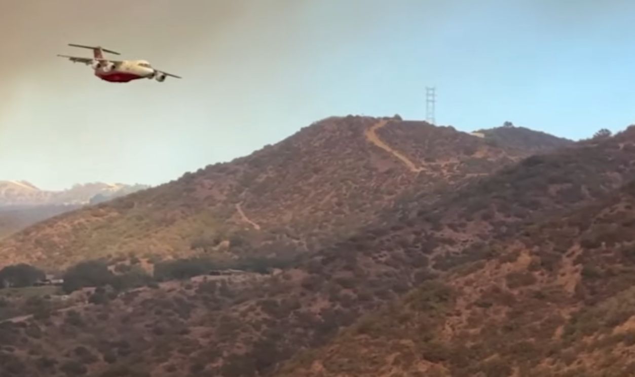
C-130 Hercules With MAFFs
With all hands on deck, the military also stepped in with their C-130 Hercules aircraft equipped with Modular Airborne Fire Fighting Systems (MAFFS). These systems allowed the planes to release 3,000 gallons of fire suppressant in one pass, covering vast areas and creating barriers to slow the spread.
 U.S. Air Force photo by Tech. Sgt. Howard Blair, Wikimedia Commons
CH-47 Chinook Helicopters
The versatile CH-47 Chinooks, three owned by Coulson Aviation, fitted with 3,000-gallon water tanks, were also essential in attacking active fire zones. Their large capacity and ability to hover over precise targets helped douse flames effectively, especially in steep, inaccessible terrains.
 Sgt. Steven Galimore, CC0, Wikimedia Commons
UH-60 Black Hawk Assistance
Equipped with water buckets, UH-60 Black Hawk helicopters were deployed for precise water drops. These helicopters targeted critical areas where fires threatened homes and key infrastructure. The collective goal was to ensure containment in hard-to-reach spots.
 147th Aviation Regiment, Wikimedia Commons
Pilatus PC-12 For Mapping
The military utilized the Pilatus PC-12 aircraft for surveillance and real-time fire mapping. These planes provided updated data on fire behavior and helped coordinate ground and aerial firefighting strategies. This collaboration was to optimize resource allocation in dynamic conditions.
 JetRequest.com, CC BY-SA 3.0, Wikimedia Commons
Navy MH-60S Helicopters Deployed
Navy MH-60S Seahawks from Naval Air Station North Island joined firefighting efforts over Southern California. Known for their versatility, these helicopters carried water buckets slung beneath them, effectively targeting flames in remote or challenging terrains.

Coordination With Civilian Teams
The Navy collaborated with Cal Fire and National Guard units to combat the Palisades, Eaton, Hurst, and Lidia fires. Their extensive training with water buckets made the MH-60S squadrons valuable partners in containing the destructive blazes.
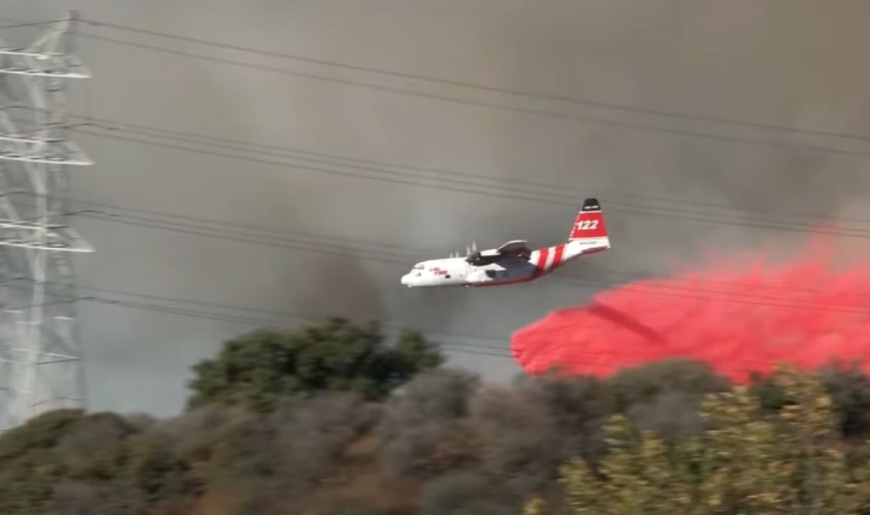
Massive Fire Suppressant Drops By The DC-10
The DC-10 aircraft, operated by 10Tanker, also played a key role in the firefighting efforts in California. Based at the old Norton Air Force Base in San Bernardino, these planes can carry and drop from 700-9,400 gallons of fire suppressant in a single mission.
Air Tankers Vs Helicopters
Unlike helicopters that drop water for direct fire attacks, air tankers like the DC-10 use fire suppressants to build containment lines. The suppressant’s red dye ensures precise placement, and this allows ground crews to follow up and control the blaze effectively.
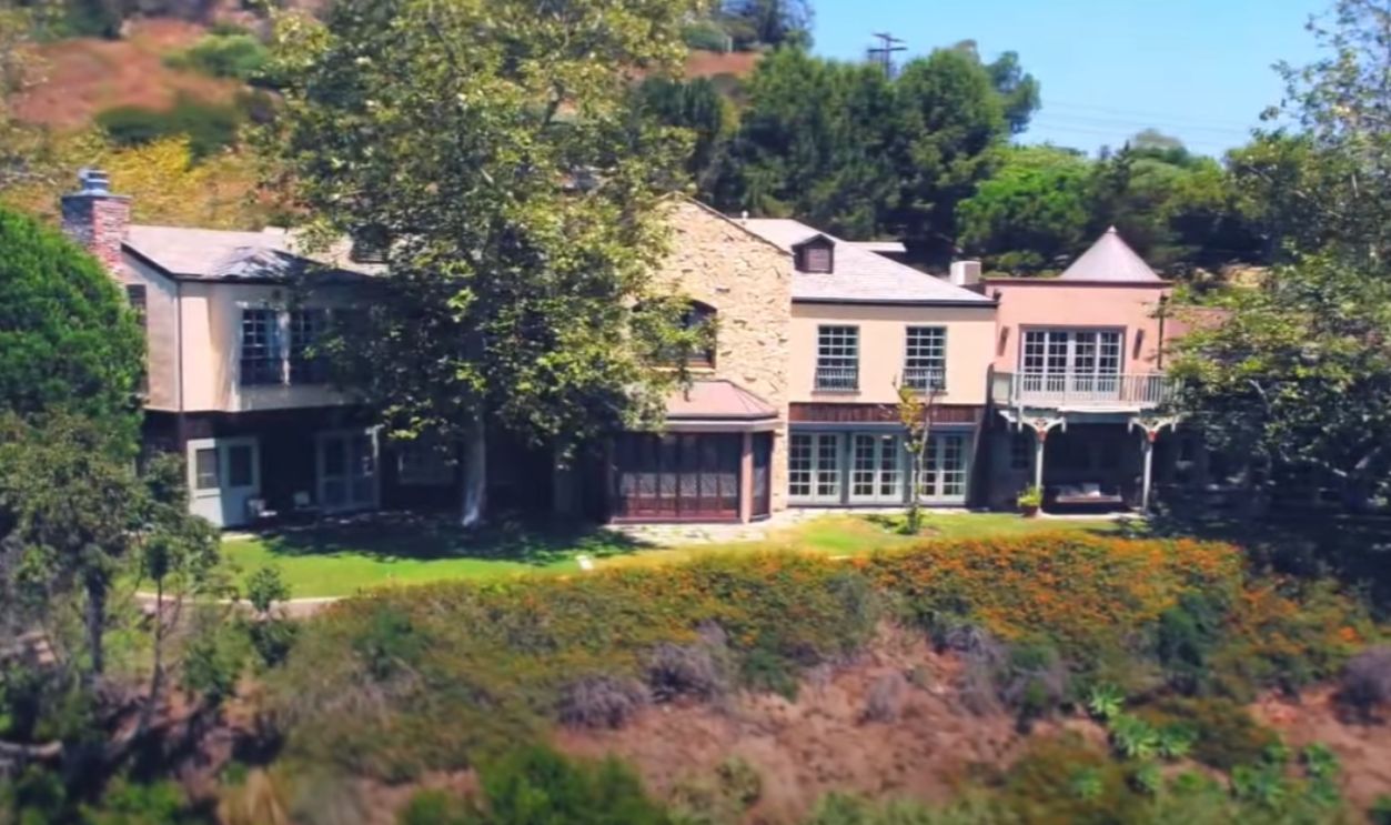
Some Celebrity Homes Saved By A Whisker
Despite the destruction, some properties miraculously survived. Bill Hader's home and others belonging to stars like Jennifer Garner and Conan O'Brien emerged unscathed. The community's resilience shines through, even amid immense personal loss.
 Jennifer Garner | House Tour | $8 Million Brentwood Mansion & More by Famous Ent.
Clearing Vegetation Around Homes
Residents were giving it their all to stop this fire, so some proactively removed dry brush and trees close to their properties to create defensible spaces. This tactic reduced the fire’s ability to spread to their homes. Fire experts recommend maintaining at least 100 feet of clearance around structures.

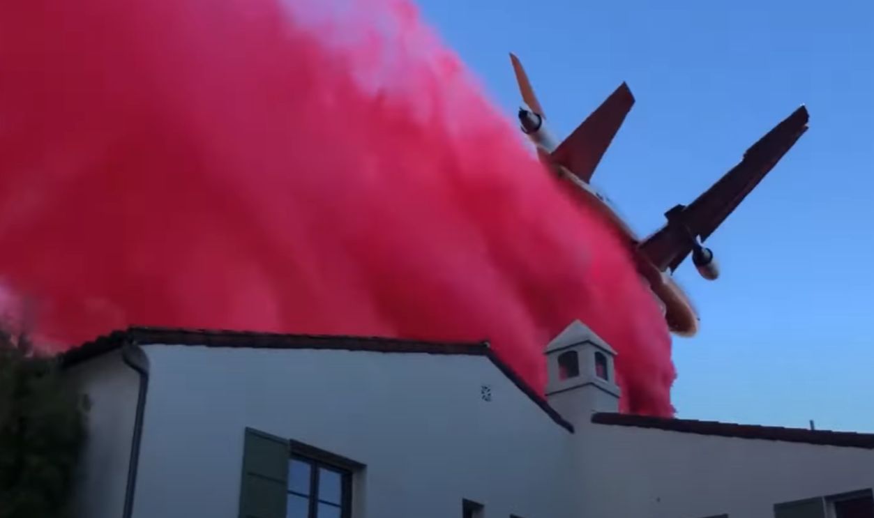
Applying Fire-Resistant Coatings
Firefighting aircraft used fire-resistant sprays on roofs, walls, and surrounding vegetation. These sprays acted as barriers to slow the fire’s progress. Combined with metal or tile roofing materials, this method significantly improved a property's resistance to embers and radiant heat during the blaze.
 Planes drop fire retardant on homes in California by The Telegraph
Installing Advanced Sprinkler Systems
Some residents were quick thinkers and installed rooftop and yard sprinklers to keep their homes wet during a wildfire. These systems were activated manually or remotely to create a protective moisture barrier between the homes and the fire.

Creating Ember-Proof Barriers
The homeowners who prepared early saved their homes thanks to sealing vents, installing ember-resistant screens, and using non-flammable materials like gravel instead of mulch in landscaping. Others’s homes were even made of concrete, which is fire-resistant. These measures prevented embers from entering and igniting.
 Emadrazo, CC BY-SA 4.0, Wikimedia Commons
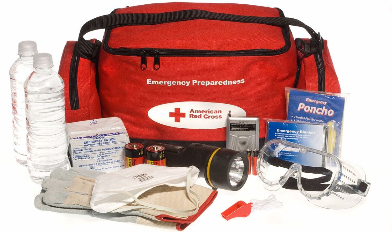
Prepping Emergency Kits And Plans
Those who weren’t lucky enough to save their homes had prepared “go bags” with essentials to ensure a quick evacuation while leaving behind accessible fire-fighting tools like hoses and shovels. Planning also involved safeguarding property documents and leaving instructions for firefighters, which helped first responders prioritize efforts.
Significant Progress In Containment
To date (January 24), the Palisade Fire is now above 70% contained, thanks to the relentless efforts of firefighters. The Eaton Fire has been contained above 90%, and the Hughes Fire that broke out on January 22 has so far burned 10,176 acres and is only 14% contained.
 Drone video of the Palisades devastation by Los Angeles Times
State Relief Funding Secured
Governor Newsom approved a $2.5 billion relief package to aid wildfire response and recovery in Los Angeles. The funding will help rebuild infrastructure, assist affected families, and bolster future wildfire preparedness. Communities have also united through fundraising and support efforts to aid those impacted.
 LIVE: Gavin Newsom announces $2.5B in aid for Los Angeles wildfires by FOX 11 Los Angeles
Still, More Fires Are Still Erupting
On January 23, the Laguna fire broke out. Based on the CAL FIRE report, the current standing as of January 23, 2025, states that about 70% of the fire has been contained, 94 acres are affected, and Ventura County is the most affected. Gibbel and Gilman fire containment is 0%.
 New fire erupts in Ventura County near Camarillo by ABC7
Additional Fires
Additionally, several smaller fires have been contained, including the Kenneth (1,052 acres), Hurst (799 acres), Lidia (395 acres), and Lilac (85 acres) fires. The Border 2 fire, which borders the Otay Lakes Road, is currently under an evacuation order because it is lawfully closed to public access.
 Fire with ‘dangerous rate of spread’ erupts at Otay Mountain by FOX 5 San Diego


