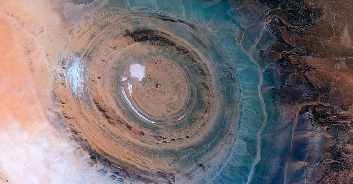
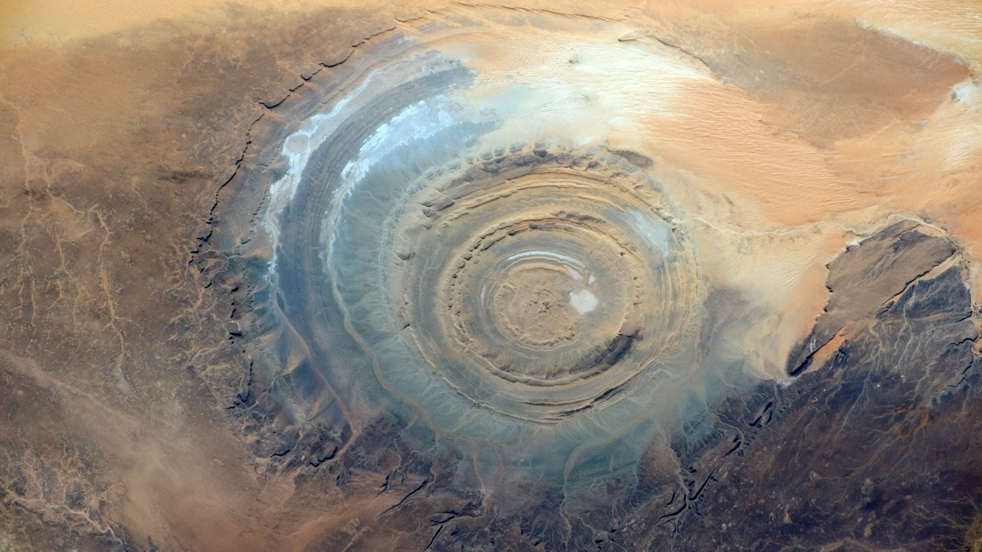
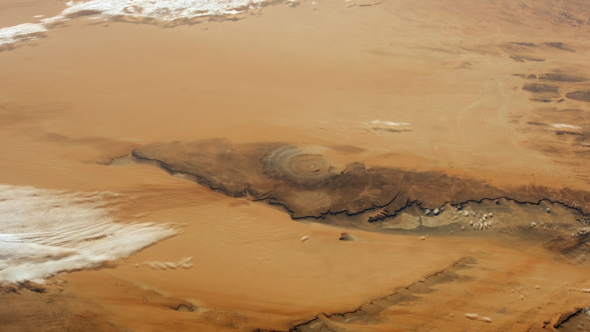
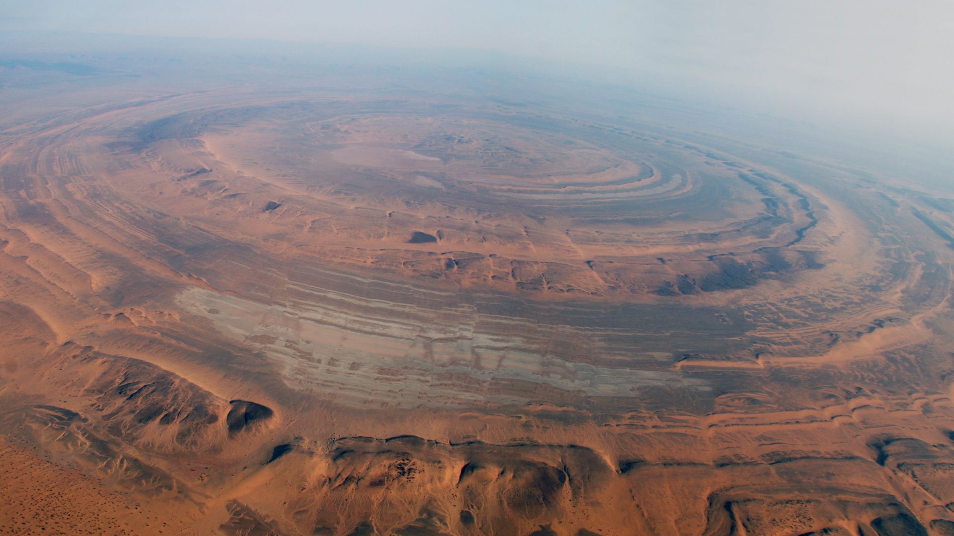
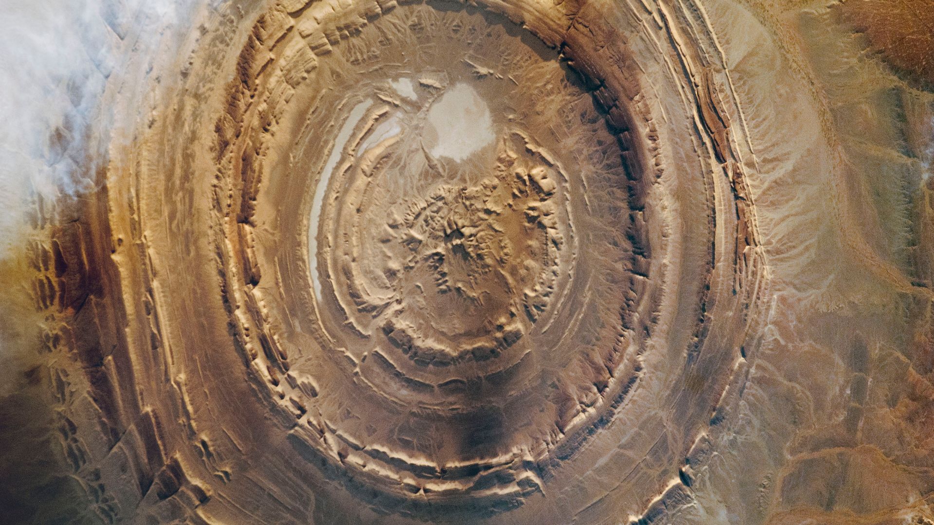
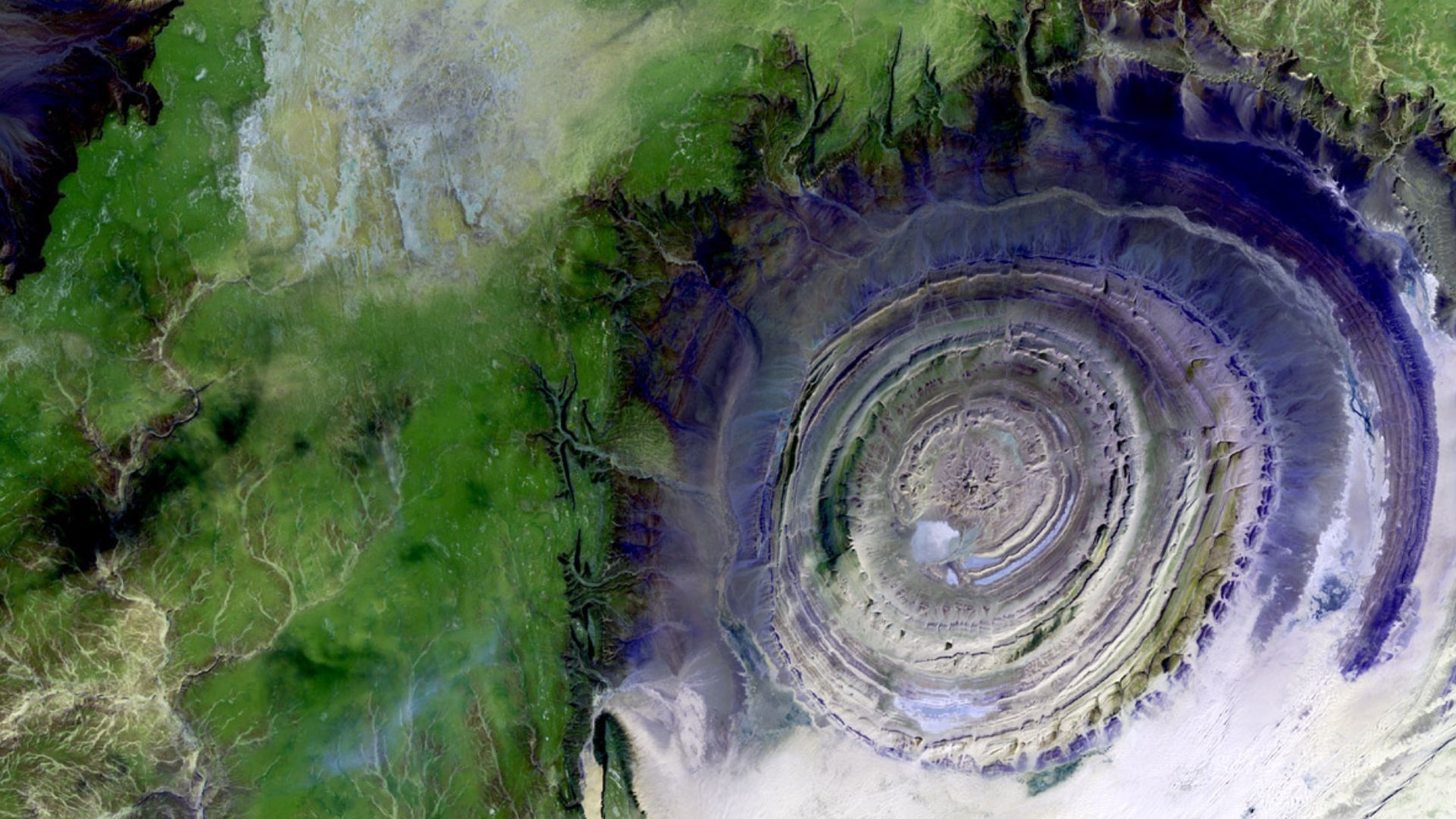
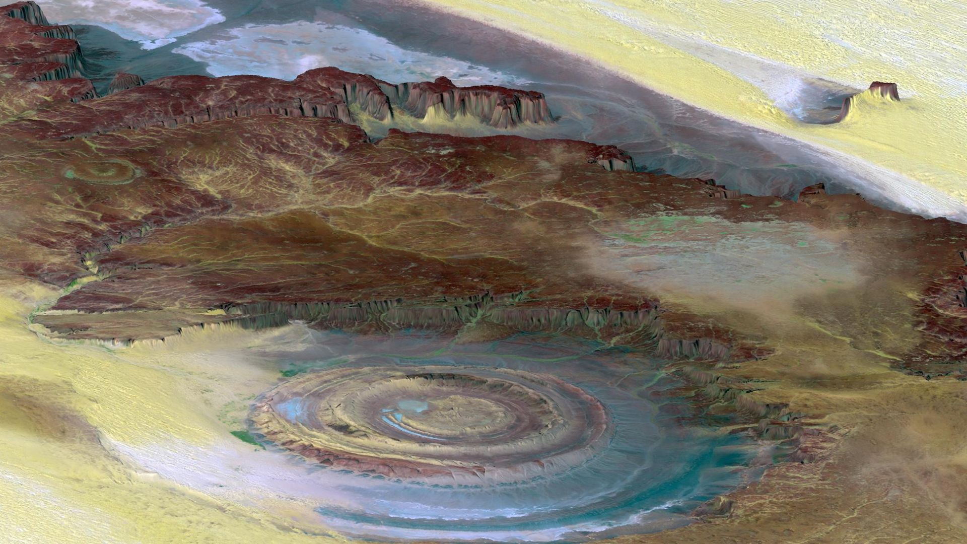
The Sahara's Giant Bullseye Isn't What You Think It Is
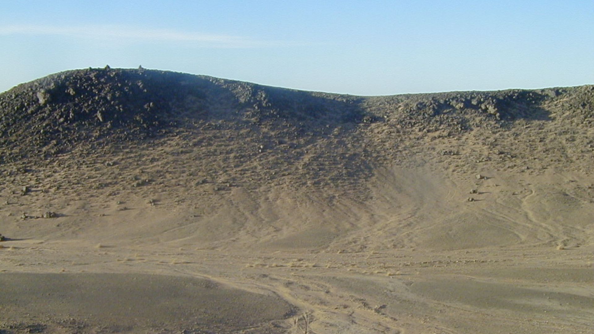
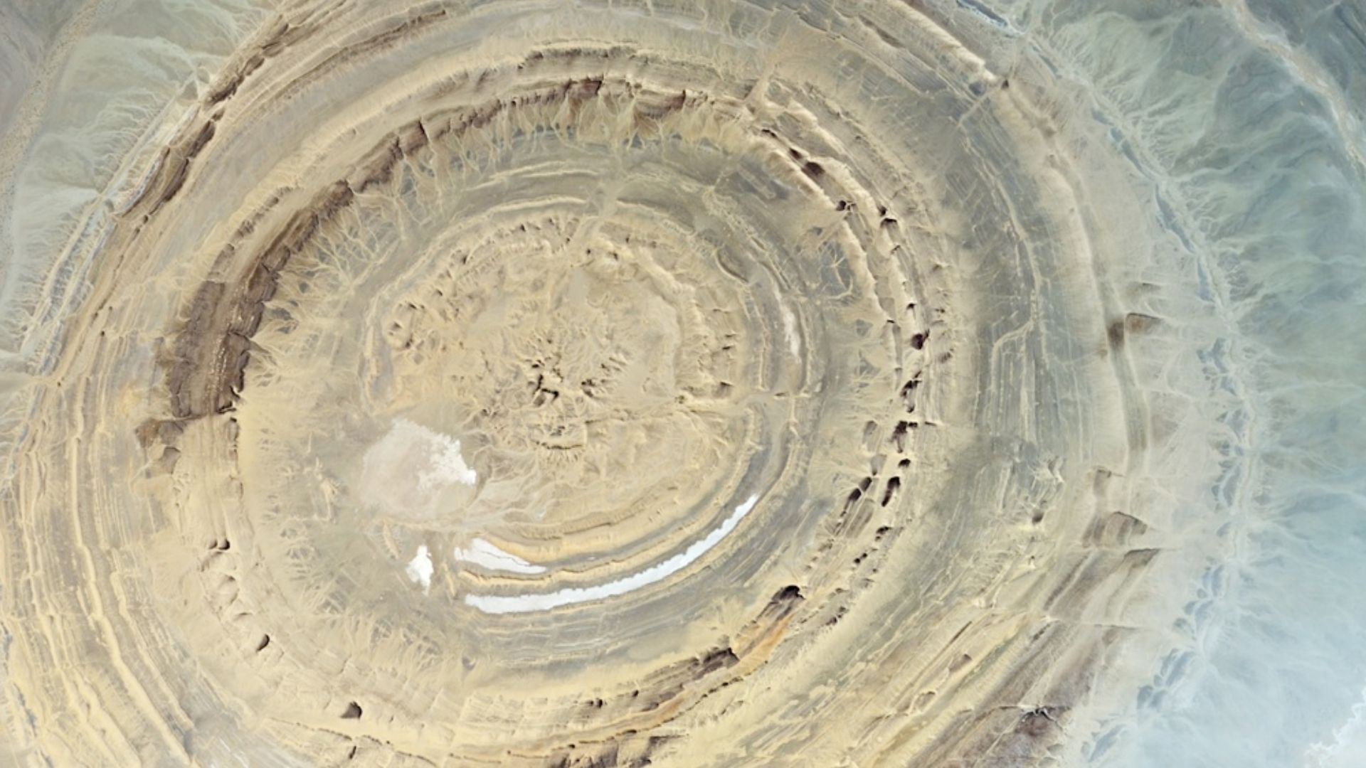
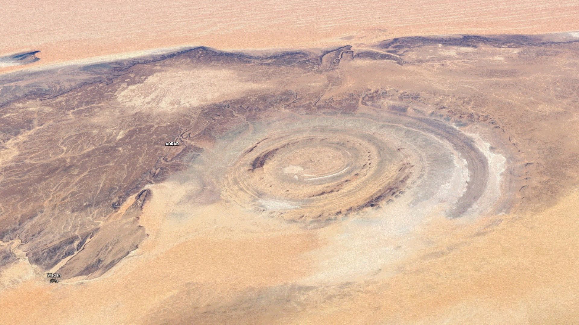
At first glance, the Richat Structure looks like the remnants of a lost civilization or a massive impact crater, but it’s entirely natural. Located in the western Sahara Desert of Mauritania, this 40-kilometer-wide geological marvel is often called the “Eye of the Sahara”.
The Richat Structure Isn’t A Crater
Originally thought to be the result of a meteorite impact, closer studies in the 1960s ruled that theory out. No shock minerals or deformation consistent with an impact have ever been found. Instead, its dome shape and layered rings are the result of natural erosion over a massive subsurface volcanic intrusion.
It’s Over 100 Million Years Old
The rocks that make up the Richat Structure are ancient, dating from the Late Proterozoic to the Ordovician. The igneous activity beneath it occurred around 94–104 million years ago, during the Cretaceous period. Over millions of years, erosion exposed these layers in a perfect bullseye.
Volcanic Forces Shaped The Dome
At the core of the Richat Structure is a large body of alkaline igneous rock. Magma from deep within the Earth pushed up and fractured the overlying layers. As the dome lifted and the rock cracked, concentric ring dikes formed and hardened underground.
 Clemens Schmillen, Wikimedia Commons
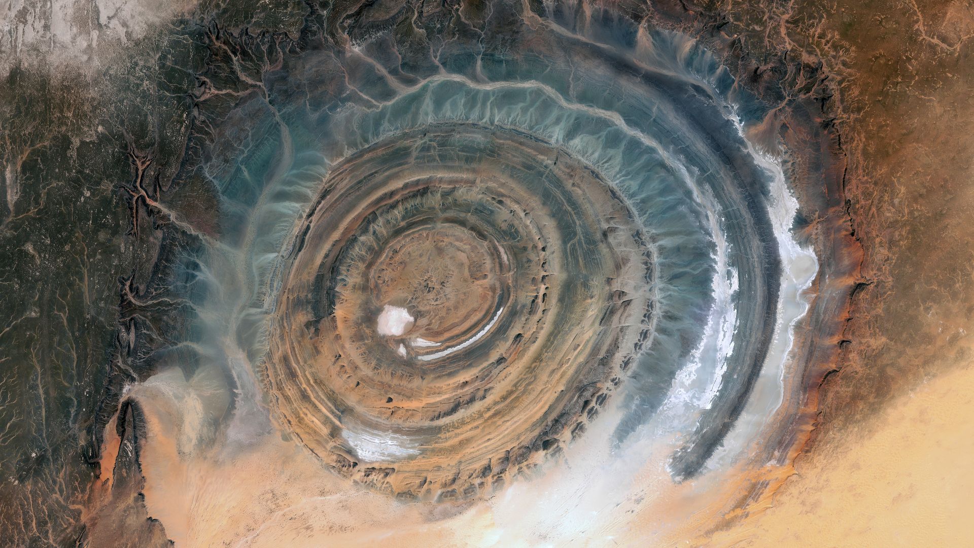
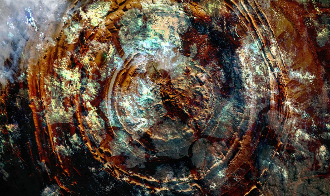
The Rings Are Layers Of Rock Exposed By Erosion
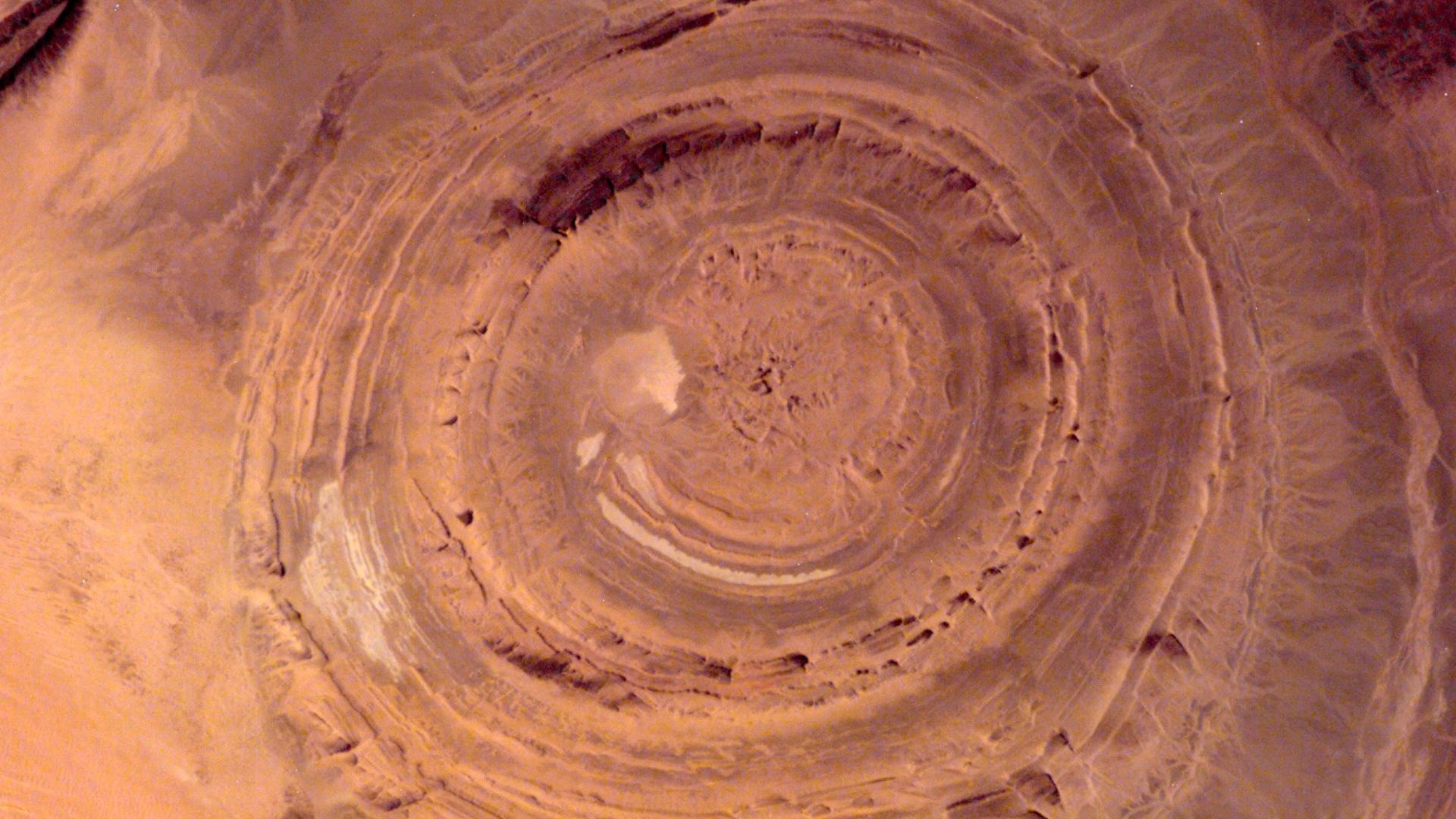
The eye’s layered look is due to alternating hard and soft sedimentary rocks that eroded at different rates. The most erosion-resistant rocks, like quartzite, now stand as ridges forming the striking circular cuestas.
Some Rocks Were Altered By Hydrothermal Fluids
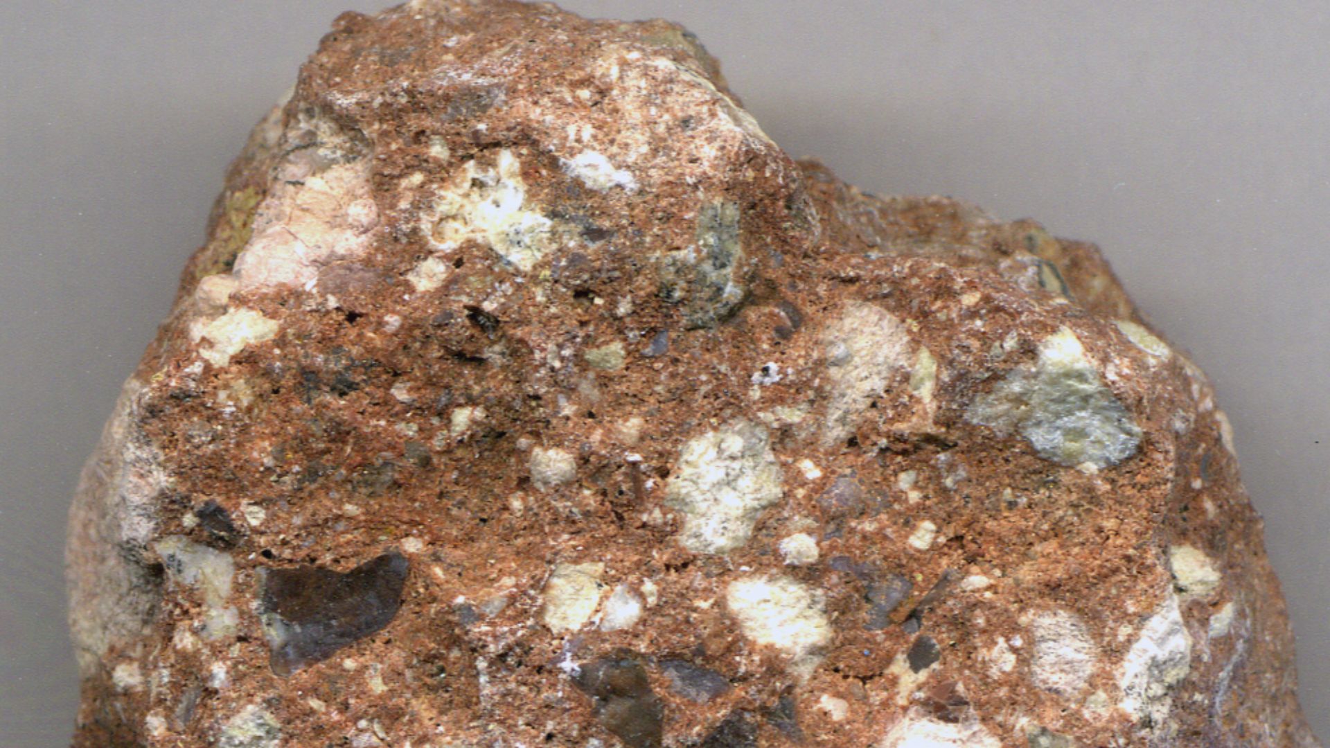
Hot fluids flowed through the dome during and after the volcanic activity, altering many of the rocks. The result is a massive central megabreccia, which is a chaotic mixture of silicified rock fragments. This core alone is 40 meters thick in some places.
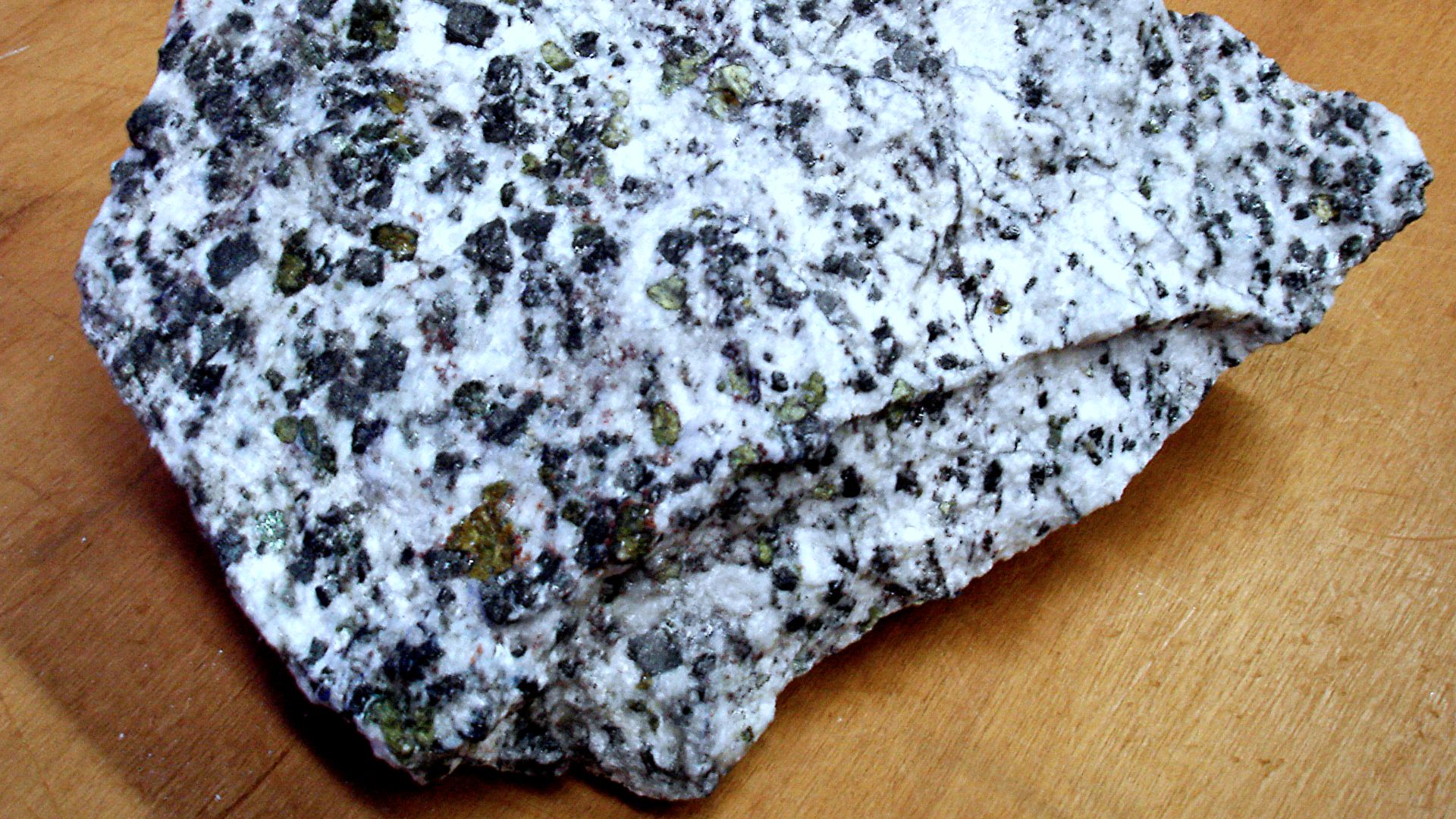
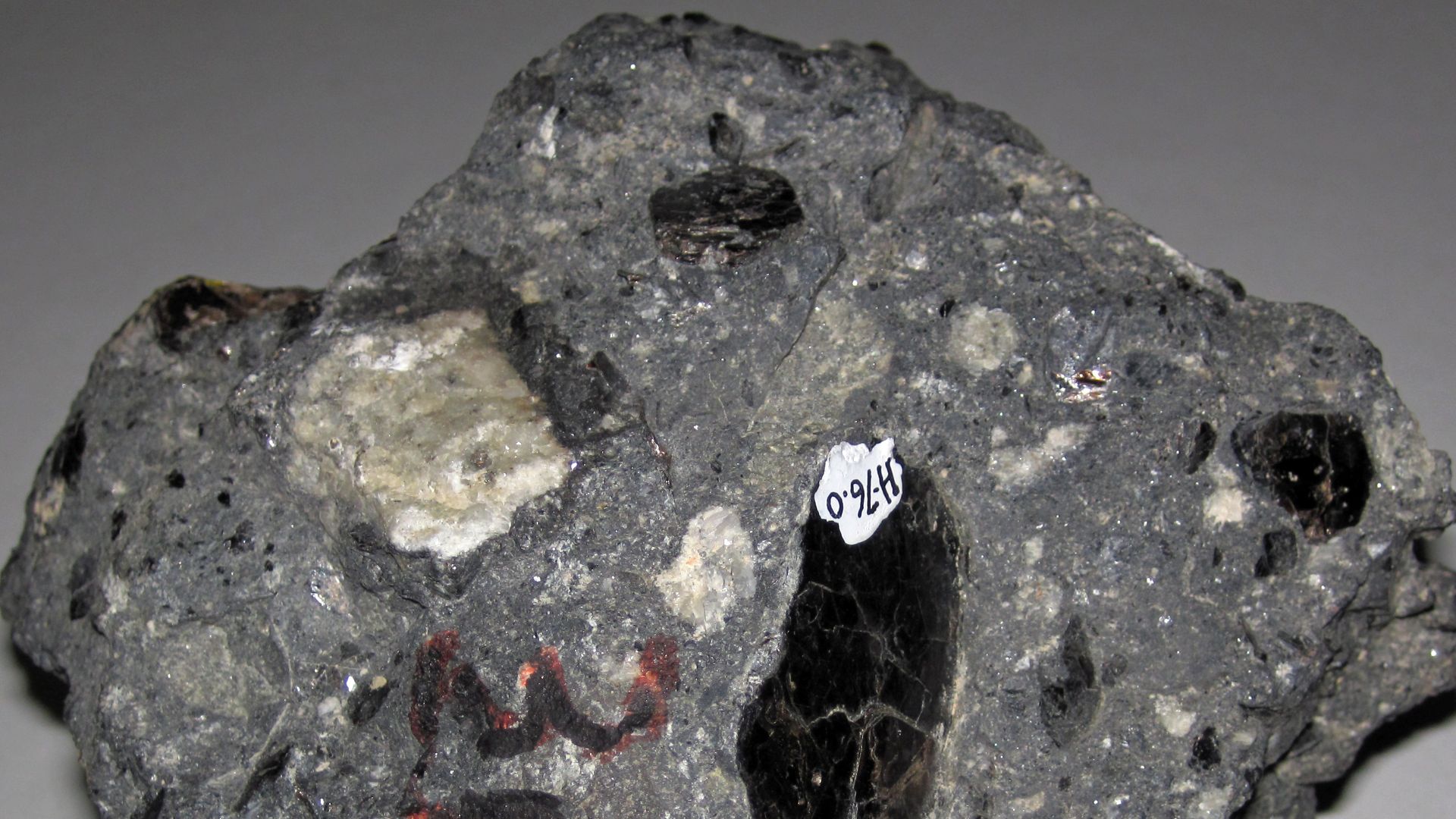
Its Interior Includes Rare Igneous Features
Inside the structure, you’ll find unusual igneous rocks like rhyolites, gabbros, carbonatites, and kimberlites. These formations include lava flows, ring dikes, sills, and even a volcanic plug. The presence of these features helped scientists confirm a deep volcanic origin.
 Eurico Zimbres Zimbres, Wikimedia Commons
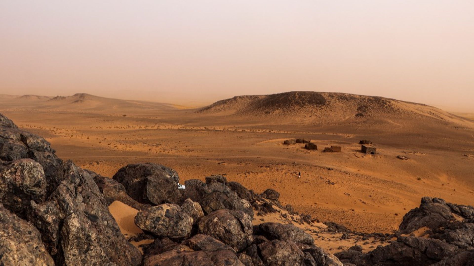
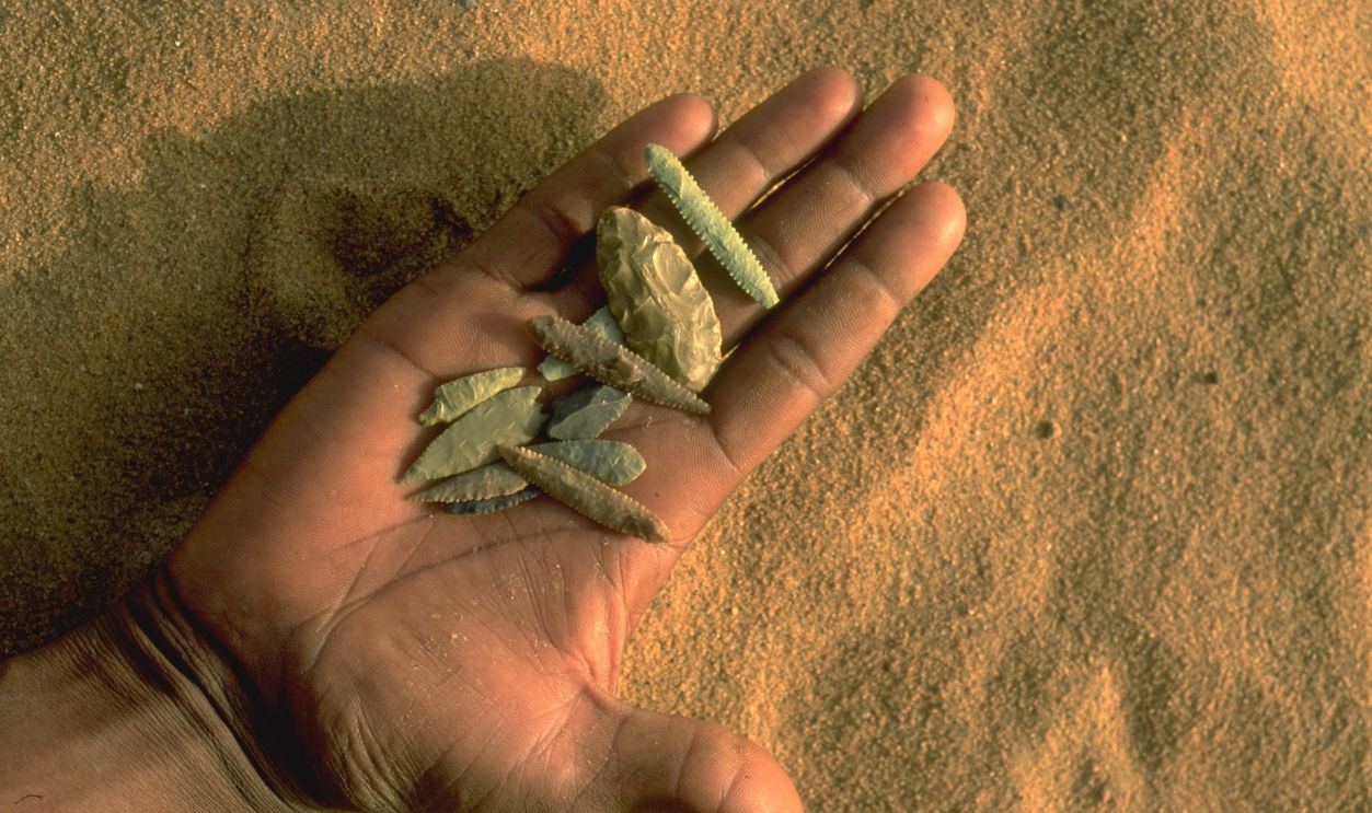
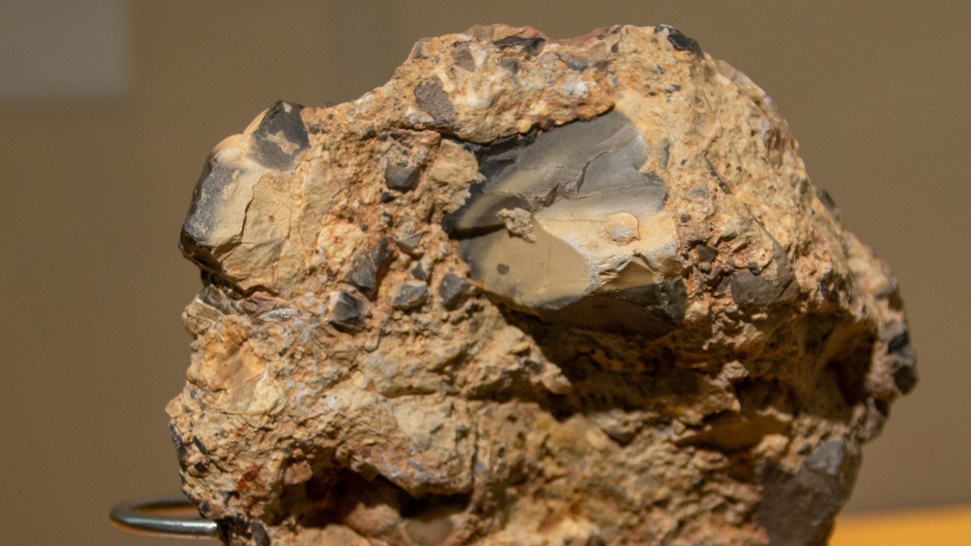
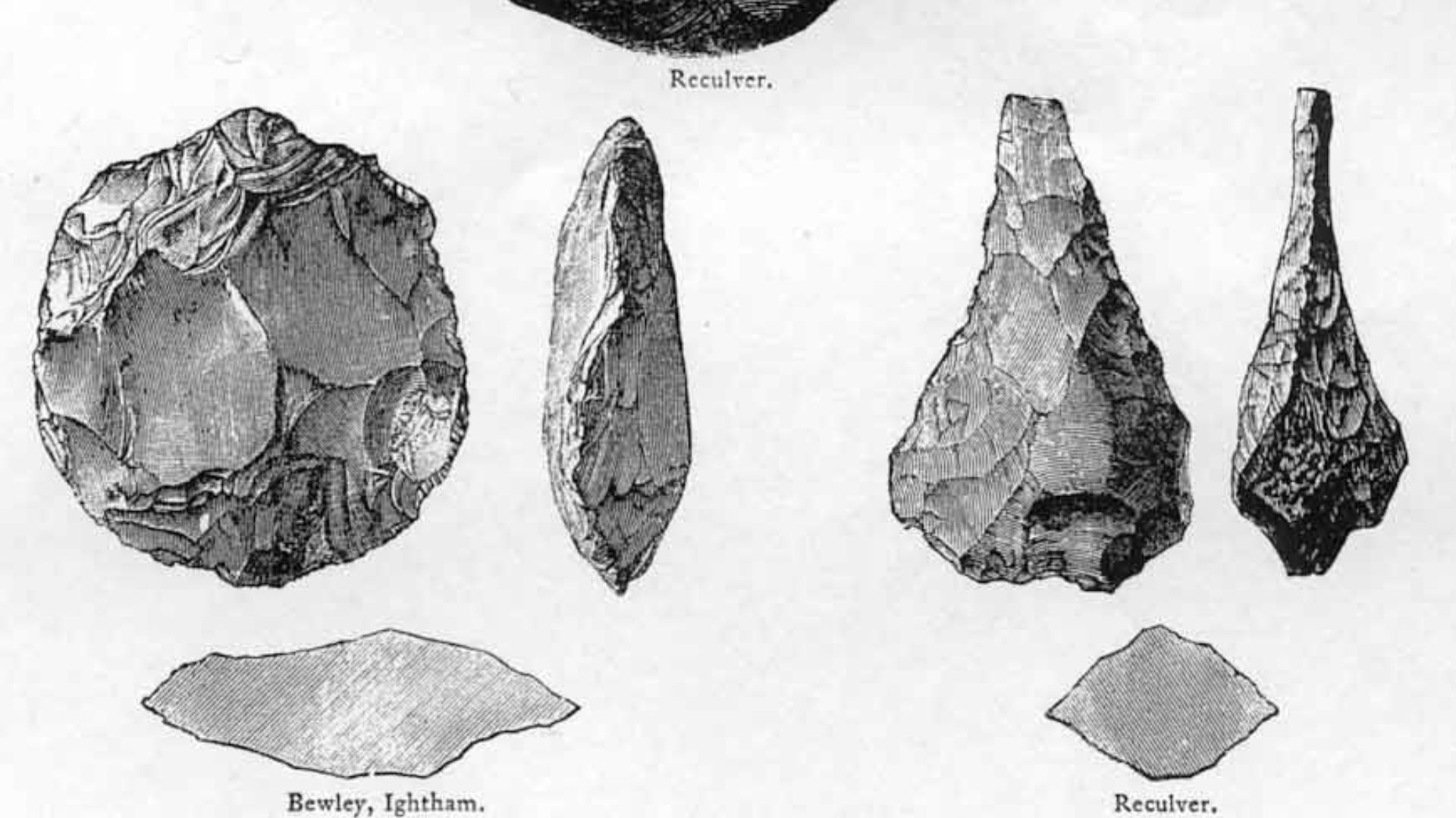
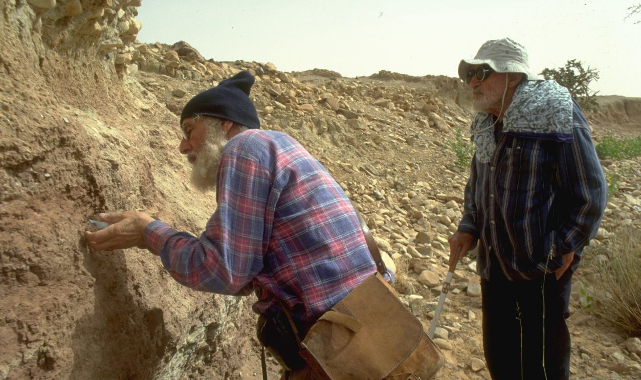
It Contains Ancient Human Artifacts
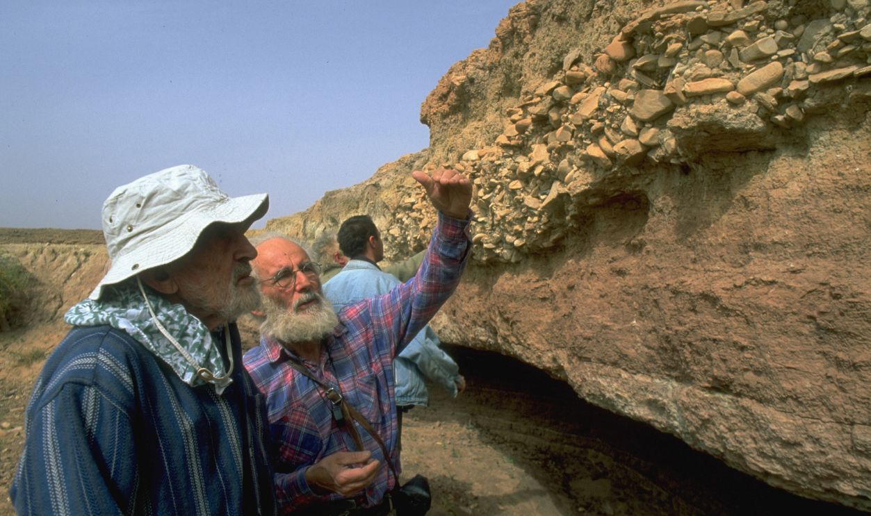
Archaeologists have discovered thousands of Acheulean-era stone tools within the Richat Structure. These artifacts are mostly found in the outer ring, near dry riverbeds. Some of them date back hundreds of thousands of years.
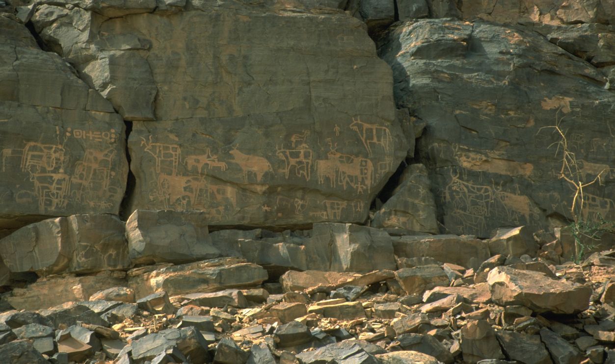
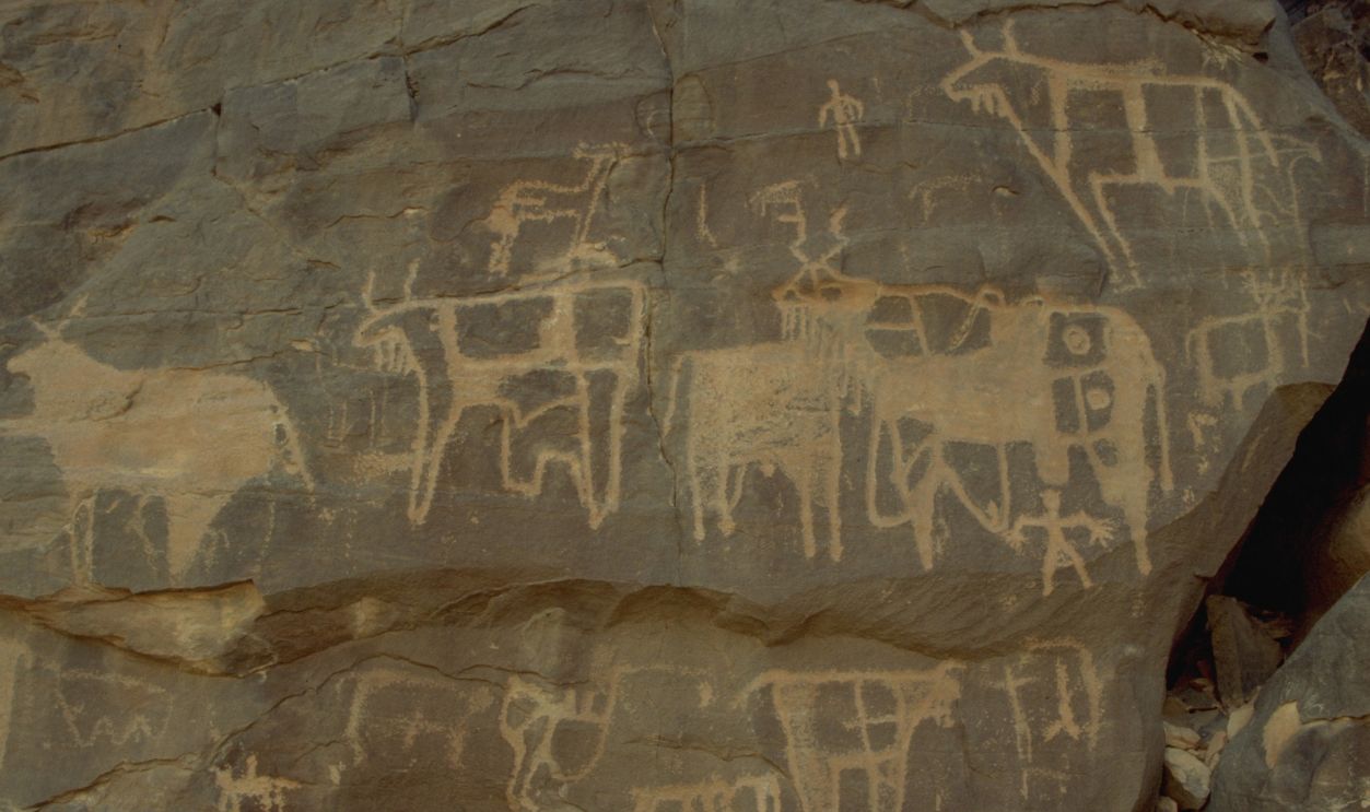
There Are Burial Mounds And Rock Art
Thousands of stone burial mounds dot the ridges and slopes of the structure. Some nearby rock art depicts warriors, chariots, and animals like elephants and bovids. These suggest the region once supported human life and rich biodiversity during the African Humid Period.
The Richat Structure Is A Geological Heritage Site
In 2022, the International Union of Geological Sciences recognized the Richat Structure as one of the world’s 100 most important geological heritage sites. It’s considered a textbook example of a magmatic concentric alkaline complex.
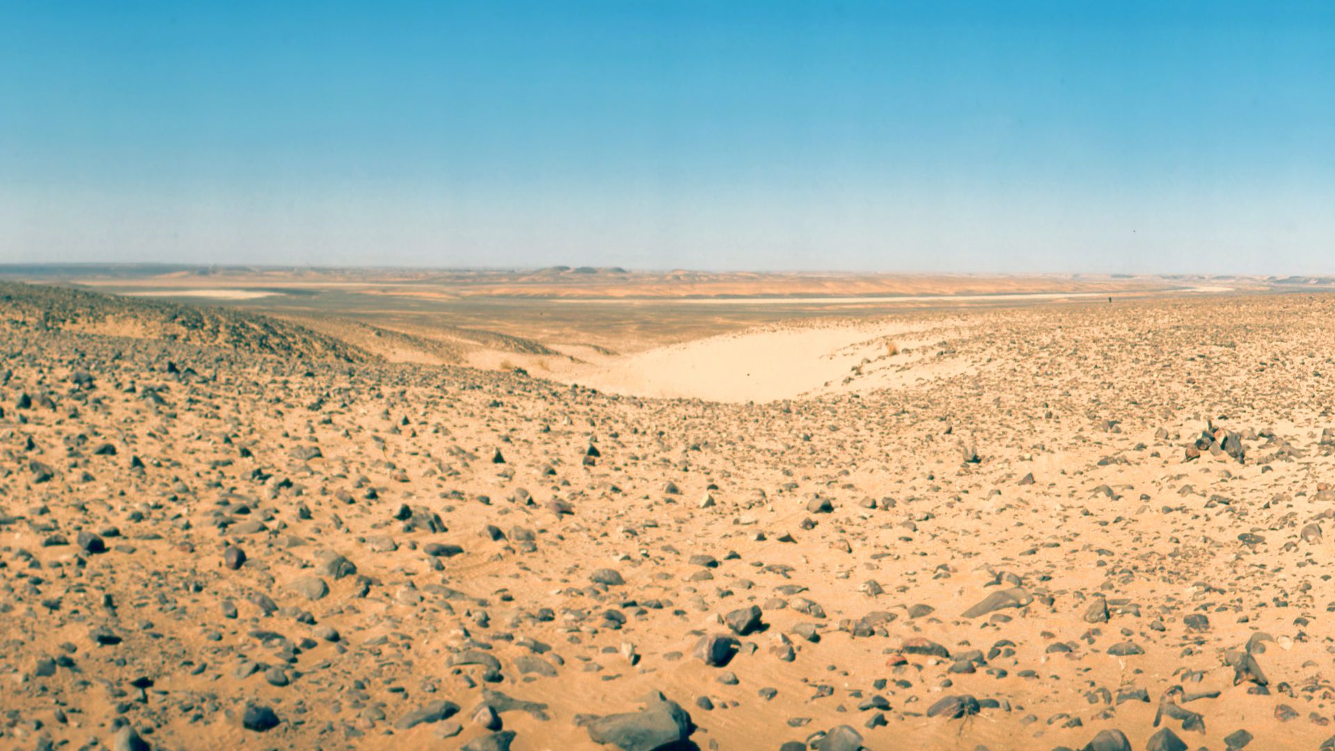
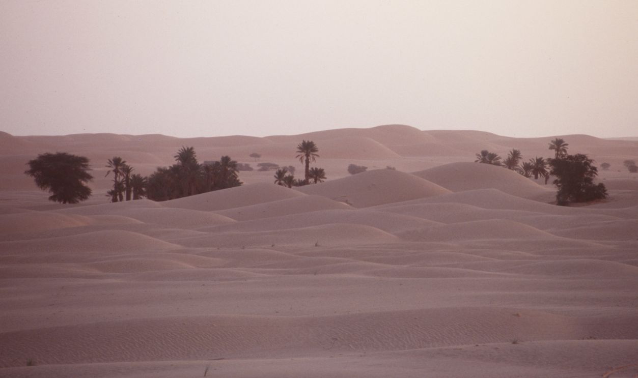
The Sahara Was Once Lush
Between 15,000 and 8,000 years ago, during the African Humid Period, this area was far from a barren wasteland. Seasonal rivers and lakes formed here, leaving behind freshwater fossils in clay and sand deposits. These sediments lie directly over deeply eroded bedrock.
 Ammar Hassan, Wikimedia Commons
The Structure Has A Local Name
Locals in Mauritania call it Guelb er Richât, or “Tagense,” a word that refers to a circular leather pouch opening used for drawing water. Its rings, seen from above, do resemble the folds of such a pouch.
 Michał Huniewicz, Wikimedia Commons
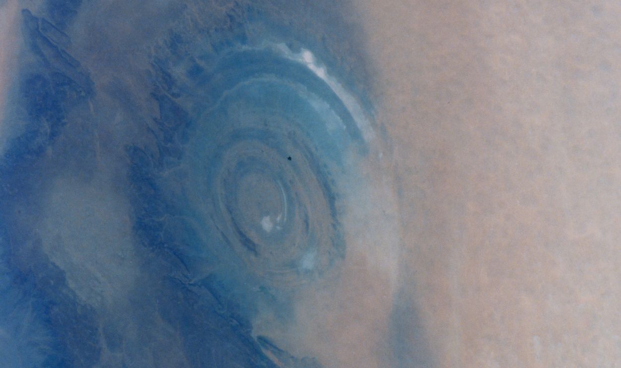
The Eye’s Size Is Mind-Blowing
At 40 kilometers in diameter, the Eye of the Sahara could fit the entire city of Paris within it. Its symmetry and scale are best appreciated from space, where it was famously photographed by astronauts aboard the International Space Station.
 USGS/EROS/NASA Landsat, Wikimedia Commons
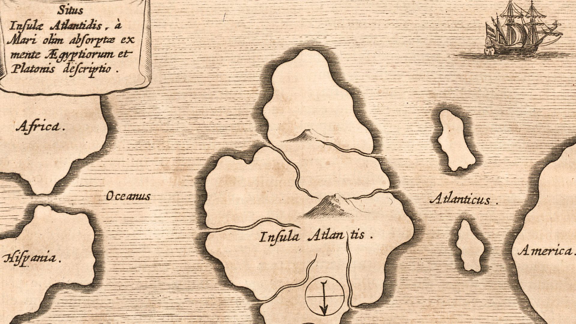
It Was Misidentified As Atlantis
Some fringe theorists believe the Eye is the remains of Plato’s Atlantis, citing its circular shape and isolated desert location. However, the structure predates Plato by millions of years, and its geological origin doesn’t match Atlantis’s description.
 Athanasius Kircher, Wikimedia Commons
The “Breathing Earth” Hypothesis Is False
A viral online theory claimed the Richat Structure “breathes” due to seismic activity. This was proven false as any visible pulsation is a time-lapse effect from satellite image processing, not geological movement.
 European Space Agency / CNES, Wikimedia Commons
Early Geologists Thought It Was An Impact Site
In the 1940s and 50s, scientists debated whether the structure was caused by an asteroid. Later fieldwork, however, debunked this, finding no signs of impact shock or melted rock. Instead, the evidence pointed to slow, internal geological forces.
 Photograph by Mike Peel (www.mikepeel.net)., Wikimedia Commons
Its Rock Layers Dip Outward
The rock strata in the Richat dome tilt outward at angles of 10–20 degrees. This outward dip is another clue supporting the theory of uplift from below, not a collapse from above, as in impact craters.
 Michel Jebrak, Wikimedia Commons
Satellite Mapping Revealed More Hidden Details
Advanced satellite imaging and geophysical surveys helped map the full complexity of the structure. This includes its buried ring dikes and the shape of the magma body that created it.
 Earth Science and Remote Sensing Unit, Lyndon B. Johnson Space Center, Wikimedia Commons
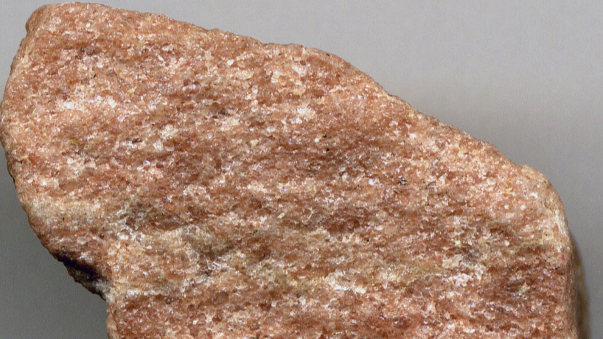
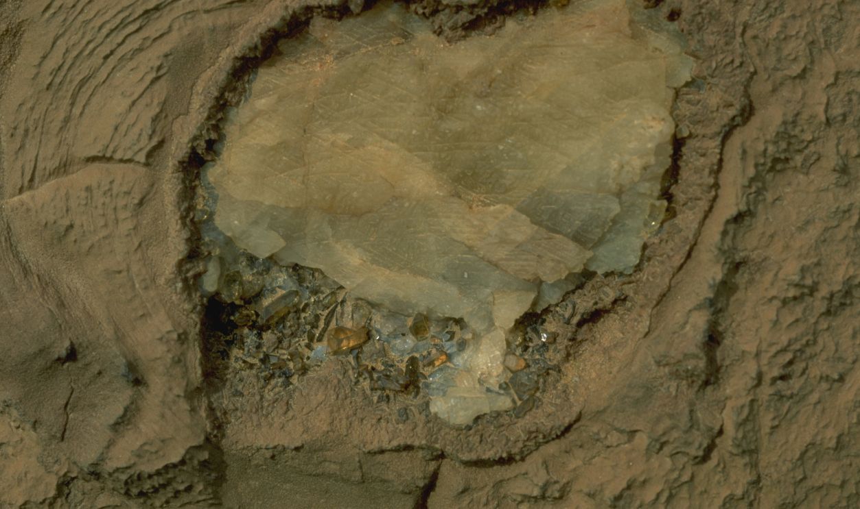
The Inner Dome Is Made Of Silica-Rich Breccia
At the center of the structure lies a thick breccia composed of shattered silica-rich rocks. These were cemented together by fluids rich in quartz. The hydrothermal activity that formed this breccia occurred nearly 100 million years ago.
 James St. John, Wikimedia Commons
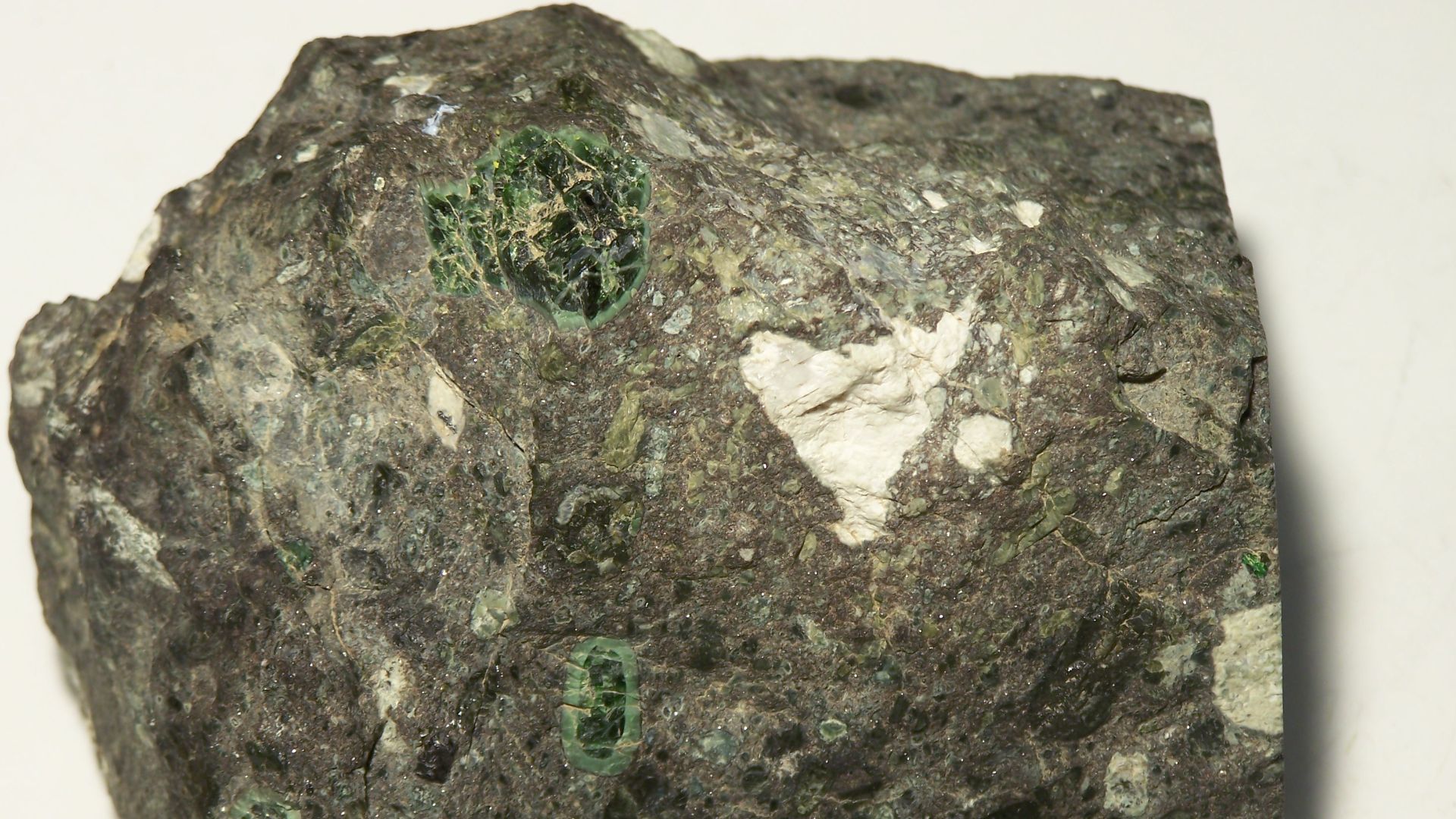
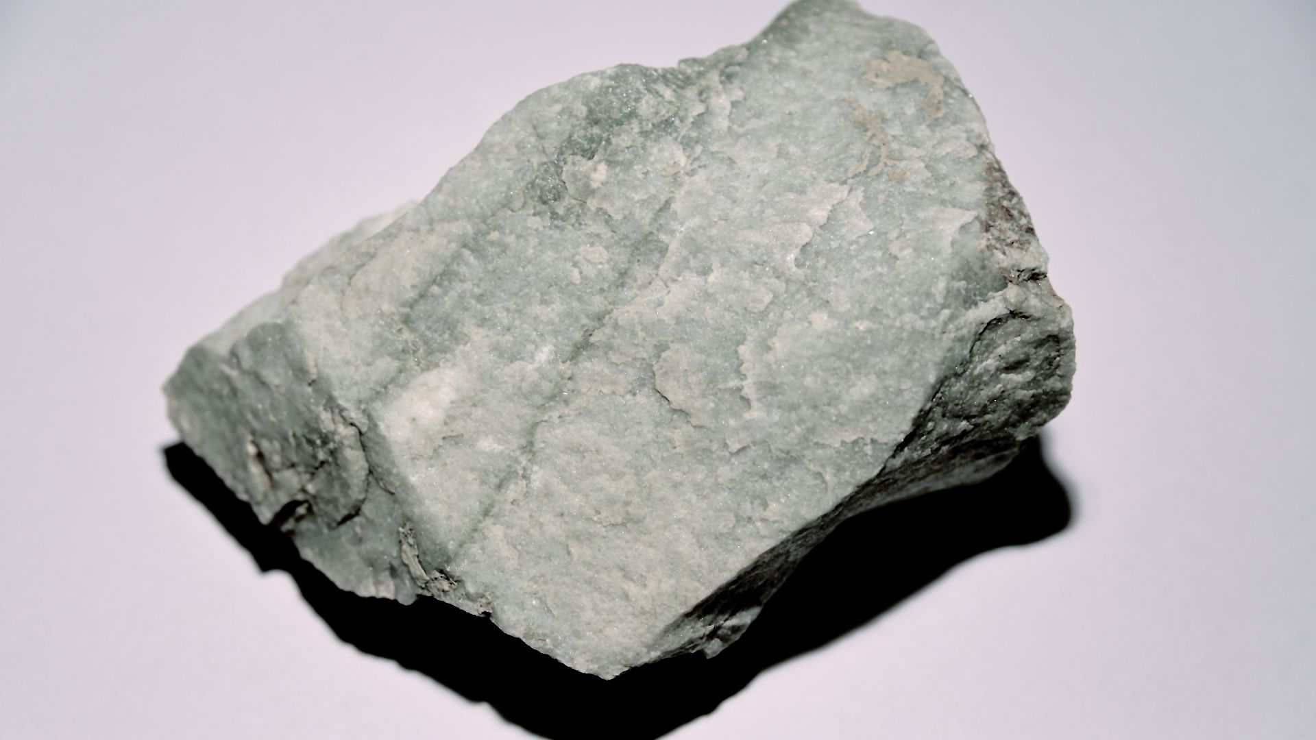
Carbonatite Dikes Are Found Throughout
Over 30 carbonatite dikes run through the Richat Structure. These dikes are hundreds of meters long and only a few meters wide. They contain unique mineral compositions and solidified without vesicles.
 James St. John, Wikimedia Commons
Kimberlite Points To Ancient Volcanic Explosions
In the northern portion of the structure lies a kimberlite plug, which suggests violent volcanic eruptions once occurred here. Kimberlite is also the rock type that often contains diamonds, although no diamonds have been reported at Richat.
It’s A Magnet For Fringe Theories
In addition to Atlantis, the Eye of the Sahara has been linked to UFOs, ancient megastructures, and even time travel portals by pseudoscientific circles. None of these ideas are supported by geologists or archaeologists.
 NASA/JPL/NIMA, Wikimedia Commons
Few Artifacts Are Found In The Center
Although outer areas contain many Acheulean and Aterian tools, the innermost part of the structure is mostly devoid of artifacts. Researchers believe this is due to both environmental conditions and ancient people avoiding the central dome.
Rivers Once Flowed Through Its Rings
Seasonal rivers, or wadis, flowed through the outer rings during wetter periods in prehistory. These rivers left behind gravel beds, fossils, and traces of human life. Today, only the channels remain as dry scars in the landscape.

Some Structures May Be Ancient Animal Pens
Satellite imagery has revealed enclosed circular structures on the outskirts of the Richat formation. Archaeologists believe these may have been Neolithic animal enclosures built between 8,000 and 5,000 years ago.
Stone Tools Span Tens Of Thousands Of Years
Tools from both the Acheulean and Aterian periods have been recovered here. These tools, made from local quartzite, span a timeline of over 100,000 years. Their presence marks the Richat area as a long-standing human habitation zone.
 James St. John, Wikimedia Commons
Freshwater Fossils Are Preserved In The Sediment
Lakebed deposits in the outermost ring contain fossils from the time when the Sahara had lakes and grasslands. These include mollusks and other aquatic organisms. Such fossils help scientists date the humid periods in the region.
It's A Case Study In Geological Time
The Richat Structure tells a story that spans hundreds of millions of years. From deep magma intrusions to erosion, uplift, and climate shifts, it's a natural record of planetary change. And it’s still teaching scientists today.
The Eye Is Visible From Space
Astronauts aboard the International Space Station have repeatedly photographed the Richat Structure. Its massive size and perfect concentric shape make it one of the most easily recognizable natural formations on Earth.
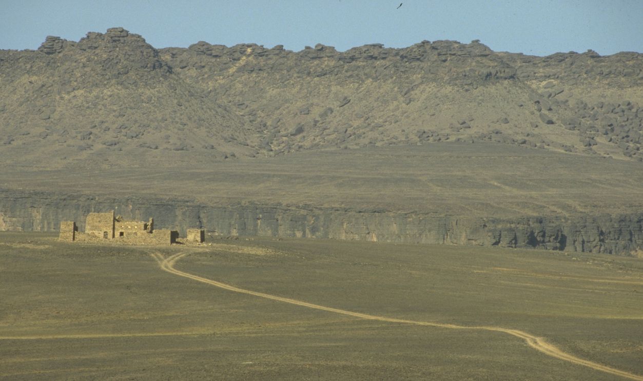
Early Explorers Thought It Was Man-Made
When early European geologists came across the Richat Structure, its symmetry made them suspect human involvement. The surrounding desert lacked context to explain such an orderly formation.

Its Outer Rings Are Quartzite
Quartzite, a highly resistant rock, forms much of the outer ring system. These harder layers stood up better to erosion, leaving behind raised ridges. Softer rocks between them wore down, carving out the eye-like grooves.
 Gabriel Haute Maurienne, Wikimedia Commons
Scientists Call It A “Dome”
Geologists describe the Richat Structure as a "slightly elliptical dome" based on how it bulges upward. Its raised center and surrounding dips resemble a flattened bubble. This doming is caused by the pressure of magma rising from below.
 Korea Aerospace Research Institute, Wikimedia Commons
Some Dikes Stretch Hundreds Of Meters
Within the Richat Structure are carbonatite dikes that can stretch up to 300 meters in length. These intrusions formed as magma pushed through cracks in the rock. They cooled into narrow, hard bands of unique mineral-rich stone.
It Hosts One Of The Largest Megabreccia On Earth
The central zone of the structure features an enormous megabreccia. This breccia is thought to have formed from the collapse of rock layers dissolved by hydrothermal fluids. It’s more than 40 meters thick in the center.
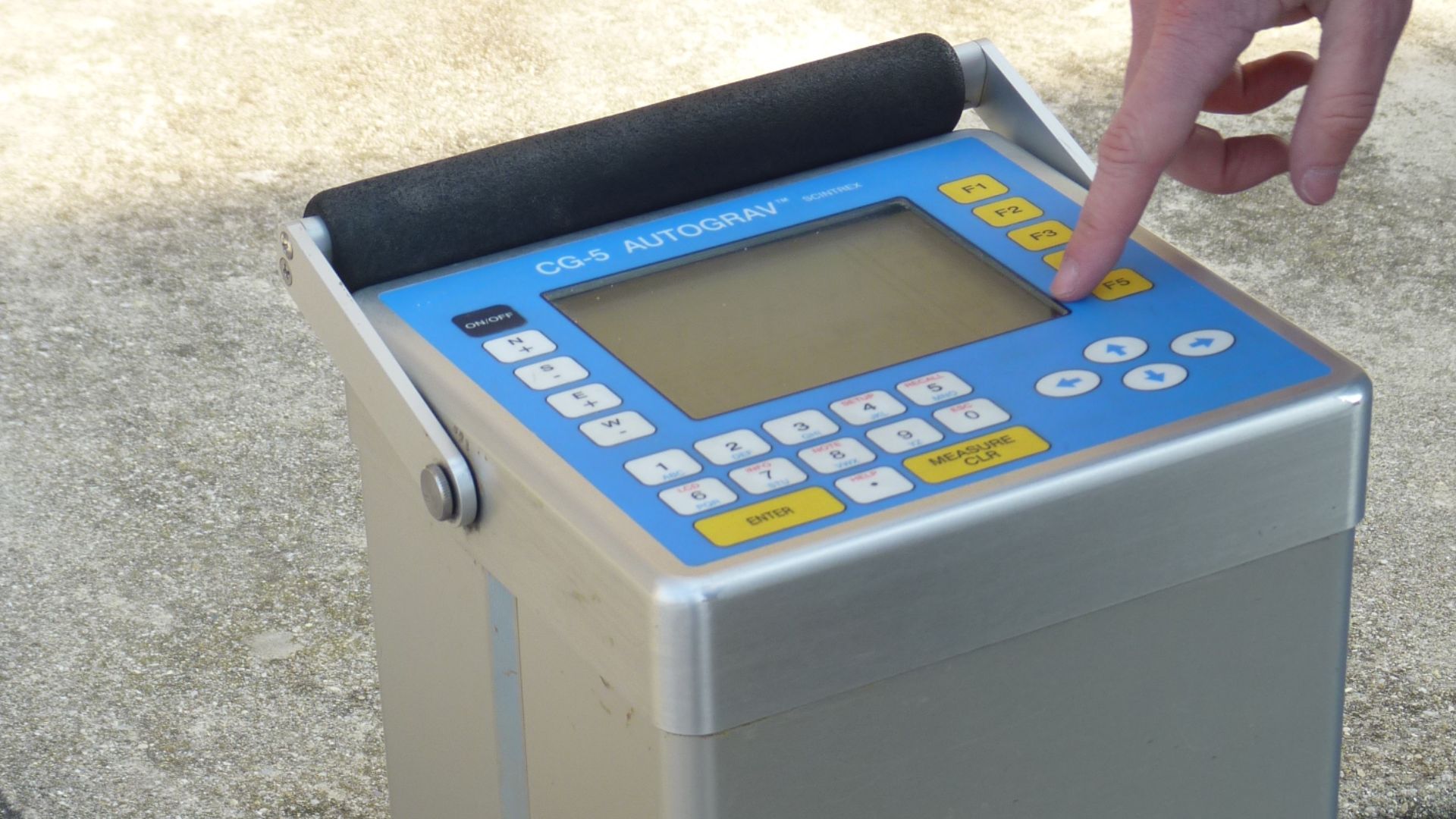
The Structure Was Mapped Using Gravimetric Tools
To understand what lay beneath the surface, scientists used aeromagnetic and gravimetric mapping. These tools measure tiny changes in Earth's gravity and magnetic field. The results revealed the shape of the giant magma body below the Richat dome.
 User:Sandeep vats, Wikimedia Commons
The Rings Are Almost Perfectly Concentric
Despite being created by natural forces, the Richat Structure’s rings maintain an astonishingly regular spacing. Each ring marks a different geological layer exposed by erosion.
 Anonymmous-21, Wikimedia Commons
The Center Contains Rare Silicified Rocks
In the middle of the structure, rocks have been altered by silica-rich fluids, making them incredibly hard. These rocks, including chert and sandstone, show how mineral-laden water changed their composition over time.
 Earth Science and Remote Sensing Unit, Lyndon B. Johnson Space Center, Wikimedia Commons
The Sahara Was Once A Different World
When the Richat Structure formed, the Sahara was not a desert. During the African Humid Period, it was filled with lakes, rivers, and savannas.
Rock Art Tells Stories Of Lost Cultures
Several locations near the Richat Structure contain ancient rock art. These include images of horse riders, wild animals, and even chariots.

Scientists Are Still Studying It
Despite decades of research, the Richat Structure continues to attract new studies. Each year brings new insights into its geology, archaeology, and significance.
You May Also Like:
Unraveling The Mysteries Of Göbekli Tepe, A Pre-Pottery Neolithic Treasure Trove
One Gorilla Fossil Changed The Science Of Evolution Forever
We Have Proof That Neanderthal Kids Were Picking Up Fossils And Storing Them
Source: 1