
Small Island Energy
You know those places that feel quietly alive? Saint Kitts is one of them. It’s small enough to know in a day, yet layered with moments that stay long after you’ve left its shores.
Island Overview
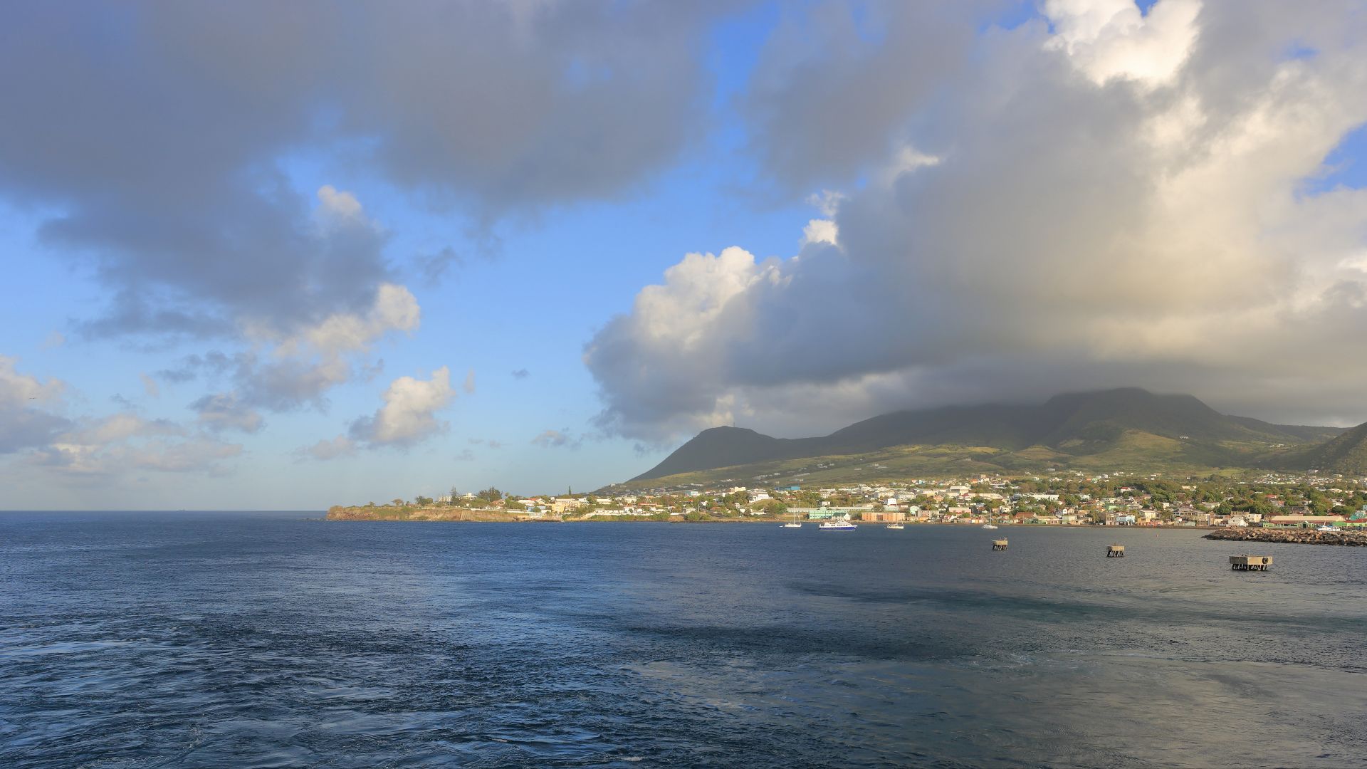
Picture a Caribbean island where dormant volcanoes meet pristine beaches, and you can literally drive the entire perimeter before lunch. Saint Kitts, officially Saint Christopher, spans just 68 square miles in the Leeward Islands chain. About 40,000 Kittitians call this volcanic paradise home.
 Martin Falbisoner, Wikimedia Commons
Compact Paradise
The island's main circular road hugs the coastline for roughly 35 to 45 minutes of non-stop driving, though you'd be crazy to rush past the jaw-dropping scenery. This twin-ocean positioning creates dramatically different coastal experiences—calm turquoise waters on one side, wild Atlantic swells on the other.
 Nesnad at English Wikipedia, Wikimedia Commons
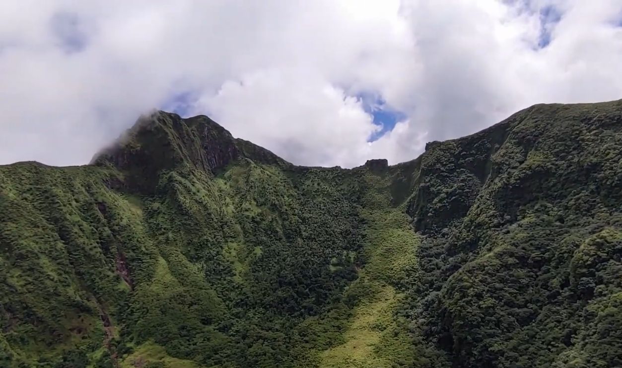
Volcanic Origins
Saint Kitts emerged from the Caribbean Sea through explosive volcanic activity less than 50 million years ago during the Miocene era. The island represents the summit of a massive submerged mountain range marking the Caribbean Tectonic Plate's eastern boundary, with three volcanic mountain groups shaping its surroundings.
 Hiking on a VOLCANO | Mount Liamuiga | St. Kitts Volcano Hike by Explorcation
Mount Liamuiga
Towering 1,156 meters above sea level, Mount Liamuiga, meaning "fertile land" in the Kalinago language, dominates Saint Kitts' northwestern skyline. This stratovolcano last erupted about 1,620 years ago. The summit crater spans one kilometer wide and mysteriously holds a lake that disappeared in 1959 but reformed by 2006.
 Hiking on a VOLCANO | Mount Liamuiga | St. Kitts Volcano Hike by Explorcation
Driving Circuit
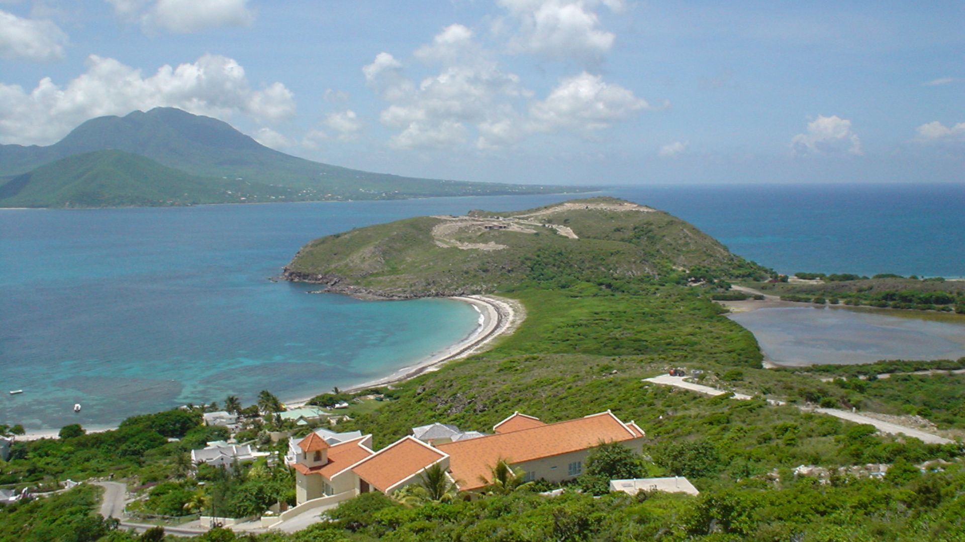
Starting from Basseterre, drivers wind past fishing villages, historic sugar estates, volcanic black sand beaches, and rainforest-covered mountainsides within an hour's unhurried journey. The southeastern peninsula adds another 15 minutes. Roads are well-maintained with left-hand British-style driving, and traffic remains light outside the capital's morning rush.
 Dr. Thomas Liptak, Wikimedia Commons
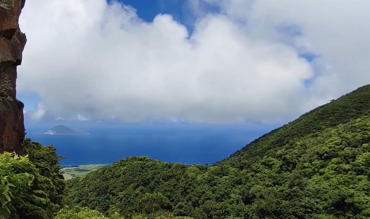
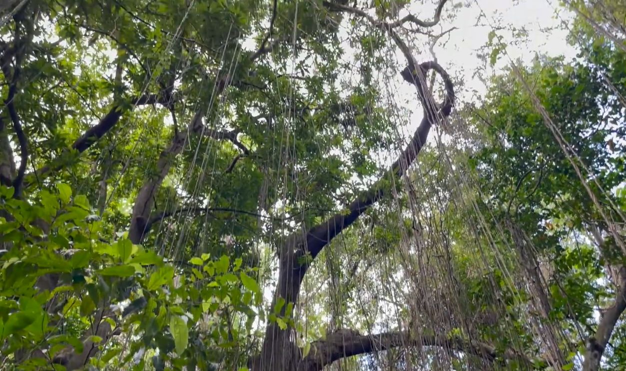
Cloud Forests
Above 460 meters of elevation, transitions into mystical cloud forest ecosystems rarely found elsewhere in the Eastern Caribbean. These high-altitude forests remain permanently shrouded in moisture-laden clouds, forming microhabitats where moss-draped trees and rare orchids thrive. Scientists classify these ecosystems as critically endangered globally.
 WORLD'S RAREST RAINFOREST! (St. Kitts & Nevis) by Jacob and Jenny
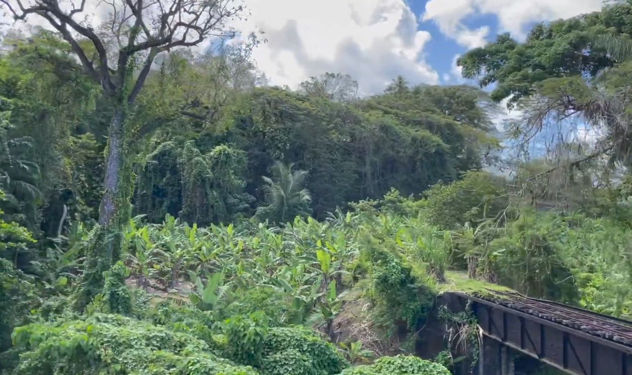
Rainforest Ecosystems
Forest cover has increased since sugar production ceased in 2005, with formerly cultivated lowlands naturally regenerating into secondary forests. Government regulations restrict most activity above the 1,000-foot elevation mark, preserving pristine sanctuaries. The rainforests burst with life.
 WORLD'S RAREST RAINFOREST! (St. Kitts & Nevis) by Jacob and Jenny
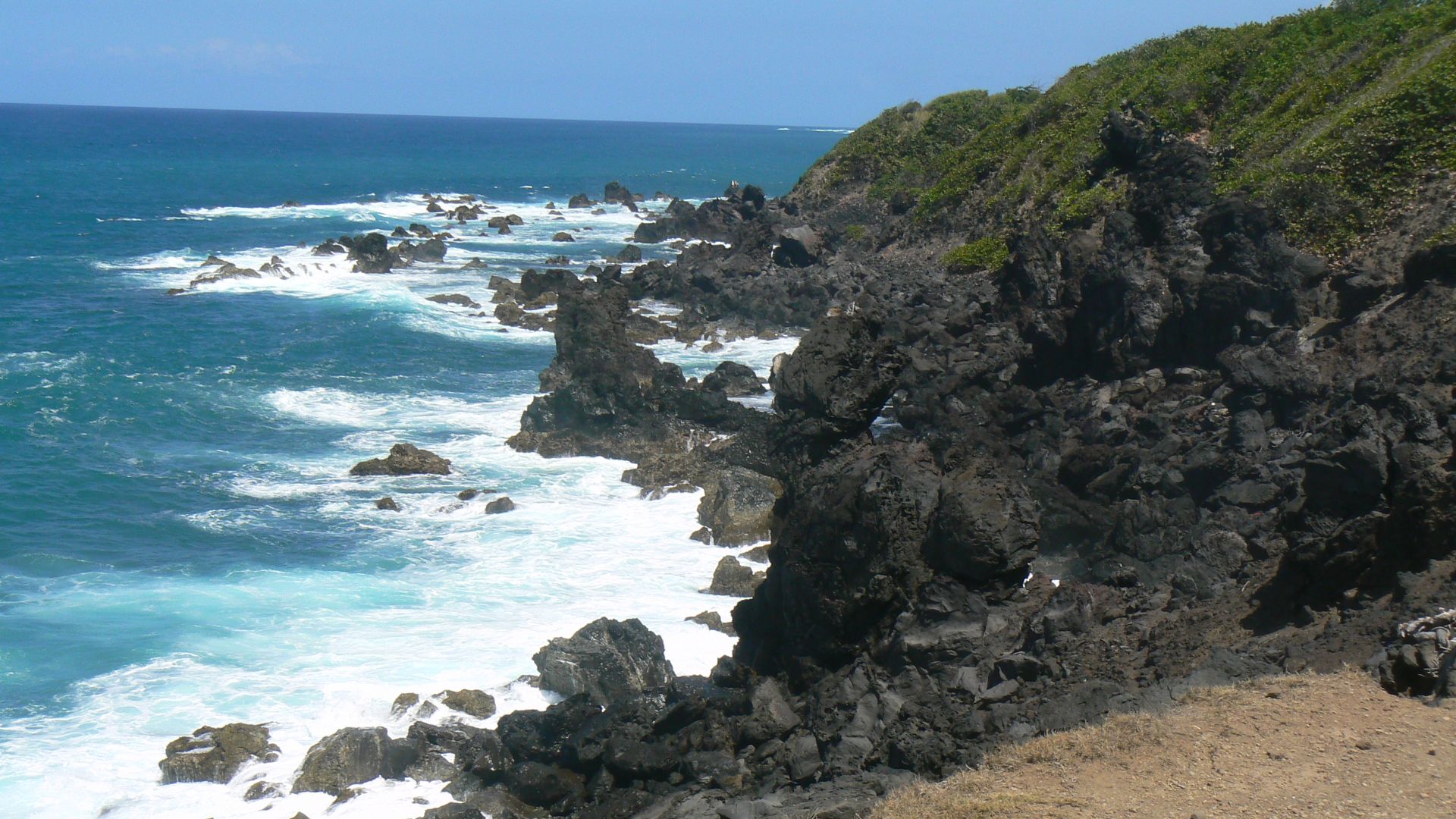
Black Rocks
These striking geological sculptures formed when molten lava from Mount Liamuiga flowed down to meet the sea thousands of years ago, cooling instantly into twisted, jagged shapes. The contrast is breathtaking. You get to see volcanic rocks against white foam and turquoise water.
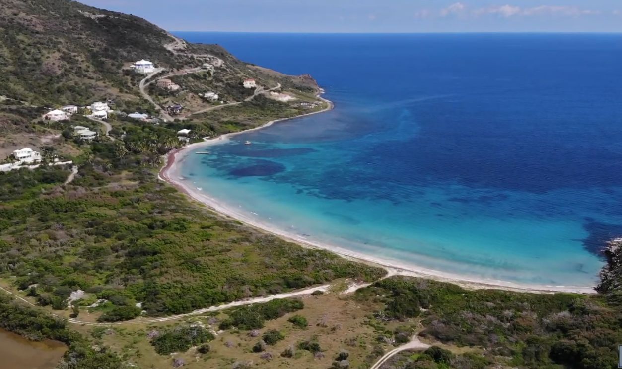
Beach Diversity
The southern peninsula has stunning stretches, with Cockleshell Bay, South Friars Bay, and Banana Bay offering postcard-perfect white sand and calm waters. North Frigate Bay faces the wild Atlantic with darker sand and dramatic waves, while South Frigate Bay has golden sand.
 Cockleshell Beach, St Kitts by 8 FIFTY Productions L.L.C.
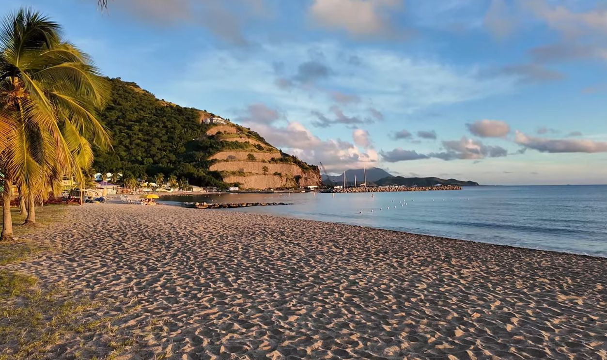
Frigate Bay
South Frigate Bay faces the tranquil Caribbean Sea with calm turquoise waters and the famous "Strip" lined with beach bars like Mr X's Shiggidy Shack, pumping reggae and rum punches from dawn to midnight. North Frigate Bay confronts the Atlantic Ocean with rougher waves and darker volcanic sand particles.
 South Frigate Bay St Kitts, The Strip, Beach Life & Where I Stayed by Liesel81
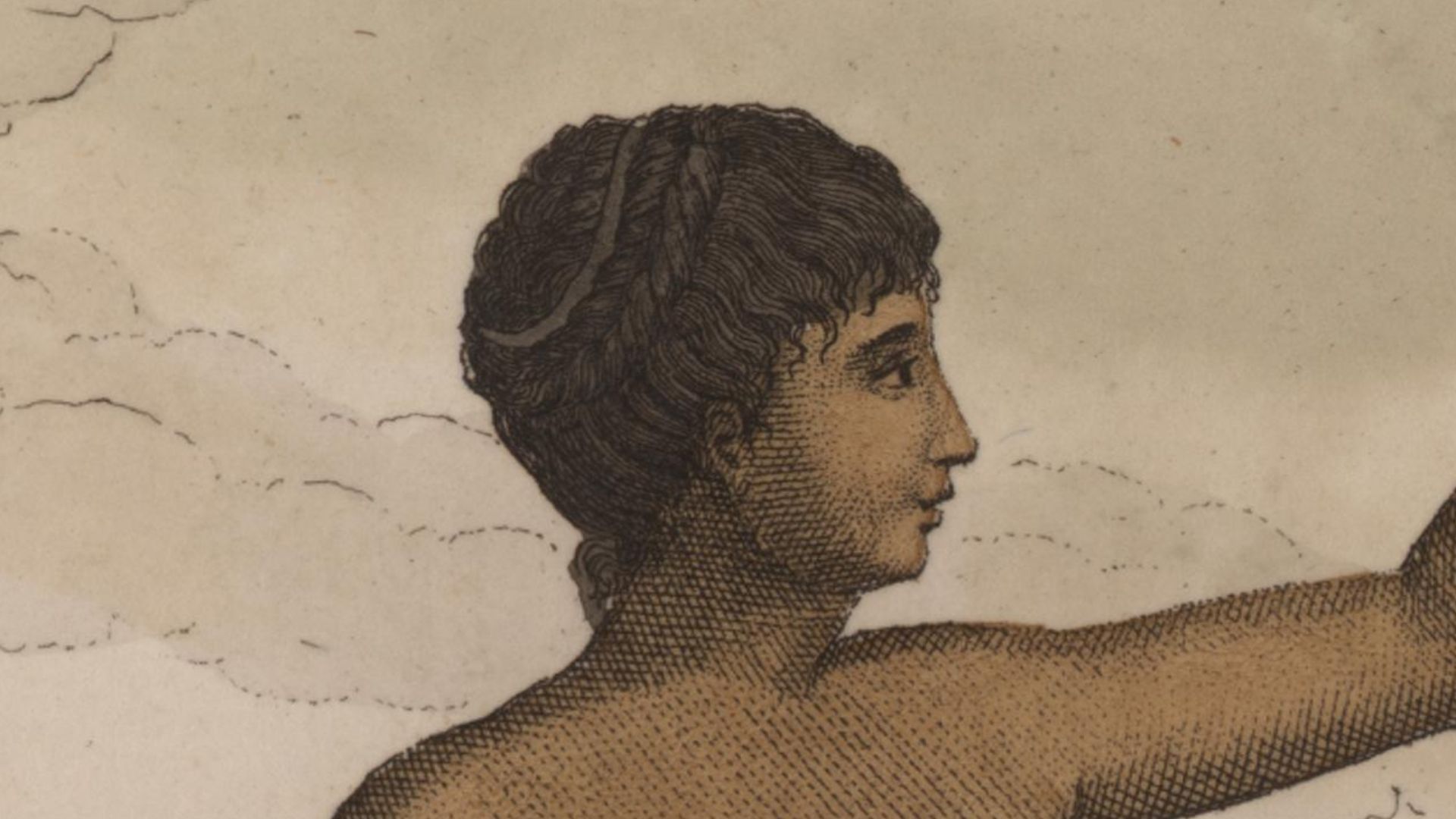
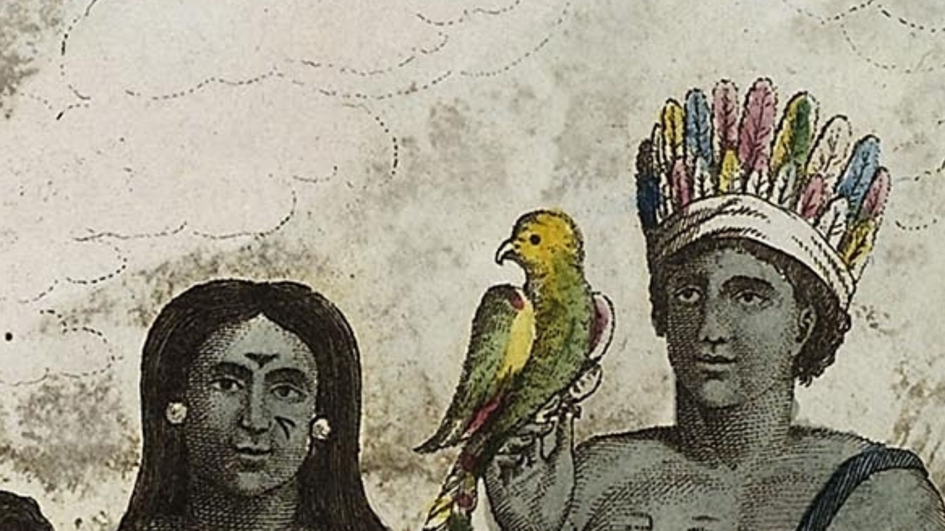
Indigenous Peoples
The Ciboney people arrived on Saint Kitts as early as 3,000 years ago, though their mysterious origins remain unclear due to the absence of pottery artifacts. Around 800 AD, the Arawak peoples, also called Taino, settled the island before the warlike Island Caribs expanded northward.
 John Gabriel Stedman, Wikimedia Commons
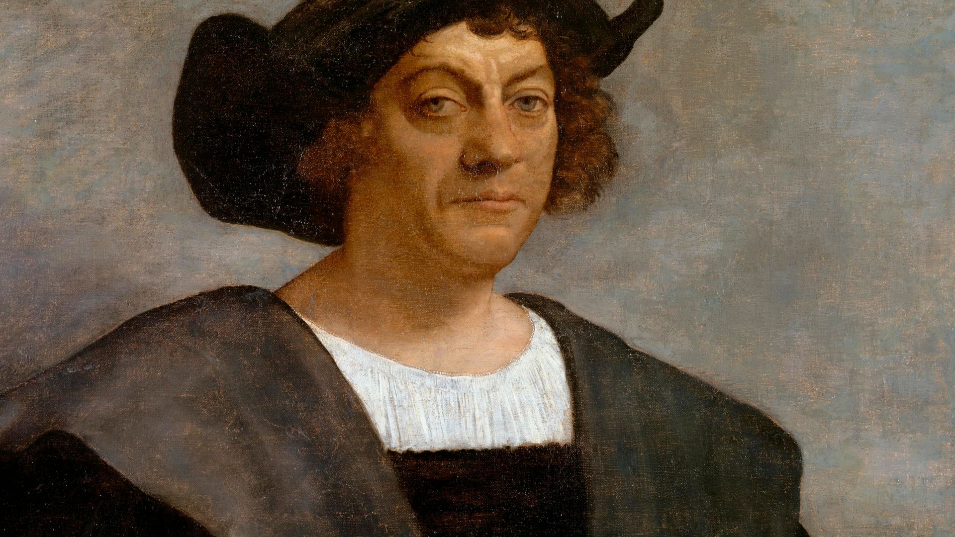
Columbus Discovery
Christopher Columbus sighted Saint Kitts on November 11, 1493, during his second voyage through the Caribbean, naming it San Cristobal after his patron saint. The Spanish never settled the island despite claiming it, leaving it untouched for over a century. English settlers later shortened Saint Christopher to “Saint Kitts Island”.
 Sebastiano del Piombo, Wikimedia Commons
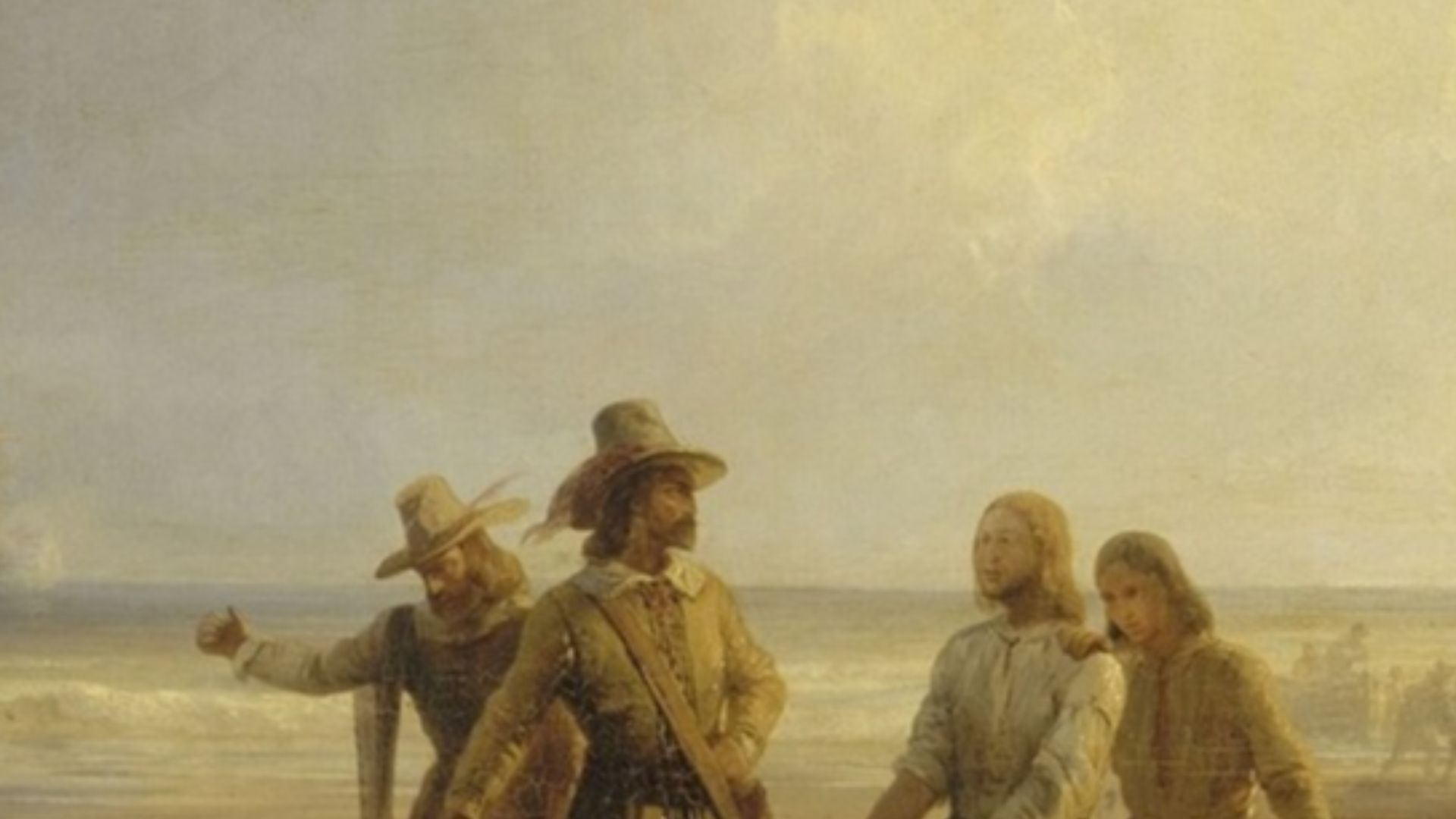
British Settlement
Sir Thomas Warner came from England in 1623, establishing the first successful English colony in the entire West Indies at Old Road Town on Saint Kitts' western coast. Warner achieved an agreement with the Carib Chief Ouboutou Tegremante to share the island peacefully.
 A. Moure Losada, Wikimedia Commons
French Rivalry
Furthermore, French Captain Pierre Belain d'Esnambuc showed up in 1625 aboard his 14-gun brigantine after escaping a Spanish warship battle near the Cayman Islands. By 1627, Warner and d'Esnambuc split Saint Kitts into quarters—the English controlled the middle sections while the French took both ends.
 Theodore Gudin (1802-1880), Wikimedia Commons
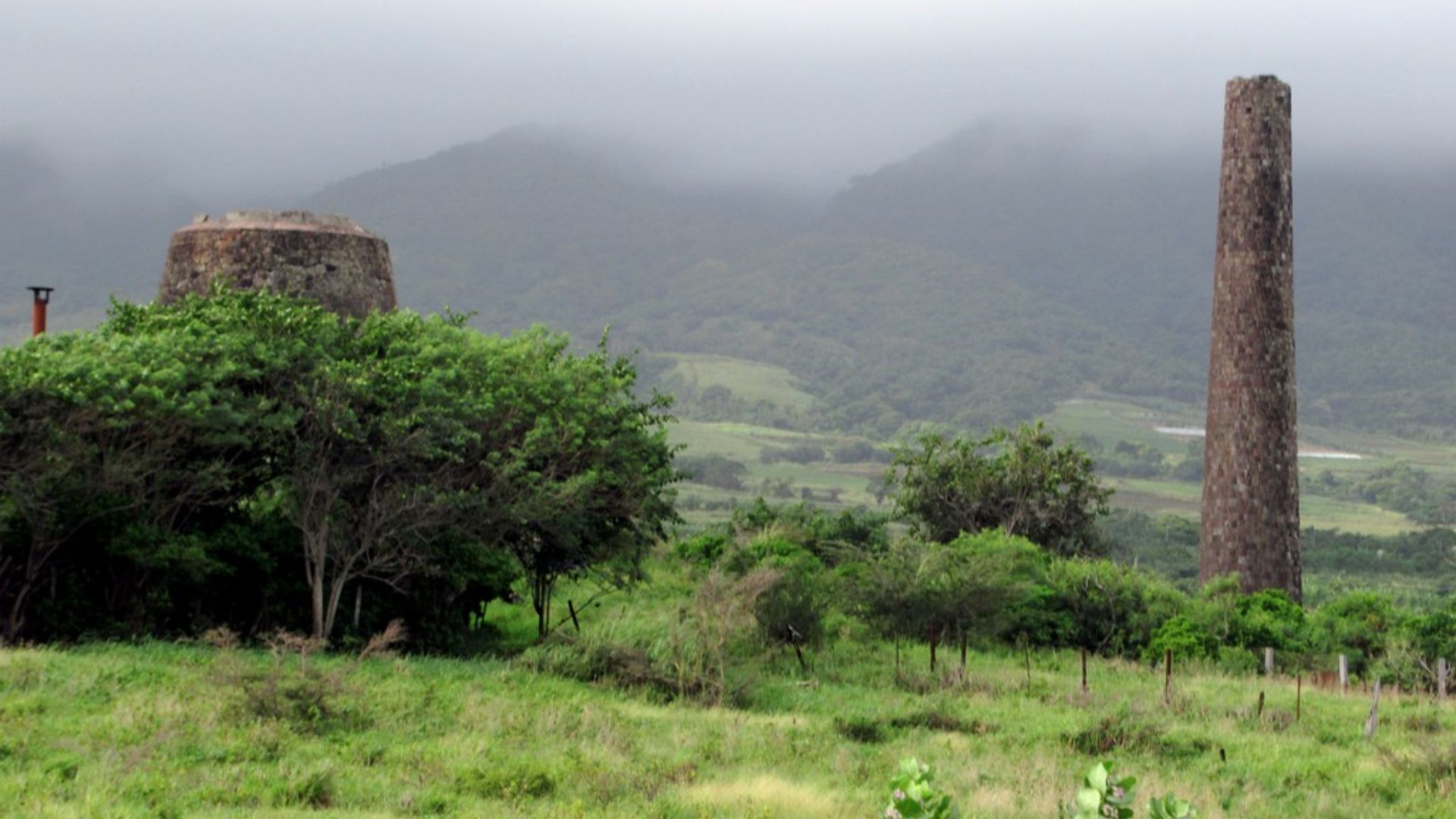
Sugar Dominance
By 1776, Saint Kitts became the richest British colony per capita in the entire Caribbean, with sugar plantations generating extraordinary wealth for European planters. Nevis had previously held this distinction in 1652 as the wealthiest British colony in the Western Hemisphere.
 David Stanley from Nanaimo, Canada, Wikimedia Commons
Slavery's Shadow
The 1626 massacre saw Anglo-French settlers unite to slaughter around 2,000 Kalinago people, allegedly to preempt a Carib expulsion plan. Afterward, enslaved Africans were imported in staggering numbers to work sugar plantations under brutal conditions.
 John Gabriel Stedman, Wikimedia Commons
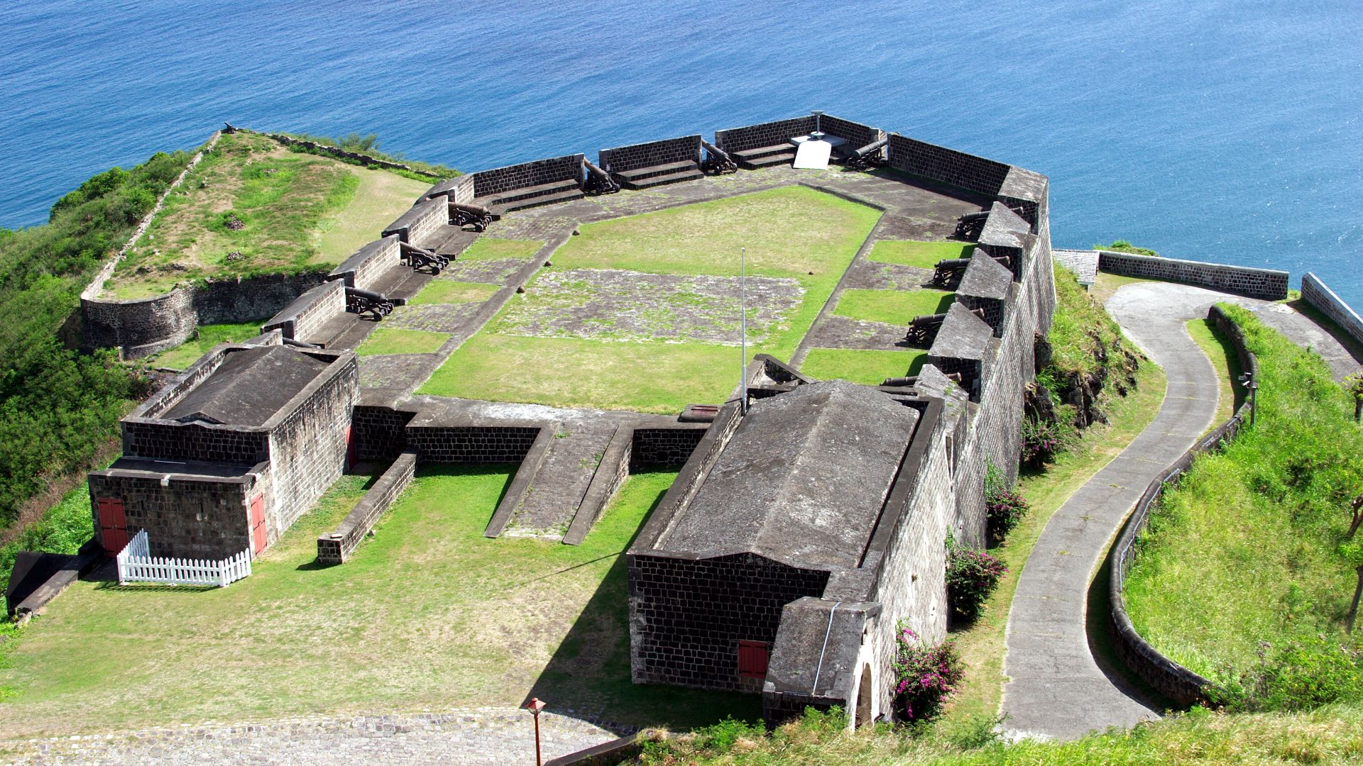
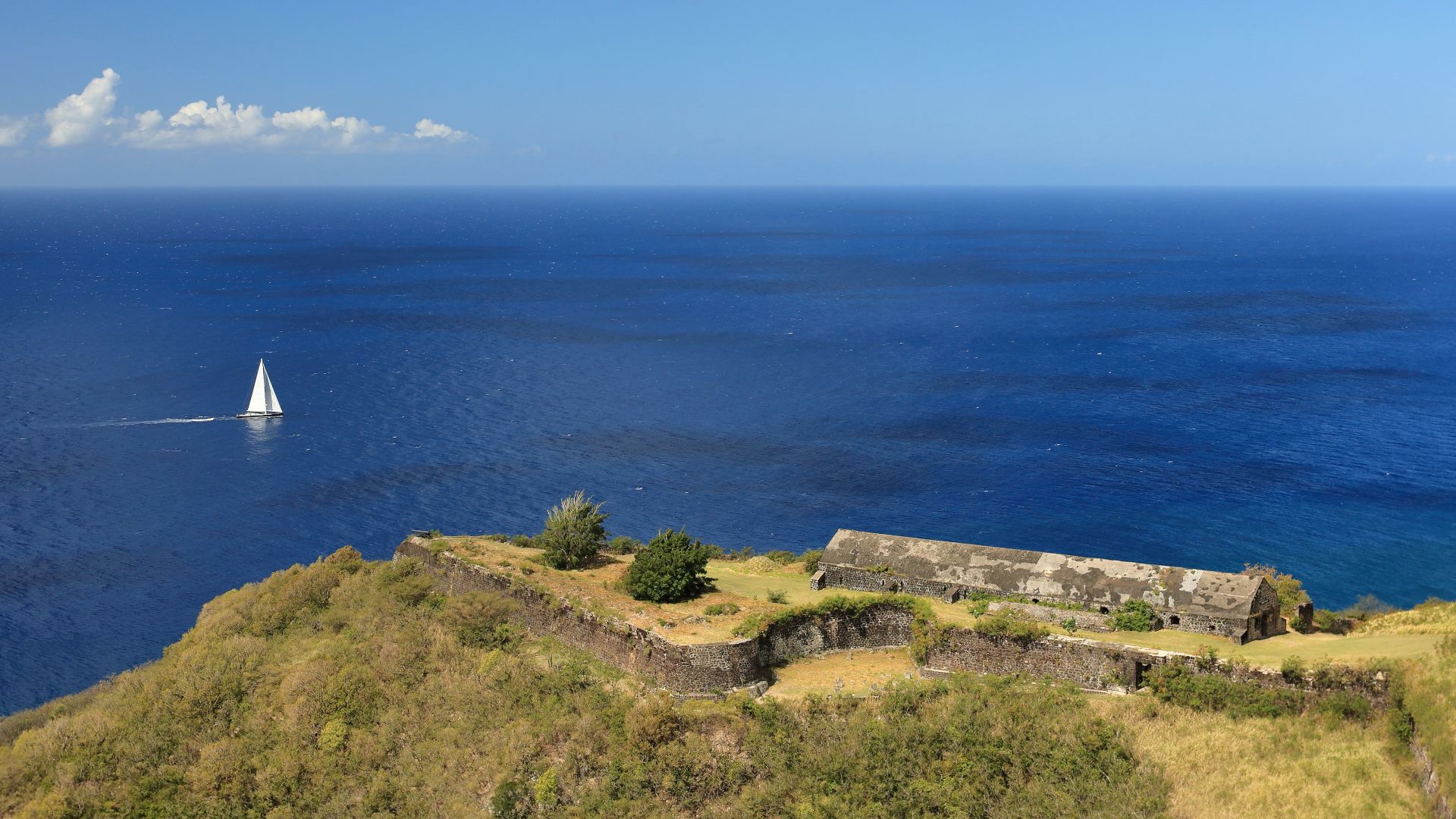
Brimstone Fortress
Construction began in 1690 on this hilltop fortification, continuing intermittently for over 100 years until completion in the 1790s. Built 800 feet above sea level by enslaved Africans to exacting British military engineering standards, Brimstone Hill earned the nickname “Gibraltar of the West Indies”.
Independence Achieved
The islands of Saint Kitts, Nevis, and Anguilla were united by a federal act in 1882, becoming an associated state with the United Kingdom on February 27, 1967, with full internal self-government. Anguilla rebelled and separated in 1971. On September 19, 1983, Saint Kitts and Nevis achieved full independence.
 No machine-readable author provided. Infilms assumed (based on copyright claims)., Wikimedia Commons
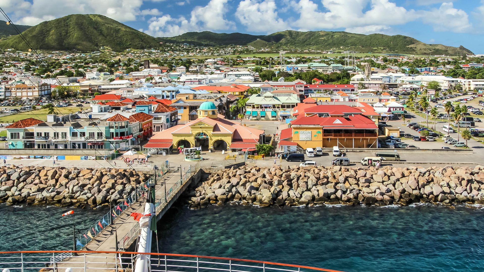
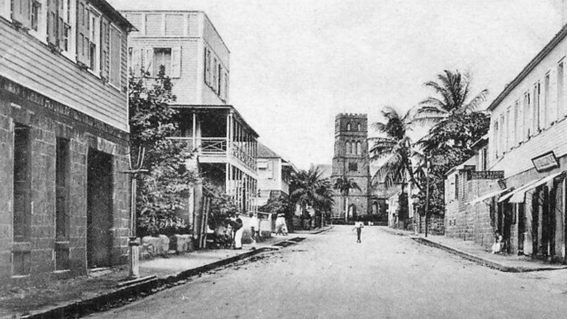
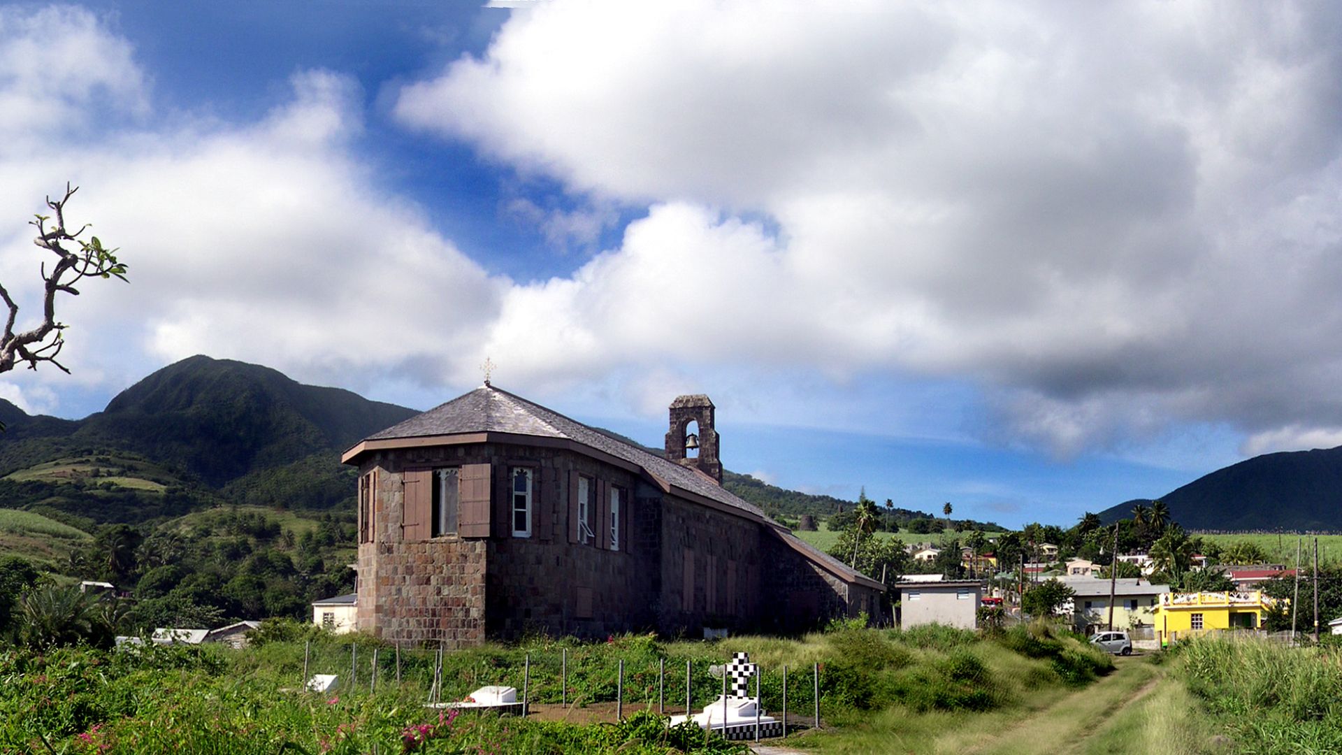
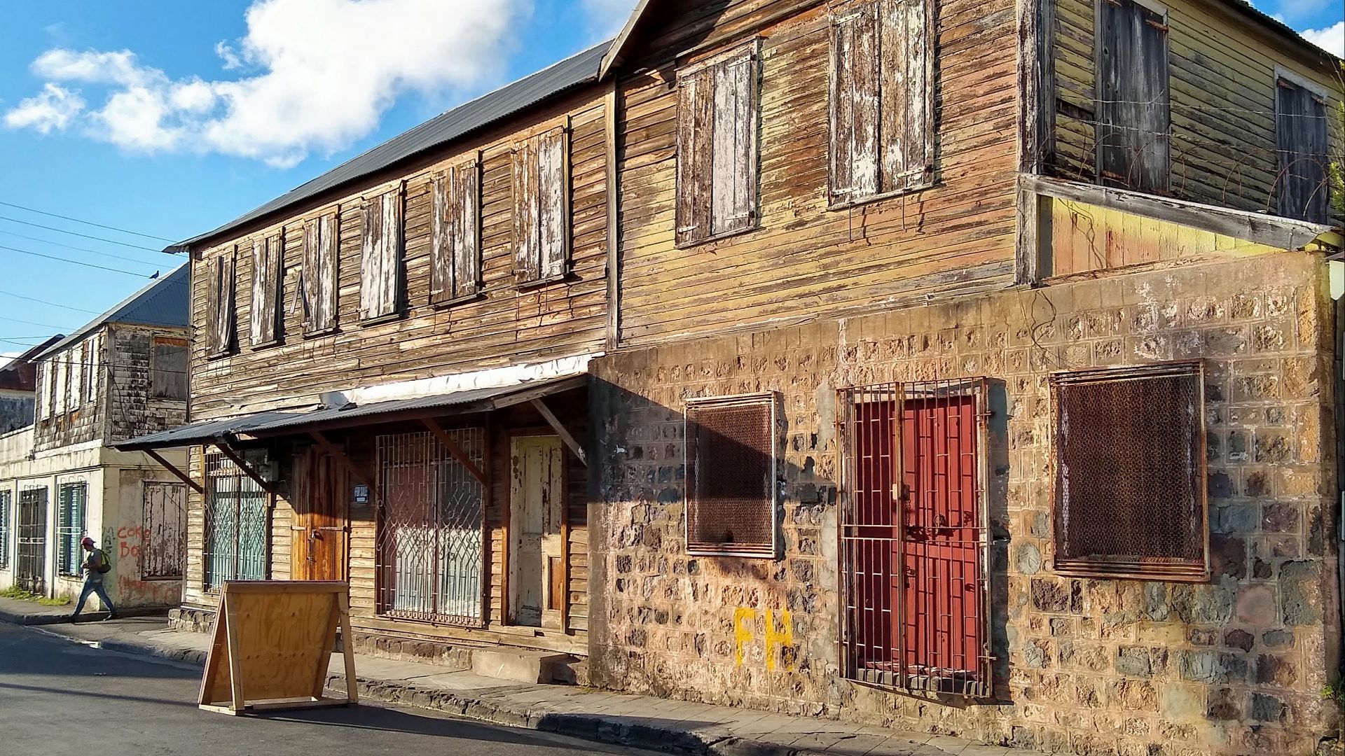
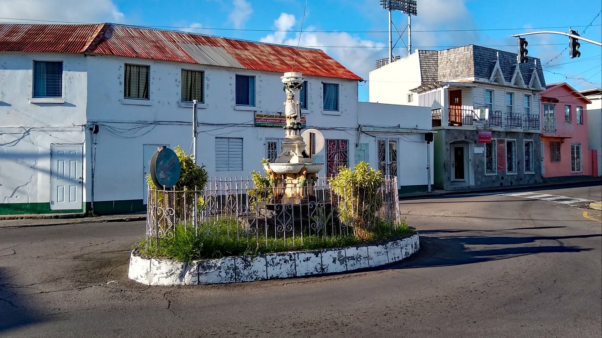
Basseterre Capital
Founded by the French in the 1620s, Basseterre translates to "low land" and serves as one of the oldest towns in the Eastern Caribbean. The historic capital features Georgian architecture, cobblestone streets, and landmarks such as Independence Square, formerly the site of slave auctions, and Pall Mall Square.
UNESCO Heritage
Brimstone Hill Fortress National Park earned UNESCO World Heritage Site designation in 1999, recognized as a remarkable example of 17th and 18th-century European military engineering in a Caribbean context. The 38-acre fortress complex includes Fort George Citadel, a rare surviving example of the "Polygonal System" fortress design.
 Martin Falbisoner, Wikimedia Commons
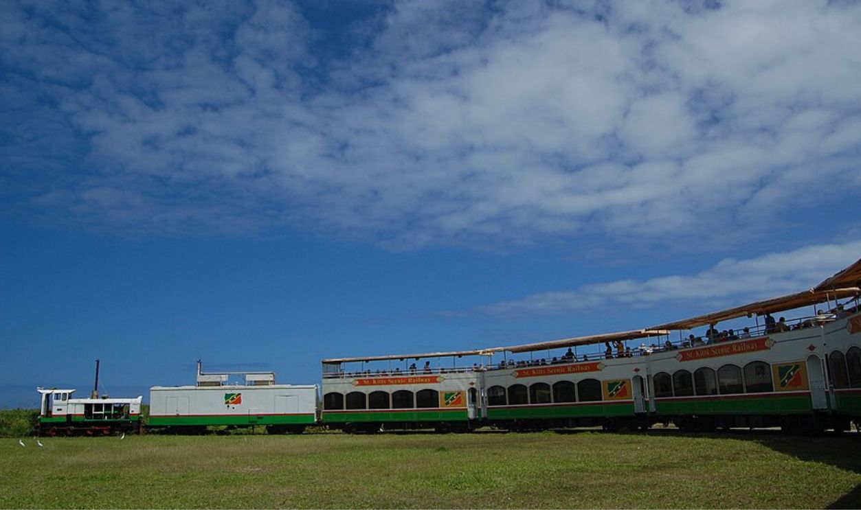
Scenic Railway
Built around 1926 to transport sugar cane from plantations to Basseterre's processing factory, the narrow-gauge railway became known as the ‘Last Railway in the West Indies’ after sugar production ended. Today's three-hour tourist excursion covers 30 miles—18 miles by restored train and 12 miles by sightseeing bus.
 Jeremy T. Hetzel from Boston, USA, CC BY 2.0, Wikimedia Commons
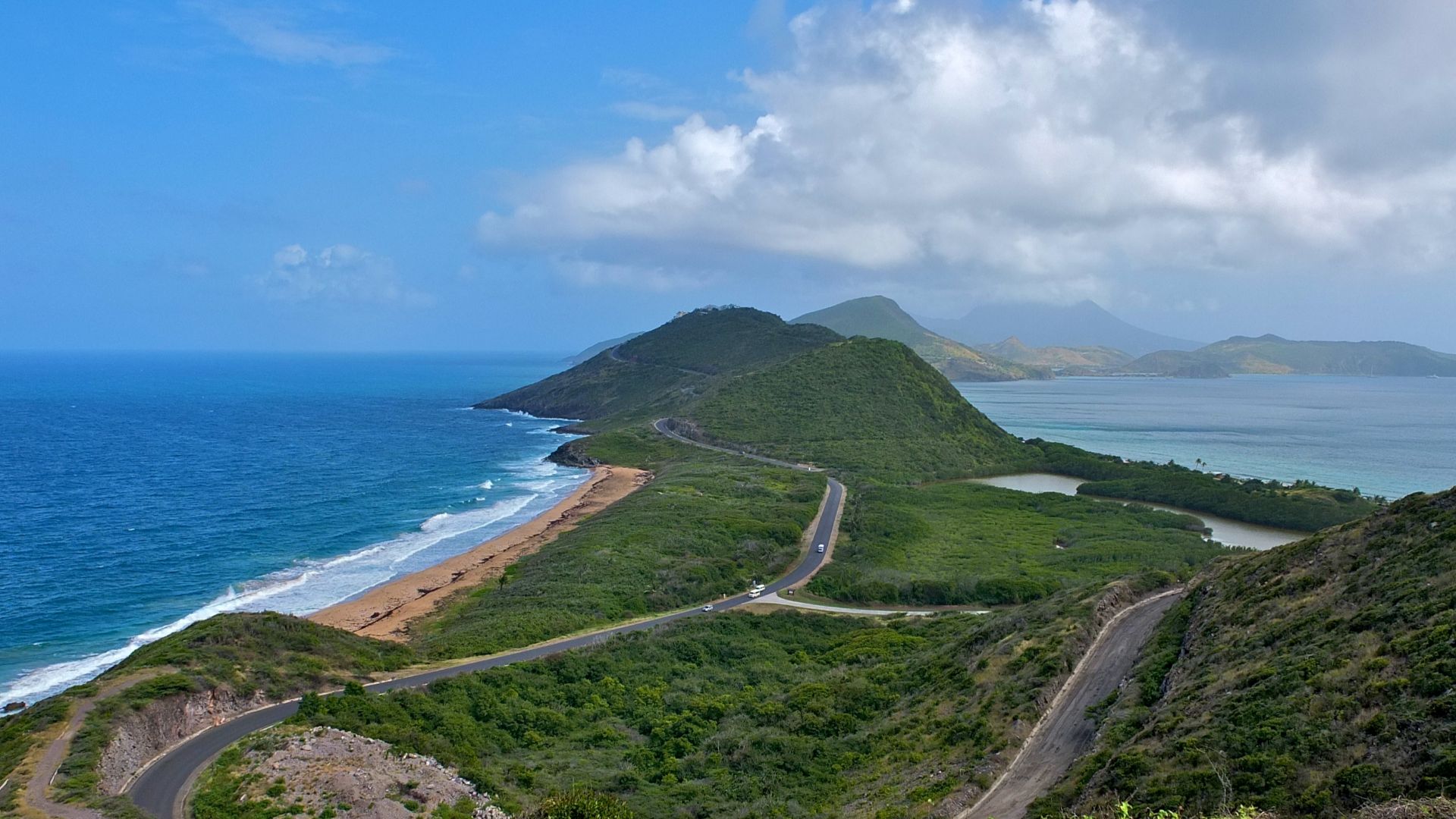
Timothy Overlook
Present atop Timothy Hill on the southeastern peninsula, this panoramic viewpoint delivers the island's most breathtaking 360-degree vistas where Caribbean Sea and Atlantic Ocean waters meet. Standing here, visitors simultaneously see both coastlines—the calm turquoise Caribbean to the west and wild blue Atlantic to the east.
 Fred Hsu on en.wikipedia, Wikimedia Commons
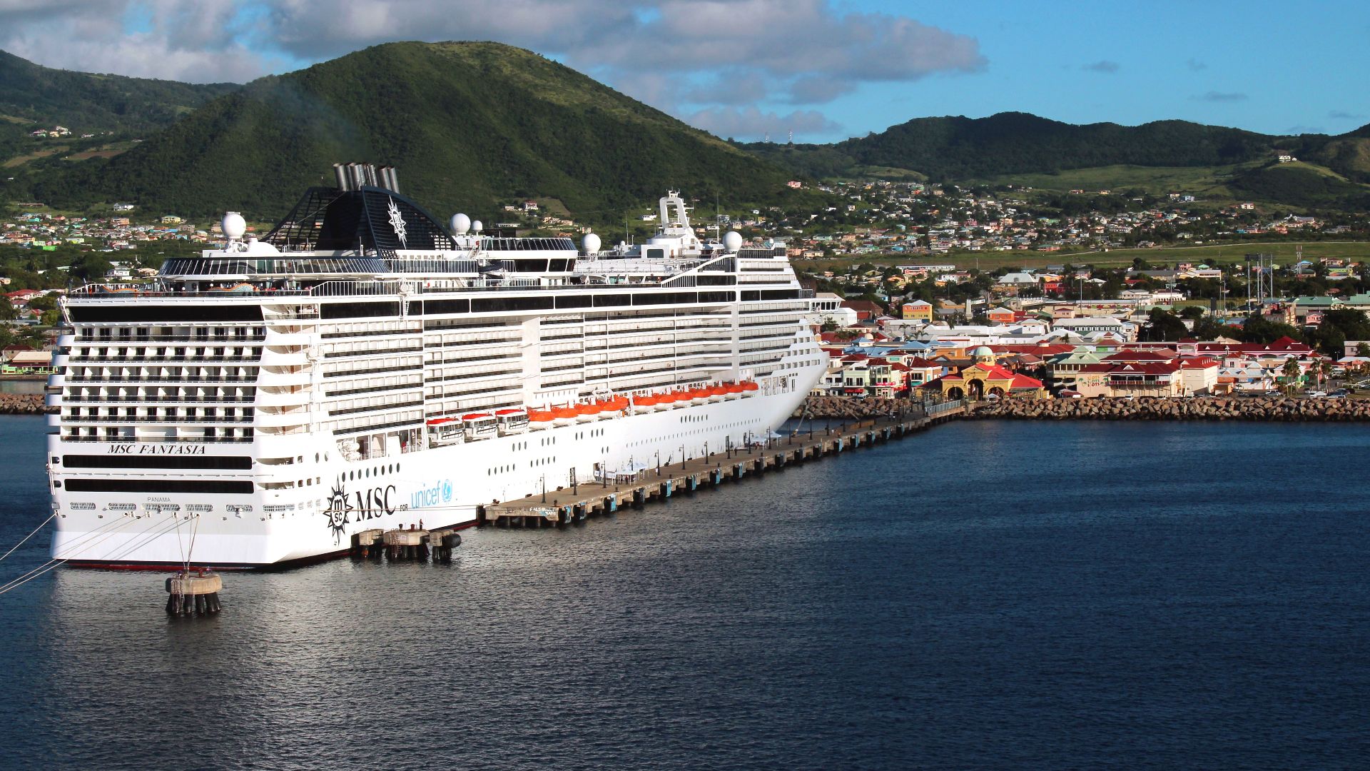
Tourism Economy
Tourism replaced sugar as Saint Kitts' economic mainstay since the 1970s, with roughly 200,000 visitors arriving annually via cruise ships at Port Zante and flights to Robert L Bradshaw International Airport. The Park Hyatt and boutique properties like Koi Resort represent significant foreign investment.
 Thank You (23 Millions+) views, Wikimedia Commons
Citizenship Program
Established in 1984, Saint Kitts and Nevis operates the world's oldest and most respected Citizenship by Investment Programme, introduced before the sugar industry collapsed as the nation sought alternative revenue. Investors obtain lifelong citizenship through real estate purchases or approved development projects.
.jpg)