
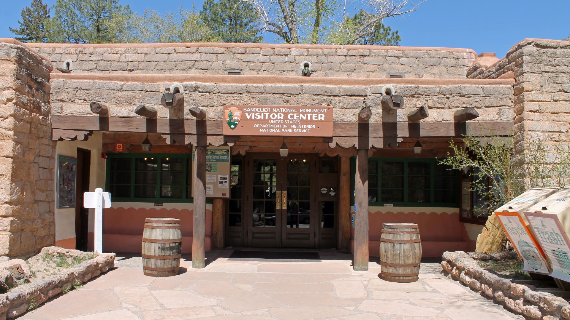
A City Carved In Stone
Spanning over 33,000 acres of rugged New Mexico terrain, Bandelier National Monument protects the homes, trails, and artifacts of the Ancestral Puebloans. Nestled in the Jemez Mountains near Los Alamos, the monument offers visitors access to ancient cliff dwellings, sprawling wilderness, and one of the largest collections of preserved Civilian Conservation Corps architecture in the country.
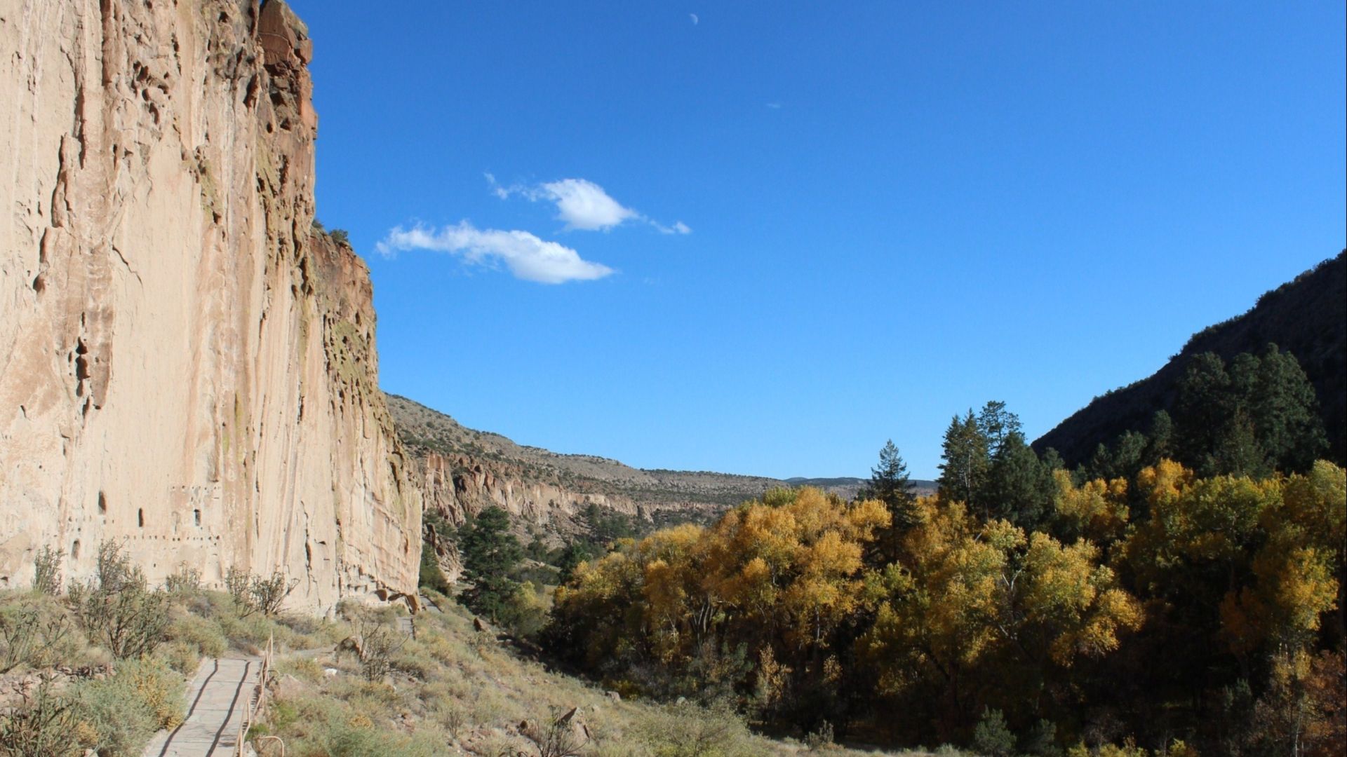
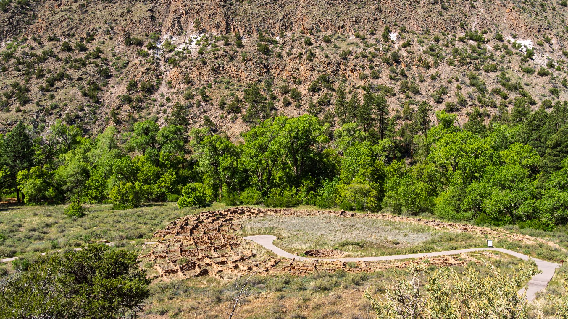
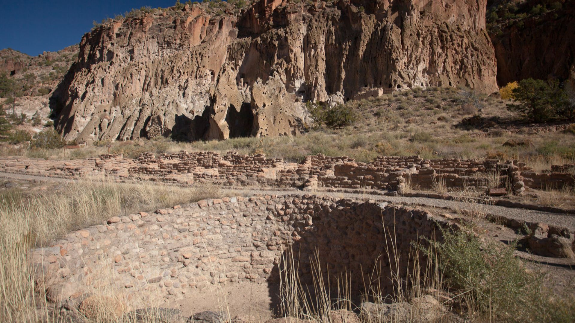
Tyuonyi Pueblo’s Lasting Legacy
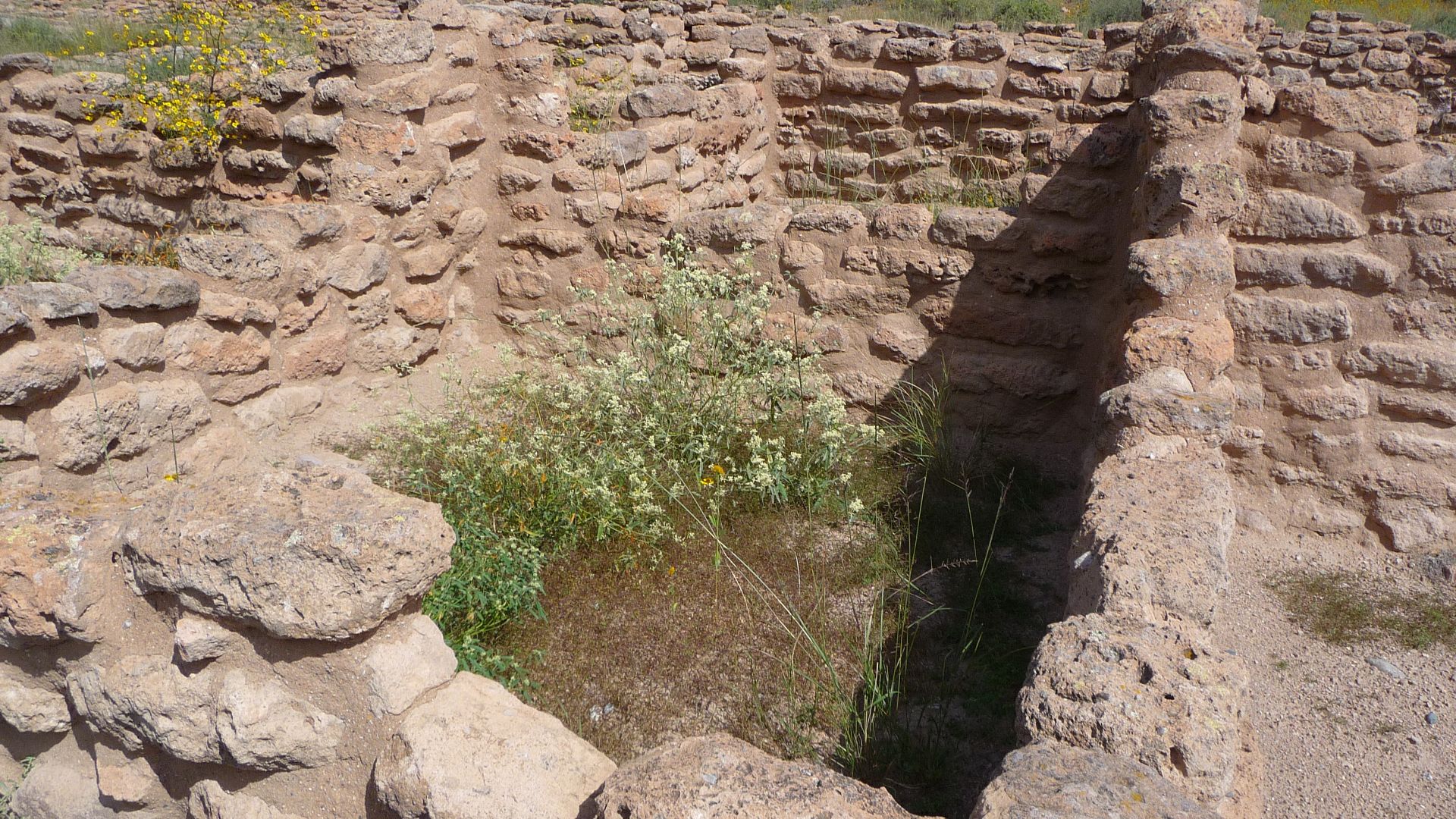
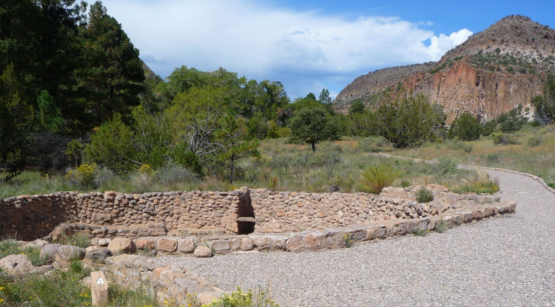
The circular ruin of Tyuonyi pueblo once housed 400 rooms. Tree-ring dating places most of its construction between 1383 and 1466. The site offers a clear view into the architectural ingenuity of the Ancestral Puebloans.
 Artotem, CC BY 2.0, Wikimedia Commons
The Monument’s Official Origins
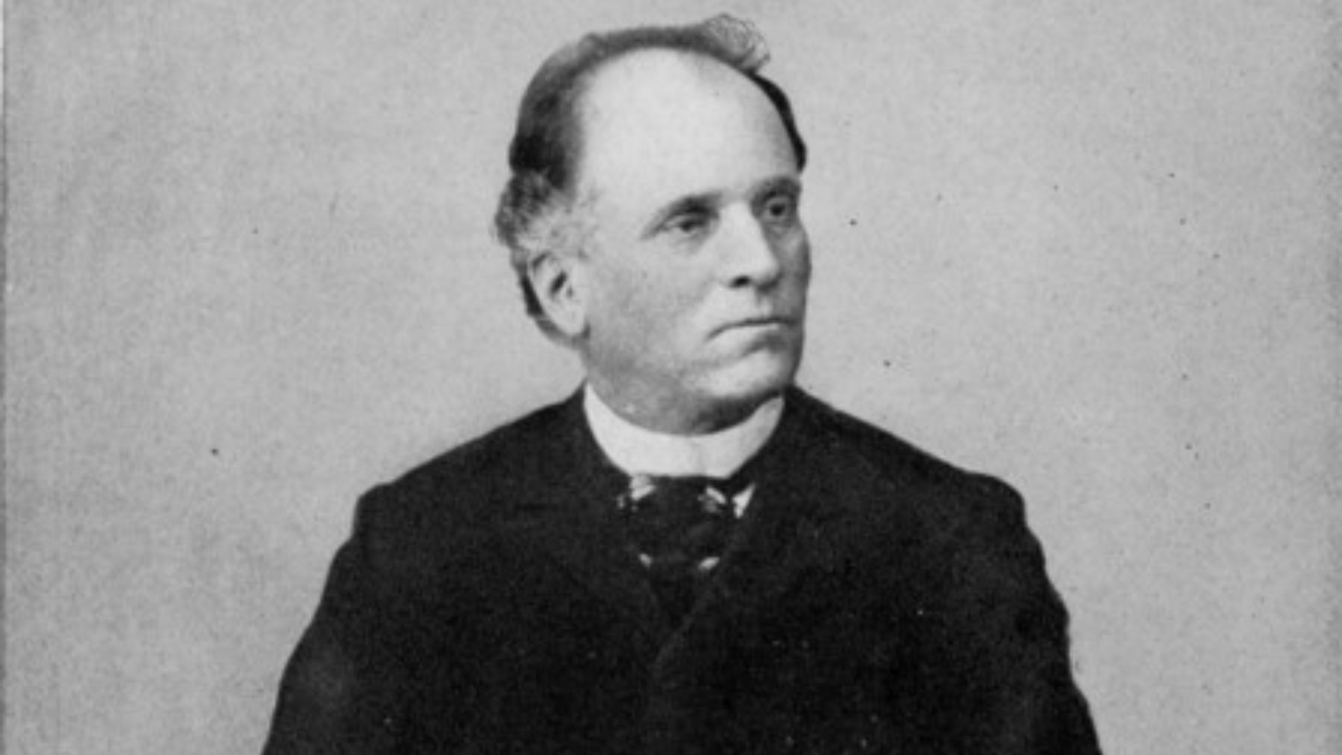
President Woodrow Wilson designated Bandelier a national monument on February 11, 1916. The decision followed efforts by Adolph Bandelier to preserve the area’s archaeological value. Bandelier called the site “the grandest thing I ever saw”.
 Photorapher unknown, Wikimedia Commons
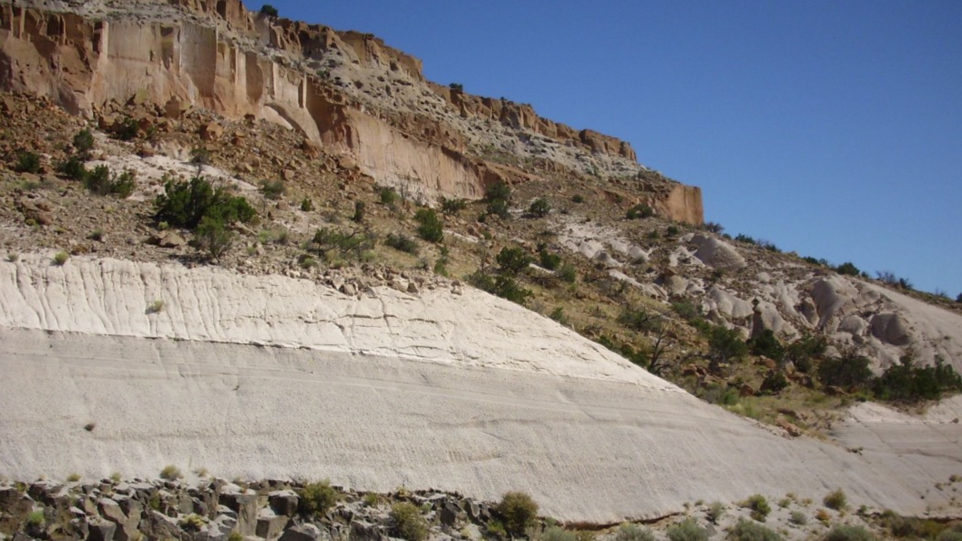
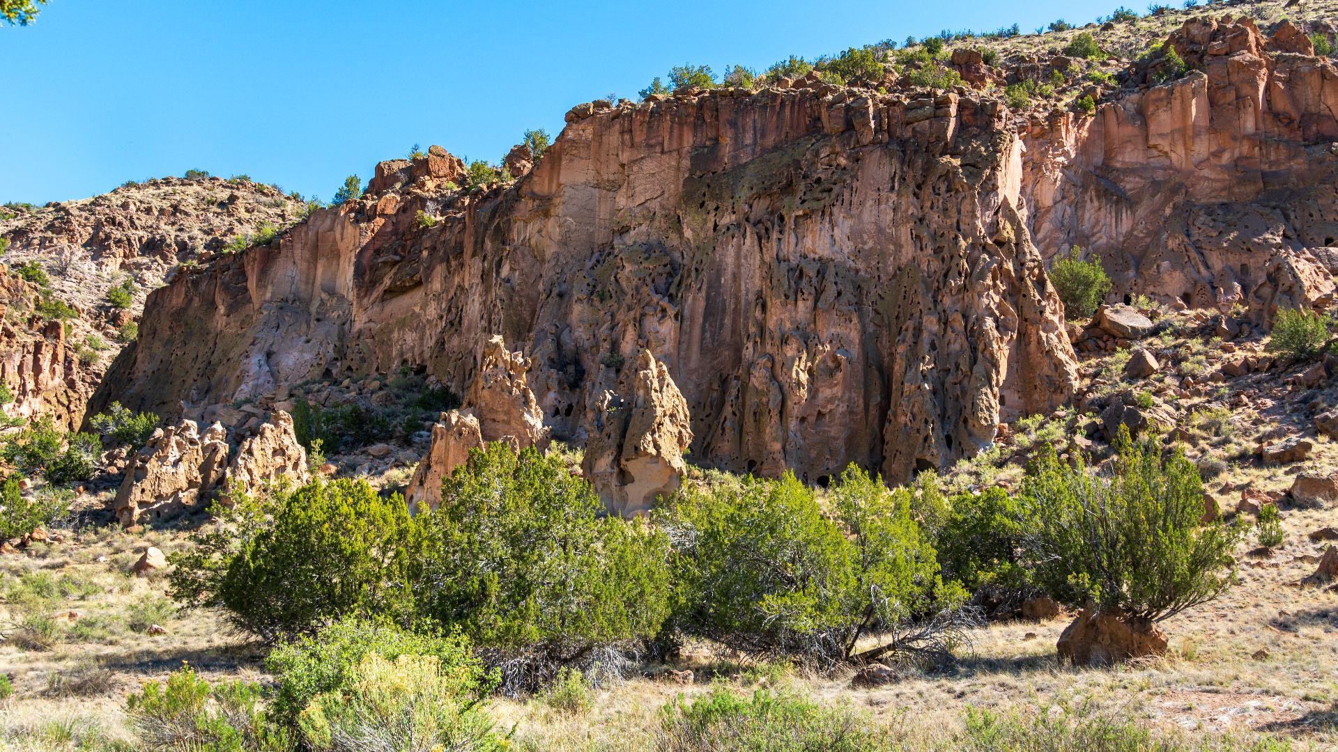
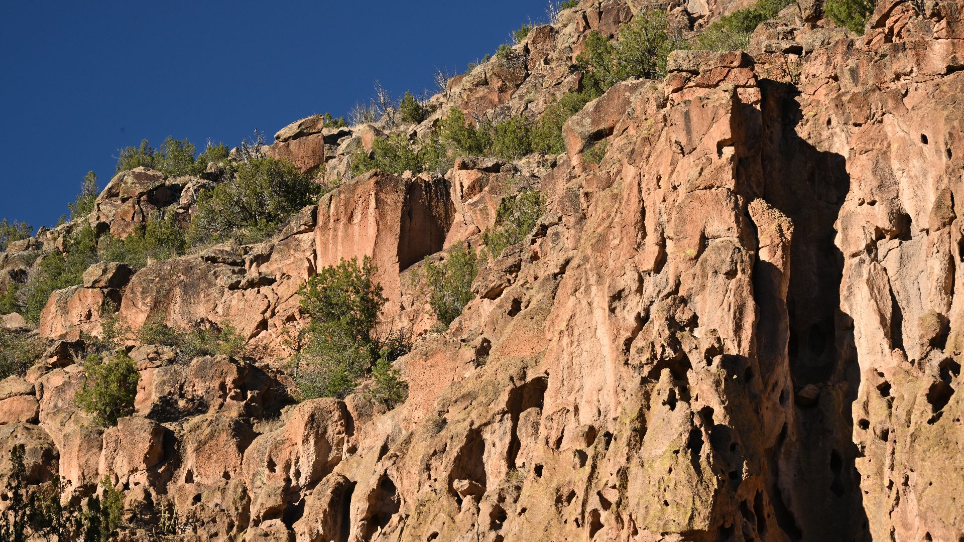
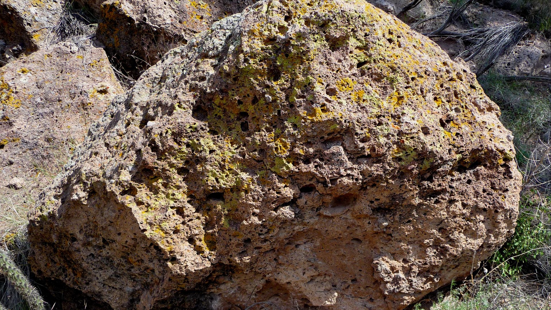
A Landscape Born Of Fire
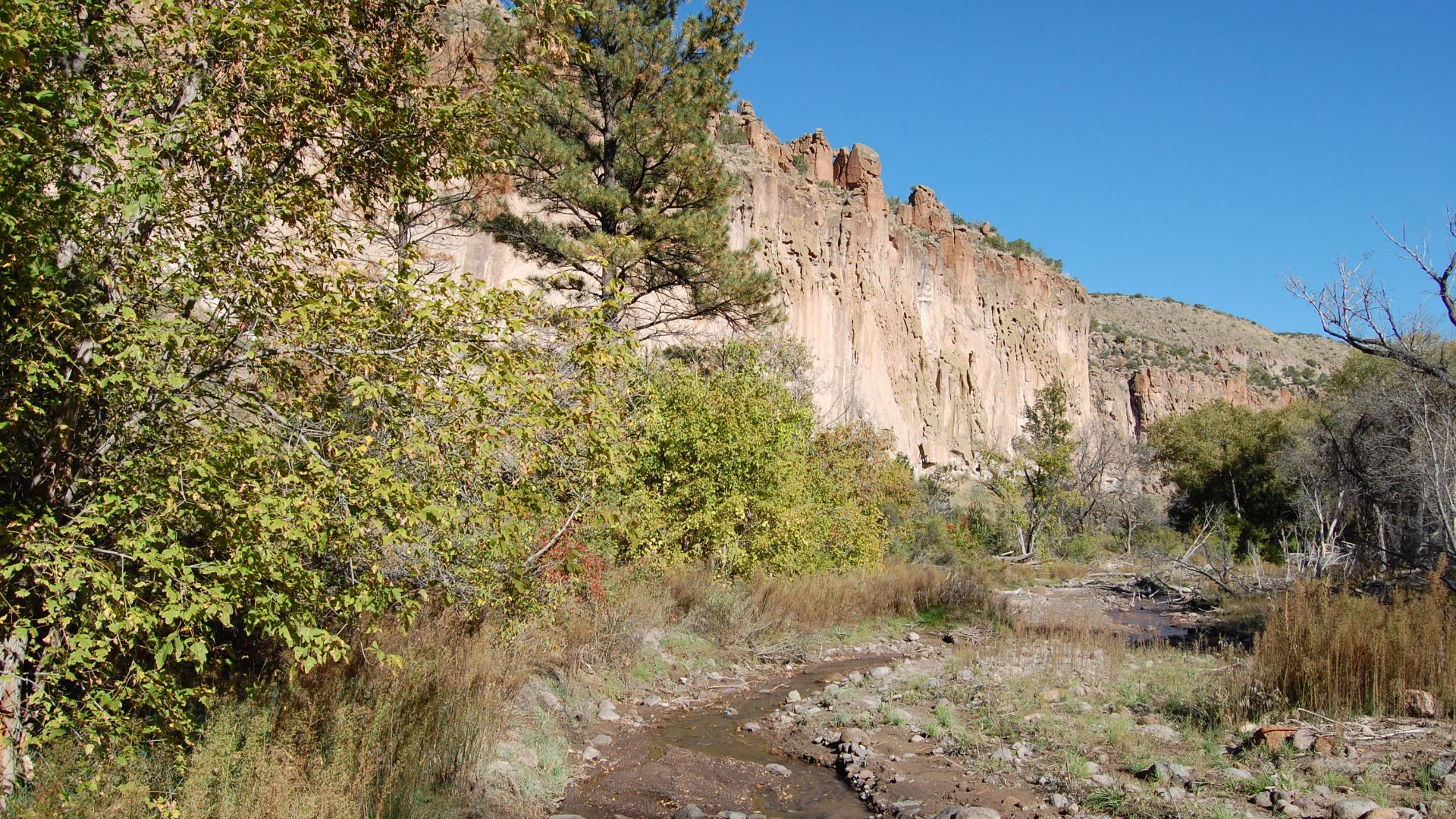
The monument sits atop volcanic ash from the Valles Caldera eruption 1.14 million years ago. This material, called Bandelier Tuff, made both brick-building and cave-carving possible. Ancestral Puebloans cleverly used its soft and hard sections for construction and excavation.
 Kent G. Budge, Wikimedia Commons
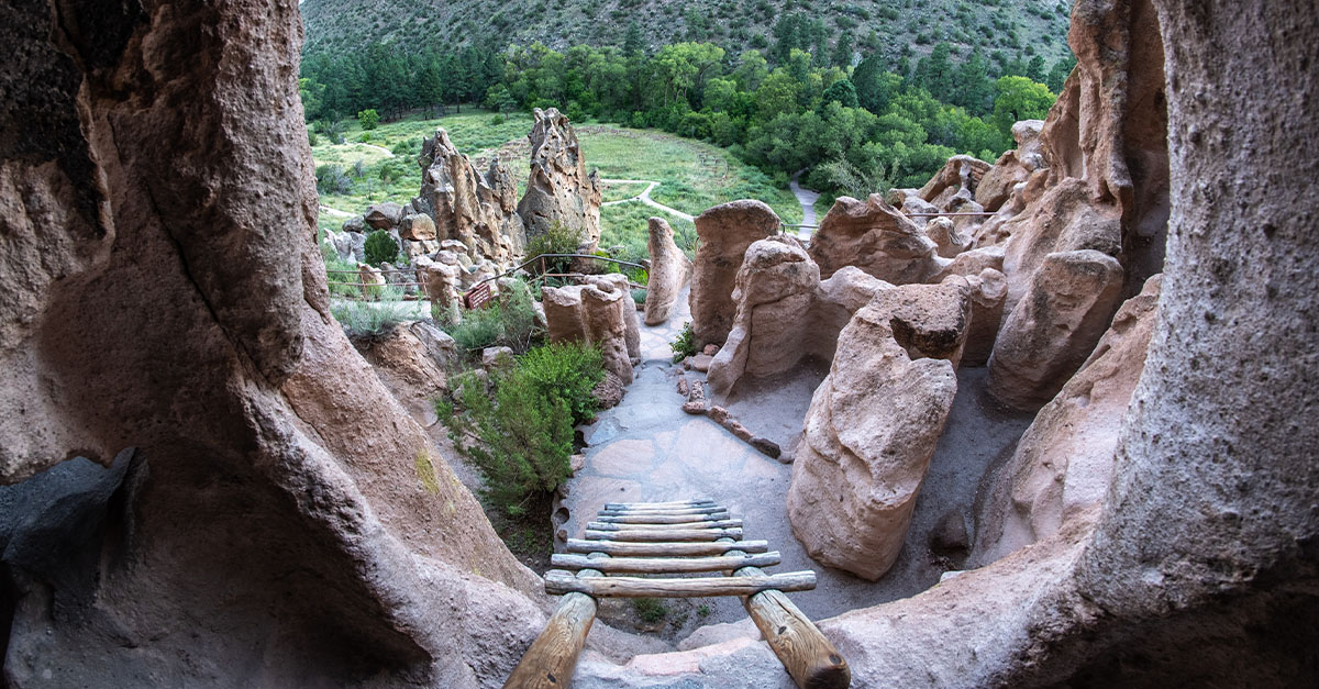
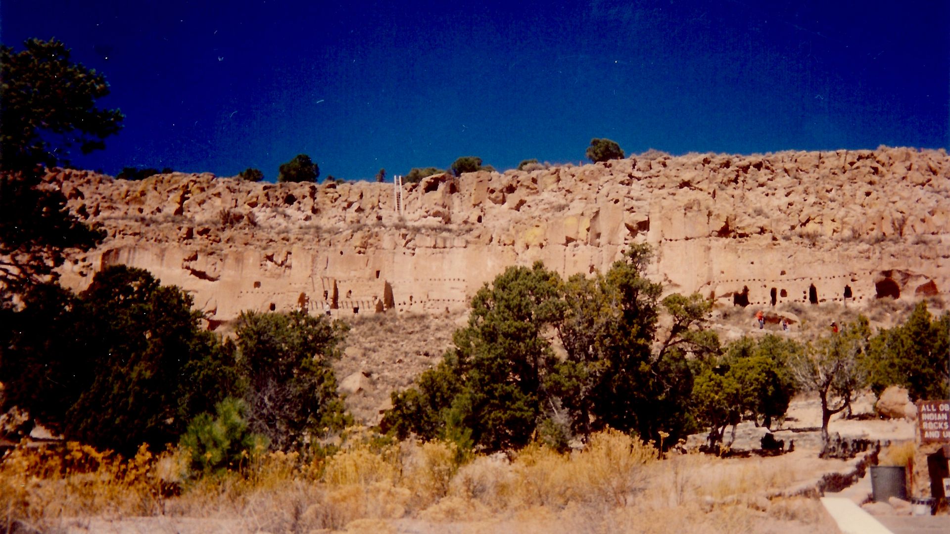
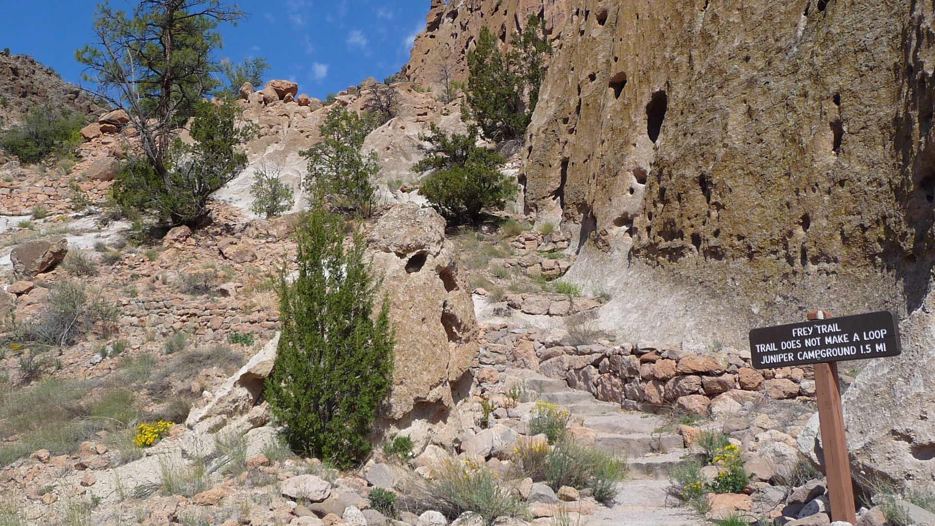
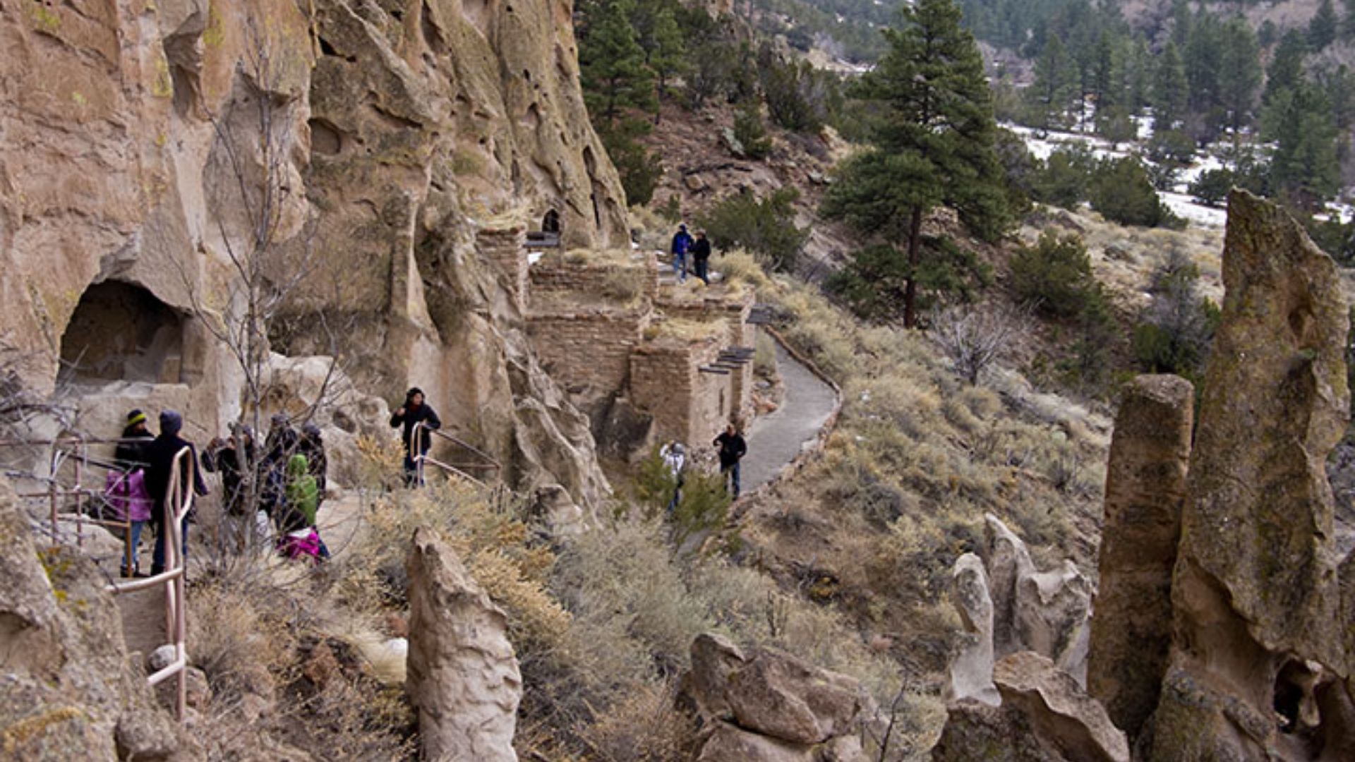
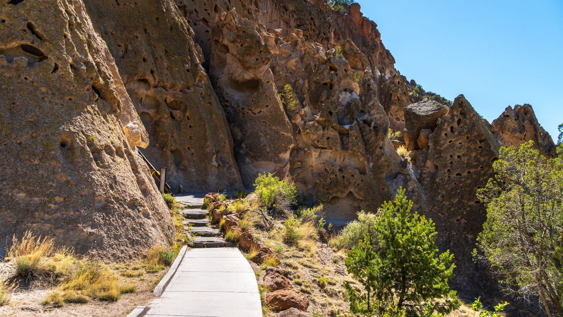
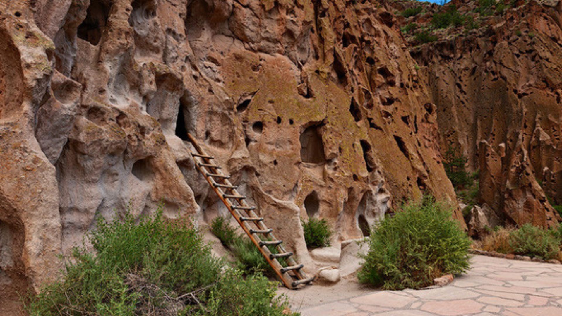
Main Loop Trail Highlights
The 1.2-mile paved Main Loop Trail guides visitors through Tyuonyi, Talus House, and Long House. Optional ladders offer access to cavates—small, human-carved alcoves in the canyon wall. It’s one of the most accessible ways to experience the ancient dwellings.
 Charles Basenga Kiyanda User: (WT-shared) Charles at wts wikivoyage, Wikimedia Commons
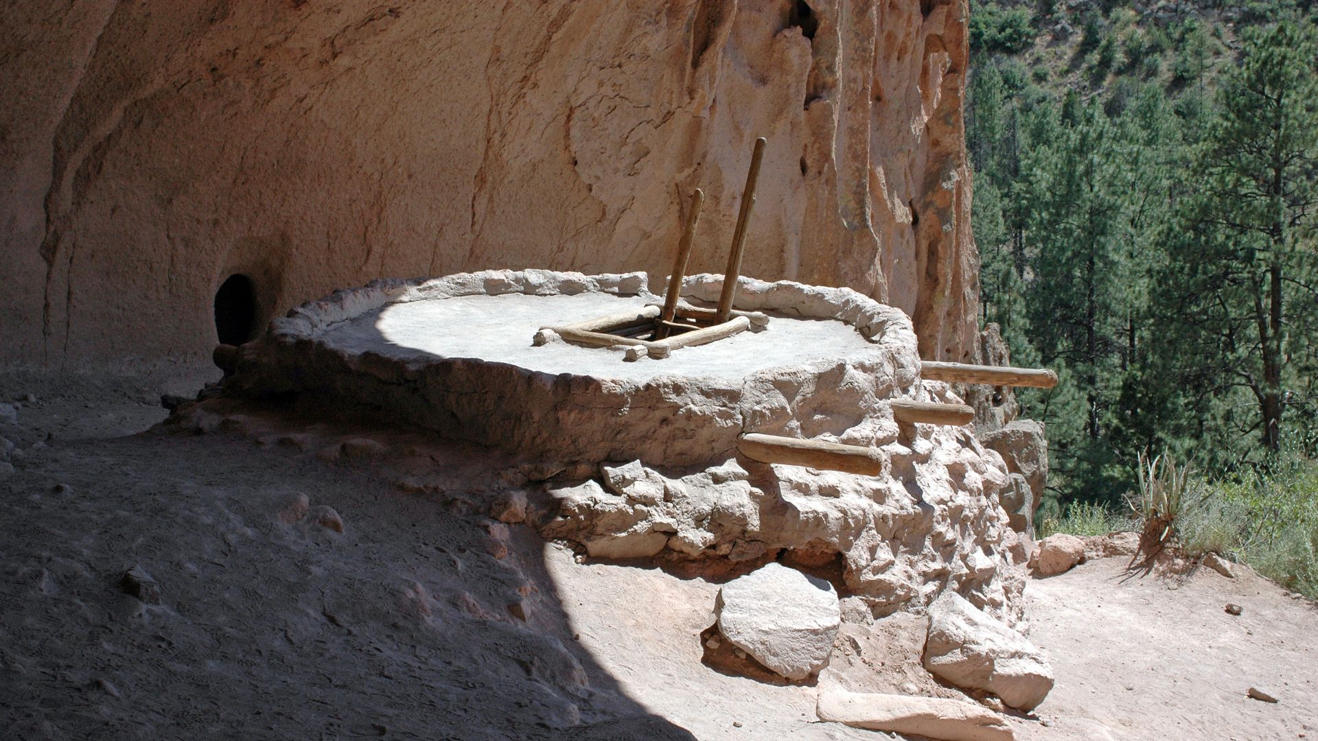
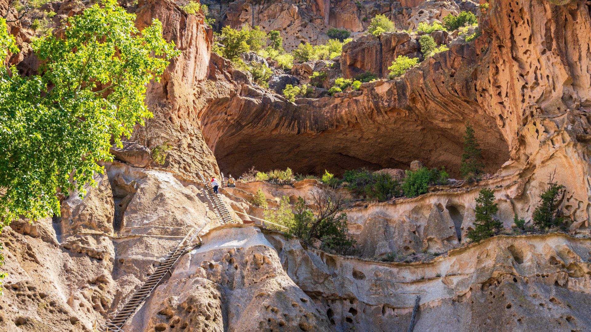
Alcove House’s Towering Climb
Located 140 feet above Frijoles Canyon’s floor, Alcove House features a reconstructed kiva. Visitors can ascend via four wooden ladders and carved stone stairs. The site once housed around 25 people and remains one of the park’s most visited spots.
The GNX Of The Ancient Southwest
The Buick Grand National of ancient architecture, Long House features multiple stories and carved dwellings. It sits directly against the canyon wall and uses natural rock voids for support. Petroglyphs and beam holes are still visible today.
Bandelier’s Elevation Range
Elevation at the monument ranges from 5,000 to 10,200 feet. This dramatic change fosters diverse wildlife habitats across multiple ecological zones. Cerro Grande, the highest point, overlooks the Valles Caldera.
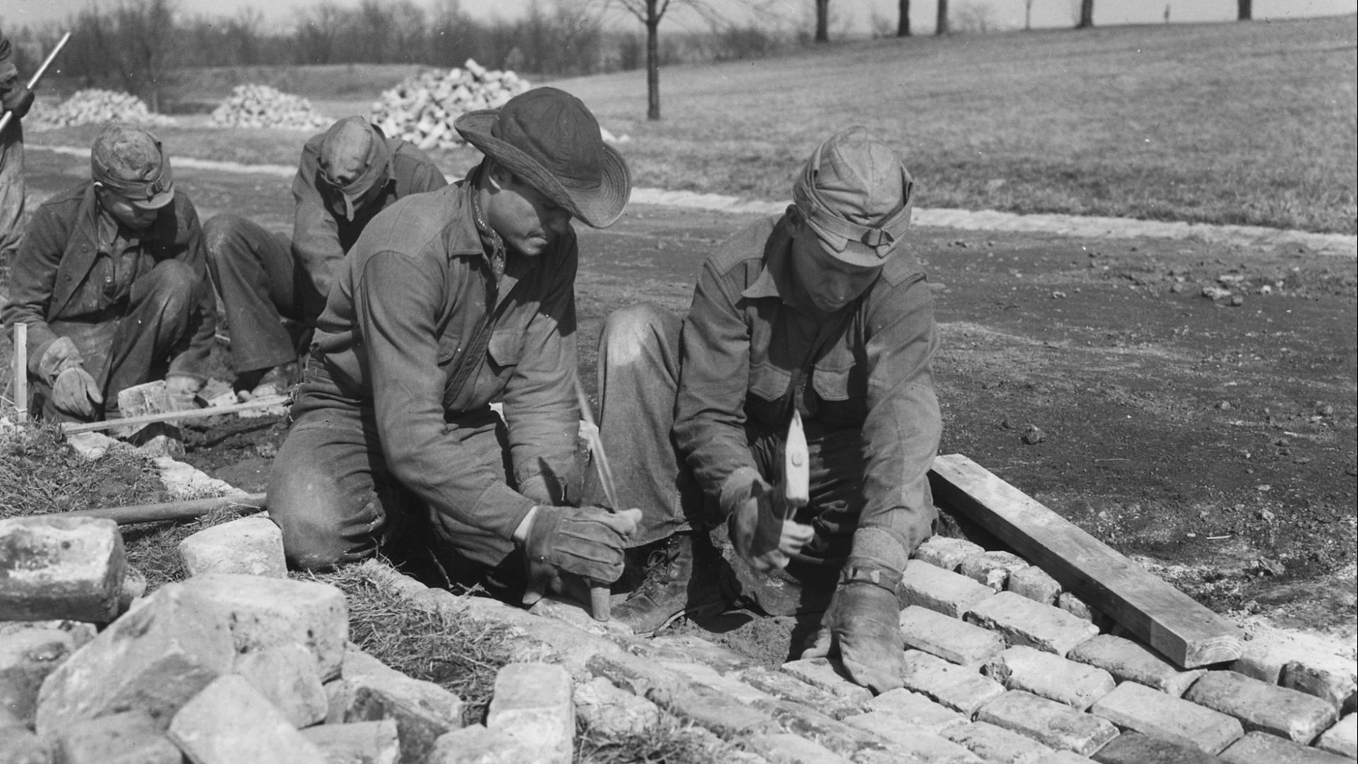
CCC-Era Rustic Design
The Civilian Conservation Corps built over 30 structures at Bandelier in the 1930s. These buildings, made with local materials, embody the National Park Service rustic style. The district was designated a National Historic Landmark in 1987.
 dconvertini, Wikimedia Commons
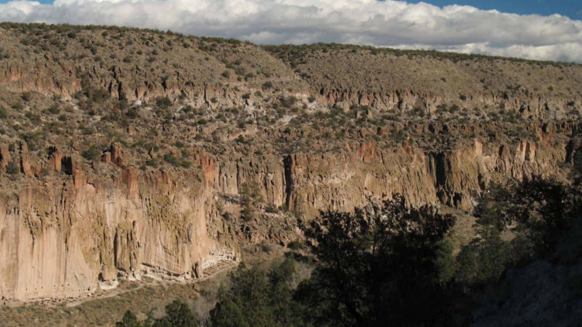
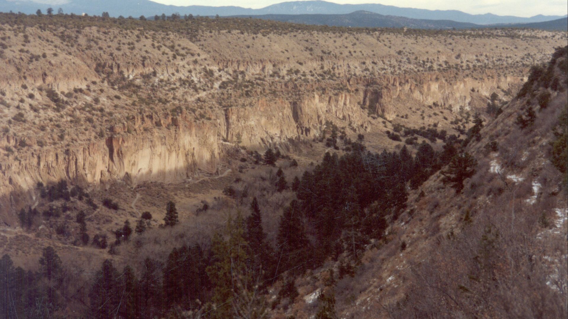
The Heart Of Bandelier
Frijoles Canyon holds the bulk of the monument’s archaeological sites. From rock art to ceremonial kivas, the area reveals centuries of habitation. Its lush environment continues to support diverse wildlife.
 Infrogmation, Wikimedia Commons
Tsankawi’s Forgotten Settlement
Tsankawi, a detached section near Los Alamos, includes ruins, petroglyphs, and trails. It also holds remnants of a school and home for Indigenous youth founded by Baroness Vera von Blumenthal.
 Thomas Shahan, Wikimedia Commons
Monument Size And Scope
The total area of the monument is 33,677 acres. Over 70% of that is designated wilderness, where permanent structures and vehicles are prohibited. The protected area includes more than 70 miles of hiking trails.
 WikTalksmart, Wikimedia Commons
Civilian Conservation Corps Impact
Between 1933 and 1941, thousands of CCC workers built trails, roads, and facilities at Bandelier. Their handiwork remains unaltered in the historic district. They also crafted furniture and artwork for the park’s structures.
 Unknown authorUnknown author or not provided, Wikimedia Commons
Wild Turkeys And Big Cats
Wild turkeys, mountain lions, and black bears roam the park. Abert’s squirrels and mule deer are commonly seen along the Main Loop Trail. Elk descend into the park in winter when snow covers the Jemez highlands.
 G. Edward Johnson, CC BY 4.0, Wikimedia Commons
Frijolito Trail’s Mesa View
The 2.5-mile Frijolito Trail climbs out of Frijoles Canyon to a mesa-top ruin. It loops back past Frijolito Pueblo, offering panoramic canyon views.
 Chris Light, Wikimedia Commons
Painted Cave’s Remote Art
Painted Cave features Ancestral Puebloan pictographs. Located deep in the backcountry, it requires a multi-day hike to access. The site preserves delicate painted symbols that predate written history.
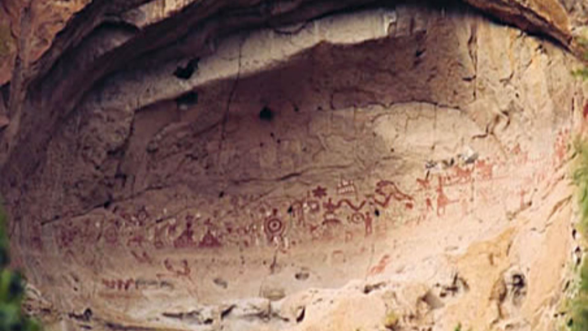
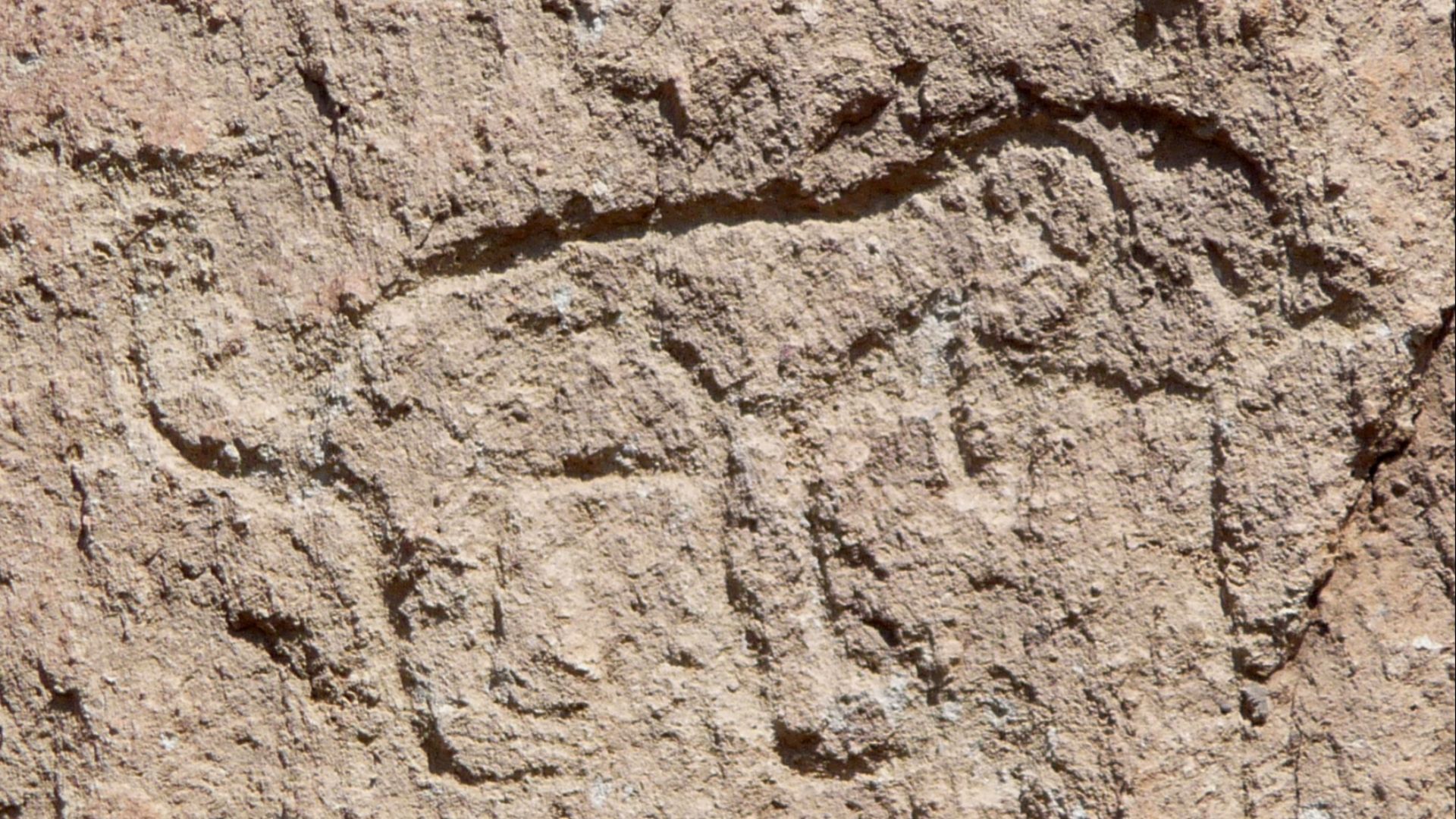
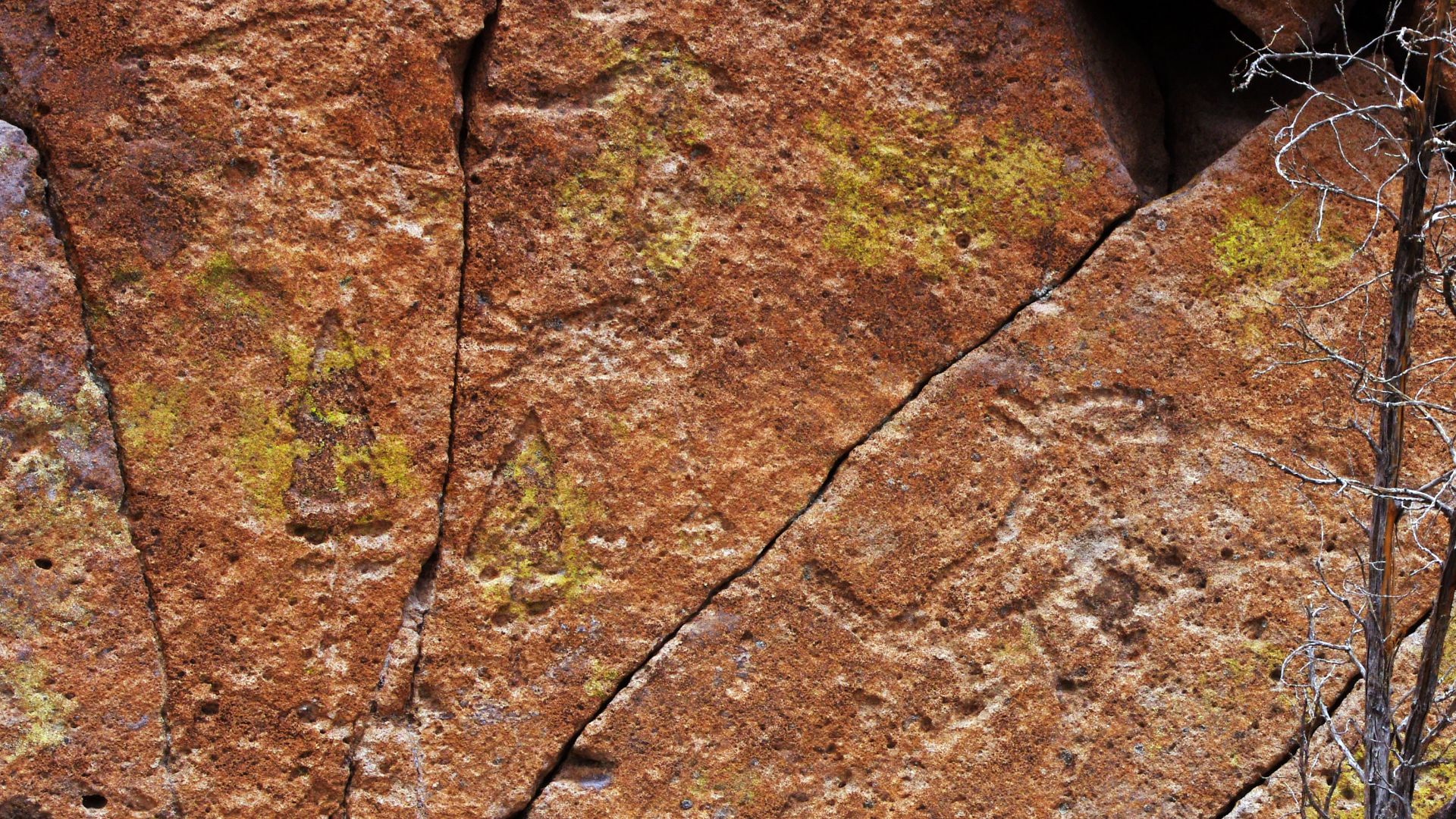
Petroglyphs Of The Past
Rock carvings, or petroglyphs, can be found throughout the monument. These depict animals, people, and abstract symbols.
 Daniel Mayer (Mav), Wikimedia Commons
Elevation Defines Wildlife
From elk at higher elevations to bats in canyon walls, wildlife at Bandelier thrives in its vertical diversity. Over one mile of elevation change creates five life zones.
 WikTalksmart, Wikimedia Commons
Tree-Ring Dating At Tyuonyi
Tree-ring dating, or dendrochronology, has helped archaeologists determine the building phases of Tyuonyi. Fragments recovered show activity from 1383 to 1466. These precise dates give scientists a timeline of community life.
 dconvertini, Wikimedia Commons
From Drought To Migration
Many Frijoles Canyon settlers came from the Four Corners region. Severe drought and social unrest around 1150–1300 CE drove them to relocate. Bandelier’s population peaked around 1500 before moving to Rio Grande Pueblos.
 G. Edward Johnson, Wikimedia Commons
Rio Grande Relocation
By 1600, Bandelier’s settlements were abandoned. Residents moved to pueblos like Cochiti and San Ildefonso, which are still occupied today. The move marked the end of an era in Frijoles Canyon.
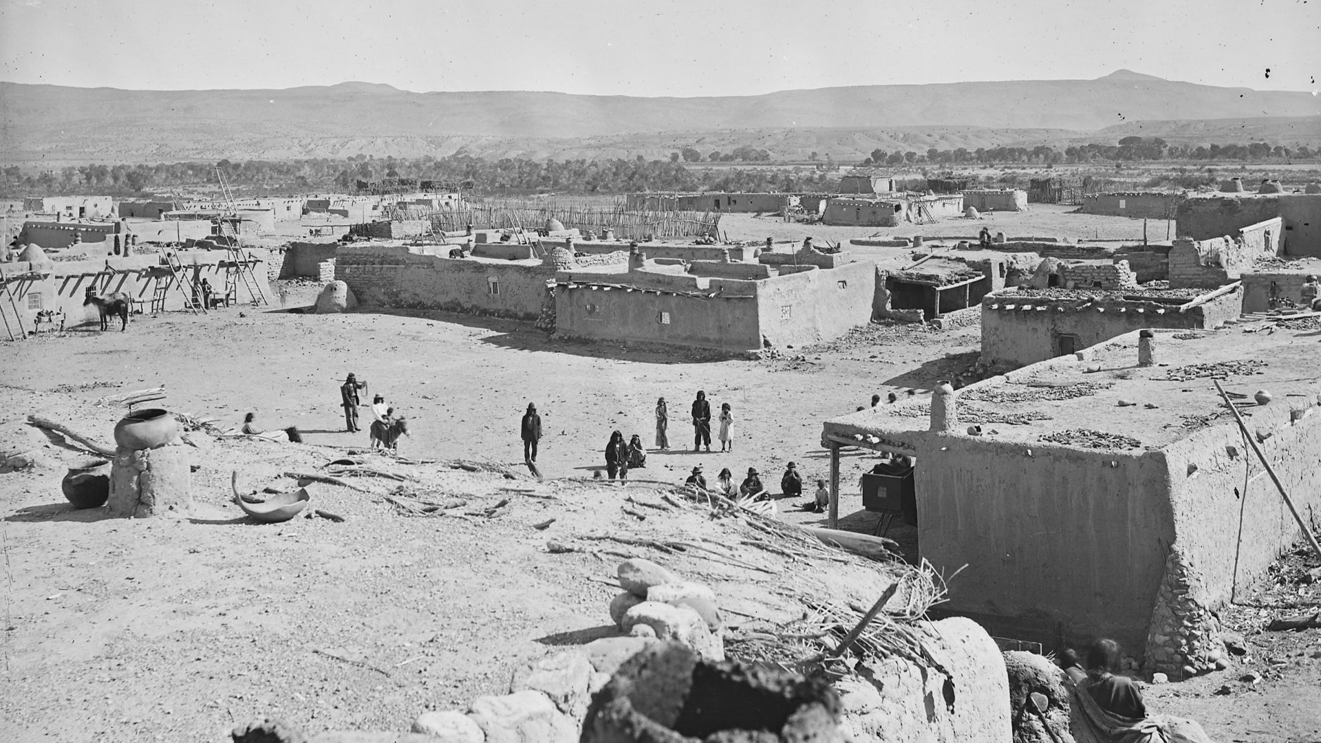 John Karl Hillers, Wikimedia Commons
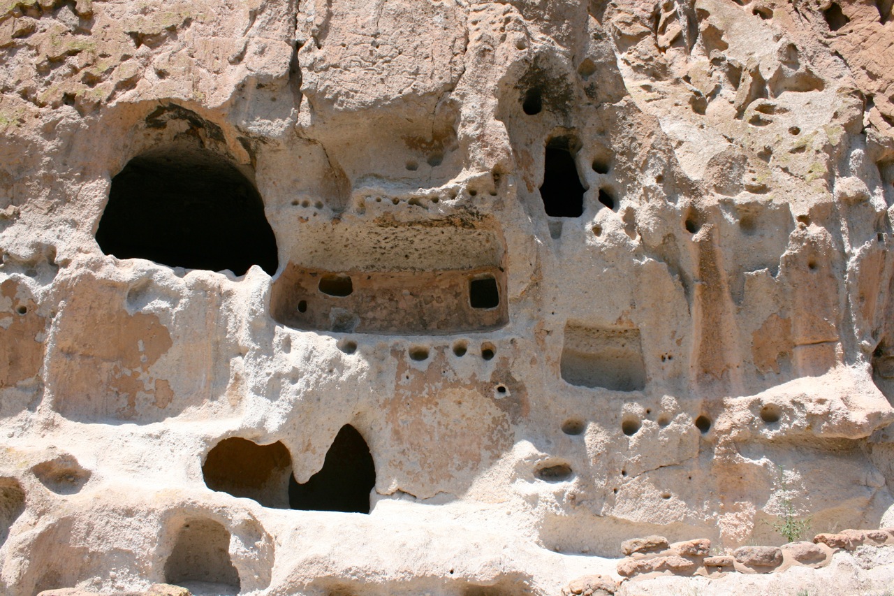
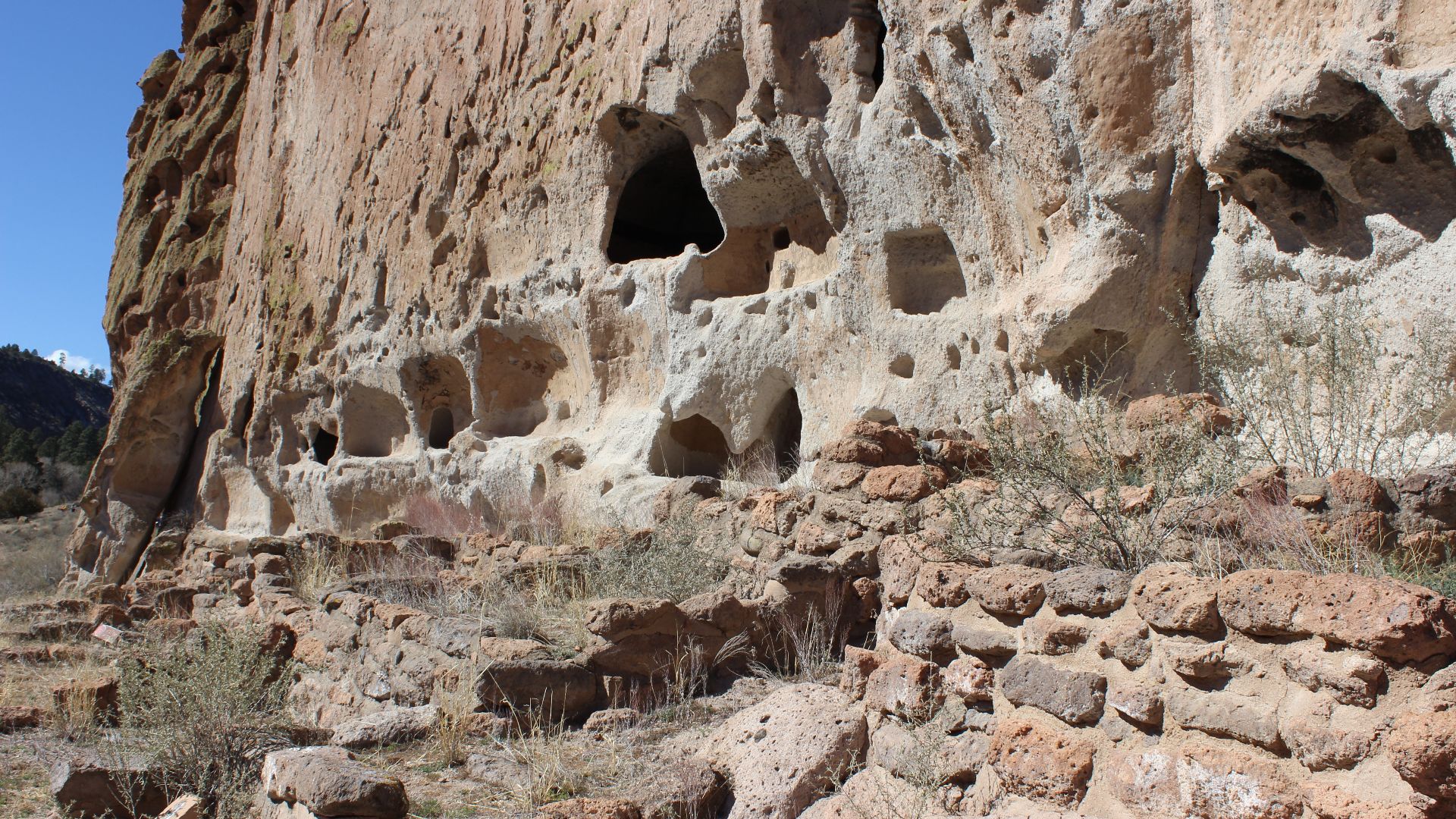
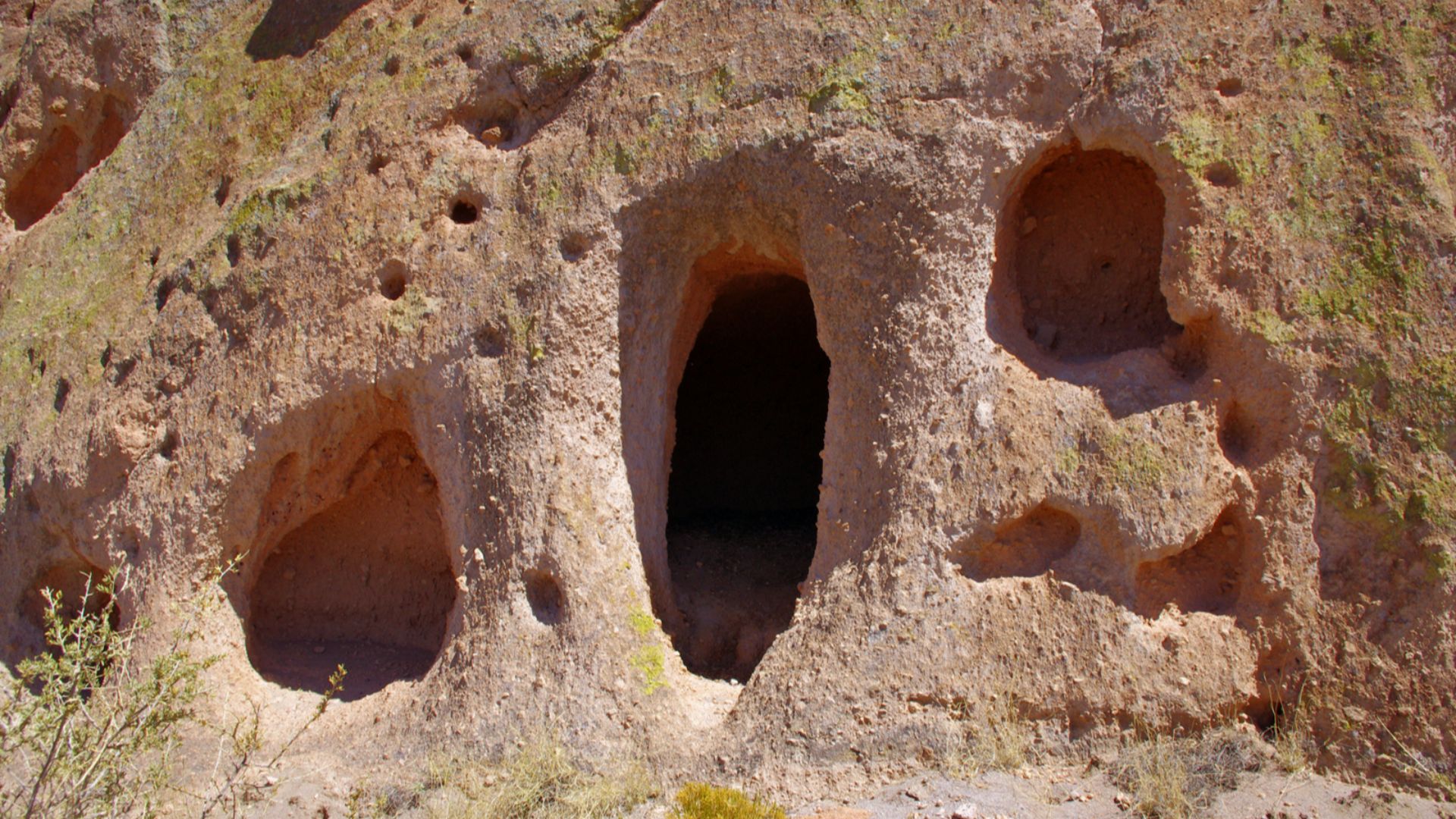
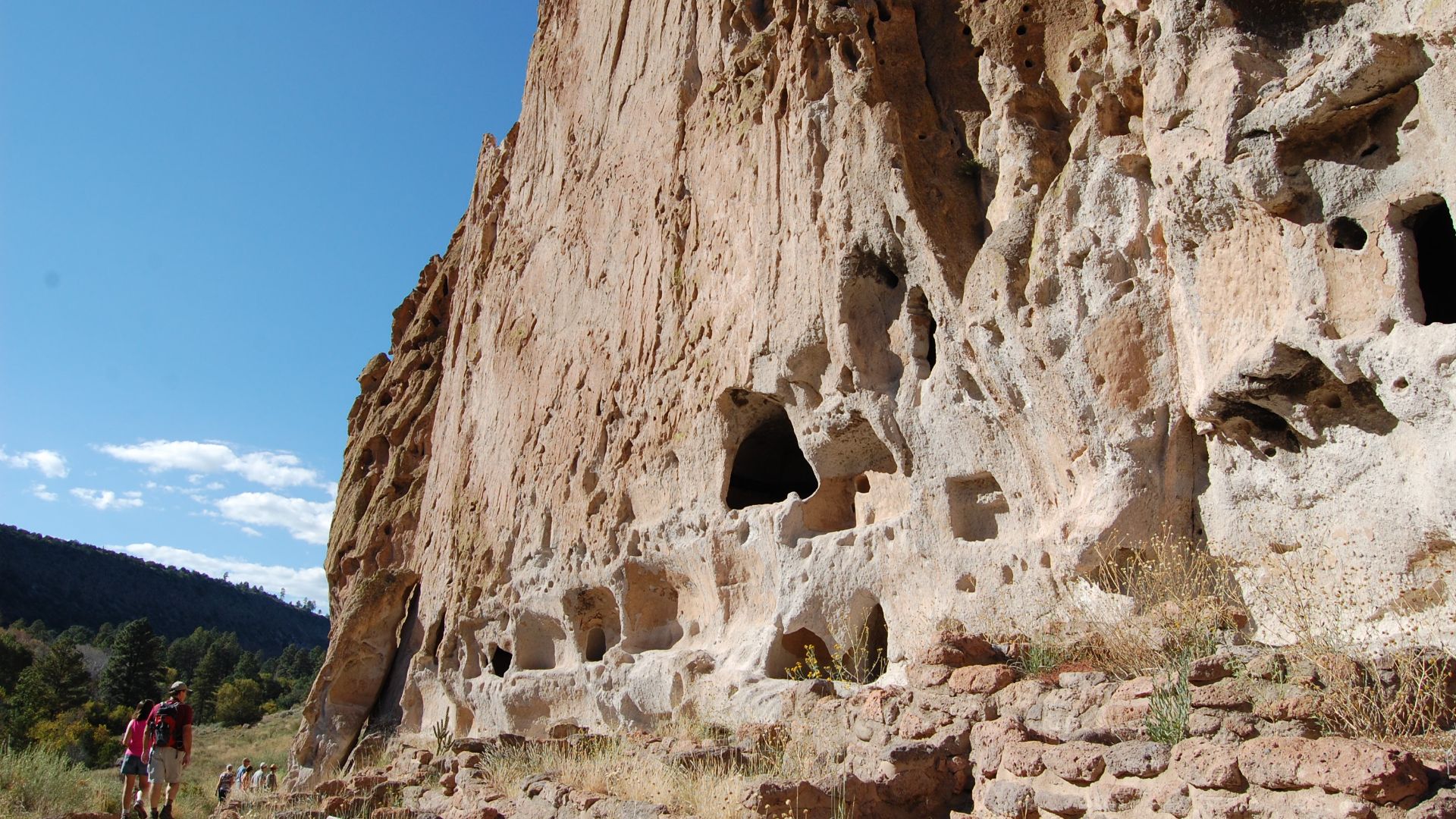
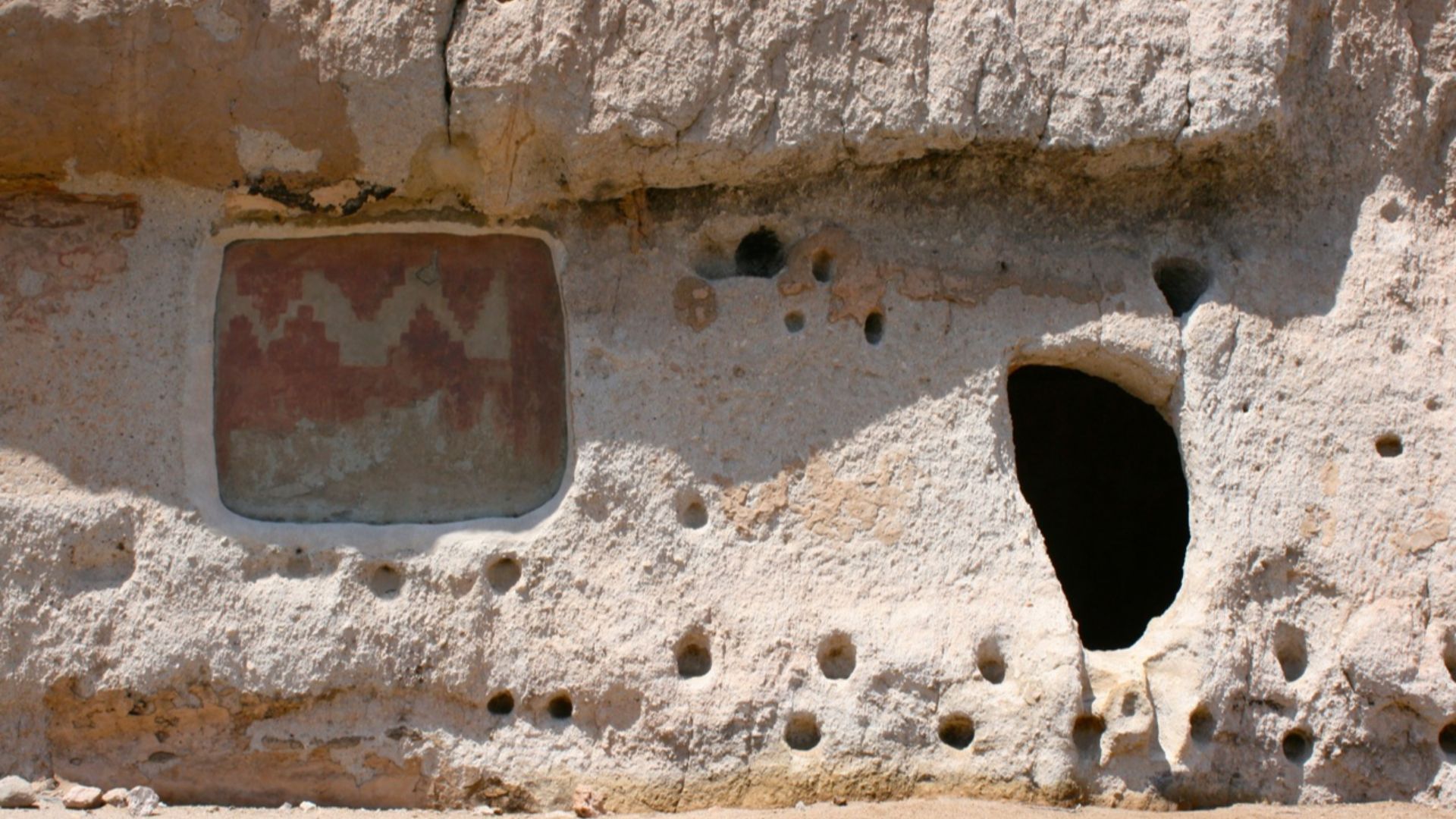
Cliffside Living
Cavates are human-carved dwellings in volcanic tuff. They provided insulation and safety, especially in winter. Many cavates are still accessible along the Main Loop Trail.
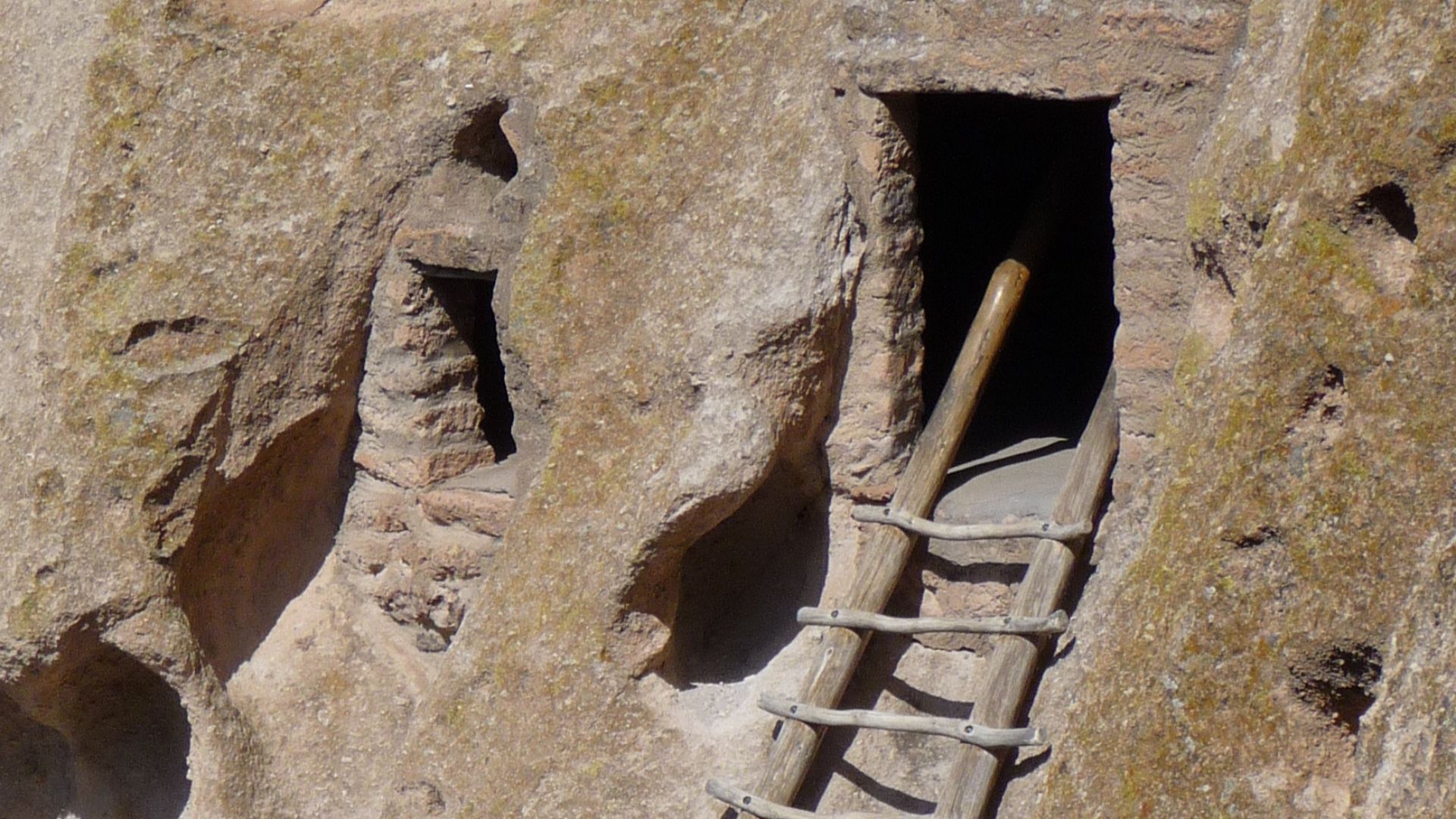 Daniel Mayer (Mav), Wikimedia Commons
Rainbow House Ruin
Located a half mile from Tyuonyi, Rainbow House was also active in the 15th century. Tree-ring dates align it with Tyuonyi’s peak years.
 Daniel Mayer (Mav), Wikimedia Commons
Pueblo Loop Trail Details
This 1.4-mile loop offers access to key archaeological features. Stops include Big Kiva, Tyuonyi, Talus House, and Long House. This is the most popular and well-marked trail in the park.
 Daniel Mayer (Mav), Wikimedia Commons
From Cliff To Canyon Floor
Structures at Bandelier range from cliff dwellings to ground-level pueblos. This architectural mix shows adaptation to the landscape. Some homes were multistory, combining natural rock and human engineering.
 Daniel Mayer (Mav), Wikimedia Commons
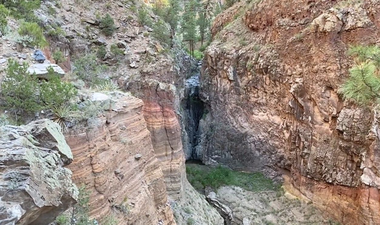
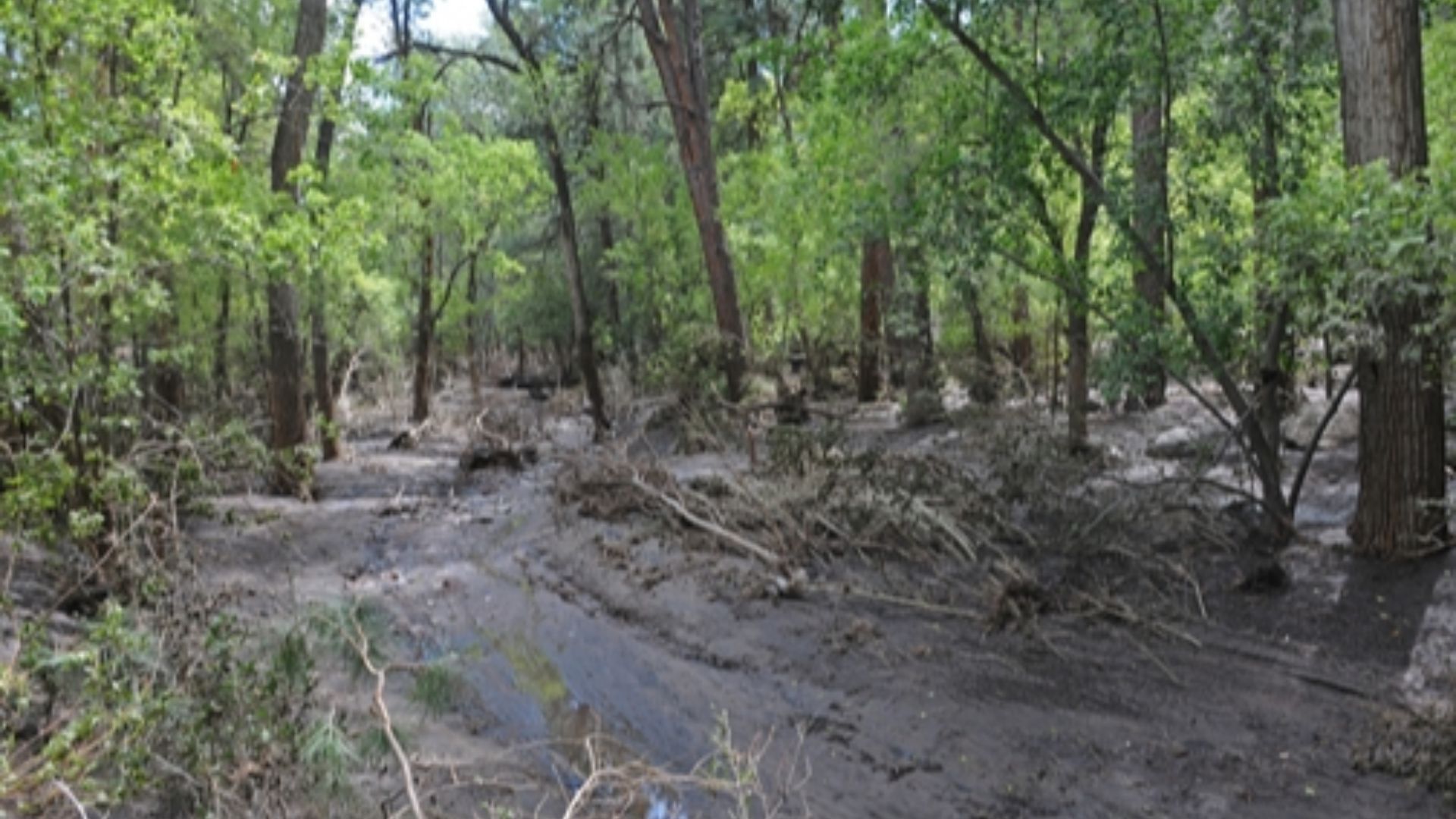
Ancient Water Use
Residents of Bandelier relied on Frijoles Creek and seasonal waterfalls. These water sources supported agriculture and daily living. Today, the creek still flows through the canyon floor.
 Bandelier National Monument - Hiking Falls Trail - ExploreTraveler, Exploretraveler
Bandelier Tuff In Architecture
Soft volcanic tuff was carved for rooms and storage areas. Harder sections were used as bricks in free-standing structures. This dual use made the most of the environment’s geology.
 Greg Willis from Denver, CO, usa, Wikimedia Commons
Tsankawi’s Ladders And Petroglyphs
Tsankawi features narrow trails, wooden ladders, and cliffside petroglyphs. The loop offers a less developed but more intimate experience with the land.
 Thomas Shahan, Wikimedia Commons
Seasonal Skiing
In years with good snowfall, Nordic skiing is possible in the upper monument. A few trails near Highway 4 become ski-accessible for tourists. Though, if you’re wanting to experience it for yourself, check the weather first—not all winters offer enough snow for this activity.
 BFS Man from Webster, TX, USA, Wikimedia Commons
National Recreation Trail Status
Bandelier’s backcountry trail network was designated a National Recreation Trail in 1982. Trails lead into canyons like Alamo and Capulin. These lesser-used paths offer solitude and historical discovery.
 dconvertini, Wikimedia Commons
Cultural Exchange Network
Artifacts found at Bandelier show trade with areas as far as modern-day Mexico. Items like basalt, obsidian, and shell came from distant sources. The site was part of a broad trade network.
 Daniel Mayer (Mav), Wikimedia Commons
Painted History In Stone
Pictographs and petroglyphs at Bandelier tell visual stories. Some depict daily life, while others are ceremonial or symbolic.
 Artotem from Here, There, and..., Wikimedia Commons
The Talus House
This reconstructed house on the Main Loop shows typical construction methods. Its placement at the cliff’s base combines rock and masonry. The original would have been connected to others via ladders and terraces.
National Park Service Collaboration
Bandelier is managed in partnership with nearby pueblos and federal agencies. These collaborations ensure cultural sensitivity and ecological integrity. The approach blends modern science with Indigenous stewardship.
 SarahStierch, Wikimedia Commons
Fire And Restoration
The 2011 Las Conchas Fire damaged several trails, including Falls Trail. Parts of the trail are permanently closed due to safety risks. Restoration work is ongoing but limited by terrain and funding.
 United States Department of the Interior, National Park Service, Wikimedia Commons
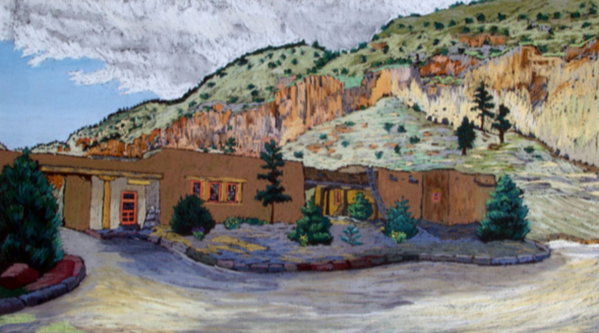
Helmut Naumer’s WPA Art
The visitor center features pastel works by Helmut Naumer Sr. His 1930s pieces were commissioned by the Works Progress Administration. They offer period-specific views of Bandelier’s beauty.
 Artwork: Helmut Naumer, Sr. ; Photo courtesy of the US National Park Service, Wikimedia Commons
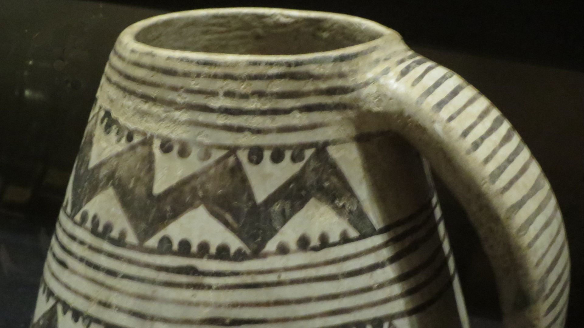
Museum Exhibits
The park museum showcases Ancestral Pueblo artifacts, dioramas, and CCC craftsmanship. It gives context to daily life before European contact. Visitors also see furniture made by Depression-era workers.
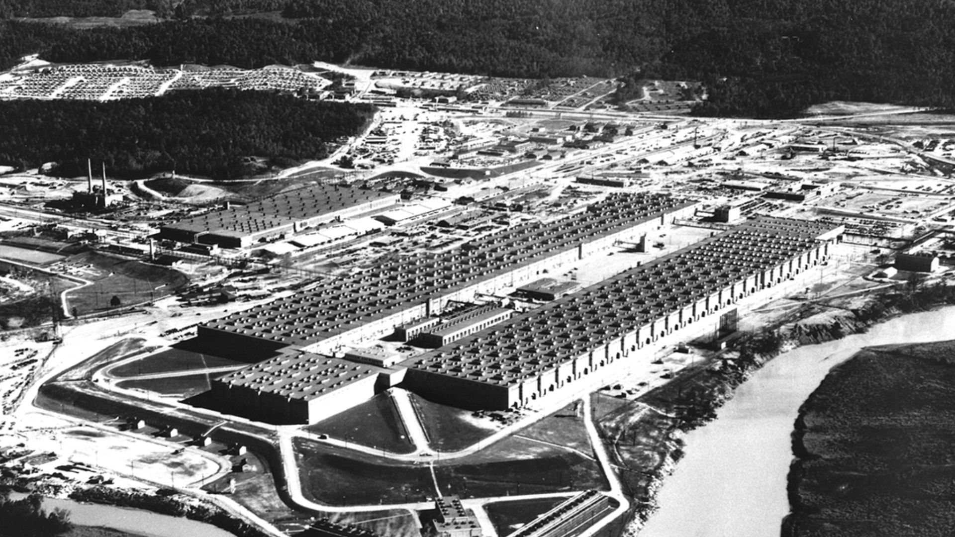
WWII’s Secret Role
This WWII-era chapter is a lesser-known part of the monument’s history. During the conflict, Bandelier was closed to the public and the park lodge was repurposed to house Manhattan Project staff working on the atomic bomb in nearby Los Alamos. The site’s remoteness made it ideal for secrecy, and the ancient ruins provided a temporary home to some early atomic scientists.
 James E. Westcott, official US Army Manhattan Project photographer, Wikimedia Commons
Bandelier Today
Bandelier remains a protected window into the past. Visitors hike, learn, and experience the legacy of the Ancestral Puebloans. The monument stands as a powerful intersection of nature, history, and cultural identity.
 dconvertini, Wikimedia Commons
You May Also Like:
What Happened To The Ancestral Puebloans?
Inside Montezuma Castle, Arizona’s Ancient Indigenous Palace
Source: 1


