
A Puzzle To Assemble Millenia After Its Creation
Stonehenge has posited many questions about the humans who existed prior to the start of the common era. But it isn’t the only mysterious site where we see evidence of civilization beyond our wildest expectations. In northeastern Louisiana, there is a site that rivals the enigma of Stonehenge.
An Uncovered Part Of Human History
The Poverty Point State Historic Monument sits on the edge of Macon River, and it was constructed by the Poverty Point culture. This culture stretched over 100 miles from the Mississippi Delta to the Gulf Coast. They were identified by one unique trait.

Accidental Discoveries Can Change Everything
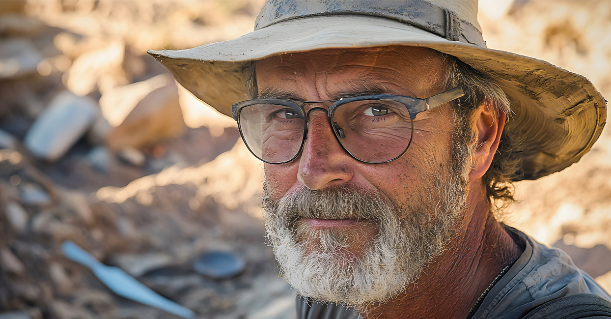
The site was initially discovered by American explorer Jacob Walter, who was looking for lead ore. Instead, he found Poverty Point. He discovered it by accident, and while he was disappointed to not find any lead native to the area, he was shocked at what he found instead.

Heaps Of Evidence That They Existed
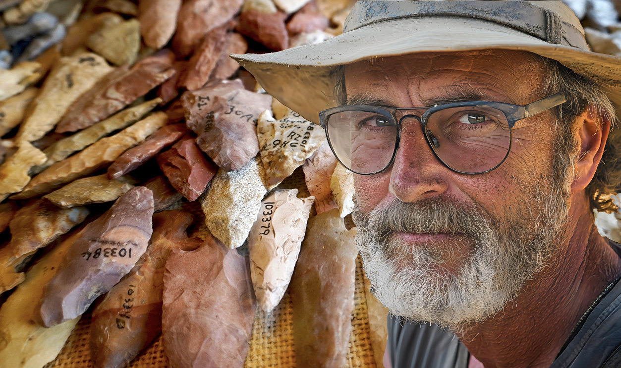
Many sites built by the Poverty Point culture are characterized by the mounds that they constructed. There are more than 100 sites that have been identified. This contributed to archeological hypotheses that the culture formed a huge trade network through most of the eastern US.
They Were An Ancient And Deep Culture
The culture is thought to have peaked at around 1500 BCE, and it is one of the oldest and most complex known cultures. Of all their sites, Poverty Point is their most well-known site, located near modern Epps, Louisiana, and dated between 1600 and 1300 BCE.

They Reached High With Their Construction
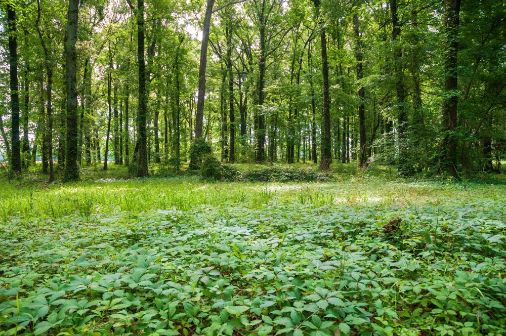
The inhabitants of Poverty Point were ambitious when they began construction of the site. They built thoughtful mounds and ridges that overlooked the Mississippi River floodplain. Considering they didn’t have any modern technology, this feat only becomes more impressive.

An Amphitheater-Shaped Construction
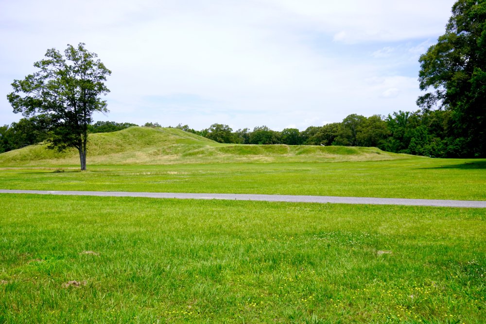
The site has six rows of concentric ridges in a C-shape, each of them nestled into the next. Some of them are six feet tall at their peak, and at their longest, the outermost ridges span nearly three-quarters of a mile.
 United States Army Corps of Engineers., Wikimedia Commons
Adding Strangeness To The Mystery
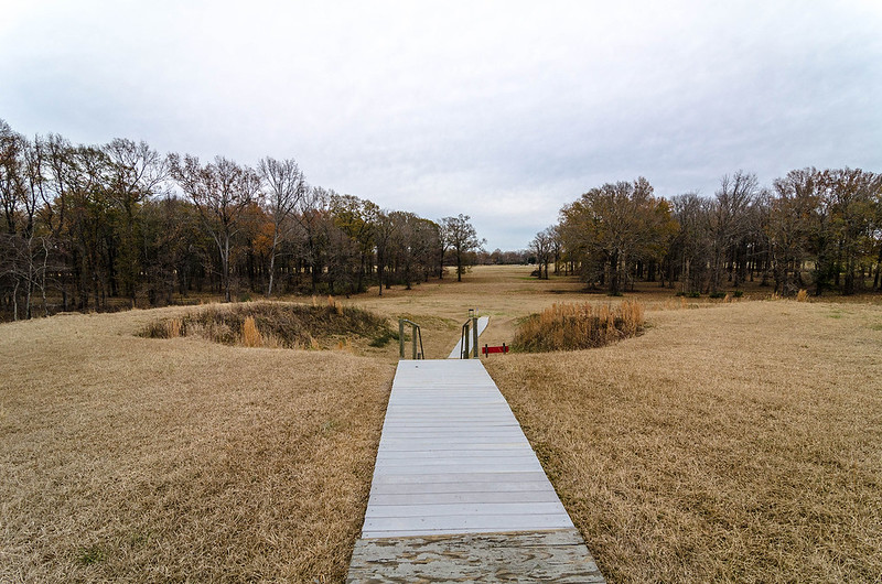
In the middle of the concentric ridges is a plaza. Using geophysical survey data, archeologists found magnetic features arranged into a circular formation. This was an odd thing for them to find, and it warranted further investigation.
 Jennifer R. Trotter, CC BY-SA 4.0, Wikimedia Commons
Strange Findings Under The Grass And Dirt
The archeologists performed location-specific excavations and discovered rings of wooden posts, which were identified as being part of the original groundwork done to prepare the land. But that wouldn’t have been the only way the inhabitants prepared to build the mounds.
 USDA Agricultural Stabilization and Conservation Service, Wikimedia Commons
Terraforming Their Home
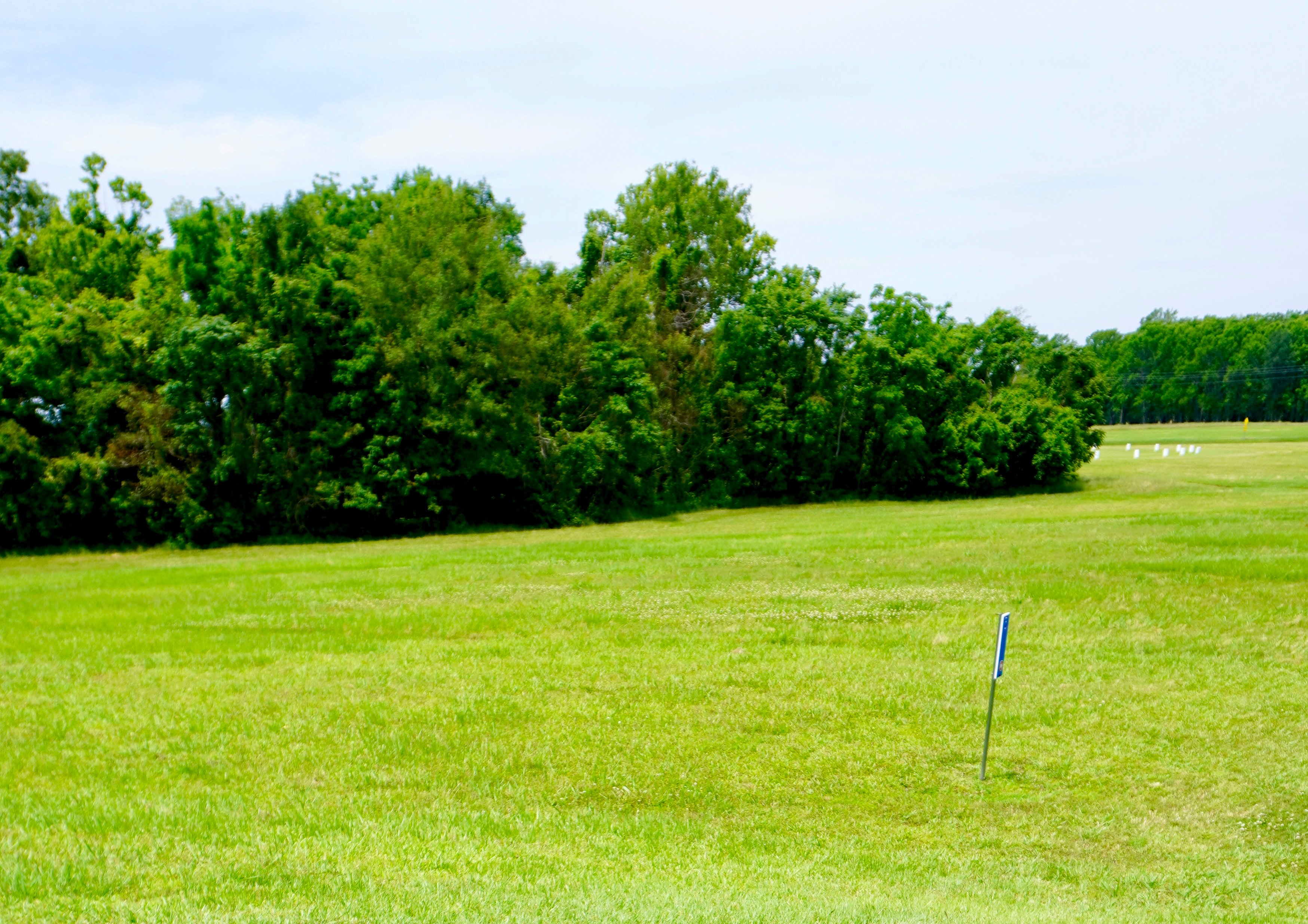
While the land appears to be flat naturally, this wouldn’t have been true during construction. The area was heavily modified by the inhabitants. In some places, soil was added to level out the ground.

Digging Up Dirt To Build Even Higher
Preparing the landscape would have been their first major project. They would have gathered as much as 53 million cubic feet of soil to make the mounds, which would have involved anyone capable of doing hard labor. And the wonder doesn’t stop there.
 Kniemla, CC BY-SA 2.0, Wikimedia Commons
An Interconnectedness We Can’t Fathom
This is where evidence of the trade network takes the stage. They imported ore and stone from other nearby areas—some from the Ouachita and Ozark mountains, and as far away as the Tennessee and Ohio River valleys. There’s even soapstone from the Appalachian foothills.

More Than A Lump Of Dirt, But A Symbol
Also in the site is Mound A, the largest of the six earthworks—human-made banks of dirt—dotted around the semi-circular ones. Located to the west of the ridges, Mound A is T-shaped, which is thought to allude to a bird or act as a symbol for the cosmological middle of the area.
 Billy Hathorn, CC BY 3.0, Wikimedia Commons
Fast And Furiously Built
Mound A was constructed at quite a shocking pace. Researchers estimated it took less than three months to build, which is quite an amazing feat. They also found another interesting part of the building process using radiocarbon analysis.

Controlled Bushfire
The analysis revealed that there was an intentional burning of the shrubs and grass in the area to make way for the building of the mound. They estimated this happened between 1450 and 1250 BCE.

An Immense Amount Of Resources
Creating this specific part of the historic site required about 8.4 million cubic feet of soil. This sets it up as the mound with the second-largest volume in eastern North America. It had one final curious trait that has researchers guessing.
 Bart Everson, CC BY 2.0, Wikimedia Commons
Using What They Had
Surrounding Mound A are shallow “borrow pits”. These pits are assumed to be where the Poverty Point people took dirt from to construct the mound. While Mound A is the largest on the site, it isn’t the oldest.
 Jennifer R. Trotter, CC BY-SA 4.0, Wikimedia Commons
An Earthwork Of A Different Type
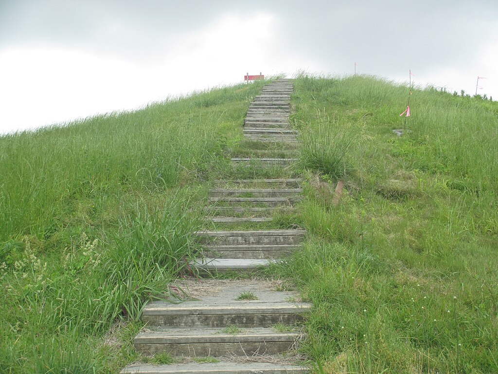
Mound B, located northwest of the six C-shaped earthworks, is in a very different shape than Mound A. It has a cone shape, and unlike its earthwork A, it was built over several stages.
 Billy Hathorn, CC BY-SA 3.0, Wikimedia Commons
Full Of Hidden Facts And Secrets
There are layers in B that don’t appear in A. Charcoal, fire pits, and what is suspected to be post-molds appear at different points within the mound. There were even impressions of woven baskets found in a surprising state of preservation in one of the upper levels of the mound.

A Surprising—And Questionable—Finding
This mound had one surprising discovery. In the 1950s, a human bone was found at the base of the mound. Initially, they called this evidence of cremation, but the discovery has been heavily disputed since. Who knows what the true purpose of this mound was?

One Of The First In This Site
Mounds C is dated as one of the earliest—or oldest—mounds on the entire site. It has several layers of different soils mixed in with various detritus—including human waste—which shows that the construction was over a long period of time with new additions at different points.

Evidence Of What Used To Be
In Mound E, they found some interesting artifacts. They found chert, a type of hard rock that wasn’t from the area, like novaculite, which was expected for the Poverty Point’s raw materials. For a long time, archeologists thought E was built at a similar time and using a similar method to B, but that changed in 2017.

Using A Tiny Piece Of Evidence To Estimate Dates
Charcoal was found in a soil core at the base of the mound. It was a small piece, but it was enough for them to revise their estimates. The radiocarbon date of the charcoal implies that E was constructed after 1500 BCE.
It Took Place Over A Long Period Of Time
One of the major details researchers have landed on throughout their discoveries is that Poverty Point wasn’t built all at the same time. Rather, the site was constructed over multiple generations and many, many decades. At its earliest, construction started in 1800 BCE and lasted until 1200 BCE.
 Jennifer R. Trotter, CC BY-SA 4.0, Wikimedia Commons
Using What Was At Hand, And Making The Best Of It
The main material they used to create the mounds was loess, which was a silty soil that erodes easily in water. They also suspect clay was used to “cap” the mounds in a final layer to prevent that erosion. This corroborated another aspect of their hypotheses.

Like Brushstrokes On A Painting
Basket imprints in the clay showed researchers how much a single person could carry. The size varied between 30-50 lbs per basket, depending on who carried it. It is thought that everyone participated in the construction: men, women, and children.

More Artifacts And Evidence Of Everyday Life
There were many artifacts discovered on the site. Most of them consist of baked objects made of the local loess and clay. Some of the objects have some pretty unique forms, but even so, archeologists believe they were used for cooking.
 Heironymous Rowe, CC BY-SA 3.0, Wikimedia Commons
There Were Recognizable Designs
There were some poetry objects created, as there was clay in the area, and they used this to create fiber- and grog-tempered objects, and untempered objects. Most of them are decorated in the Wheeler and Old Floyd Tchefuncte style designs. But there were other, stranger objects found.

A Long Route For Trading
As previously mentioned, there were many imported objects and materials. One of these were stone vessels made of steatite which was brought to the area from the Appalachian Mountains. This once again supports that there was a lot of trade going in and out of the area.

A Primarily Dirt-Based Area
Interestingly, there isn’t any stone that forms naturally in Poverty Point—most of the dirt in the area is loess and silt dirt. But this leads us to the next mystery: What were the people doing here if they had to import so much?
 Billy Hathorn, CC BY-SA 3.0, Wikimedia Commons
An Unknown And Puzzling History
Like many sites of this sort, the way its people used it during and after its construction is pretty unclear and heavily debated. Especially in the case of Poverty Point, the construction and artifacts allude to one particular theory.
 Jennifer R. Trotter, CC BY-SA 4.0, Wikimedia Commons
A Place To Rest, Not To Settle: One Theory On Its Use
Archeologists have thought it was used as a temporary settlement rather than a full-time one. They theorize that temporary houses were built atop the concentric ridges, as indicated by the postholes and evidence of hearths and ovens found on the ridges. But that’s not all.

A Settlement Meant To Last
Jon L Gibson posits that intervals of inhabitation would have created far fewer postholes than there are on the site, so it must have been occupied far more consistently than that. But there is one thing that stops this from being the prevailing hypothesis.

Accidental Loss Of Evidence And History
The site had been plowed over in the centuries before its discovery, causing destruction to the mounds and whatever evidence they might have carried. This fact, combined with how minimally archeologists have excavated the site, means there isn’t enough evidence to prove either theory.
Another Point Toward One Option
Archeologists Sherwood Gagliano and Edwin Jackson are in support of the intermittent use theory, especially since this area was near a river on a well-used trade route. They think the site was used as a location for groups to meet and trade sometimes. Gibson, however, points to one strange piece of evidence to negate this.

The Eternal Rebuttal, Bolstered By A Strange Bit Of Evidence
Gibson rebutted this, claiming there is way too much detritus left behind on the site for it to only have been used intermittently. He believes that the amount of garbage left behind by the inhabitants shows it was an established settlement. That, and it's unlikely they put so much effort into building the site only to not use it.
The Interpretations Of Modern Scholars
In the 70s, archaeologist William Haag theorized that the inhabitants had religious or spiritual uses for Poverty Point culture. He saw the aisles dividing the ridges as astronomically significant and related to the solstices. Others disagree, saying they’re more geometrically aligned.

Conservation And Discovery
Unfortunately, there isn’t a single theory to inform us on how the site was used at the time. The theories each carry their own evidence, but not much can be backed up with so little of the site excavated. But that doesn’t mean we can’t believe, just like we do with Stonehenge.
 Billy Hathorn, CC BY-SA 3.0, Wikimedia Commons
Ongoing Research
Excavations have been ongoing since 1913, when Clarence B Moore inspected the area. With everything researchers have found and discovered about the area, a museum was founded to inform locals and tourists about the site, and visitors can tour the area throughout most of the year.
 Michael Homan, CC BY 2.0, Wikimedia Commons
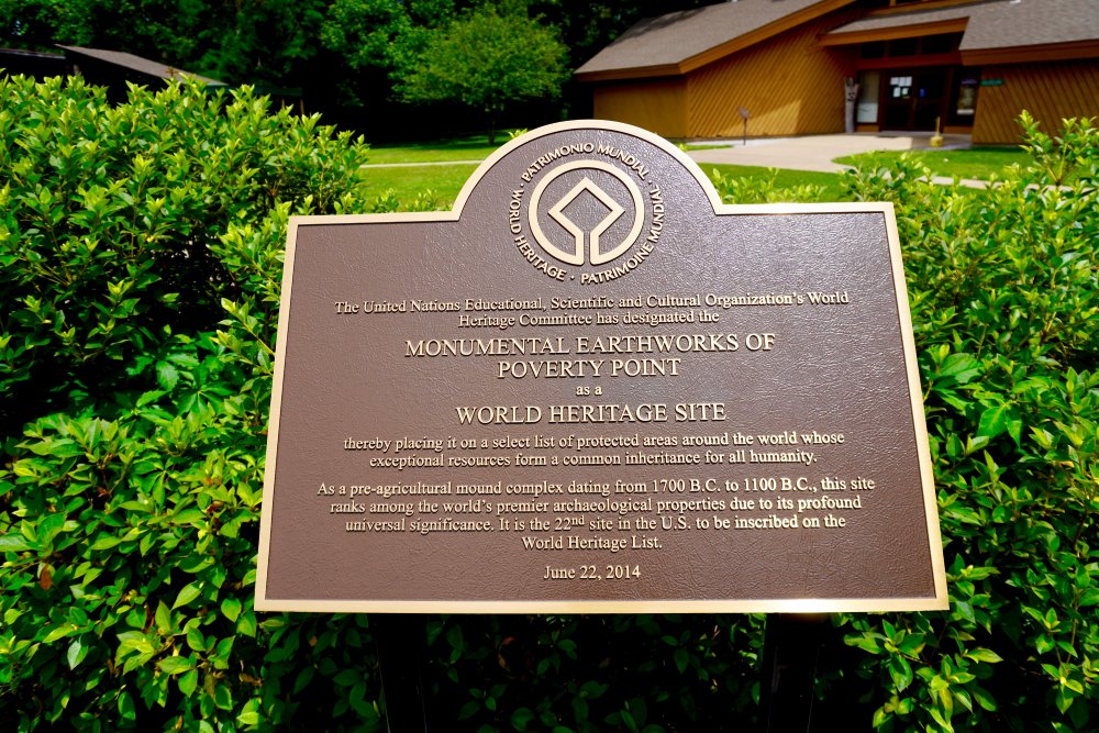
The Preservation Of Several Millennia Worth Of Life
Today, the site is a UNESCO World Heritage Site. As of 2013, the designation indicates just how important the site and the history it contains are to our broader understanding of humanity. It was the first World Heritage Site in Louisiana.
You May Also Like:
Behind The Building Of Stonehenge
The Story Of America's First Megacity


_at_Poverty_Point.jpg)