
Your Window Wins…Again
Some drives never let the moment pass quietly. Scenery shifts so quickly that the road feels like a doorway into somewhere new. Across the country, certain stretches transform an ordinary trip into one everyone instinctively tries to linger in longer.

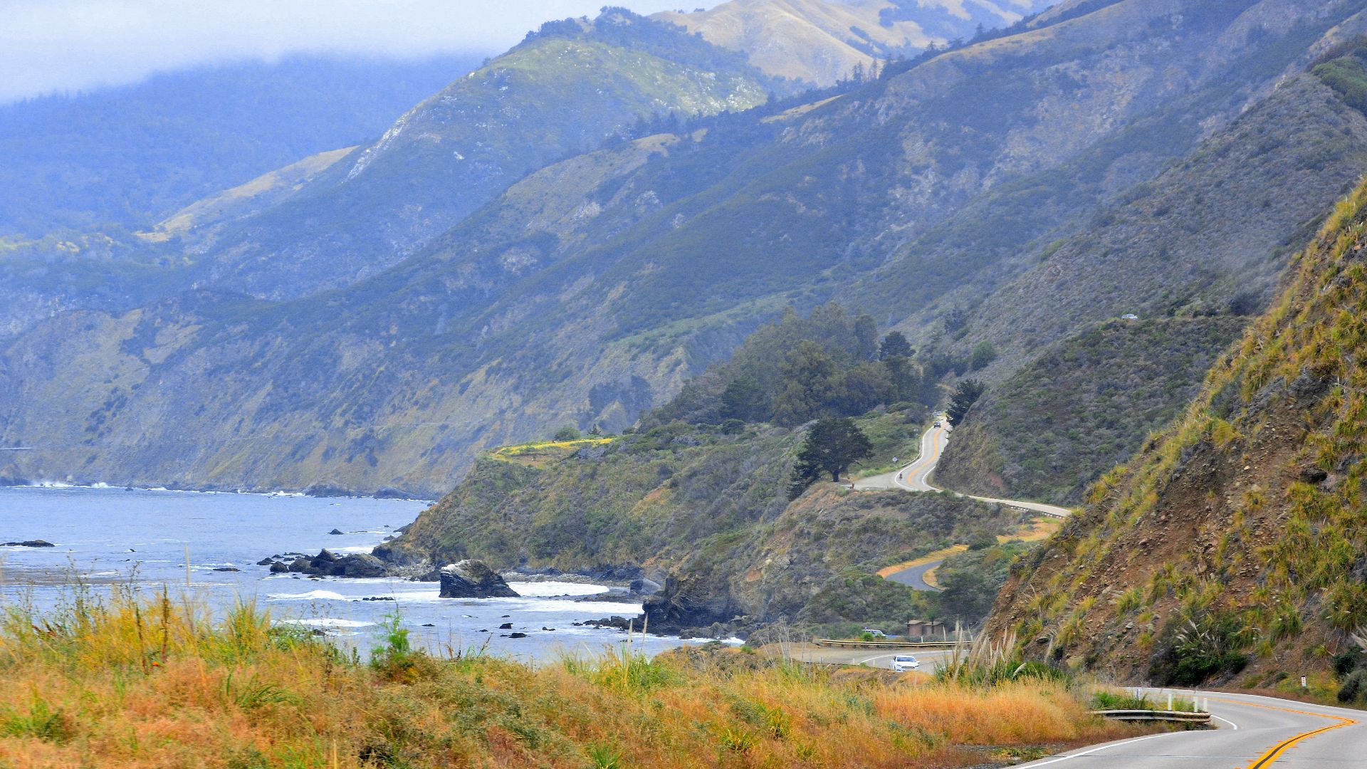
Pacific Coast Highway
The coastline feels larger than the road itself as the pavement wraps around California’s cliffs and sets a steady rhythm. That flow carries you toward Big Sur, where marine life slips into view. Curves shaped by 1930s engineering link each scene until the Bixby Bridge rises into an unforgettable panorama.
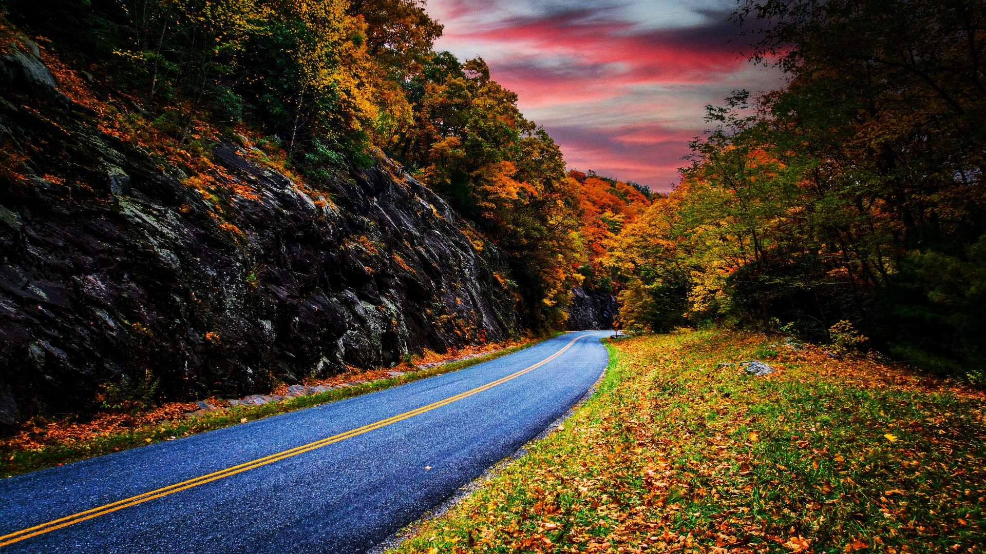
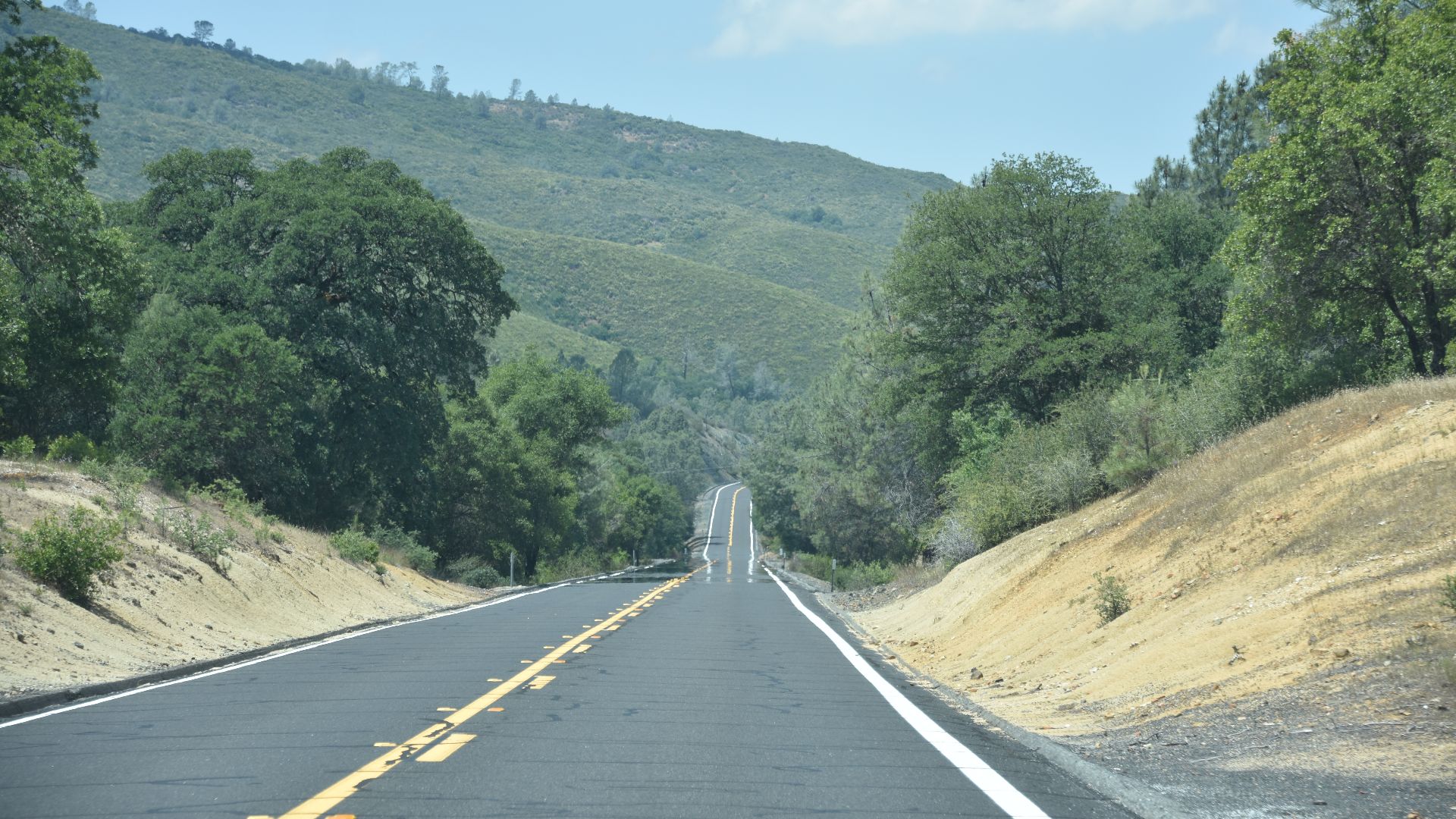
Blue Ridge Parkway
Some roads feel like quiet companions, and this one connects Shenandoah to the Smokies with overlook after overlook. Built during the New Deal, the route carries travelers through Appalachian ridgelines and wildlife crossings. It holds the title of America’s longest linear park for a reason.
 Chrishash1991, Wikimedia Commons
Overseas Highway
Long before reaching Key West, the sight of 42 bridges over clear water creates the sense of gliding between worlds. Portions of the route were built on an old railroad, and the Seven Mile Bridge is the moment everyone remembers. Sunsets linger here as though designed for drivers.
 United States Department of Transportation, Wikimedia Commons
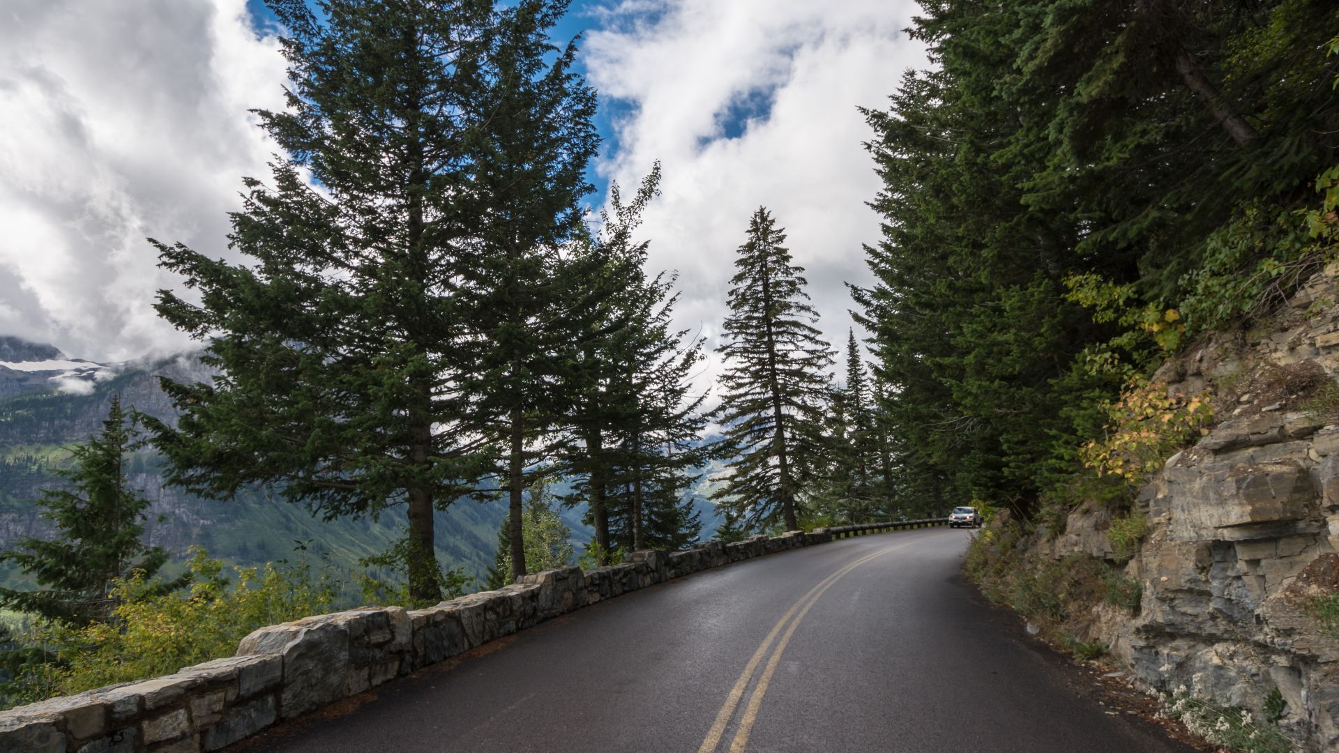
Going-To-The-Sun Road
High inside Glacier National Park, this road doesn’t wait to impress. Logan Pass rises above 6,600 feet, with snow shutting the gates for much of the year, and mountain goats appear near the edges. Every bend rewards travelers with views sculpted by ice and altitude.
 m01229 from USA, Wikimedia Commons
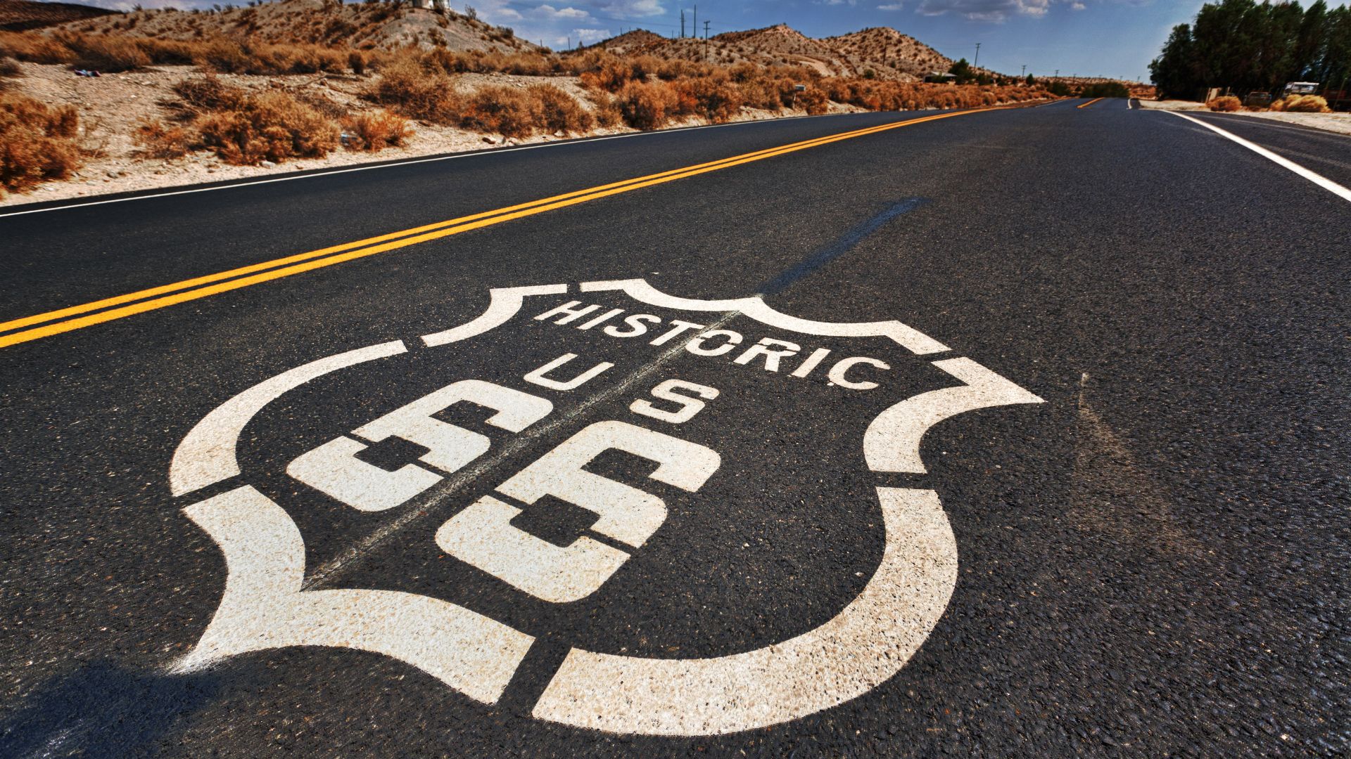
Route 66
Nostalgia sets in early as the old pavement leads from Chicago toward Santa Monica. Decommissioned in 1985, the historic route still glows with neon and roadside icons. Songs and movies keep it alive, while travelers chase the feeling of a more scenic America.
 Randy Heinitz, Wikimedia Commons
Hana Highway
Rainforest shadows fall across more than 600 curves, and each one-lane bridge signals another shift in Maui’s scenery. Built in the early 1900s, the route reveals waterfalls and roadside fruit stands. Drivers come for the scenery but stay for the sense of exploration around every corner.

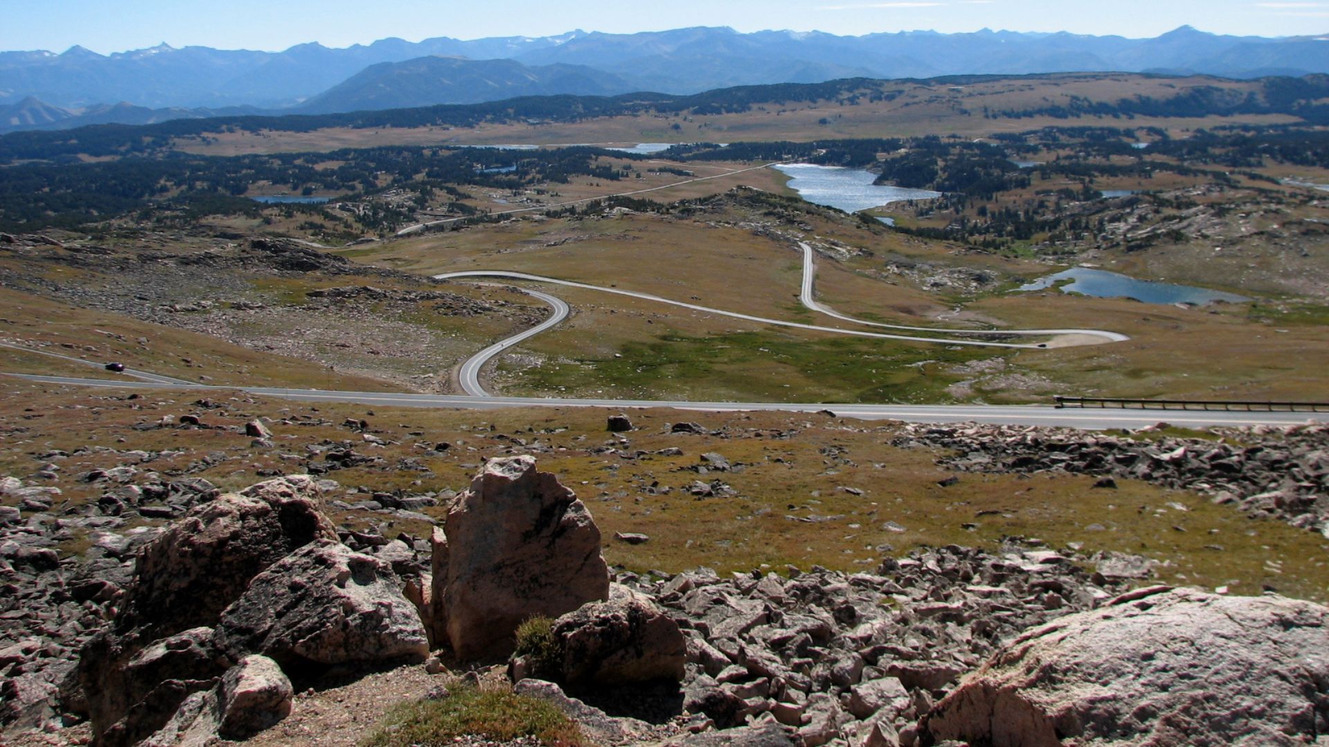
Beartooth Highway
Some drives feel like climbing into the sky, and this one reaches nearly 11,000 feet. Though seasonal closures keep it short-lived, its alpine tundra and sweeping Montana-Wyoming views make it legendary. Many call it the nation’s most beautiful highway, and the beauty easily proves the claim.
 WizardFusion, Wikimedia Commons
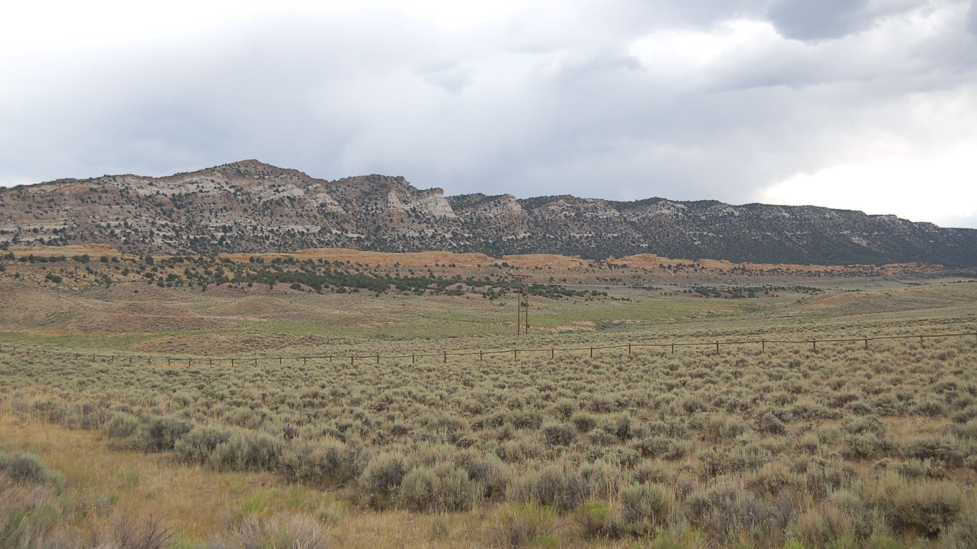
Natchez Trace Parkway
History leads this peaceful stretch that follows ancient Indigenous paths. Commercial traffic is banned to create a quiet rhythm through three states. Travelers notice historic sites that sit along the way, and the protected 444-mile corridor turns a simple drive into something reflective and deeply scenic.
 US Government, Wikimedia Commons
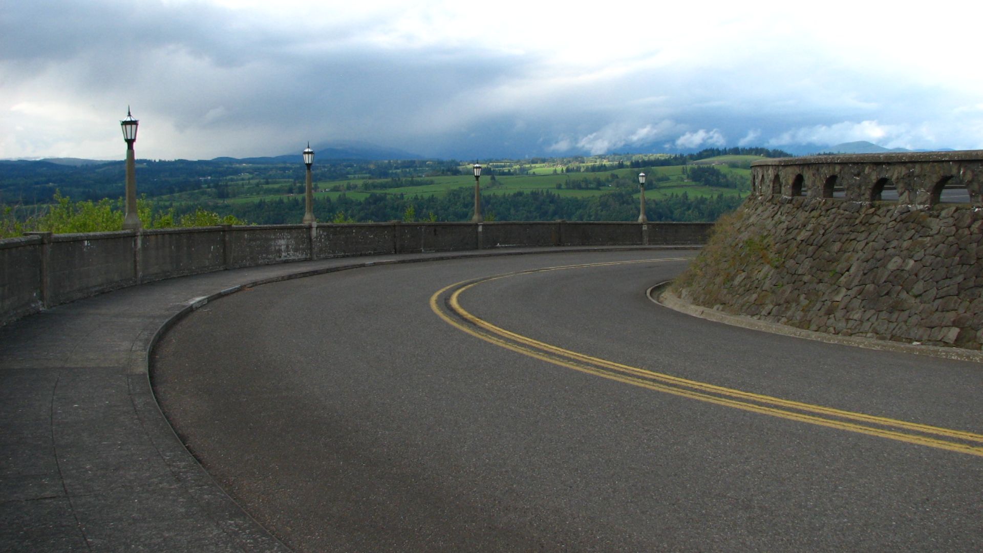
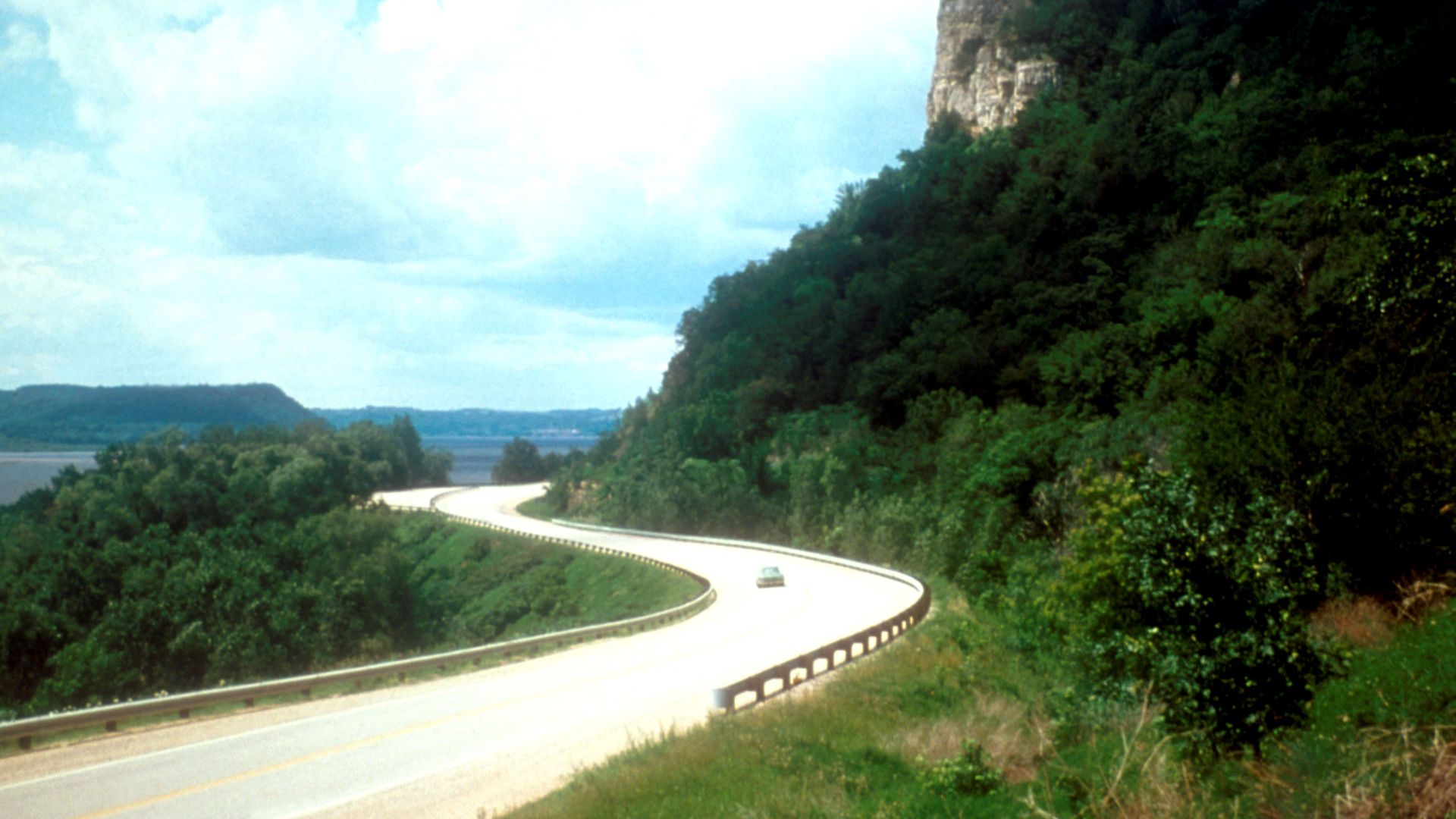
Columbia River Gorge Highway
Waterfalls appear before the river does, and that’s part of its magic. As America’s first planned scenic roadway, it carries travelers between Oregon cliffs and the Columbia’s edge. The Vista House stands like a lookout tower marking a route listed on the National Register of Historic Places.
 Ian Poellet, Wikimedia Commons
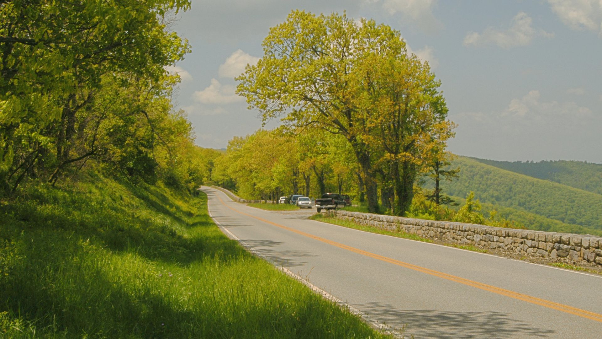
Skyline Drive
Morning light lands softly on Shenandoah’s ridges while more than 70 overlooks frame the Blue Ridge Mountains. Completed in the 1930s, the road often brings black bears into view and becomes a leaf-season favorite. Its steady 105-mile stretch encourages drivers to slow down and simply look around.
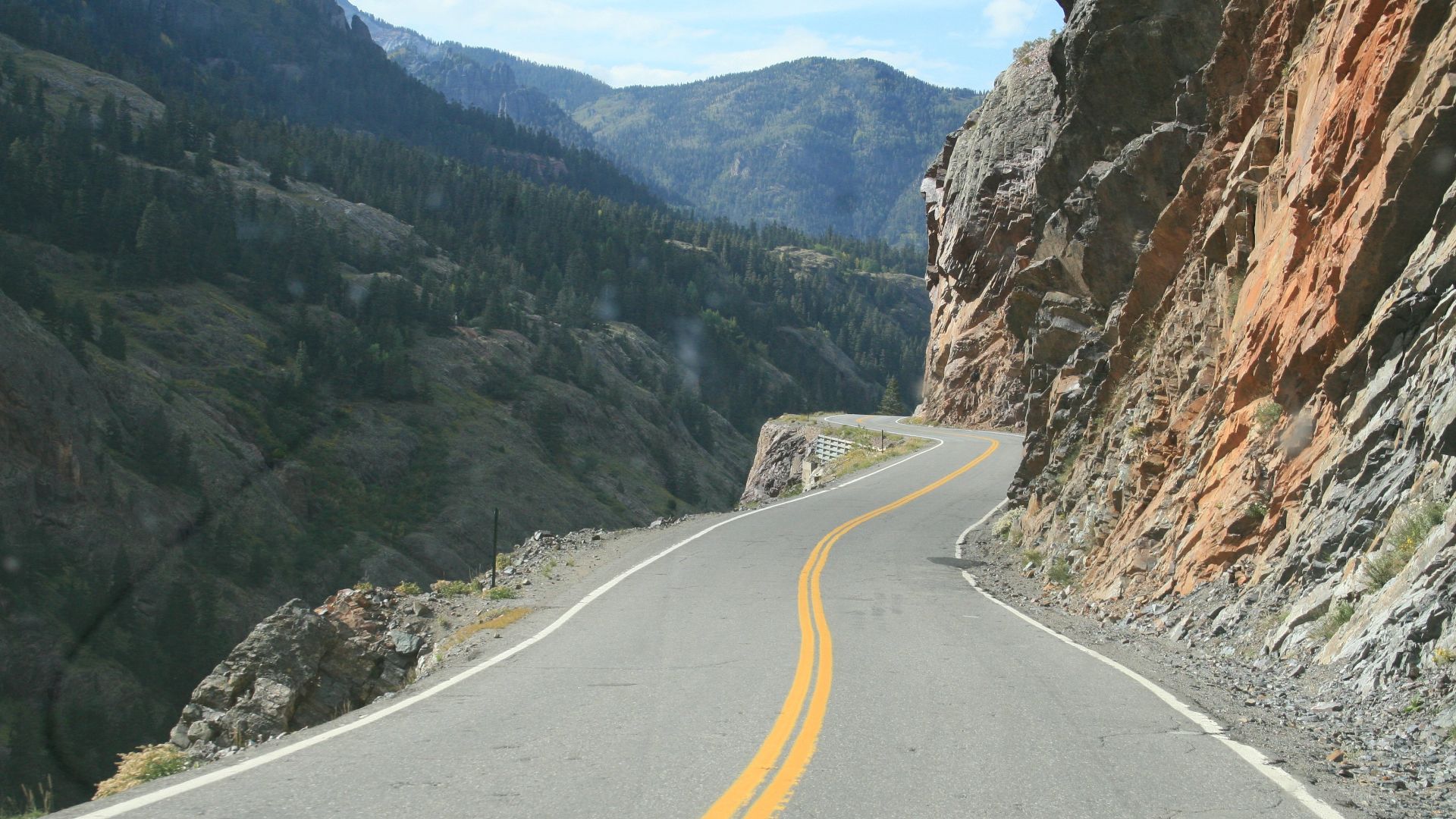
Million Dollar Highway
Colorado’s San Juan Mountains rise so sharply here that every drop-off looks like a viewpoint carved by chance. The road dates back to the late 1800s, and the absence of guardrails adds to the thrill. Photographers chase the shifting light as the route continues to earn its reputation for unforgettable mountain drama.
 Reinhard Schon, Wikimedia Commons
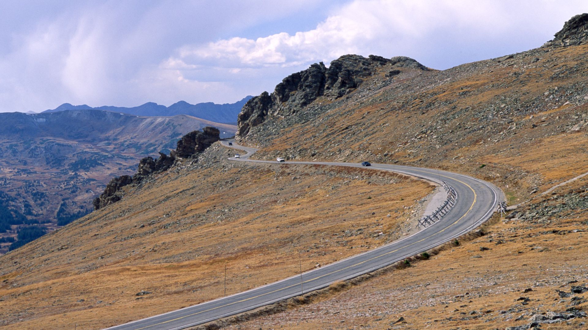
Trail Ridge Road
Climbing above 12,000 feet changes the air and the pace of the Rockies. This high paved route inside Rocky Mountain National Park closes each winter, leaving only a short window to see the tundra scenery unfold. Wildlife sightings complete the picture on this sky-level drive.
 Dariusz Kowalczyk, Wikimedia Commons
Great River Road
This Great River Road route echoes the Mississippi’s unhurried path through ten states. Travelers come for culture as much as for scenery, watching history unfold along the river. It's 3,000 miles of an All-American Road stitched together with local highways.
 U.S. Government, Wikimedia Commons
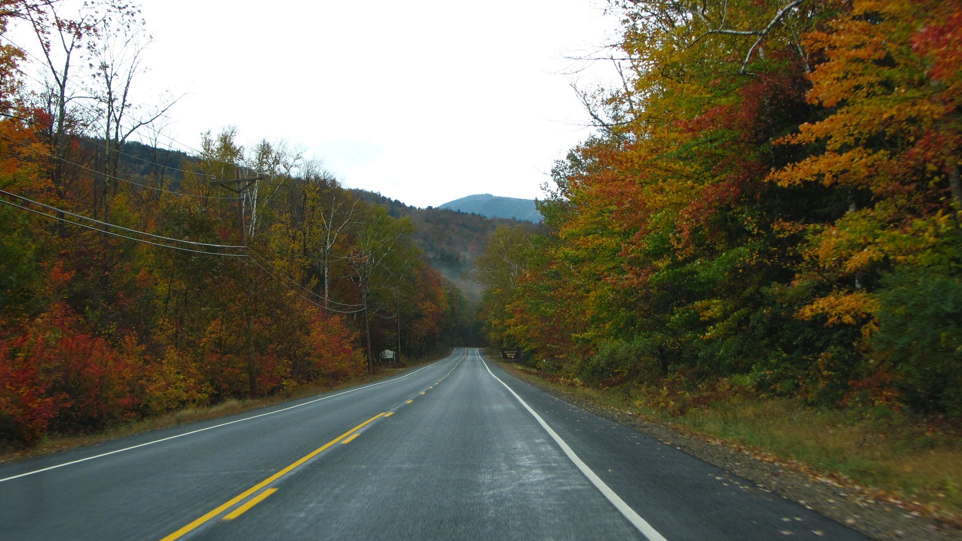
Kancamagus Highway
New Hampshire’s White Mountains flare with color as the “Kanc” runs through untouched forest. With no homes or businesses on the route, the quiet feels intentional. Completed in 1959 and named after a Native leader, it delivers fall foliage that travelers rank among the best in the country.
 Bob Linsdell, Wikimedia Commons
Highway 12 Scenic Byway
You feel the scenery shift fast on the road between Bryce Canyon and Capitol Reef, especially when red rock cliffs suddenly give way to forest. The Hogback ridge pushes things higher with its dramatic drop-offs. Every mile reinforces why this stretch stands as an officially designated All-American Road.
 Wolfgang Staudt from Saarbruecken, Germany, Wikimedia Commons
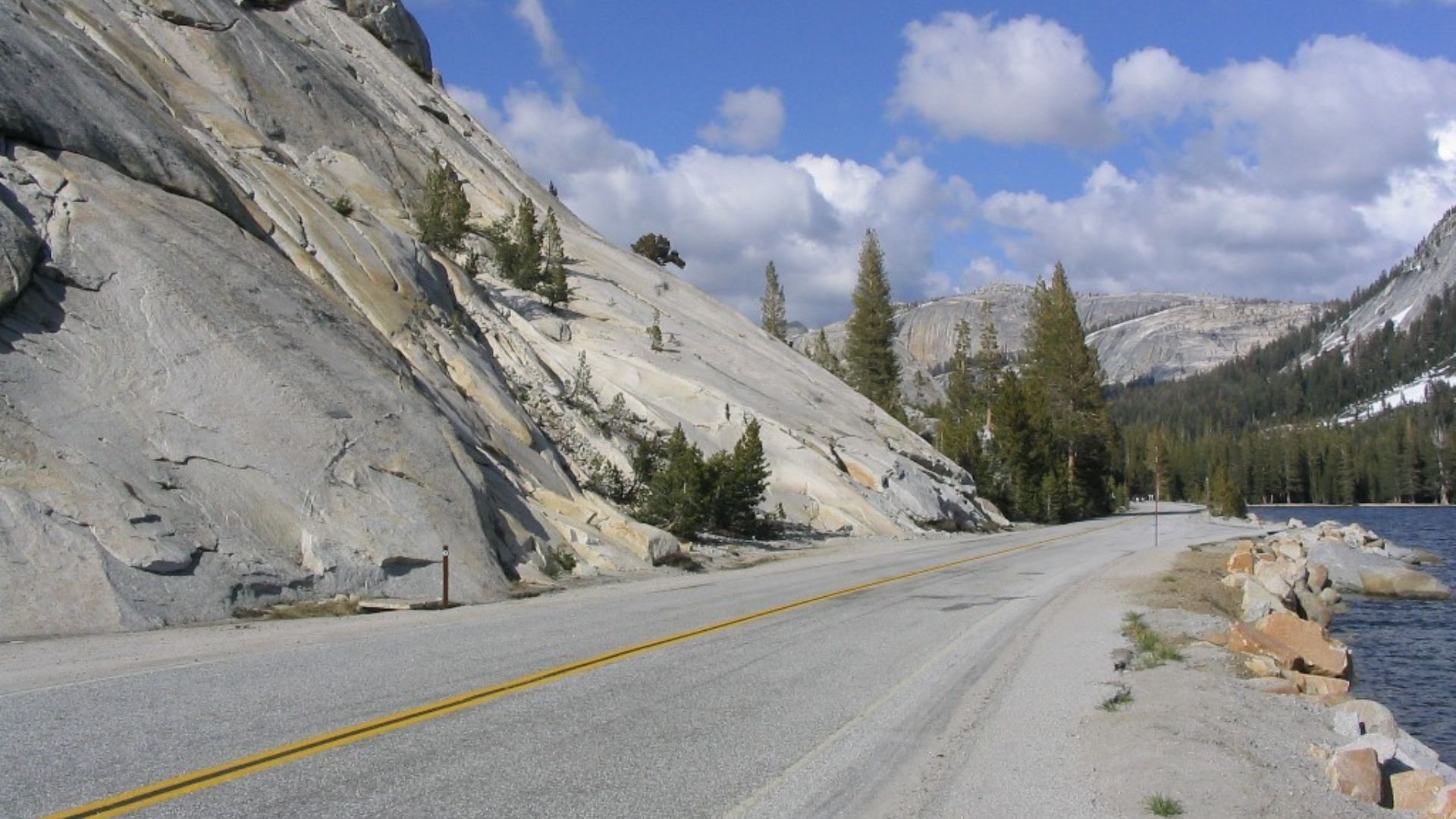
Tioga Road
Granite domes and alpine lakes define Yosemite’s high country, accessible only during summer when the snow finally melts from the road. Built in the early 1900s, this nearly 10,000-foot route carries travelers through a quieter side of the park.
North Cascades Highway
The season feels brief here because winter avalanches close the road without fail, and this leaves a limited window to cross Washington’s rugged peaks. During that time, glacier-fed turquoise lakes steal the spotlight before ending with Diablo Lake. As part of the Cascade Loop, the route was built by ice and isolation.
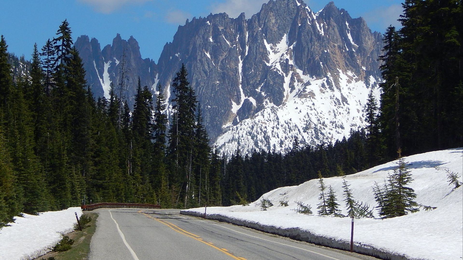 Ron Clausen, Wikimedia Commons
Denali Park Road
Only a limited number of vehicles have access to this Alaskan route. Created beginning in 1922, the road draws travelers hoping for wildlife sightings against Denali’s backdrop. Each mile pushes deeper into a wilderness that feels far removed from anything outside the park.
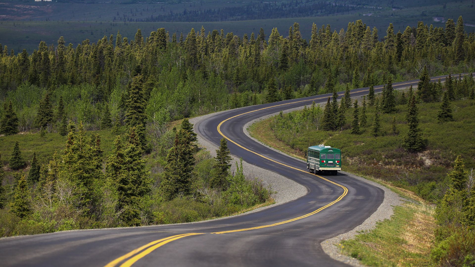 NPS Photo / Emily Mesner, Wikimedia Commons
Avenue Of The Giants
Drivers easing into this old section of Highway 101 find themselves surrounded by redwoods rising more than 300 feet. The canopy filters the light until the whole corridor darkens. Humboldt County’s cool climate keeps the area green year-round, and you end up slowing down simply to take in the scale.
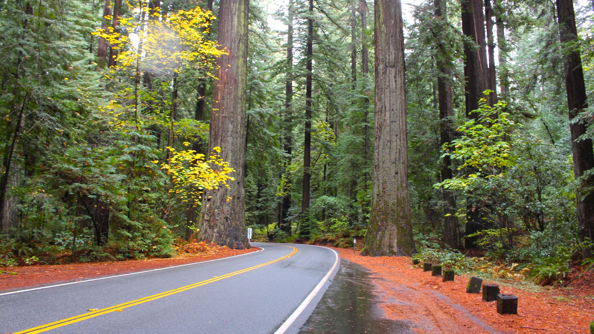 Ramakrishna Gundra, Wikimedia Commons
Red Rock Scenic Byway
Arizona’s sandstone formations appear almost immediately, surrounding the short route with towering shapes like Bell Rock and Courthouse Butte. Sunrises turn the scene fiery, and Sedona marks the finish with its red rock skyline. It may be brief, but every mile feels oversized in color and scenery.
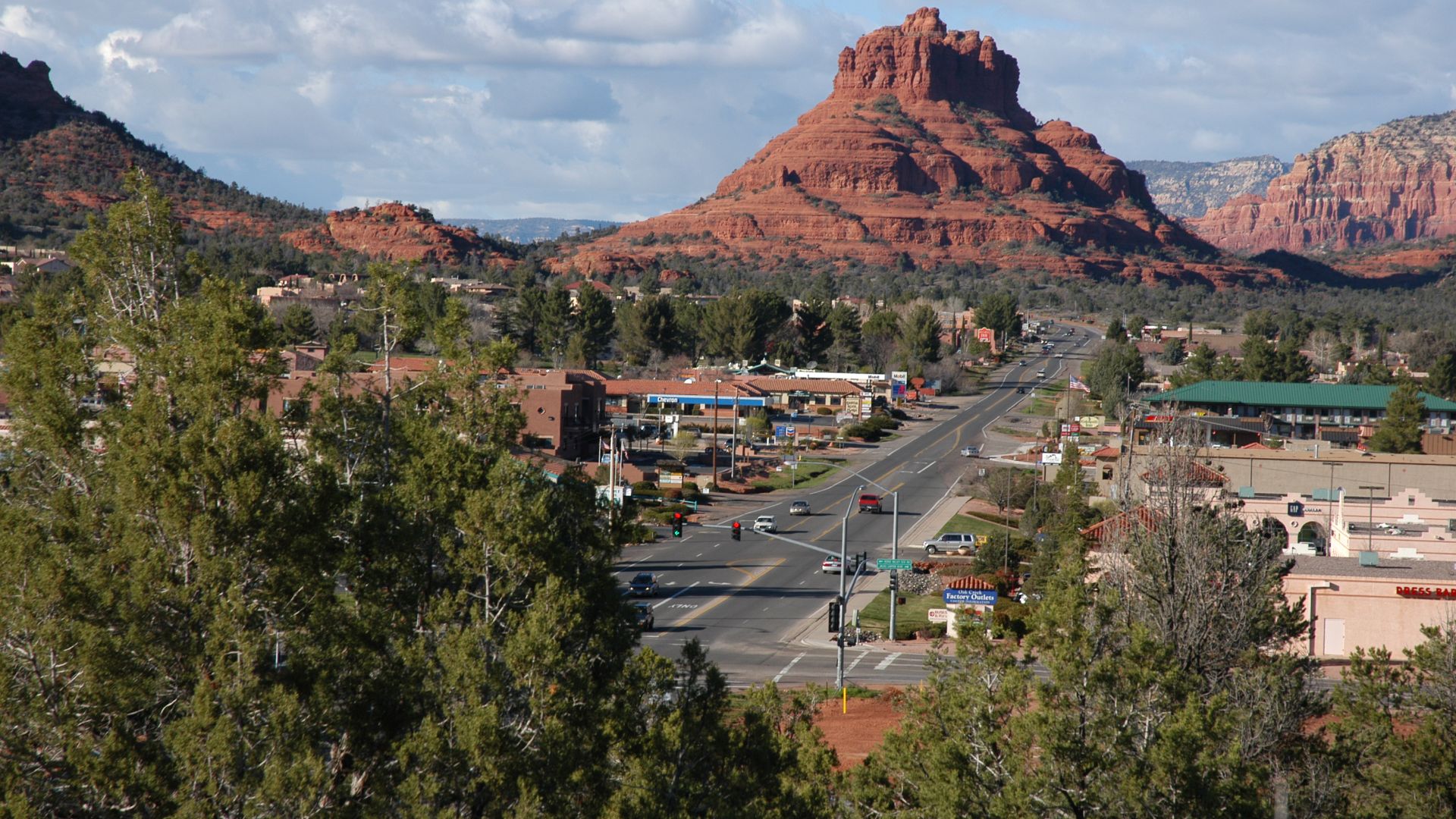 Unknown authorUnknown author or not provided, Wikimedia Commons
Iron Mountain Road
Pigtail bridges curl through South Dakota’s Black Hills, guiding travelers toward tunnels that perfectly frame Mount Rushmore. Designed for thoughtful driving, the route dates back to the 1930s. Forest shade and deliberate worksmanship make the experience feel like a moving postcard built for exploration.
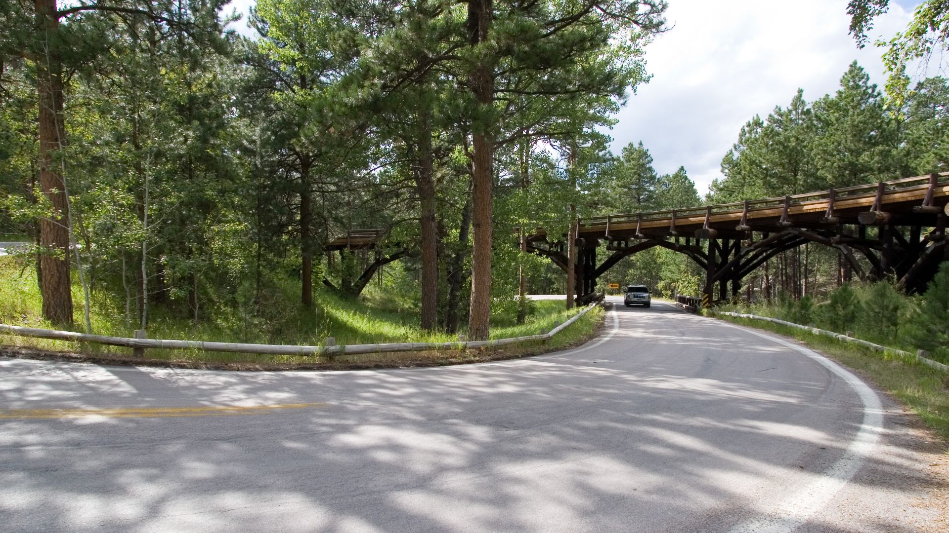 Kimon Berlin, user:Gribeco, Wikimedia Commons
Cherohala Skyway
This Tennessee-North Carolina drive rises above 5,000 feet and blends sweeping forest views with long, quiet stretches. Construction took 34 years to leave a modern roadway with almost no development along its edges. The mix of high elevation and minimal distractions creates a peaceful trip across the mountains.
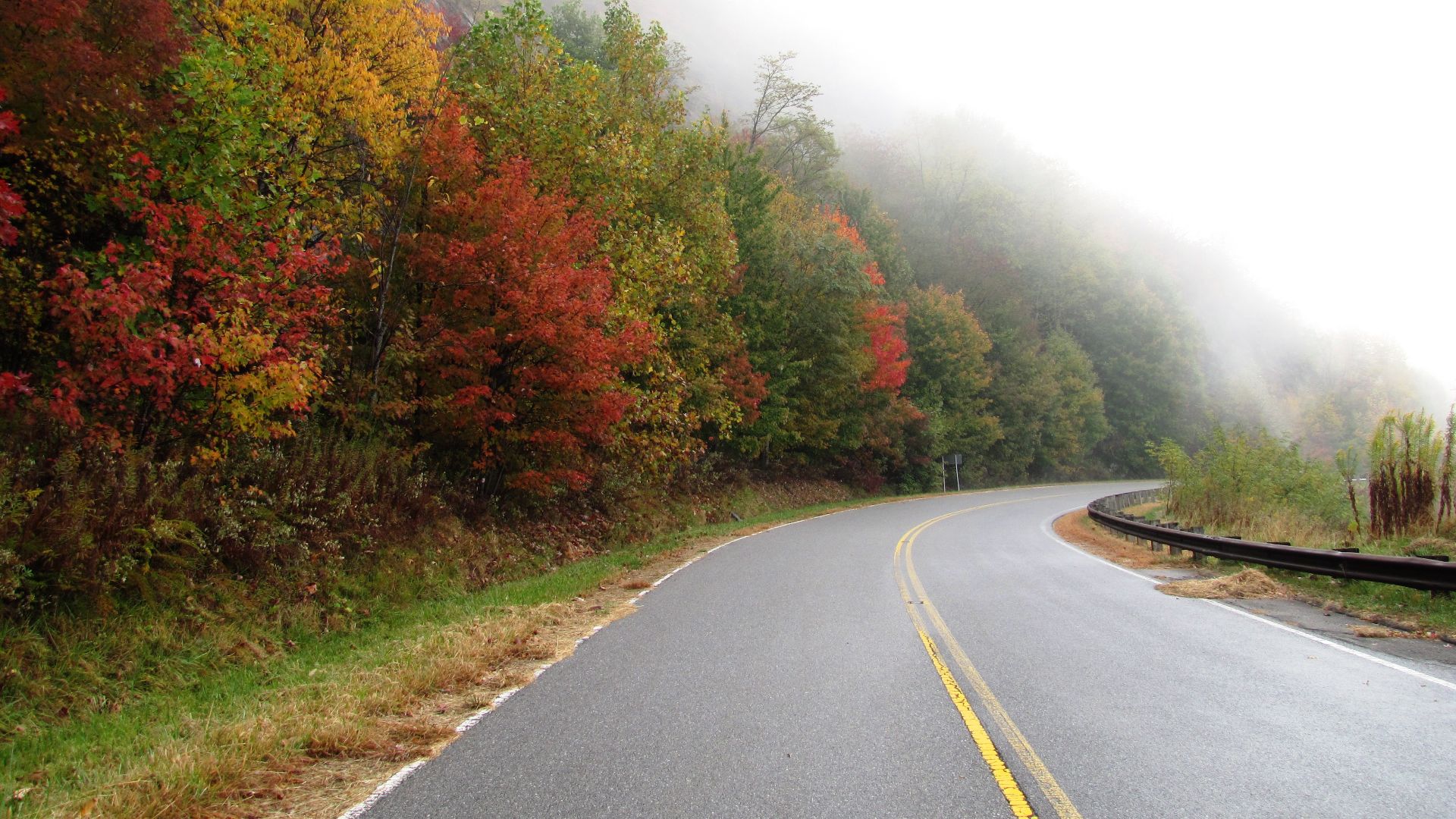 Brian Stansberry, Wikimedia Commons
San Juan Skyway
Colorado’s mountain towns link together in a loop where mining history meets dramatic scenery. The route includes the famed Million Dollar Highway, adding cliffside moments to an already spectacular drive. Alpine views and shifting weather patterns turn each section into its own scenic chapter.
 Jeffrey Beall, Wikimedia Commons
Peter Norbeck Scenic Byway
The road moves through granite spires on a route shaped intentionally for beauty rather than speed. Tunnels frame South Dakota landmarks like planned viewpoints. With Custer State Park nearby, wildlife sightings slip into the experience and turn the drive into more than simple sightseeing.
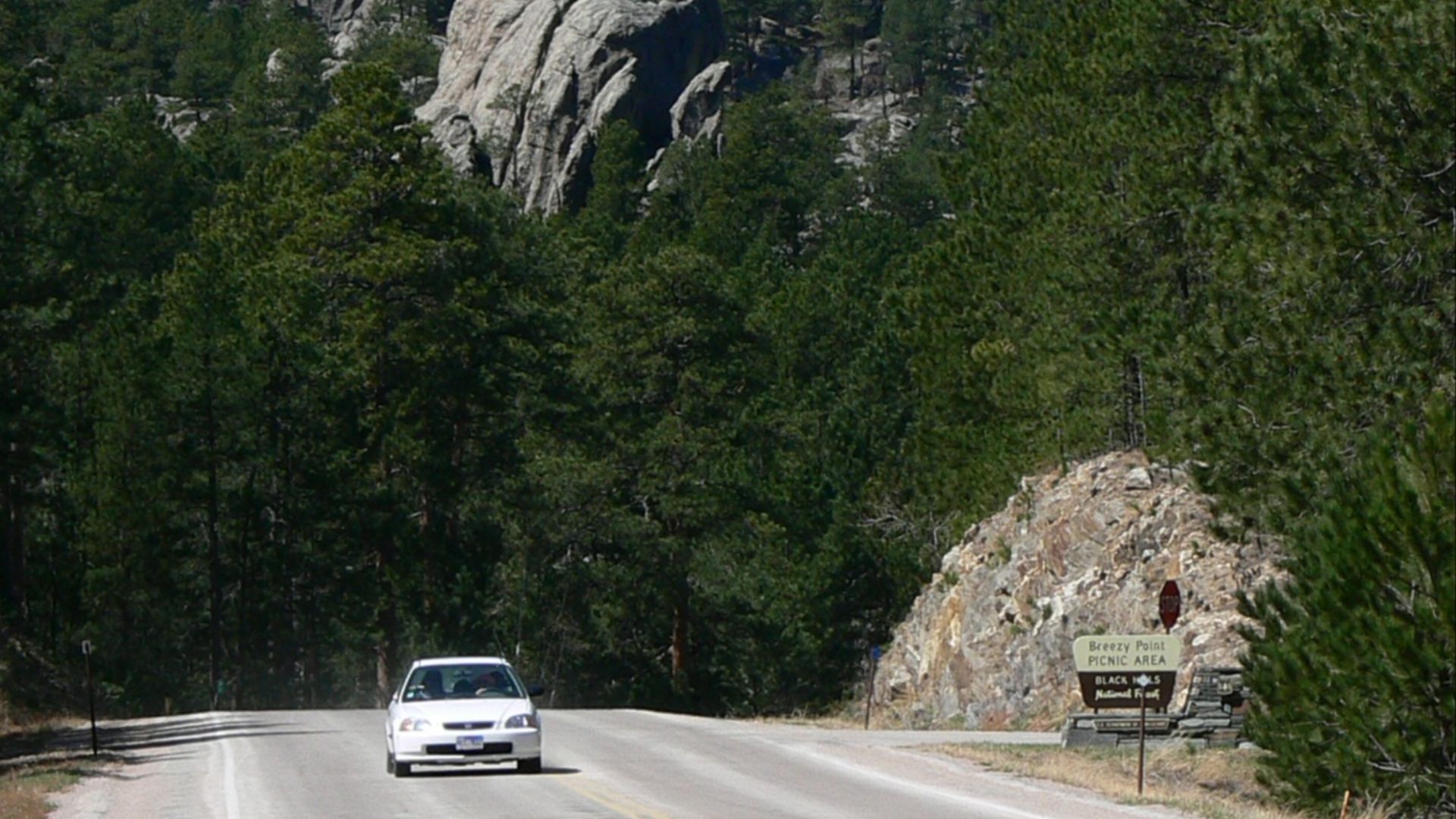 Unknown authorUnknown author or not provided, Wikimedia Commons
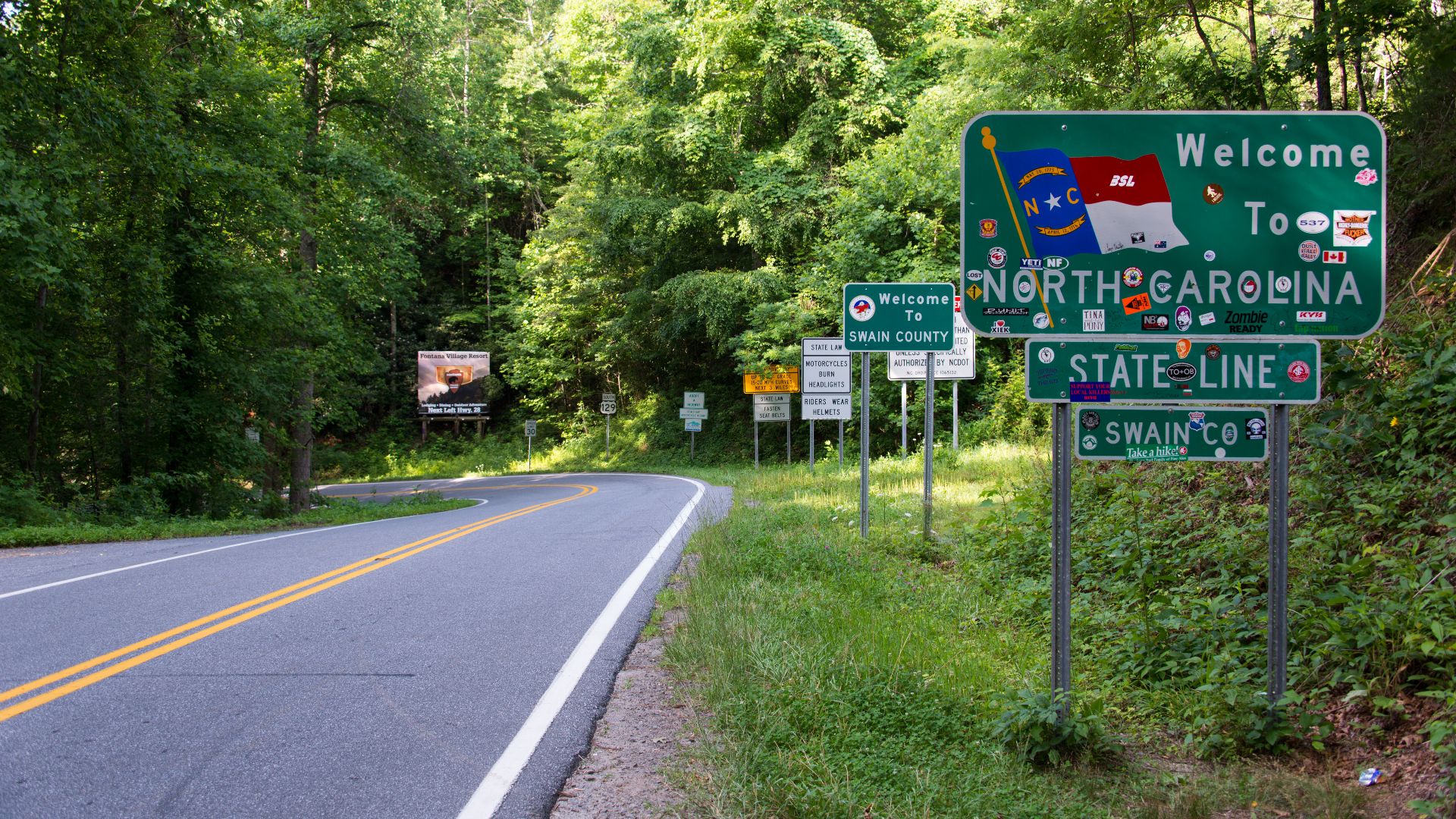
Tail Of The Dragon
With 318 curves packed into 11 miles, this Tennessee-North Carolina stretch feels like a test of rhythm and control. Dense forest closes in around each switchback. Motorcyclists consider it a bucket-list ride, and the route’s reputation only grows with each traveler’s story.
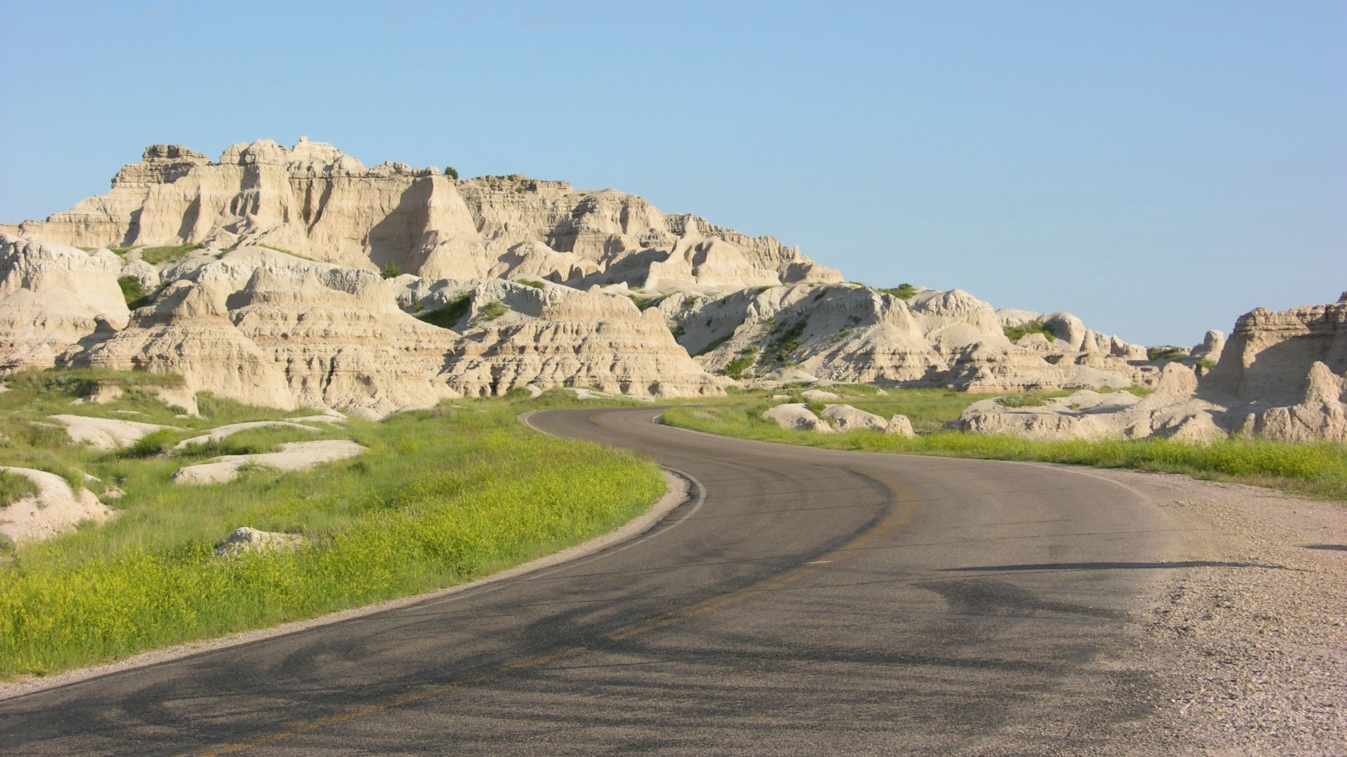
Badlands Loop Road
Eroded rock layers rise in unexpected colors across South Dakota’s Badlands. That stillness shifts as bison and bighorn sheep wander near the overlooks. As the day fades, sunsets wash over the ridges and turn the short loop into a surprisingly dramatic experience.
 Belissarius, Wikimedia Commons
Bluebonnet Trail
Texas wildflowers take center stage as entire fields turn blue during peak bloom near Ennis. Routes shift slightly year to year, so travelers get a fresh layout each spring. Open farmlands and bursts of color make the area a seasonal magnet for photographers and road trip enthusiasts.

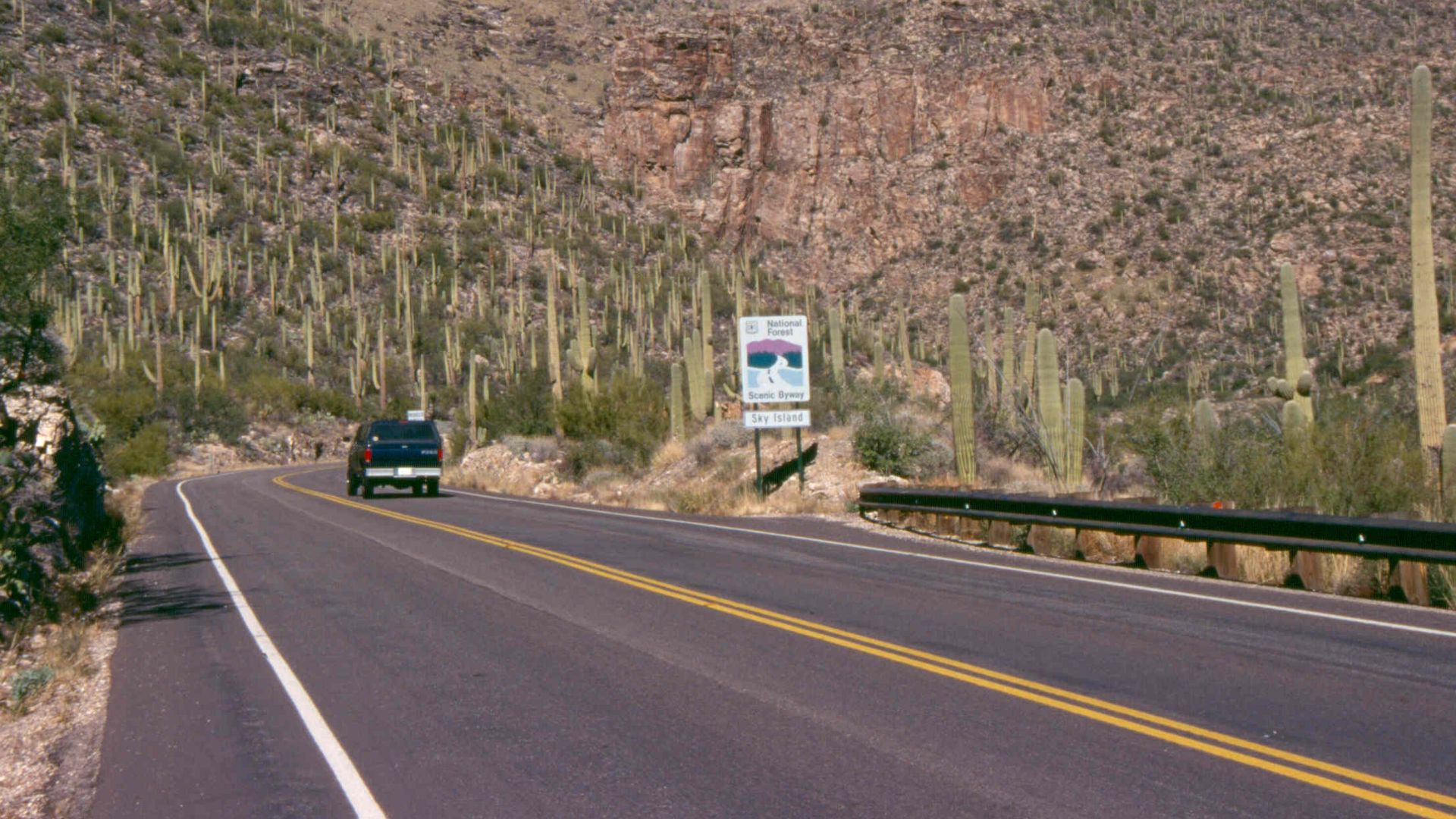
Mount Lemmon Scenic Road
The climb from Tucson’s desert floor to the alpine forest mirrors a journey across continents. Built in the 1950s, the route reveals hoodoos and viewpoints that feel far removed from the heat below. The changing ecosystems offer one of Arizona’s most dramatic elevation transitions.
 Debby Kriegel, Wikimedia Commons
Tunnel Of Trees Road
Branches stretch overhead along Michigan’s M 119, forming a shaded ribbon above the pavement. Once a Native footpath, the route now offers glimpses of Lake Michigan and bursts of fall color. Its tight curves and cozy scale create a drive that feels intimate and hidden away from crowds.
 Bobak Ha'Eri, Wikimedia Commons
Hells Canyon Scenic Byway
Oregon’s ranchlands fade into sharp cliffs as the route circles the nation’s deepest river gorge. The dramatic drop-offs reveal how ancient uplift shaped the terrain. With bighorn sheep moving across the slopes and wide-open viewpoints, the drive balances rugged isolation with some of the Northwest’s boldest scenery.
 Unknown authorUnknown author or not provided, Wikimedia Commons
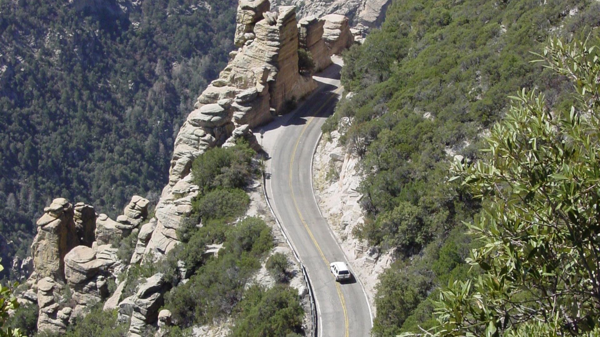
Sky Island Parkway
Elevation rises fast on the way to Mount Graham, turning desert heat into cool forest air. Seasonal closures underline how rugged the terrain can be. Near the summit, astronomical observatories come into view, creating an unlikely blend of science, quiet surroundings, and sweeping mountain scenery.
 Unknown authorUnknown author or not provided, Wikimedia Commons
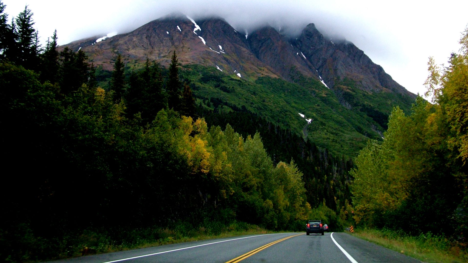
Seward Highway
Between Anchorage and Seward, mountains press in from one side while ocean water and fjords stretch from the other. Turnagain Arm’s dramatic bore tides create moving walls of water, and wildlife often appears along the route. Glaciers and quick weather shifts define this Alaskan coastal corridor.
 Kate Mereand from Silver Spring, MD (Washington, DC), United States, Wikimedia Commons
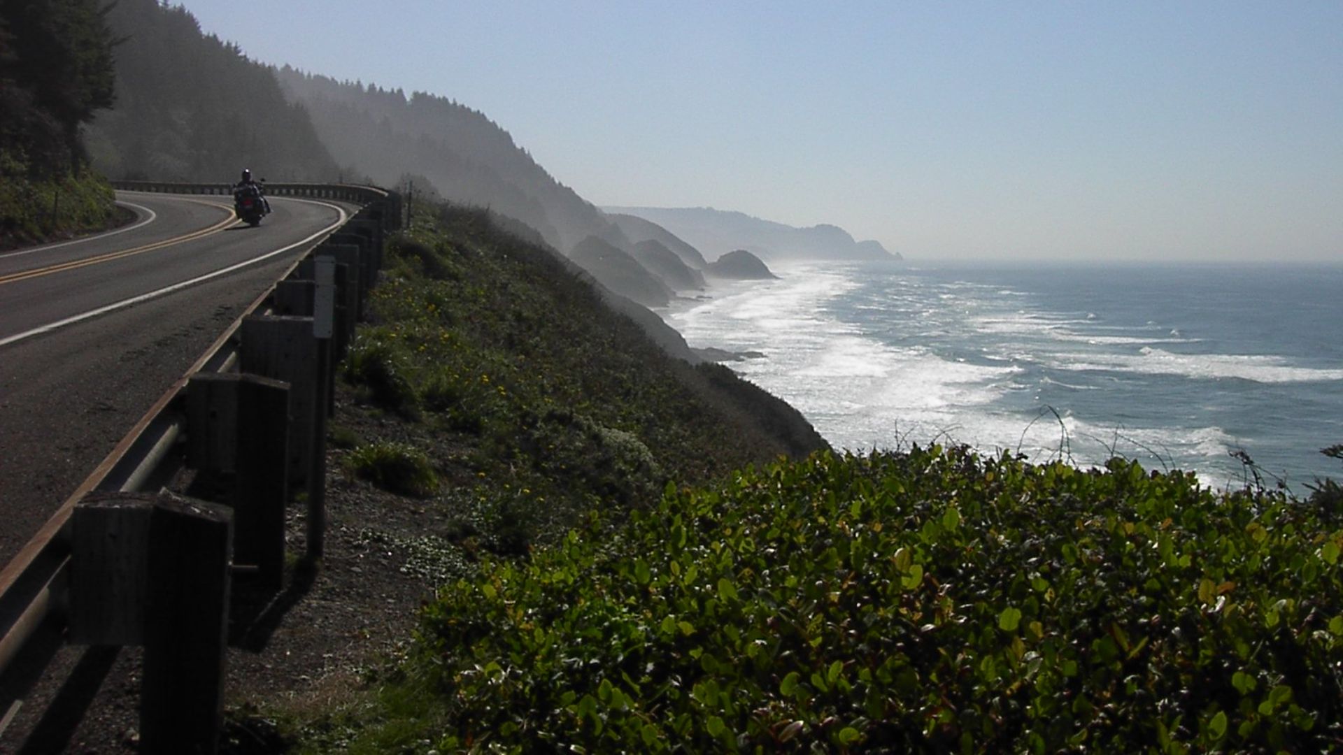
Highway 101 Oregon Coast
Storms, sea stacks, and lighthouse silhouettes shape a drive that follows the Pacific’s rough edges. Viewpoints are easy to reach, and migrating whales usually surface offshore. The route’s dramatic headlands have turned this coastal stretch into one of Oregon’s most recognizable scenic experiences.
 JT Perreault, Wikimedia Commons
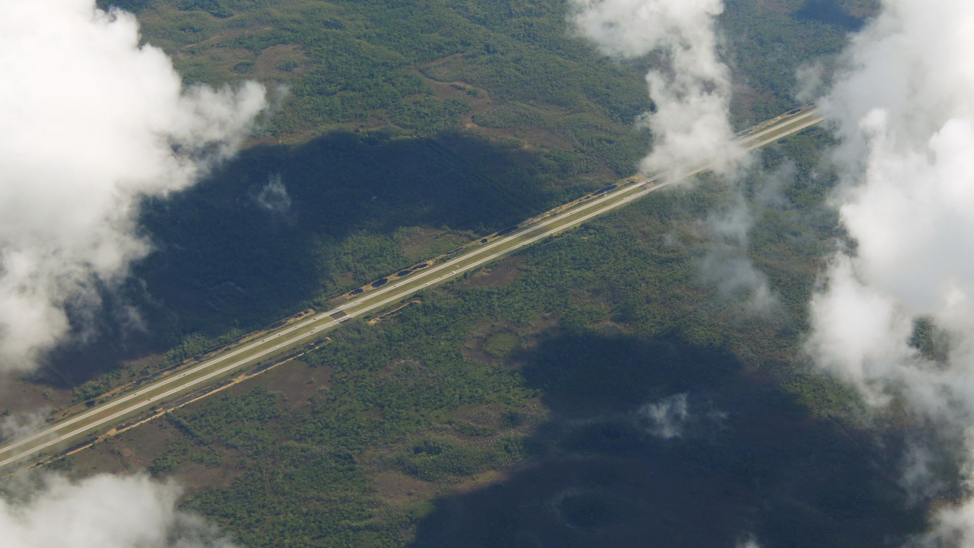
Alligator Alley
Wetlands spread endlessly on both sides as the highway crosses the Everglades on a straight elevated line. Built in the late 1960s, it lives up to its name with frequent alligator sightings. The combination of open water and wildlife creates a surprisingly tranquil ride across Florida.
 formulanone from Huntsville, United States, Wikimedia Commons
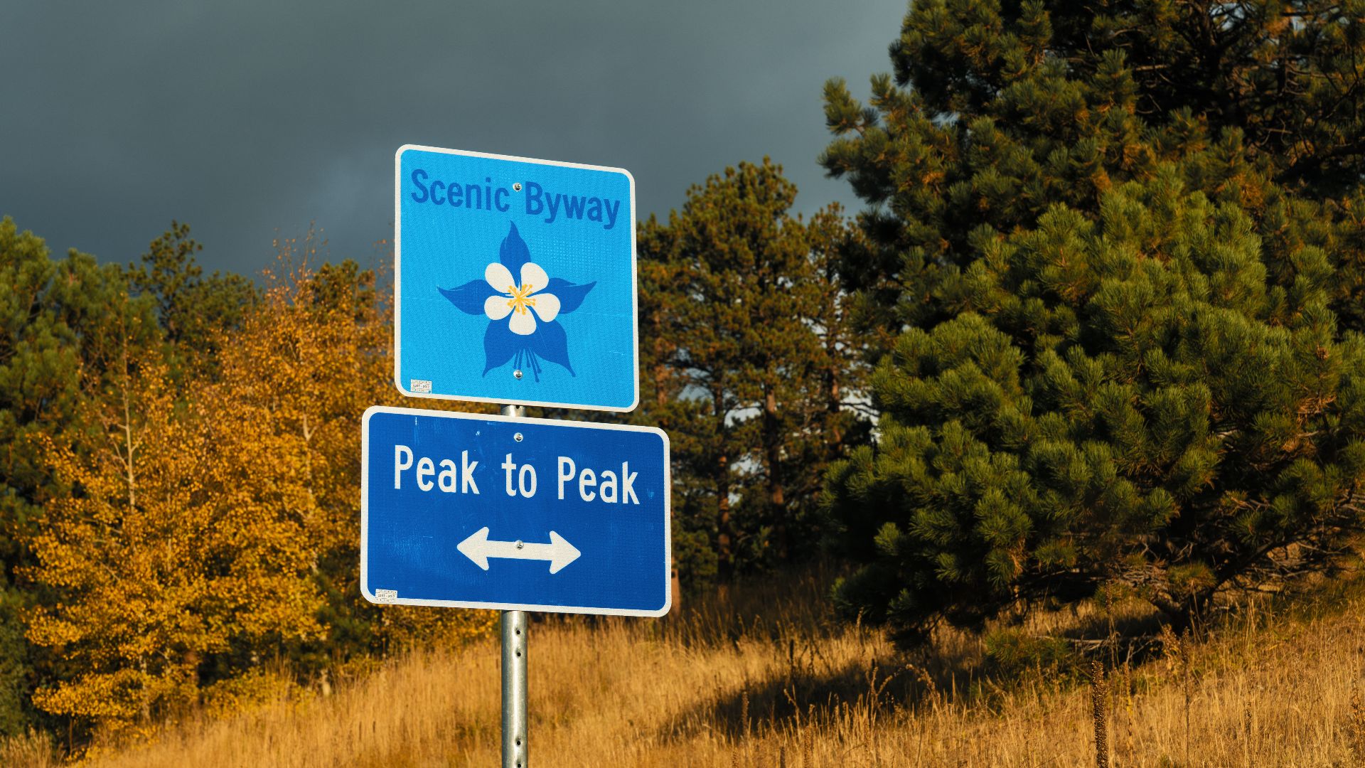
Peak To Peak Highway
Colorado’s oldest scenic byway links forested slopes and mountain peaks in a way that feels like a travelogue of the Front Range. Gold rush history lingers in nearby towns, and autumn colors brighten every curve. Its proximity to Rocky Mountain National Park adds an extra layer of appeal.
 Tony Webster from Minneapolis, Minnesota, United States, Wikimedia Commons
Highway 49 Gold Country Route
You can sense the past quickly on this route as the foothills reveal trails once walked by 1849 prospectors. Towns built during the Gold Rush line the way, surrounded by scenic hillsides and artifacts. The winding curves make it a favorite for motorcyclists who enjoy a lively ride.
 Qwert upoiuz, Wikimedia Commons
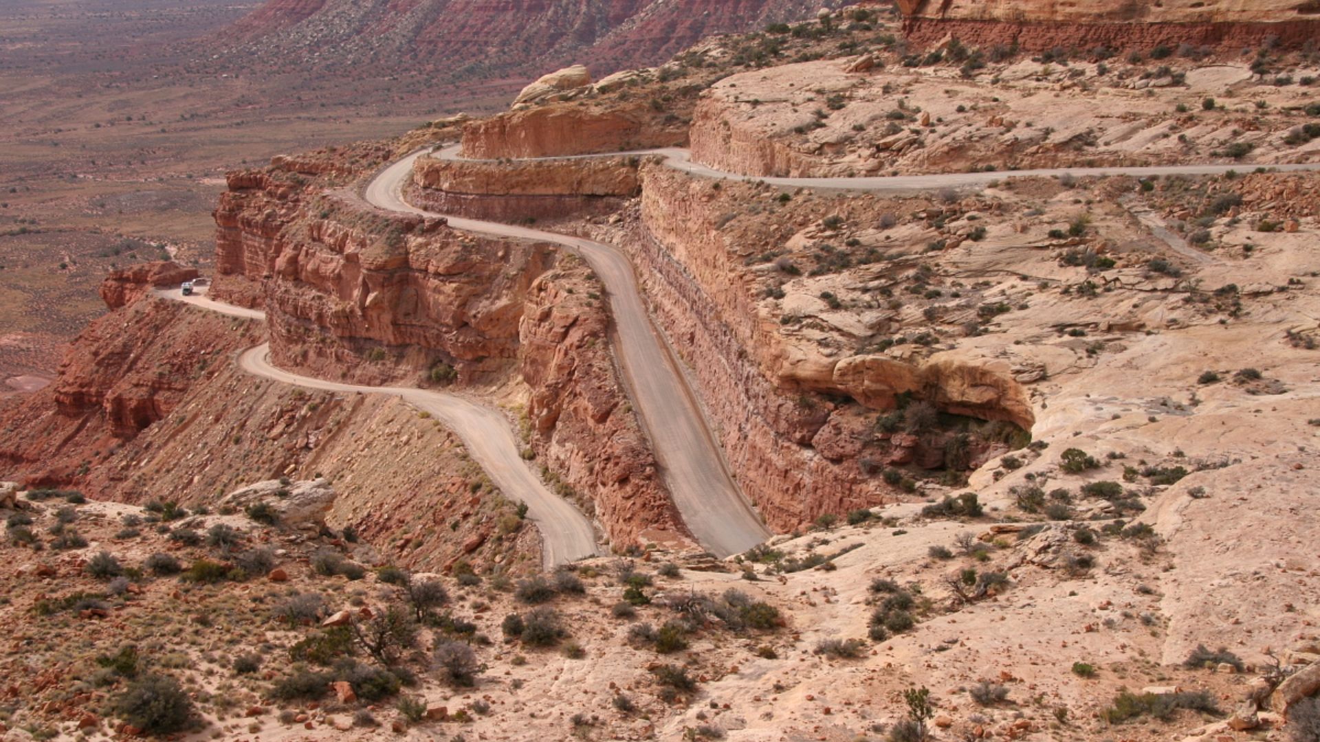
Mokee Dugway
The climb begins immediately on gravel switchbacks that lift you into Utah’s cliffs, which makes the area look far larger than the twisting road. First built for uranium crews, the route now attracts adventure-minded travelers. At the top, the Valley of the Gods spreads out like a painted desert scene.
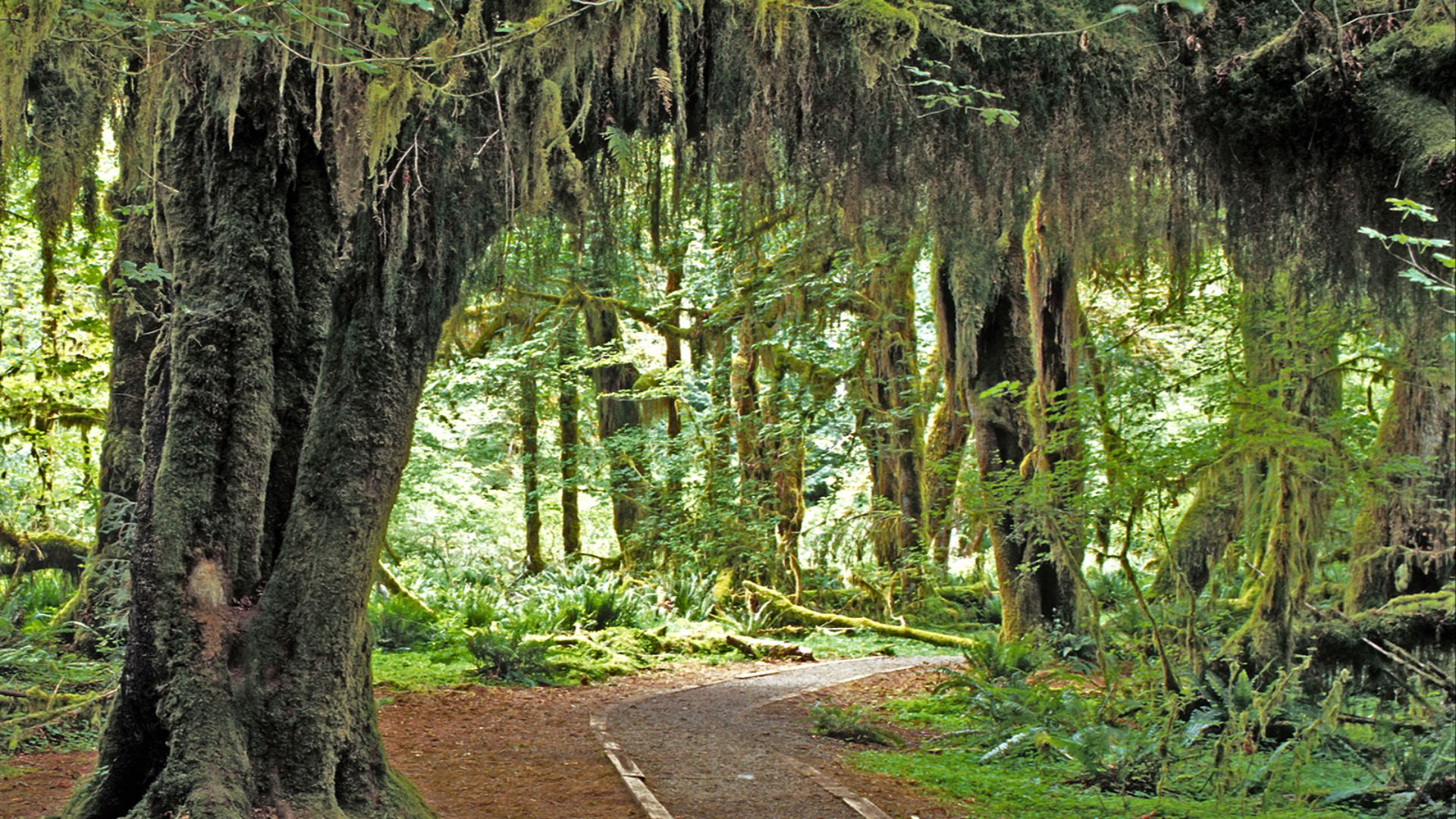
Hoh River Road
There’s a hush to this stretch as the Olympic rainforest gathers around the road, with the Hoh River guiding the way into Washington’s deep interior. Frequent rain feeds the moss and ferns that carpet the surroundings. At the end, the trailheads deliver access to an unusually immersive temperate rainforest.
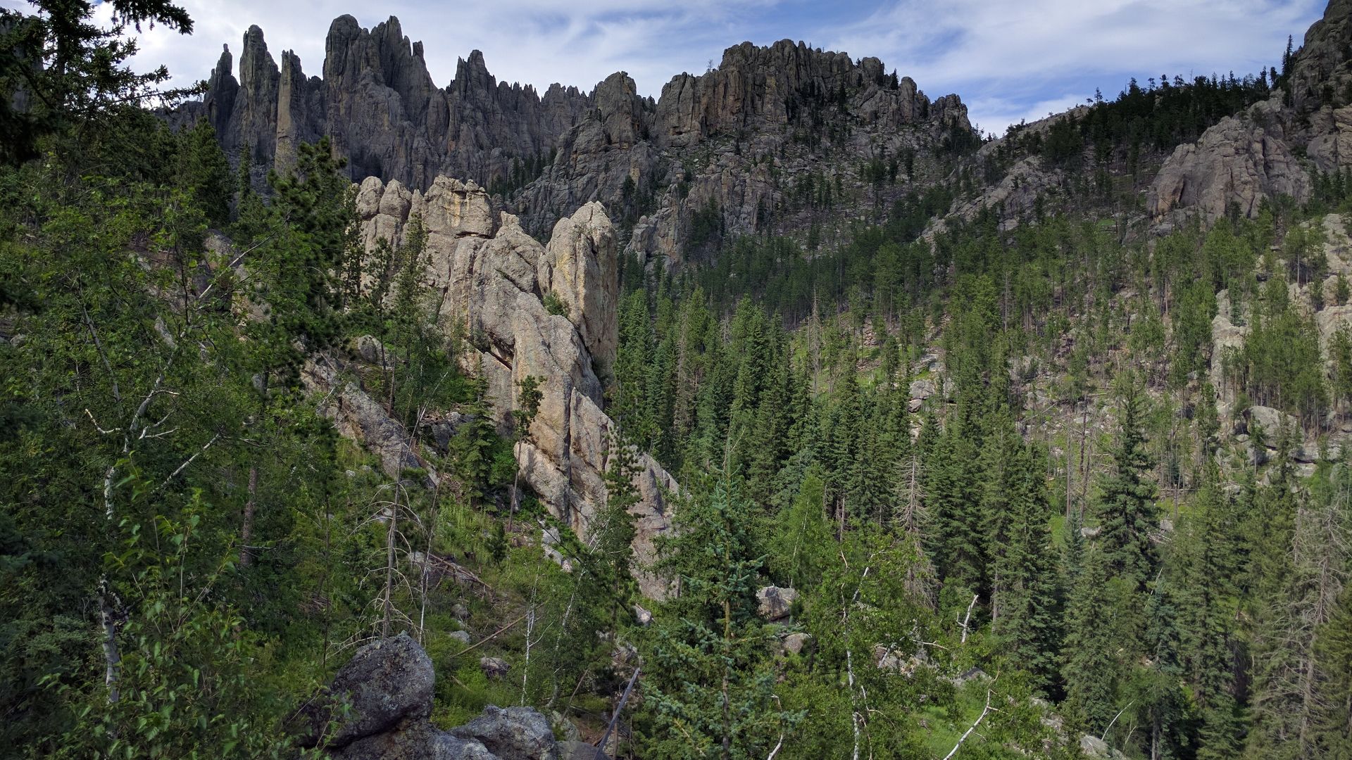
Needles Highway
Granite spires pierce the skyline in South Dakota’s Black Hills, and narrow tunnels frame the rock formations like natural windows. Designed intentionally for slow travel, the roadway encourages travelers to linger. The “Needles Eye” formation becomes the moment everyone remembers, especially during warm summer months.
Flaming Gorge Scenic Byway
Light catches the red cliffs differently each hour, glowing above reservoirs formed by ancient uplift. That shifting palette follows you across the Utah-Wyoming line, where overlooks seem perfectly placed. Most drivers end up joining the fishermen and sightseers at the pullouts to watch the place change color.
 A. E. Crane, U.S. Department of Transportation, Wikimedia Commons
Richard B Russell Scenic Highway
North Georgia’s wooded mountains stretch into the distance as the route climbs above 3,600 feet. Built in the 1960s, it winds through the Chattahoochee National Forest, where fall colors ignite the hillsides. Leaf season draws steady crowds, yet the road still feels calm and unhurried.
 Thomsonmg2000, Wikimedia Commons
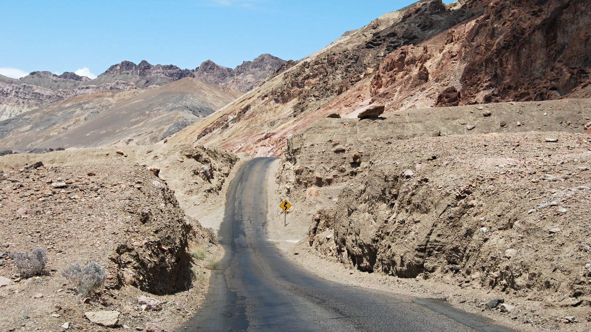
Artists Drive In Death Valley
Minerals tint the hillsides in pink, green, and purple, creating a one-way route that feels almost otherworldly. Sitting below sea level, the scene glows at sunset when the colors deepen. Its narrow curves make the short drive feel like moving through a natural gallery.
 Pavel Spindler, Wikimedia Commons
Lake Shore Drive
Chicago’s skyline rises beside Lake Michigan. That gives travelers waterfront scenery and city energy all at once. Originally built in the 1930s, the drive passes beaches and open shoreline. Sunrises reflect off the buildings, turning a routine stretch into one of the country’s most iconic urban views.
 Rhett Sutphin, Wikimedia Commons
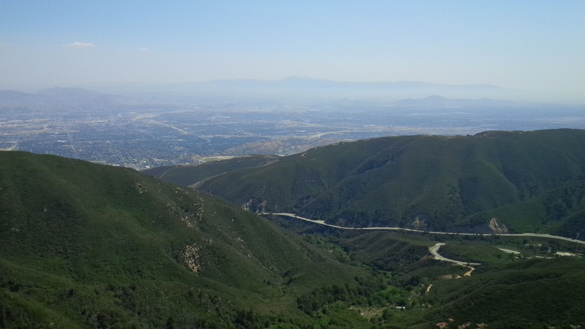
Rim Of The World Highway
High along the San Bernardino Mountains, this California route delivers valley overlooks that seem to stretch forever. Sharp viewpoints appear around sudden bends while forests fill the ridgelines. The mountain perch makes sunrise drives especially colorful as the light breaks across the peaks.
 Steve Riggins, Wikimedia Commons