

Space-Age Tools Meet Stone-Age Mysteries
Archaeologists once relied solely on surface surveys and chance discoveries to locate ancient habitation areas. Satellite sensors now capture subtle terrain variations that highlight the presence of walls buried ten feet underground. This new method has the potential to reveal mankind's oldest permanent settlement after 12,000 years buried under Turkish sands.
 Joi Ito, Wikimedia Commons, Modified
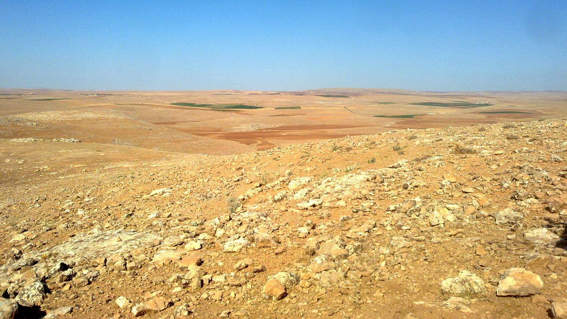
The Sanliurfa Region In Southeastern Turkey
Sanliurfa rovince sits where the Anatolian plateau meets the Mesopotamian plains. Limestone outcrops punctuate rolling hills while the Taurus Mountains rise northward. Ancient streams carved valleys that attracted human settlement thousands of years before recorded history began.
 Hamit Maskan, Wikimedia Commons
What The Pre-Pottery Neolithic Period Was (9000 BCE)
Archaeologists divide the Neolithic into phases based on technological developments. The Pre-Pottery Neolithic spanned roughly 10,000 to 6500 BCE. Communities built permanent structures and organized large construction projects without developing ceramic technology during this window.
 Steven Mithen, Wikimedia Commons
Hunter-Gatherer Societies Before Agriculture Existed
People inhabiting Sanliurfa11,000 years ago didn't farm wheat or herd sheep. They harvested wild einkorn grains and hunted gazelle during seasonal migrations. Deep environmental knowledge allowed sustained occupation of specific territories without cultivating domesticated crops.

The Transition From Nomadic To Settled Life
Something fundamental shifted around 10,000 BCE when groups began occupying the same locations year-round. Permanent dwellings replaced temporary camps. This transition happened gradually as communities experimented with residential patterns while maintaining connections to traditional hunting territories.
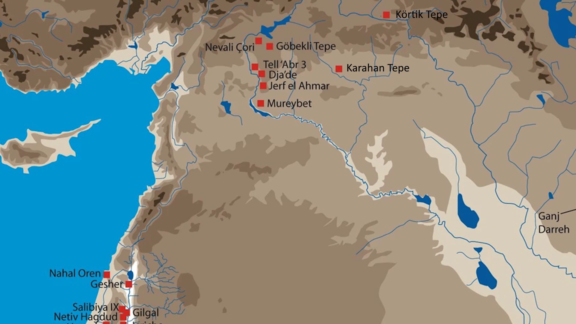
What The Tas Tepeler (Stone Hills) Region Represents
Tas Tepeler translates to "Stone Hills," referring to numerous archaeological mounds scattered across Sanliurfa province. These elevated sites contain layered evidence spanning thousands of years. The concentration within a small geographic area suggests interconnected communities sharing cultural practices.
 Natural Earth, Eylem Ozdogan, B. Kosker, K. Akdemir, Wikimedia Commons
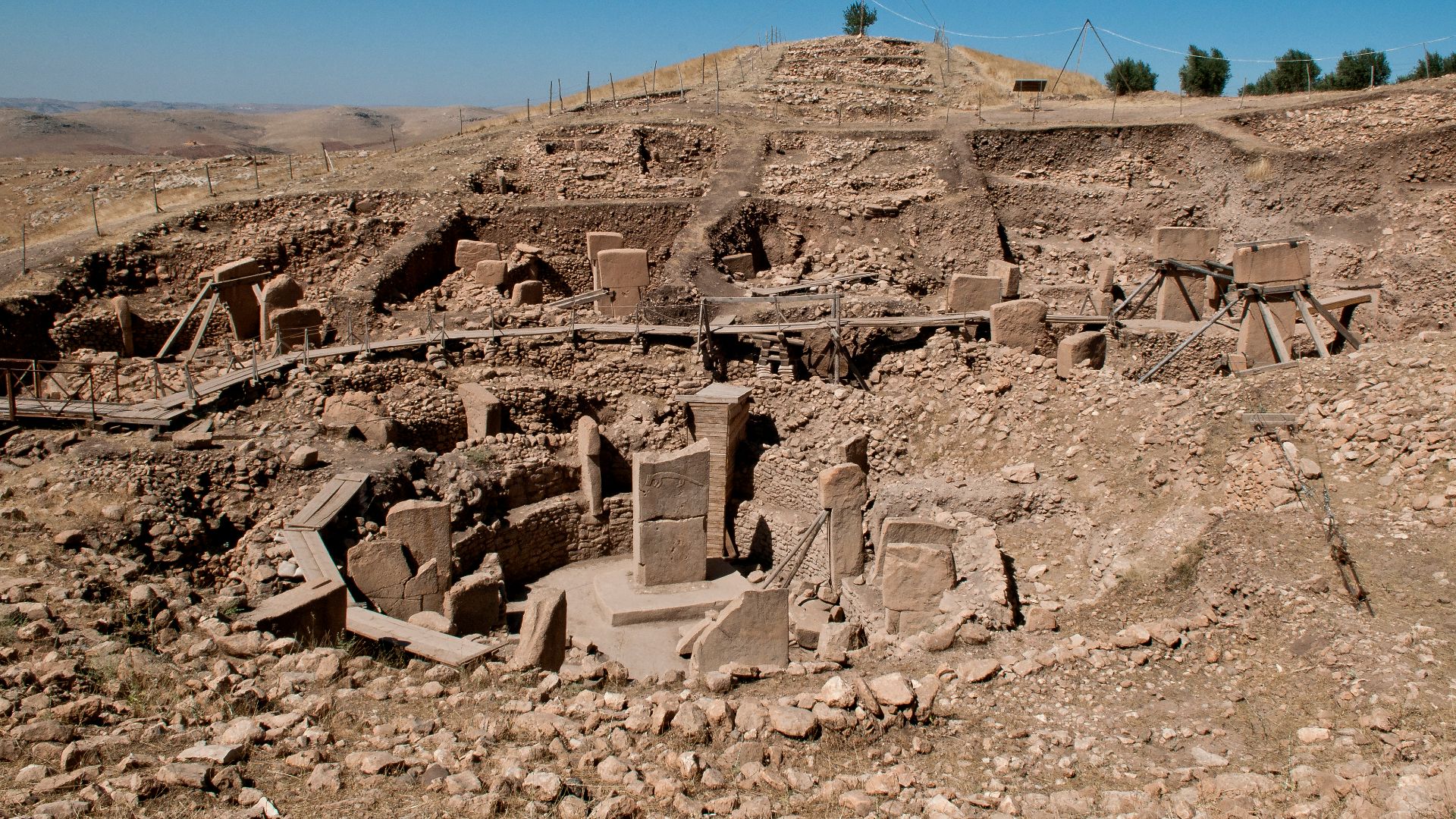
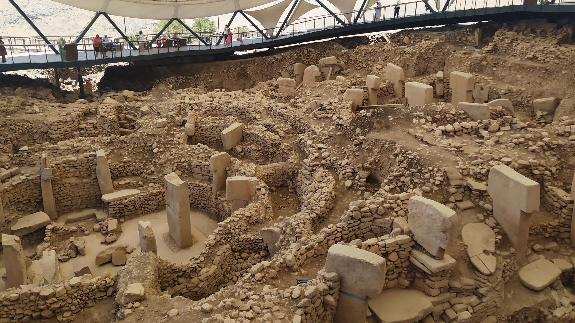
Gobekli Tepe: The World's Oldest Known Temple Complex
Discovered in the 1990s, Gobekli Tepe features massive T-shaped limestone pillars arranged in circular enclosures. The site dates to approximately 9500 BCE. Carved animal reliefs cover the pillars—snakes, foxes, wild boars, birds—executed with surprising artistic skill.
 Teomancimit, Wikimedia Commons
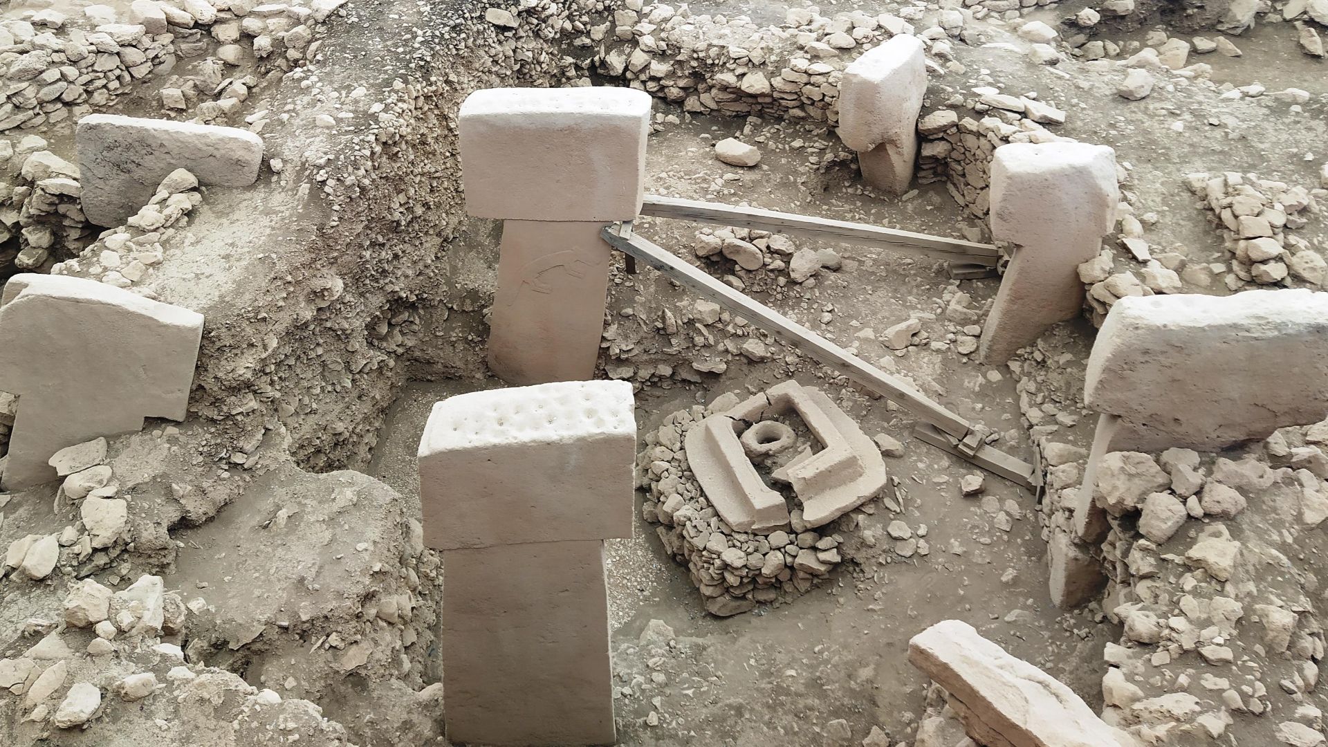
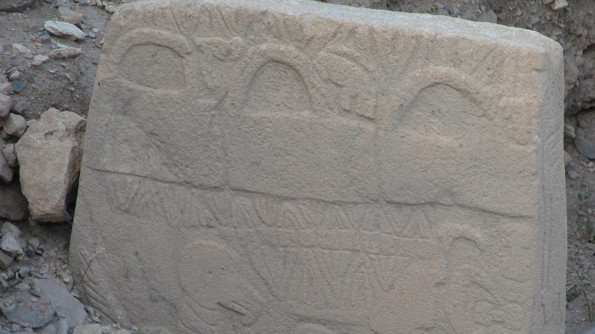
T-Shaped Megalithic Pillars Characteristic Of The Culture
The distinctive T-shaped monoliths stand as tall as sixteen feet and weigh up to ten tons. Quarried from local limestone bedrock, these pillars feature vertical shafts topped by horizontal capstones. Archaeologists interpret this shape as stylized human forms.
 Radoslaw Botev, Wikimedia Commons
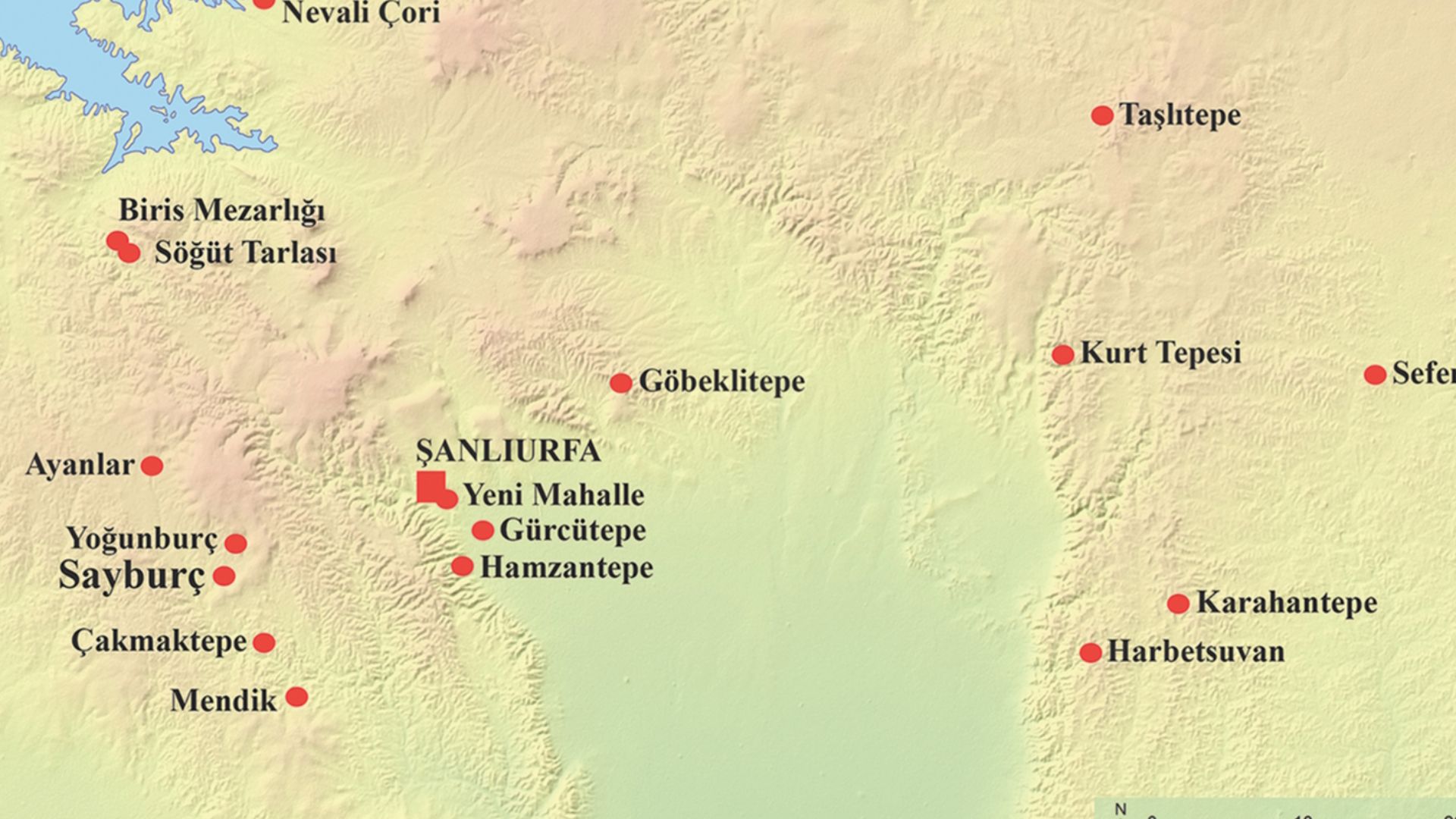
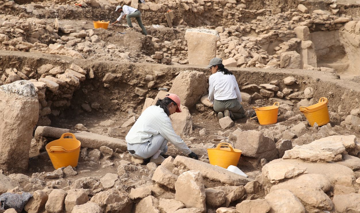
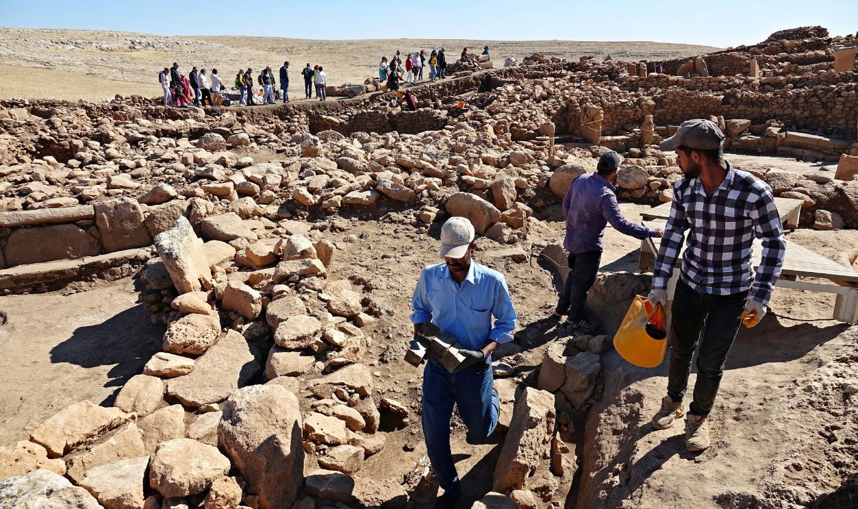
The 12 Known Tas Tepeler Sites Currently Under Excavation
Turkey's Ministry of Culture coordinates research across a dozen Pre-Pottery Neolithic locations. Each site displays variations on the T-pillar architectural theme while sharing enough commonalities to indicate cultural unity. Excavation teams work simultaneously at multiple locations.
Monumental Architecture Created By Non-Agricultural People
Traditional models assumed only farming societies possessed a labor surplus for large construction projects. The Tas Tepeler sites shattered this assumption. Hunter-gatherer communities built massive stone structures requiring coordinated effort from dozens of workers through seasonal gatherings.
 Radoslaw Botev, Wikimedia Commons
The Pre-Pottery Neolithic Cultural Network Across The Region
The various Tas Tepeler sites maintained contact through trade and shared ritual practices. Similar artistic motifs appear across locations separated by many miles. This interconnected zone allowed different communities to contribute to common symbolic traditions.
 Guerin Nicolas, Wikimedia Commons
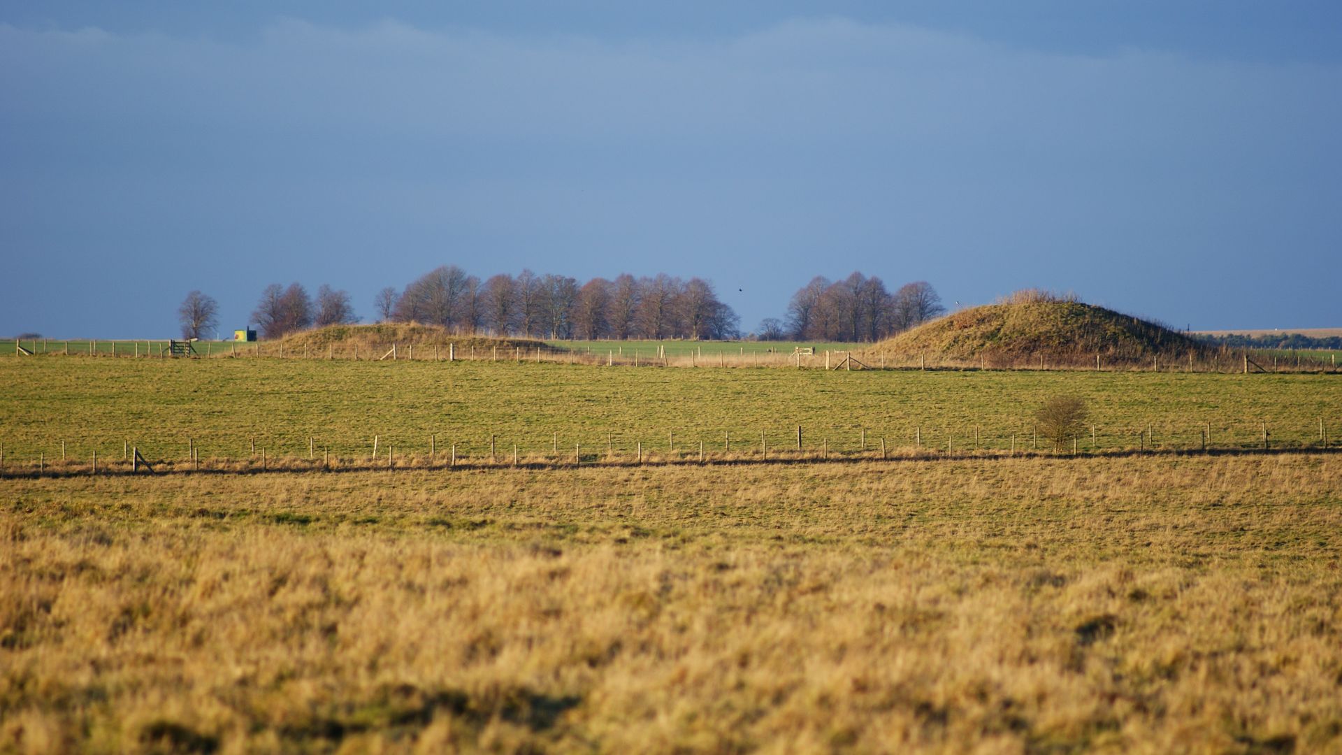
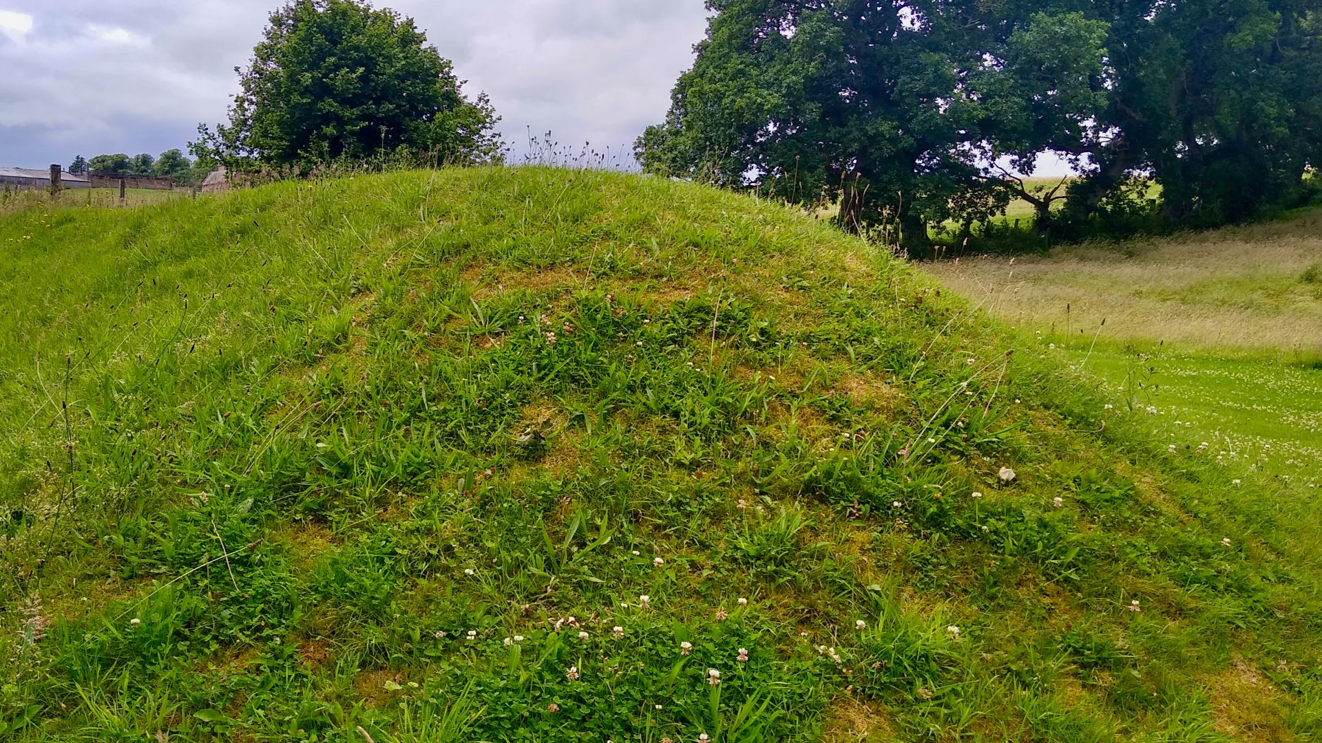
Why Some Tas Tepeler Sites Remain Undiscovered
Vegetation covers many Neolithic mounds, making them indistinguishable from natural hills to anyone walking past. Centuries of erosion smoothed artificial features while agricultural plowing scattered surface artifacts. Visual ground surveys miss structures buried beneath several meters of accumulated soil and windblown sediment.
 Peter Trimming, Wikimedia Commons
How Satellite Archaeology Detects Buried Archaeological Sites
Orbital sensors measure electromagnetic radiation reflected from Earth's surface at wavelengths invisible to the human eye. Buried stone foundations alter soil chemistry and moisture retention patterns. These differences create subtle variations in how ground surfaces absorb and reflect light captured by satellite cameras.

Space Archaeology Pioneer Sarah Parcak's Methods
Egyptologist Sarah Parcak developed techniques using NASA satellite imagery to locate hidden archaeological features. Her approach combines infrared photography with computer algorithms that highlight anomalies in soil composition. The methods successfully identified thousands of previously unknown sites across Egypt and beyond.
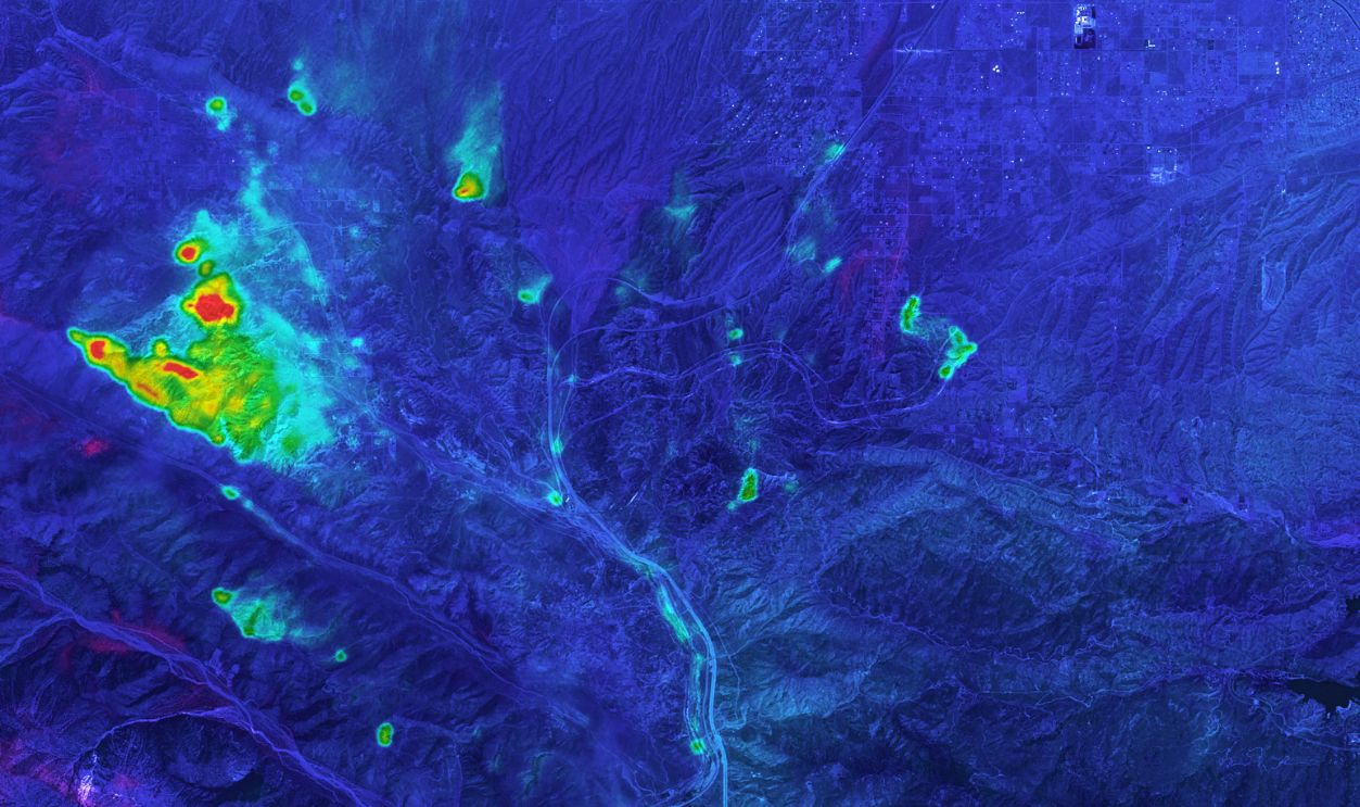
Infrared And Thermal Imaging From Space
Infrared cameras detect heat signatures rather than visible light wavelengths. Stone buried underground retains heat differently than the surrounding earth, creating temperature variations. Satellites equipped with thermal sensors capture these differences during specific times when contrast reaches maximum visibility.
 Pierre Markuse, Wikimedia Commons
Why Ancient Structures Show Up Differently In Satellite Images
Limestone foundations compact soil above them while blocking moisture penetration to lower layers. Plants growing over buried walls experience different water access than vegetation in the surrounding areas. These botanical stress patterns become visible in multispectral satellite photography as color variations.
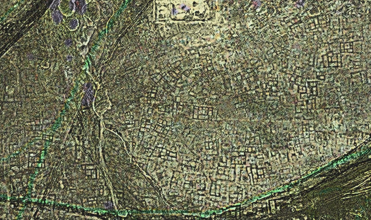
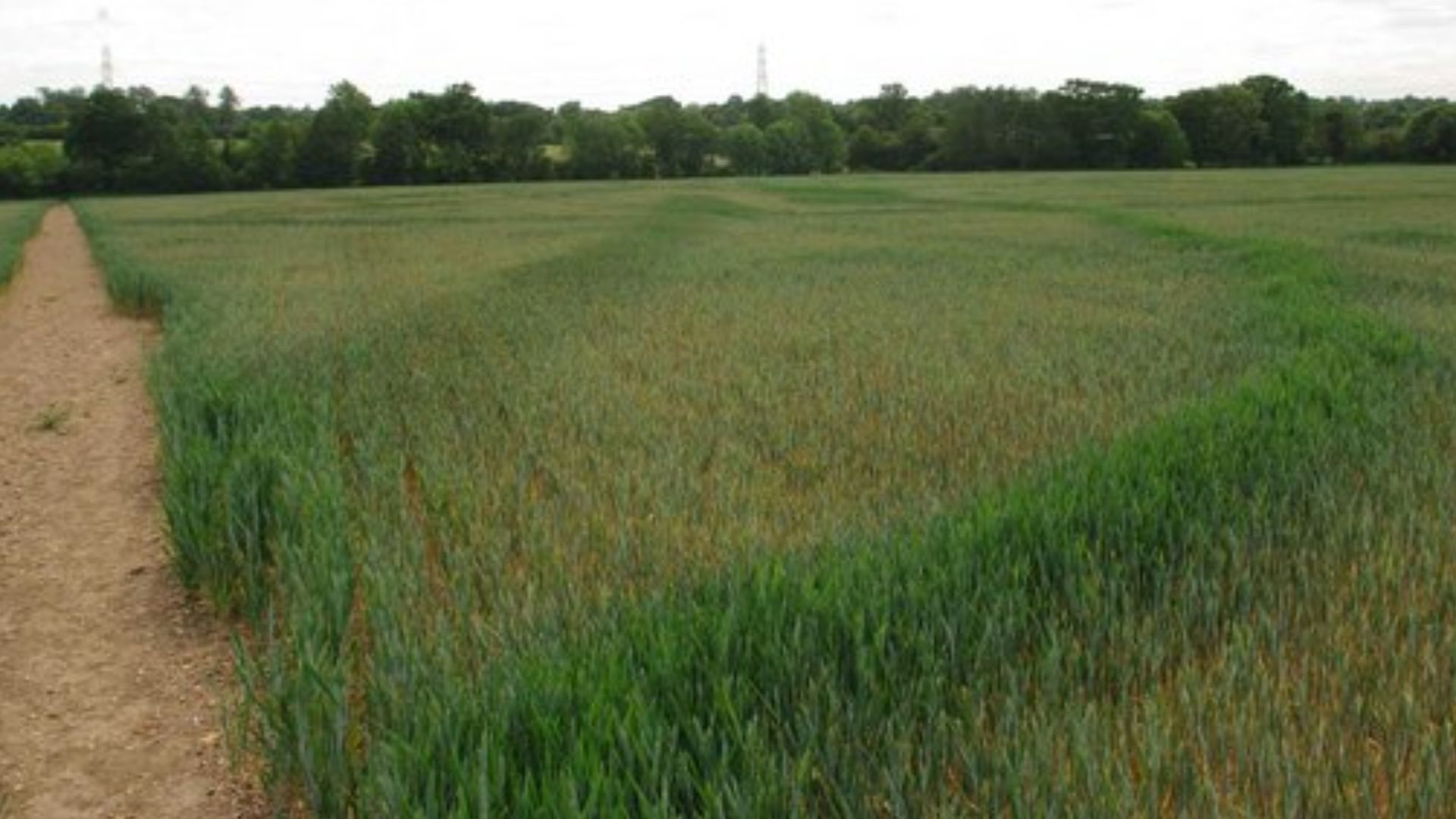
How Vegetation Patterns Reveal Buried Walls And Foundations
Crops and wild grasses grow stunted above stone features that restrict root penetration and water movement. Conversely, plants flourish along ancient ditches where organic material accumulated over centuries. Archaeologists call these "crop marks" because they appear most dramatically in agricultural fields.
 Glyn Baker , Wikimedia Commons
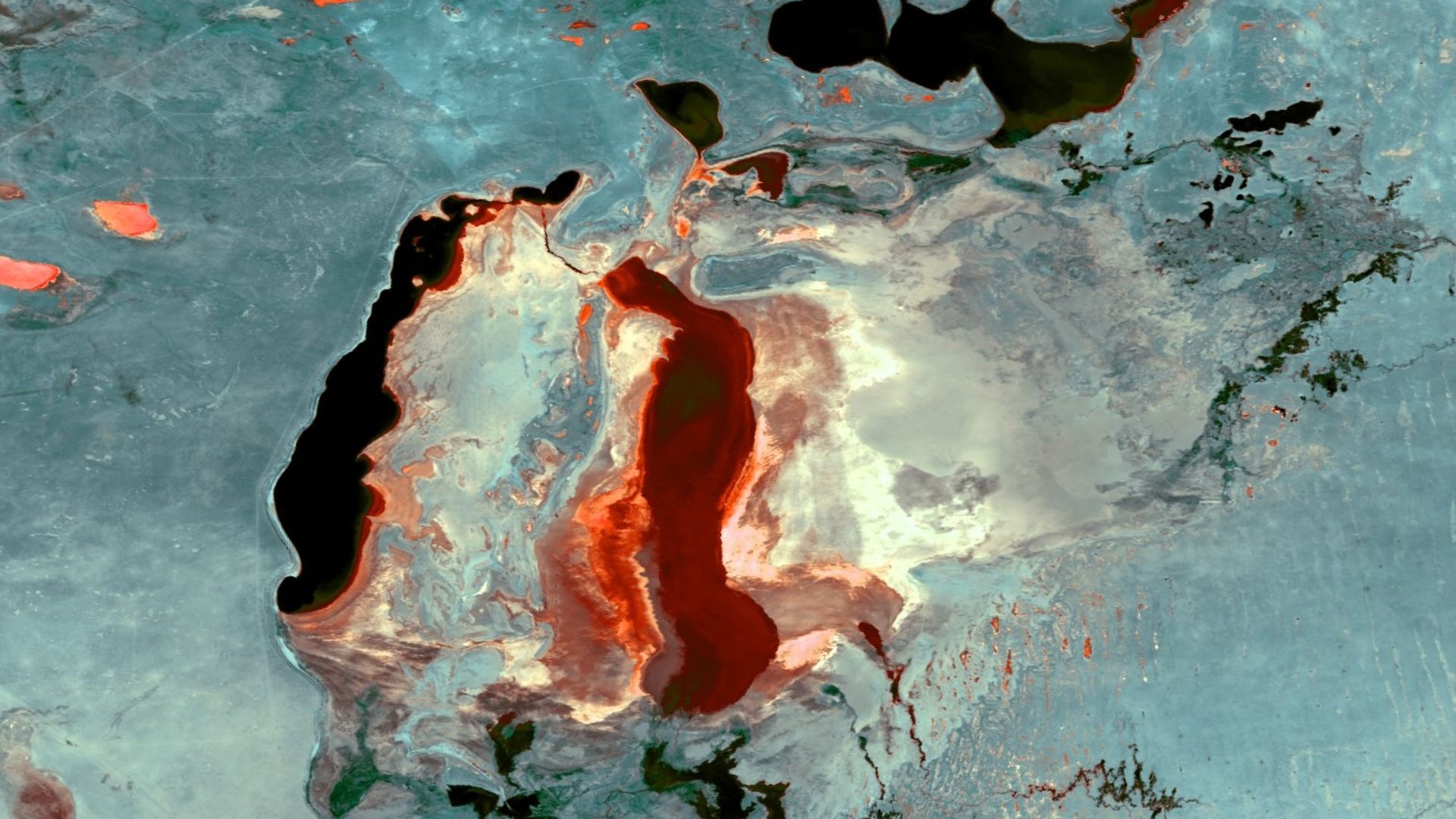
Multispectral Satellite Imagery Analysis
Satellites capture data across numerous electromagnetic spectrum bands beyond visible light. Researchers compare near-infrared, thermal, and visible wavelengths to identify archaeological features. Computer processing enhances subtle contrasts invisible in any single wavelength, revealing geometric patterns characteristic of human construction.
 NOAASatellites, Wikimedia Commons
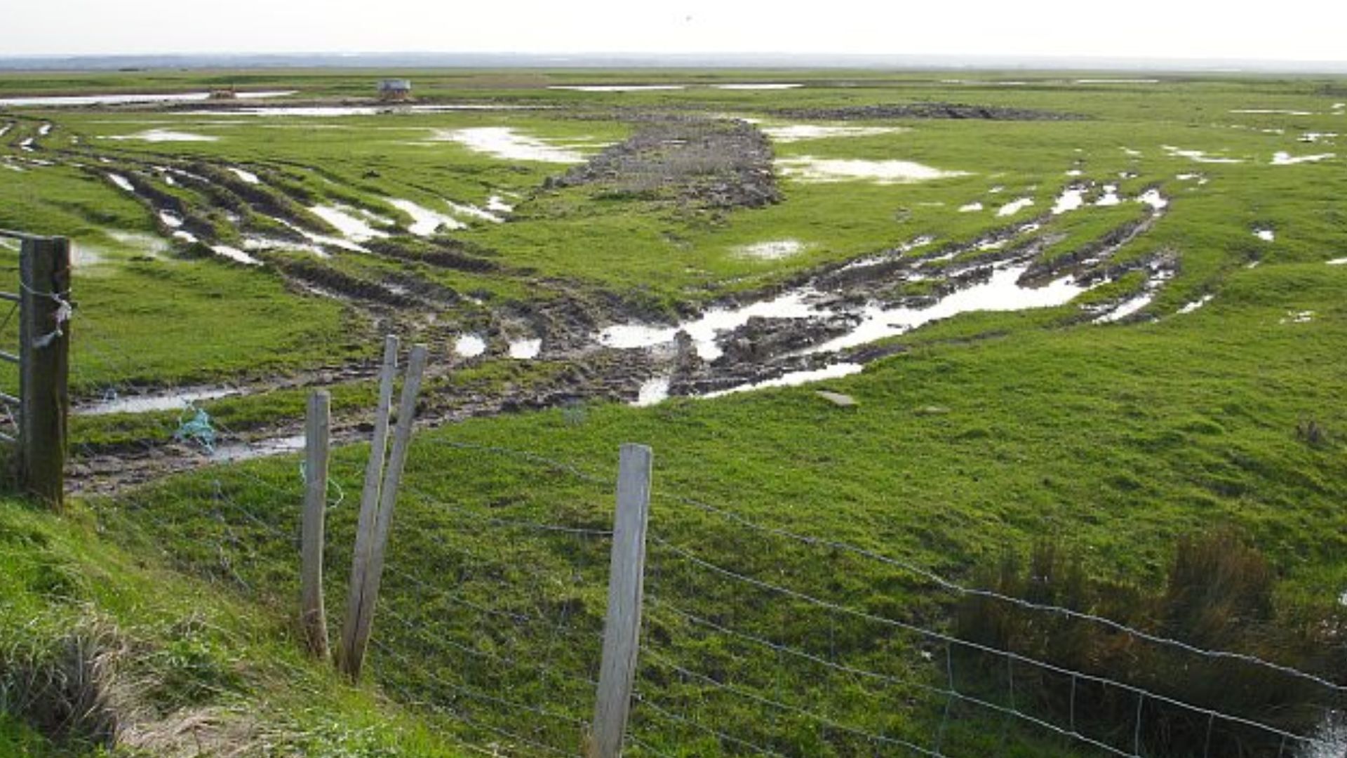
Why Wet Winter Seasons Provide Better Satellite Data
Moisture amplifies the contrast between buried stone and the surrounding soil matrix. Winter rains saturate the ground, whereas stone features drain more quickly than earth. Satellite passes during late winter capture peak differential moisture retention that highlights architectural remains most clearly.
 Penny Mayes, Wikimedia Commons
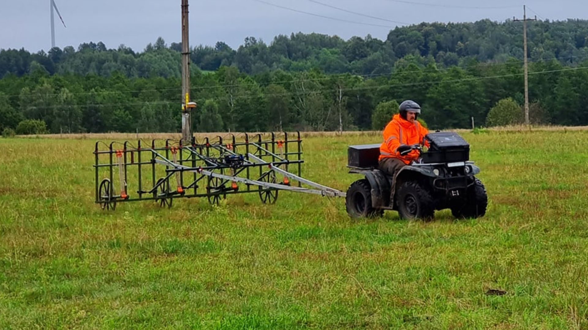
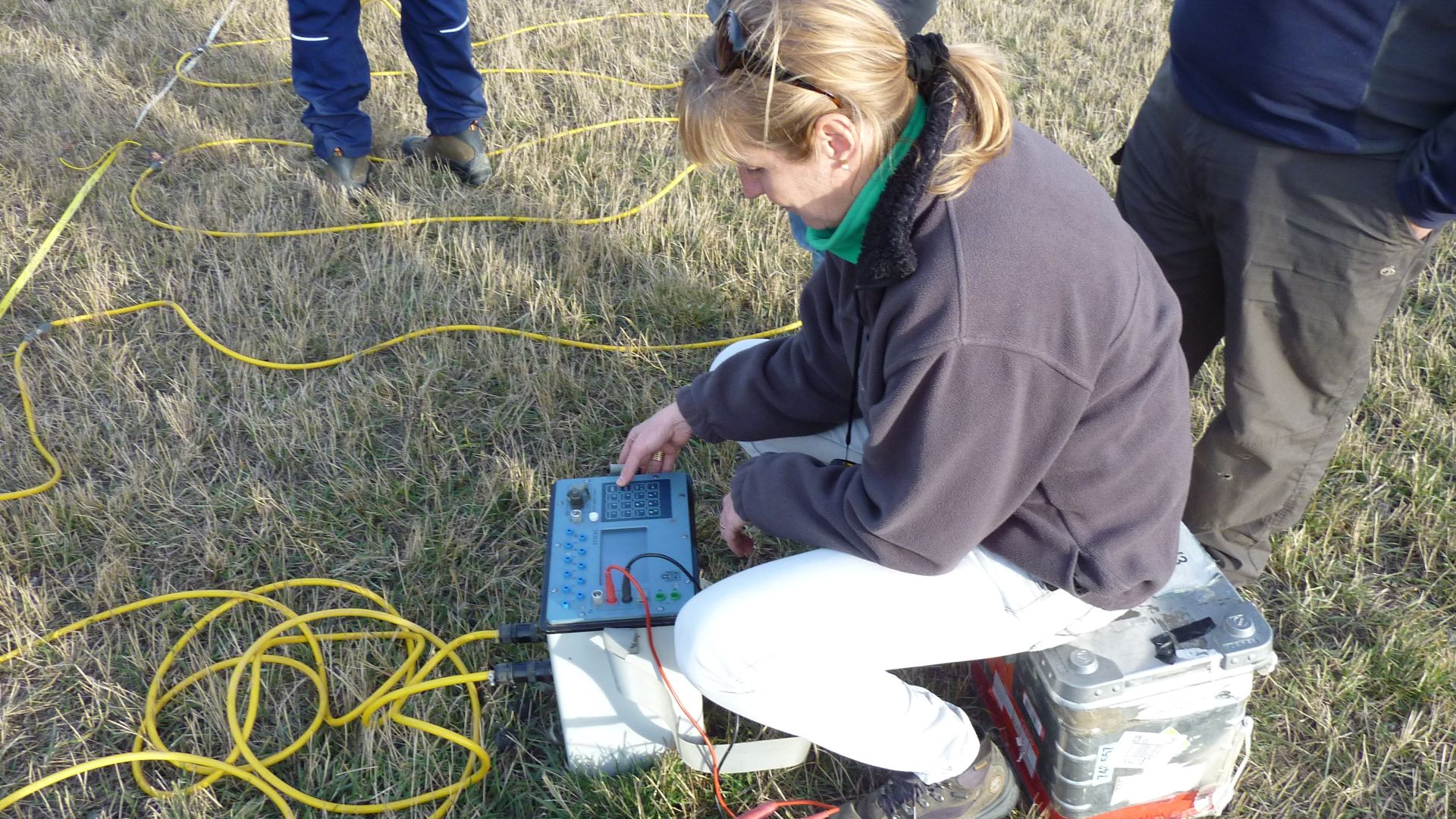
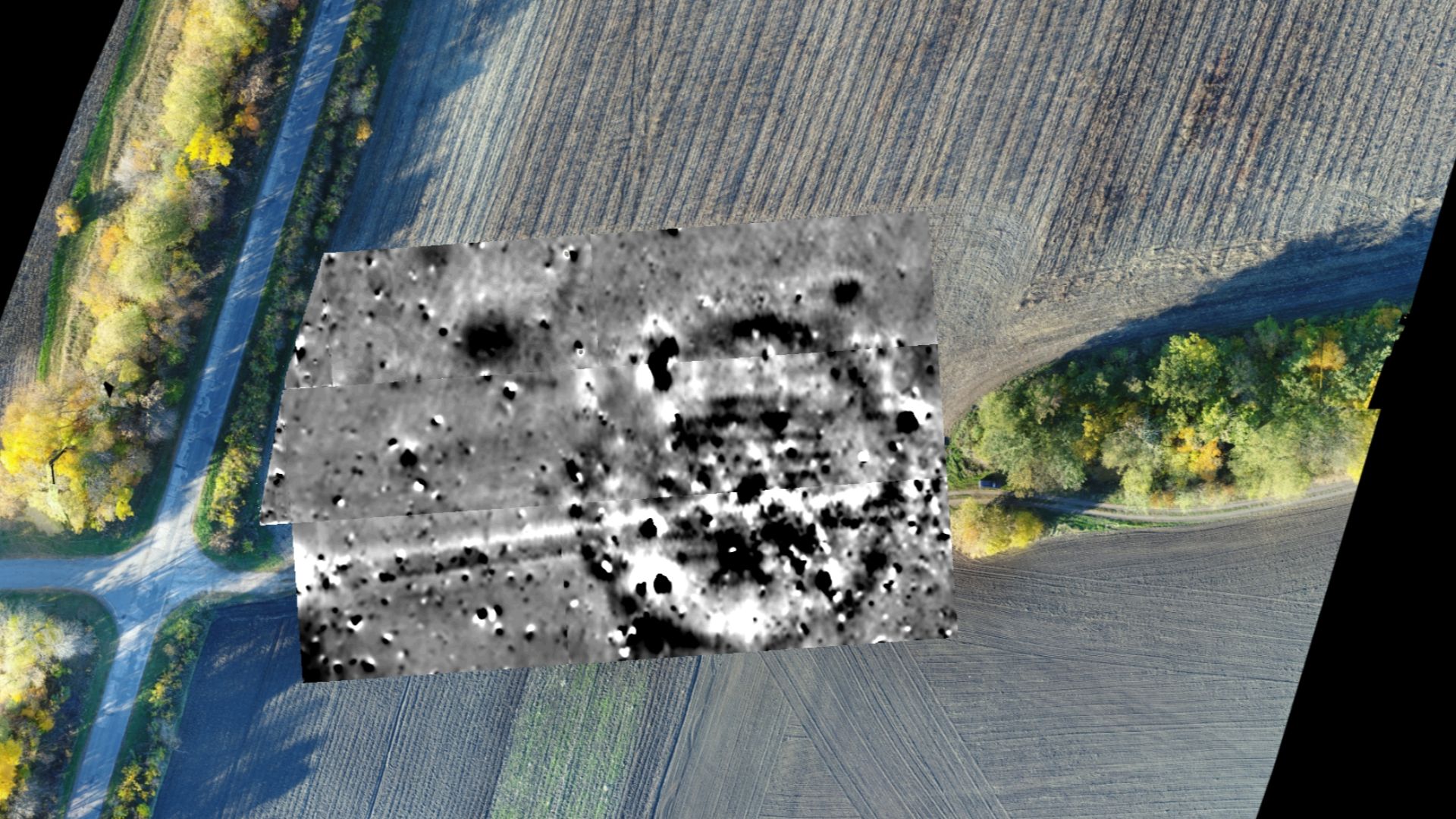
Geomagnetic Surveys Revealing Structures Beneath The Surface
Magnetometers measure tiny variations in Earth's magnetic field caused by buried materials. Stone structures, fire-altered clay, and filled ditches create detectable magnetic anomalies. Survey teams walk systematic grids while instruments record measurements that produce underground maps without excavation.
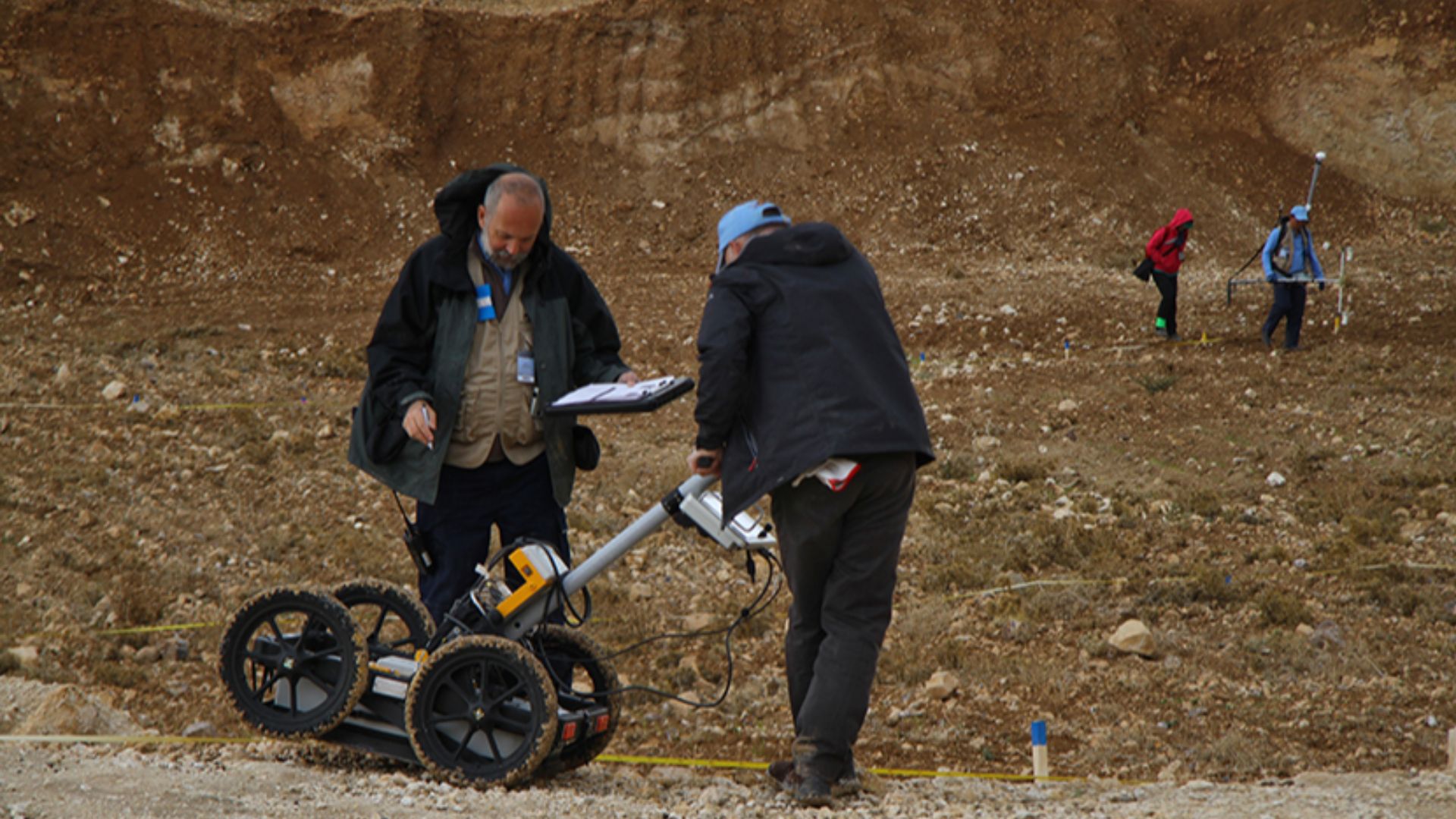
Ground-Penetrating Radar (GPR) Technology
GPR equipment transmits radio waves into the ground and records echoes bouncing back from subsurface features. Different materials reflect signals at varying speeds and intensities. Technicians analyze return patterns to generate cross-sectional images showing buried walls, floors, and voids.
 The Official CTBTO Photostream, Wikimedia Commons
LiDAR Scanning For Detecting Landscape Anomalies
LiDAR uses laser pulses to measure precise distances between aircraft and ground surfaces. The technology penetrates the forest canopy to reveal the topography hidden beneath vegetation. Subtle elevation changes indicate buried structures and leveled platforms invisible from ground level or conventional aerial photography.
 DLR German Aerospace Center, Wikimedia Commons
How Remote Sensing Identifies Archaeological Proxies
Archaeological proxies are indirect indicators of human activity rather than artifacts themselves. Altered soil chemistry, vegetation stress, and topographic irregularities all signal potential sites. Remote sensing detects these proxies across vast areas faster than traditional pedestrian surveys could cover.
 Yellowstone National Park, Wikimedia Commons
Geophysical Anomalies Indicating Unexcavated Structures
Instruments detect deviations from expected readings in magnetism or density measurements. Rectangular patterns of anomalies suggest walls, while circular formations indicate pits or postholes. These signatures allow archaeologists to map entire buried buildings before removing a single shovelful of dirt.
 The Official CTBTO Photostream, Wikimedia Commons
The Tas Tepeler Project's Systematic Survey Approach
Turkey's coordinated research program combines satellite analysis with ground-based geophysical surveys across Sanliurfa province. Teams prioritize areas showing multiple indicators—thermal anomalies, crop marks, magnetic signatures—for detailed investigation. This methodology identifies high-probability targets while documenting the full archaeological terrain.
Future Excavation Targets Based On Geophysical Data
Current geomagnetic maps show numerous unexcavated anomalies exhibiting signatures consistent with T-pillar enclosures. Thermal imaging highlights additional zones requiring ground-truthing to confirm archaeological significance. Funding and personnel limitations mean many documented targets await investigation for years or decades.
 KseniiaBondar, Wikimedia Commons


.jpg)