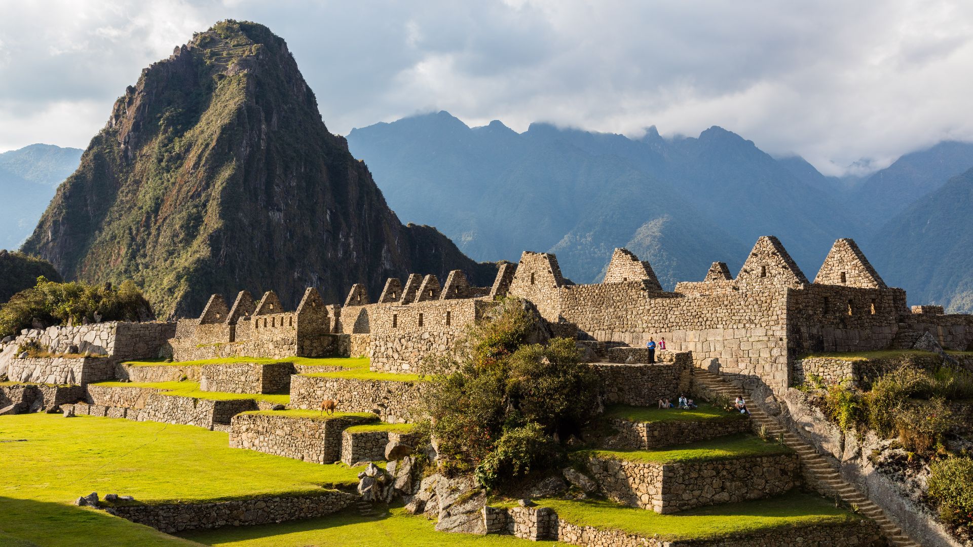
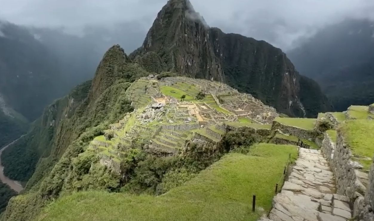
Where Forest Meets Mystery
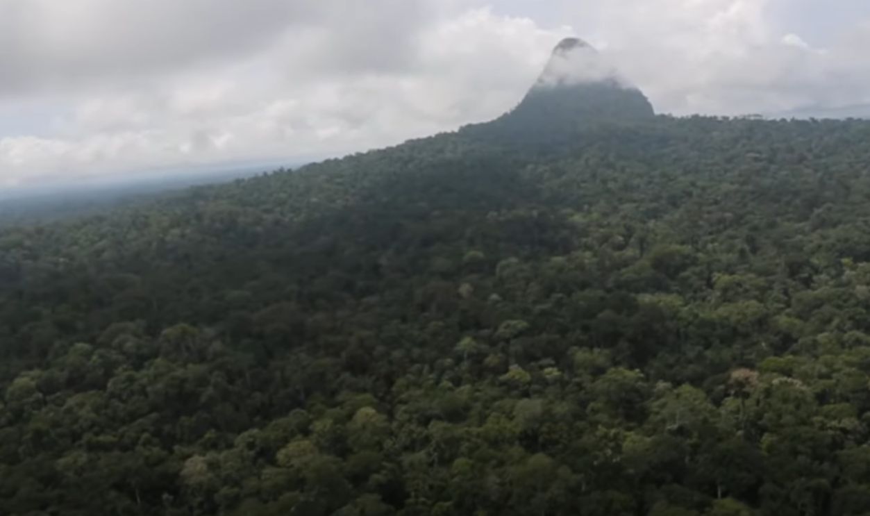
Rising above the Amazon’s green canopy is a formation so sharp it resembles a forgotten monument. The closer the researchers looked, the more questions emerged. And the locals had most of the answers.
A Peak That Evaded Every Map
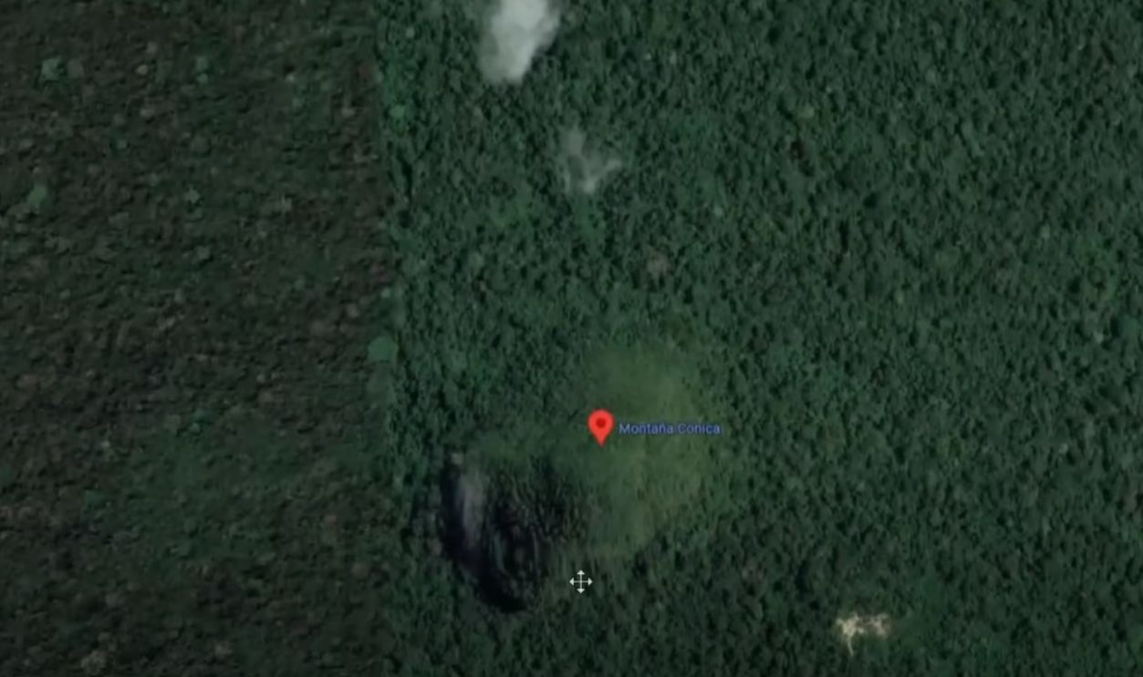
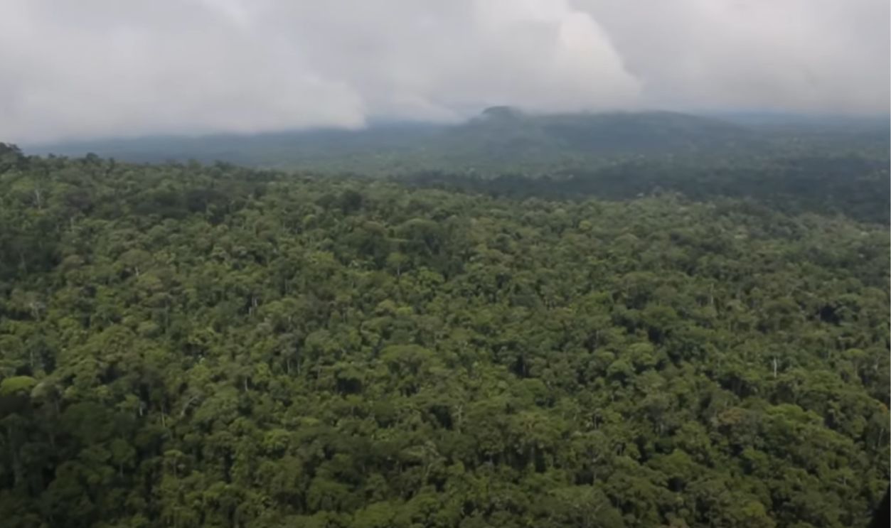
For centuries, Cerro El Cono remained absent from official maps. Located inside Peru's Sierra del Divisor, it sat shielded by dense rainforest and sheer remoteness. Explorers and surveyors overlooked it—not out of doubt, but because they simply couldn’t reach it.
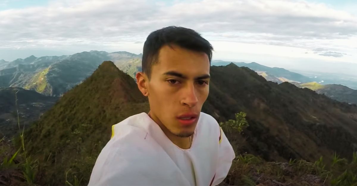
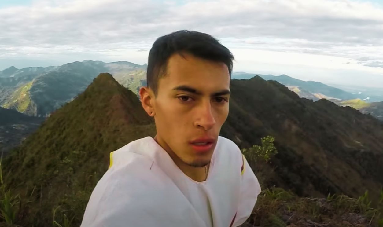
 Enigmatic Pyramid in the AMAZON protected by Indigenous Tribes (Cerro el Cono) by Dan Xuisoko
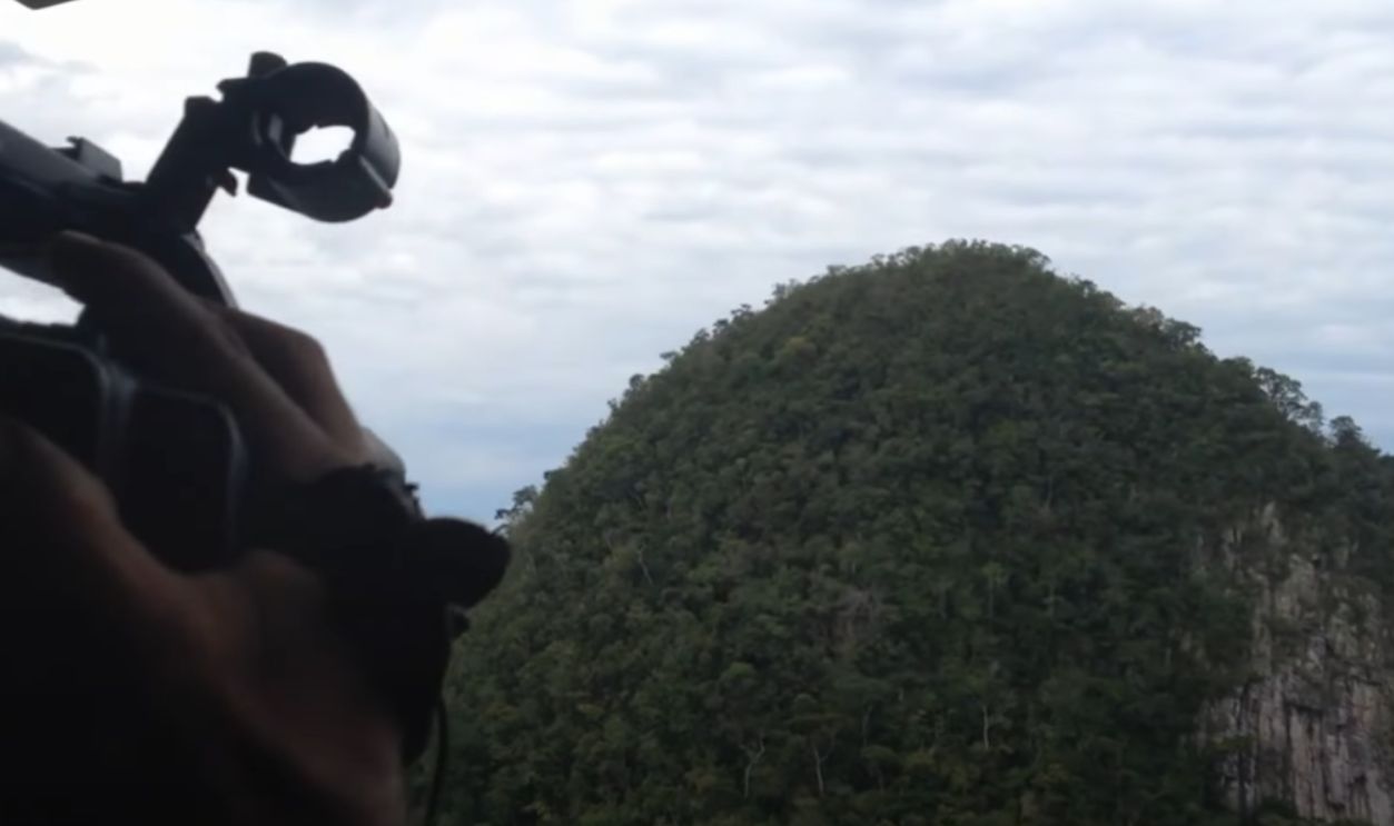
Its Shape Appears From The Sky
When satellite imagery became accessible, an unexpected geometric form emerged from Peru’s canopy. A near-perfect pyramid stood alone among uneven jungle terrain. Its sharp angles and elevation raised immediate interest, especially from those scanning Amazonia for ancient features hidden beneath vegetation.
 Enigmatic Pyramid in the AMAZON protected by Indigenous Tribes (Cerro el Cono) by Dan Xuisoko
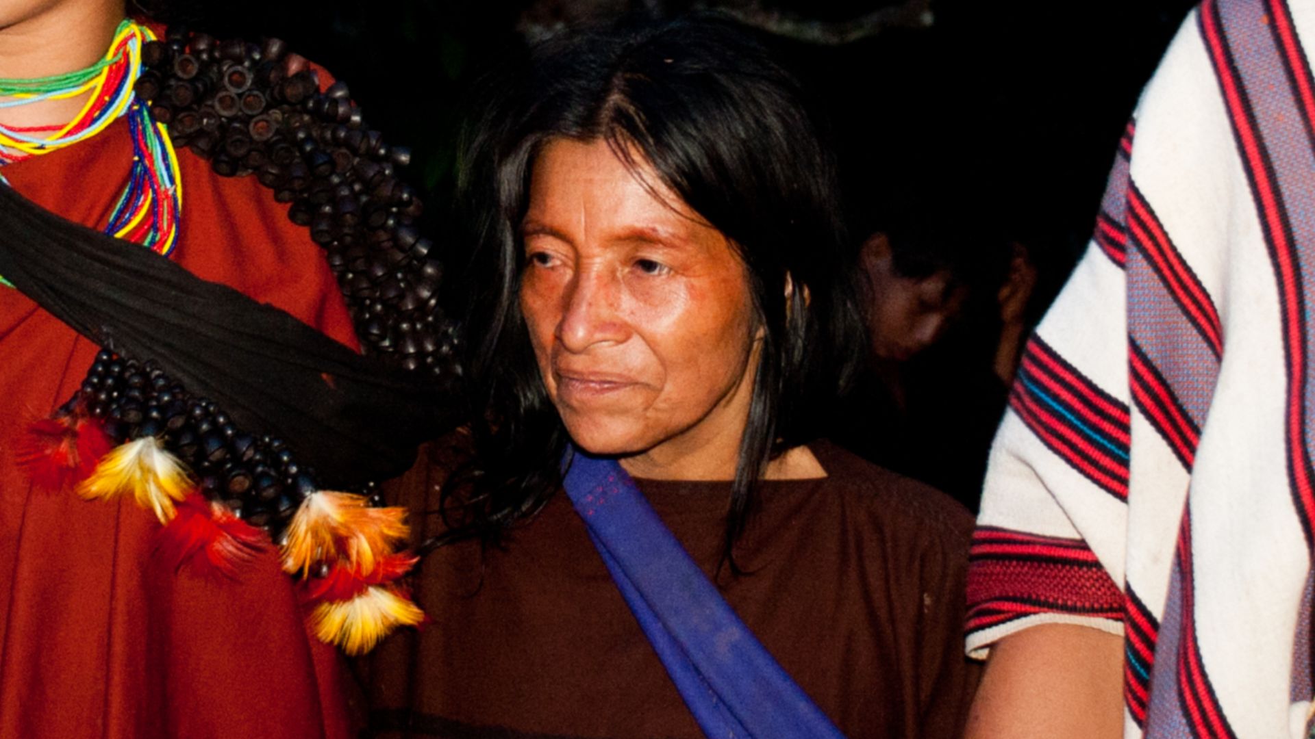
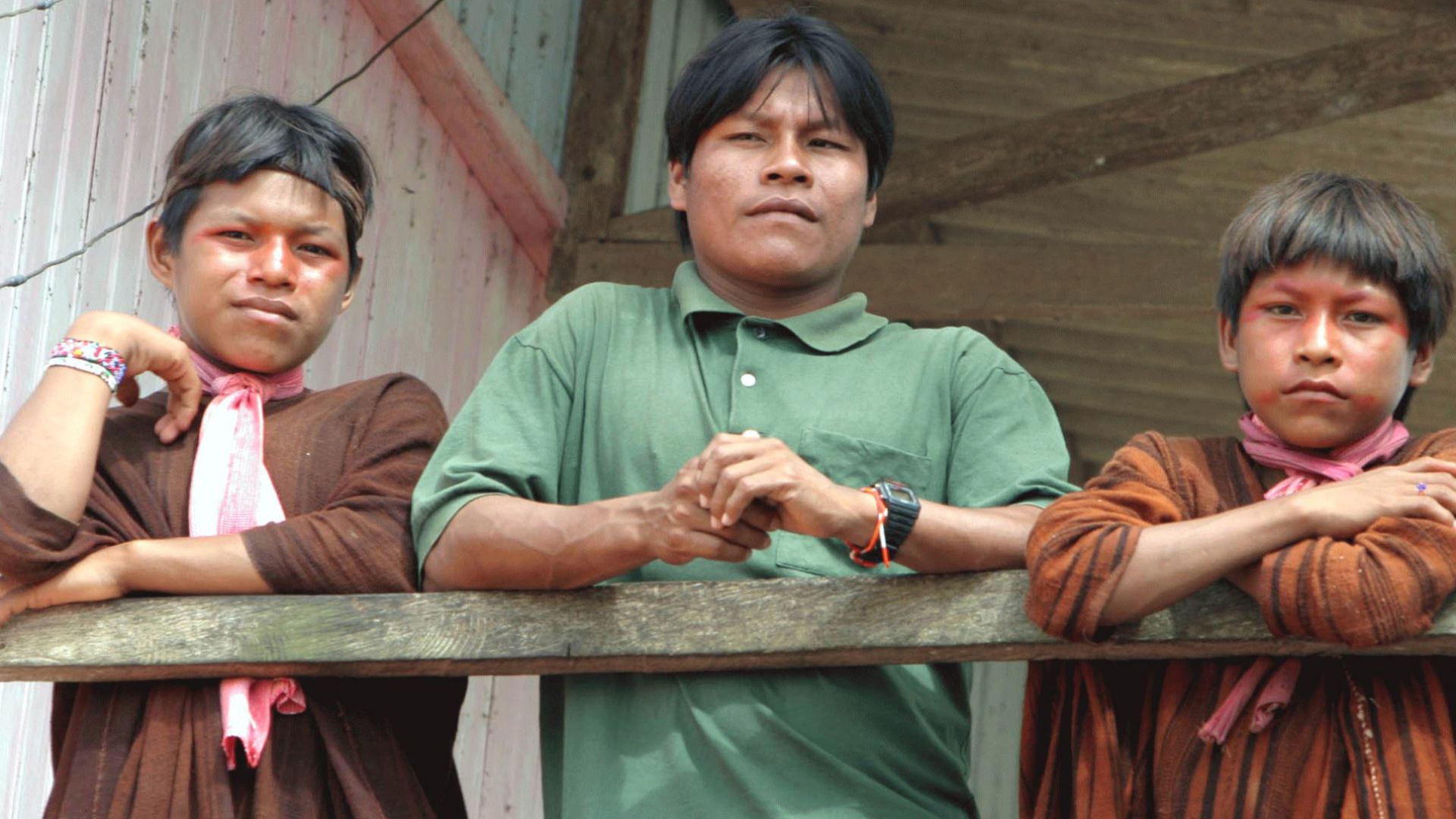
The Local Communities Always Knew
Long before aerial scans, the Matses and Ashaninka recognized the peak. They spoke of a spirit that lived within it, describing its slopes as a place of power. Their oral traditions portrayed the mountain not as a geographical feature but as a living presence embedded in cultural memory.
 Ministério da Cultura, Wikimedia Commons
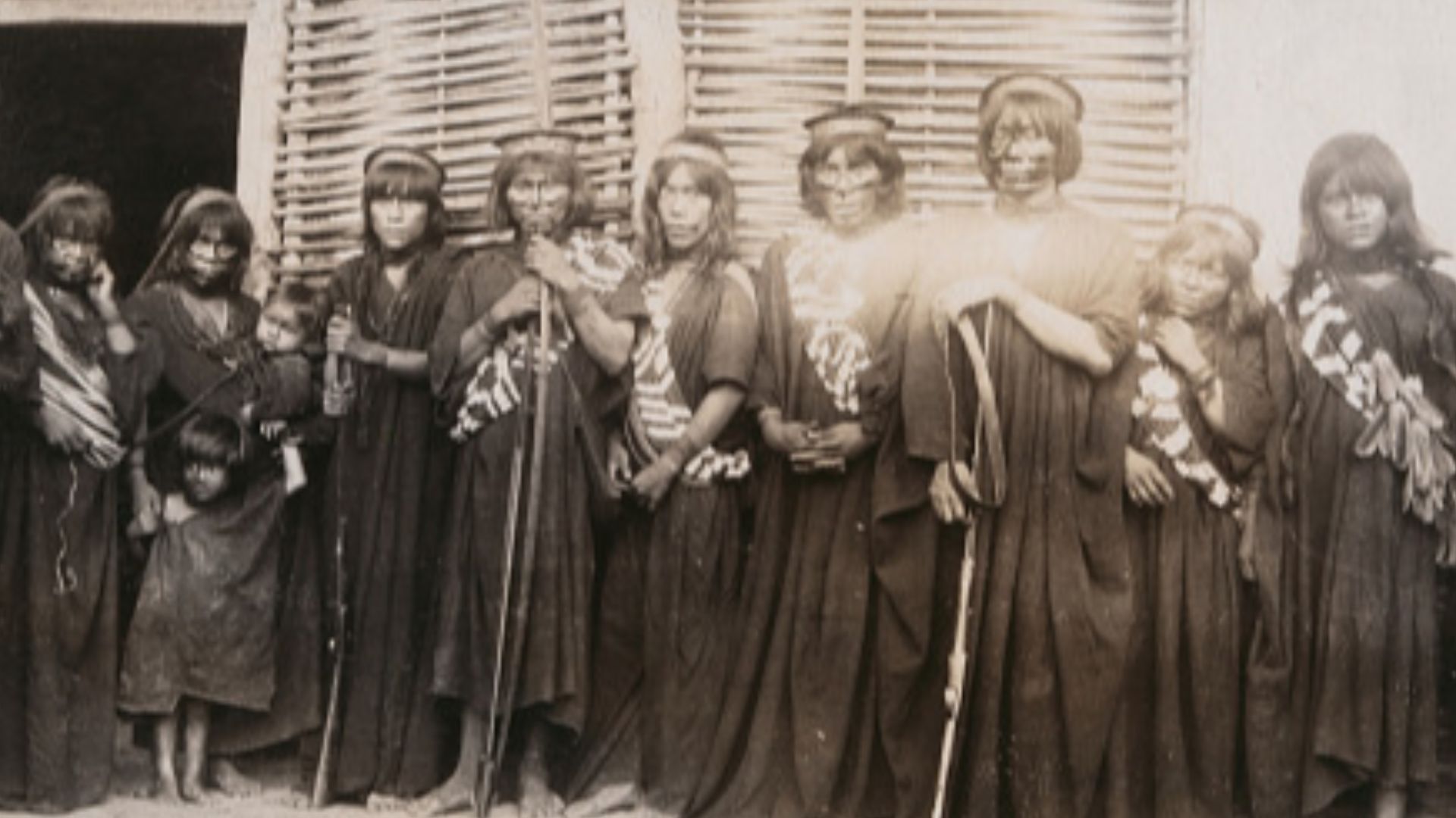
The Local Communities Always Knew (Cont.)
These communities pass down knowledge through oral storytelling, not written records, so references to the mountain appear in chants and seasonal migration tales. Elders identify the peak as a territorial marker and spiritual boundary between the physical world and beyond.
 Stahl, Ferdinand Anthony, Wikimedia Commons
Western Science Arrives Late
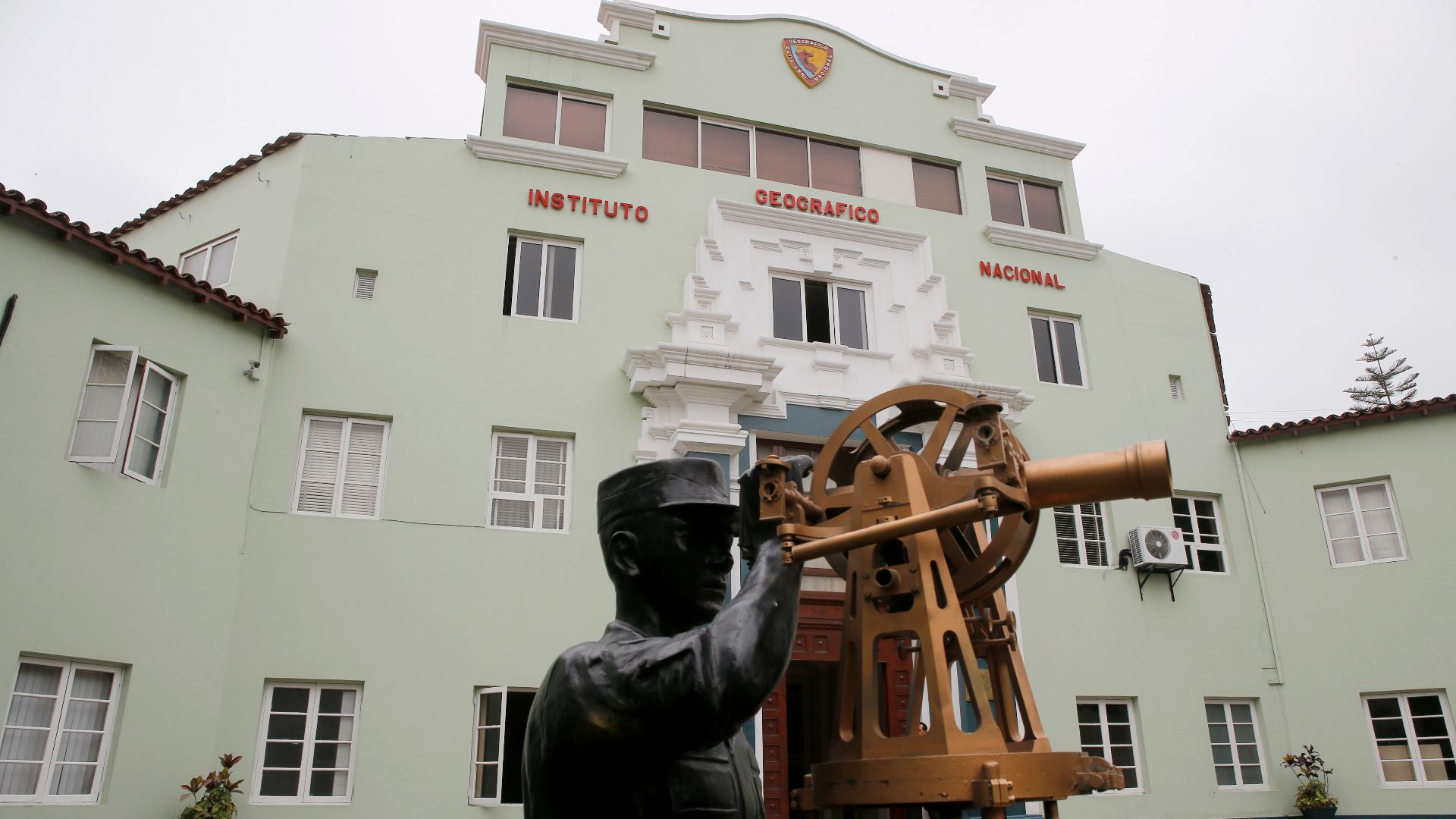
In the early 2000s, scientists finally began acknowledging Cerro El Cono as its location became traceable with the improvement of GPS and aerial survey tools. However, the forbidding terrain discouraged close approach, and local reverence for the mountain further reinforced the need for respectful distance.
Western Science Arrives Late (Cont.)
That’s why most early research remained remote. Scientists relied on satellite imagery and elevation data to study the mountain’s symmetry. Although Peru’s National Geographic Institute documented its location, conservation laws and Indigenous protocols continued to restrict on-site access and discouraged direct exploration of the sacred area.
 Galeria del Ministerio de Defensa del Perú, Wikimedia Commons
Early Accounts Faced Dismissal
19th-century travelers mentioned a mountain with a “singular profile” in field notes and letters. These included rubber traders and Catholic missionaries. However, without photos or coordinates, scholars classified such accounts as rumors. The rainforest had buried the story—and the shape—from the formal record.
 Enigmatic Pyramid in the AMAZON protected by Indigenous Tribes (Cerro el Cono) by Dan Xuisoko
A Cultural Divide Over Meaning
To scientists, Cerro El Cono was a natural formation with a unique symmetry. To locals, it was sacred. Some viewed it as an "Apu"—a protector mountain spirit common in Andean and Amazonian belief systems. What science saw in structure, the community saw in spirit.
 Enigmatic Pyramid in the AMAZON protected by Indigenous Tribes (Cerro el Cono) by Dan Xuisoko
A Cultural Divide Over Meaning (Cont.)
Moreover, anthropologists studying Andean cosmology emphasize that Apus are viewed not as symbols but as living beings. This belief also applies to Cerro El Cono, where the spiritual presence and territorial identity are inseparable, and they shape how communities approach conservation and continued respect for the mountain.
 Enigmatic Pyramid in the AMAZON protected by Indigenous Tribes (Cerro el Cono) by Dan Xuisoko
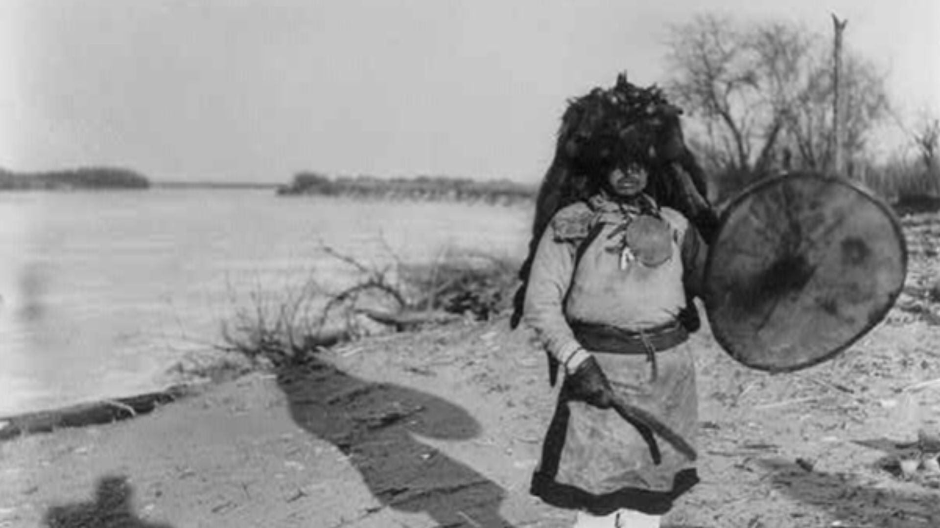
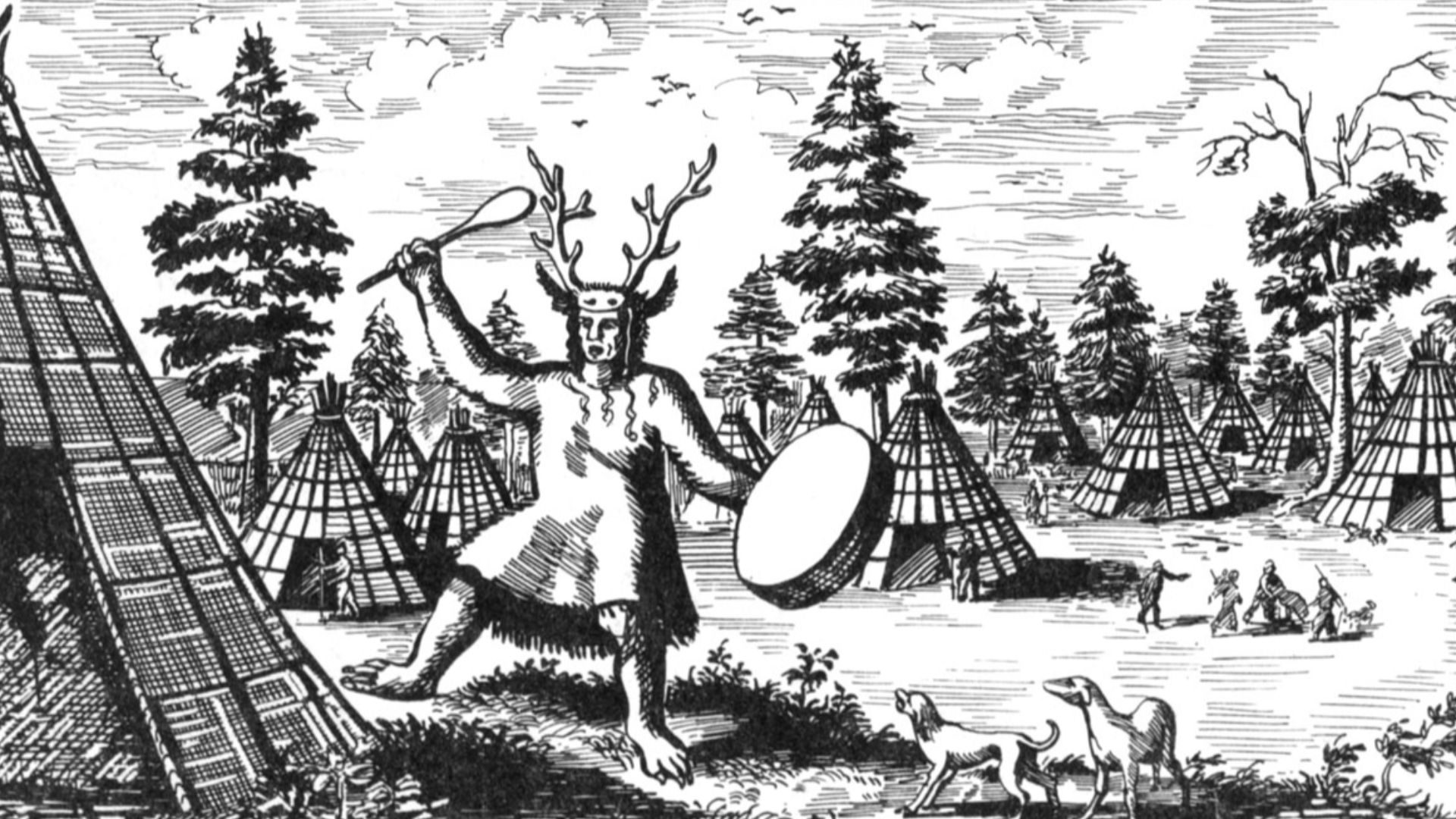
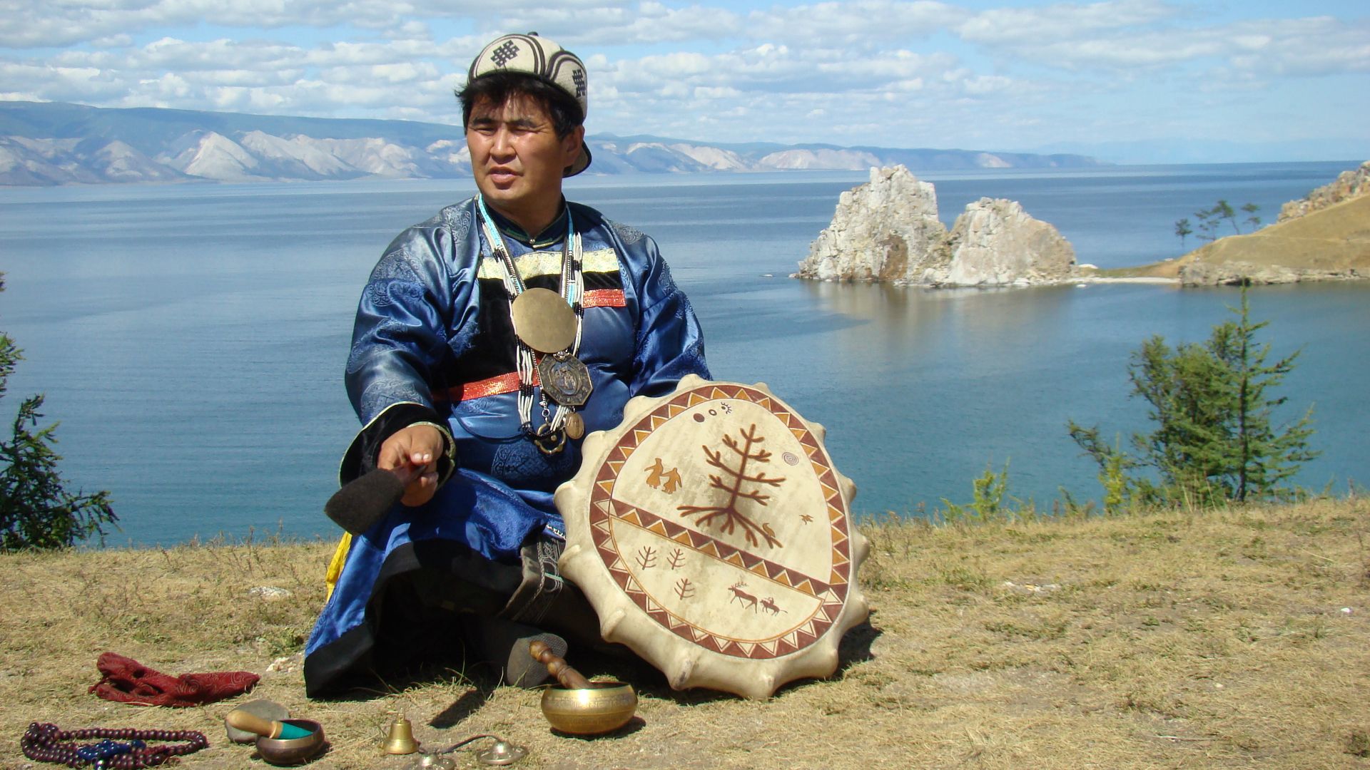
Spirits Are Said To Dwell Within
Among the Ashaninka and Matses, Cerro El Cono is believed to be home to spiritual entities. During rituals, shamans call upon these beings for healing or guidance. Stories passed through generations speak of voices from the mountain that reveal wisdom in moments of deep silence.
 Jackson, William Henry, 1843-1942, Wikimedia Commons
Spirits Are Said To Dwell Within (Cont.)
These spiritual presences are said to inhabit caves and stone recesses near the summit. The Ashaninka and Matses describe them as powerful forces acknowledged through the ceremony. While some reports mention visions or sensations, these are part of the oral tradition and have not been verified through empirical research.
 Unknown authorUnknown author, Wikimedia Commons
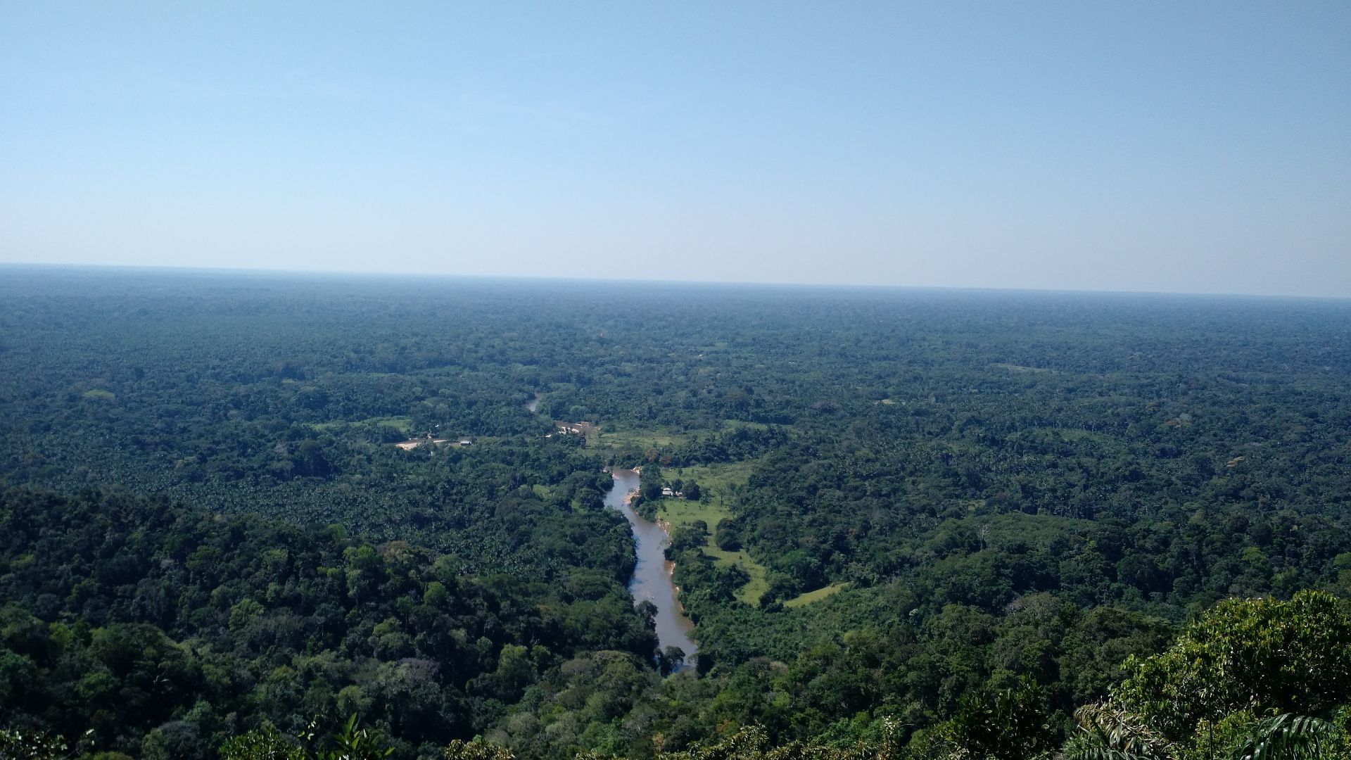
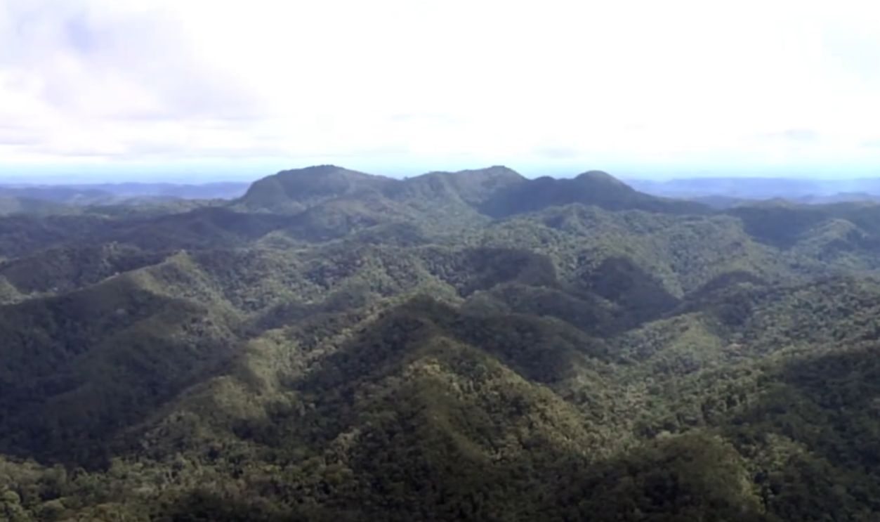
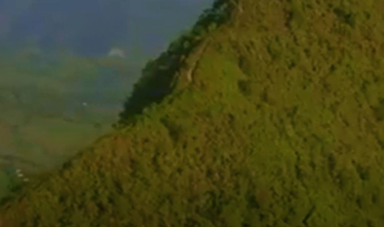
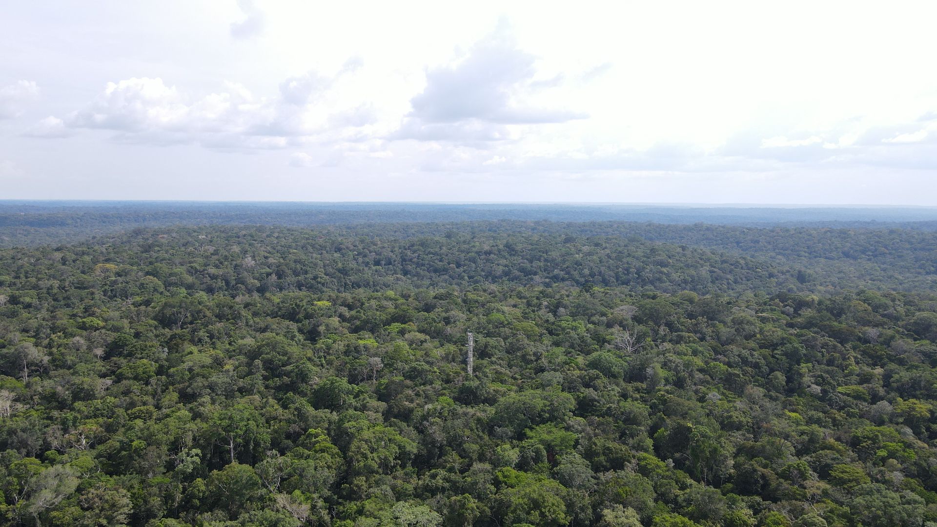
The Rainforest Acted As A Shield
For decades, the dense rainforest canopy obscured Cerro El Cono from aerial detection. Its slopes blended with vegetation, and low-flying aircraft offered no clear view. The remote location in the Sierra del Divisor meant that satellite imaging lacked the resolution to highlight its form accurately.
 Mário Broering, Wikimedia Commons
The Rainforest Acted As A Shield (Cont.)
It wasn’t until LiDAR scans and high-elevation drone footage were captured above 2,500 feet that the mountain’s pyramid shape became visible. Researchers estimated Cerro El Cono rises roughly 400 meters from base to summit, and the angles traced by imaging software showed immaculate geometric symmetry.
 David Monniaux, Wikimedia Commons
Flickers In The Night Sky
Local elders say they have seen faint, flashing lights above Cerro El Cono during full moons or solstices. No scientific observation has confirmed these events. While some suggest atmospheric causes, communities regard the lights as spiritual signals from the sacred mountain and its unseen forces.
Dreams Carry Warnings From The Peak
Shamans have long claimed that dreams involving Cerro El Cono often precede communal hardship, as illness or social unrest tends to follow. These visions are typically vivid and symbolic, and they are interpreted not as coincidence but as deliberate guidance from the spirit of the mountain.
 Arkady Zarubin, Wikimedia Commons
Translation Errors Erased The Name
In colonial records, the mountain’s Indigenous names were misheard or dismissed entirely. Missionaries substituted Spanish descriptors like "El Cono" without documenting the native terms. As a result, the cultural context was stripped from the name used in today’s maps and reports.

Sacred Despite The Absence Of Altars
Cerro El Cono lacks carved stones or formal temples, which are commonly seen at other sacred Andean sites. However, reverence remains strong. Locals avoid casual approaches to the mountain, and rituals are performed at a distance to respect an unseen boundary between the sacred and the everyday.
 Diego Delso, Wikimedia Commons
Digital Tools Amplified The Mystery
As users scanned the Amazon basin on Google Earth, a sharp and unnatural shape emerged—one that refused to blend with the forest. Soon, amateur researchers flagged it online. Cerro El Cono’s angular form caught global attention by sparking even more speculations.

Digital Tools Amplified The Mystery (Cont.)
The coordinates soon appeared on open-source mapping forums, where enthusiasts traced the angles and estimated the base width at roughly 250 meters. However, institutional researchers expressed caution, as terrain shadows and natural contours could easily distort satellite views and exaggerate the mountain’s apparent geometric precision.

The “Lost Pyramid” Label Went Viral
By 2016, images of the peak spread quickly across social media and mystery-themed blogs. Many described it as a “lost pyramid” or “Amazonian monument,” though few provided verifiable coordinates. Academic publications or peer-reviewed studies didn’t mirror this surge of public interest.

Photos Sparked Doubt, Then Silence
Circulating images often lacked clear metadata or context, and some were digitally altered. Geographers and field researchers hesitated to cite them. With little verified fieldwork to support the visuals, most professional institutions opted to remain silent rather than endorse unconfirmed claims.
 Oak Ridge National Laboratory, Wikimedia Commons
Legal Barriers Block Expeditions
Cerro El Cono lies within Sierra del Divisor National Park and adjacent Indigenous reserves. Gaining entry requires authorization from Peru’s National Service of Natural Protected Areas (SERNANP) and consent from local tribal councils. This multistep approval process ensures protection but limits spontaneous or rapid exploration.
Legal Barriers Block Expeditions (Cont.)
Research teams must also coordinate with regional authorities in Ucayali and Loreto, depending on access points. Environmental impact assessments are typically required before fieldwork begins. These layers of regulation reflect conservation priorities but create delays, especially for international institutions seeking to launch preliminary expeditions.
 Tadd and Debbie Ottman., Wikimedia Commons
Geologists Rejected Man-Made Claims
Volcanologists and structural geologists who reviewed available topographic scans identified the peak as a likely volcanic plug. Formed from solidified magma, such formations can erode into symmetrical shapes. Their findings contradicted online theories of lost civilizations or it being a man-made architecture.
 Qfl247 (talk) (Transferred by Citypeek/Original uploaded by Qfl247), Wikimedia Commons
Predators Pass At Its Base
Camera trap studies in the Sierra del Divisor region show jaguars and giant armadillos frequenting trails near Cerro El Cono. These species, sensitive to human presence, indicate that the area remains majorly undisturbed, which adds to the mountain’s ecological and spiritual significance.
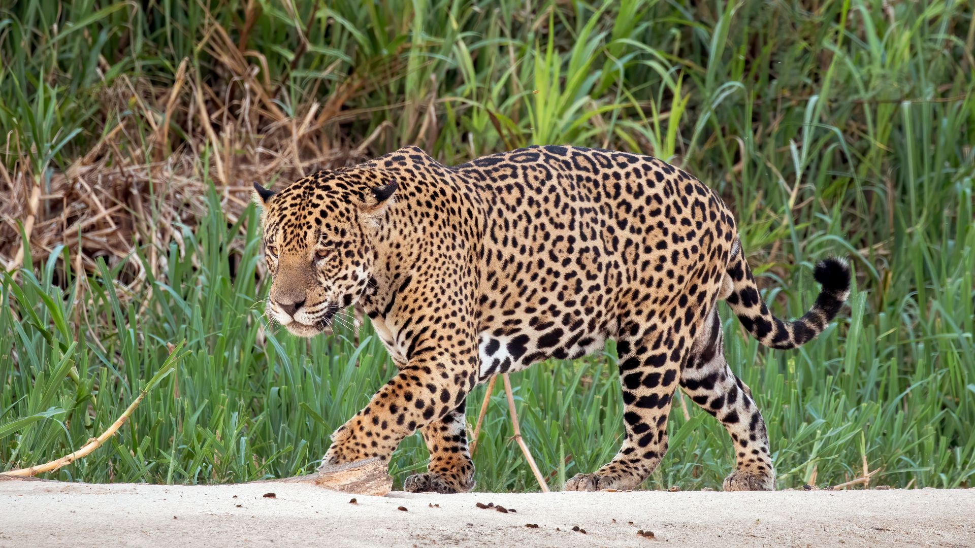 Charles J. Sharp, Wikimedia Commons
Sound Travels Differently There
Field ecologists have noted unusual echoes of bird calls near Cerro El Cono, possibly due to the mountain’s shape and dense forest. While these observations are intriguing, no formal acoustic studies have confirmed the presence of a natural chamber or its influence on sound behavior.
 Thayne Tuason, Wikimedia Commons
Climbing Paths Remain Undocumented
Despite drone footage and elevation data, no established ascent route even exists for Cerro El Cono. Dense root systems and sudden slope angles make climbs unpredictable. Attempts to approach the summit have often stopped short due to weather and logistical constraints.
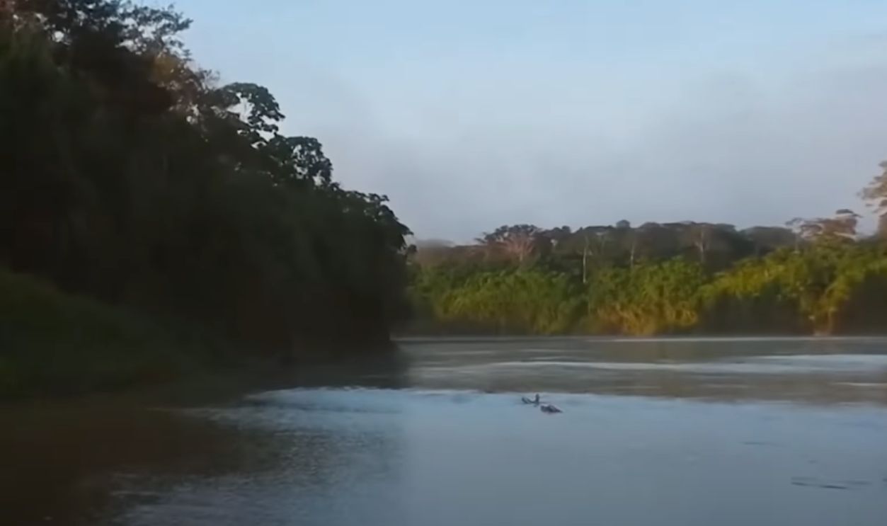
 Sobrevuelo Sierra del Divisor by CEDIA Peru
Fire History At The Summit Remains Unclear
Although no data confirms that Cerro El Cono’s summit has remained untouched by forest fires, its microclimate may help reduce the risk. Fire distribution maps indicate burns across eastern Peru, but none specifically verify whether this peak has experienced fire since the 1990s.
 Mystery Pyramid Discovered in the Amazon – What Lies Behind This Ancient Structure? by Dailygalaxy
Inaccessibility Prevented Looting
Unlike other sacred sites in Latin America, Cerro El Cono shows no signs of looting or illegal excavation as well. Its isolation—requiring days of travel by river and foot—makes unauthorized entry extremely difficult. This remoteness has likely preserved the area’s integrity for both researchers and locals.
 Enigmatic Pyramid in the AMAZON protected by Indigenous Tribes (Cerro el Cono) by Dan Xuisoko
Soil Around The Peak Holds Clues
Soil compaction testing in forest clearings around the base revealed dense layers in circular patterns. While some archaeologists hypothesize these could indicate past gathering activity, no tools or confirming evidence have been found. Suggestions of ritual use also remain speculative and unverified at this stage.
 United States Air Force, MSgt. Rickie D. Bickle, Wikimedia Commons
No Signs Of Ancient Settlements Found
Repeated LiDAR and drone surveys over Cerro El Cono’s surroundings have revealed no evidence of ancient structures. And researchers found no remnants of foundations or ceremonial plazas, which are commonly associated with significant archaeological sites across Peru’s highland and lowland zones.
Satellite Passes Confirm Isolation
Sequential satellite imagery from the past two decades shows no modern trails or soil disturbance near Cerro El Cono. The surrounding terrain remains largely intact, and its preservation reinforces assessments that no long-term habitation or agricultural settlement ever formed around the peak.
 MODIS Land Rapid Response Team, NASA GSFC, Wikimedia Commons
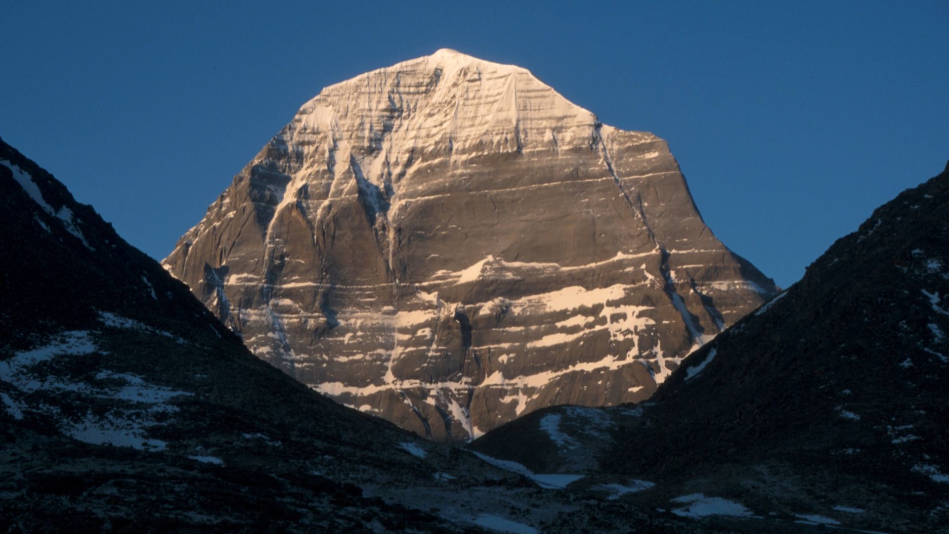
Other Peaks Share Similar Shapes
Other pyramid-like formations include Pico Cao Grande in Sao Tome and Mount Kailash in Tibet. These peaks, though naturally formed, carry spiritual significance. Like Cerro El Cono, their distinct shapes have inspired religious reverence and debates about their role in cultural memory.
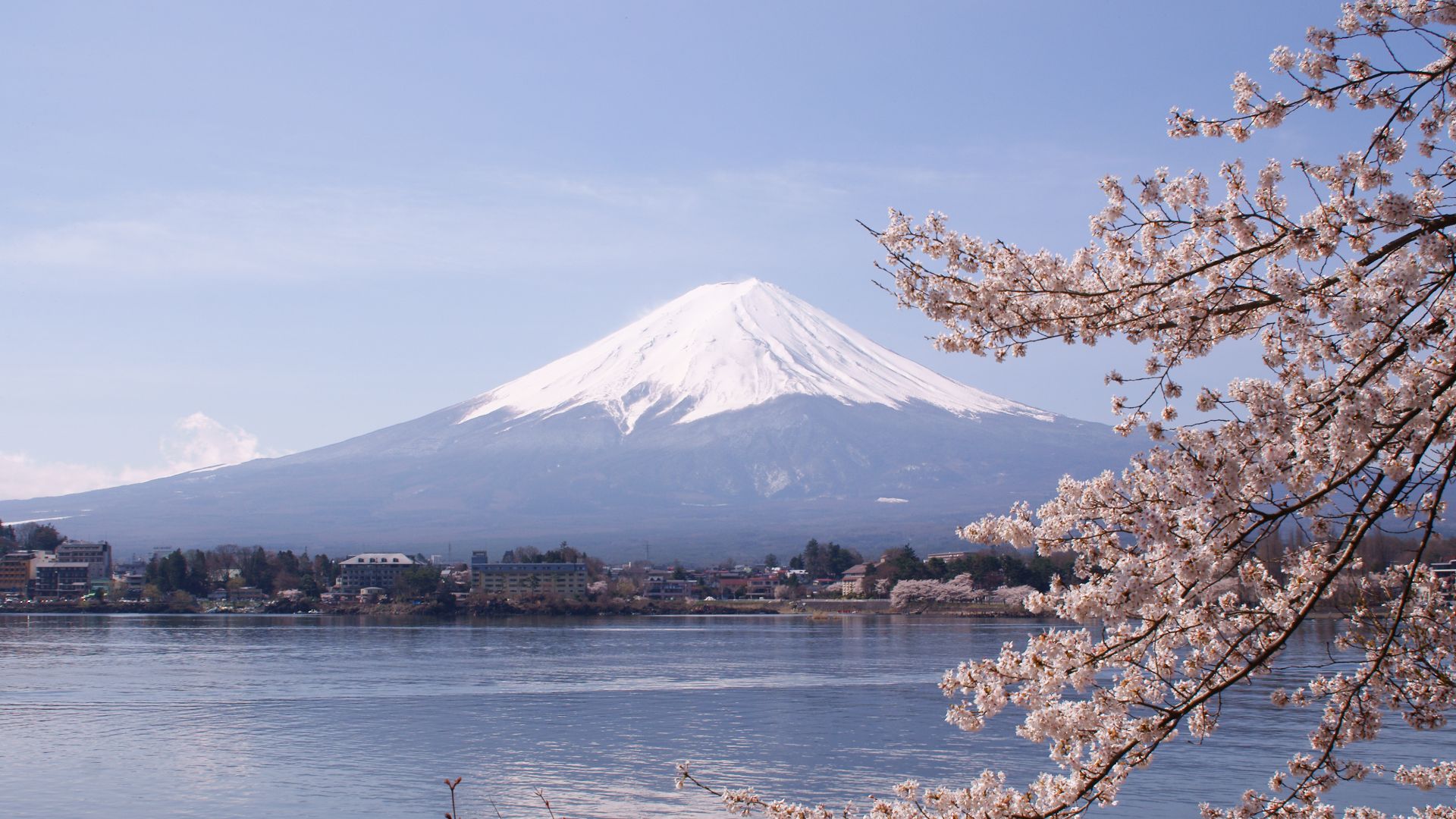
Elevation Often Becomes Sacred
Mountains hold sacred status across cultures, often because they feel unreachable. From Mount Fuji in Japan to Mount Olympus in Greece, peaks are seen as the realm of gods or spirits. Cerro El Cono fits this pattern by standing distant in its remote rainforest basin.
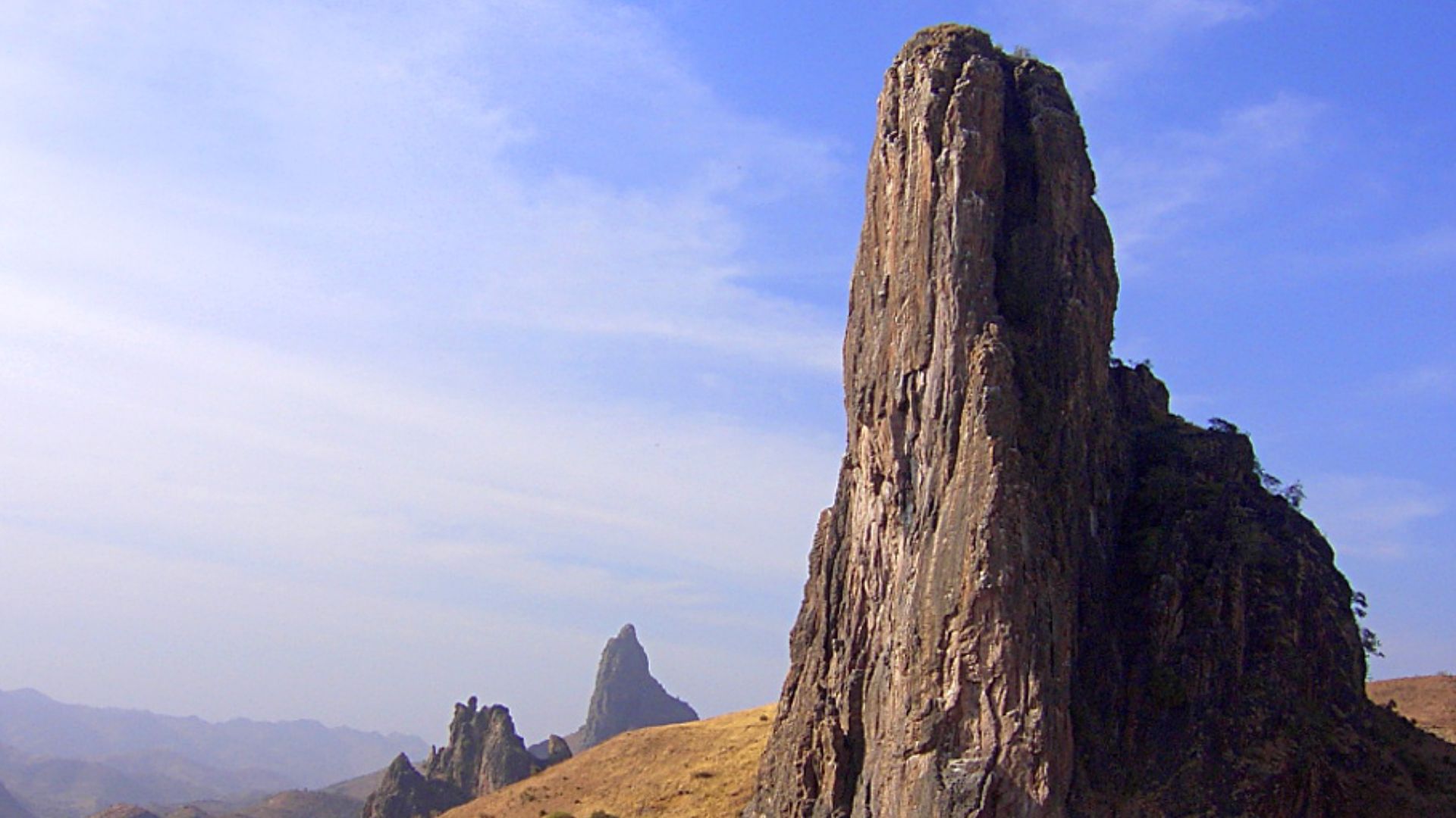
Volcanic Forms Resemble Human Structures
Volcanic plugs and eroded necks often develop angular symmetry. Cerro El Cono, likely a volcanic plug, shares this trait. Its steep, fluted sides resemble architecture, especially when vegetation softens irregularities. Many such peaks are misread as artificial before geological origins are fully understood.
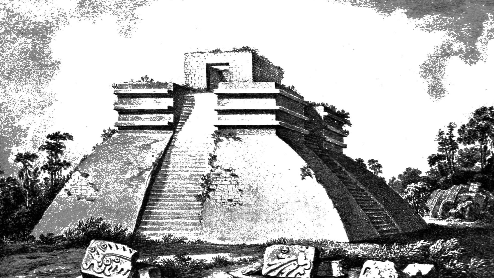
Triangles Hold Cross-Cultural Meaning
In sacred geometry, triangles symbolize the ascent and connection between worlds. A naturally triangular mountain, such as Cerro El Cono, easily lends itself to spiritual interpretations across different belief systems—from Mesoamerican pyramids to Hindu yantras.
 Unknown authorUnknown author, Wikimedia Commons
Mapping Reveals Cardinal Alignment
Preliminary GIS analysis suggests Cerro El Cono’s longest ridgeline trends roughly north to south. While some see alignment with solar paths or ritual directionality, geologists caution that erosion patterns and fault lines can produce coincidental alignments with no deliberate or cultural basis.
Mapping Reveals Cardinal Alignment (Cont.)
A 2019 study using ASTER satellite data found that the ridge maintained a consistent orientation across elevation bands. While some researchers propose a deeper ethnographic study in cultures with ritual directionality, no Indigenous narratives have confirmed that Cerro El Cono’s alignment holds ceremonial or cosmological importance.
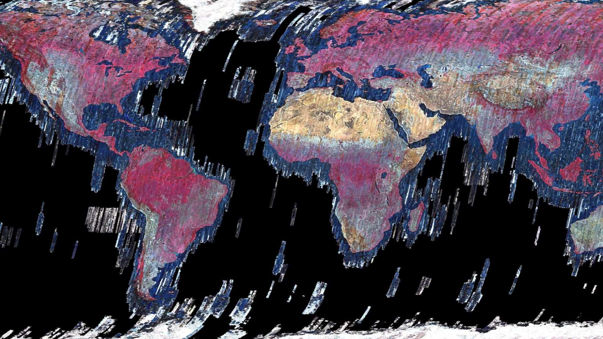 NASA/METI/AIST/Japan Space Systems, and U.S./Japan ASTER Science Team, Wikimedia Commons
Modern Tech Shapes New Myths
High-resolution drone imaging and 3D terrain models give Cerro El Cono renewed visibility. As these tools spread, more people reinterpret natural sites as engineered. Online forums now discuss alignments and sacred shapes, which echoes a trend where technology reawakens forgotten sacred terrain through visual discovery.
 Odjair Nascimento Baena, Wikimedia Commons
Triangular Alignments Are Debated
Some online discussions suggest that Cerro El Cono aligns geometrically with other sites; however, no peer-reviewed research supports this claim. GIS analysts generally attribute such patterns to chance or selective framing and caution against overinterpreting unverified spatial alignments as intentional design.
Ancient Riverways May Have Led There
Hydrological reconstructions show that historical Amazon tributaries may have passed closer to Cerro El Cono than modern maps suggest. River migration over centuries means ancient travelers could have accessed the mountain more directly, which makes its present isolation potentially misleading from a historical accessibility standpoint.
 Enigmatic Pyramid in the AMAZON protected by Indigenous Tribes (Cerro el Cono) by Dan Xuisoko
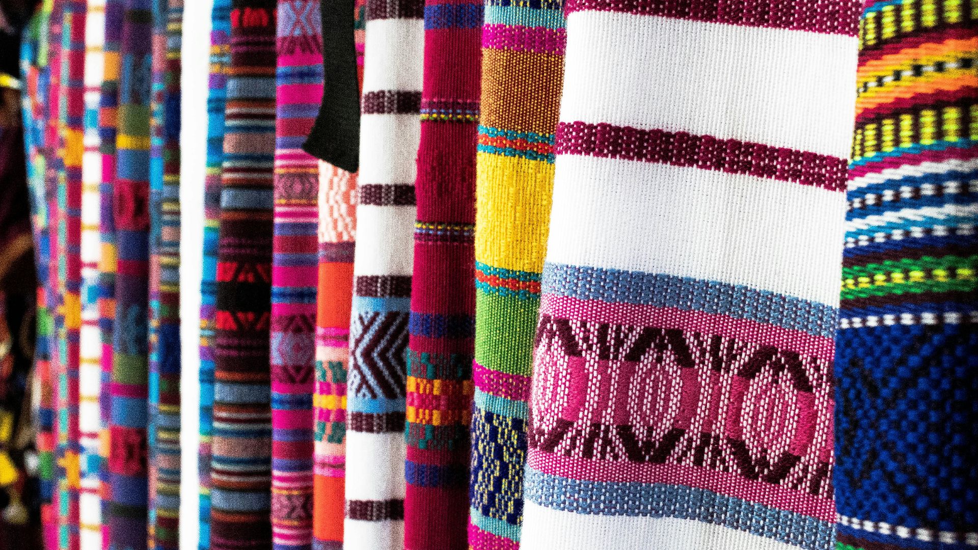
Textile Motifs May Suggest A Visual Link
Anthropologists studying regional textile motifs have identified repeated triangular shapes, especially in ceremonial garments. Some suggest that these patterns may evoke Cerro El Cono’s form. However, no direct evidence confirms a link and such interpretations remain speculative within the broader academic context.
A Matriarchal Spirit Is Remembered
Oral histories from Matses and Ashaninka communities describe a female spirit associated with Cerro El Cono. Often referred to as a guardian or ancestral protector, she is said to reside within the stone and ensure equilibrium between the natural world and human actions.
 Antônio Milena/ABr, Wikimedia Commons
Goddess Parallels Span The Andes
The concept of a protective feminine force resonates with broader Andean traditions. Deities like Pachamama and Mama Quilla represent fertility and cosmic balance. Though Cerro El Cono lies in a distinct region, its guardian figure fits a wider mythological pattern of female spirits in sacred terrain.
 Bernard Gagnon, Wikimedia Commons