
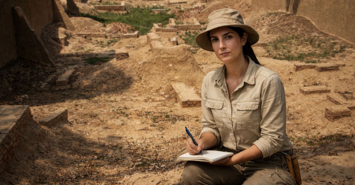
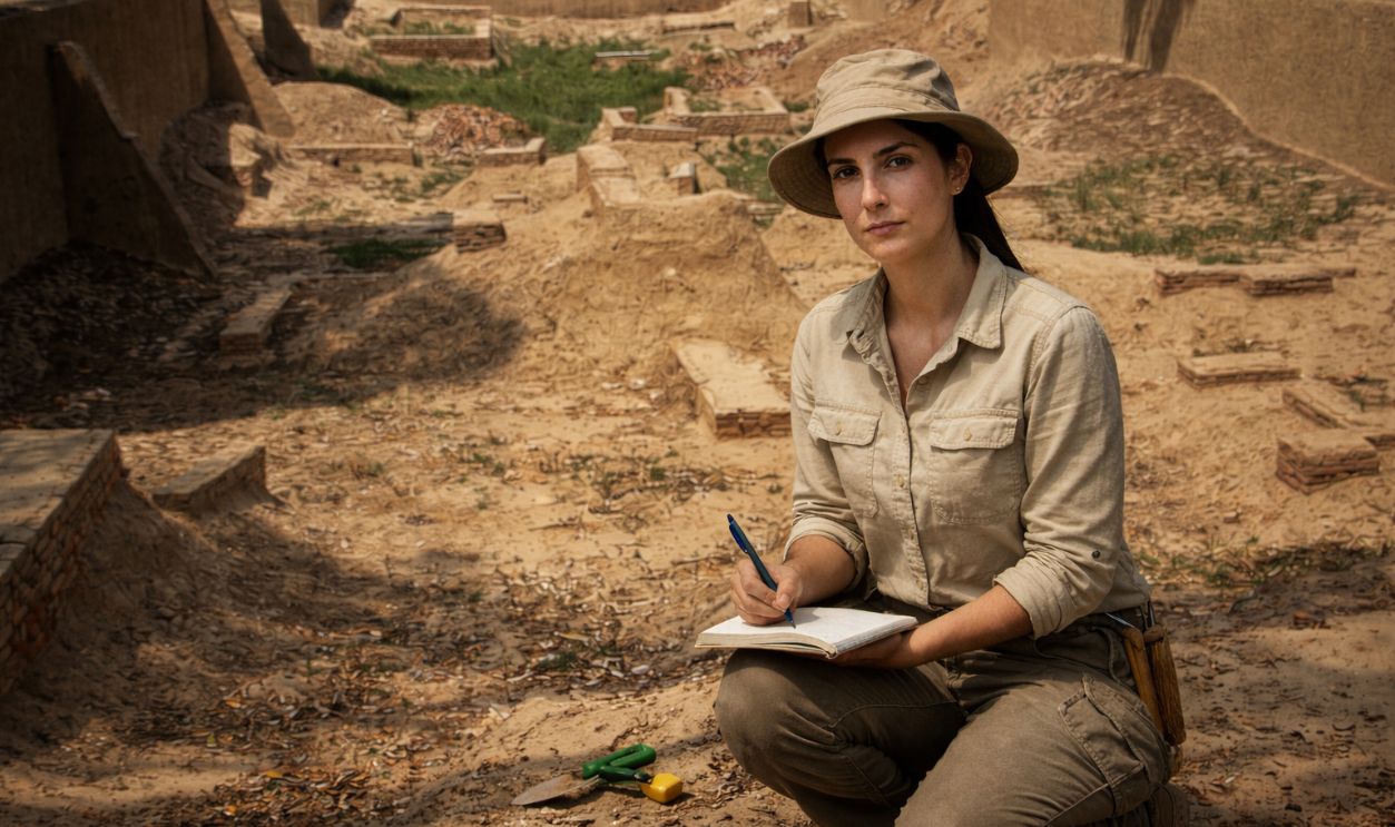
The Slow Fade No One Saw Coming
The Indus Valley Civilization created things like indoor plumbing while much of humanity was still in the stone age. These incredibly industrious people adapted again and again, changing their habits to keep going in a brutal world. But despite their ingenuity, their ultimate doom was something they never could have prepared against.
 Hassan Nasir, CC BY-SA 3.0, Wikimedia Commons, Modified
A Civilization Spread Across Rivers And Plains
The Indus Valley civilization flourished across a vast region of present-day Pakistan and northwest India. Hundreds of settlements formed along river systems and fertile plains. Size and reach placed this society among the earliest large-scale civilizations known to archaeology.
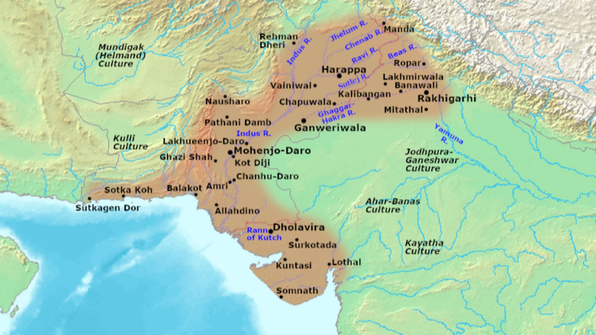 Avantiputra7, Wikimedia Commons
City Dwellers In A Surprisingly Urban World
Most people lived in organized towns rather than scattered villages. Excavations reveal dense neighborhoods and shared infrastructure. Urban life shaped daily routines, from water collection to trade, creating communities built around cooperation and predictable order.
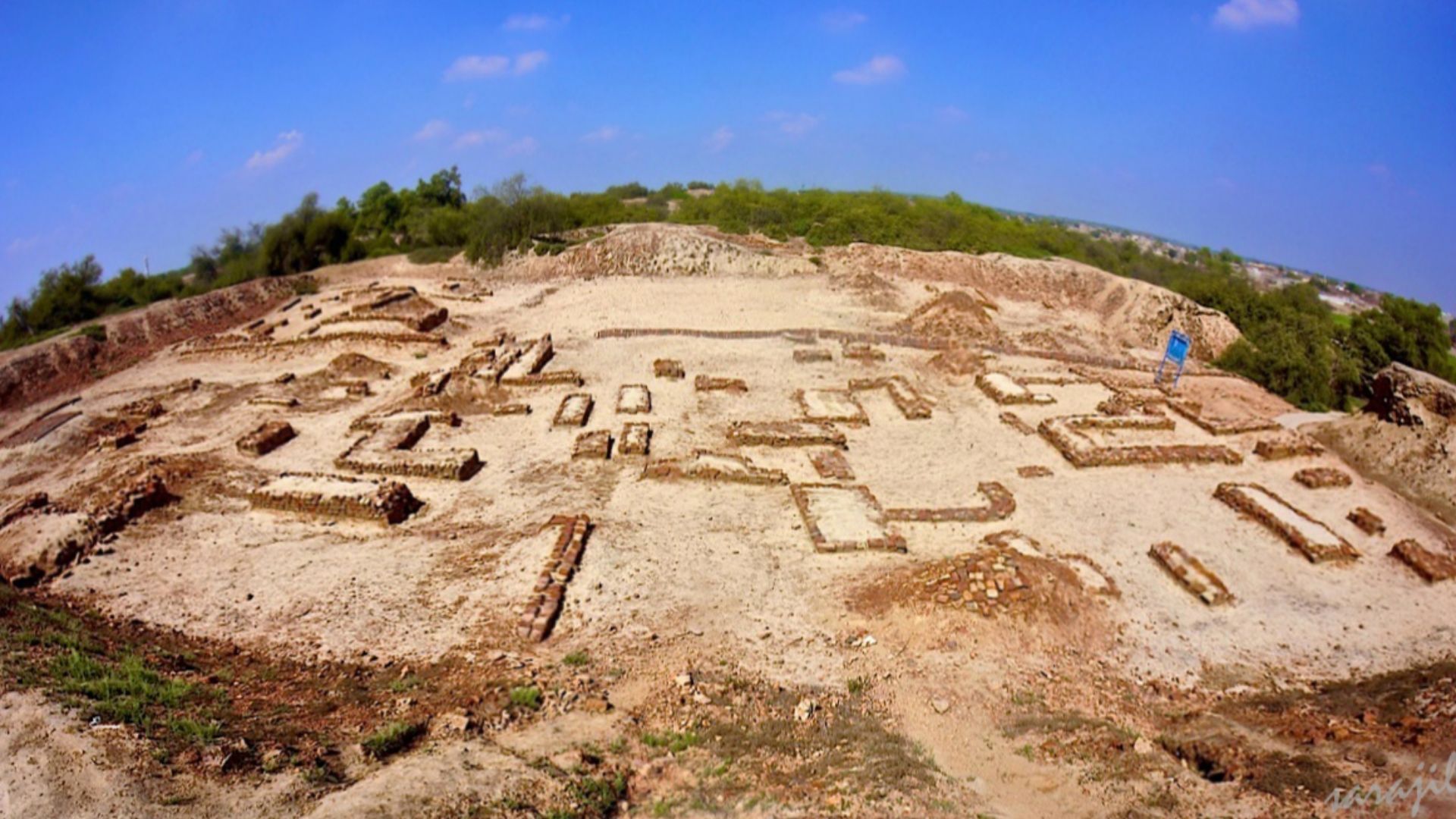 Sara jilani, Wikimedia Commons
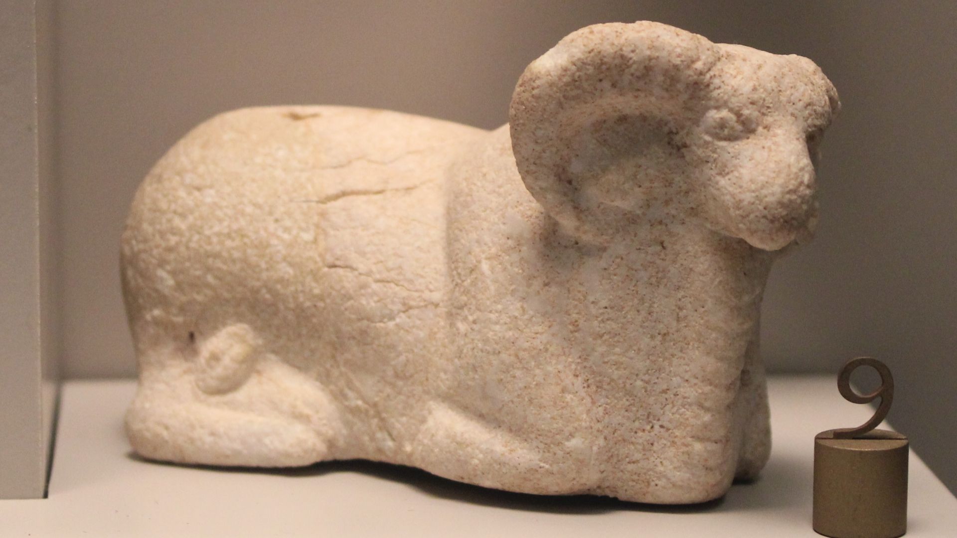
Daily Life Built Around Craft And Trade
Artifacts show lives filled with work beyond farming. People shaped beads, stamped seals, and molded figurines. Markets moved goods locally and across regions. Trade connected households to distant communities, and it made exchange a normal part of everyday experience.
This Was A Society Without Kings Or Palaces
Excavations reveal no royal tombs or monuments glorifying rulers. Public buildings served practical functions. Authority likely rested in councils or civic systems. Social organization favored administration and planning over displays of personal power.
 Biswarup Ganguly, Wikimedia Commons
Thousands Of Years Before The Fade Began
This civilization took shape over centuries. Early settlements predate the formation of large cities. Urban life expanded gradually and held steady for generations. By the time subtle changes began, communities had already refined daily routines that felt reliable and deeply established.
 Biswarup Ganguly, Wikimedia Commons
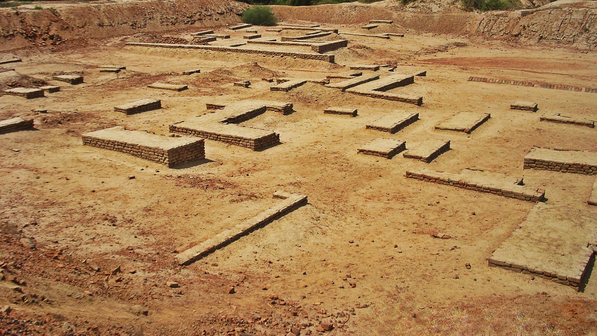
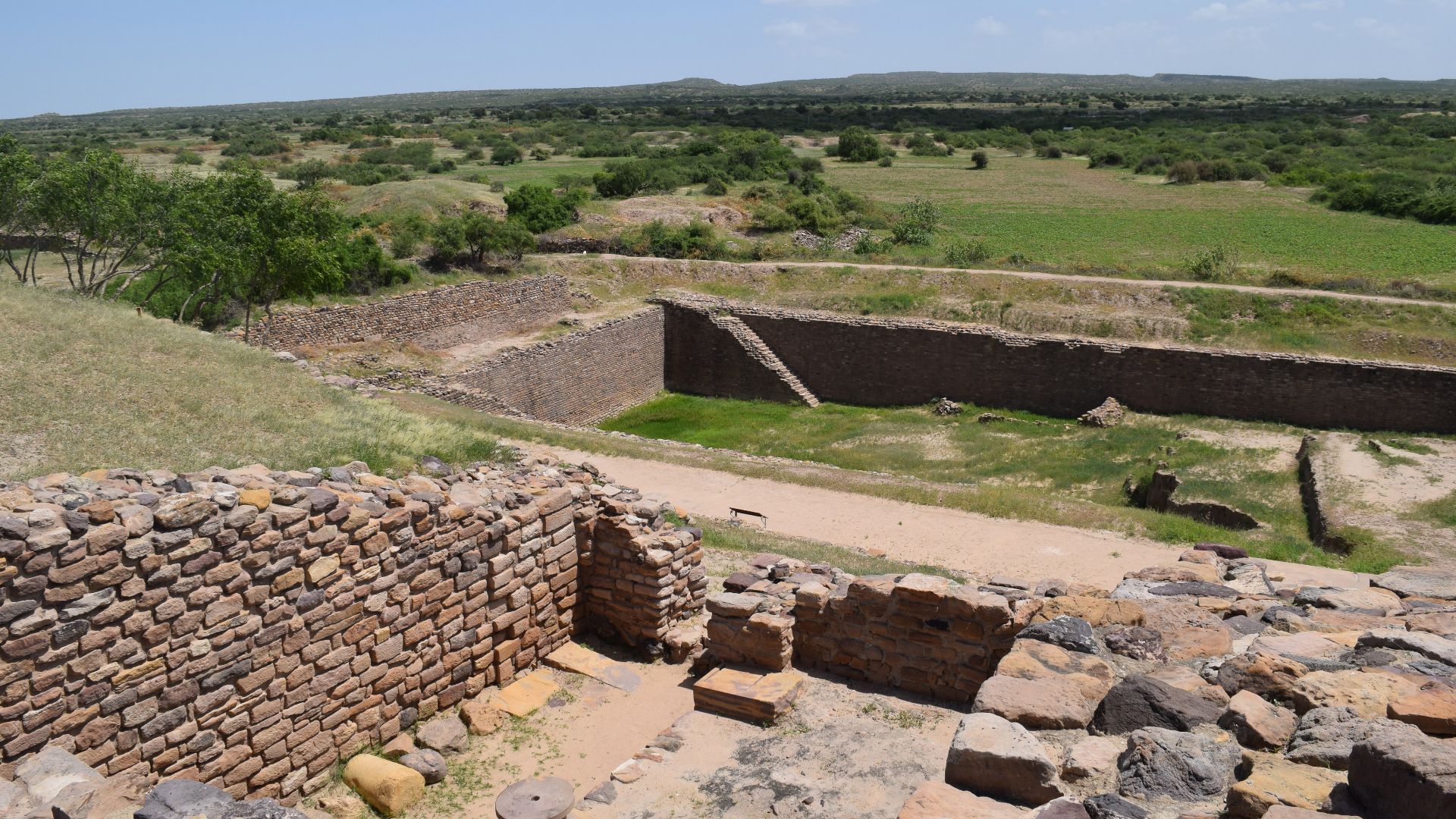
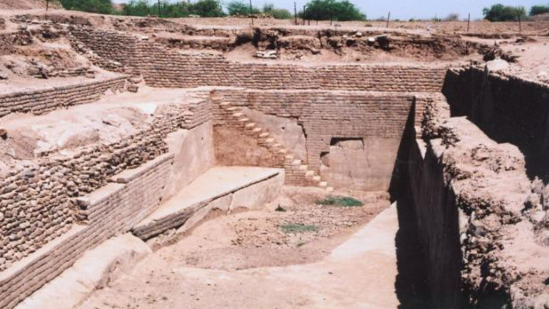
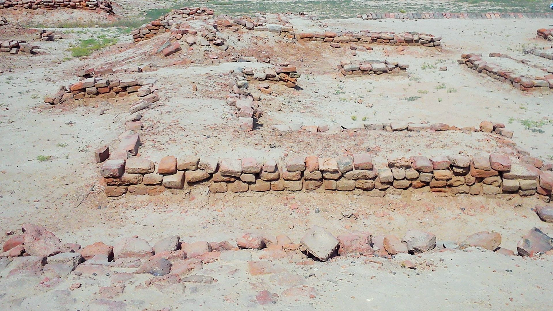
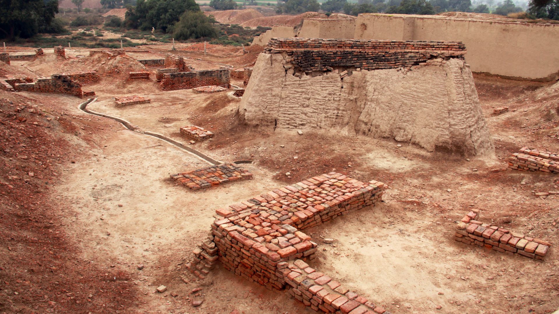
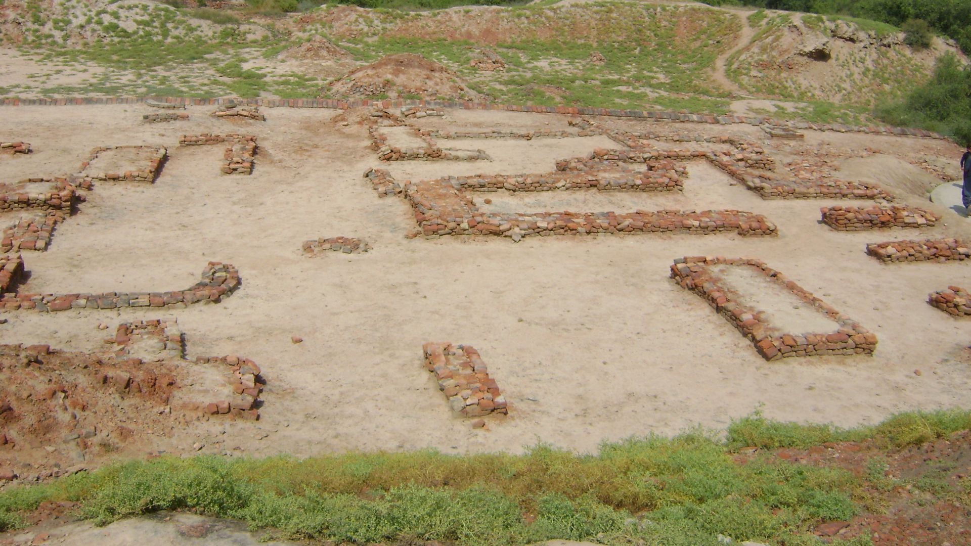
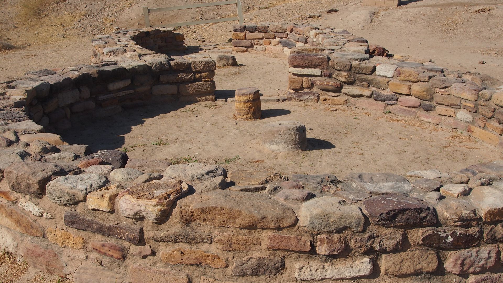
Early Planned Cities With Grid Layouts
That long period of stability shaped the development of cities. Excavations revealed streets laid out in straight lines, intersecting at regular angles. When sites such as Harappa and Mohenjo-daro were mapped, repeated block measurements across distant cities indicated shared planning principles guiding urban growth.
 Hassan Nasir, Wikimedia Commons
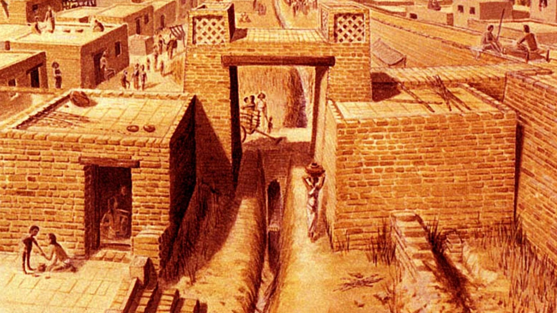
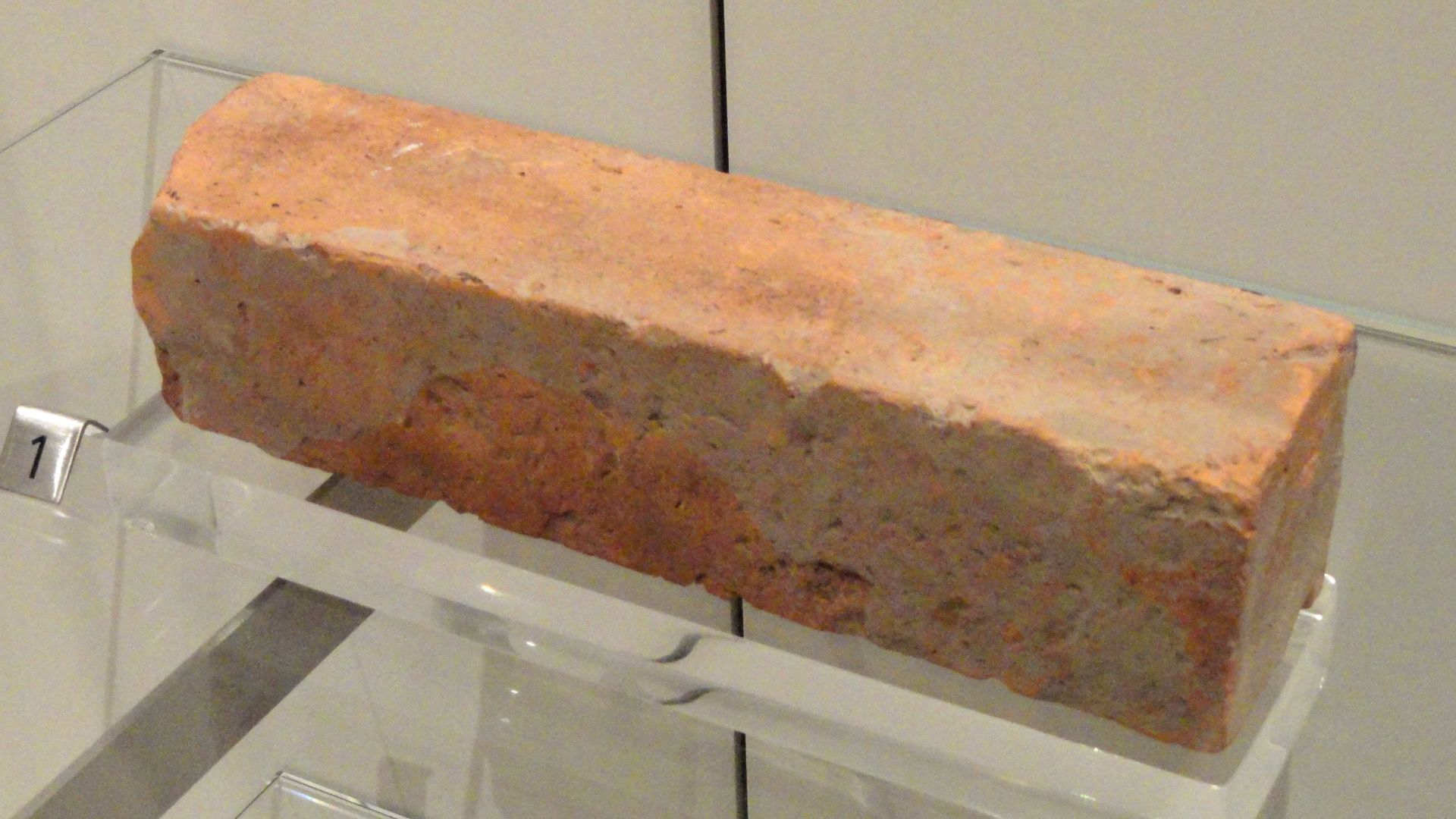
Durable Multistory Brick Housing
Once street plans emerged, attention turned upward. Mortimer Wheeler measured walls and foundations across multiple sites. Brick sizes matched precisely, regardless of location. Staircases built into homes confirmed two and three-story construction. Housing design followed the same standardized logic seen in city layouts.
 Tejavalli reddy(1830787), Wikimedia Commons
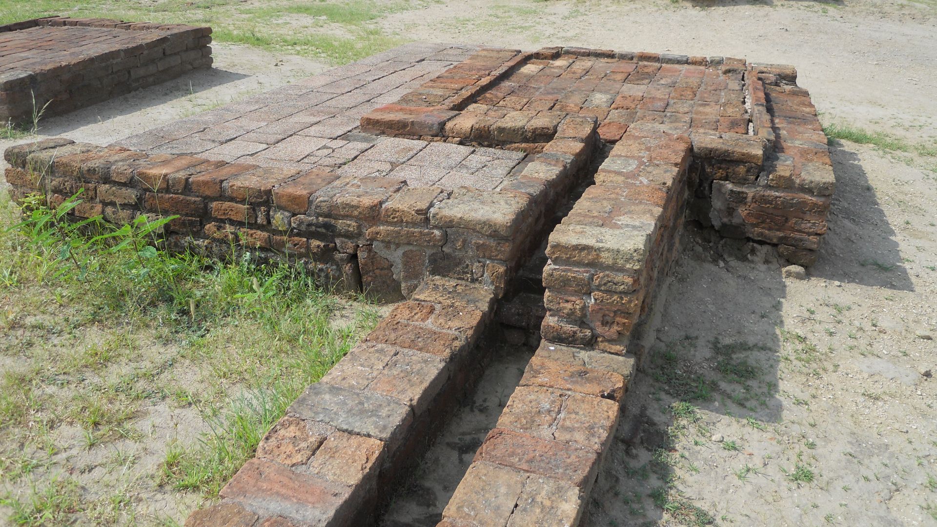
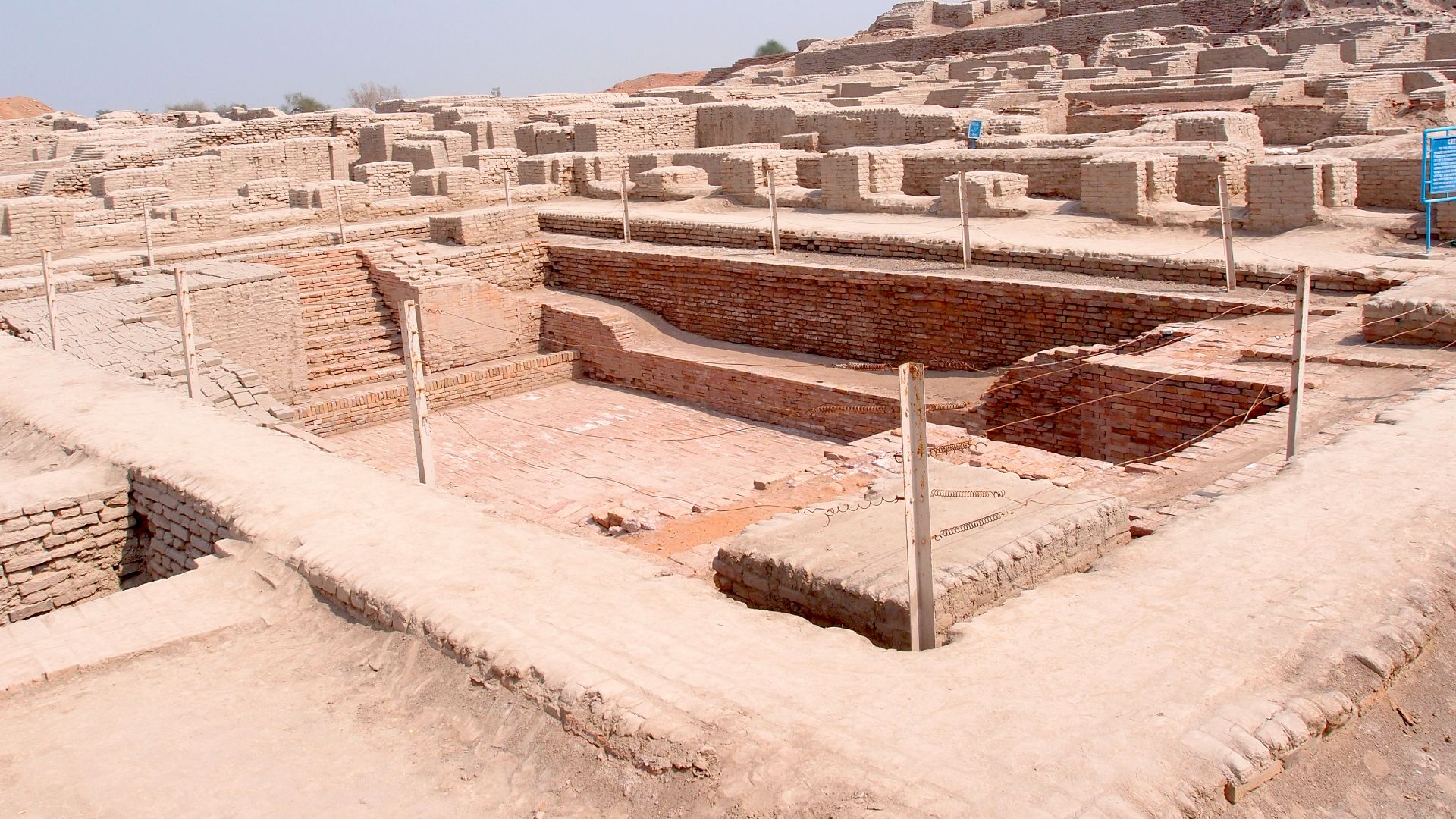
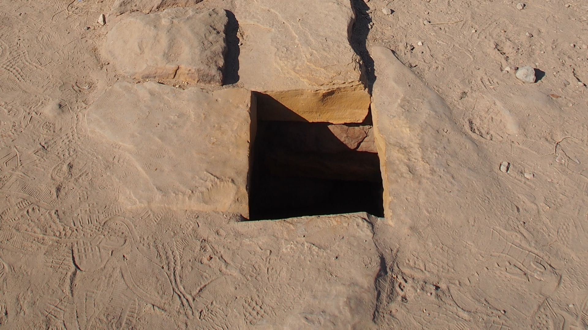
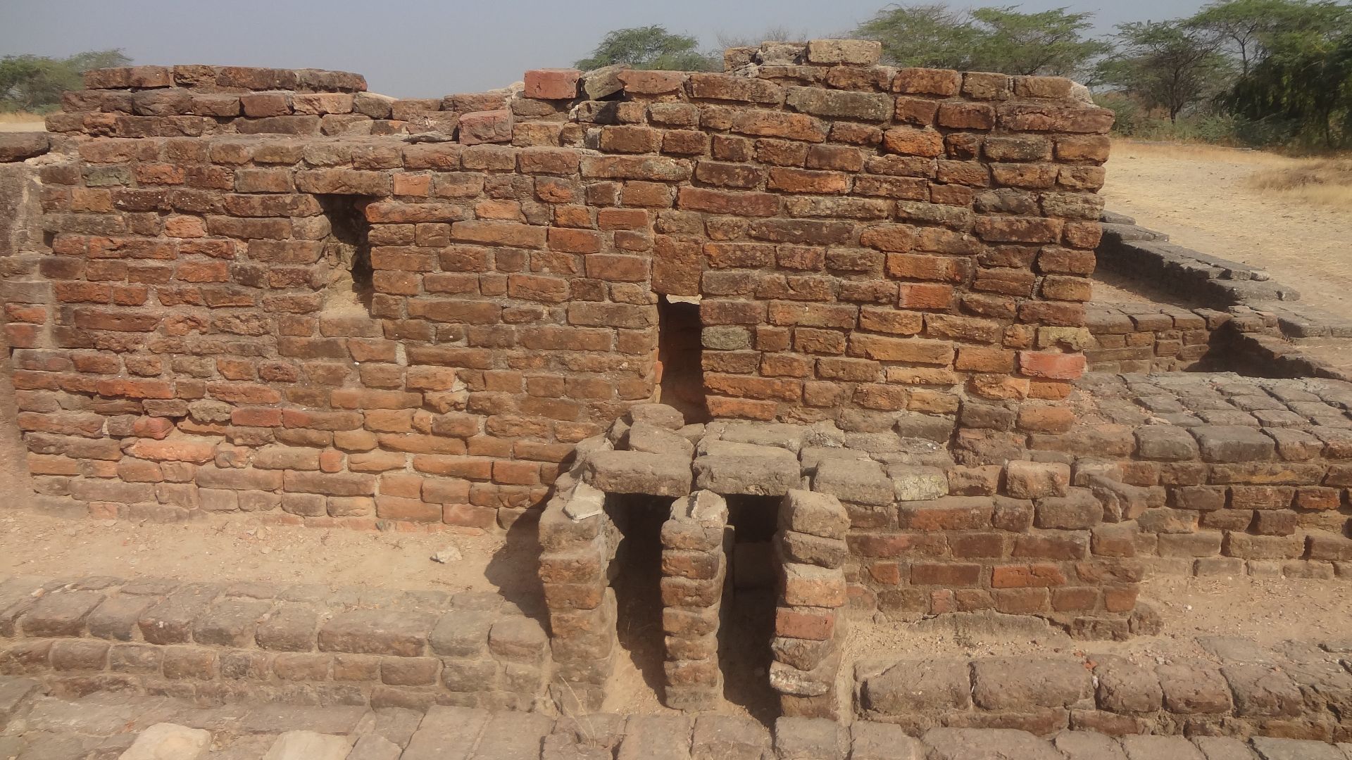
Advanced Sanitation And Drainage Systems
Street grids and housing plans led researchers underground, and Ernest Mackay traced brick-lined drains beneath roads and private homes through methodical trench excavation. Inspection openings appeared at regular intervals. Household latrines connected directly to these channels, revealing sanitation as an integrated urban system.
 Abhilashdvbk, Wikimedia Commons
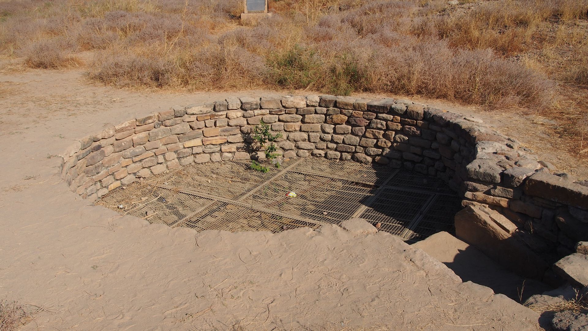
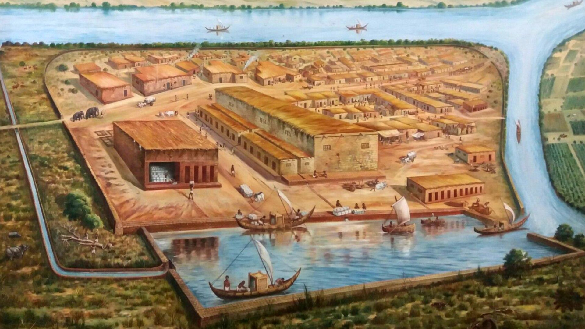
River-Based Trade Networks
Urban infrastructure raised another question. How did goods move between cities? Archaeologists answered by mapping artifact distribution. Identical seals surfaced far apart. Mineral analysis traced raw materials to distant sources. Structures near riverbanks suggested loading zones. They place waterways at the center of economic life.
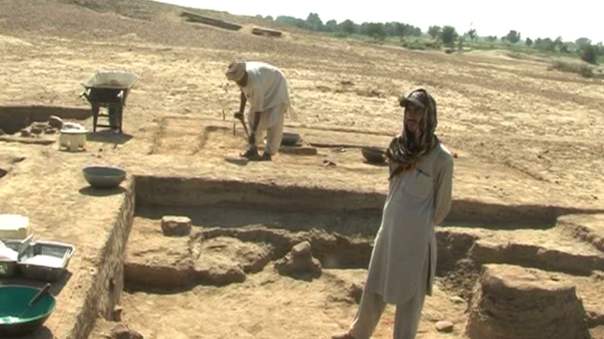
Specialized Craft Production
At Chanhu-daro, excavators uncovered workshops containing drills, raw stone, and unfinished beads. Tool wear patterns showed repeated precision use. Separate production zones appeared consistently to confirm organized craft specialization tied directly to trade demand.
Monsoon-Dependent Agriculture
Botanists analyzed charred seeds recovered from storage pits and hearths. Wheat, barley, and cotton were the dominant crops in the samples. These crop selections matched seasonal rainfall cycles. Agricultural planning followed monsoon timing, linking food supply to predictable climate behavior.
Settlement Clustering Near Rivers
Agriculture and trade consistently pulled communities toward water. Excavation records and satellite mapping show long-term settlements concentrated near rivers and tributaries. Access supported farming, transport, and daily household needs. Geography quietly shaped where life could persist across generations.
 Lalit Gajjer, Wikimedia Commons
Then Came The Long Period Of Climatic Stability
Those settlement patterns held because environmental conditions remained dependable. Mineral records preserved within cave formations show extended periods of consistent rainfall during early urban growth. Construction layers across major cities align with that stability, reflecting sustained building during times of predictable water availability.
 Saqib Qayyum, Wikimedia Commons
Gradual Weakening Of Monsoon Rains
Teams extracted lake sediment cores and analyzed mineral composition. Results showed a gradual rainfall decline over long periods. Archaeological layers recorded settlement movement during the same timeframe. Environmental change unfolded slowly, and they guided relocation rather than sudden abandonment.
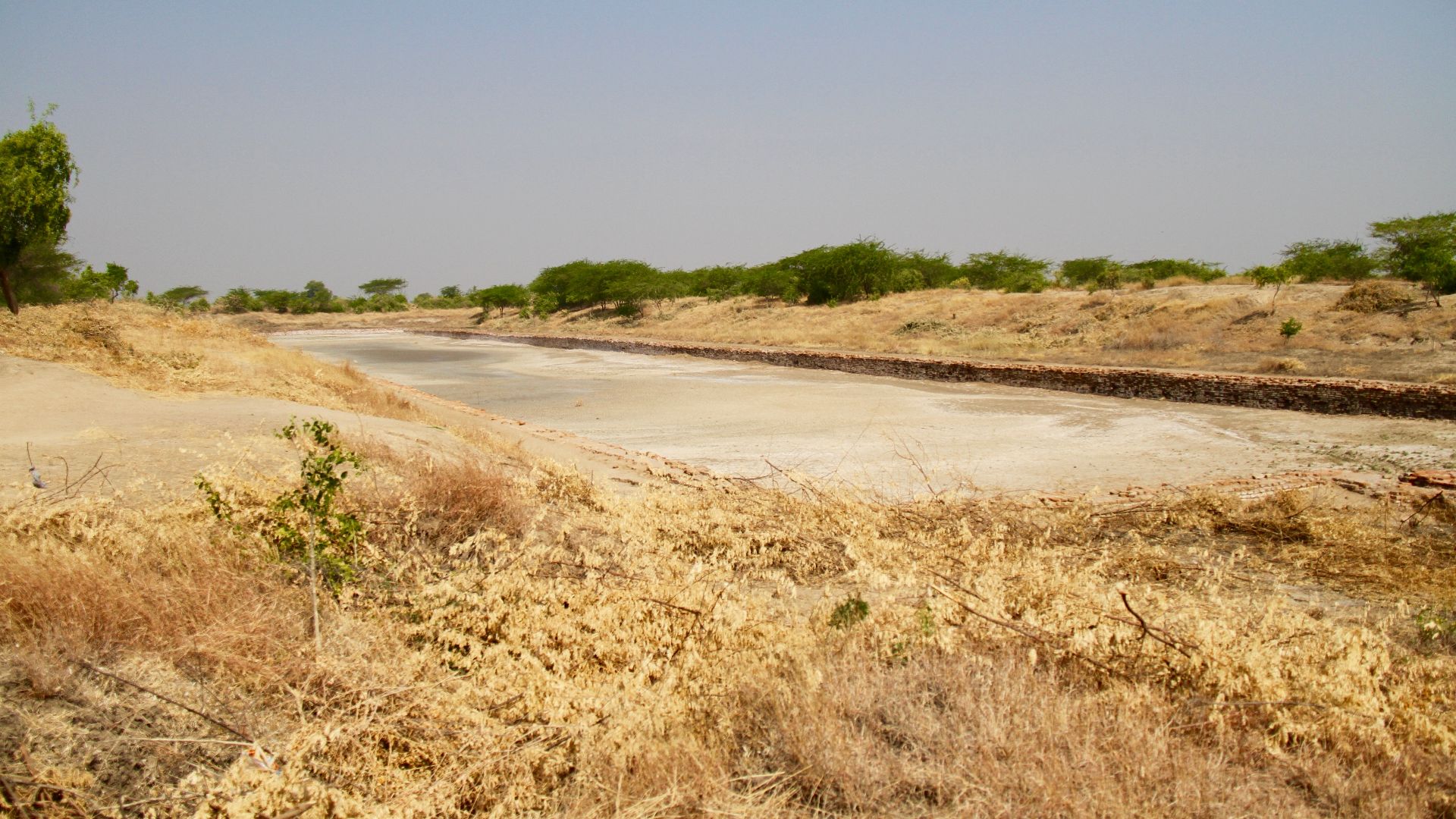
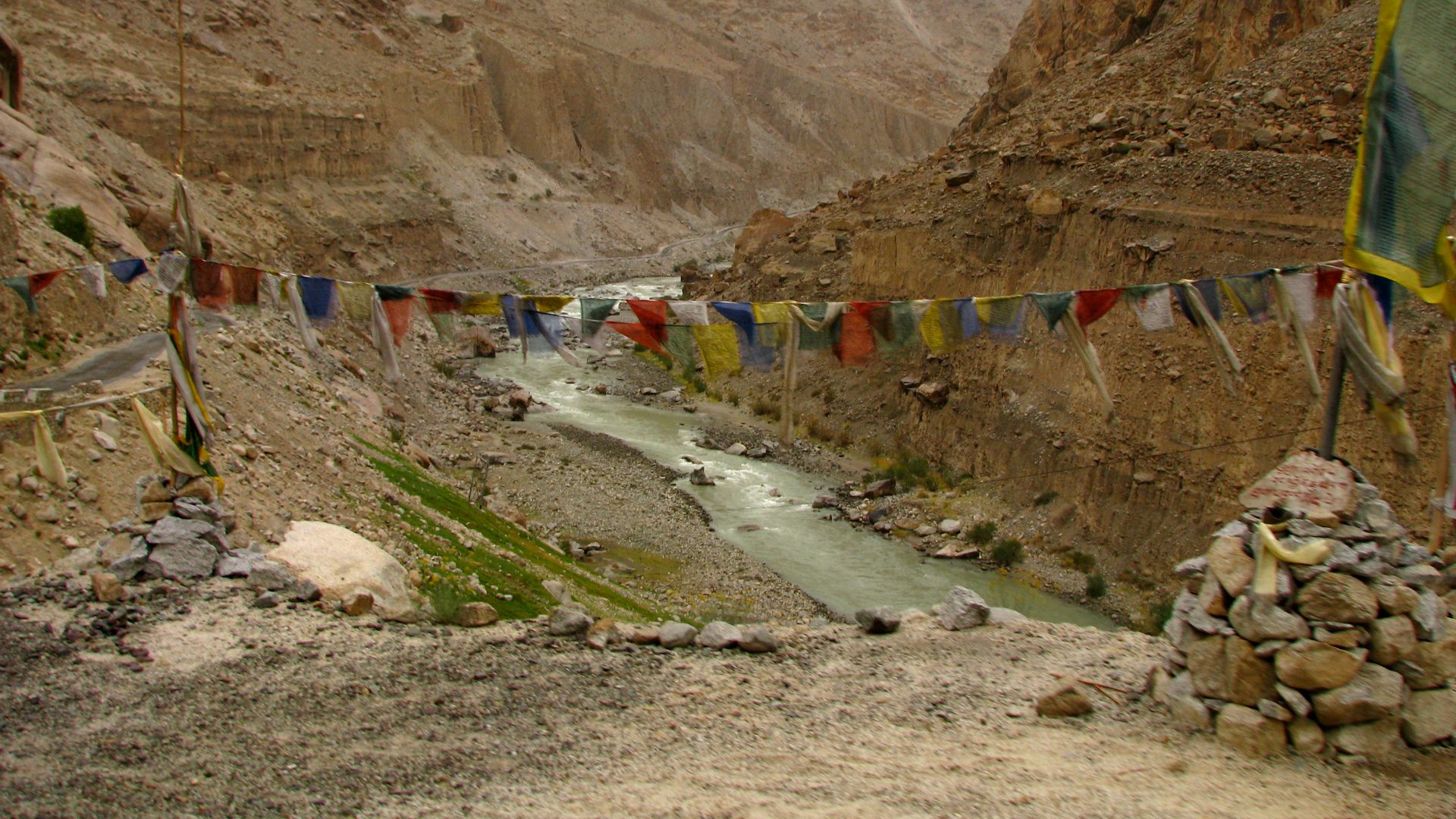
Declining River Flow
Rainfall patterns shifted over long periods, and rivers responded accordingly. Water levels dropped across major channels, changing how boats moved and when travel remained possible. Excavated riverfront structures show signs of abandonment. Trade increasingly followed seasonal limits shaped by depth and current behavior.
 McKay Savage from London, UK, Wikimedia Commons
Shrinking Lakes And Wetlands
As rivers lost volume, nearby lakes and shallow wetlands followed suit. Sediment layers reveal receding shorelines over long periods. Former waterbeds turned compacted and dry. These changes reduced seasonal storage, which once buffered communities against rainfall variability.
 Rama's Arrow, Wikimedia Commons
Drying Agricultural Soils
Soil samples from multiple regions show declining moisture retention across farming zones. Fields farther from rivers required greater effort to cultivate. Crop remains are present in smaller quantities in later layers. Farming shifted toward more reliable water sources, narrowing the areas where food production remained viable.
 Prof Ranga Sai, Wikimedia Commons
Repeated Population Relocation
Settlement layers tell a story of movement rather than abandonment. Homes appear briefly, then vanish from the record. New clusters formed elsewhere. These relocations occurred repeatedly over centuries to reflect communities adjusting location to follow water rather than clinging to fixed ground.
Shift Toward Tributaries
Smaller river branches became more important as main channels weakened. Archaeological surveys document increased settlement density along tributaries. These waterways offered steadier seasonal flow. Communities reorganized daily life around narrower corridors that continued to support transport and irrigation.
Movement Eastward Toward Stable Water
Over time, settlement patterns drifted east. Mapping shows that newer habitation zones cluster where rainfall has remained more reliable. This gradual shift unfolded across generations. The terrain guided movement quietly, without a single defining moment.
 Prof Ranga Sai, Wikimedia Commons
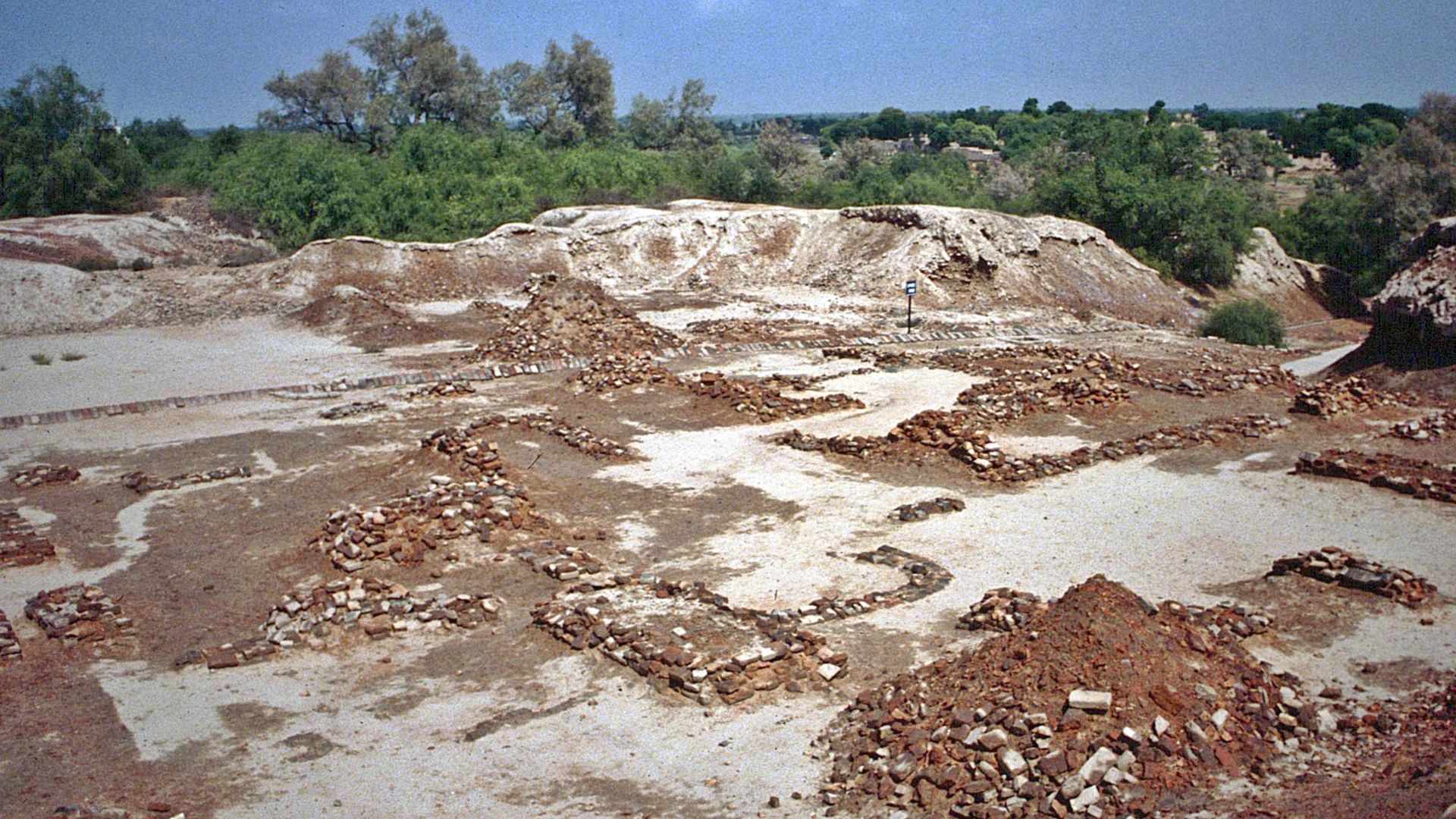
Then Came The Decline Of Major Urban Centers
Large cities show reduced building activity in later phases. Public structures stopped expanding. Residential density thinned. Excavation layers contain fewer repairs and renovations. Urban life contracted as populations dispersed into smaller, less centralized communities.
 Haseeb Ur Rehman malik, Wikimedia Commons
None Of It Was Caused By Warfare
Excavation records lack burn layers or fortification damage. Weapons appear rarely in domestic contexts. City walls show no signs of siege. The decline unfolded without widespread conflict, pointing toward systemic stress rather than violent collapse.
Climate Reconstruction Through Models
To connect physical evidence across regions, researchers combined environmental records into large-scale climate reconstructions. These models aligned rainfall shifts with settlement movement. Patterns emerged clearly at a regional scale to confirm that change unfolded gradually.
 IgorMorozoff, Wikimedia Commons
A Civilization That Dissolved, Not Disappeared
Archaeological evidence shows people did not vanish all at once. Urban centers thinned, smaller communities persisted, and daily life continued in altered forms. Traditions carried on without cities to anchor them. What faded was the urban system itself, not the population behind it.
 Aravind Kudalapura Gopinathan, Wikimedia Commons
Why The Pieces Finally Fit Together
For decades, clues to the Indus Valley civilization fade lay apart: settlement maps here, climate records there. When researchers aligned environmental data with excavation layers, the timeline clicked into place. Slow change explained steady movement. The mystery did not end with drama. It was resolved through accumulation, pattern, and patience.
 Prof Ranga Sai, Wikimedia Commons


