
A Place Called Doggerland
Thousands of years ago, a thriving population lived on a massive stretch of land known as Doggerland, once connecting Britain to mainland Europe. Though swallowed by the sea, archaeologists have uncovered striking evidence of its prehistoric culture—revealing astonishing details about Doggerland’s mysterious past.
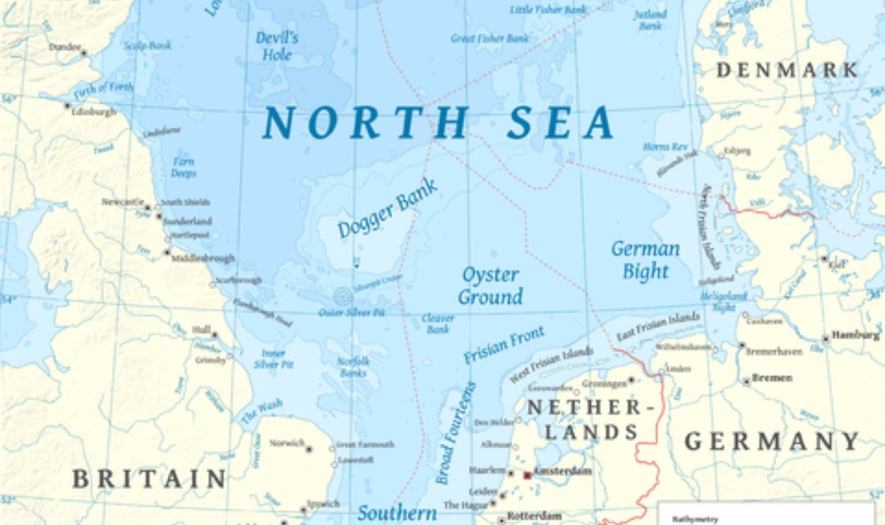
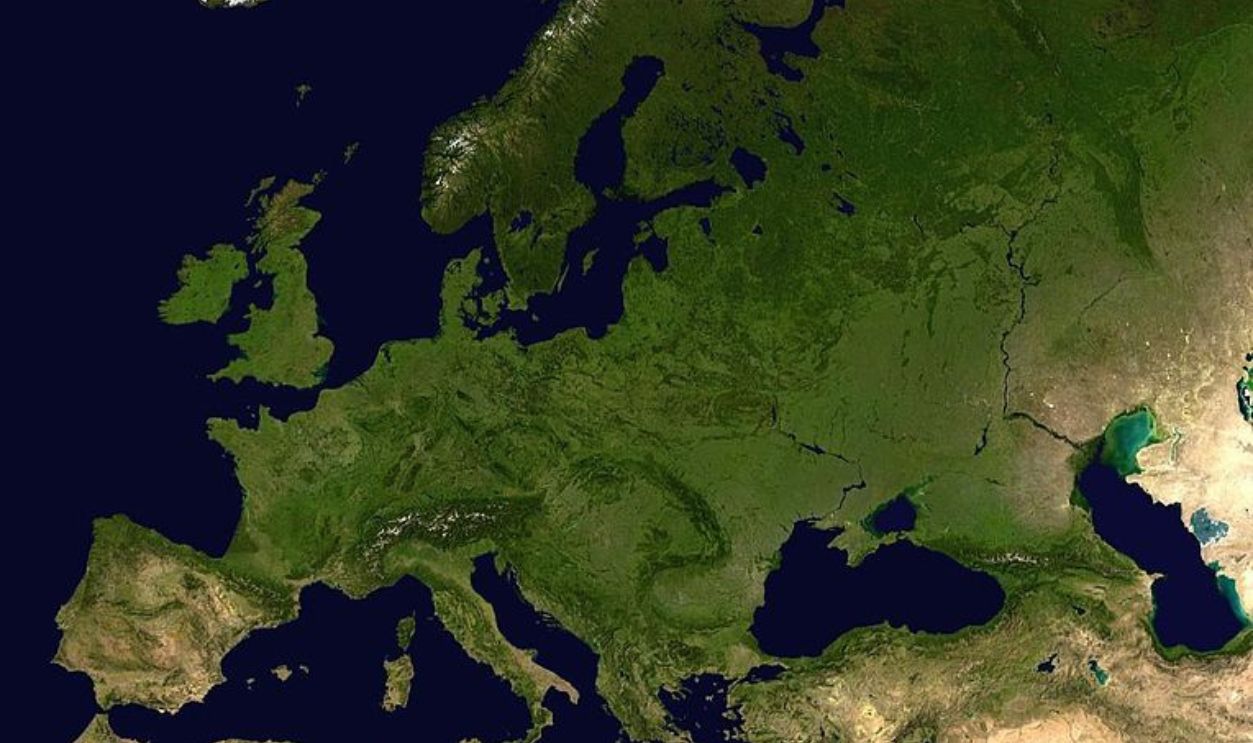
Regions Of Doggerland
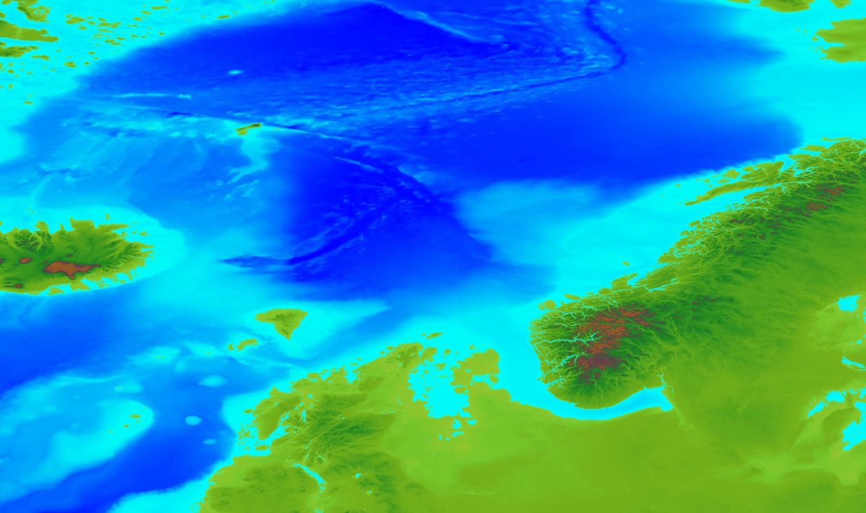
The British Isles stand alone today, yet only 8,000 years ago, they were part of a huge landmass known as Doggerland. This submerged area was a rich habitat for diverse species and human communities. As some of it floats ashore, we are left with proof of the planet’s dynamic history.
 Unknown author, Wikimedia Commons
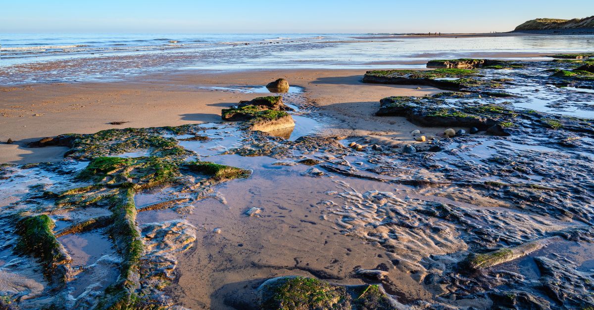
Ancient Doggerland
Beneath the southern part of the North Sea lies an area on which animals once roamed over 700,000 years ago. After the last ice age, hunter-gatherers inhabited the land. Over time, rising sea levels caused this area to submerge, and it came to be known as the "lost land."
 Halava, CC BY-SA 3.0, Wikimedia Commons
Connecting Britain To Other Countries
This landmass linked Britain to countries such as Belgium, the Netherlands, and Southern Scandinavia. This link allowed hunters and gatherers to forage further out for food or animals when things were scarce where they lived.
 Aquintero82, CC BY-SA 4.0, Wikimedia Commons
Cross-Channel Trade
The strategic position of Doggerland helped people who lived in Britain move across the channels that connected with mainland Europe. This included the movement of people, animals, and possibly ideas, as opposed to the organized trade seen later in history.
 Unknown author, Wikimedia Commons
Not Just A Landbridge
For years, historians believed Doggerland was nothing more than a land bridge linking Britain to Europe. But new discoveries reveal it was far richer than a simple passageway—an ancient landscape of rivers, lakes, and dense forests that provided an ideal home for hunters, fishers, and gatherers.
 Unknown author, Wikimedia Commons
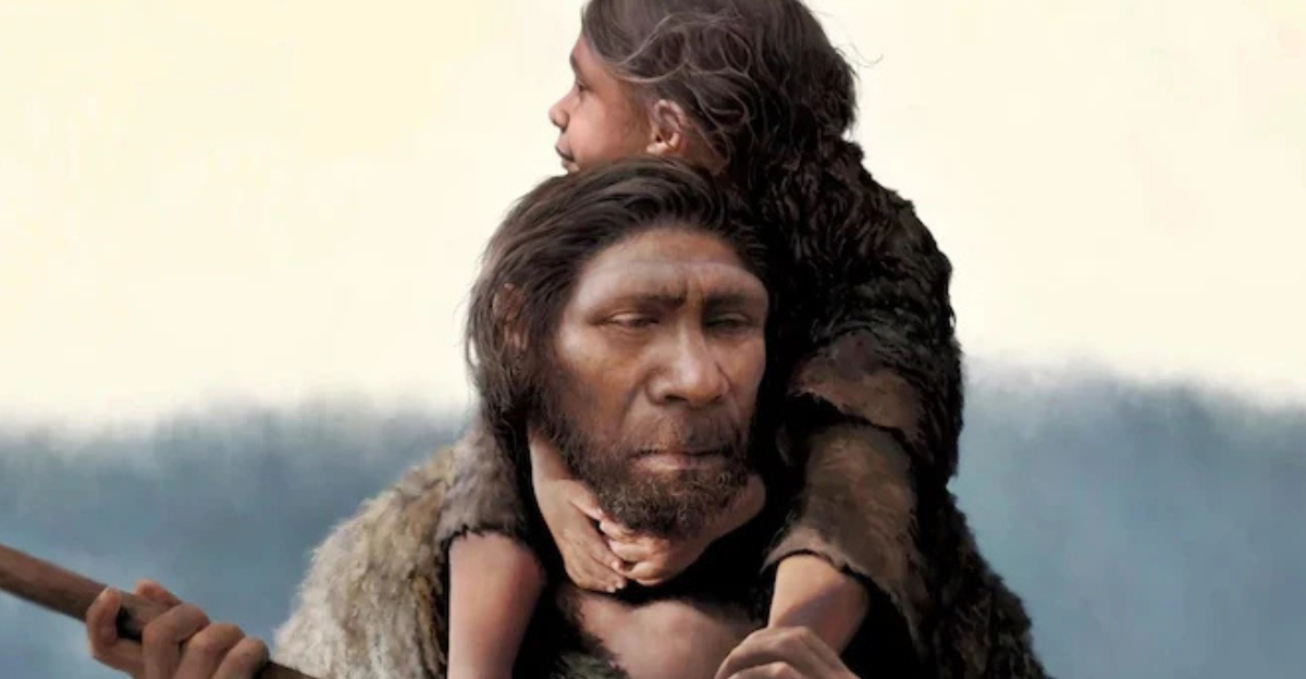
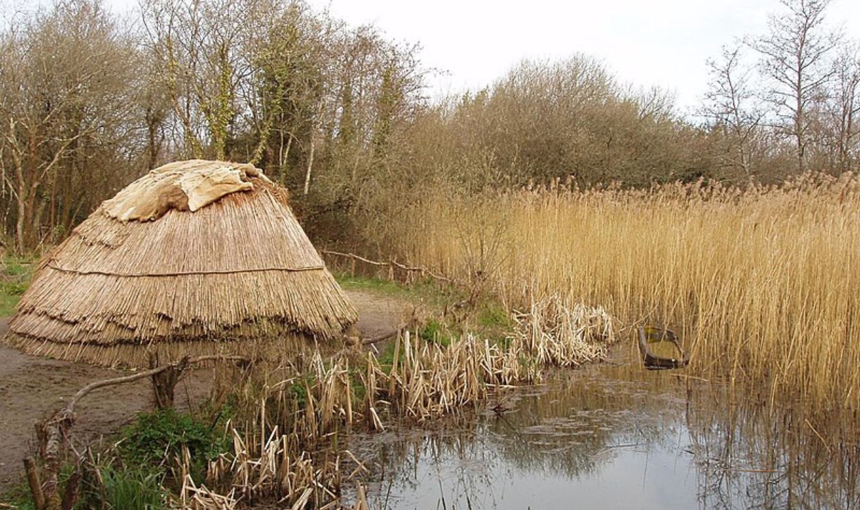
Mesolithic Inhabitants
Before rising sea levels covered it, Doggerland was inhabited during the Mesolithic era, the last part of the Stone Age. These hunter-gatherers likely stayed on the move around Doggerland, living near rivers and lakes where food and resources were easier to find. Where's the proof?
 David Hawgood, CC BY-SA 2.0, Wikimedia Commons
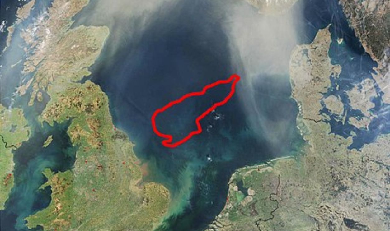
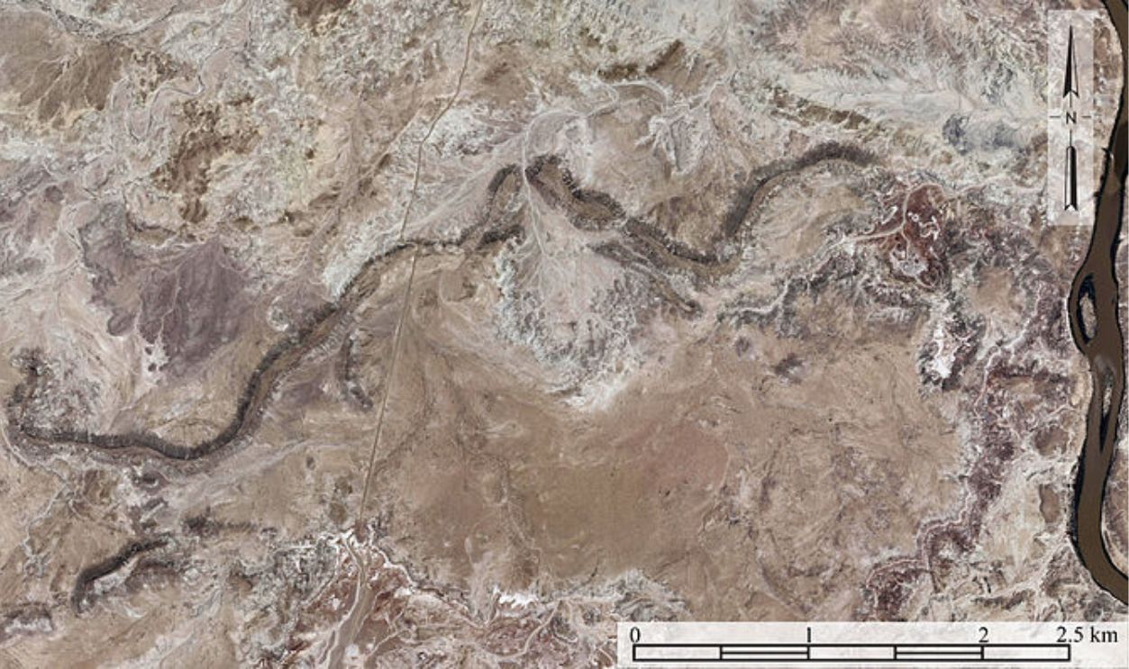
Seismic Surveys
Oil companies in the North Sea use unique technology to send sound waves onto the ocean floor. These waves bounce back and help create detailed maps of what is under the water. This process helps locate oil and gas but has also revealed information about Doggerland.

Working In Partnership
Archaeologists interested in learning more about Doggerland asked oil companies for access to their maps. Initially, the companies were hesitant, but they eventually agreed to share their data. This partnership allowed scientists to study the landscape that was once above water.

Discovering A Missing Link
In partnership with the oil companies, archaeologists have searched large stretches of the North Sea's ocean floor for remnants of this vanished community. This is done using technology based on magnetic fields that can reveal the location of buried structures.
 Max Naylor, CC BY-SA 3.0, Wikimedia Commons
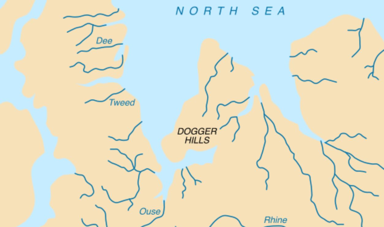
Mapping The Landscape
Using data gathered by oil companies, researchers pieced together detailed maps of Doggerland’s ancient terrain—revealing the rivers, hills, and forests that once stretched across the landscape before it vanished beneath the sea.
Submerged Communities
Scientists continue to find evidence of other ancient sites that are currently buried. These revelations are changing our perspective of prehistoric human settlements. Every discovery reveals how people adapted and survived in the face of rising sea levels.
 Gilbert, Frank, Wikimedia Commons
How Did These People Live?
The discovery of animal fossils, tools, and even bones from ancient humans provides clues about how these people lived. Some of the tools reveal that mammoths and deer lived there, while human bones offer information on when it was inhabited. We know this because…
 Mistvan, CC BY-SA 4.0, Wikimedia Commons
Evidence Washing Ashore
Over the decades, thousands of archaeological items from Doggerland have washed ashore. These remnants point to ongoing human activity motivated by a continuously available food supply, although the exact size of these communities is yet unknown.
 GOHSEP, CC BY-SA 2.0, Wikimedia Commons
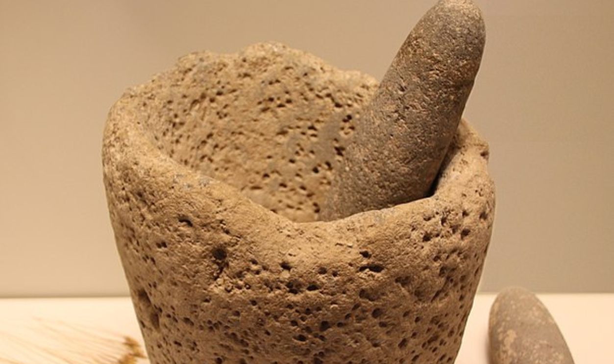
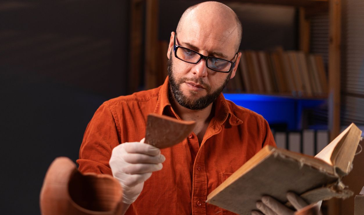
Artifact Analysis
Examining objects from Doggerland calls for an interdisciplinary approach, looking at materials, workmanship, and context. Modern methods like carbon dating, along with the use of optics and microscopy allow a more thorough understanding how these artifacts were used.
 Louvre Museum, Wikimedia Commons
Why All The Fuss Now?
In the 1990s, scientists began focusing more closely on Doggerland. Each new discovery made during North Sea construction projects fueled growing interest, while advances in technology gave researchers powerful tools to probe the seabed in unprecedented detail.
 National Oceanic and Atmospheric Administration, Wikimedia Commons
Radiocarbon Dating
Every living thing has carbon, and when it dies, the carbon slowly disappears. By measuring how much is left, scientists can estimate when the organism lived. This works best for things that are less than 50,000 years old, like bones or wood found in Doggerland.
 Unknown author, Wikimedia Commons
Optically Stimulated Luminescence (OSL) Dating
OSL dating is another method used to find out when minerals like sand were last exposed to sunlight. Scientists can tell how long the sand has been buried by measuring the light that the minerals give off. This technique works well for dating land areas like Doggerland that are more than 50,000 years old.
 BlessingAdeoti, CC BY-SA 4.0, Wikimedia Commons
Cutting-Edge Technology
Often, with assistance from oil firms, archaeologists dug further into the secrets of what the structure of Doggerland used to look like, thanks to modern magnetometry technologies. Ground-penetrating radar reveals more about these communities by recording the magnetic fields of particular regions.
 Biswarup Ganguly, CC BY 3.0, Wikimedia Commons
Magnetometry Procedure
PhD student Ben Urmston of the University of Bradford explained that minute changes in the magnetic field can indicate changes in the landscape, including what used to be river channels. These precise measurements allow archaeologists to accurately map ancient landscapes.

Underwater Archaeology
Because Doggerland now lies underwater, archaeologists rely on diving gear and remote-controlled robots to scour the seabed for traces of the past. Any tools, bones, or artifacts they uncover are handled with extreme care to ensure nothing is damaged.
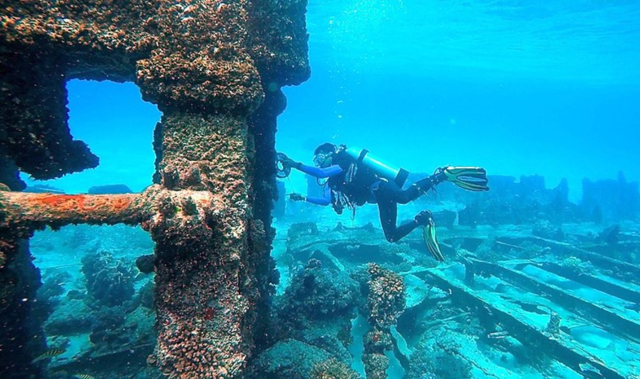 Dwi sumiyyah, CC BY-SA 4.0, Wikimedia Commons
Analysis Of Materials
Scientists study these artifacts closely to figure out what they were made of and how they were used. For example, they might examine the shape of stone tools to understand how ancient people used them to cut or hunt.
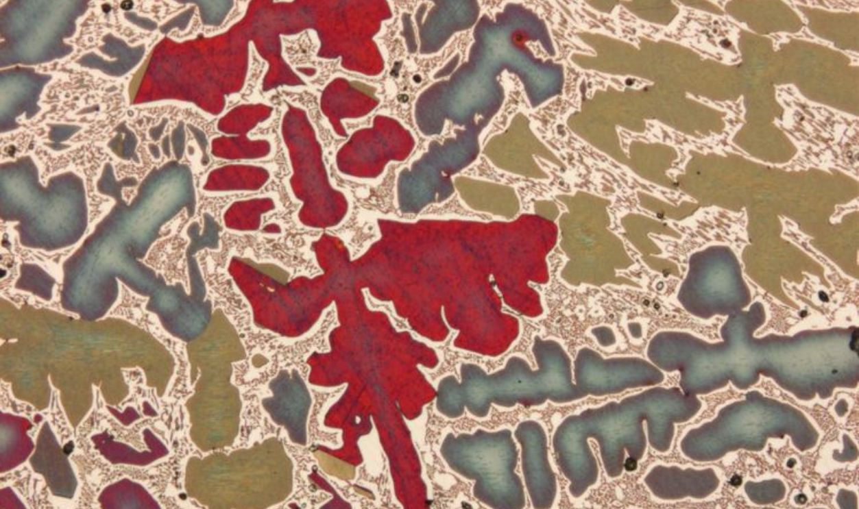 Eisenbeisser, CC BY-SA 3.0, Wikimedia Commons
Microscopic Examination
Sometimes, scientists use microscopes to look at tiny details on the tools and bones. This can show them how the tools were used, such as whether they were used to carve wood or butcher animals. It also leaves clues about the people's skills and craftsmanship.
 Thamizhpparithi Maari, CC BY-SA 4.0, Wikimedia Commons
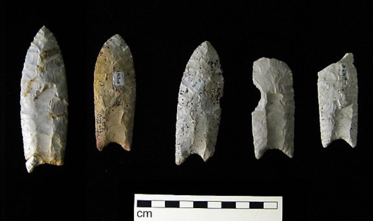
Stone Tools
Many of the stone tools collected from Doggerland illustrate the technological developments of its people. These instruments show creativity and adaptability in their use of techniques that range from simple flakes to sophisticated blades.
 Unknown author, Wikimedia Commons
Flint Knapping
The people of Doggerland often used flint knapping, a technique to create a sharp tool or weapon from flint. Hunting, cooking, and daily chores all depended on this ability. Be sure that they were not as primitive as once thought.
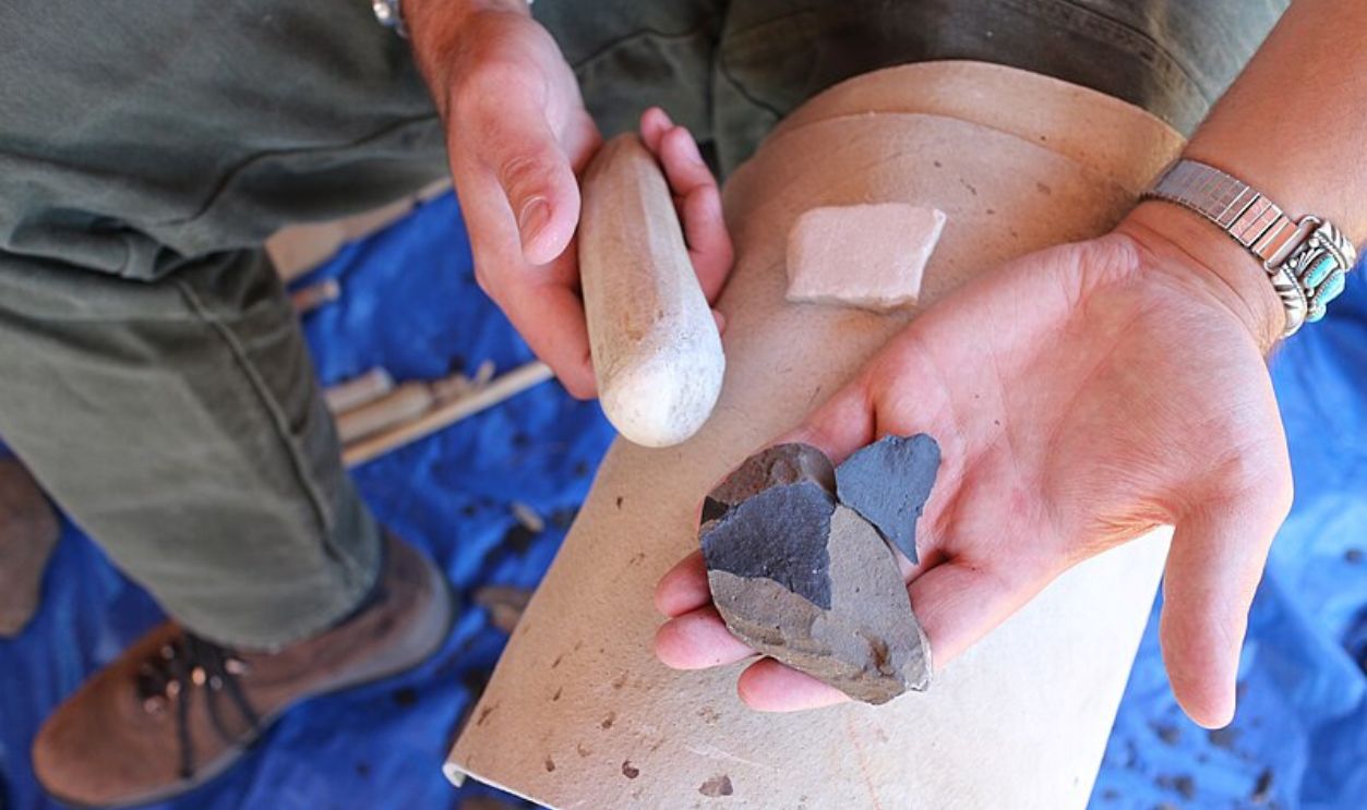 Tonto National Monument, CC BY 2.0, Wikimedia Commons
Prehistoric Tool
Dr. Sasja van der Vaart-Verschoof, assistant curator at the National Museum of Antiquities, made a remarkable find: a 50,000-year-old tool. A small piece of flint, still fixed in place with birch resin, reveals clear signs of how it was once used.
 Billwhittaker, CC BY-SA 3.0, Wikimedia Commons
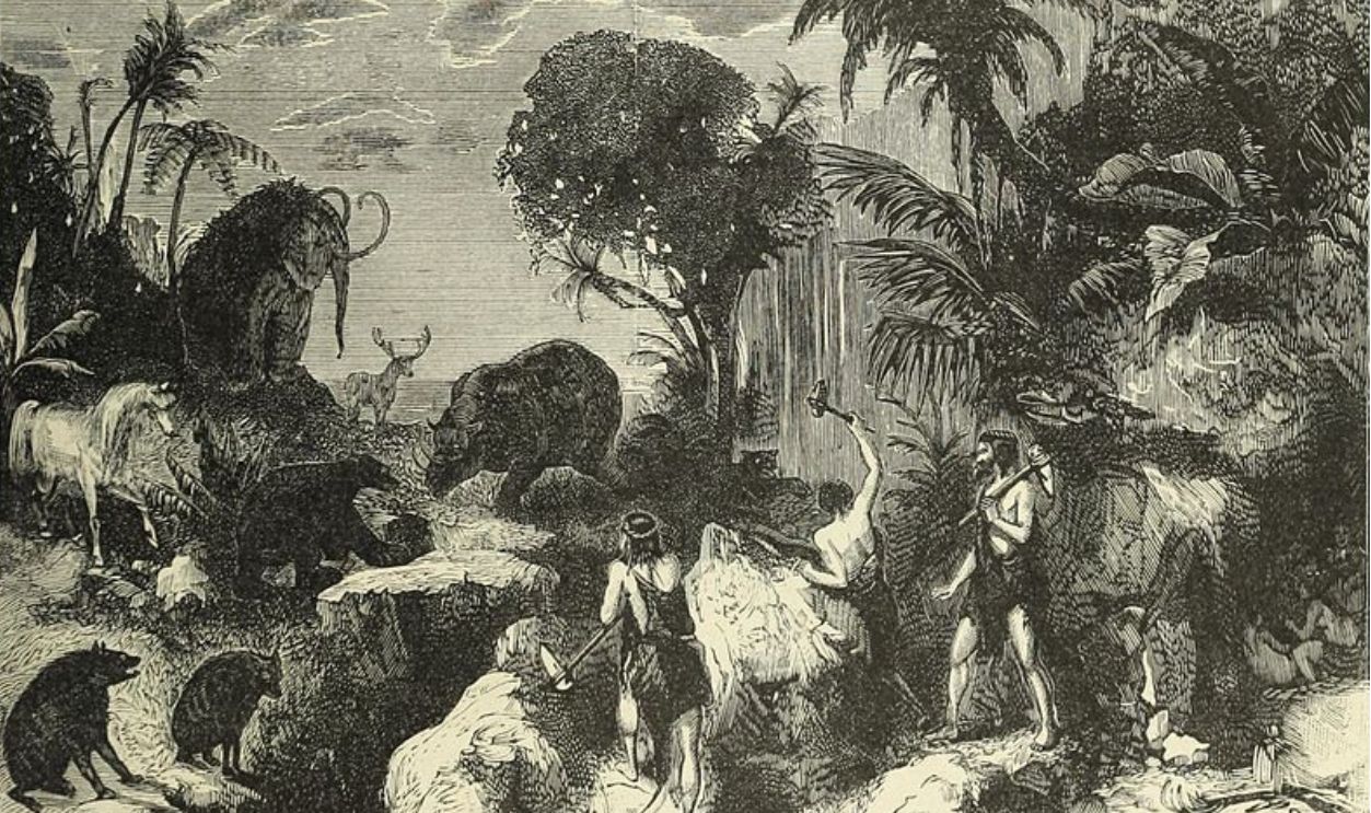
Hunters and Warriors
Alongside tools, the artifacts from Doggerland include weapons like antler spear points, arrowheads, etc. made from bone or stone. Life there was very much about practical hunting and survival.
 Old Time Music Fan, CC BY-SA 3.0, Wikimedia Commons
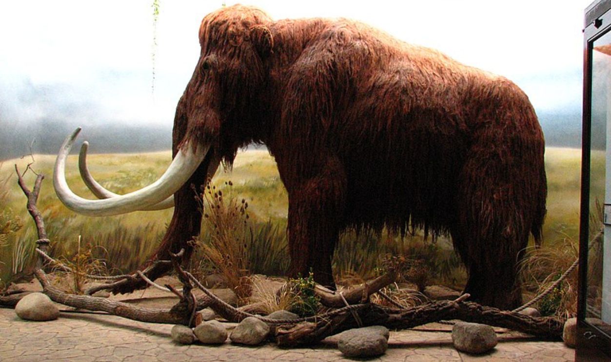
Animal Remains
By examining Doggerland, underwater scientists were able to discover the bones of several animals, including deer, bison, and mammoths. These bones could help us recreate ancient human diets and hunting methods knowing the wildlife that existed then.

Diet And Subsistence
Dependent on fishing, hunting, and gathering, Doggerland's population ate a varied and nutritional diet. The bones found on the seafloor underwent an isotope analysis, which allowed scientists to understand more about their diet and its diversity.
 MUSE, CC BY-SA 3.0, Wikimedia Commons
Meat, Fish, And Sea Creatures
Based on these analyses, the people of Doggerland ate both land and freshwater animals. More specifically, they got their nutrition from hunted animals, fish, and possibly other sea animals, especially once the seas began to cover more of the landmass.

Ancient Settlement Structures
Researchers in Doggerland have also uncovered postholes, hearths, and pits—remnants of ancient settlements that suggest organized communities with distinct social and economic structures.
 HOWI, CC BY 3.0, Wikimedia Commons
Ancient River Channels
The old river routes along Doggerland were vital for trade, transportation, and food. For their inhabitants, the Doggerland rivers were lifelines to food and other communities. For us, it's a way to discover more about their lives.
Settlement Patterns
Examining Doggerland's settlement patterns give us a peek into their social and economic hierarchies. The way artifacts and the shape of the landscape are distributed points out the places that had greater population density and activity.
Evidence Of Humans
Human remains discovered in Doggerland provide more information into lifestyle, diet, and health. These relics help us get a closer look at prehistoric societies and gain a better sense of human evolution and migration.
 Neanderthal-Museum, CC BY-SA 4.0, Wikimedia Commons
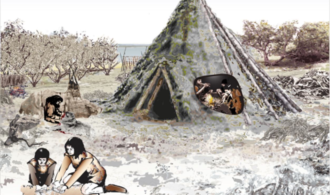
Social Life
Culturally, the Mesolithic people led a nomadic lifestyle that adapted to seasonal changes. They used tools and artifacts, some of which were those that washed up ashore or were found embedded in the seafloor. These artifacts, along with preserved footprints, provide a glimpse into their way of life.
 Gary Todd, CC0, Wikimedia Commons
A Lost Culture
Doggerland was a thriving hub of life and activity during the Mesolithic era. Its disappearance, driven by drastic climate change, left a lasting mark on both the landscape and the people of northwest Europe.
 RachelAM, CC BY-SA 4.0, Wikimedia Commons
Climate Change Impact
Doggerland was submerged because of climate change, rising sea levels, and shifting landscapes created by changing weather patterns. Examining these effects helps explain historical human reactions to environmental problems and how we should do better.

Public Engagement
Raising knowledge and respect for this ancient landscape depends on public involvement and education. Exhibits, films, and instructional courses about Doggerland are helping spread interest in this story, which links us with the inhabitants and our climate challenges.

Research Collaborations
Discovering Doggerland's mysteries has required close cooperation among archaeologists, geologists, and other specialists. These multidisciplinary projects study the lost land by combining tech and theory. Cooperation improves this research and results in innovative ideas. We wonder what kind of fresh alliances will propel future studies.

Future Research
Future studies in this area will definitely reveal more surprises about this extinct society. Technological and methodological developments intend to stretch the boundaries of exploration. Every fresh discovery reveals the complexity of our past and contributes to the jigsaw puzzle that is Mesolithic history.


.jpg)