
As nature intended
Imagine a place where nature reigns supreme. Hidden away from civilization, these landscapes are almost completely pure; left virtually unexplored by humans. From towering mountains and endless forests to shimmering oceans teeming with life, here are some of our planet's most mesmerizing untouched places.
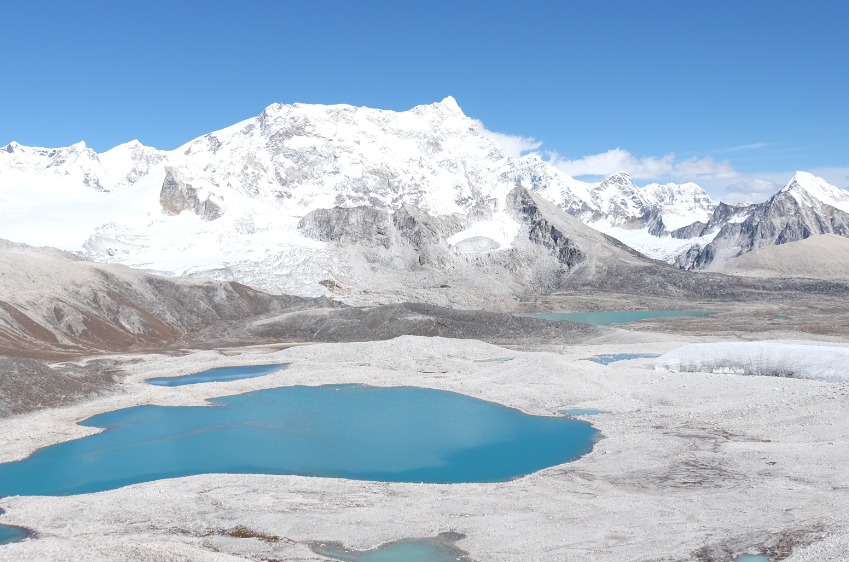
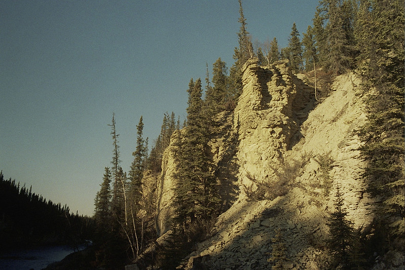
Gangkhar Puensum
Gangkhar Puensum, standing 7,570 meters tall, is the world's tallest unclimbed peak. Not only is it inaccessible by nature, but Bhutanese mountains are considered sacred, hindering climbers from attempting to climb it in the first place.
 Steynard--Thanks for 5 million views!, Flickr
Gangkhar Puensum
In 1922, Gangkhar Puensum's height was initially calculated, but inaccurate maps caused much confusion about its location and elevation. The peak was not even located by the first team attempting to reach it. Its location is debated to be somewhere between Tibet and Bhutan.
 Champer, CC BY-SA 3.0, Wikimedia Commons
Gangkhar Puensum
Despite attempts in the 1980s, no one has conquered Gangkhar Puensum. Bhutan banned climbing peaks over 6,000 meters in 1996 leaving much of the mountain still untouched by modern humans.
 Gradythebadger, CC BY-SA 4.0, Wikimedia Commons
Gangkhar Puensum
In 1998, Japanese climbers tried to ascend a peak in Bhutan from the Chinese side. Bhutan requested China to cancel their permit, and China complied. The fact that China was willing to comply with Bhutan's request speaks volumes—Gangkhar Puensum is clearly revered and respected by many.
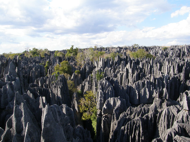
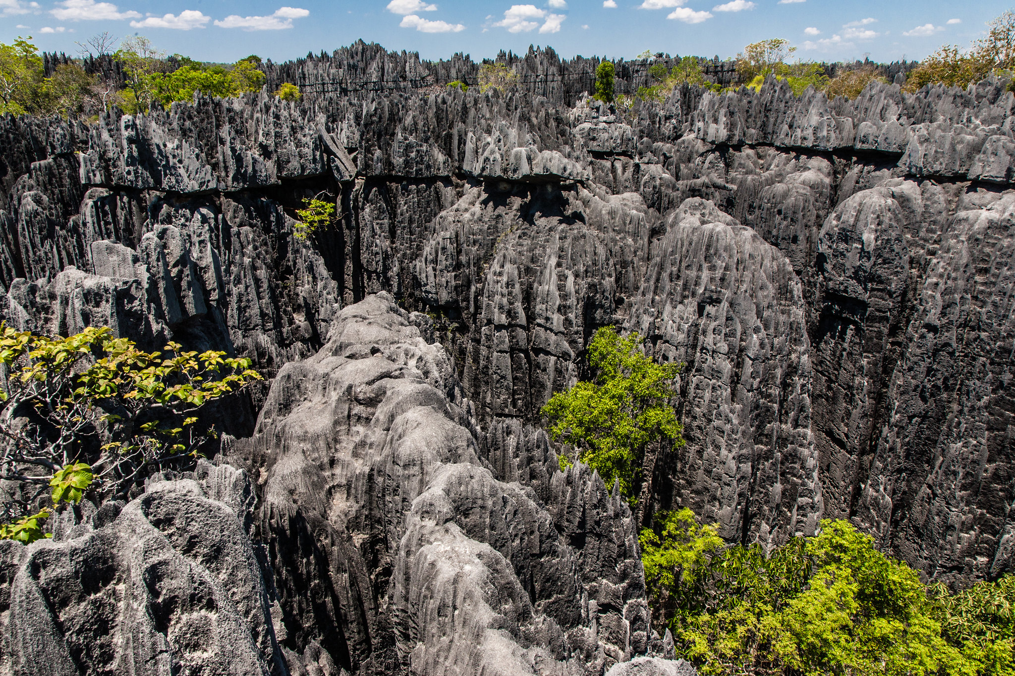
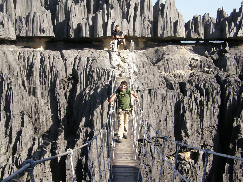
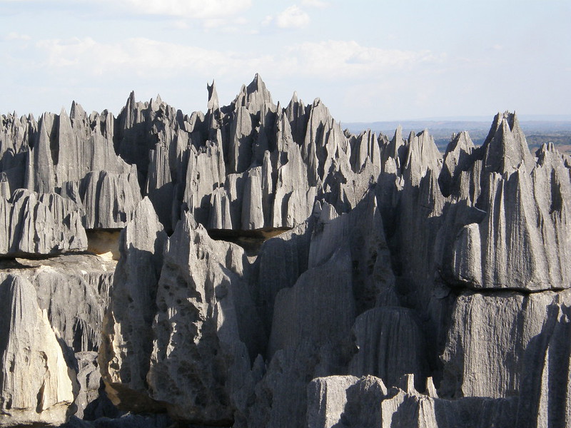
Grand Tsingy
The Grand Tsingy, or The Tsingy de Bemaraha National Park in Madagascar, is known for its unique karst formations created by erosion. The term "tsingy" translates to "walking on tiptoes" in Malagasy, reflecting the park's strikingly rugged terrain.
Grand Tsingy
Elevated plateaus known as Tsingys are formed by groundwater erosion, creating caves and cracks in limestone. In western Madagascar, vertical and horizontal erosion has created impressive limestone needle "forests."
Grand Tsingy
Designated as a UNESCO World Heritage Site, it is home to rare species like bamboo lemurs and fossas. Hiking enthusiasts flock to this untamed destination to explore its distinct landscapes and wildlife.
Grand Tsingy
While the Grand Tsingy is virtually untouched (and well-protected to keep it that way), visitors can still explore via the park's meticulously planned walkways, steel ladders, and cable ropes. To reach the park from Morondava, a 10-hour journey on bumpy dirt roads is required. An overnight stay at Kirindy Forest can break up the journey, followed by a ferry ride and a 5-hour trip to Bekopaka with security personnel accompanying tourists.
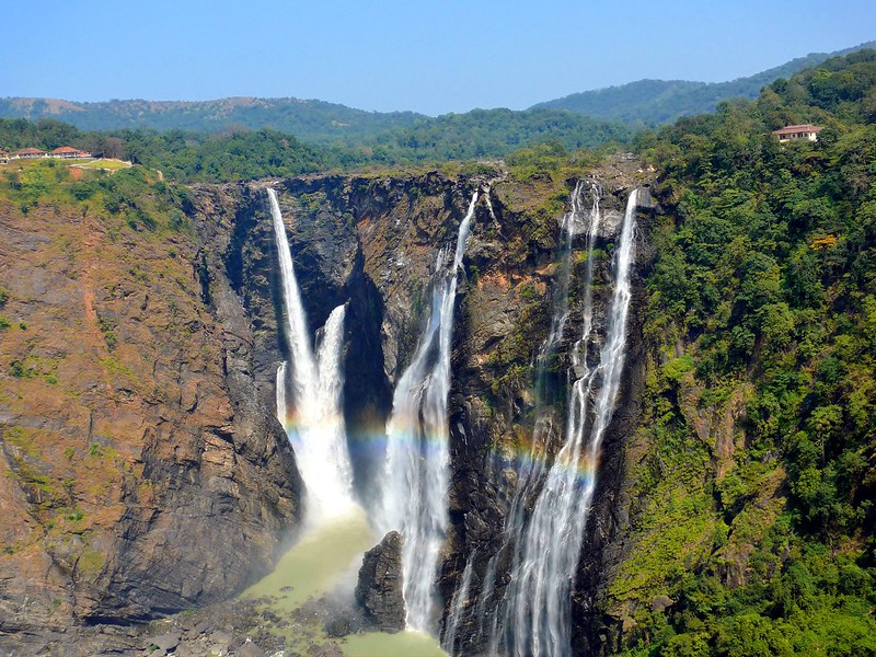
Honokohau Falls
The best view of Honokohau Falls, Maui's tallest waterfall, can only be seen from higher ground. The impressive waterfall stands at 1,100 feet and cascades in two levels in a secluded valley with no access roads. Helicopter tour offer a unique aerial perspective of this iconic waterfall, which was featured in the popular '90s film "Jurassic Park."
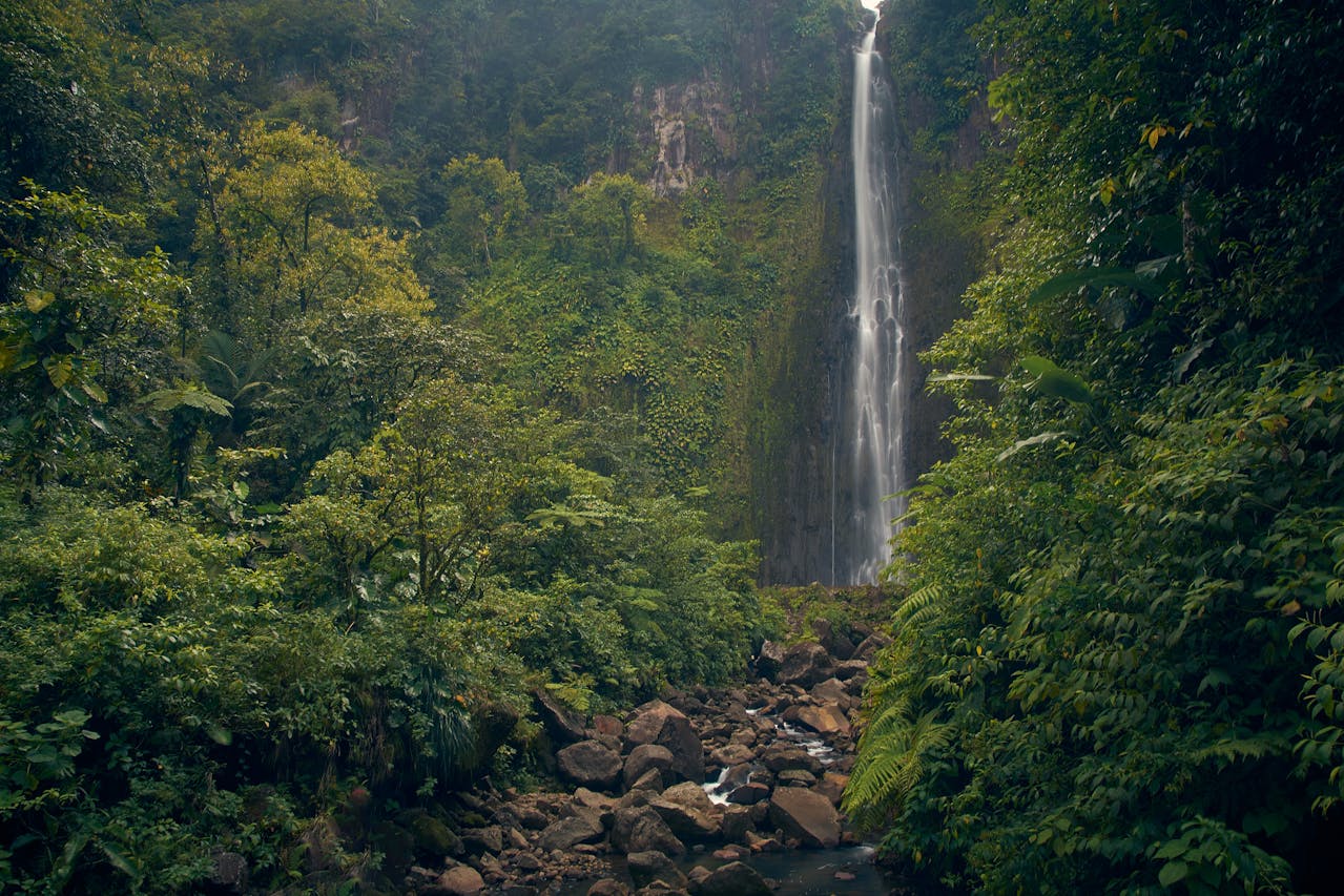
Honokohau Falls
Honokohau Falls, named after Honohokau stream, is a beautiful spot in Hawaii originating at Puu Kukui peak. It offers stunning views, but getting there is not as easy as it seems.
Honokohau Falls
Not only is there no access to Honokohau Falls from the ground, it can also be very difficult to get a helicopter tour to take you there due to the risky nature of the trip. This makes Honokohau Falls even more inaccessbile, making it one of the most untouched places in the world.
Honokohau Falls
The Puu Kukui summit of Honokohau Falls is one of the rainiest places globally, receiving over 9,000 mm of rain annually. As such, weather plays a significant role in sightseeing in this region. Checking weather conditions before planning a helicopter trip to Honokohau Falls is recommended.
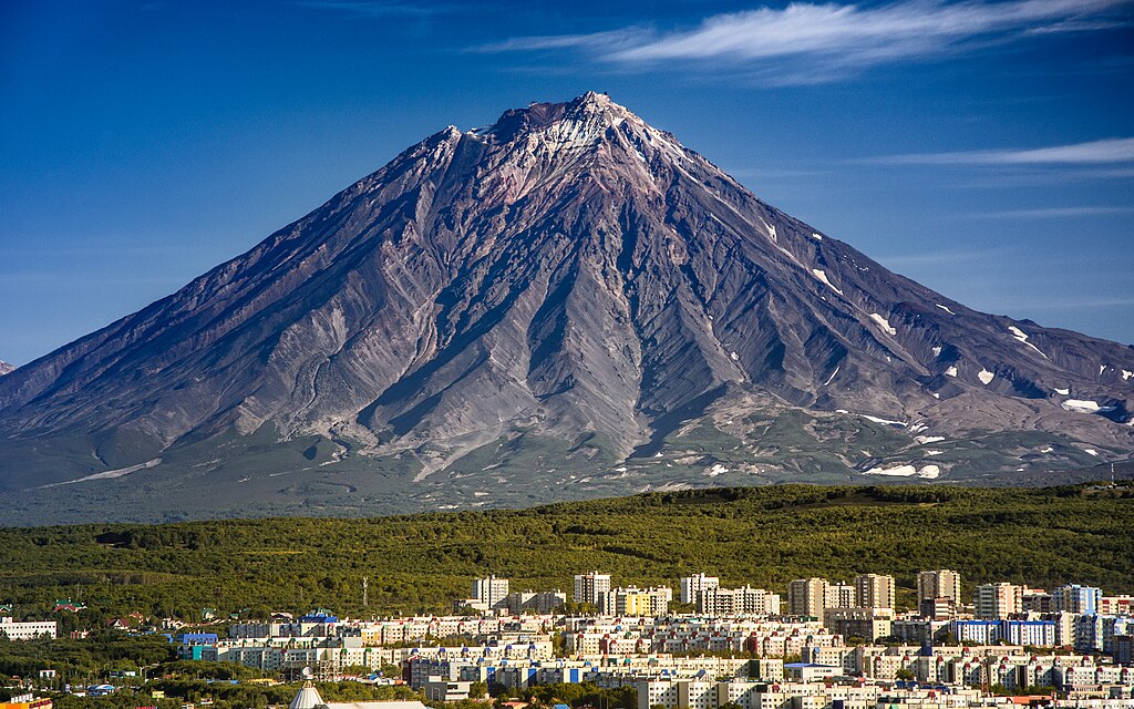
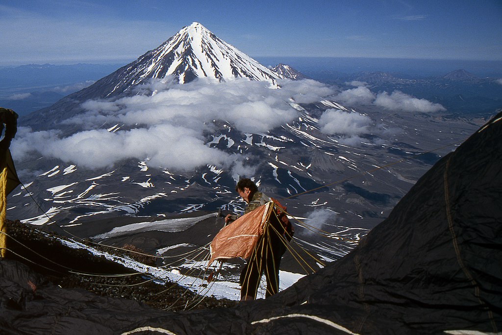
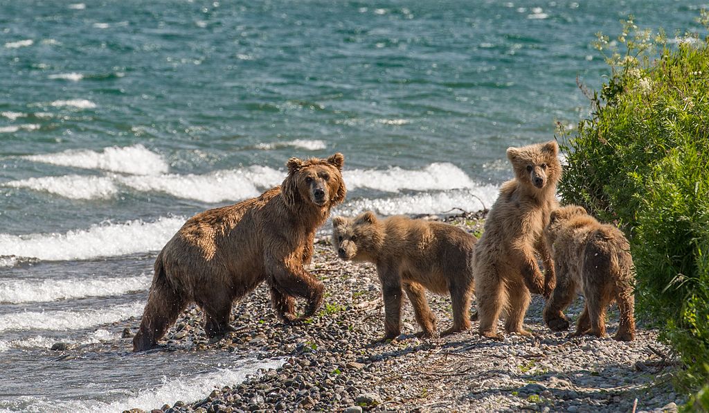
Kamchatka
Kamchatka in eastern Russia is renowned for its breathtaking beauty, rugged terrain, and rich wildlife. The landscape consists of tundras with mosses and lichens, alder thickets, and birch and larch forests in protected areas. Kamchatka also receives extreme weather with cold winters and mild summers.
 kuhnmi, CC BY 2.0, Wikimedia Commons
Kamchatka
The Kamchatka Peninsula has many geographical marvels to behold. It is home to two mountain ranges, the Sredinny and Vostochny, with the Klyuchevskaya Volcano reaching 15,584 feet. The Kamchatka River flows between these mountains.
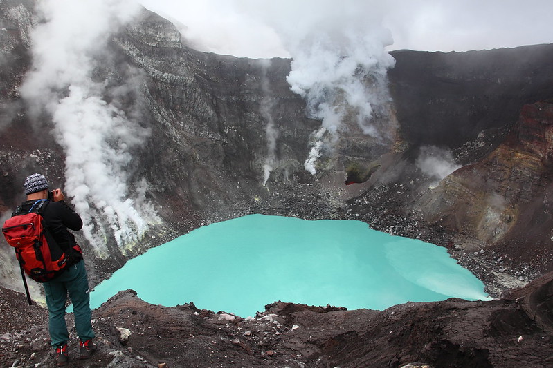
Kamchatka
Of the 127 volcanoes on the peninsula, 22 are active, along with geysers and hot springs. Most operational volcanoes are on a fault line on the eastern side of the Vostochny Range. The fiery volcanic activity offers a spectacular contrast with the cold, snowy, and barren terrain more inland.
 Giorgio Galeotti, Wikimedia Commons
Kamchatka
Despite being a vastly remote region, Kamchatka still offers tourists the chance to explore Siberian tundra and experience untouched nature, from snow-covered mountains to clear rivers and fertile valleys.
 lusika33, CC BY 3.0, Wikimedia Commons
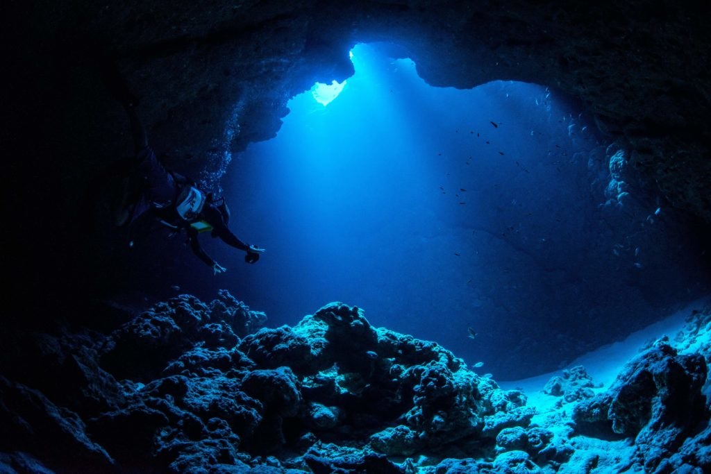
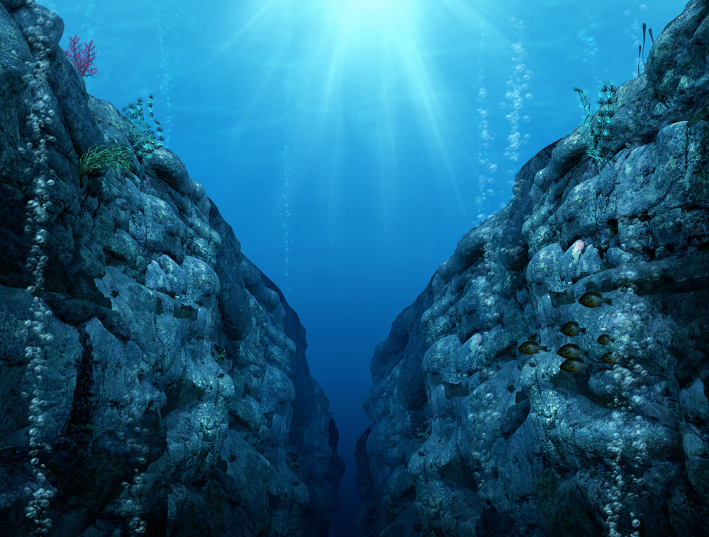
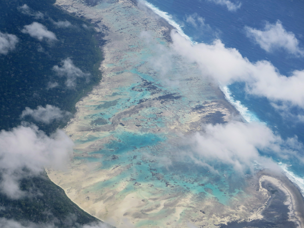
Mariana Trench
The Mariana Trench is the deepest ocean trench globally, located in the Pacific Ocean. With all the technological advances of our society today, the trench has barely been touched by humans.
 1840489pavan nd, CC BY-SA 4.0, Wikimedia Commons
Mariana Trench
The Mariana Trench reaches a maximum depth of around 11,000 meters, or 36,000 feet. Formed by the convergence of tectonic plates, this area presents a challenging environment with cold temperatures and high pressure.
Mariana Trench
Despite these conditions, researchers have discovered over 200 unique organisms that have adapted to survive in this extreme habitat. These creatures exhibit unusual traits like cartilage bodies and bioluminescence, showcasing the incredible biodiversity of the Mariana Trench.

Mariana Trench
Unfortunately, the trench has indirectly suffered from human polluting activities. Plastic debris has been found in its depths, leading to concerns from environmentalists. Ongoing investigations by scientists aim to better understand and protect the Mariana Trench, with collaboration from various nations.
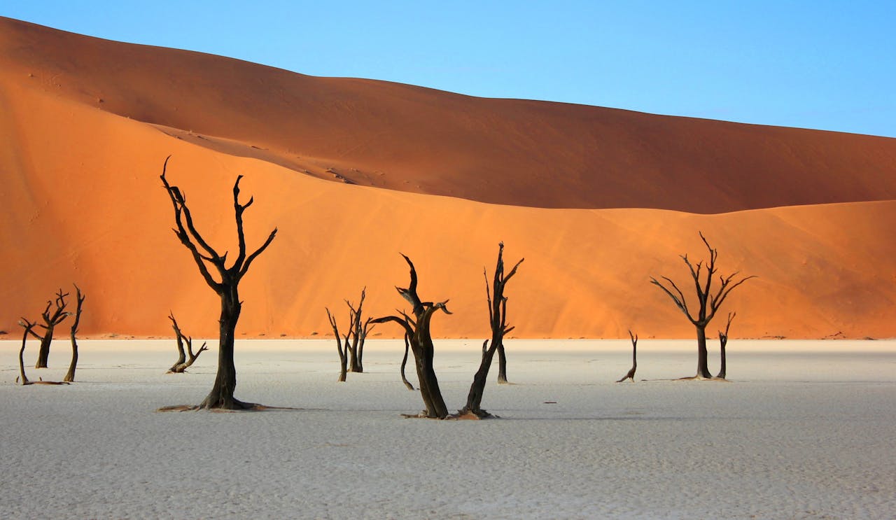
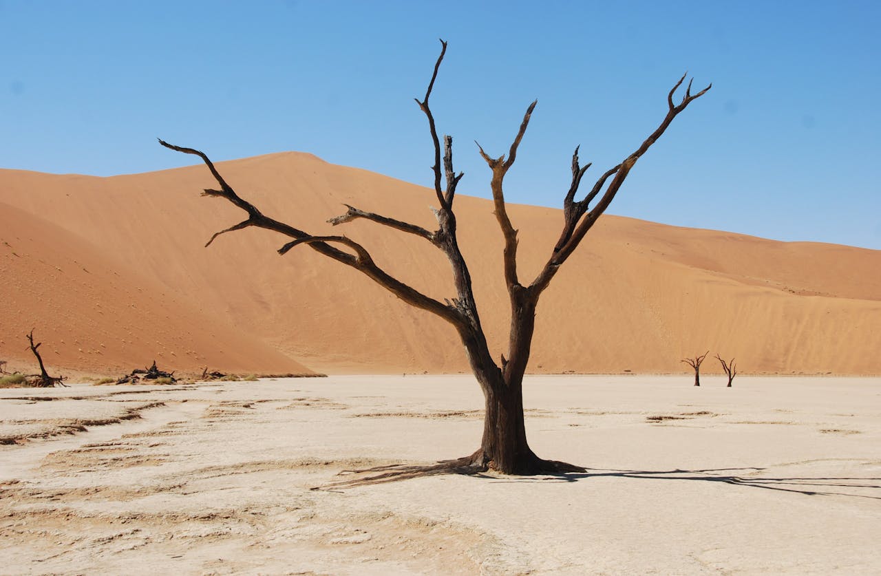
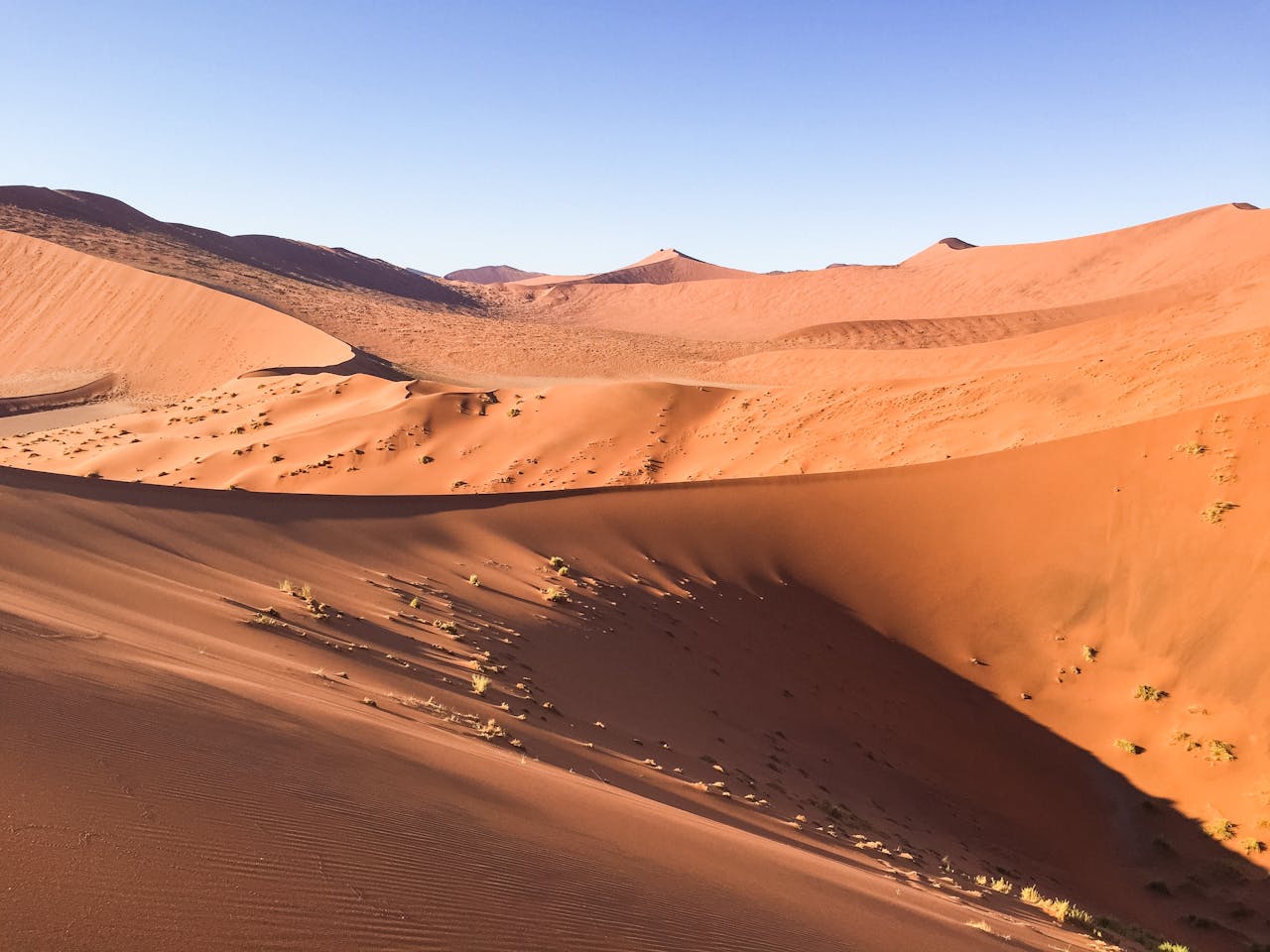
Namib Desert
The Namib Desert in Namibia is among the driest and oldest deserts on Earth, stretching 120 miles along the coast with extreme weather conditions that keep it mostly uninhabited. This isolation has allowed the desert to remain untouched, resulting in a unique landscape shaped by time and weathering, with flowing dunes, dry streambeds, and otherworldly hills.
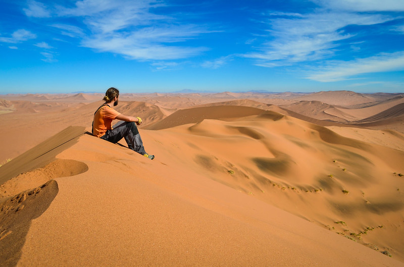
Namib Desert
The Namib Desert is believed to have been dry for up to 80 million years. Although not the largest desert, it is likely the oldest. Some parts receive as little rainfall as South America's Atacama Desert, one of the driest places on Earth, with an average of 2 mm per 0.08 inches annually.
Namib Desert
Travelers in Namibia are often surprised by a sudden chill and fog when moving from landlocked areas to sandy shores with dunes. Looking out at the sea from a sand dune on a foggy day creates a strange, chilling feeling. About 180 days of fog happen per year due to cold air from the Benguela Current meeting hot air from the dry interior.
Namib Desert
The Namib Desert may also be a hotbed for evolutionary processes. Unique adaptations in behavior, form, and physiology are seen in species living in mist-covered coastal dunes of Namib Sand Sea. Diverse plant and animal species show evolution and life's resilience.
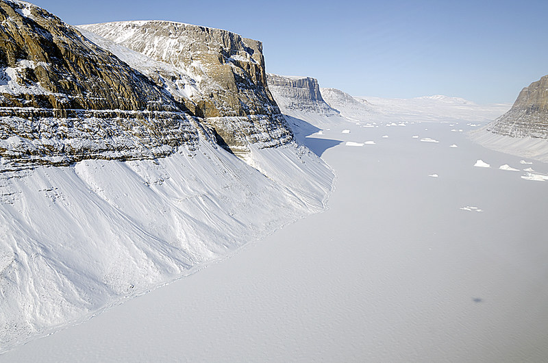
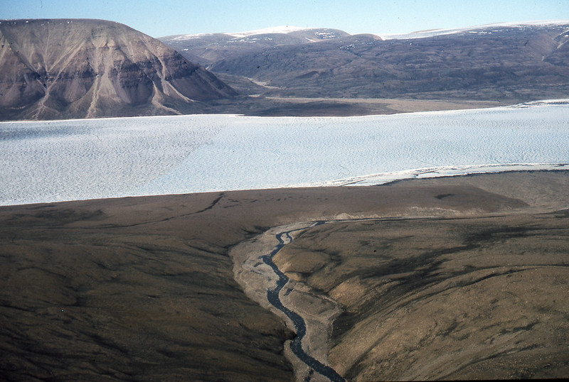
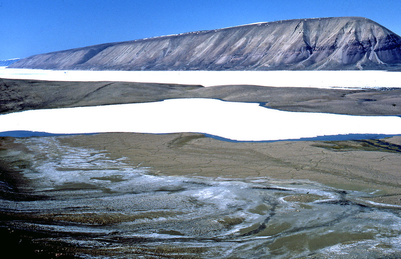
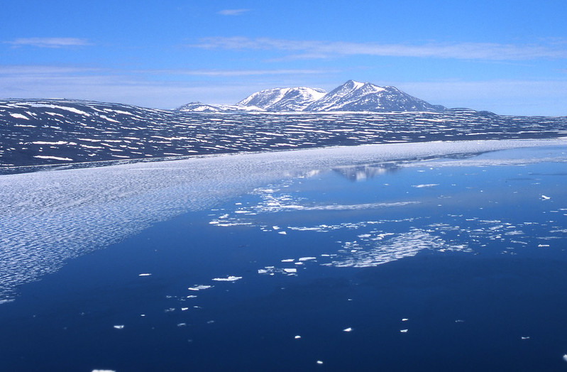
Northern Greenland
Northeast Greenland National Park is a vast, pristine area with protected wildlife, plants, and landscapes.The park features tundra, mountains, and icy fjords filled with icebergs. Access may be challenging—but visitors can explore nearly one million square kilometers of artic wonderland.
 NASA Goddard Space Flight Center, Flickr
Northern Greenland
Northern Greenland has no infrastructure like roads, harbours, or commercial airports, with no accommodation options. Small gravel runways in the National Park are used for station maintenance, but not for civilians. The nearest public airport, Nerlerit Inaat (Constable Point), is 80 km south of the National Park near Ittoqqortoormiit (Scoresbysund).
Northern Greenland
Northern Greenland is so remote that in order to enter the Greenland National Park, obtain a government permit in advance. Cruise passengers don't need to do this as the travel agency manages it. Solo travelers often explore the park by boat.
Northern Greenland
Expedition cruises in Northern Greenland, originating from Iceland and Svalbard, offer a unique way to explore the area. Cruise ships usually disembark in the southern regions at points of interest. Access to the park can also be gained from the nearby town of Ittoqqortoormiit.

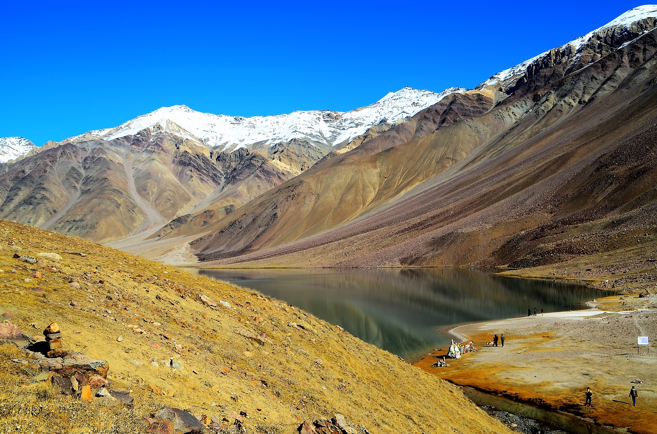
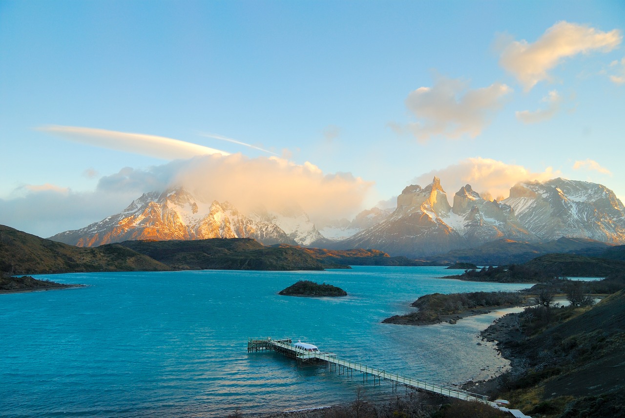
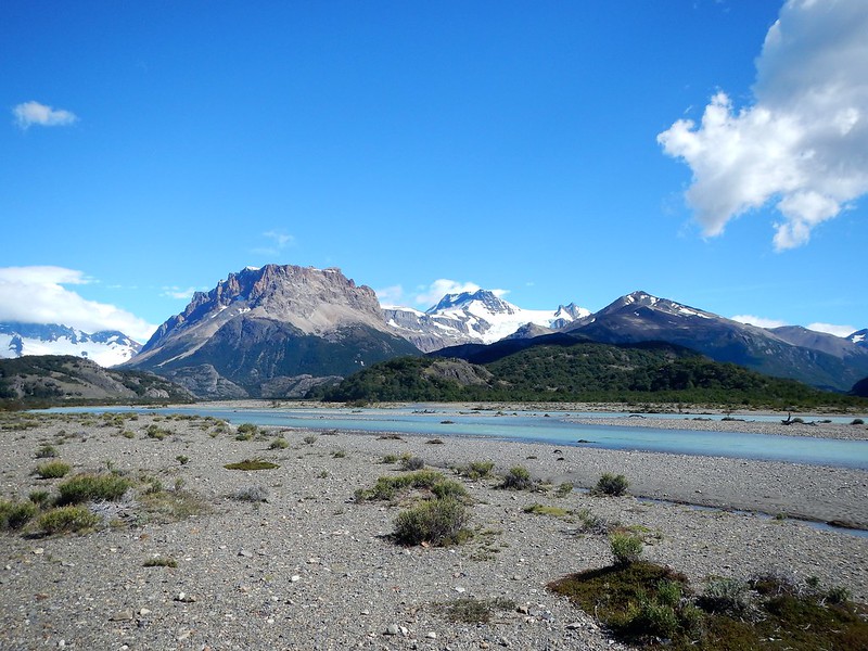
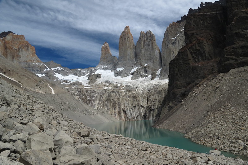
Northern Patagonia
Few places on Earth remain as untouched by humans as Patagonia. The northern region of the Chilean park offers a unique environment with enchanted forests, active volcanoes, powerful rivers, and intricate fjords.
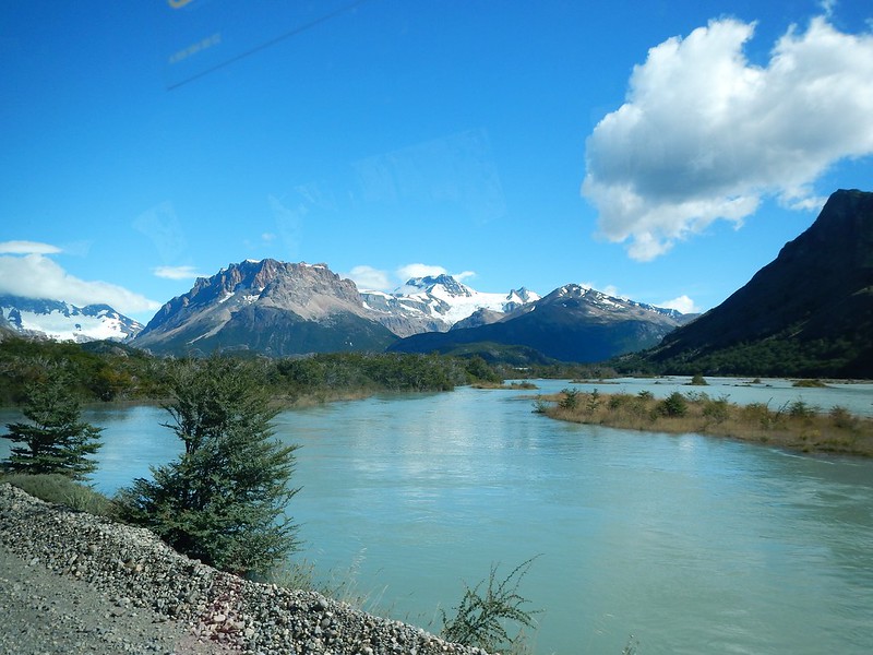
Northern Patagonia
Puerto Montt is the ideal starting point for exploring Northern Patagonia. The area's U-shaped valley resembles California's Yosemite Valley, where Butch Cassidy allegedly led his cows under alerce trees. Nearby, La Junta offers adventurous rock-climbing opportunities on tall granite domes.
Northern Patagonia
Northern Patagonia is home to lush rainforests that capture most clouds from the Southern Ocean. Parque Pumalin, founded by Doug Tompkins of The North Face and now a national park, offers scenic hiking trails like Sendero Cascada and Sendero Volcán Chaitén, leading to a spectacular waterfall and an active volcano.
Northern Patagonia
For a change of pace, explorers can soak in a natural hot spring called Termas del Ventisquero in the Puyuhuapi region of the park. Kayaks are also available for rent to see sea lions, petrels, dophins, and penguins in the fjord.
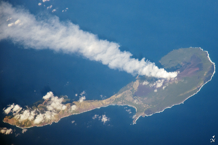
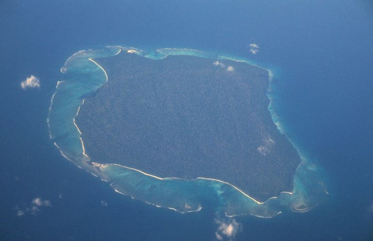
North Sentinel Island
North Sentinel Island is home to maybe the last uncontacted group on Earth. Known as the Sentinelese, they fiercely reject any attempts by outsiders to approach their secluded home in the Bay of Bengal in India. Sentinelese population estimates vary from 50 to 500.
North Sentinel Island
In 2018, American missionary John Allen Chau was killed on North Sentinel Island by the Sentinelese. This incident highlighted the island's history of hostility towards outsiders. Despite this, limited information reveals the fascinating lifestyle of the inhabitants, who live a simple, untouched existence.
North Sentinel Island
Flying over North Sentinel Island is the only way to see its beauty, with lush forests, clear blue waters, and coral reefs. The island is 60 square kilometers in size and its twin, South Sentinel Island, has no residents.
North Sentinel Island
Following a 2004 earthquake, the island's elevation rose and a nearby islet merged with it. When Indian government officials inspected the island after the quake and tsunami, the Sentinelese people were unharmed and even attacked the helicopter sent to check on them. Today, it remains just as untouched as it was decades ago.
 Medici82, CC BY-SA 4.0, Wikimedia Commons
Northwest Territories
While there are communities that exist in the Northwest Territories, there are many inaccessible areas of the Canadian province that are yet to be explored. Nearly 40 percent of the Northwest Territories is considered Arctic land, and that comes with the expected rough conditions of snow, ice, and severe cold.
Northwest Territories
The landscape of the Northwest Territories is as raw as it gets. It is a remote, pristine area with towering mountains, endless forests, and crystal-clear lakes that will transport you to a bygone era.
Northwest Territories
Nahanni National Park Reserve in the Northwest Territories features impressive waterfalls and canyons. In the southern half of the province, the massive Great Slave Lake offers plenty fishing and boating opportunities—but it is just as unexplored as many other sites in the area.
Northwest Territories
Banks Island's northern area in Aulavik National Park is the most isolated region in the Northwest Territories, located within the Arctic Archipelago. The park, known as "place where people travel" in Inuvialuktun, offers a rare wilderness experience with purely natural landscapes and abundant wildlife, including muskoxen and Arctic foxes.
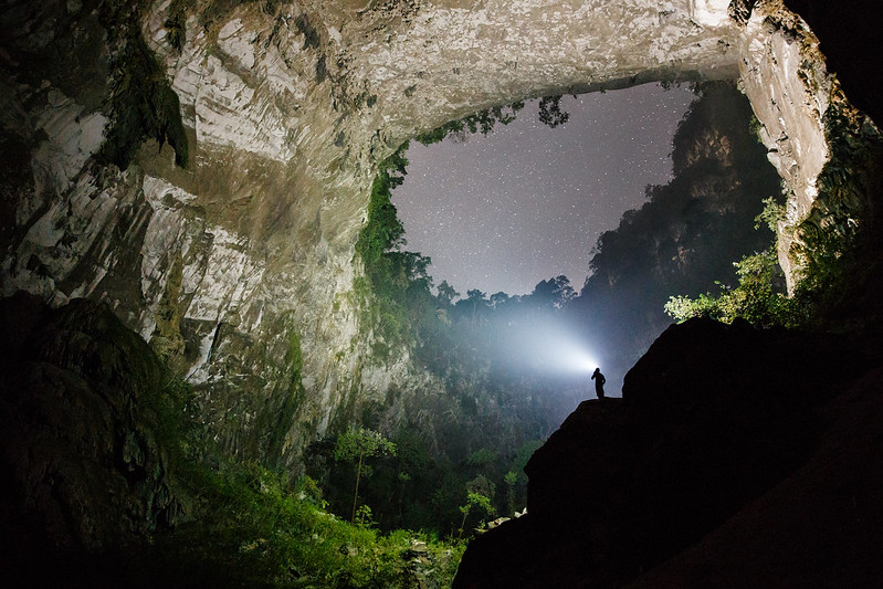
Son Doong Cave
Son Doong cave in Vietnam holds three world records, one being its status as the world's largest natural cave. is a stunning underground masterpiece. Located in Quang Binh province, it's a UNESCO World Heritage Site, highlighting its exceptional beauty and significance.
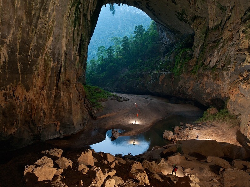
Son Doong Cave
Son Doong is the largest cave globally, measuring almost 9 kilometers long with a volume of 38.5 million cubic meters. Its tallest cave arch reaches 243.84 meters in height, and its maximum width is 150 meters. Comparatively, it is five times bigger than En Cave, the third largest cave globally, surpassing it in all dimensions and making everything else around it seem small.
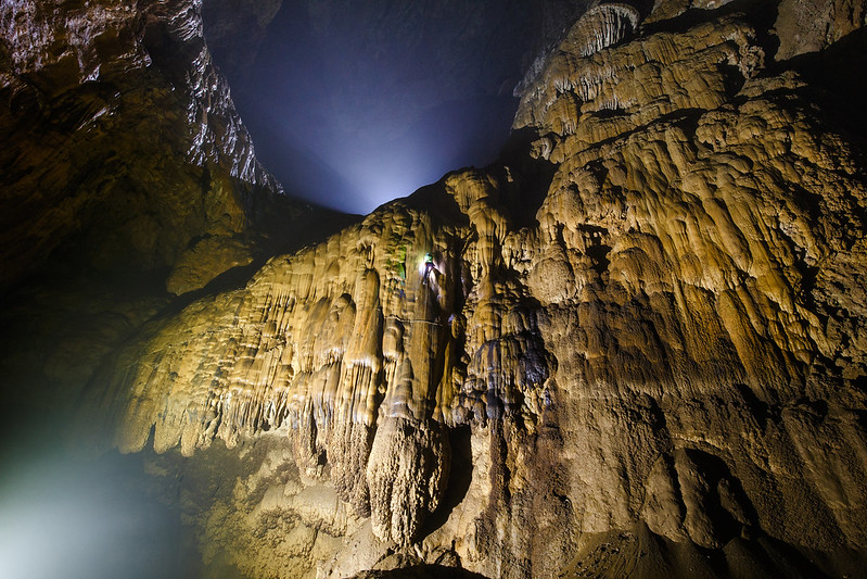
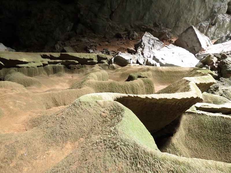
Son Doong Cave
The cave of Son Doong has various chambers creating different microclimates that impact the distribution of organisms. Life thrives in unique niches due to varying humidity, temperature, and light levels.
Son Doong Cave
The cave is adorned with mesmerizing stalagmites and stalactites, formed over millions of years by mineral-rich water droplets. Towering up to 80 meters high, Son Doong is rich in plant life and distinct wildlife, flourishing in unexpected locations. Nature's power and life's enduring strength are showcased within this awe-inspiring cave.
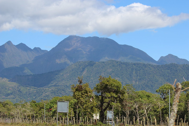
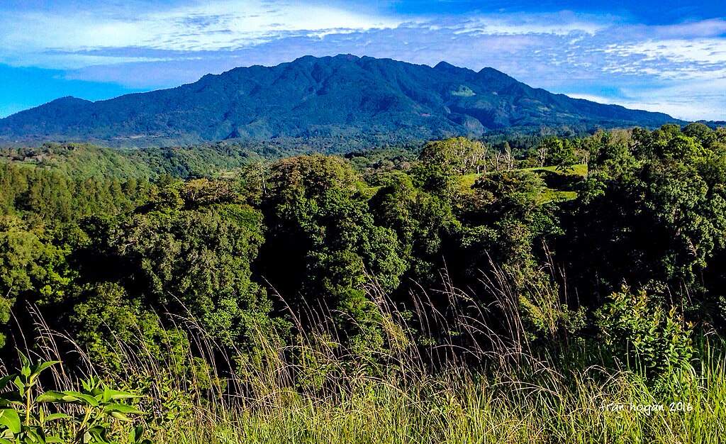
Star Mountains
The Star Mountains in Papua New Guinea are 100 km long with a 4,760 m peak. It's been climbed by only 10 people since 1958, leaving the majority of the range unexplored and untouched.
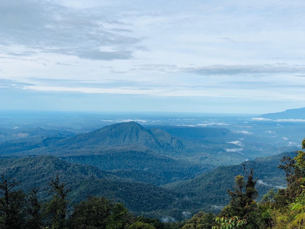
Star Mountains
The Star Mountains have a special ecosystem where almost 100 out of 1,100 species are thought to be new to science. The harsh landscape and extreme rainfall contribute to the area's undiscovered nature and challenging conditions.
 Rick Kimpel, CC BY-SA 2.0, Wikimedia Commons
Star Mountains
In this remote area lies the Hindenburg Wall, a mile-high series of limestone plateaus. Stretching 30 miles, these bluffs host pristine ecosystems at high elevations.
Star Mountains
Trips to the Star Mountains are available for adventure seekers, including a 20-day trekking and pack-rafting expedition. It offers a once-in-a-lifetime experience—however, it will set you back a whopping £10,995.
 FranHogan, CC BY-SA 4.0, Wikimedia Commons
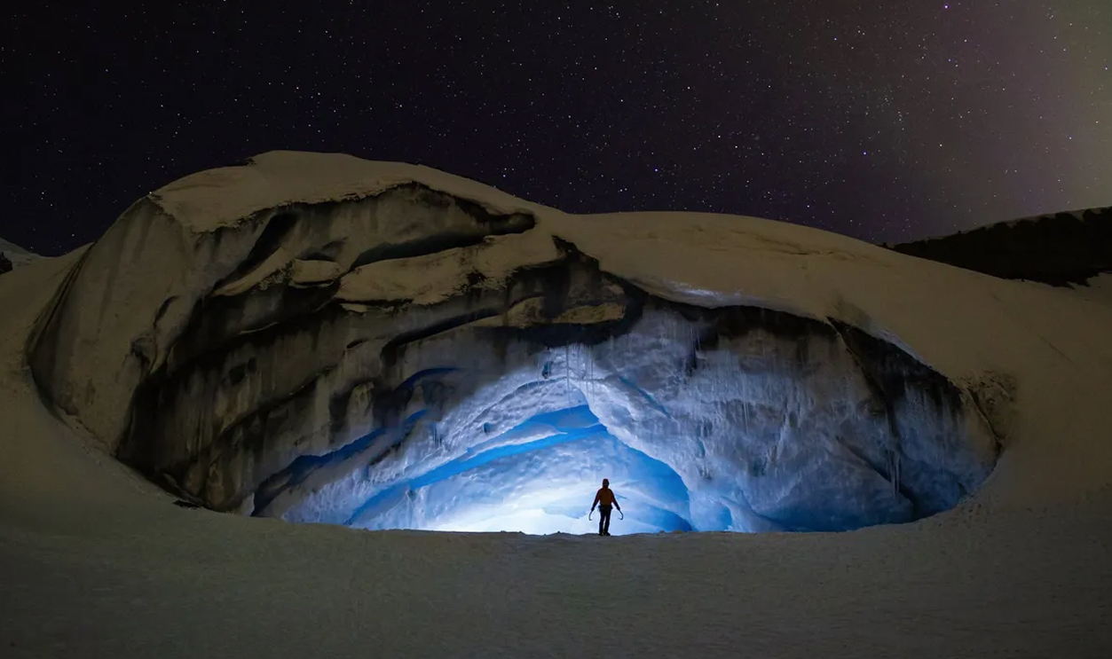
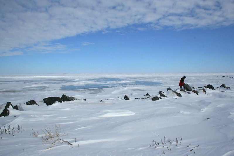
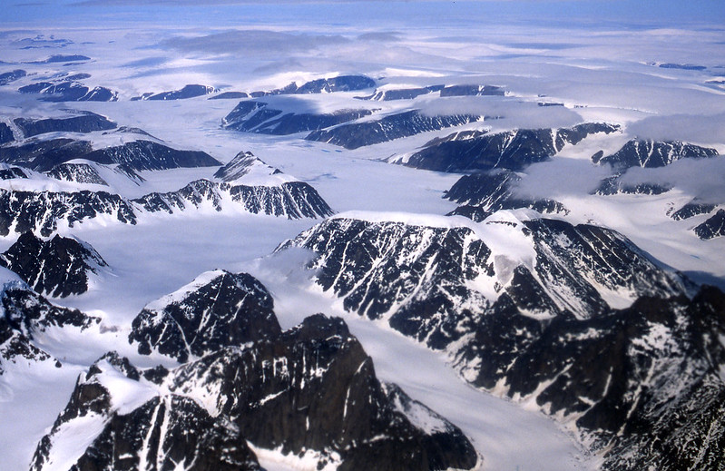
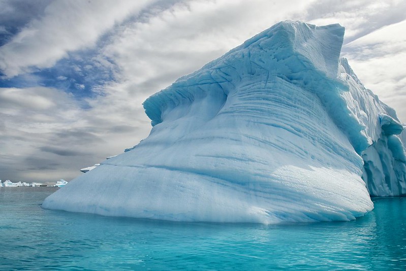
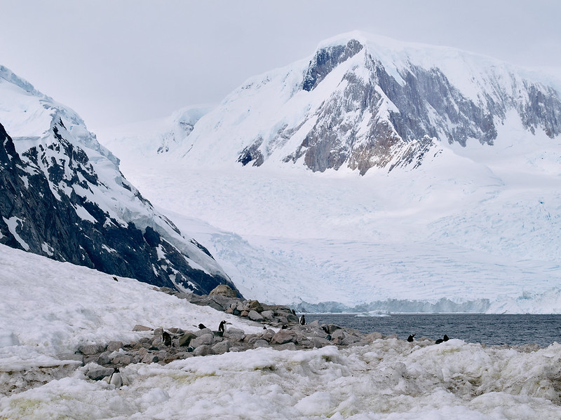
Subglacial Antarctica
Antarctica is a vast, untouched wilderness without farms, cities, or factories, with a low population. It covers over 99% of the continent, comparable to the expansive forests in the far Northern Hemisphere and almost twice the size of Australia.
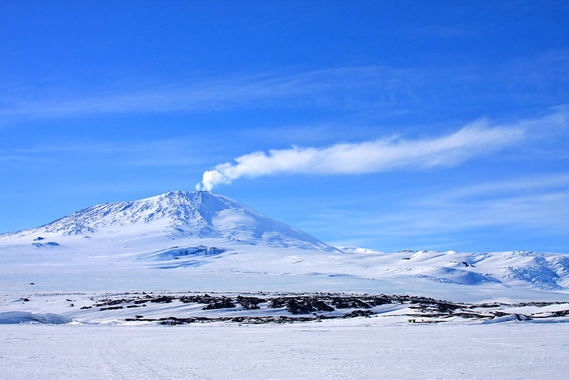
Subglacial Antarctica
Scientists have long known about hidden water chambers under Antarctica's ice sheet. Over 300 subglacial lakes have been found using remote sensing, kept from freezing by geothermal heat. Organisms there could be unique due to isolation for millions of years.
Subglacial Antarctica
Lake Vostok, hidden under an ice sheet, is an untouched territory with potential undiscovered life forms. Discovering life in its depths could reveal if life is possible in harsh environments like Mars or Jupiter's Europa, providing insights into Earth's pre-ice age times.
Subglacial Antarctica
Expedition cruises starting from Ushuaia, Argentina, through the Drake Passage are a popular way to visit Antarctica. Options range from luxurious to simpler, expedition-style journeys. For those wanting to avoid the challenging waters of the Drake Passage, some companies offer fly-cruise options from Punta Arenas, Chile, to King George Island in Antarctica.
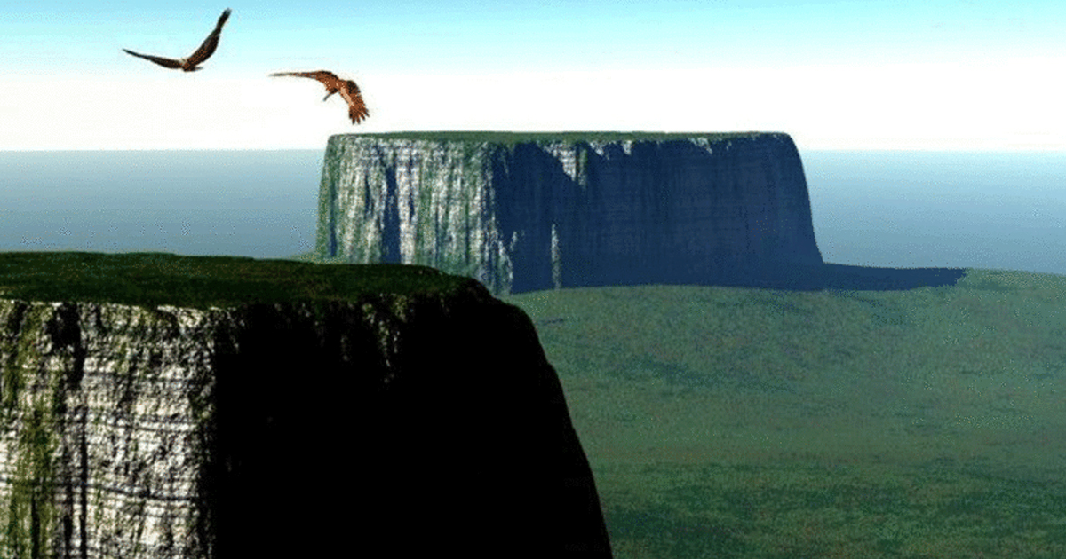
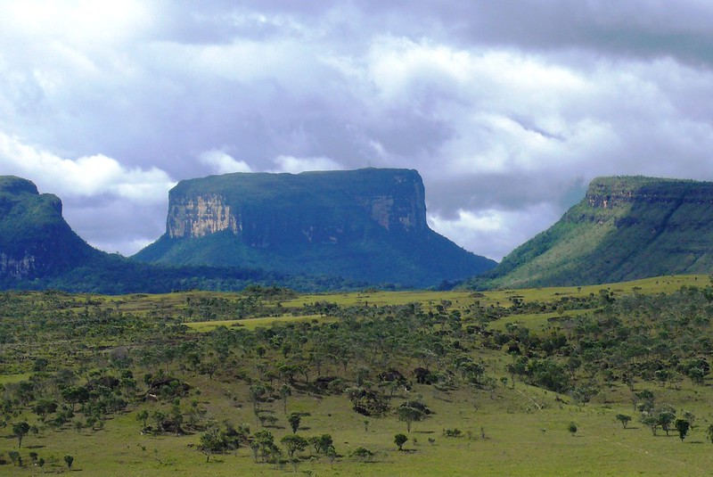
Tepui Mountains
Canaima National Park in Venezuela covers over 30,000 square kilometers, making it one of the country's largest parks. It features steep mountains with flat summits called tepuis, housing over 100 of these geological formations.
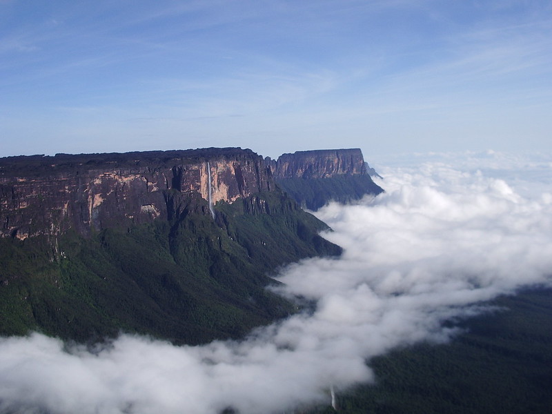
Tepui Mountains
Tepuis range from 1,000 to 3,000 meters in height and are among South America's most ancient formations. These table-top mountains formed from sandstone plateau overlaying a 1.7 billion-year-old granite basement rock, with layers of sand compressing into thick rocks.
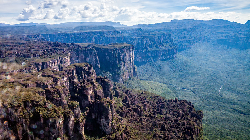
Tepui Mountains
Tepuis tower above the forest and host exclusive animal and plant species. Around 33% of mountain plants are local. Lower slopes house mammals like monkeys, jaguars, and sloths, while reptiles inhabit the peaks and sides. Unique biodiversity thrives in these elevated ecosystems, unmatched elsewhere on Earth.
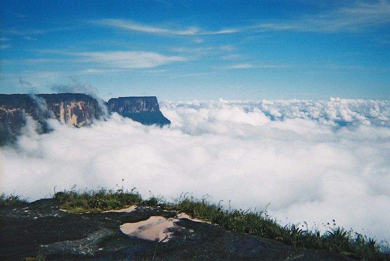
Tepui Mountains
Auyán Tepui is one of the most famous tepuis in the region. Shape like a heart, it is where Angel Falls, the tallest waterfall on land, is located. Angel Falls has a height of almost 1,000 meters (3,300 feet), which is 19 times greater compared to Niagara Falls.


.JPG)
.jpg)
.jpg)