Roads That Keep Drivers Guessing
Some highways invite you in with their beauty, then test your nerve with every turn. These routes prove the journey itself can shape the story.
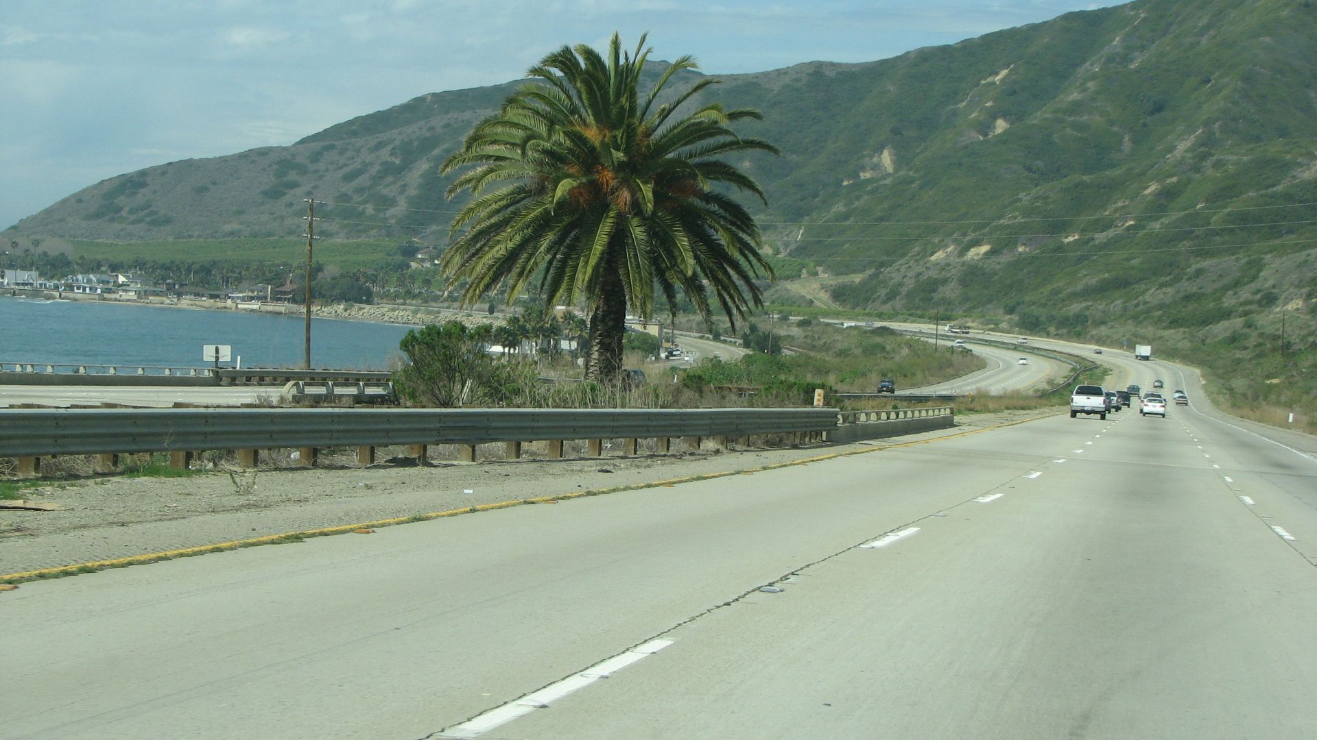
Pacific Coast Highway
California’s Pacific Coast Highway endures a constant struggle against nature, where cliffs and volatile weather test drivers along its 656-mile route. Even its construction met fierce resistance, with May Rindge’s legal fights delaying Malibu’s completion until 1929.
US Route 550 (The Million Dollar Highway)
Between Silverton and Ouray, Colorado, US Route 550’s famed 25-mile Million Dollar Highway promises white-knuckle thrills. Its dramatic cliffs and lack of guardrails intimidate even seasoned drivers. Avalanches and winter closures increase dangers.
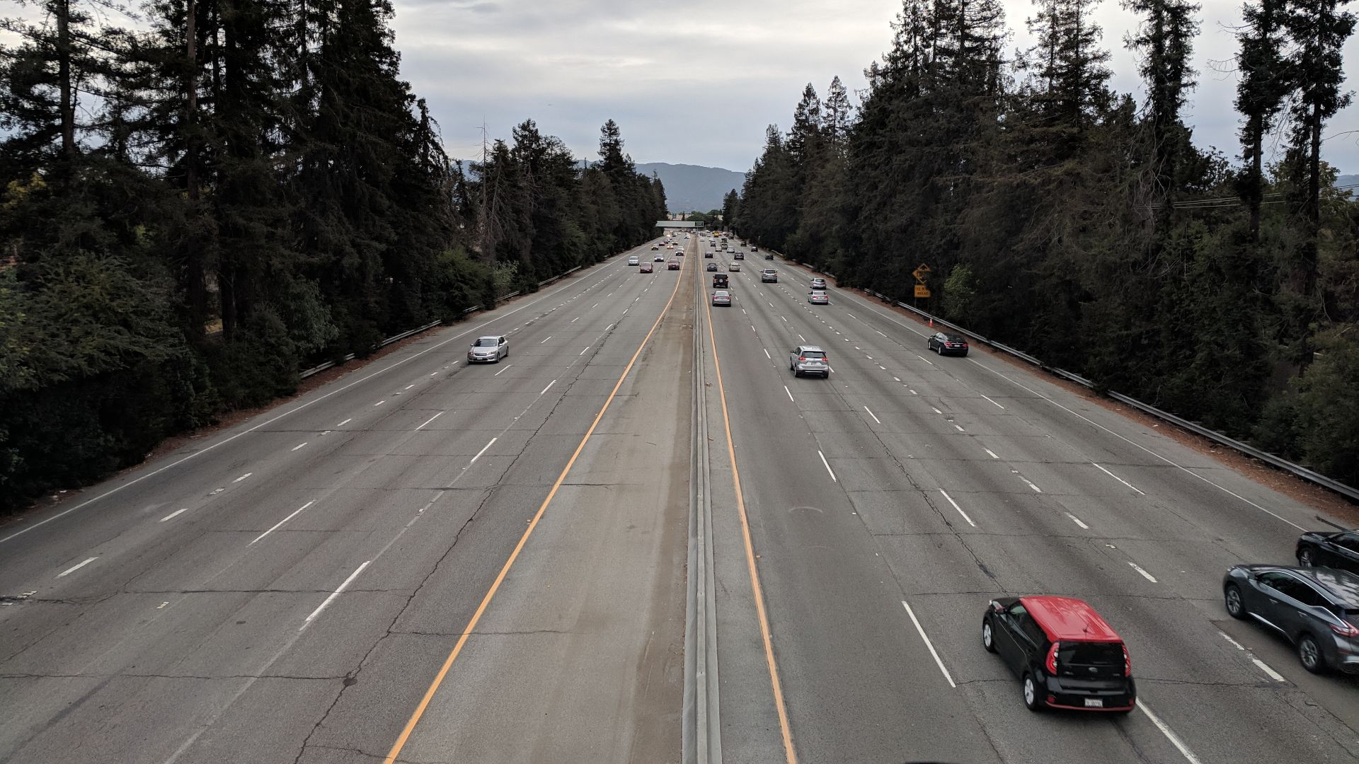
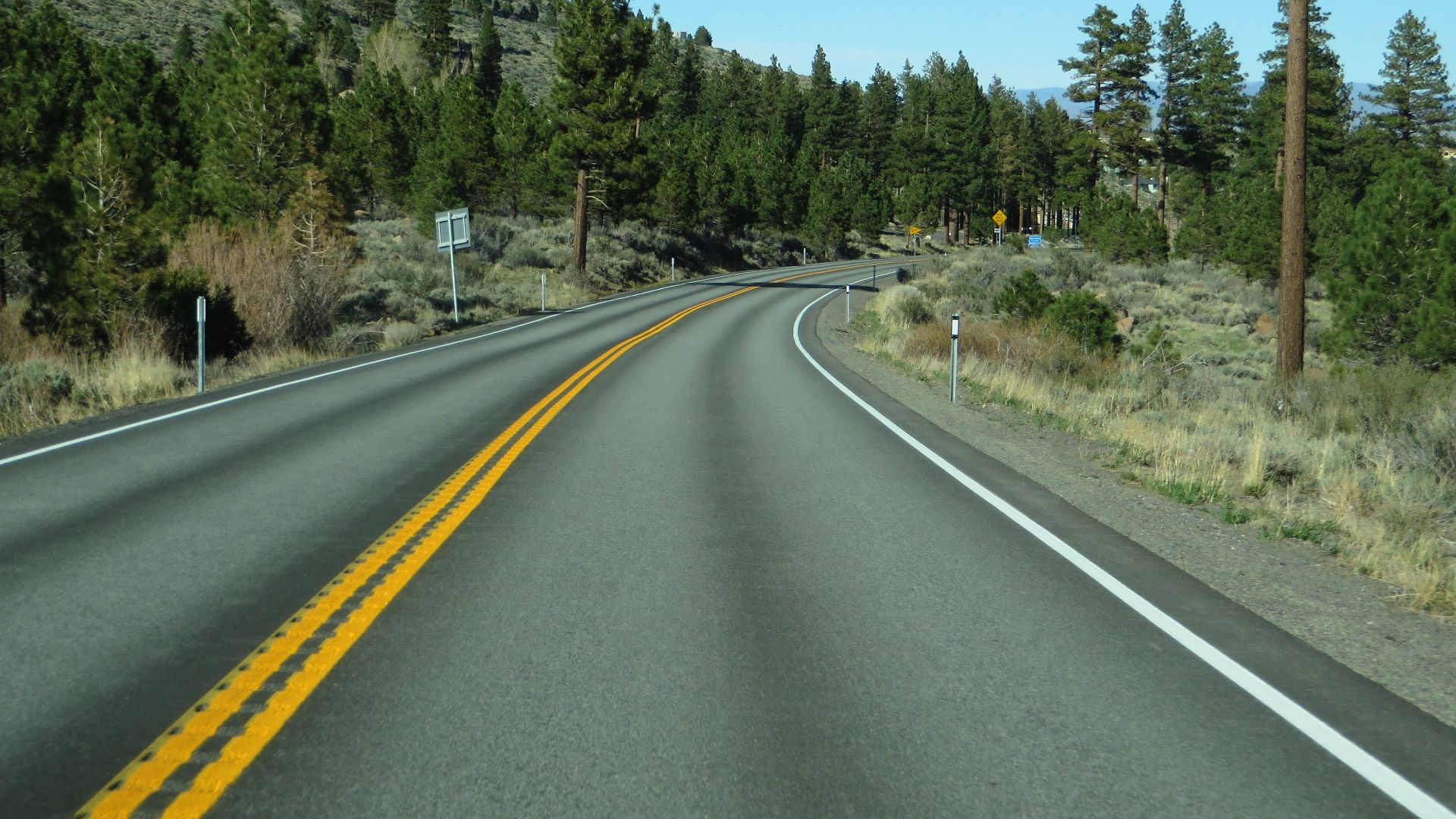
State Route 17 (Santa Cruz Mountains, California)
If you’ve ever driven Route 17, you know it’s chaos on asphalt. Tight forested curves, impatient commuters, and sudden lane merges make this mountain road a real-life video game. One wrong move or an unexpected rain slick, and you’re in the heart of one of California’s most notorious crash zones.
 Grendelkhan, Wikimedia Commons
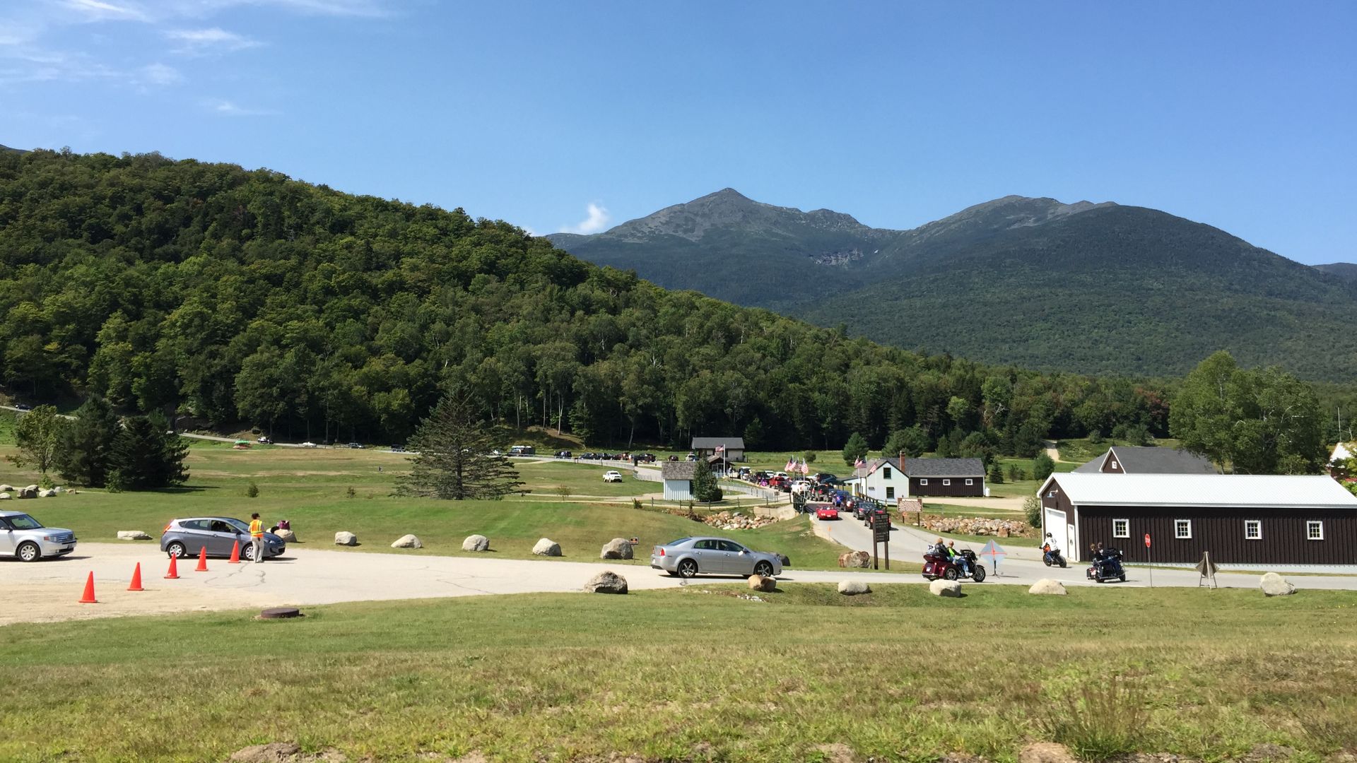
Mount Washington Auto Road
America’s oldest man-made mountain attraction, the Mount Washington Auto Road, has braved extreme conditions since 1861. Stretching 7.6 miles and climbing 4,600 feet, it faces ferocious weather with winds once measured at 231 mph. Stay alert.
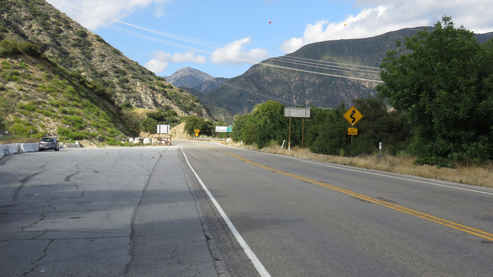
Angeles Crest Highway
Rising above Los Angeles, Angeles Crest Highway snakes through the San Gabriel Mountains for 66 miles, climbing past 7,000 feet. Thrill-seeking motorcyclists love its sharp curves, though nature often wins—winter storms close sections under snow or rockslides.
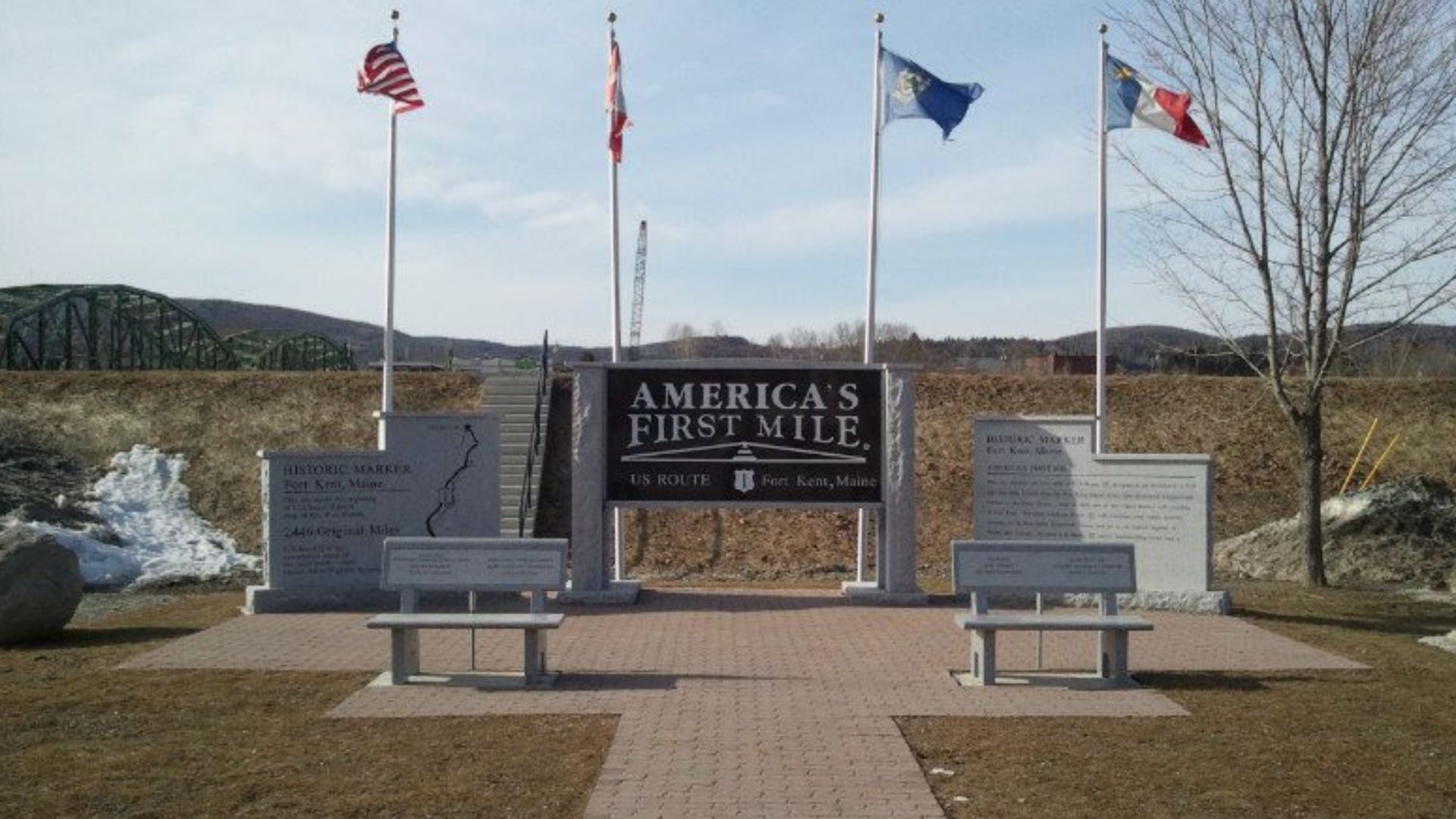
Route 1 (Maine)
Stretching 526 miles from Kittery to Fort Kent, Maine’s Route 1 features lobster shacks and lighthouses along a picturesque coastal path. Yet winter storms transform this postcard-perfect drive into a treacherous ordeal as it turns historic towns and ocean views into a driver’s white-knuckle survival test.
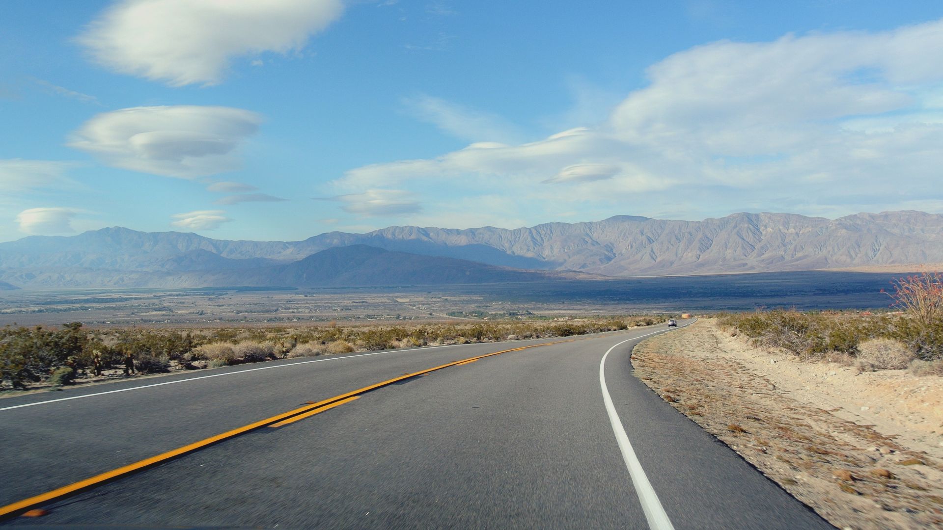
State Route 78 (Anza-Borrego, California)
Driving through the Anza-Borrego Desert isn’t for the faint of heart. The narrow lanes squeeze between sharp cliffs and sun-baked badlands where heat waves blur your vision. Add surprise elevation changes and the constant fear your engine might overheat, and the “scenic route” starts to feel like a dare.
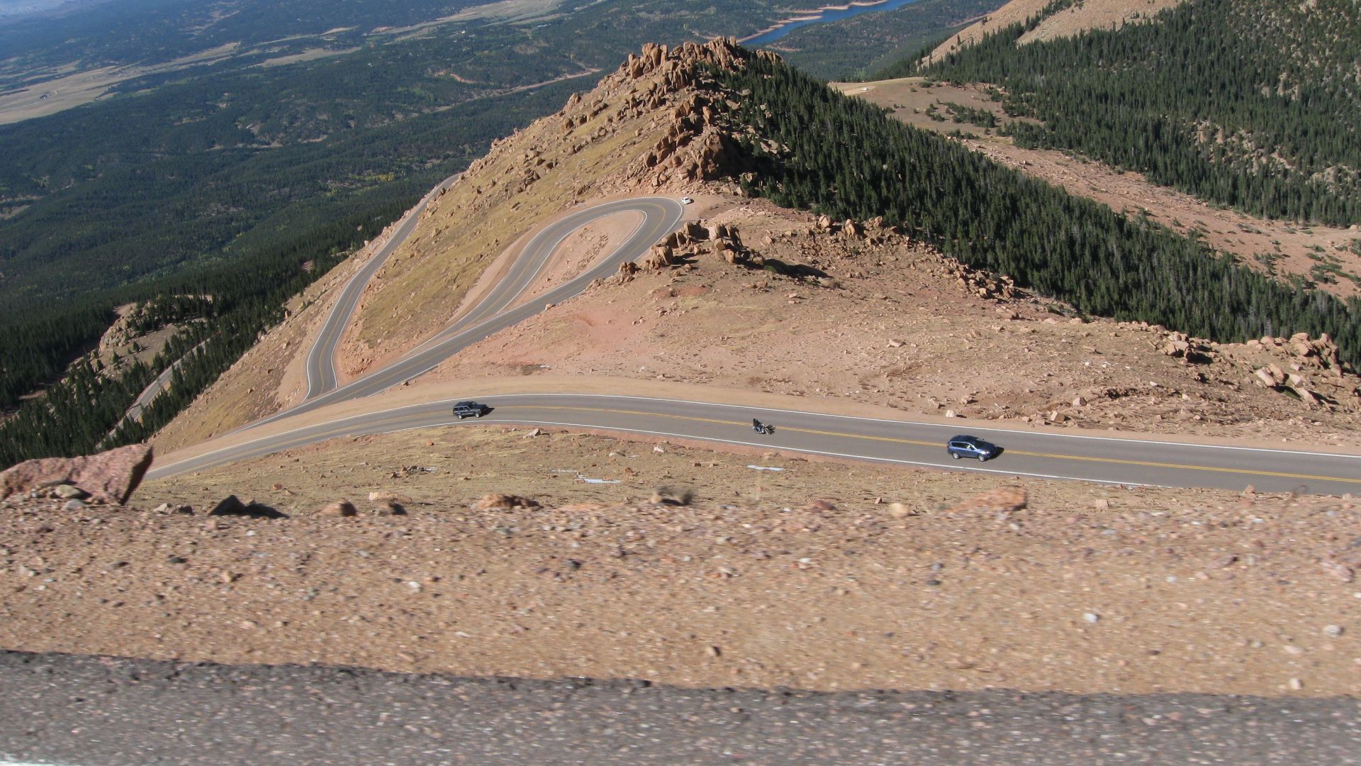
Pikes Peak Highway
At 14,115 feet, this highway dominates the horizon. Its 19-mile toll road, once a rugged climb, was fully paved in 2011. The summit road remains legendary; it hosts the Pikes Peak International Hill Climb, where racers test their nerves and engines against the extreme elevation.
 DrunkDriver, Wikimedia Commons
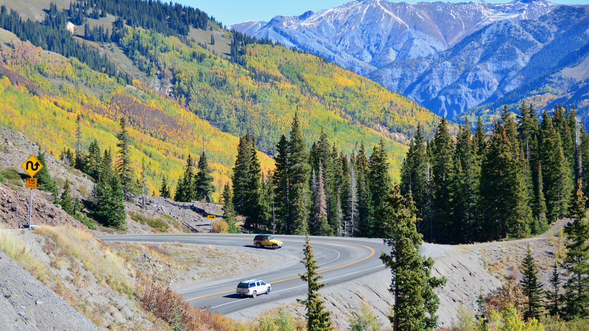
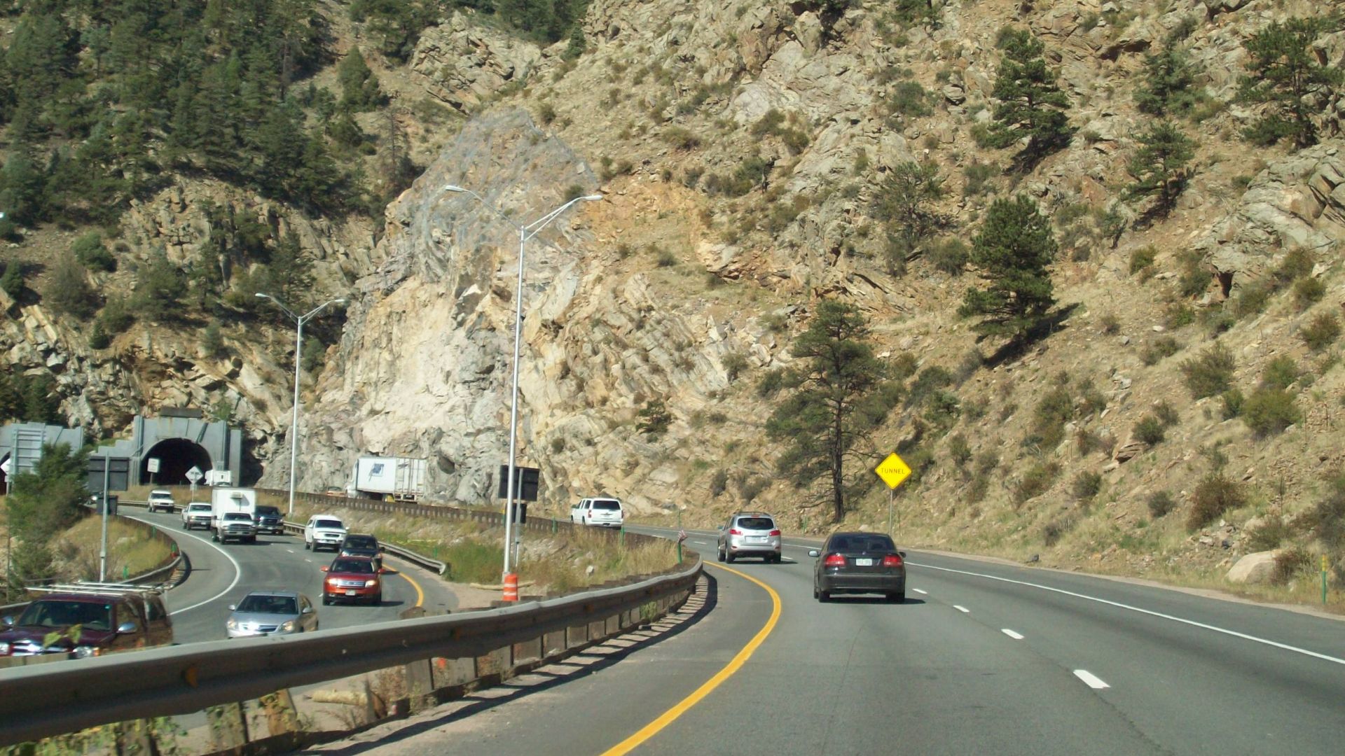
Interstate 70 (Colorado)
Interstate 70’s Colorado section conquers formidable Rocky Mountain obstacles. The Eisenhower Tunnel carries travelers through elevations exceeding 11,000 feet, while the steep grades of Vail Pass demand careful engineering. Frequent winter storms sometimes force closures.
 Retaildesigner (talk), Wikimedia Commons
The Snake (Tennessee)
US 421’s 33-mile “Snake” between Mountain City and Bristol, Tennessee, features 489 curves. Revered by motorcyclists and sports car drivers alike, it challenges skill, endurance, and precision. Its fearsome reputation has cemented it among America’s most respected and exhilarating driving experiences.
 Brian Stansberry, Wikimedia Commons
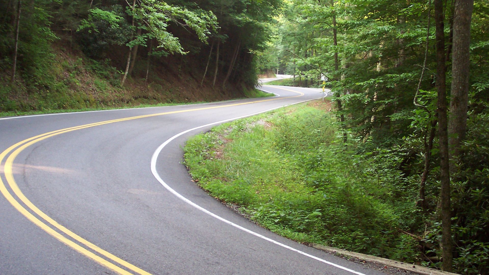
US Route 129 (The Dragon)
On the Tennessee-North Carolina border, US Route 129 compresses 318 curves into only 11 miles. With no intersections or driveways, its hypnotic rhythm is legendary. Nicknamed “The Dragon,” it remains one of the ultimate tests for serious drivers and motorcyclists.
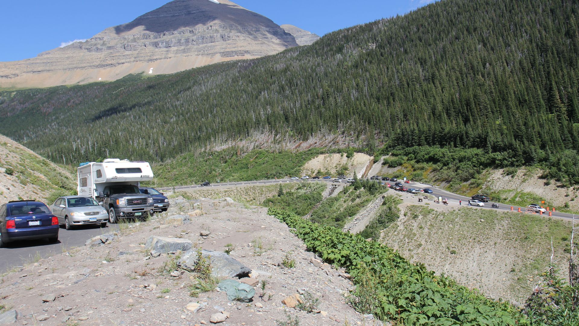
Going-To-The-Sun Road
Completed in 1932, Glacier National Park’s Going-to-the-Sun Road stretches 50 miles across rugged terrain. Recognized as a National Historic Landmark, it still bows to nature; Logan Pass, at 6,646 feet, opens only between late June and mid-October, with weather dictating the road’s fleeting accessibility.
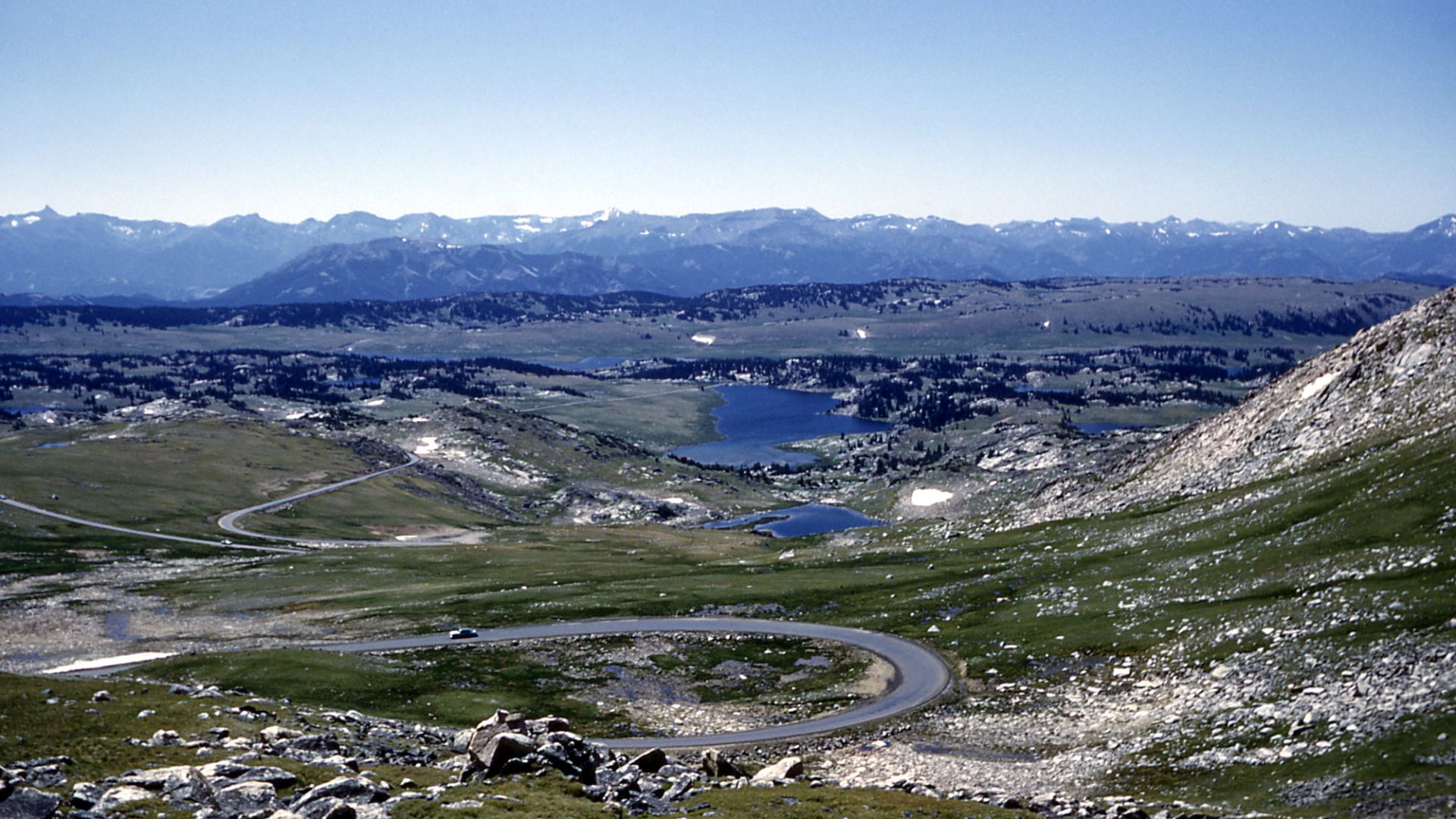
The Beartooth Highway
The Beartooth Highway, called “the most beautiful drive in America,” climbs nearly 11,000 feet between Red Lodge, Montana, and Yellowstone’s northeast gate. It's 68 miles surrender to winter’s grip for half the year, reopening only late May through mid-October.
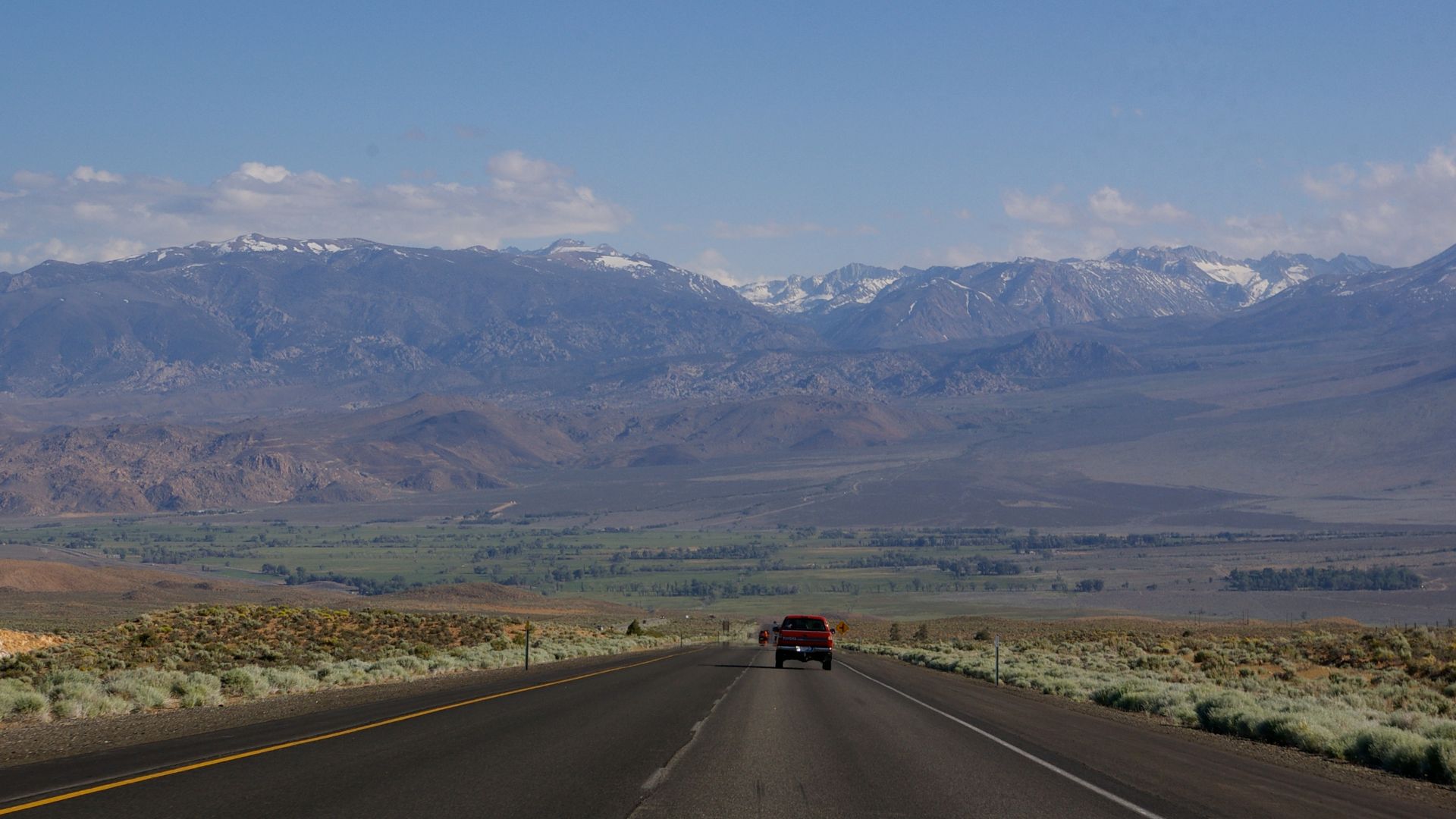
Highway 395 (California)
Running south from Oregon through California’s Sierra Nevada, Route 395 passes ghost towns and hot springs before climbing near Mount Whitney, the nation’s highest peak. It then plunges into the Mojave Desert to offer stark elevation changes across one of California’s most dramatic routes.
 Davemeistermoab, Wikimedia Commons
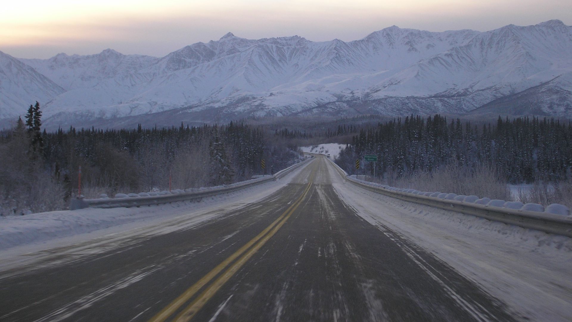
Alaska Highway
Constructed in just eight months during WWII, the Alaska Highway spans 1,390 miles, running from Dawson Creek, British Columbia, to Delta Junction, Alaska. Built for military use, it crosses Canada before reaching US soil, forever changing northern frontier travel.
State Route 431 (Mount Rose, Nevada)
High above Lake Tahoe, Mount Rose Highway twists through mountain air that can turn treacherous in seconds. One minute it’s sunny; the next, whiteout conditions erase the road entirely. Icy switchbacks, sudden elevation drops, and speeding skiers rushing to Tahoe make this scenic stretch anything but relaxing.
 Ken Lund from Reno, Nevada, USA, Wikimedia Commons
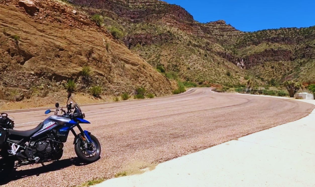
Devil’s Highway (Arizona)
US Route 666, the Devil’s Highway, earned notoriety from its number and frequent accidents. Renumbered Route 491 in 2003, superstition gave way to wilderness. Today, it winds through Apache-Sitgreaves National Forest to reveal natural beauty that contrasts with its ominous history.
 Solo Camping on Devil's Highway Arizona by FTA Adventures
Highway 64 (North Carolina)
This highway crosses North Carolina from the Appalachian Mountains to the coastal plains. Beginning with twisting, weather-battered mountain sections, it eventually reaches Roanoke Island, infamous site of the Lost Colony. This long route highlights the state’s contrasting geography and its challenging, diverse driving conditions.
 Adam Moss from Tonawanda, New York, United States, Wikimedia Commons
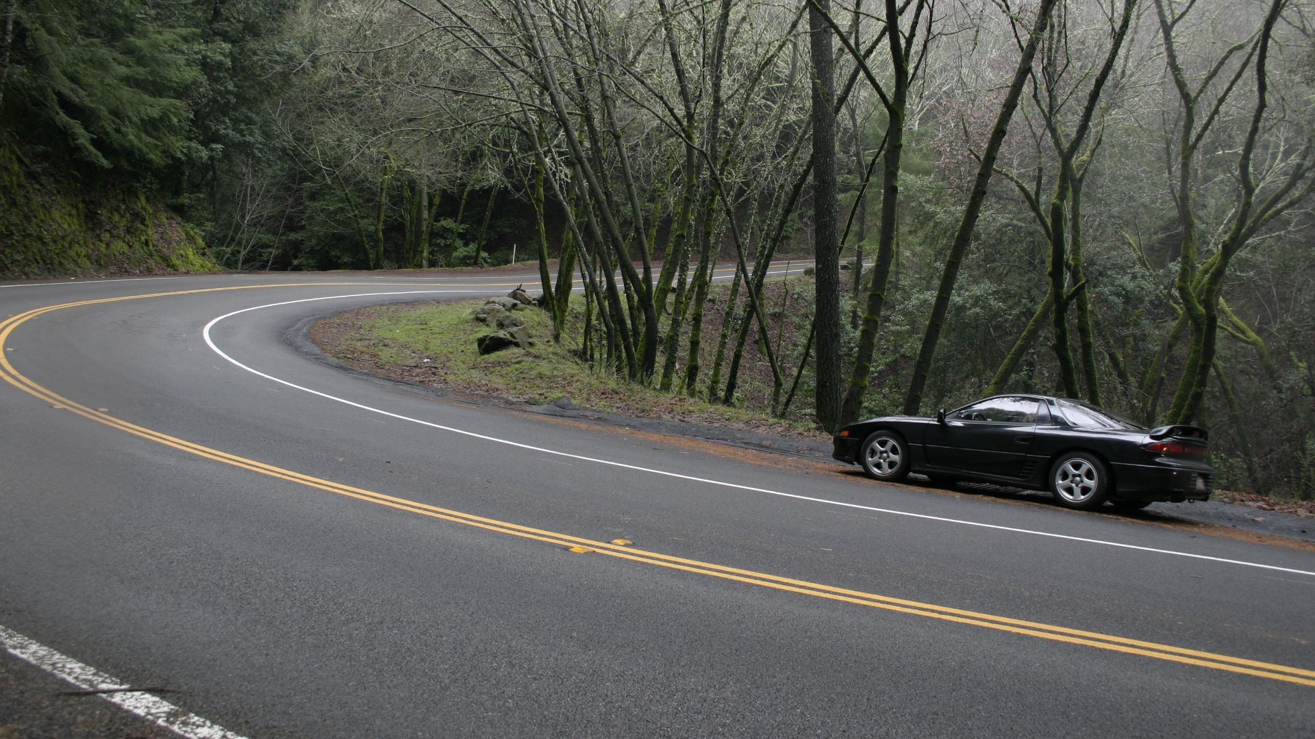
Highway 9 (California)
Through the Santa Cruz Mountains, Highway 9 tempts motorcyclists with thrilling twists. For cautious drivers, those same curves become nerve-wracking. Both groups, however, share stunning redwood forest views before reaching Saratoga and Los Gatos.
 Original uploader was Facegarden at en.wikipedia, Wikimedia Commons
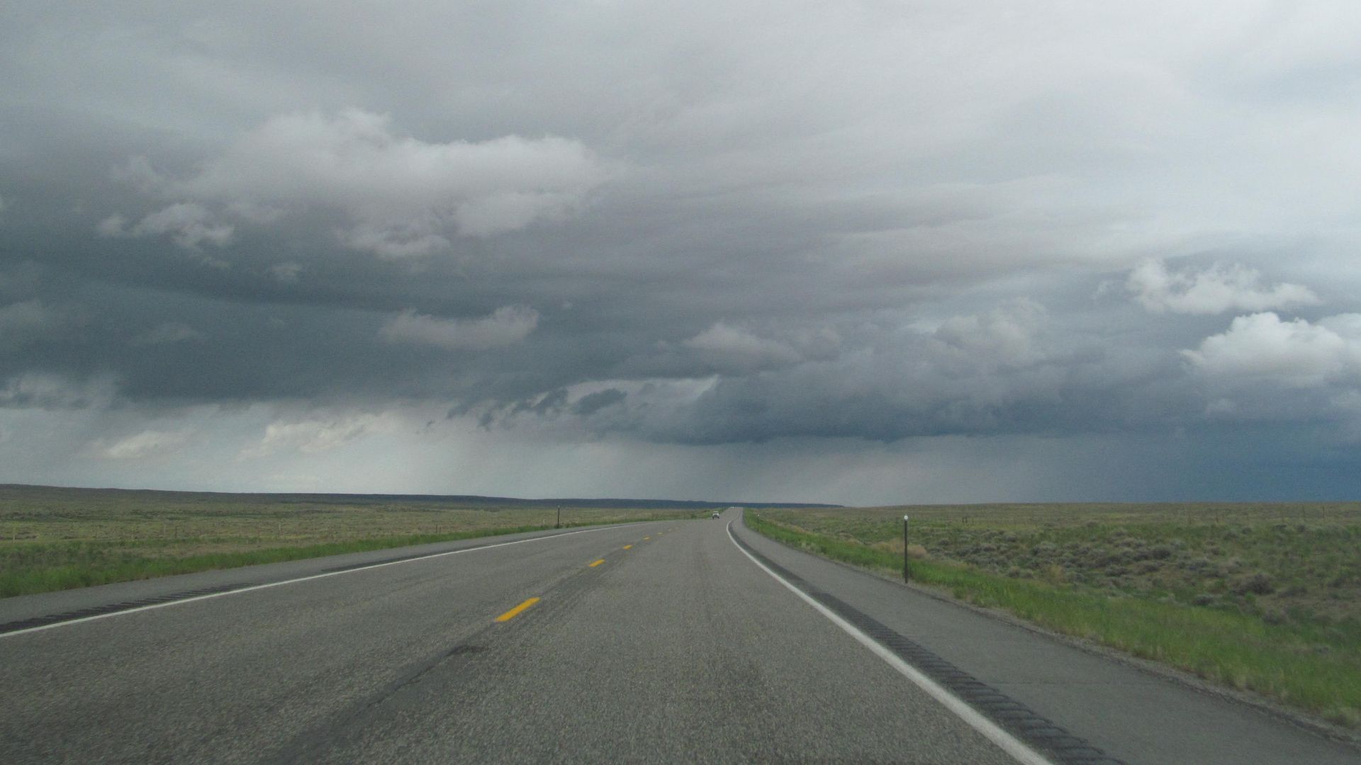
Route 20 (Wyoming)
Route 20, stretching 3,300 miles from Boston to Newport, is America’s longest road. Wyoming’s portion crosses Yellowstone and Wind River Canyon to expose travelers to wilderness, rugged terrain, and volatile weather. Here, the country’s most ambitious highway meets the untamed frontier.
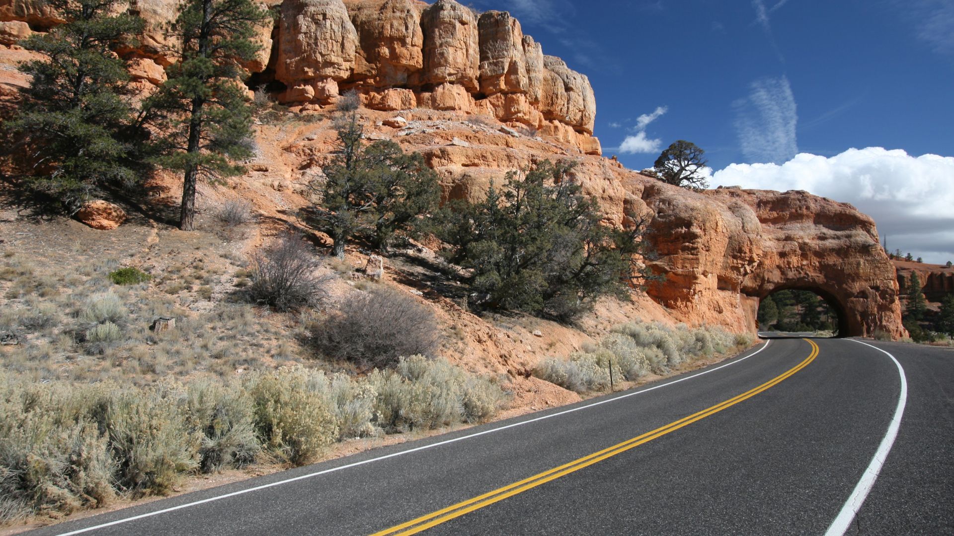
US Route 12 (Utah)
Utah’s Scenic Byway 12 runs 124 miles of nail-biting drops and panoramic rewards. It crosses the Hogsback with sheer cliff views and reveals Grand Staircase-Escalante’s crimson formations. This All-American Road delivers breathtaking vistas while demanding steady nerves from every driver.
 Christian Mehlfuhrer, User:Chmehl, Wikimedia Commons
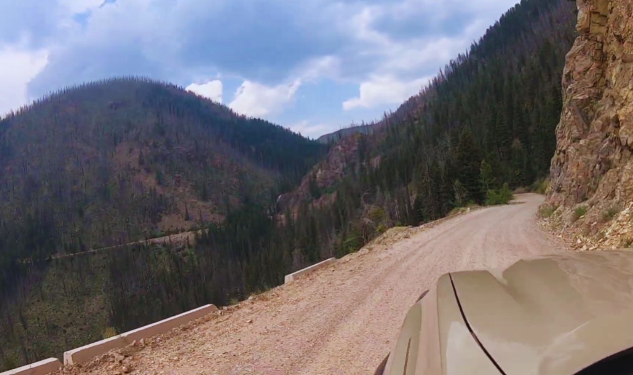
Skalkaho Highway (Montana)
Skalkaho Highway snakes through Montana’s remote wilderness with no guardrails, barely enough room for two vehicles, and sheer drop-offs that make your palms sweat. Add gravel that loosens under your tires, and you’ve got a true white-knuckle trip through bear country.
 Skalkaho Falls ~ Driving Skalkaho Pass, Montana by Smell N Roses
James Dalton Highway (Alaska)
The Dalton Highway isn’t just remote—it’s practically a survival test. Stretching 414 miles from Fairbanks to the Arctic Ocean, it’s mostly gravel, constantly slick with ice, and patrolled by massive trucks that don’t slow down for anyone. Break down out here, and you’re on your own.
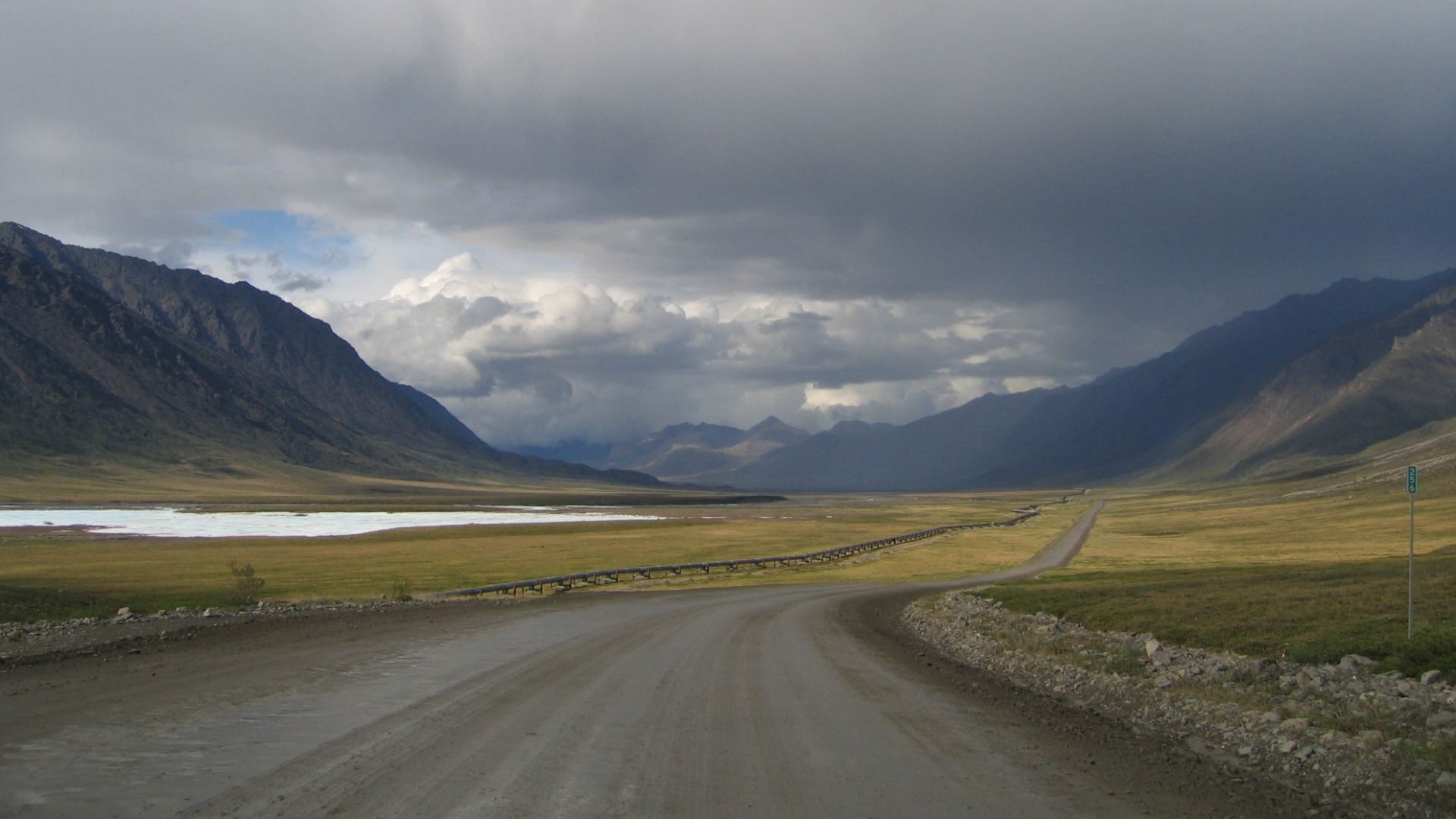 Photo by Micah Bochart, Wikimedia Commons
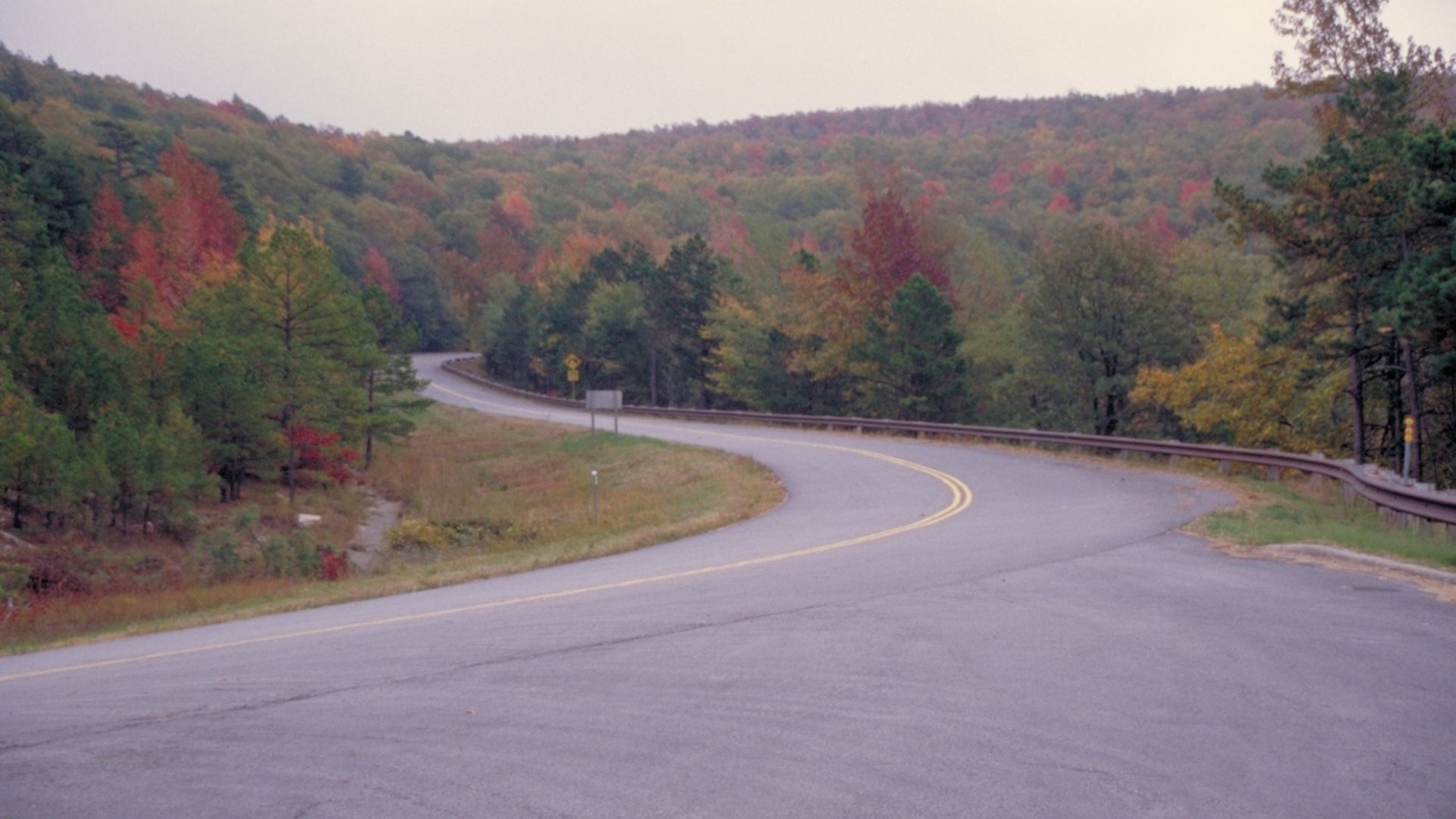
Talimena Scenic Drive (Oklahoma & Arkansas)
It may look postcard-perfect, but the Talimena Scenic Drive can turn hair-raising fast. Fog rolls in without warning, cutting visibility to almost nothing as deer and wild turkeys dart across the pavement. Those sweeping mountain curves? They’re gorgeous—until you’re braking hard on a steep downhill grade.
 Unknown authorUnknown author or not provided, Wikimedia Commons
State Route 152 (Pacheco Pass, California)
Don’t let the rolling hills fool you—Pacheco Pass has a dark reputation. Heavy fog settles in fast, erasing visibility as trucks thunder by at high speeds. The sharp curves and constant traffic make it one of California’s most accident-prone stretches.