A World Hidden In The Mist
Deep in the Andes, dense clouds once shielded a civilization from view. Now, scanning tools have unveiled a vast network of ancient structures. These forgotten highland builders are finally stepping back into the story of South America.

A Lost World Beneath The Canopy
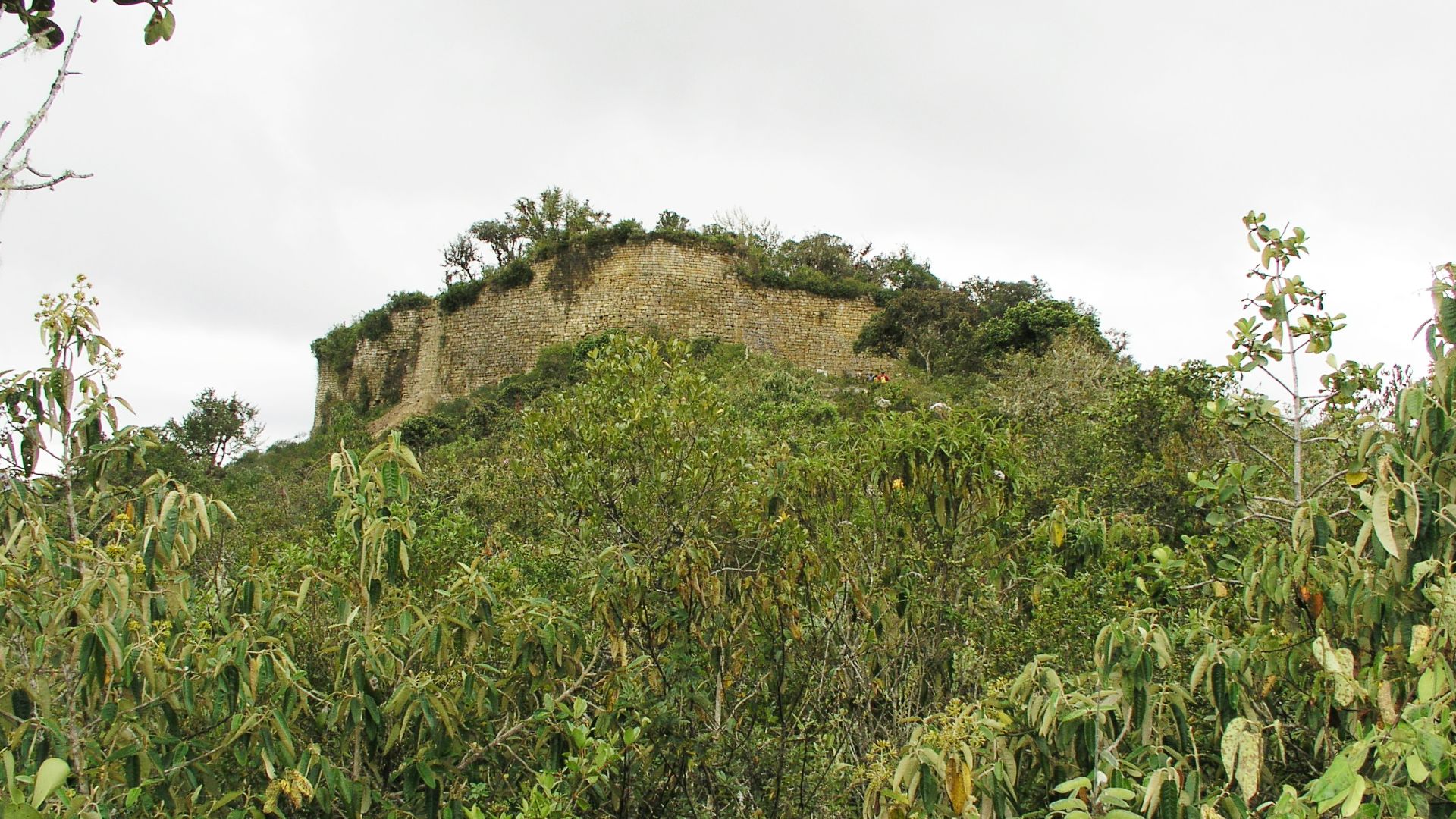
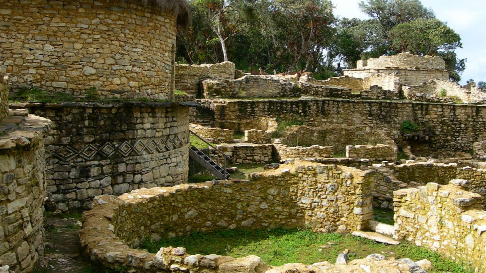
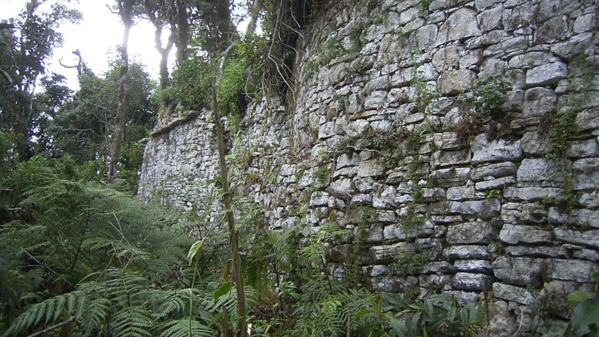
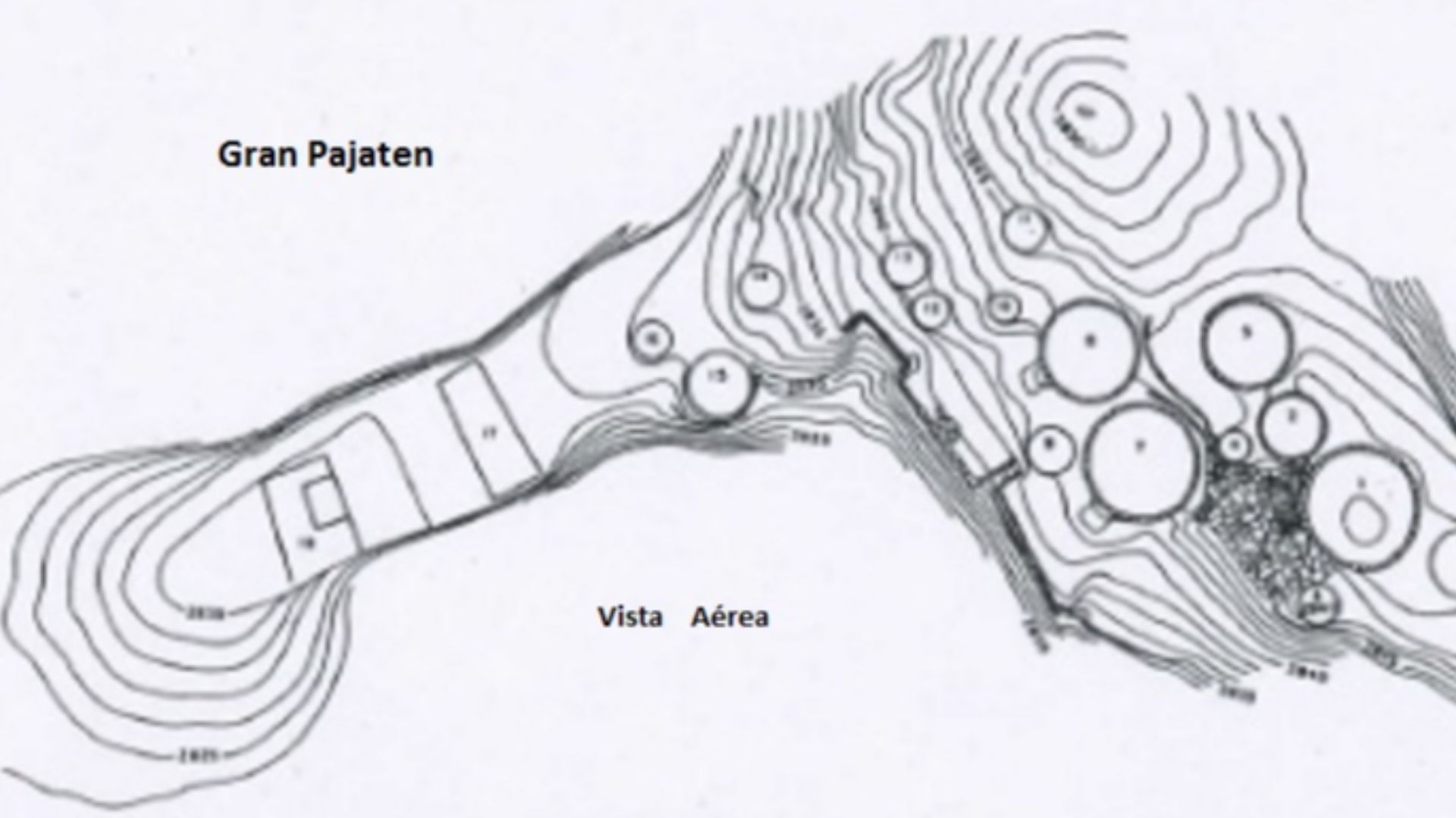
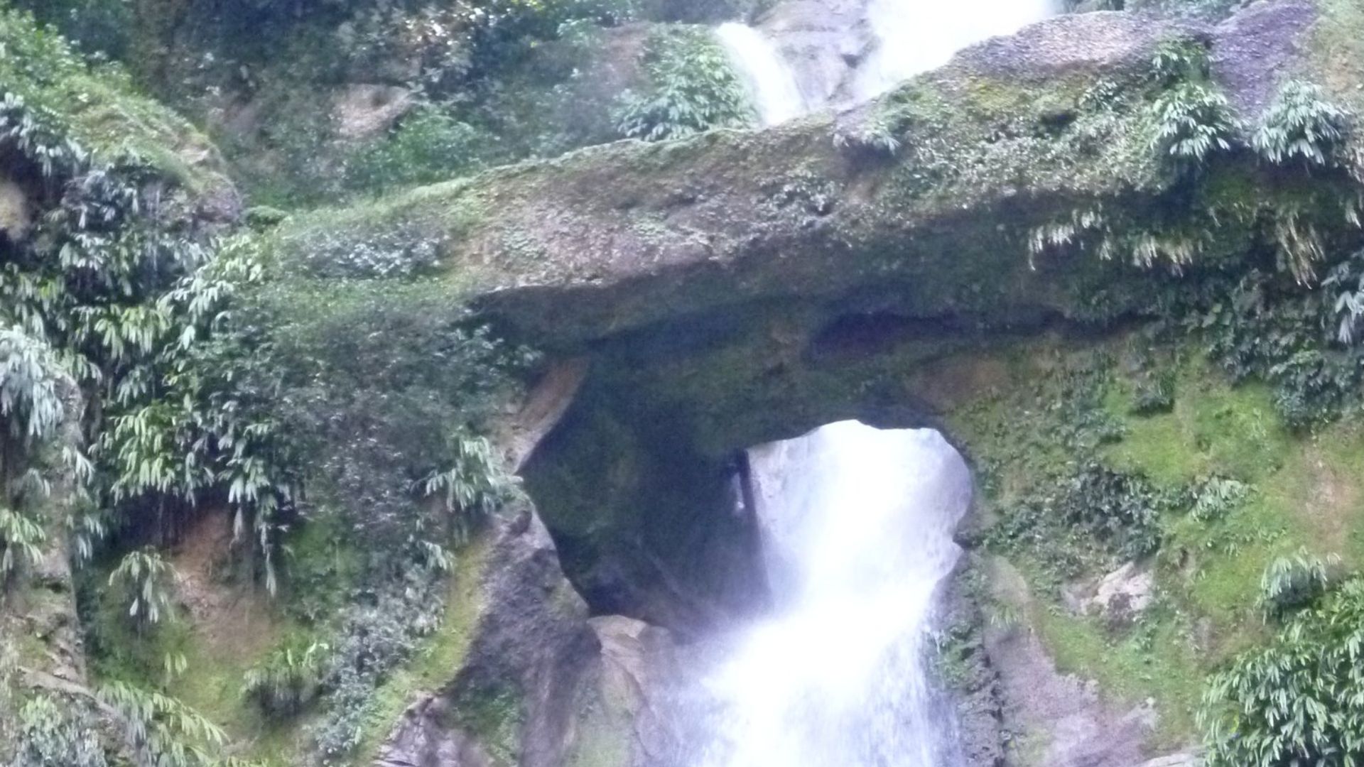
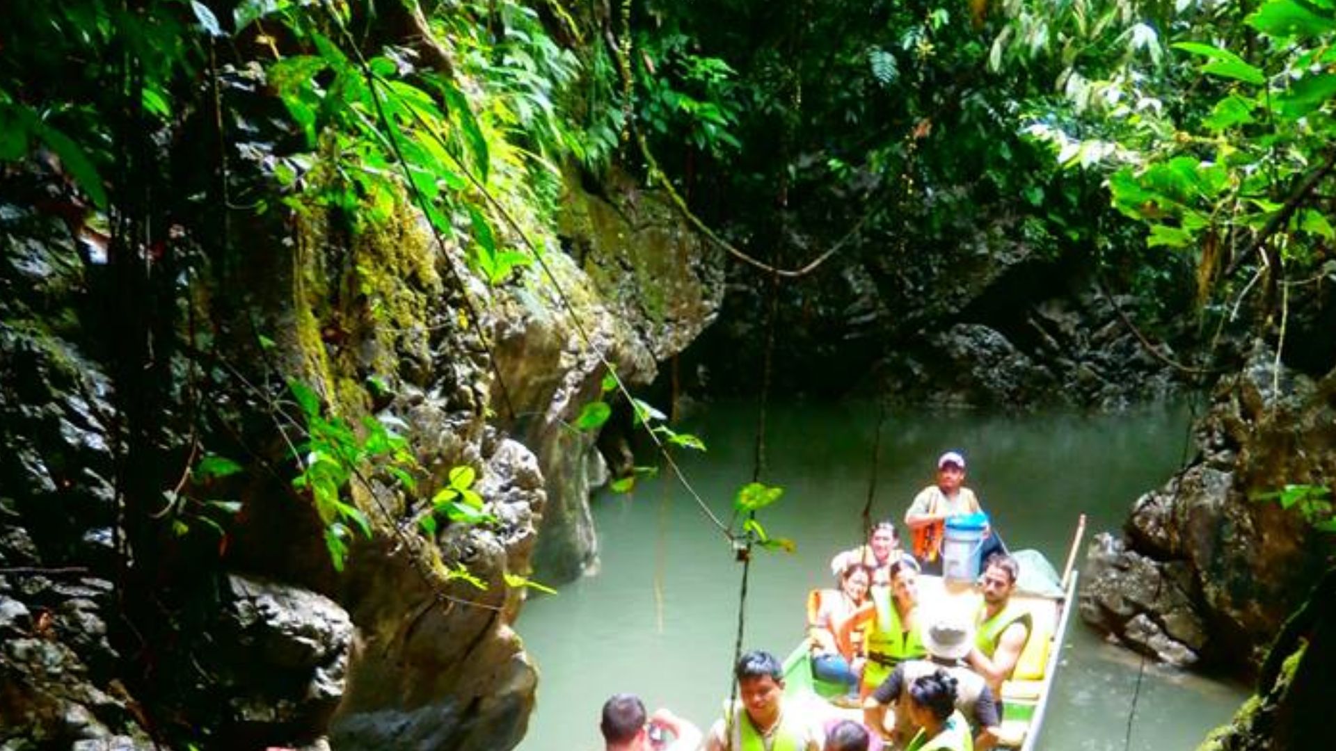
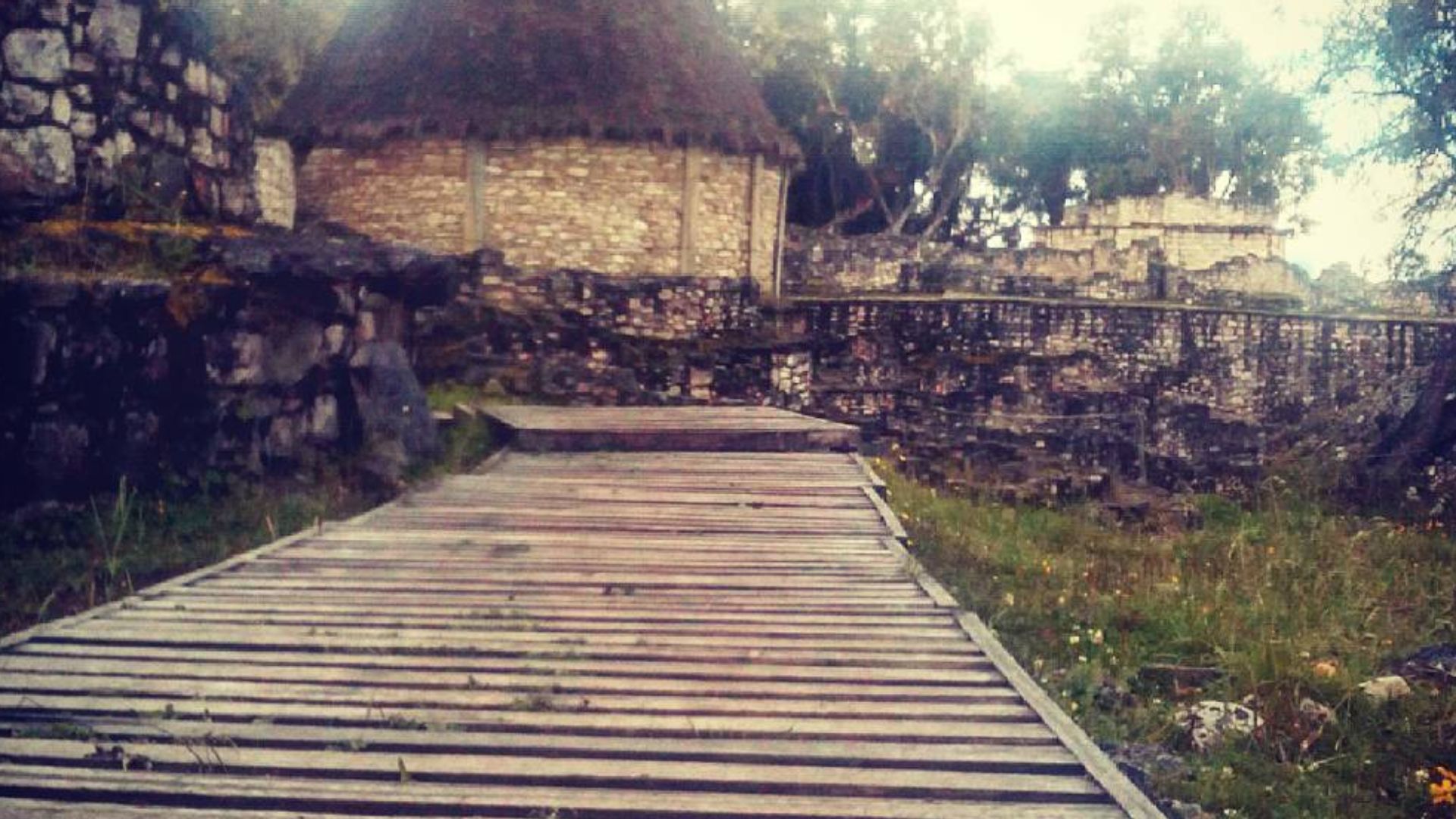
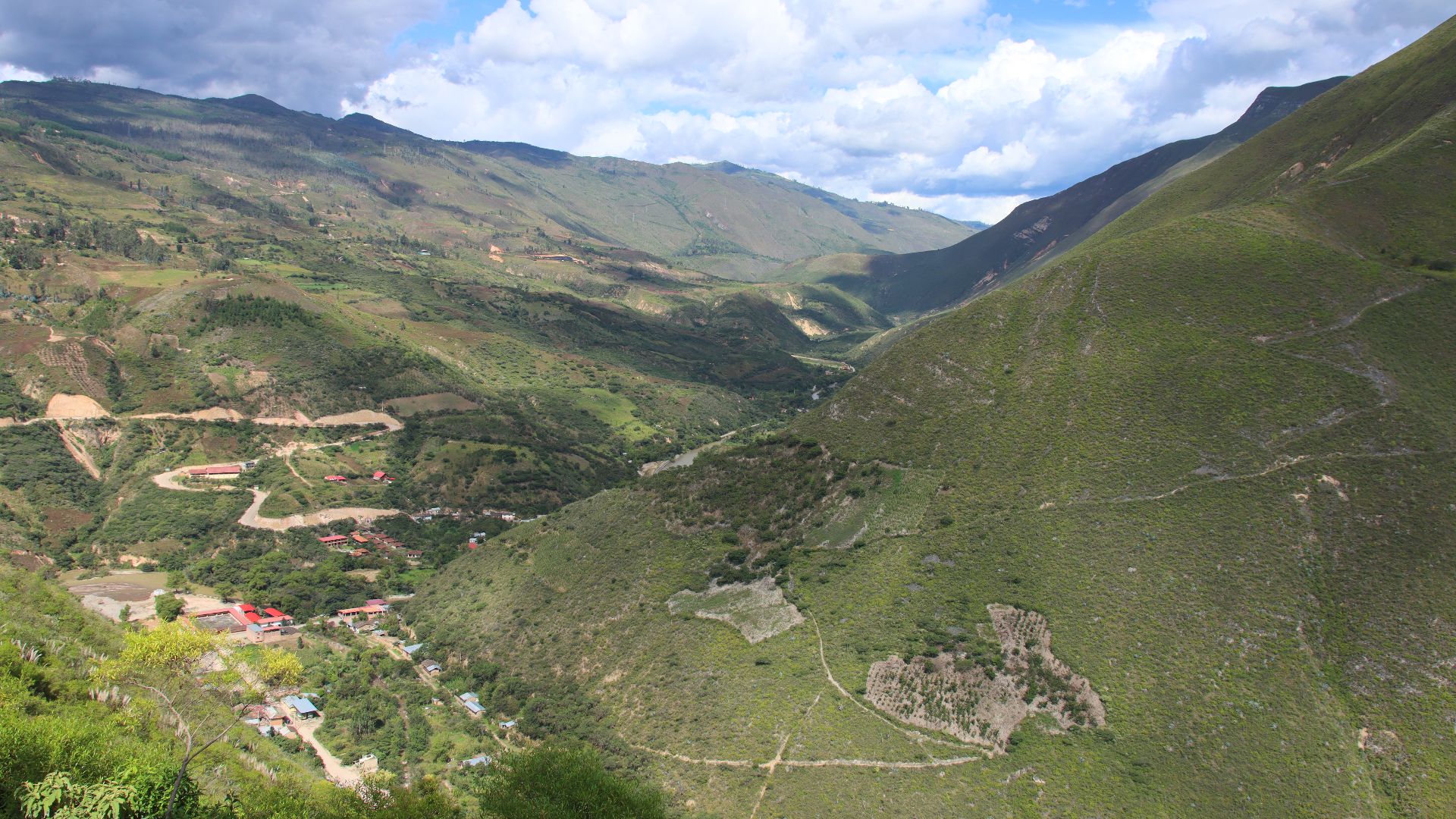
The cloud forest of northern Peru concealed more than vines and mist. Gran Pajaten, located in Rio Abiseo National Park, lay cloaked in vegetation for centuries. Its stone walls and circular structures remained hidden despite its proximity to known archaeological zones.
 El Gran Pajatén: un tesoro escondido en el Amazonas by Agencia de Noticias Andina
A Lost World Beneath The Canopy (Cont.)
Spanish chroniclers made no mention of Gran Pajaten, and early 20th-century explorers passed nearby without recognizing its importance. The combination of overgrowth and lack of visible monumental features made it easy to miss. Yet the site lay just above the Montecristo River, near well-documented Andean routes.
 Alicudi at Danish Wikipedia, Wikimedia Commons
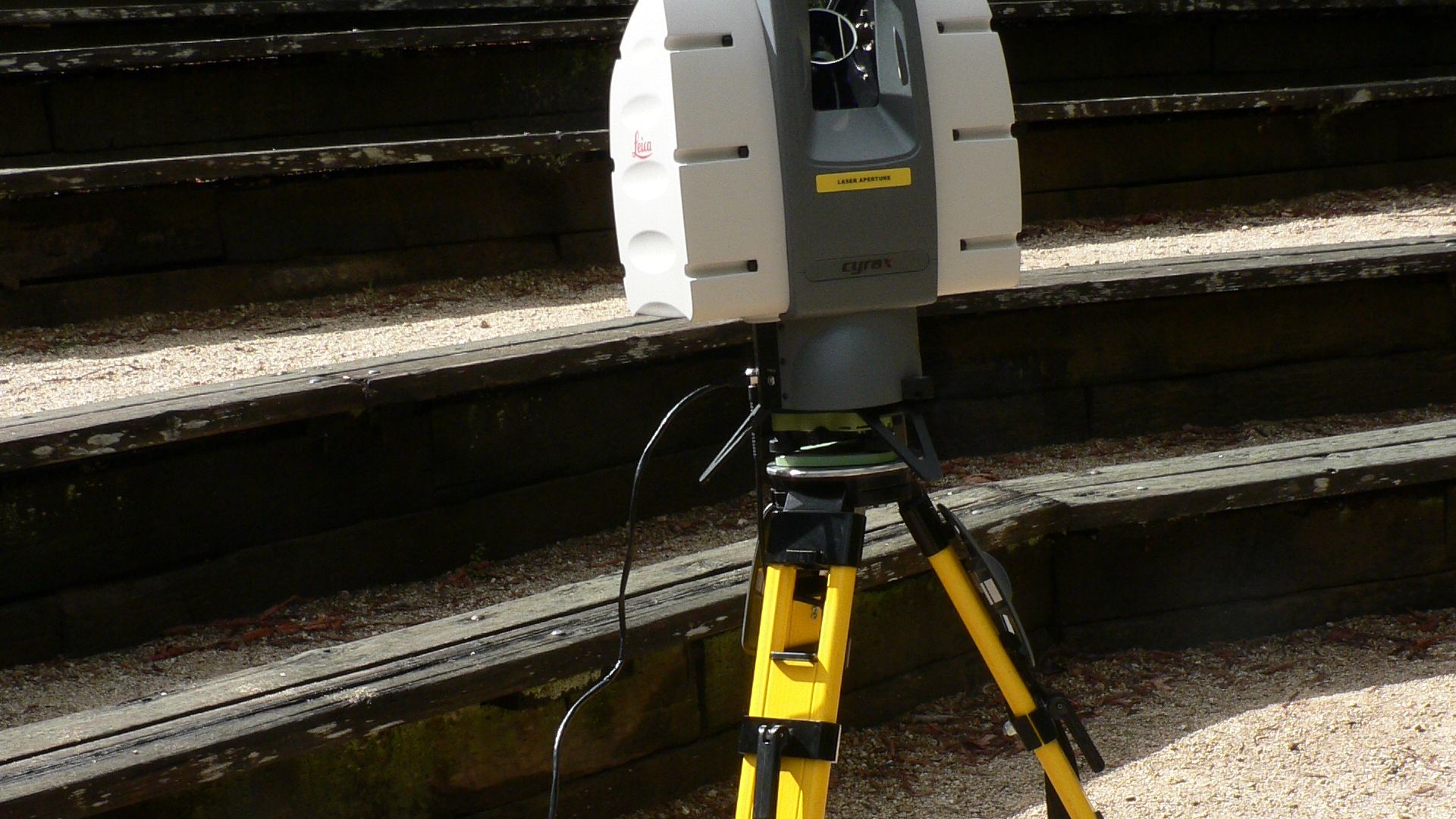
LiDAR Pulled The Forest Apart
It was light detection and ranging (LiDAR) that changed the story. From the aircraft, laser pulses pierced the thick canopy and mapped the contours beneath. What seemed like an untouched jungle revealed geometric shapes: buildings and staircases layered across steep slopes where no path had previously been marked.
 David Monniaux, Wikimedia Commons
More Than 100 Structures, Once Unseen
Digital modeling revealed a cityscape no one expected. Over 100 stone-built features emerged: circular dwellings, ritual platforms, retaining walls, and connecting paths. Their scale and spacing implied deliberate design. Unlike isolated ruins, this was a networked settlement woven into the highlands with intention and complexity.
 Nasa.gov http://www.nasa.gov/topics/earth/earthday/earthday_gallery.html, Wikimedia Commons
More Than 100 Structures, Once Unseen (Cont.)
Many structures followed a standard layout found in Chachapoya architecture—circular bases with low stone walls and internal divisions. Some were grouped on terraces overlooking valleys, while others bordered plazas. The layout indicated a communal life, with residential zones, ceremonial spaces, and interlinking footpaths that shaped a clear urban hierarchy.
A Discovery Decades In The Making
In 1985, Peruvian explorers identified 26 structures through manual surveys. Dense forests prevented further exploration. For decades, the scale of Gran Pajaten was underestimated. LiDAR applied in the early 2020s expanded the visible footprint exponentially. Evidence now confirms it as a regional center.
Satellite Clues That Preceded The Ground Truth
Before laser mapping came into play, researchers spotted strange patterns in low-res satellite images—cleared patches and angular shadows that didn't match the natural terrain. Something was off. Once LiDAR revealed clear geometric shapes, archaeologists upgraded the site from a "possible settlement" to a confirmed urban center.
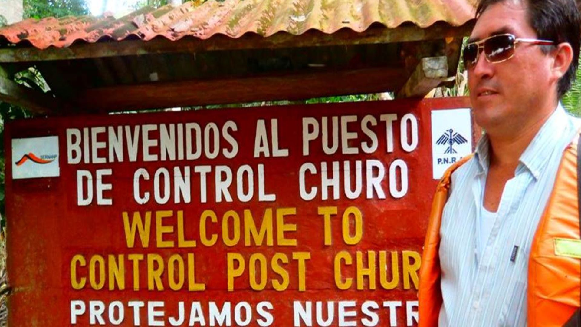
Why Gran Pajaten Wasn't Accessible Until Now
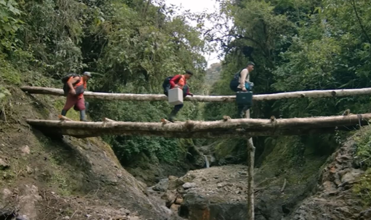
Gran Pajaten is situated within a legally protected ecological zone. The forest is humid and dense, and human access is restricted to preserve biodiversity. Without clear paths or permits, extensive ground surveys were impossible for years. Technology finally bridged the divide between preservation and exploration.
 El Gran Pajatén: un tesoro escondido en el Amazonas by Agencia de Noticias Andina
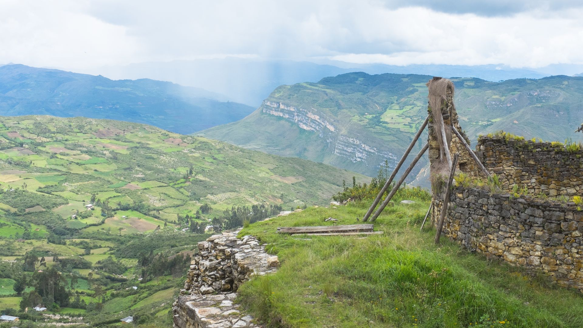
Walls That Snaked Along The Slopes
Gran Pajaten's outer boundaries were defined by low, curving walls that followed the mountain's natural contours. These weren't random dividers. Their uniform thickness and use of dressed stone suggested purposeful planning. In some sections, the walls bordered platforms or terraces used for activity zones.
The Purpose Of Elevated Platforms
Archaeologists found raised stone platforms that lacked typical domestic features. These were flat and centrally positioned. Their placement near staircases and plazas hints at ritual function. Similar Chachapoya platforms elsewhere were used for public ceremonies or offerings tied to seasonal or astronomical events.
 Martin St-Amant (S23678), Wikimedia Commons
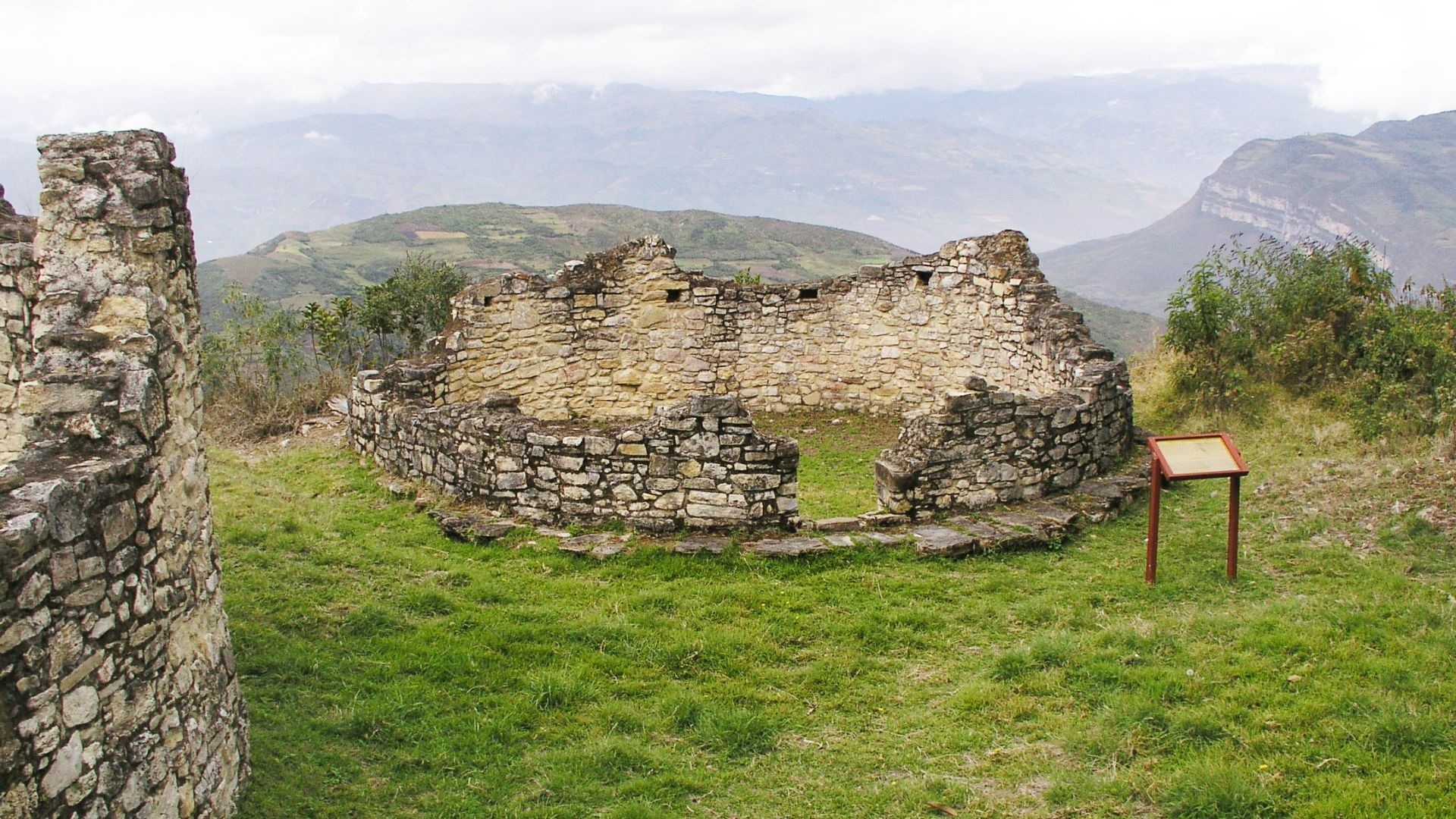
Circular Structures And Their Interior Layouts
Standard Chachapoya dwellings had circular stone foundations and walls with small interior niches. At Gran Pajaten, several of these structures showed traces of multiple room divisions, which suggests they weren't just homes. Some may have housed communal tools or served specific roles in daily economic life.
Plazas Large Enough For A Community
Within the settlement, wide-open plazas broke the pattern of clustered dwellings. These spaces lacked roofing remnants, which confirms their open-air function. Their size and centrality suggest that these were communal gatherings. Drainage channels near the point are intentionally designed, which prevents erosion from the constant moisture of the cloud forest.
Staircases That Rise Without Context
Several steep staircases emerged from undergrowth, unconnected to any remaining roofed structures. Built from cut stone and mortared at joints, they led from terraces to raised platforms. Some may have functioned as ceremonial approaches that guided movement toward ritual zones within the settlement.
 Martin St-Amant (S23678), Wikimedia Commons
A Settlement Built Into The Hillside
Rather than flattening terrain, Gran Pajaten’s architects worked with it. Buildings hug the slope in staggered tiers, with walls supporting uphill construction. This layout reduced structural stress and maximized usable space on inclines without the need for deep excavation or large retaining embankments.
 User:Gelber21, Wikimedia Commons
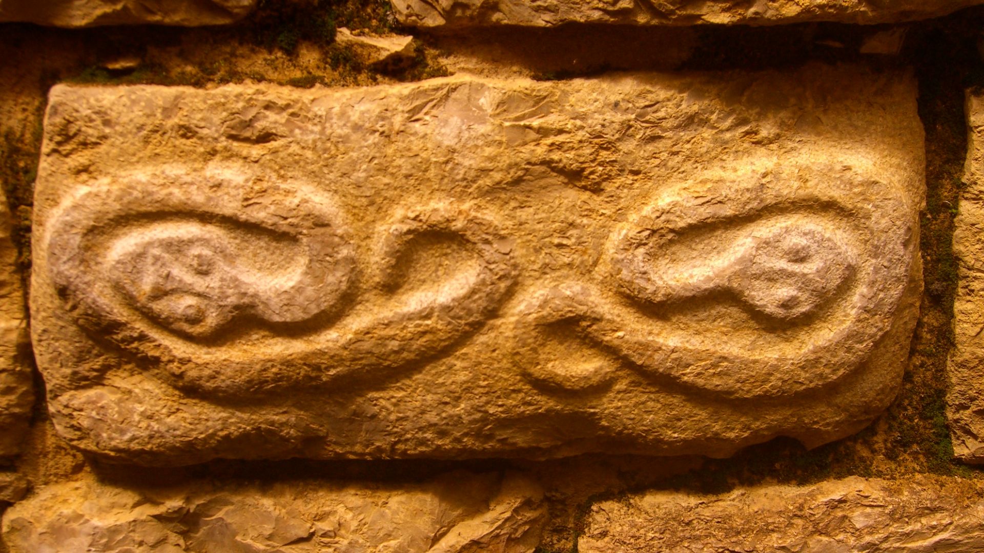
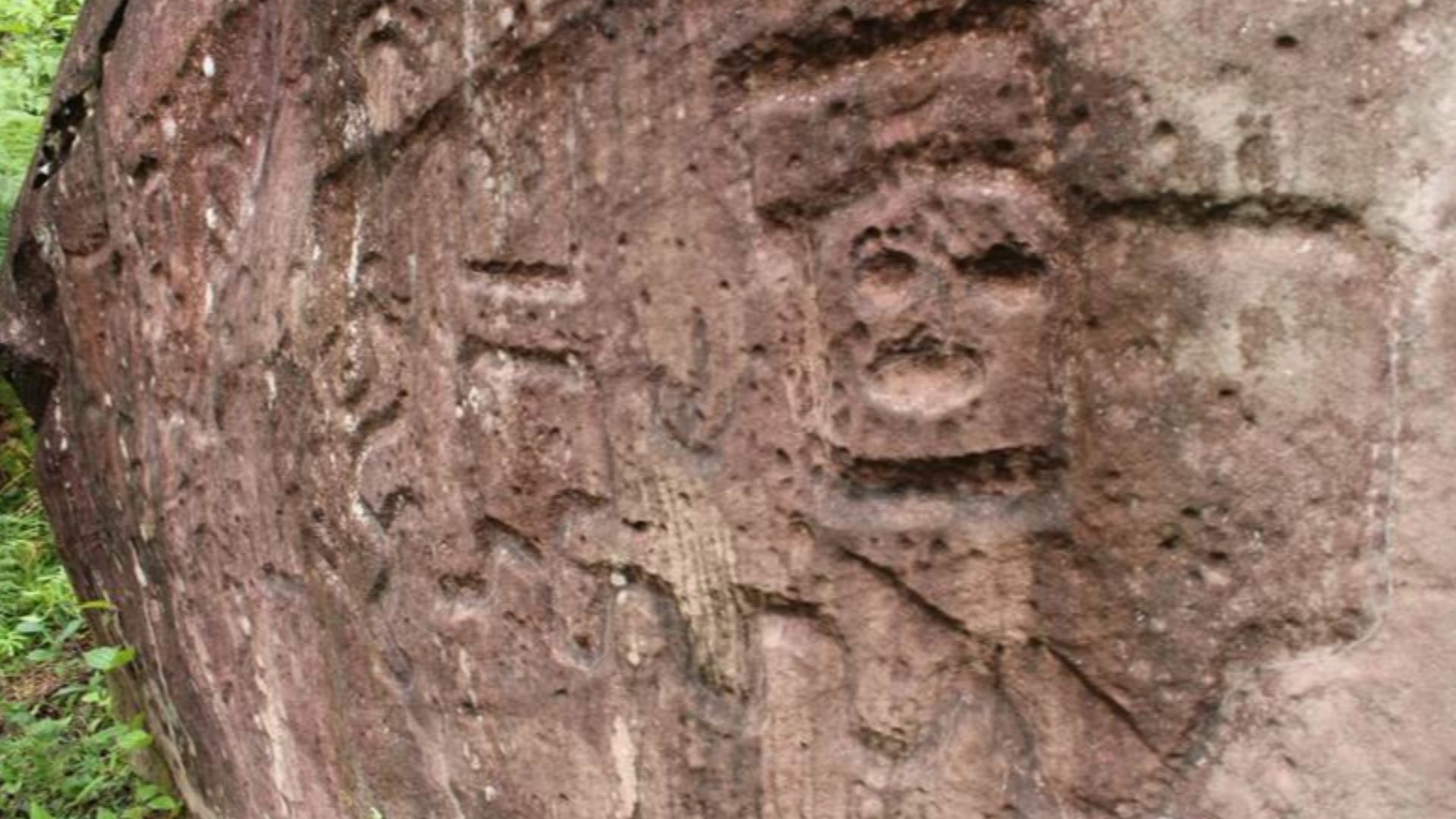
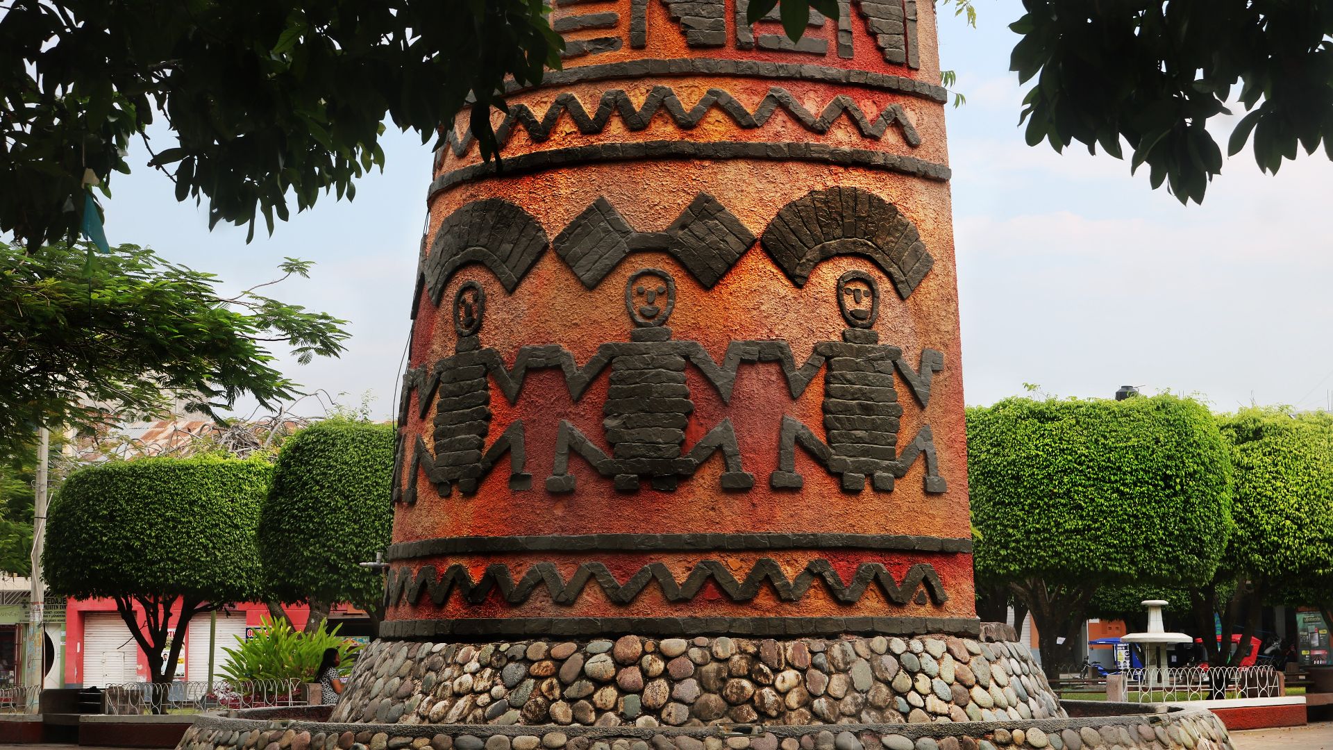
Petroglyphs Still Etched Into The Stonework
Faint engravings appear on certain blocks within Gran Pajaten's walls. Though worn, patterns of circles and spirals echo motifs found in other Chachapoya ceremonial zones. These symbols are believed to possess spiritual meaning, likely representing ancestral lands or functioning as protective emblems.
The Chachapoya Left No Written Record
The Chachapoya left behind no written records, despite their impressive engineering and artistic legacy. Instead, their knowledge lived on through stories and the structures they built. Today, archaeologists piece together their history by studying what remains—stone walls, sacred spaces, and the patterns woven into their designs.
The Chachapoya Left No Written Record (Cont.)
Spanish chroniclers wrote very little about the Chachapoya, and most of what survives comes filtered through Inca sources. The absence of indigenous texts makes interpretation dependent on material culture. As a result, architectural patterns and funerary practices now serve as the primary keys to their worldview.
 Javier cosavalente galán, Wikimedia Commons
"Warriors Of The Clouds" Wasn't Just A Name
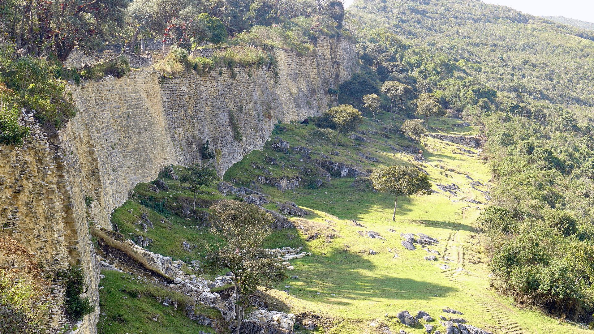
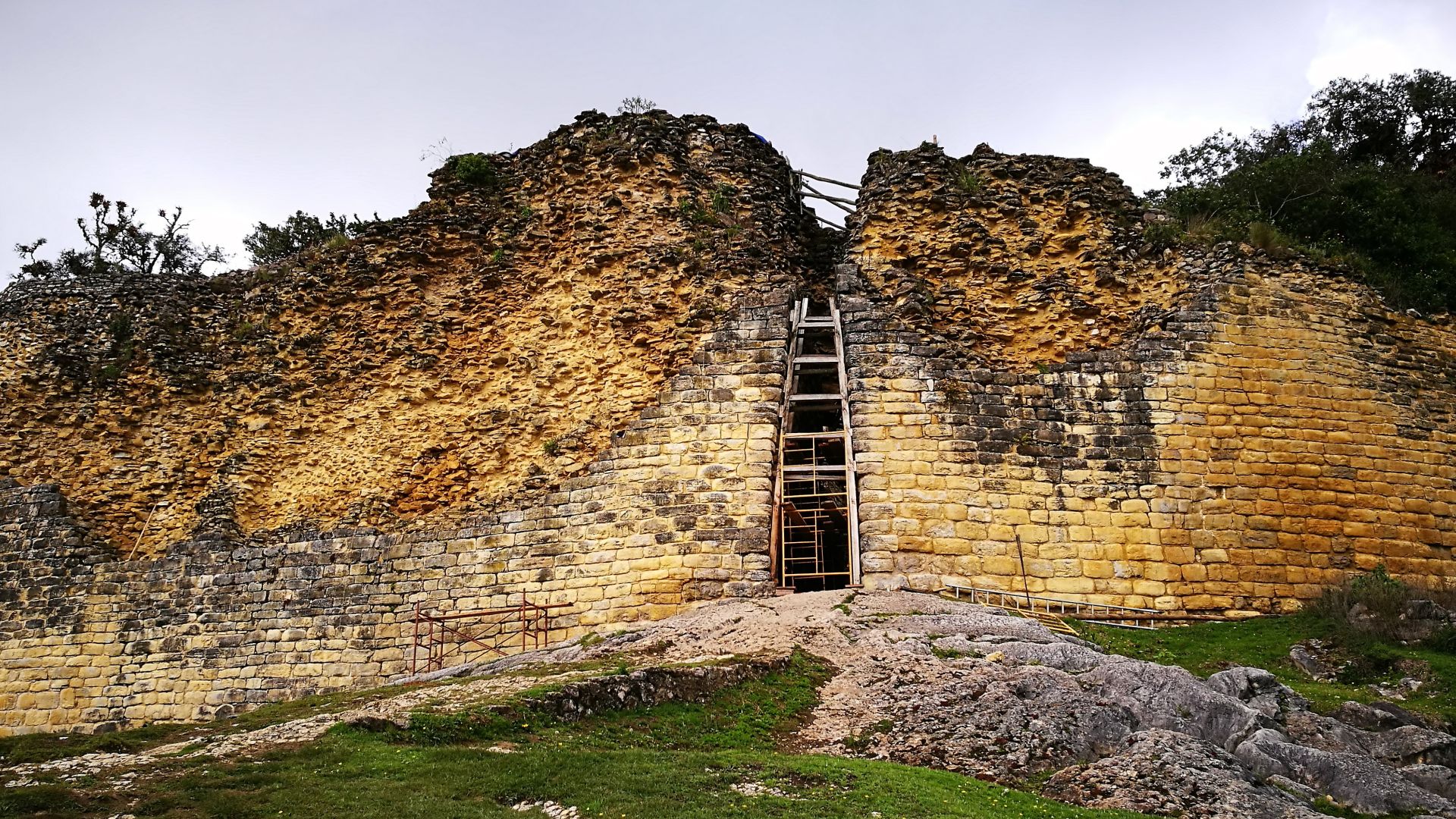
Inca accounts referred to the Chachapoya as fierce highland resistors. When Inca armies advanced into northern Peru, they faced prolonged opposition. Fortresses like Kuelap and mountaintop settlements such as Gran Pajaten were defensible, with steep access points and strategic views across valleys.
 BrunoLocatelli, Wikimedia Commons
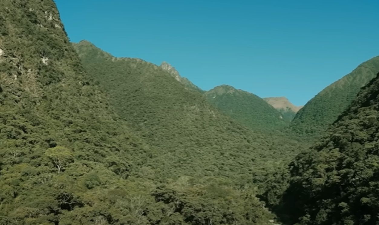
High-Altitude Settlement Was Deliberate
Many Chachapoya sites rise above 2,500 meters, surrounded by cliffs and dense cloud forests. These locations offered defense from invaders and climate benefits for agriculture. Architectural adaptations included sloped foundations and structural reinforcements to withstand frequent landslides and seismic activity in the Andes.
Layers Of Time Shaped Gran Pajaten
Gran Pajaten's origins predate the Incas' arrival, with evidence of occupation dating back as early as 200 BCE. Carbon dating confirms early foundations. However, visible structures show signs of construction or modification during Inca times, distinct from their usual trapezoidal doorways and polygonal masonry techniques.
 Javier cosavalente galán, Wikimedia Commons
Structures Aligned With Peaks And Sun
Many Chachapoya structures face east or northeast, which aligns with solstice sunrises and local mountain peaks. This orientation likely held cosmological meaning. At Gran Pajaten, primary platforms and entryways track seasonal light angles by suggesting ceremonies timed with celestial events and regional geographic landmarks.

Concentric Zones Of Social Use
At Gran Pajaten, spatial patterns separate core ceremonial areas from domestic clusters. Central plazas and elevated platforms dominate the upper zone. Residences and utility structures lie further out. This design reflects planned zoning, where ritual and everyday activities occupy distinct layers of settlement space.
 COSAVALENTE, Wikimedia Commons
No Wall Without A Reason
Even modest walls at Gran Pajaten show intentional placement, as retaining walls follow contour lines to prevent erosion, and interior dividers mark living areas or direct circulation. Their repeated angles and consistent materials reflect an advanced grasp of terrain mechanics and purposeful spatial organization.
 El Gran Pajatén: un tesoro escondido en el Amazonas by Agencia de Noticias Andina
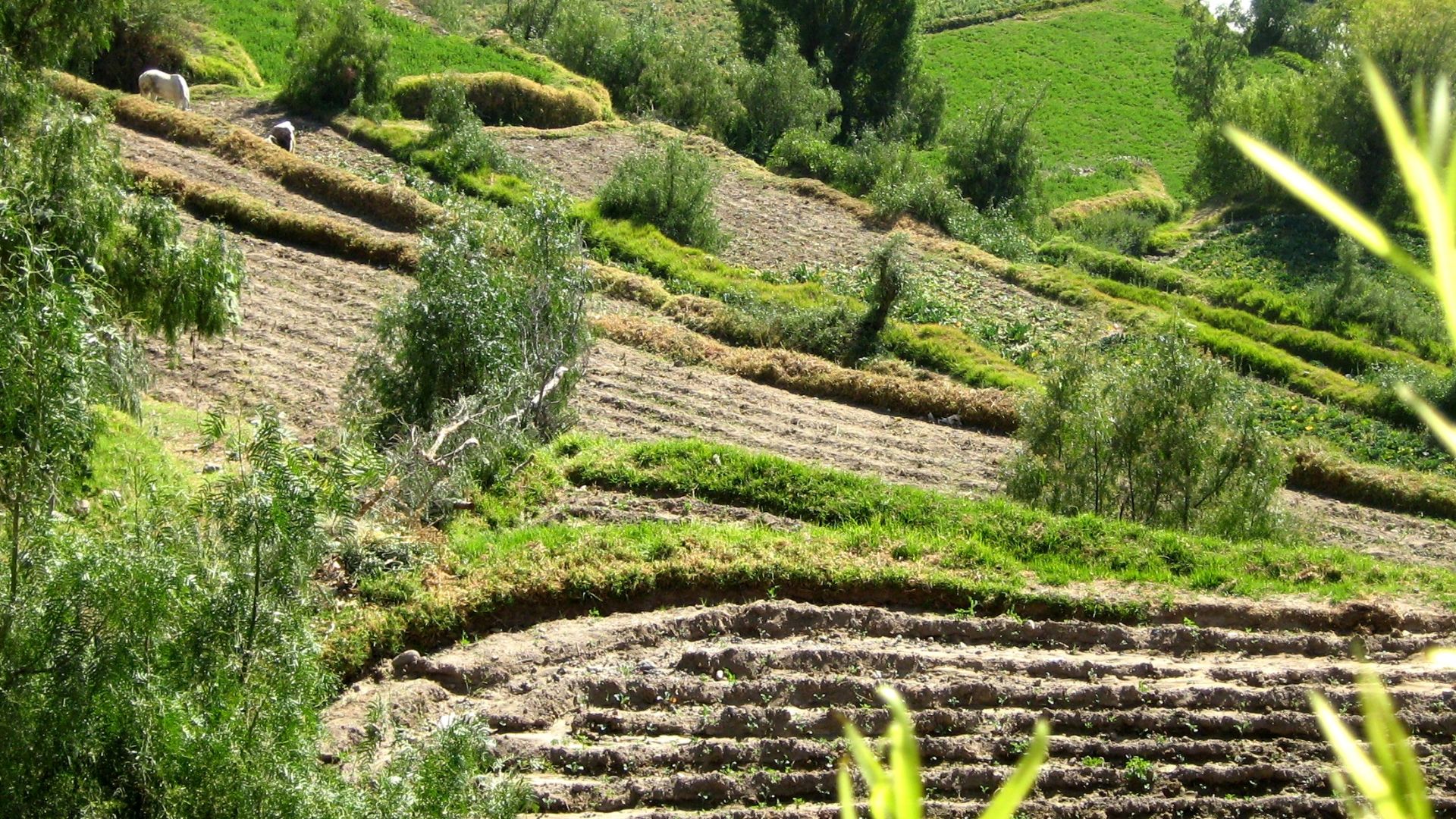
Terracing That Maximized Food Yield
Chachapoya farmers adapted to steep slopes by building expansive, level terraces reinforced with stone. These platforms collected runoff and preserved soil. Botanical evidence suggests maize and tubers grew there. Paired with hillside water channels, this setup formed a high-efficiency agricultural system well-suited to the cloud forest's moisture.
 J. Thompson (talk) 21:23, 2 November 2008 (UTC), Wikimedia Commons
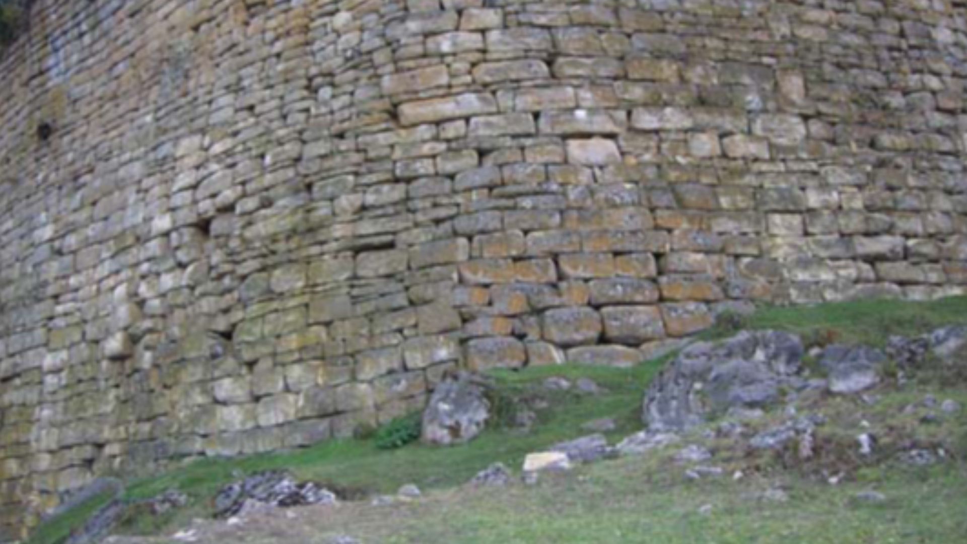
Why Circular Design Was Practically Ideal
The round structures served more than symbolic purposes. Circular walls offered uniform weight distribution and better resistance to seismic shocks. Roof poles converged centrally by simplifying support. In damp highland conditions, the design also helped the rain run off quickly to minimize interior flooding and long-term wall erosion.
 El Gran Pajatén: un tesoro escondido en el Amazonas by Agencia de Noticias Andina
Sacred Geometry Or Functional Design?
Architectural studies at Gran Pajaten reveal repeating diameters and radial symmetry in floor plans, likely due to practical considerations such as seismic resistance and space efficiency. Some scholars speculate this reflects sacred geometry tied to sun worship, though evidence supporting that interpretation remains limited.
 El Gran Pajatén: un tesoro escondido en el Amazonas by Agencia de Noticias Andina
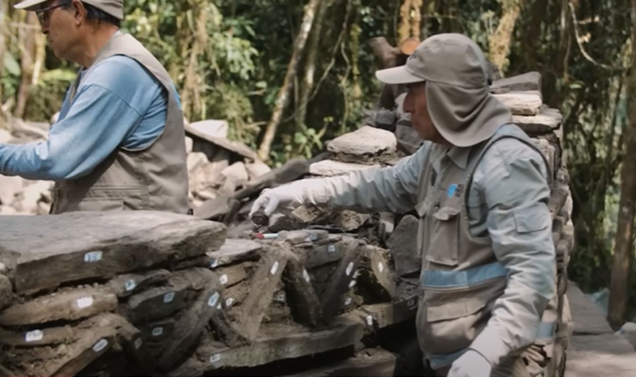
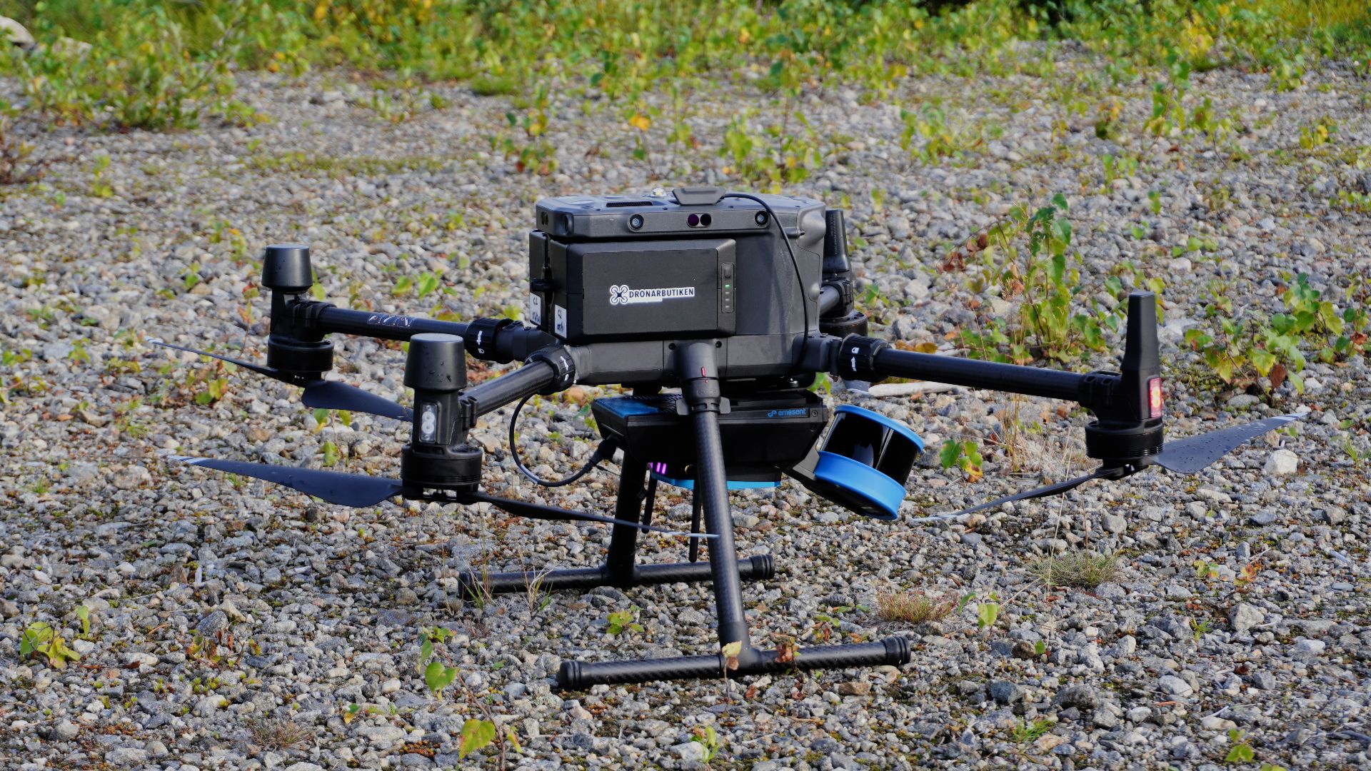
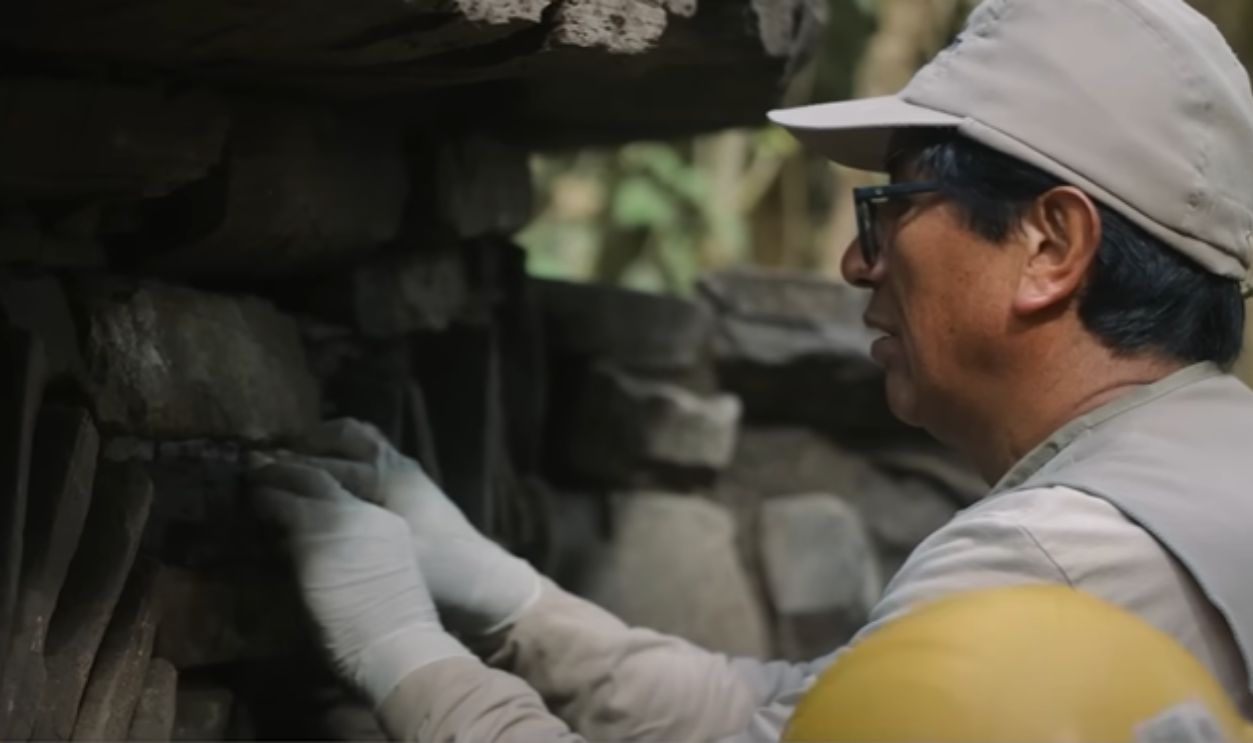
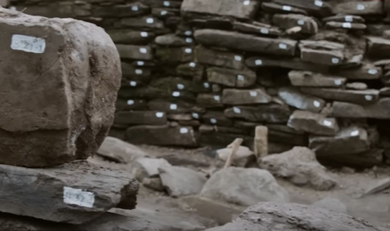
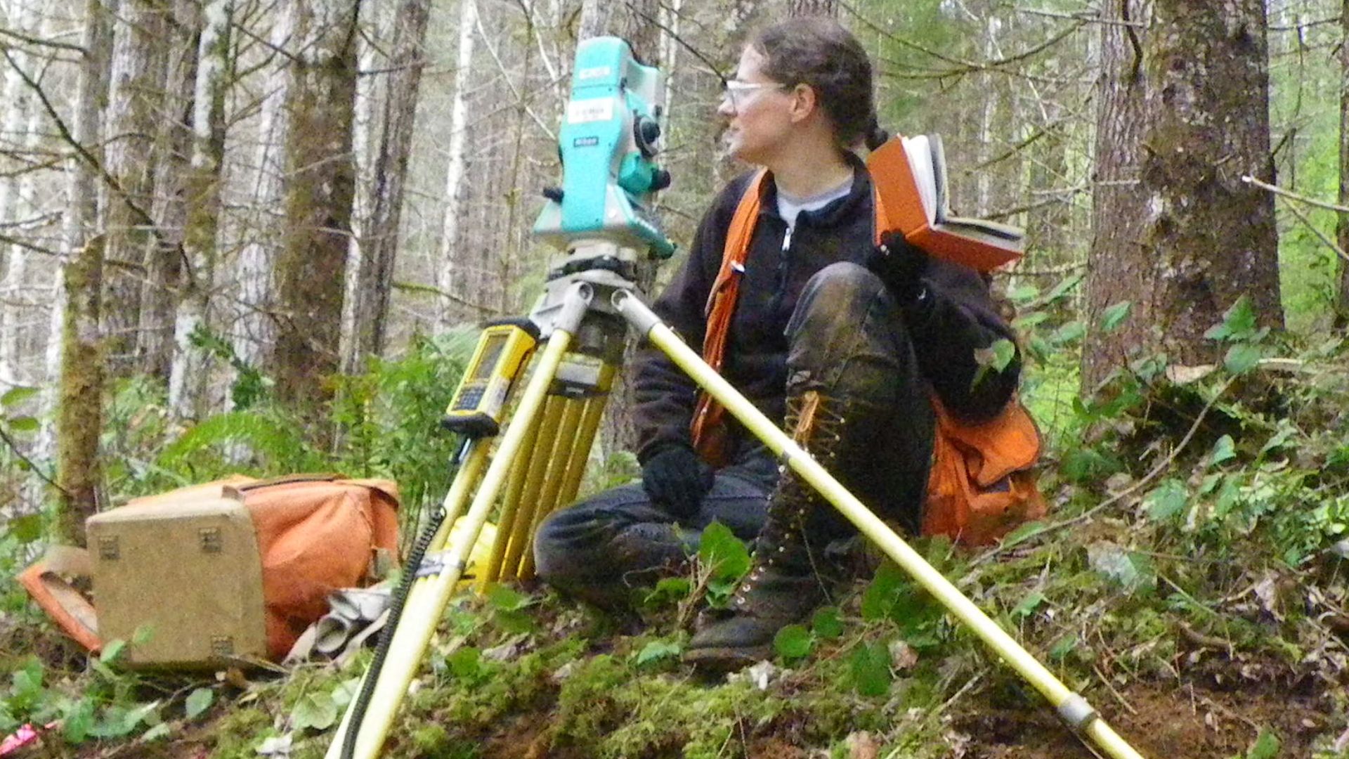
Photogrammetry Mapped Every Wall Face
High-resolution drone photography captured thousands of overlapping images. These were processed into 3D models using photogrammetry, a method that calculates depth from the angles of images. Every wall face and slope angle was digitally recorded to enable precise analysis without disturbing fragile structures or surrounding flora.
 Josh Sorenson, Wikimedia Commons
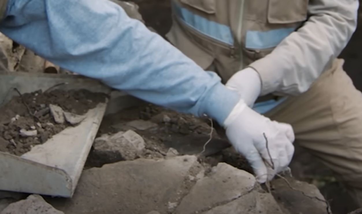
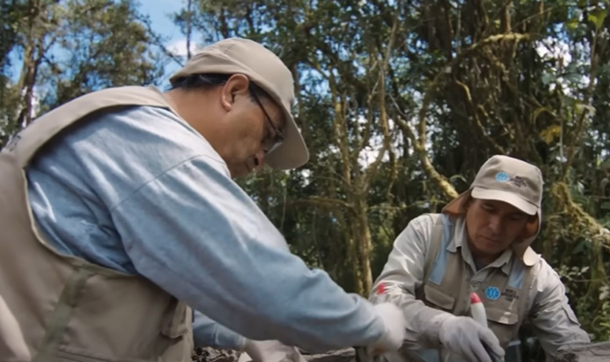
Discoveries Without A Single Shovel
Excavation is restricted in Rio Abiseo National Park to protect biodiversity. As a result, archaeologists turned to non-invasive survey tools. LiDAR and photogrammetry replaced shovels. Data-driven methods revealed more than trenching ever could, especially across steep terrain where digging was dangerous and limited.
 Joss.alberto, Wikimedia Commons
Discoveries Without A Single Shovel (Cont.)
Digital scans revealed terraced platforms and staircase remnants that were previously hidden by vegetation. These findings would have taken years to uncover using traditional digs. Remote sensing not only preserves delicate ecosystems but also provides researchers with comprehensive views of the site's planning and construction logic.
 Jfoster7991, Wikimedia Commons
Old Expedition Maps Misled Everyone
Sketches from mid-century expeditions underestimated the site's scale and layout. Dense forests and basic surveying tools led to distorted maps. What had once looked like scattered outposts turned out to be clustered sectors of a single city, with unified design and precise spatial planning.
 Bureau of Land Management Derivative Work by TBP25 (Cropped), Wikimedia Commons
Why Rio Abiseo Was A Preservation Fortress
The park's World Heritage designation, in effect since 1990, has protected both its cloud forest and archaeological heritage, and entry permits remain tightly controlled. Since no road reaches Gran Pajaten, this isolation has preserved fragile structures from looting and unauthorized tourism that damaged other Chachapoya sites across northern Peru.
Why Rio Abiseo Was A Preservation Fortress (Cont.)
Legal protections also ban most forms of infrastructure development within the park, and helicopter access is limited to emergencies or government-sanctioned research. Additionally, the lack of permanent staffing near the site has helped keep Gran Pajaten undisturbed longer than most comparable Andean locations.
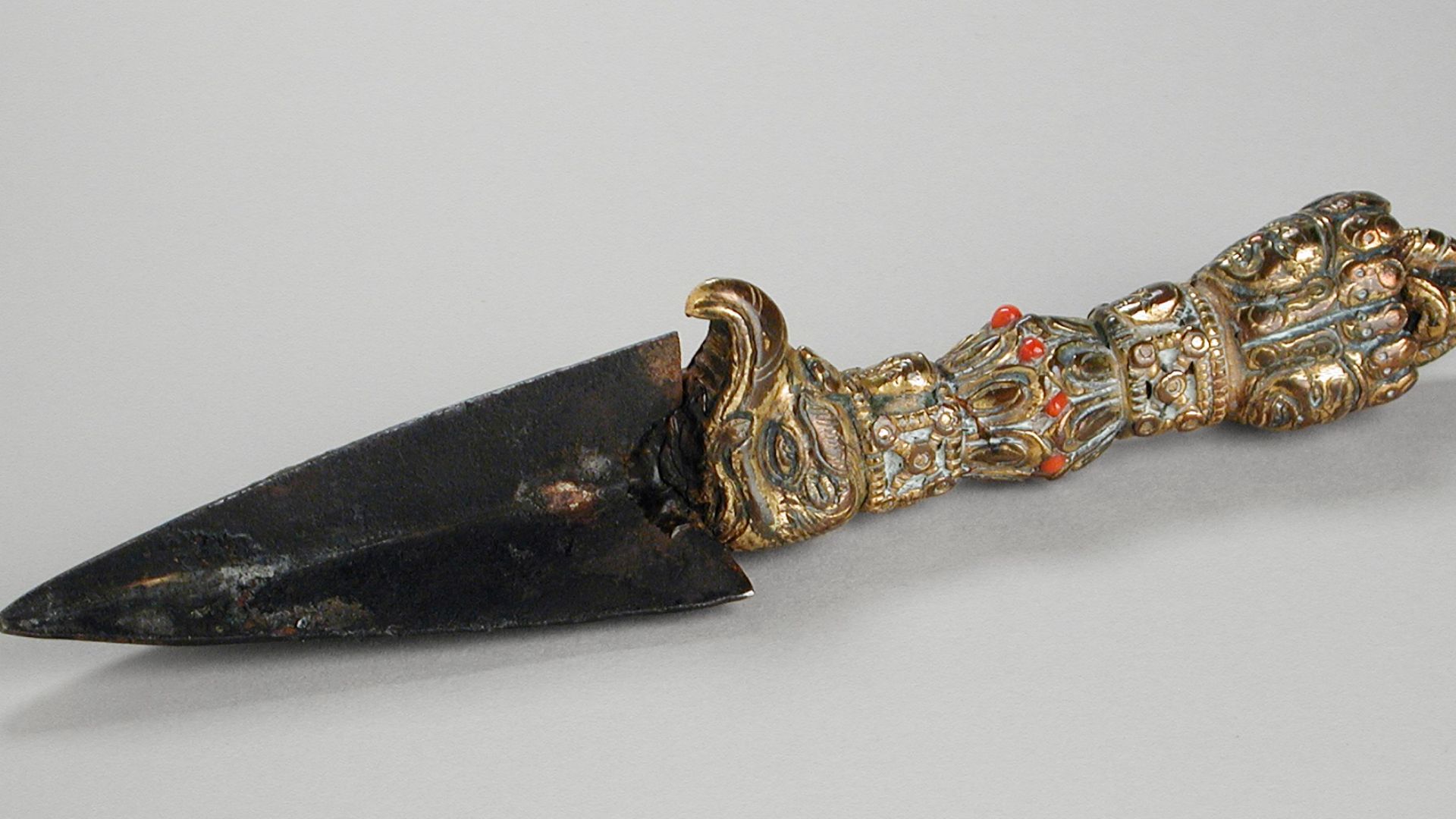
Trade Items Found Miles From Origin
Excavations at Gran Pajaten revealed ceramics and shell beads sourced from regions far beyond the site. Chemical analysis of clay matched distant Chachapoya production zones. These objects confirm long-distance trade across mountain corridors, which link Gran Pajaten with other Andean cultural hubs.
 El Gran Pajatén: un tesoro escondido en el Amazonas by Agencia de Noticias Andina
Crops That Shouldn't Have Grown At This Altitude
Botanical evidence shows maize and legumes were cultivated above 2,800 meters. This was possible through soil improvement using organic mulch and stone borders. Ancient pollen and phytoliths confirm crop rotation, and this pattern of management reflects the Chachapoya’s advanced adaptation to their high-altitude environment.

There Was No Central Temple, Yet Ritual Was Everywhere
Although no singular temple structure dominates Gran Pajaten, ceremonial activity is evident, as decorated platforms and ritual artifacts appear across multiple buildings. Burnt organic matter suggests offerings, and religious life here was distributed and embedded in daily movement rather than confined to a central sacred hall.
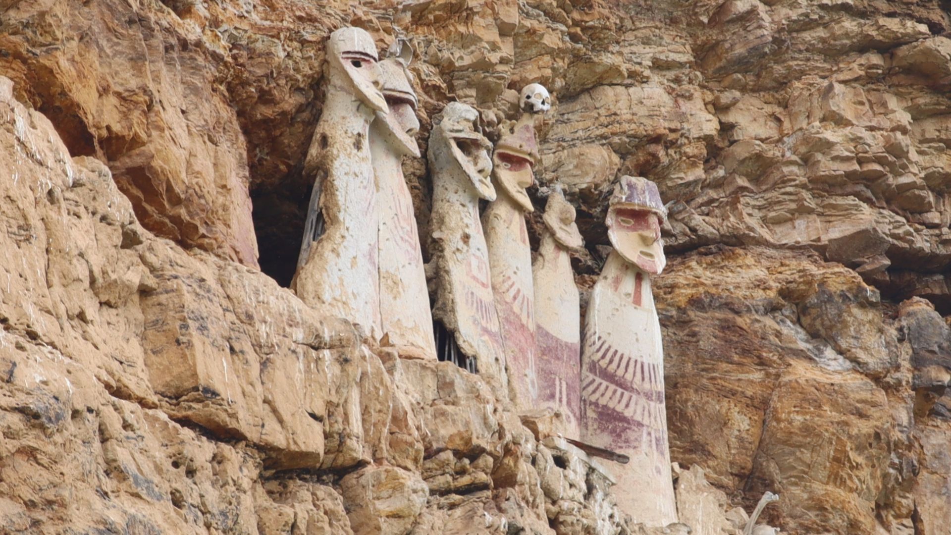
Their Dead Lived High Above The Living
Cliffside tombs carved into sheer rock faces surround Gran Pajaten. Access required ladders or rope systems. The elevation symbolized spiritual distance and ancestral oversight. Human remains found within show complex mortuary practices, including bundled burials wrapped in textiles and placed in niches overlooking inhabited zones.
 Christopher Crouzet, Wikimedia Commons
Gran Pajaten Was Never Cut Off
Faint roadbeds and carved steps link Gran Pajaten to neighboring settlements. These routes followed ridgelines and river valleys, forming part of a regional network. Artifacts from distant regions found onsite support the idea of ongoing exchange and reinforce the site's role as a node in Chachapoya mobility.
They Built To Outsmart The Mountain
Gran Pajaten was anything but improvised. Drainage channels ran beneath its platforms, and retaining walls held the slopes in place. The buildings were constructed to withstand humidity and landslides, showing a clear grasp of the terrain. Every element was purposefully designed to endure in a rugged, unpredictable environment.

Archaeology Now Begins With Ecology
Gran Pajaten's research now operates under dual mandates: uncovering the past while protecting present biodiversity. Archaeologists work alongside ecologists to minimize impact. Survey methods minimize habitat disruption, and data collection is often conducted remotely. Cultural knowledge expands only when the surrounding ecosystems are left intact.
 El Gran Pajatén: un tesoro escondido en el Amazonas by Agencia de Noticias Andina
The Site Is At Risk From Climate Shifts
Intensified rainfall and erratic weather patterns have destabilized parts of the site, as the retaining walls exhibit signs of water damage, and unchecked plant growth disrupts the stone alignments. Landslides also threaten trail access, and as cloud forest climate trends shift, they require increasingly urgent monitoring and mitigation in areas like Gran Pajaten.
Conservation Means Working With The Forest, Not Against It
Instead of clearing vast swaths, teams selectively trim vegetation and use reversible materials, such as geotextiles and natural binders, for stabilization. No heavy equipment enters the core zone, and strategies prioritize ecological balance, so plant diversity and endangered species coexist with ongoing archaeological research.
 El Gran Pajatén: un tesoro escondido en el Amazonas by Agencia de Noticias Andina
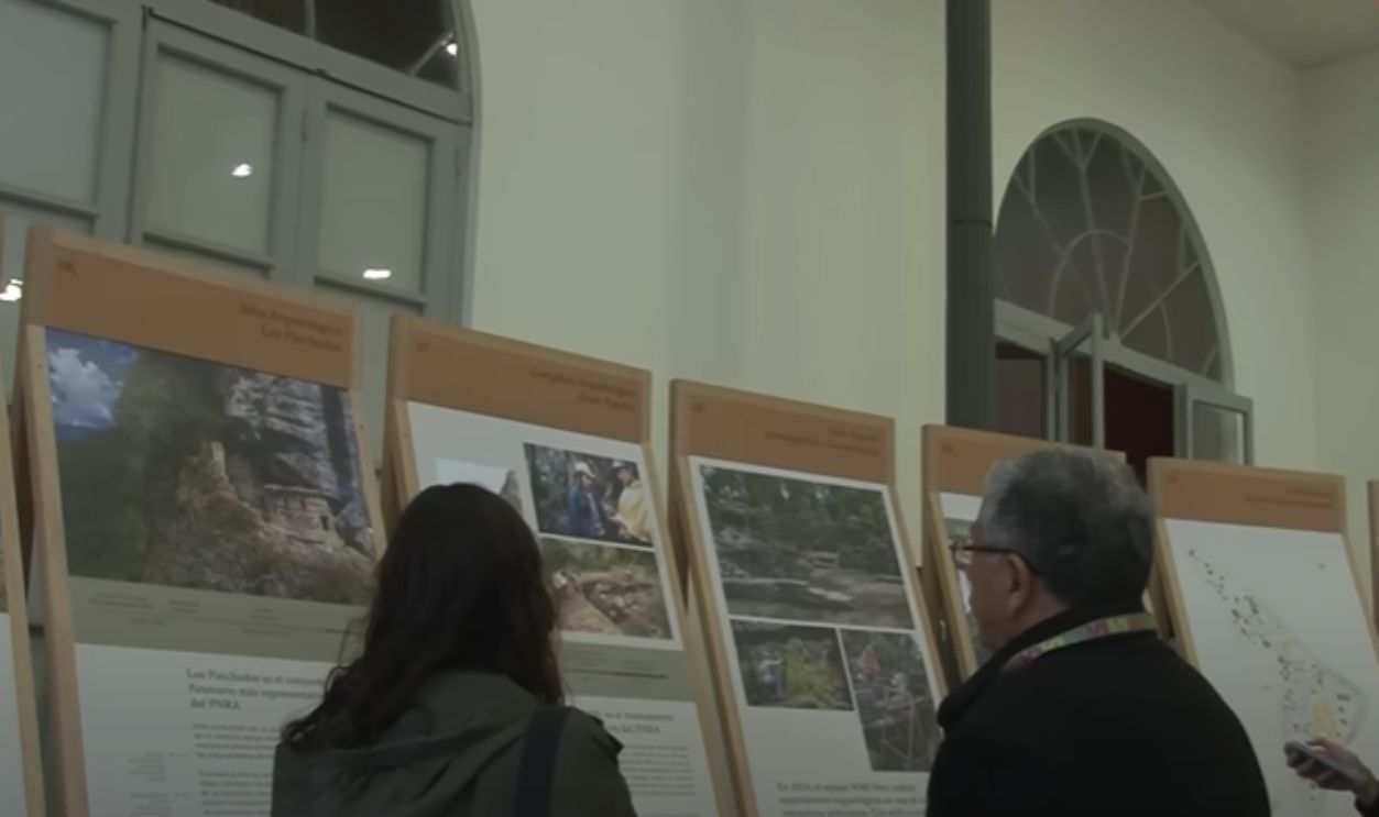
We've Only Just Scratched The Surface
As of June 2025, only a portion of the site's structures have been mapped in detail. Dense foliage still obscures additional terraces and retaining features. Experts believe much remains hidden beyond current LiDAR scans, and expanded documentation may eventually double or triple known layout dimensions.
 El Gran Pajatén: un tesoro escondido en el Amazonas by Agencia de Noticias Andina
We've Only Just Scratched The Surface (Cont.)
As mentioned earlier, initial scans mapped approximately 26 hectares, but newer estimates indicate that the full extent extends beyond 60 hectares. Some peripheral ridges reveal linear anomalies aligned with old walls, and recent aerial data now prompts archaeologists to revise boundaries and include adjoining zones as part of the complex.
The Andes Keep Rewriting Their Past
Gran Pajaten isn't alone. Recent finds in Chachapoyas and La Libertad have revealed urban centers that predate Inca expansion. Together, they suggest a denser, more complex highland occupation. These discoveries shift attention from imperial narratives toward a richer mosaic of pre-Inca innovation.